Embed Size (px)
Citation preview
History of AntarcticaFrom Wikipedia, the free encyclopedia
For the natural history of the Antarctic continent, see Antarctica.
The history of Antarctica emerges from early Western theories of a vast continent, known as Terra Australis, believed to exist in the farsouth of the globe. The term Antarctic, referring to the opposite of the Arctic Circle, was coined by Marinus of Tyre in the 2nd century AD.
The rounding of the Cape of Good Hope and Cape Horn in the 15th and 16th centuries proved that Terra Australis Incognita ("UnknownSouthern Land"), if it existed, was a continent in its own right. In 1773 James Cook and his crew crossed the Antarctic Circle for the firsttime but although they discovered nearby islands, they did not catch sight of Antarctica itself. It is believed he was as close as 150 milesfrom the mainland.
In 1820, several expeditions claimed to have been the first to have sighted the ice shelf or the continent. A Russian expedition was led byFabian Gottlieb von Bellingshausen and Mikhail Lazarev, a British expedition was captained by Edward Bransfield and an American sealerNathaniel Palmer participated. The first landing was probably just over a year later when American Captain John Davis, a sealer, set footon the ice.
Several expeditions attempted to reach the South Pole in the early 20th century, during the 'Heroic Age of Antarctic Exploration'. Manyresulted in injury and death. Norwegian Roald Amundsen finally reached the Pole on December 14, 1911, following a dramatic race withthe Englishman Robert Falcon Scott.
Contents
◾ 1 Early exploration◾ 1.1 The search for Terra Australis Incognita◾ 1.2 South of the Antarctic Convergence◾ 1.3 The Antarctic Circle◾ 1.4 First sighting◾ 1.5 Exploration
◾ 2 Heroic Age of Antarctic Exploration◾ 2.1 Origins◾ 2.2 Early British expeditions◾ 2.3 Expeditions from other countries◾ 2.4 Race to the Pole◾ 2.5 Further expeditions
◾ 3 Further exploration◾ 3.1 By air◾ 3.2 Overland crossing
◾ 4 Political history◾ 4.1 British claims◾ 4.2 Other European claims◾ 4.3 South American involvement◾ 4.4 Post war developments◾ 4.5 Towards an international treaty
◾ 5 Recent history◾ 6 See also◾ 7 References◾ 8 Further reading◾ 9 External links
Early exploration
The search for Terra Australis Incognita
Coordinates: 67°15′S 39°35′E
Page 1 of 13History of Antarctica - Wikipedia, the free encyclopedia
3/28/2016https://en.wikipedia.org/wiki/History_of_Antarctica
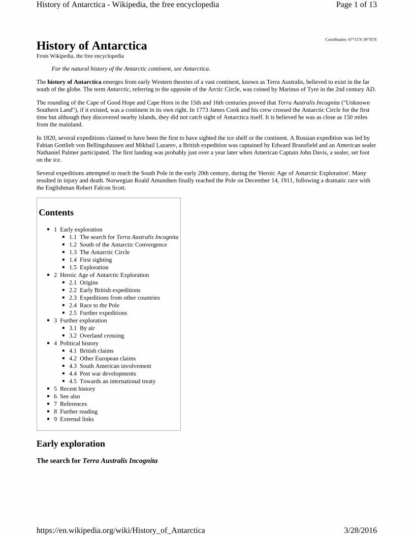
In 1570 a map by Ortelius showed theimagined link between the proposedcontinent of Antarctica and SouthAmerica. Note also the proposedlandmasses surrounding the North Pole.
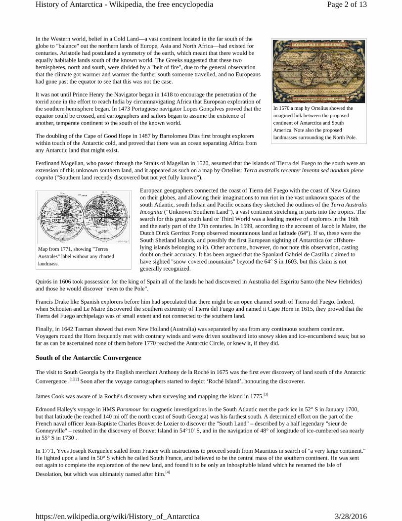
Map from 1771, showing "TerresAustrales" label without any chartedlandmass.
In the Western world, belief in a Cold Land—a vast continent located in the far south of theglobe to "balance" out the northern lands of Europe, Asia and North Africa—had existed forcenturies. Aristotle had postulated a symmetry of the earth, which meant that there would beequally habitable lands south of the known world. The Greeks suggested that these twohemispheres, north and south, were divided by a "belt of fire", due to the general observationthat the climate got warmer and warmer the further south someone travelled, and no Europeanshad gone past the equator to see that this was not the case.
It was not until Prince Henry the Navigator began in 1418 to encourage the penetration of thetorrid zone in the effort to reach India by circumnavigating Africa that European exploration ofthe southern hemisphere began. In 1473 Portuguese navigator Lopes Gonçalves proved that theequator could be crossed, and cartographers and sailors began to assume the existence ofanother, temperate continent to the south of the known world.
The doubling of the Cape of Good Hope in 1487 by Bartolomeu Dias first brought explorerswithin touch of the Antarctic cold, and proved that there was an ocean separating Africa fromany Antarctic land that might exist.
Ferdinand Magellan, who passed through the Straits of Magellan in 1520, assumed that the islands of Tierra del Fuego to the south were anextension of this unknown southern land, and it appeared as such on a map by Ortelius: Terra australis recenter inventa sed nondum plenecognita ("Southern land recently discovered but not yet fully known").
European geographers connected the coast of Tierra del Fuego with the coast of New Guineaon their globes, and allowing their imaginations to run riot in the vast unknown spaces of thesouth Atlantic, south Indian and Pacific oceans they sketched the outlines of the Terra AustralisIncognita ("Unknown Southern Land"), a vast continent stretching in parts into the tropics. Thesearch for this great south land or Third World was a leading motive of explorers in the 16thand the early part of the 17th centuries. In 1599, according to the account of Jacob le Maire, theDutch Dirck Gerritsz Pomp observed mountainous land at latitude (64°). If so, these were theSouth Shetland Islands, and possibly the first European sighting of Antarctica (or offshore-lying islands belonging to it). Other accounts, however, do not note this observation, castingdoubt on their accuracy. It has been argued that the Spaniard Gabriel de Castilla claimed tohave sighted "snow-covered mountains" beyond the 64° S in 1603, but this claim is notgenerally recognized.
Quirós in 1606 took possession for the king of Spain all of the lands he had discovered in Australia del Espiritu Santo (the New Hebrides)and those he would discover "even to the Pole".
Francis Drake like Spanish explorers before him had speculated that there might be an open channel south of Tierra del Fuego. Indeed,when Schouten and Le Maire discovered the southern extremity of Tierra del Fuego and named it Cape Horn in 1615, they proved that theTierra del Fuego archipelago was of small extent and not connected to the southern land.
Finally, in 1642 Tasman showed that even New Holland (Australia) was separated by sea from any continuous southern continent.Voyagers round the Horn frequently met with contrary winds and were driven southward into snowy skies and ice-encumbered seas; but sofar as can be ascertained none of them before 1770 reached the Antarctic Circle, or knew it, if they did.
South of the Antarctic Convergence
The visit to South Georgia by the English merchant Anthony de la Roché in 1675 was the first ever discovery of land south of the AntarcticConvergence .[1][2] Soon after the voyage cartographers started to depict ‘Roché Island’, honouring the discoverer.
James Cook was aware of la Roché's discovery when surveying and mapping the island in 1775.[3]
Edmond Halley's voyage in HMS Paramour for magnetic investigations in the South Atlantic met the pack ice in 52° S in January 1700,but that latitude (he reached 140 mi off the north coast of South Georgia) was his farthest south. A determined effort on the part of theFrench naval officer Jean-Baptiste Charles Bouvet de Lozier to discover the "South Land" – described by a half legendary "sieur deGonneyville" – resulted in the discovery of Bouvet Island in 54°10′ S, and in the navigation of 48° of longitude of ice-cumbered sea nearlyin 55° S in 1730 .
In 1771, Yves Joseph Kerguelen sailed from France with instructions to proceed south from Mauritius in search of "a very large continent."He lighted upon a land in 50° S which he called South France, and believed to be the central mass of the southern continent. He was sentout again to complete the exploration of the new land, and found it to be only an inhospitable island which he renamed the Isle ofDesolation, but which was ultimately named after him.[4]
Page 2 of 13History of Antarctica - Wikipedia, the free encyclopedia
3/28/2016https://en.wikipedia.org/wiki/History_of_Antarctica
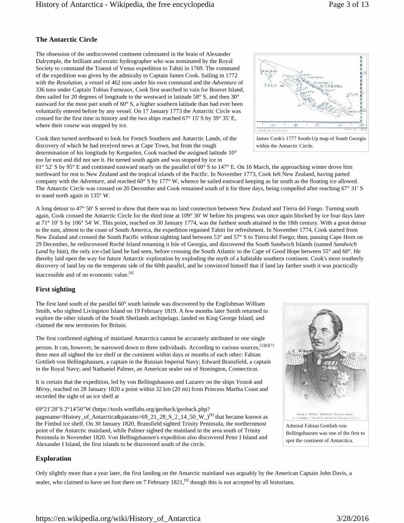
James Cook's 1777 South-Up map of South Georgiawithin the Antarctic Circle.
Admiral Fabian Gottlieb vonBellingshausen was one of the first tospot the continent of Antarctica.
The Antarctic Circle
The obsession of the undiscovered continent culminated in the brain of AlexanderDalrymple, the brilliant and erratic hydrographer who was nominated by the RoyalSociety to command the Transit of Venus expedition to Tahiti in 1769. The commandof the expedition was given by the admiralty to Captain James Cook. Sailing in 1772with the Resolution, a vessel of 462 tons under his own command and the Adventure of336 tons under Captain Tobias Furneaux, Cook first searched in vain for Bouvet Island,then sailed for 20 degrees of longitude to the westward in latitude 58° S, and then 30°eastward for the most part south of 60° S, a higher southern latitude than had ever beenvoluntarily entered before by any vessel. On 17 January 1773 the Antarctic Circle wascrossed for the first time in history and the two ships reached 67° 15' S by 39° 35' E,where their course was stopped by ice.
Cook then turned northward to look for French Southern and Antarctic Lands, of thediscovery of which he had received news at Cape Town, but from the roughdetermination of his longitude by Kerguelen, Cook reached the assigned latitude 10°too far east and did not see it. He turned south again and was stopped by ice in61° 52′ S by 95° E and continued eastward nearly on the parallel of 60° S to 147° E. On 16 March, the approaching winter drove himnorthward for rest to New Zealand and the tropical islands of the Pacific. In November 1773, Cook left New Zealand, having partedcompany with the Adventure, and reached 60° S by 177° W, whence he sailed eastward keeping as far south as the floating ice allowed.The Antarctic Circle was crossed on 20 December and Cook remained south of it for three days, being compelled after reaching 67° 31′ Sto stand north again in 135° W.
A long detour to 47° 50′ S served to show that there was no land connection between New Zealand and Tierra del Fuego. Turning southagain, Cook crossed the Antarctic Circle for the third time at 109° 30′ W before his progress was once again blocked by ice four days laterat 71° 10′ S by 106° 54′ W. This point, reached on 30 January 1774, was the farthest south attained in the 18th century. With a great detourto the east, almost to the coast of South America, the expedition regained Tahiti for refreshment. In November 1774, Cook started fromNew Zealand and crossed the South Pacific without sighting land between 53° and 57° S to Tierra del Fuego; then, passing Cape Horn on29 December, he rediscovered Roché Island renaming it Isle of Georgia, and discovered the South Sandwich Islands (named SandwichLand by him), the only ice-clad land he had seen, before crossing the South Atlantic to the Cape of Good Hope between 55° and 60°. Hethereby laid open the way for future Antarctic exploration by exploding the myth of a habitable southern continent. Cook's most southerlydiscovery of land lay on the temperate side of the 60th parallel, and he convinced himself that if land lay farther south it was practicallyinaccessible and of no economic value.[4]
First sighting
The first land south of the parallel 60° south latitude was discovered by the Englishman WilliamSmith, who sighted Livingston Island on 19 February 1819. A few months later Smith returned toexplore the other islands of the South Shetlands archipelago, landed on King George Island, andclaimed the new territories for Britain.
The first confirmed sighting of mainland Antarctica cannot be accurately attributed to one singleperson. It can, however, be narrowed down to three individuals. According to various sources,[5][6][7]
three men all sighted the ice shelf or the continent within days or months of each other: FabianGottlieb von Bellingshausen, a captain in the Russian Imperial Navy; Edward Bransfield, a captainin the Royal Navy; and Nathaniel Palmer, an American sealer out of Stonington, Connecticut.
It is certain that the expedition, led by von Bellingshausen and Lazarev on the ships Vostok andMirny, reached on 28 January 1820 a point within 32 km (20 mi) from Princess Martha Coast andrecorded the sight of an ice shelf at
69°21′28″S 2°14′50″W (https://tools.wmflabs.org/geohack/geohack.php?pagename=History_of_Antarctica¶ms=69_21_28_S_2_14_50_W_)[8] that became known asthe Fimbul ice shelf. On 30 January 1820, Bransfield sighted Trinity Peninsula, the northernmostpoint of the Antarctic mainland, while Palmer sighted the mainland in the area south of TrinityPeninsula in November 1820. Von Bellingshausen's expedition also discovered Peter I Island andAlexander I Island, the first islands to be discovered south of the circle.
Exploration
Only slightly more than a year later, the first landing on the Antarctic mainland was arguably by the American Captain John Davis, asealer, who claimed to have set foot there on 7 February 1821,[9] though this is not accepted by all historians.
Page 3 of 13History of Antarctica - Wikipedia, the free encyclopedia
3/28/2016https://en.wikipedia.org/wiki/History_of_Antarctica
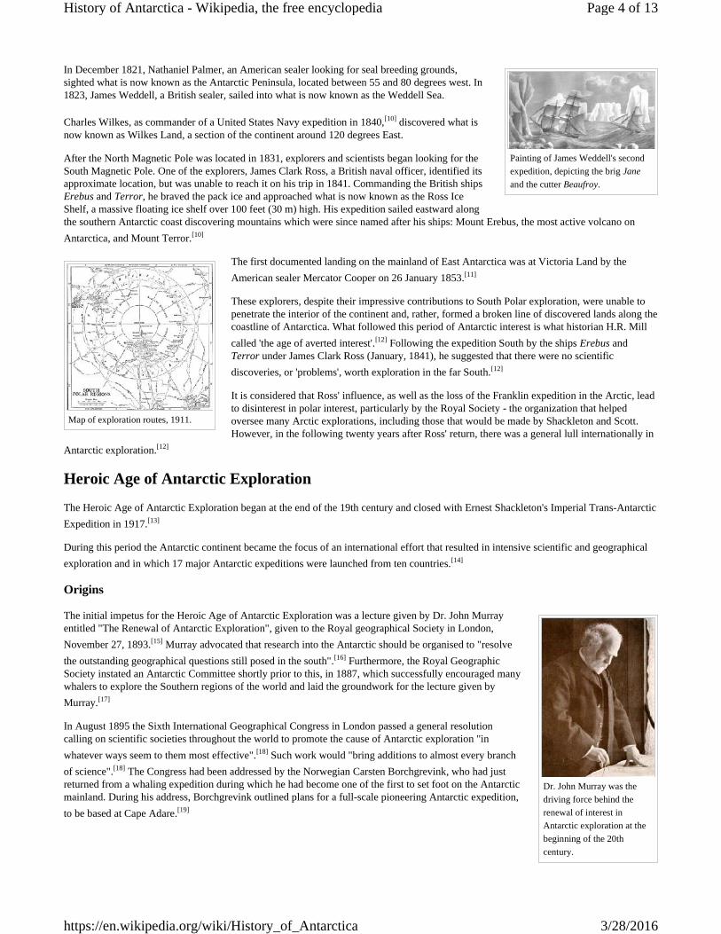
Painting of James Weddell's secondexpedition, depicting the brig Janeand the cutter Beaufroy.
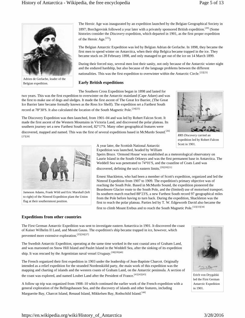
Map of exploration routes, 1911.
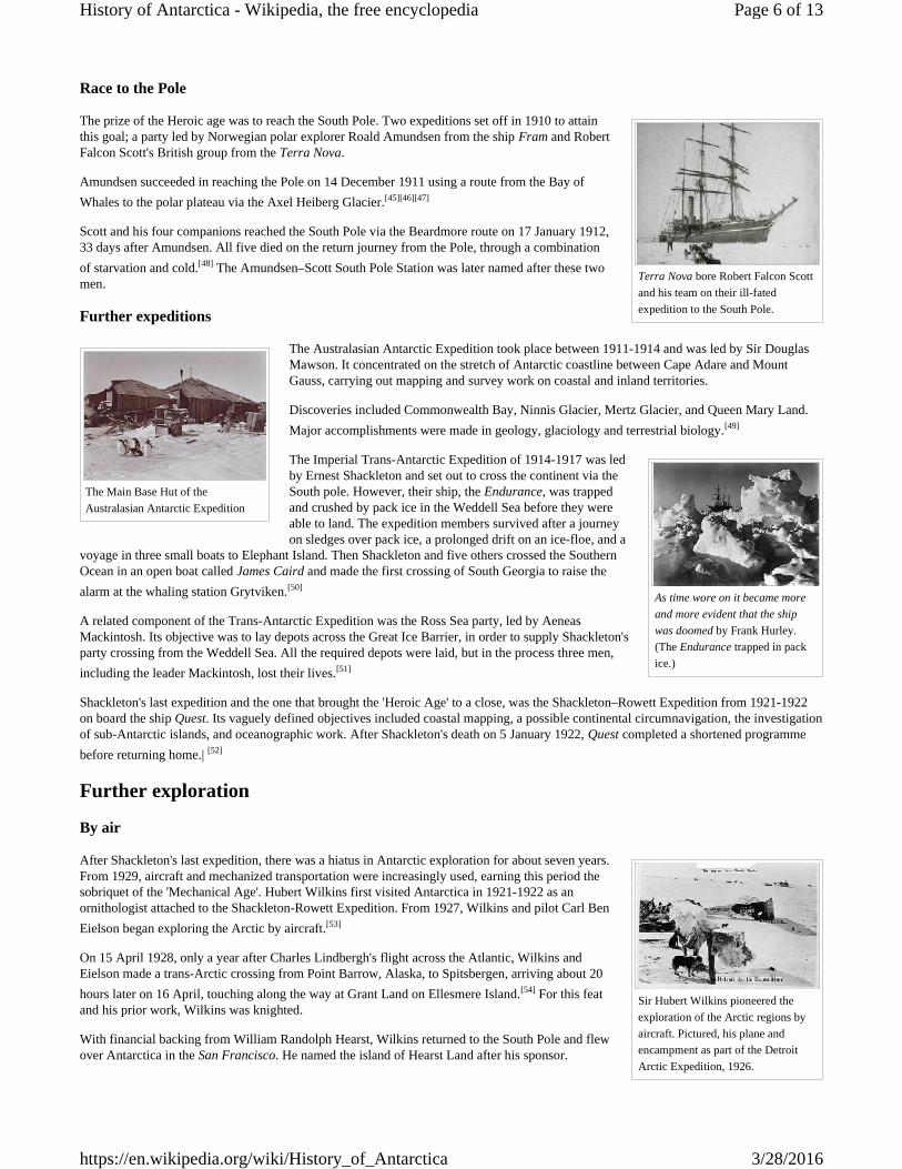
Dr. John Murray was thedriving force behind therenewal of interest inAntarctic exploration at thebeginning of the 20thcentury.
In December 1821, Nathaniel Palmer, an American sealer looking for seal breeding grounds,sighted what is now known as the Antarctic Peninsula, located between 55 and 80 degrees west. In1823, James Weddell, a British sealer, sailed into what is now known as the Weddell Sea.
Charles Wilkes, as commander of a United States Navy expedition in 1840,[10] discovered what isnow known as Wilkes Land, a section of the continent around 120 degrees East.
After the North Magnetic Pole was located in 1831, explorers and scientists began looking for theSouth Magnetic Pole. One of the explorers, James Clark Ross, a British naval officer, identified itsapproximate location, but was unable to reach it on his trip in 1841. Commanding the British shipsErebus and Terror, he braved the pack ice and approached what is now known as the Ross IceShelf, a massive floating ice shelf over 100 feet (30 m) high. His expedition sailed eastward alongthe southern Antarctic coast discovering mountains which were since named after his ships: Mount Erebus, the most active volcano onAntarctica, and Mount Terror.[10]
The first documented landing on the mainland of East Antarctica was at Victoria Land by theAmerican sealer Mercator Cooper on 26 January 1853.[11]
These explorers, despite their impressive contributions to South Polar exploration, were unable topenetrate the interior of the continent and, rather, formed a broken line of discovered lands along thecoastline of Antarctica. What followed this period of Antarctic interest is what historian H.R. Millcalled 'the age of averted interest'.[12] Following the expedition South by the ships Erebus andTerror under James Clark Ross (January, 1841), he suggested that there were no scientificdiscoveries, or 'problems', worth exploration in the far South.[12]
It is considered that Ross' influence, as well as the loss of the Franklin expedition in the Arctic, leadto disinterest in polar interest, particularly by the Royal Society - the organization that helpedoversee many Arctic explorations, including those that would be made by Shackleton and Scott.However, in the following twenty years after Ross' return, there was a general lull internationally in
Antarctic exploration.[12]
Heroic Age of Antarctic ExplorationThe Heroic Age of Antarctic Exploration began at the end of the 19th century and closed with Ernest Shackleton's Imperial Trans-AntarcticExpedition in 1917.[13]
During this period the Antarctic continent became the focus of an international effort that resulted in intensive scientific and geographicalexploration and in which 17 major Antarctic expeditions were launched from ten countries.[14]
Origins
The initial impetus for the Heroic Age of Antarctic Exploration was a lecture given by Dr. John Murrayentitled "The Renewal of Antarctic Exploration", given to the Royal geographical Society in London,November 27, 1893.[15] Murray advocated that research into the Antarctic should be organised to "resolvethe outstanding geographical questions still posed in the south".[16] Furthermore, the Royal GeographicSociety instated an Antarctic Committee shortly prior to this, in 1887, which successfully encouraged manywhalers to explore the Southern regions of the world and laid the groundwork for the lecture given byMurray.[17]
In August 1895 the Sixth International Geographical Congress in London passed a general resolutioncalling on scientific societies throughout the world to promote the cause of Antarctic exploration "inwhatever ways seem to them most effective".[18] Such work would "bring additions to almost every branchof science".[18] The Congress had been addressed by the Norwegian Carsten Borchgrevink, who had justreturned from a whaling expedition during which he had become one of the first to set foot on the Antarcticmainland. During his address, Borchgrevink outlined plans for a full-scale pioneering Antarctic expedition,to be based at Cape Adare.[19]
Page 4 of 13History of Antarctica - Wikipedia, the free encyclopedia
3/28/2016https://en.wikipedia.org/wiki/History_of_Antarctica
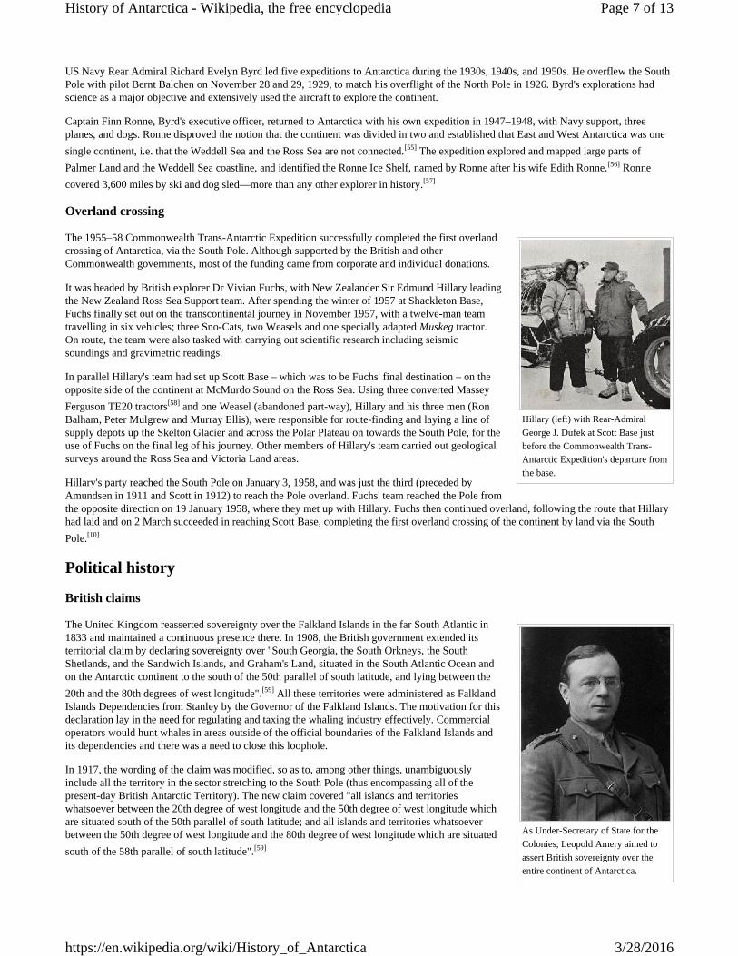
Adrien de Gerlache, leader of theBelgian expedition.
RRS Discovery carried anexpedition led by Robert FalconScott in 1901.
Jameson Adams, Frank Wild and Eric Marshall (leftto right) of the Nimrod Expedition plant the Unionflag at their southernmost position.
Erich von Drygalskiled the First GermanAntarctic Expeditionin 1901.
The Heroic Age was inaugurated by an expedition launched by the Belgian Geographical Society in1897; Borchgrevink followed a year later with a privately sponsored British expedition.[20] (Somehistories consider the Discovery expedition, which departed in 1901, as the first proper expeditionof the Heroic Age.[21])
The Belgian Antarctic Expedition was led by Belgian Adrian de Gerlache. In 1898, they became thefirst men to spend winter on Antarctica, when their ship Belgica became trapped in the ice. Theybecame stuck on 28 February 1898, and only managed to get out of the ice on 14 March 1899.
During their forced stay, several men lost their sanity, not only because of the Antarctic winter nightand the endured hardship, but also because of the language problems between the differentnationalities. This was the first expedition to overwinter within the Antarctic Circle.[22][23]
Early British expeditions
The Southern Cross Expedition began in 1898 and lasted fortwo years. This was the first expedition to overwinter on the Antarctic mainland (Cape Adare) and wasthe first to make use of dogs and sledges. It made the first ascent of The Great Ice Barrier, (The GreatIce Barrier later became formally known as the Ross Ice Shelf). The expedition set a Farthest Southrecord at 78°30'S. It also calculated the location of the South Magnetic Pole.[24][25]
The Discovery Expedition was then launched, from 1901–04 and was led by Robert Falcon Scott. Itmade the first ascent of the Western Mountains in Victoria Land, and discovered the polar plateau. Itssouthern journey set a new Farthest South record, 82°17'S. Many other geographical features werediscovered, mapped and named. This was the first of several expeditions based in McMurdo Sound.[26]
[27][28]
A year later, the Scottish National AntarcticExpedition was launched, headed by WilliamSpeirs Bruce. 'Ormond House' was established as a meteorological observatory onLaurie Island in the South Orkneys and was the first permanent base in Antarctica. TheWeddell Sea was penetrated to 74°01'S, and the coastline of Coats Land wasdiscovered, defining the sea's eastern limits.[29][30][31]
Ernest Shackleton, who had been a member of Scott's expedition, organized and led theNimrod Expedition from 1907 to 1909. The expedition's primary objective was ofreaching the South Pole. Based in McMurdo Sound, the expedition pioneered theBeardmore Glacier route to the South Pole, and the (limited) use of motorised transport.Its southern march reached 88°23'S, a new Farthest South record 97 geographical milesfrom the Pole before having to turn back. During the expedition, Shackleton was thefirst to reach the polar plateau. Parties led by T. W. Edgeworth David also became thefirst to climb Mount Erebus and to reach the South Magnetic Pole.[32][33][34]
Expeditions from other countries
The First German Antarctic Expedition was sent to investigate eastern Antarctica in 1901. It discovered the coastof Kaiser Wilhelm II Land, and Mount Gauss. The expedition's ship became trapped in ice, however, whichprevented more extensive exploration.[35][36][37]
The Swedish Antarctic Expedition, operating at the same time worked in the east coastal area of Graham Land,and was marooned on Snow Hill Island and Paulet Island in the Weddell Sea, after the sinking of its expeditionship. It was rescued by the Argentinian naval vessel Uruguay.[38][39][40]
The French organized their first expedition in 1903 under the leadership of Jean-Baptiste Charcot. Originallyintended as a relief expedition for the stranded Nordenskiöld party, the main work of this expedition was themapping and charting of islands and the western coasts of Graham Land, on the Antarctic peninsula. A section ofthe coast was explored, and named Loubet Land after the President of France.[41][42][43]
A follow up trip was organized from 1908–10 which continued the earlier work of the French expedition with ageneral exploration of the Bellingshausen Sea, and the discovery of islands and other features, includingMarguerite Bay, Charcot Island, Renaud Island, Mikkelsen Bay, Rothschild Island.[44]
Page 5 of 13History of Antarctica - Wikipedia, the free encyclopedia
3/28/2016https://en.wikipedia.org/wiki/History_of_Antarctica
Terra Nova bore Robert Falcon Scottand his team on their ill-fatedexpedition to the South Pole.
The Main Base Hut of theAustralasian Antarctic Expedition
As time wore on it became moreand more evident that the shipwas doomed by Frank Hurley.(The Endurance trapped in packice.)
Sir Hubert Wilkins pioneered theexploration of the Arctic regions byaircraft. Pictured, his plane andencampment as part of the DetroitArctic Expedition, 1926.
Race to the Pole
The prize of the Heroic age was to reach the South Pole. Two expeditions set off in 1910 to attainthis goal; a party led by Norwegian polar explorer Roald Amundsen from the ship Fram and RobertFalcon Scott's British group from the Terra Nova.
Amundsen succeeded in reaching the Pole on 14 December 1911 using a route from the Bay ofWhales to the polar plateau via the Axel Heiberg Glacier.[45][46][47]
Scott and his four companions reached the South Pole via the Beardmore route on 17 January 1912,33 days after Amundsen. All five died on the return journey from the Pole, through a combinationof starvation and cold.[48] The Amundsen–Scott South Pole Station was later named after these twomen.
Further expeditions
The Australasian Antarctic Expedition took place between 1911-1914 and was led by Sir DouglasMawson. It concentrated on the stretch of Antarctic coastline between Cape Adare and MountGauss, carrying out mapping and survey work on coastal and inland territories.
Discoveries included Commonwealth Bay, Ninnis Glacier, Mertz Glacier, and Queen Mary Land.Major accomplishments were made in geology, glaciology and terrestrial biology.[49]
The Imperial Trans-Antarctic Expedition of 1914-1917 was ledby Ernest Shackleton and set out to cross the continent via theSouth pole. However, their ship, the Endurance, was trappedand crushed by pack ice in the Weddell Sea before they wereable to land. The expedition members survived after a journeyon sledges over pack ice, a prolonged drift on an ice-floe, and a
voyage in three small boats to Elephant Island. Then Shackleton and five others crossed the SouthernOcean in an open boat called James Caird and made the first crossing of South Georgia to raise thealarm at the whaling station Grytviken.[50]
A related component of the Trans-Antarctic Expedition was the Ross Sea party, led by AeneasMackintosh. Its objective was to lay depots across the Great Ice Barrier, in order to supply Shackleton'sparty crossing from the Weddell Sea. All the required depots were laid, but in the process three men,including the leader Mackintosh, lost their lives.[51]
Shackleton's last expedition and the one that brought the 'Heroic Age' to a close, was the Shackleton–Rowett Expedition from 1921-1922on board the ship Quest. Its vaguely defined objectives included coastal mapping, a possible continental circumnavigation, the investigationof sub-Antarctic islands, and oceanographic work. After Shackleton's death on 5 January 1922, Quest completed a shortened programmebefore returning home.| [52]
Further exploration
By air
After Shackleton's last expedition, there was a hiatus in Antarctic exploration for about seven years.From 1929, aircraft and mechanized transportation were increasingly used, earning this period thesobriquet of the 'Mechanical Age'. Hubert Wilkins first visited Antarctica in 1921-1922 as anornithologist attached to the Shackleton-Rowett Expedition. From 1927, Wilkins and pilot Carl BenEielson began exploring the Arctic by aircraft.[53]
On 15 April 1928, only a year after Charles Lindbergh's flight across the Atlantic, Wilkins andEielson made a trans-Arctic crossing from Point Barrow, Alaska, to Spitsbergen, arriving about 20hours later on 16 April, touching along the way at Grant Land on Ellesmere Island.[54] For this featand his prior work, Wilkins was knighted.
With financial backing from William Randolph Hearst, Wilkins returned to the South Pole and flewover Antarctica in the San Francisco. He named the island of Hearst Land after his sponsor.
Page 6 of 13History of Antarctica - Wikipedia, the free encyclopedia
3/28/2016https://en.wikipedia.org/wiki/History_of_Antarctica
Hillary (left) with Rear-AdmiralGeorge J. Dufek at Scott Base justbefore the Commonwealth Trans-Antarctic Expedition's departure fromthe base.
As Under-Secretary of State for theColonies, Leopold Amery aimed toassert British sovereignty over theentire continent of Antarctica.
US Navy Rear Admiral Richard Evelyn Byrd led five expeditions to Antarctica during the 1930s, 1940s, and 1950s. He overflew the SouthPole with pilot Bernt Balchen on November 28 and 29, 1929, to match his overflight of the North Pole in 1926. Byrd's explorations hadscience as a major objective and extensively used the aircraft to explore the continent.
Captain Finn Ronne, Byrd's executive officer, returned to Antarctica with his own expedition in 1947–1948, with Navy support, threeplanes, and dogs. Ronne disproved the notion that the continent was divided in two and established that East and West Antarctica was onesingle continent, i.e. that the Weddell Sea and the Ross Sea are not connected.[55] The expedition explored and mapped large parts ofPalmer Land and the Weddell Sea coastline, and identified the Ronne Ice Shelf, named by Ronne after his wife Edith Ronne.[56] Ronnecovered 3,600 miles by ski and dog sled—more than any other explorer in history.[57]
Overland crossing
The 1955–58 Commonwealth Trans-Antarctic Expedition successfully completed the first overlandcrossing of Antarctica, via the South Pole. Although supported by the British and otherCommonwealth governments, most of the funding came from corporate and individual donations.
It was headed by British explorer Dr Vivian Fuchs, with New Zealander Sir Edmund Hillary leadingthe New Zealand Ross Sea Support team. After spending the winter of 1957 at Shackleton Base,Fuchs finally set out on the transcontinental journey in November 1957, with a twelve-man teamtravelling in six vehicles; three Sno-Cats, two Weasels and one specially adapted Muskeg tractor.On route, the team were also tasked with carrying out scientific research including seismicsoundings and gravimetric readings.
In parallel Hillary's team had set up Scott Base – which was to be Fuchs' final destination – on theopposite side of the continent at McMurdo Sound on the Ross Sea. Using three converted MasseyFerguson TE20 tractors[58] and one Weasel (abandoned part-way), Hillary and his three men (RonBalham, Peter Mulgrew and Murray Ellis), were responsible for route-finding and laying a line ofsupply depots up the Skelton Glacier and across the Polar Plateau on towards the South Pole, for theuse of Fuchs on the final leg of his journey. Other members of Hillary's team carried out geologicalsurveys around the Ross Sea and Victoria Land areas.
Hillary's party reached the South Pole on January 3, 1958, and was just the third (preceded byAmundsen in 1911 and Scott in 1912) to reach the Pole overland. Fuchs' team reached the Pole fromthe opposite direction on 19 January 1958, where they met up with Hillary. Fuchs then continued overland, following the route that Hillaryhad laid and on 2 March succeeded in reaching Scott Base, completing the first overland crossing of the continent by land via the SouthPole.[10]
Political history
British claims
The United Kingdom reasserted sovereignty over the Falkland Islands in the far South Atlantic in1833 and maintained a continuous presence there. In 1908, the British government extended itsterritorial claim by declaring sovereignty over "South Georgia, the South Orkneys, the SouthShetlands, and the Sandwich Islands, and Graham's Land, situated in the South Atlantic Ocean andon the Antarctic continent to the south of the 50th parallel of south latitude, and lying between the20th and the 80th degrees of west longitude".[59] All these territories were administered as FalklandIslands Dependencies from Stanley by the Governor of the Falkland Islands. The motivation for thisdeclaration lay in the need for regulating and taxing the whaling industry effectively. Commercialoperators would hunt whales in areas outside of the official boundaries of the Falkland Islands andits dependencies and there was a need to close this loophole.
In 1917, the wording of the claim was modified, so as to, among other things, unambiguouslyinclude all the territory in the sector stretching to the South Pole (thus encompassing all of thepresent-day British Antarctic Territory). The new claim covered "all islands and territorieswhatsoever between the 20th degree of west longitude and the 50th degree of west longitude whichare situated south of the 50th parallel of south latitude; and all islands and territories whatsoeverbetween the 50th degree of west longitude and the 80th degree of west longitude which are situatedsouth of the 58th parallel of south latitude".[59]
Page 7 of 13History of Antarctica - Wikipedia, the free encyclopedia
3/28/2016https://en.wikipedia.org/wiki/History_of_Antarctica
Discovery by Jules Dumont d'Urvilleof Adélie Land in 1840. This servedas a basis for the French claim to thisregion in 1924.
Norwegian expedition landing on thePeter I Island in 1929.
Under the ambition of Leopold Amery, the Under-Secretary of State for the Colonies, Britain attempted to incorporate the entire continentinto the Empire. In a memorandum to the governor-generals for Australia and New Zealand, he wrote that 'with the exception of Chile andArgentina and some barren islands belonging to France... it is desirable that the whole of the Antarctic should ultimately be included in theBritish Empire.'
The first step was taken on 30 July 1923, when the British government passed an Order in Council under the British Settlements Act 1887,defining the new borders for the Ross Dependency - "that part of His Majesty's Dominions in the Antarctic Seas, which comprises all theislands and territories between the 160th degree of East Longitude and the 150th degree of West Longitude which are situated south of the60th degree of South Latitude shall be named the Ross Dependency."
The Order in Council then went on to appoint the Governor-General and Commander-in Chief of New Zealand as the Governor of theterritory.[60]
In 1930, the United Kingdom claimed Enderby Land. In 1933, a British imperial order transferred territory south of 60° S and betweenmeridians 160° E and 45° E to Australia as the Australian Antarctic Territory.[61][62]
Following the passing of the Statute of Westminster in 1931, the government of the United Kingdom relinquished all control over thegovernment of New Zealand and Australia. This however had no bearing on the obligations of the Governor-General of both countries intheir capacity as Governor of the Antarctic territories.
Other European claims
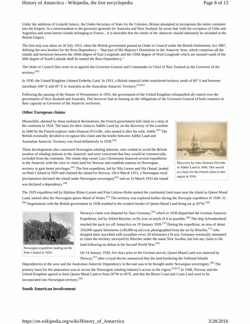
Meanwhile, alarmed by these unilateral declarations, the French government laid claim to a strip ofthe continent in 1924. The basis for their claim to Adélie Land lay on the discovery of the coastlinein 1840 by the French explorer Jules Dumont d'Urville, who named it after his wife, Adèle.[63] TheBritish eventually decided to recognize this claim and the border between Adélie Land andAustralian Antarctic Territory was fixed definitively in 1938.[64]
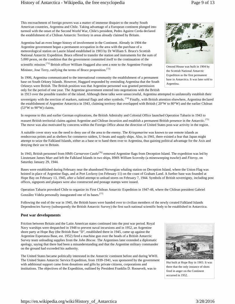
These developments also concerned Norwegian whaling interests, who wished to avoid the Britishtaxation of whaling stations in the Antarctic and were concerned that they would be commerciallyexcluded from the continent. The whale-ship owner Lars Christensen financed several expeditionsto the Antarctic with the view to claim land for Norway and establish stations on Norwegianterritory to gain better privileges.[65] The first expedition, led by Nils Larsen and Ola Olstad, landedon Peter I Island in 1929 and claimed the island for Norway. On 6 March 1931, a Norwegian royalproclamation declared the island under Norwegian sovereignty[65] and on 23 March 1933 the islandwas declared a dependency.[66]
The 1929 expedition led by Hjalmar Riiser-Larsen and Finn Lützow-Holm named the continental land mass near the island as Queen MaudLand, named after the Norwegian queen Maud of Wales.[67] The territory was explored further during the Norvegia expedition of 1930–31.[68] Negotiations with the British government in 1938 resulted in the western border of Queen Maud Land being set at 20°W.[68]
Norway's claim was disputed by Nazi Germany,[69] which in 1938 dispatched the German AntarcticExpedition, led by Alfred Ritscher, to fly over as much of it as possible.[68] The ship Schwabenlandreached the pack ice off Antarctica on 19 January 1939.[70] During the expedition, an area of about350,000 square kilometres (140,000 sq mi) was photographed from the air by Ritscher,[71] whodropped darts inscribed with swastikas every 26 kilometres (16 mi). Germany eventually attemptedto claim the territory surveyed by Ritscher under the name New Swabia, but lost any claim to theland following its defeat in the Second World War.[69]
On 14 January 1939, five days prior to the German arrival, Queen Maud Land was annexed byNorway,[67] after a royal decree announced that the land bordering the Falkland Islands
Dependencies in the west and the Australian Antarctic Dependency in the east was to be brought under Norwegian sovereignty.[68] Theprimary basis for the annexation was to secure the Norwegian whaling industry's access to the region.[67][72] In 1948, Norway and theUnited Kingdom agreed to limit Queen Maud Land to from 20°W to 45°E, and that the Bruce Coast and Coats Land were to beincorporated into Norwegian territory.[68]
South American involvement
Page 8 of 13History of Antarctica - Wikipedia, the free encyclopedia
3/28/2016https://en.wikipedia.org/wiki/History_of_Antarctica
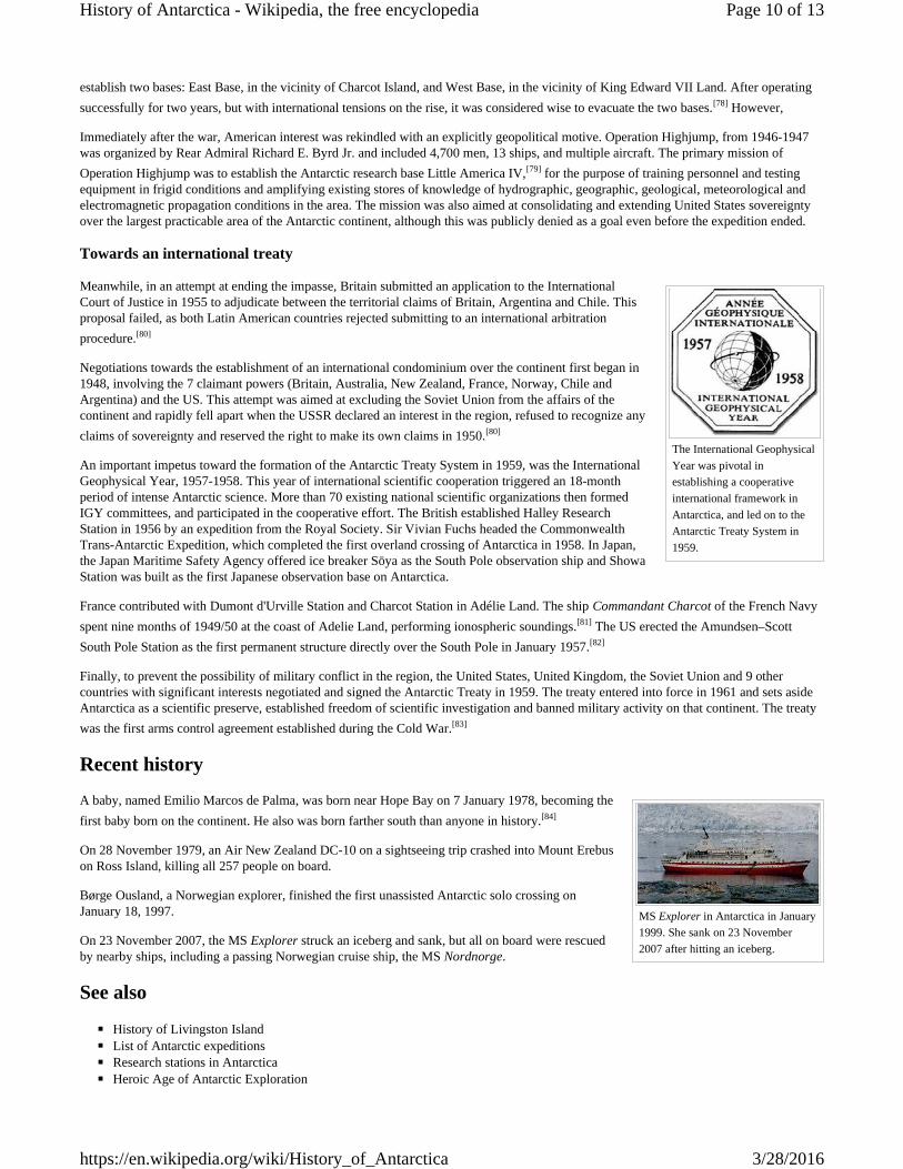
Omond House was built in 1904 bythe Scottish National AntarcticExpedition as the first permanentbase in Antarctica. It was later sold toArgentina.
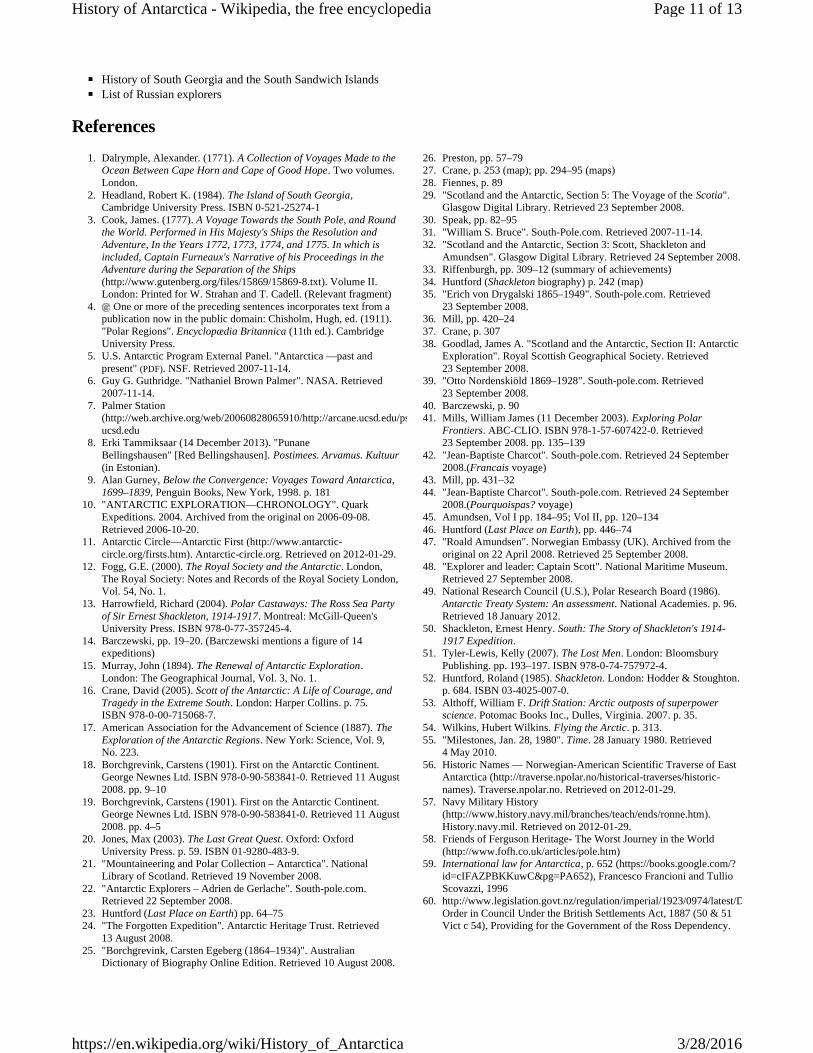
Hut built at Hope Bay in 1903. It wasthere that the only instance of shotsfired in anger on the Continentoccurred in 1952.
This encroachment of foreign powers was a matter of immense disquiet to the nearby SouthAmerican countries, Argentina and Chile. Taking advantage of a European continent plunged intoturmoil with the onset of the Second World War, Chile's president, Pedro Aguirre Cerda declaredthe establishment of a Chilean Antarctic Territory in areas already claimed by Britain.
Argentina had an even longer history of involvement in the Continent. Already in 1904 theArgentine government began a permanent occupation in the area with the purchase of ameteorological station on Laurie Island established in 1903 by Dr William S. Bruce's ScottishNational Antarctic Expedition. Bruce offered to transfer the station and instruments for the sum of5.000 pesos, on the condition that the government committed itself to the continuation of thescientific mission.[73] British officer William Haggard also sent a note to the Argentine ForeignMinister, Jose Terry, ratifying the terms of Bruce proposition.[73]
In 1906, Argentina communicated to the international community the establishment of a permanentbase on South Orkney Islands. However, Haggard responded by reminding Argentina that the SouthOrkneys were British. The British position was that Argentine personnel was granted permissiononly for the period of one year. The Argentine government entered into negotiations with the Britishin 1913 over the possible transfer of the island. Although these talks were unsuccessful, Argentina attempted to unilaterally establish theirsovereignty with the erection of markers, national flags and other symbols. [74] Finally, with British attention elsewhere, Argentina declaredthe establishment of Argentine Antarctica in 1943, claiming territory that overlapped with British ( 20°W to 80°W) and the earlier Chilean(53°W to 90°W) claims.
In response to this and earlier German explorations, the British Admiralty and Colonial Office launched Operation Tabarin in 1943 toreassert British territorial claims against Argentine and Chilean incursion and establish a permanent British presence in the Antarctic.[75]
The move was also motivated by concerns within the Foreign Office about the direction of United States post-war activity in the region.
A suitable cover story was the need to deny use of the area to the enemy. The Kriegsmarine was known to use remote islands asrendezvous points and as shelters for commerce raiders, U-boats and supply ships. Also, in 1941, there existed a fear that Japan mightattempt to seize the Falkland Islands, either as a base or to hand them over to Argentina, thus gaining political advantage for the Axis anddenying their use to Britain.
In 1943, British personnel from HMS Carnarvon Castle[76] removed Argentine flags from Deception Island. The expedition was led byLieutenant James Marr and left the Falkland Islands in two ships, HMS William Scoresby (a minesweeping trawler) and Fitzroy, onSaturday January 29, 1944.
Bases were established during February near the abandoned Norwegian whaling station on Deception Island, where the Union Flag washoisted in place of Argentine flags, and at Port Lockroy (on February 11) on the coast of Graham Land. A further base was founded atHope Bay on February 13, 1945, after a failed attempt to unload stores on February 7, 1944. Symbols of British sovereignty, including postoffices, signposts and plaques were also constructed and postage stamps were issued.
Operation Tabarin provoked Chile to organize its First Chilean Antarctic Expedition in 1947-48, where the Chilean president GabrielGonzález Videla personally inaugurated one of its bases.[77]
Following the end of the war in 1945, the British bases were handed over to civilian members of the newly created Falkland IslandsDependencies Survey (subsequently the British Antarctic Survey) the first such national scientific body to be established in Antarctica.
Post war developments
Friction between Britain and the Latin American states continued into the post war period. RoyalNavy warships were despatched in 1948 to prevent naval incursions and in 1952, an Argentineshore party at Hope Bay (the British Base "D", established there in 1945, came up against theArgentine Esperanza Base, est. 1952) fired a machine gun over the heads of a British AntarcticSurvey team unloading supplies from the John Biscoe. The Argentines later extended a diplomaticapology, saying that there had been a misunderstanding and that the Argentine military commanderon the ground had exceeded his authority.
The United States became politically interested in the Antarctic continent before and during WWII.The United States Antarctic Service Expedition, from 1939-1941, was sponsored by the governmentwith additional support came from donations and gifts by private citizens, corporations andinstitutions. The objectives of the Expedition, outlined by President Franklin D. Roosevelt, was to
Page 9 of 13History of Antarctica - Wikipedia, the free encyclopedia
3/28/2016https://en.wikipedia.org/wiki/History_of_Antarctica
The International GeophysicalYear was pivotal inestablishing a cooperativeinternational framework inAntarctica, and led on to theAntarctic Treaty System in1959.
MS Explorer in Antarctica in January1999. She sank on 23 November2007 after hitting an iceberg.
establish two bases: East Base, in the vicinity of Charcot Island, and West Base, in the vicinity of King Edward VII Land. After operatingsuccessfully for two years, but with international tensions on the rise, it was considered wise to evacuate the two bases.[78] However,
Immediately after the war, American interest was rekindled with an explicitly geopolitical motive. Operation Highjump, from 1946-1947was organized by Rear Admiral Richard E. Byrd Jr. and included 4,700 men, 13 ships, and multiple aircraft. The primary mission ofOperation Highjump was to establish the Antarctic research base Little America IV,[79] for the purpose of training personnel and testingequipment in frigid conditions and amplifying existing stores of knowledge of hydrographic, geographic, geological, meteorological andelectromagnetic propagation conditions in the area. The mission was also aimed at consolidating and extending United States sovereigntyover the largest practicable area of the Antarctic continent, although this was publicly denied as a goal even before the expedition ended.
Towards an international treaty
Meanwhile, in an attempt at ending the impasse, Britain submitted an application to the InternationalCourt of Justice in 1955 to adjudicate between the territorial claims of Britain, Argentina and Chile. Thisproposal failed, as both Latin American countries rejected submitting to an international arbitrationprocedure.[80]
Negotiations towards the establishment of an international condominium over the continent first began in1948, involving the 7 claimant powers (Britain, Australia, New Zealand, France, Norway, Chile andArgentina) and the US. This attempt was aimed at excluding the Soviet Union from the affairs of thecontinent and rapidly fell apart when the USSR declared an interest in the region, refused to recognize anyclaims of sovereignty and reserved the right to make its own claims in 1950.[80]
An important impetus toward the formation of the Antarctic Treaty System in 1959, was the InternationalGeophysical Year, 1957-1958. This year of international scientific cooperation triggered an 18-monthperiod of intense Antarctic science. More than 70 existing national scientific organizations then formedIGY committees, and participated in the cooperative effort. The British established Halley ResearchStation in 1956 by an expedition from the Royal Society. Sir Vivian Fuchs headed the CommonwealthTrans-Antarctic Expedition, which completed the first overland crossing of Antarctica in 1958. In Japan,the Japan Maritime Safety Agency offered ice breaker Sōya as the South Pole observation ship and ShowaStation was built as the first Japanese observation base on Antarctica.
France contributed with Dumont d'Urville Station and Charcot Station in Adélie Land. The ship Commandant Charcot of the French Navyspent nine months of 1949/50 at the coast of Adelie Land, performing ionospheric soundings.[81] The US erected the Amundsen–ScottSouth Pole Station as the first permanent structure directly over the South Pole in January 1957.[82]
Finally, to prevent the possibility of military conflict in the region, the United States, United Kingdom, the Soviet Union and 9 othercountries with significant interests negotiated and signed the Antarctic Treaty in 1959. The treaty entered into force in 1961 and sets asideAntarctica as a scientific preserve, established freedom of scientific investigation and banned military activity on that continent. The treatywas the first arms control agreement established during the Cold War.[83]
Recent historyA baby, named Emilio Marcos de Palma, was born near Hope Bay on 7 January 1978, becoming thefirst baby born on the continent. He also was born farther south than anyone in history.[84]
On 28 November 1979, an Air New Zealand DC-10 on a sightseeing trip crashed into Mount Erebuson Ross Island, killing all 257 people on board.
Børge Ousland, a Norwegian explorer, finished the first unassisted Antarctic solo crossing onJanuary 18, 1997.
On 23 November 2007, the MS Explorer struck an iceberg and sank, but all on board were rescuedby nearby ships, including a passing Norwegian cruise ship, the MS Nordnorge.
See also
◾ History of Livingston Island◾ List of Antarctic expeditions◾ Research stations in Antarctica◾ Heroic Age of Antarctic Exploration
Page 10 of 13History of Antarctica - Wikipedia, the free encyclopedia
3/28/2016https://en.wikipedia.org/wiki/History_of_Antarctica
◾ History of South Georgia and the South Sandwich Islands◾ List of Russian explorers
References1. Dalrymple, Alexander. (1771). A Collection of Voyages Made to the
Ocean Between Cape Horn and Cape of Good Hope. Two volumes.London.
2. Headland, Robert K. (1984). The Island of South Georgia,Cambridge University Press. ISBN 0-521-25274-1
3. Cook, James. (1777). A Voyage Towards the South Pole, and Roundthe World. Performed in His Majesty's Ships the Resolution andAdventure, In the Years 1772, 1773, 1774, and 1775. In which isincluded, Captain Furneaux's Narrative of his Proceedings in theAdventure during the Separation of the Ships(http://www.gutenberg.org/files/15869/15869-8.txt). Volume II.London: Printed for W. Strahan and T. Cadell. (Relevant fragment)
4. One or more of the preceding sentences incorporates text from apublication now in the public domain: Chisholm, Hugh, ed. (1911)."Polar Regions". Encyclopædia Britannica (11th ed.). CambridgeUniversity Press.
5. U.S. Antarctic Program External Panel. "Antarctica —past andpresent" (PDF). NSF. Retrieved 2007-11-14.
6. Guy G. Guthridge. "Nathaniel Brown Palmer". NASA. Retrieved2007-11-14.
7. Palmer Station(http://web.archive.org/web/20060828065910/http://arcane.ucsd.edu/pstat.html).ucsd.edu
8. Erki Tammiksaar (14 December 2013). "PunaneBellingshausen" [Red Bellingshausen]. Postimees. Arvamus. Kultuur(in Estonian).
9. Alan Gurney, Below the Convergence: Voyages Toward Antarctica,1699–1839, Penguin Books, New York, 1998. p. 181
10. "ANTARCTIC EXPLORATION—CHRONOLOGY". QuarkExpeditions. 2004. Archived from the original on 2006-09-08.Retrieved 2006-10-20.
11. Antarctic Circle—Antarctic First (http://www.antarctic-circle.org/firsts.htm). Antarctic-circle.org. Retrieved on 2012-01-29.
12. Fogg, G.E. (2000). The Royal Society and the Antarctic. London,The Royal Society: Notes and Records of the Royal Society London,Vol. 54, No. 1.
13. Harrowfield, Richard (2004). Polar Castaways: The Ross Sea Partyof Sir Ernest Shackleton, 1914-1917. Montreal: McGill-Queen'sUniversity Press. ISBN 978-0-77-357245-4.
14. Barczewski, pp. 19–20. (Barczewski mentions a figure of 14expeditions)
15. Murray, John (1894). The Renewal of Antarctic Exploration.London: The Geographical Journal, Vol. 3, No. 1.
16. Crane, David (2005). Scott of the Antarctic: A Life of Courage, andTragedy in the Extreme South. London: Harper Collins. p. 75.ISBN 978-0-00-715068-7.
17. American Association for the Advancement of Science (1887). TheExploration of the Antarctic Regions. New York: Science, Vol. 9,No. 223.
18. Borchgrevink, Carstens (1901). First on the Antarctic Continent.George Newnes Ltd. ISBN 978-0-90-583841-0. Retrieved 11 August2008. pp. 9–10
19. Borchgrevink, Carstens (1901). First on the Antarctic Continent.George Newnes Ltd. ISBN 978-0-90-583841-0. Retrieved 11 August2008. pp. 4–5
20. Jones, Max (2003). The Last Great Quest. Oxford: OxfordUniversity Press. p. 59. ISBN 01-9280-483-9.
21. "Mountaineering and Polar Collection – Antarctica". NationalLibrary of Scotland. Retrieved 19 November 2008.
22. "Antarctic Explorers – Adrien de Gerlache". South-pole.com.Retrieved 22 September 2008.
23. Huntford (Last Place on Earth) pp. 64–7524. "The Forgotten Expedition". Antarctic Heritage Trust. Retrieved
13 August 2008.25. "Borchgrevink, Carsten Egeberg (1864–1934)". Australian
Dictionary of Biography Online Edition. Retrieved 10 August 2008.
26. Preston, pp. 57–7927. Crane, p. 253 (map); pp. 294–95 (maps)28. Fiennes, p. 8929. "Scotland and the Antarctic, Section 5: The Voyage of the Scotia".
Glasgow Digital Library. Retrieved 23 September 2008.30. Speak, pp. 82–9531. "William S. Bruce". South-Pole.com. Retrieved 2007-11-14.32. "Scotland and the Antarctic, Section 3: Scott, Shackleton and
Amundsen". Glasgow Digital Library. Retrieved 24 September 2008.33. Riffenburgh, pp. 309–12 (summary of achievements)34. Huntford (Shackleton biography) p. 242 (map)35. "Erich von Drygalski 1865–1949". South-pole.com. Retrieved
23 September 2008.36. Mill, pp. 420–2437. Crane, p. 30738. Goodlad, James A. "Scotland and the Antarctic, Section II: Antarctic
Exploration". Royal Scottish Geographical Society. Retrieved23 September 2008.
39. "Otto Nordenskiöld 1869–1928". South-pole.com. Retrieved23 September 2008.
40. Barczewski, p. 9041. Mills, William James (11 December 2003). Exploring Polar
Frontiers. ABC-CLIO. ISBN 978-1-57-607422-0. Retrieved23 September 2008. pp. 135–139
42. "Jean-Baptiste Charcot". South-pole.com. Retrieved 24 September2008.(Francais voyage)
43. Mill, pp. 431–3244. "Jean-Baptiste Charcot". South-pole.com. Retrieved 24 September
2008.(Pourquoispas? voyage)45. Amundsen, Vol I pp. 184–95; Vol II, pp. 120–13446. Huntford (Last Place on Earth), pp. 446–7447. "Roald Amundsen". Norwegian Embassy (UK). Archived from the
original on 22 April 2008. Retrieved 25 September 2008.48. "Explorer and leader: Captain Scott". National Maritime Museum.
Retrieved 27 September 2008.49. National Research Council (U.S.), Polar Research Board (1986).
Antarctic Treaty System: An assessment. National Academies. p. 96.Retrieved 18 January 2012.
50. Shackleton, Ernest Henry. South: The Story of Shackleton's 1914-1917 Expedition.
51. Tyler-Lewis, Kelly (2007). The Lost Men. London: BloomsburyPublishing. pp. 193–197. ISBN 978-0-74-757972-4.
52. Huntford, Roland (1985). Shackleton. London: Hodder & Stoughton.p. 684. ISBN 03-4025-007-0.
53. Althoff, William F. Drift Station: Arctic outposts of superpowerscience. Potomac Books Inc., Dulles, Virginia. 2007. p. 35.
54. Wilkins, Hubert Wilkins. Flying the Arctic. p. 313.55. "Milestones, Jan. 28, 1980". Time. 28 January 1980. Retrieved
4 May 2010.56. Historic Names — Norwegian-American Scientific Traverse of East
Antarctica (http://traverse.npolar.no/historical-traverses/historic-names). Traverse.npolar.no. Retrieved on 2012-01-29.
57. Navy Military History(http://www.history.navy.mil/branches/teach/ends/ronne.htm).History.navy.mil. Retrieved on 2012-01-29.
58. Friends of Ferguson Heritage- The Worst Journey in the World(http://www.fofh.co.uk/articles/pole.htm)
59. International law for Antarctica, p. 652 (https://books.google.com/?id=cIFAZPBKKuwC&pg=PA652), Francesco Francioni and TullioScovazzi, 1996
60. http://www.legislation.govt.nz/regulation/imperial/1923/0974/latest/DLM1195.htmlOrder in Council Under the British Settlements Act, 1887 (50 & 51Vict c 54), Providing for the Government of the Ross Dependency.
Page 11 of 13History of Antarctica - Wikipedia, the free encyclopedia
3/28/2016https://en.wikipedia.org/wiki/History_of_Antarctica
61. Antarctica and international law: a collection of inter-state andnational documents, Volume 2. pp. 143. Author: W. M. Bush. Editor:Oceana Publications, 1982. ISBN 0-379-20321-9, ISBN 978-0-379-20321-9
62. C2004C00416 / Australian Antarctic Territory Acceptance Act 1933(http://www.austlii.edu.au/au/legis/cth/consol_act/) ( Cth )
63. Dunmore, John (2007). From Venus to Antarctica: The Life ofDumont D'Urville. Auckland: Exisle Publ. p. 209.ISBN 9780908988716.
64. "A Brief History of Mawson". Australian Government - AustralianArctic Division. Archived from the original on 27 July 2008.Retrieved 2008-07-16.
65. Kyvik, Helga, ed. (2008). Norge i Antarktis. Oslo: Schibsted Forlag.p. 52. ISBN 82-516-2589-0.
66. "Lov om Bouvet-øya, Peter I's øy og Dronning Maud Land m.m.(bilandsloven)" (in Norwegian). Lovdata. Archived from the originalon 29 August 2011. Retrieved 29 August 2011.
67. "Dronning Maud Land" (in Norwegian). Norwegian Polar Institute.Retrieved 10 May 2011.
68. Gjeldsvik, Tore. "Dronning Maud Land". Store norske leksikon (inNorwegian). Retrieved 9 May 2011.
69. Widerøe, Turi (2008). "Annekteringen av Dronning Maud Land".Norsk Polarhistorie (in Norwegian). Retrieved 15 July 2011.
70. Murphy, 2002, p. 192.71. Murphy, 2002, p. 204.72. "Forutsetninger for Antarktistraktaten". Norsk Polarhistorie (in
Norwegian). Retrieved 15 May 2011.
73. Escude, Carlos; Cisneros, Andres. "Historia General de lasRelaciones Exteriores de la Republica Argentina" (in Spanish).Retrieved July 6, 2012.
74. Kieran Mulvaney (2001). At the Ends of the Earth: A History of thePolar Regions. Island Press. pp. 124–130.
75. British Research Stations and Refuges - History(http://www.antarctica.ac.uk/about_bas/our_history/stations_and_refuges/index.php)
76. HMS Carnarvon Castle 1943(http://www.spri.cam.ac.uk/library/pictures/catalogue/hmscc1943/)
77. Antarctica and the Arctic: the complete encyclopedia, Volume 1, byDavid McGonigal, Lynn Woodworth, page 98
78. Bertrand, Kenneth J. (1971). Americans in Antarctica 1775-1948.New York: American Geographical Society.
79. Kearns, David A. (2005). "Operation Highjump: Task Force 68".Where Hell Freezes Over: A Story of Amazing Bravery and Survival.New York: Thomas Dunne Books. p. 304. ISBN 0-312-34205-5.Retrieved 2011-05-31.
80. Klaus Dodds (2012). The Antarctic: A Very Short Introduction.Oxford University Press.
81. M. Barré, K. Rawer: "Quelques résultats d’observationsionosphériques effectuées près de la Terre Adélie". Journal ofAtmospheric and Terrestrial Physics volume 1, issue 5–6 (1951), pp.311–314.
82. "South Pole's first building blown up after 53 years".OurAmazingPlanet.com. 2011-03-31.
83. ATS.aq (http://www.ats.aq/index_e.htm)84. antarctica.org
(http://www.antarctica.org/old/UK/Envirn/pag/antar_history/pag/science1.htm#science)—Science: in force...
Further reading
◾ "Working-Class Hero". Portland Magazine. 8 November 2012. — "'She’s just moored there at the dock in Bay Center, sitting in themud,' says Charles Lagerbom, Northport, Maine, resident and president of the Antarctican Society".
◾ The South Pole; an account of the Norwegian Antarctic expedition in the "Fram," 1910–12 — Volume 1 and Volume 2 at ProjectGutenberg
◾ The Worst Journey in the World, Volumes 1 and 2 Antarctic 1910–1913 at Project Gutenberg◾ South: the story of Shackleton's 1914–1917 expedition at Project Gutenberg◾ Anthony, Jason C. (2012). Hoosh : roast penguin, scurvy day, and other stories of Antarctic cuisine. Lincoln, NB: University of
Nebraska Press. ISBN 978-0-8032-2666-1.◾ Robert Clancy, John Manning, Henk Brolsma: Mapping Antarctica: A Five Hundred Year Record of Discovery. Springer, 2014.
ISBN 978-94-007-4320-5 [Print]; ISBN 978-94-007-4321-2 [eBook]◾ Ivanov, L. General Geography and History of Livingston Island. (http://livingston-island.weebly.com/) In: Bulgarian Antarctic
Research: A Synthesis. Eds. C. Pimpirev and N. Chipev. Sofia: St. Kliment Ohridski University Press, 2015. pp. 17–28. ISBN 978-954-07-3939-7
External links
◾ Early Antarctic Adventures (State Library of New South Wales)(http://www.sl.nsw.gov.au/discover_collections/natural_world/antarctica/antarctica/index.html)
◾ PCO: Antarctic History (http://www.polarconservation.org/education/antarctic-history)◾ Antarctic Heritage Trust (http://www.heritage-antarctica.org/)◾ Surveying Antarctica, 1957 (https://secure.flickr.com/photos/terrymct/sets/72057594098237101/)◾ Big Dead Place (http://www.bigdeadplace.com/)◾ Working-Class 'Hero' after two decades of polar exploration. (http://www.portlandmonthly.com/portmag/2012/10/working-class-
hero/)◾ Hurley's Antarctica (http://www.sl.nsw.gov.au/discover_collections/natural_world/antarctica/hurley/index.html)
Retrieved from "https://en.wikipedia.org/w/index.php?title=History_of_Antarctica&oldid=710072364"
Categories: History of Antarctica World history
◾ This page was last modified on 14 March 2016, at 20:13.
Page 12 of 13History of Antarctica - Wikipedia, the free encyclopedia
3/28/2016https://en.wikipedia.org/wiki/History_of_Antarctica
◾ Text is available under the Creative Commons Attribution-ShareAlike License; additional terms may apply. By using this site, youagree to the Terms of Use and Privacy Policy. Wikipedia® is a registered trademark of the Wikimedia Foundation, Inc., a non-profitorganization.
Page 13 of 13History of Antarctica - Wikipedia, the free encyclopedia
3/28/2016https://en.wikipedia.org/wiki/History_of_Antarctica


![THE CHRISTIAN FOUNDATIONS OF AUSTRALIA - … us; or what advantage has Hollandia Nova [alias Australia] or Terra Australis Incognita [or unknown Australasia], from the Indian Ocean's](https://img.pdfslide.us/doc/110x75/5afca14f7f8b9a444f8c52fd/the-christian-foundations-of-australia-us-or-what-advantage-has-hollandia.jpg)