Embed Size (px)
Citation preview

PUBLISHED BY TAOS COUNTY LODGERS ASSOCIATION AND THE TOWN OF TAOS
WITH SUPPORT FROM
Historic Churches first printing, 2011 taos.org/churches
■
HISTORICCHURCHES
of Taos andNorthern New Mexico
A Self-Guided Driving Tour of 24 Historic Iglesias
Chevron Mining, Inc.Questa Mine
$25 COMBINATION ADMISSION TICKETGOOD AT ALL 5 MUSEUMS
VALID FOR A FULL YEARE.L. Blumenschein Home and Museum
La Hacienda de los MartínezThe Harwood Museum of Art, University of New Mexico
Millicent Rogers MuseumTaos Art Museum and Fechin House
MUSEUM ASSOCIATION OF TAOSTaosMuseums.org • [email protected]
■
SPONSORS
■
HISTORIC CHURCHESof Taos and Northern New Mexico
Experience Southwestern charm and history in the only hotel on Taos Plaza. Nineteen rooms,
five suites, and the Plaza Penthouse, each unique, offer modern amenities amidst authentic Taos historyand architecture. Walking distance to much of what
Taos has to offer. Free on-site parking.
HOTEL LA FONDA DE TAOS108 South Plaza
800.833.2211 • 575-758-2211lafondataos.com
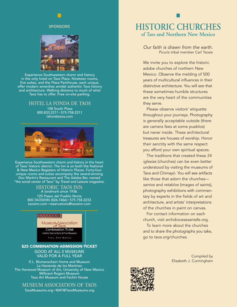
Our faith is drawn from the earth.Picurís tribal member Carl Tsosie
We invite you to explore the historicadobe churches of northern NewMexico. Observe the melding of 500years of multicultural influences in theirdistinctive architecture. You will see thatthese sometimes humble structuresare the very heart of the communitiesthey serve.
Please observe visitors’ etiquettethroughout your journeys. Photographyis generally acceptable outside (thereare camera fees at some pueblos) but never inside. These architecturaltreasures are houses of worship. Honortheir sanctity with the same respectyou afford your own spiritual spaces.
The traditions that created these 24iglesias (churches) can be even betterunderstood by visiting the museums ofTaos and Chimayó. You will see artifactslike those that adorn the churches—santos and retablos (images of saints),photography exhibitions with commen-tary by experts in the fields of art andarchitecture, and artists’ interpretationsof the churches in paint on canvas.
For contact information on eachchurch, visit archdiocesesantafe.org.
To learn more about the churchesand to share the photographs you take,go to taos.org/churches.
Compiled byElizabeth J. Cunningham
Experience Southwestern charm and history in the heartof Taos’ historic district. The Inn is on both the National & New Mexico Registers of Historic Places. Forty-four
unique rooms and suites accompany the award-winningDoc Martin’s Restaurant and The Adobe Bar, named
“the social center of Taos” by Travel and Leisure magazine.
HISTORIC TAOS INNA landmark since 1936.
125 Paseo del Pueblo Norte800.TAOSINN (826.7466) • 575.758.2233taosinn.com • [email protected]

PHOTO BY
CARLOS VIERRA,
CIRCA 1917
21High Road to Taos Española to Picurís Pueblo
NATIONAL HISTORIC LANDMARK
EL SANTUÁRIO DE CHIMAYÓSanctuary of ChimayóBuilt: 1813-1816Community: Chimayó Feast Days: January 15 and July 25Distance from Taos Plaza: 52 miles
PHOTO BY ALFRED V. KIDDER, 1908
SANTA CRUZ DE LA CAÑADAHoly Cross of the CanyonBuilt: 1733-1748Community: Santa Cruz near Española Feast Day: May 3Distance from Taos Plaza: 47 miles
History: The village of Santa Cruz, just eastof Española, played a prominent role in late17th century New Mexico. In 1692 Diegode Vargas led his first expedition into NewMexico, intent on recolonization after the1680 Pueblo Revolt that routed the Span-ish. Through reconnaissance he found theSanta Cruz Valley the most promising areaoutside the capital, Santa Fe. In 1695 deVargas brought sixty-six Zacatecas familiesto settle what would become the northernregion’s administrative center.
As the royally appointed Spanish gover-nor of New Mexico, de Vargas named itssecond official city La Villa Nueva de SantaCruz de la Cañada de Españoles Mexicanosdel Rey Nuestro Señor Don Carlos Segundo(the New Town of the Holy Cross of theCanyon of Spanish Mexicans of the KingOur Lord Carlos the Second).
In 1733 the colonists began constructingtheir church, Santa Cruz de la Cañada. Thecruciform adobe mud and mortar structureconsists of a steep gabled front with adjoin-ing twin bell towers and thick, massive buttresses at the rear that support thebuilding’s side and back walls. Since 1920the church has been under the guidance of the Sons of the Holy Family.
Today: This is one of the finest remainingexamples of 18th-century Franciscanarchitecture in New Mexico.
Directions: From NM 84/285 in Española,turn east on NM 76. Drive one mile toMcCurdy Road; turn north.
History: This masterpiece of Spanish Colonial architecture is built on earth said to have miraculous curative powers.
The Spanish settled in Chimayó (TewaIndian: flaking stone of superior quality)prior to 1680. Between 1813 and 1816,Bernardo Abeyta began work on a privatechapel to house the crucifix of Our Lord ofEsquipulas. As early as 1813 a Spanishpriest had written of people coming herefrom afar to seek cures. The church Abeytabuilt measured 60 by 24 feet with three-foot-thick adobe walls, twin towers, and abuttress at the back. A pitched corrugatedroof was added by Santa Fe architectJohn Gaw Meem shortly before ownershipwas transferred to the Archdiocese ofSanta Fe in 1929.
Today: El Santuário is designated by theArchdiocese as a pilgrimage shrine. DuringLent and Holy Week thousands of peregri-nos (pilgrims) journey on foot to Chimayófrom as far away as Taos and Albuquerque.Don’t miss the interpretive museum locatednearby. Masses are held throughout theweek.
Directions: From NM 76, turn south onNM 503. Location/parking clearly marked.
NATIONAL HISTORIC LANDMARK

4
3
SAN JOSÉ DE GRACIA DE LAS TRAMPASSaint JosephBuilt: 1760-1776Community: Las TrampasFeast Day: March 19Distance from Taos Plaza: 32 miles
History: What has been called “the mostperfectly preserved Spanish Colonial churchin the United States” is located in the smallmountain community of Las Trampas (thetraps, or snares). The settlement datesback to 1751 when Governor Tomás VélezCachupin granted the valley to twelveHispanic families. The villagers financedand built their church by contributing asixth of their annual earnings as well asperforming all the work themselves. Thechurch with its massive four-foot-thick wallsand two towers was completed in 1776.
Recent preservation efforts started in1932 when the Society for the Preservationof New Mexico Mission Churches provideda new roof. In 1966 parishioners, citizens,and historians saved San José de Graciafrom bulldozers when NM 76 was widened.Its mayordomos (church stewards) andparishioners received national recognitionfor maintenance of their church. Every twoor three years the community remuds thestructure, assisted by volunteers from nearand far.
Today: This is one of New Mexico’s threesurviving 18th-century churches. Mass isheld every first and third Sunday. The areais known for its fine weavers and fiberartists.
Directions: On NM 76, 7 1⁄2 miles south of Peñasco; 7 1⁄2 miles north of Truchas.
NATIONAL HISTORIC LANDMARK
NUESTRA SEÑORADEL ROSARIOOur Lady of the RosaryBuilt: 1760Community: TruchasFeast Day: October 7Distance from Taos Plaza: 40 miles
History: Two families, the Romeros ofSanta Cruz and the Espinosas of Chimayó,founded this mountain settlement on theHigh Road to Taos in the mid-1700s.Named for the Rio Truchas (trout river),the village was built according to Spanishgovernment specifications. All housesshared common outside walls and formedan interior plaza. The walled communityhad only one zaguan (entrance gate) the width of a single cart. This provideddefense in times of Indian attacks. In 1762,however, Comanche raids became so fiercethat residents from Truchas and neighbor-ing Las Trampas took shelter within thewalls of nearby Picurís Pueblo.
By 1770 the Truchas settlement hadgrown to 25 families. Their church, thoughtto date back to 1760, underwent renova-tions in 1878. Changes by 1900 includeda corrugated pitched roof overlaying theoriginal flat one, a bell tower, and a but-tress on the south wall.
Today: Residences and a partial wall, part of the village’s original layout, stillsurround the church. Mass is held everySunday at one of Truchas’ two churches.Allow time to visit art galleries and artists’studios within the village.
Directions: NM 76 makes a right angleturn in Truchas at County Road 75. Take 75 north 1⁄4 mile to church.
PHOTO BY
SAM BACA,
1986
NATIONAL REGISTER OF HISTORIC PLACES

6
5
SAN LORENZO DE PICURÍSSaint Lawrence of PicurísBuilt: circa 1769, began restoring circa 1988 Community: Picurís Pueblo Feast Day: August 10Distance from Taos Plaza: 26 miles
PHOTO ABOVE
CIRCA 1915
PHOTO BY
NANCY
WOODWARD,
1990
SAGRADO CORAZÓN DE JESUSSacred Heart of JesusBuilt: 1920Community: Rio LucioFeast Day: the Friday following theSolemnity of the Body and Blood of ChristDistance from Taos Plaza: 28 miles
PHOTO BY JAKE RODRIGUEZ, 1986
History: Picurís Pueblo, one of the country’searliest continuously-inhabited settlements,has been home to the northern Tiwa-speaking pe’ewi (mountain people) since1250. In the early 1600s the Spanish government sent missionaries to Nuevo Mexico to build churches and convert thenative people. The first San Lorenzo church,built at Picurís in 1621, was burned to theground during the Pueblo Revolt of 1680.Comanches destroyed the rebuilt churchin 1746.
Construction began again in 1769 usingthe ancient puddled adobe building tech-nique. The single nave structure measuring19 by 66 feet was completed in 1786.After several changes,the entire church wasrebuilt to its originalprofile in 1960. In the1980s water damagecaused the structure’scomplete collapse.
When the commu-nity decided to rebuildin 1990, the newlyformed Picurís Pueblo Restoration Leagueoversaw the project. Although the Picuríspeople did most of the work, volunteerscame from neighboring Peñasco, a localmotorcycle club, even from California, tohelp. One tribal member stated the newchurch with its solid cruciform-shapedfoundation represents the future strengthof the Picurís tribe.
Today: Though the church is seldom open to the public, there are interestingcrafts shops nearby and Picurís welcomesvisitors to tour the pueblo and attendannual ceremonial dances.
Directions: Off NM 75, 1 mile west of NM 76.
History: Not far from Peñasco on the HighRoad to Taos is the small farming commu-nity of Rio Lucero (shiny river). One of sev-eral small villages in the Peñasco Valley,including Rodarte and Llano San Juan, it adjoins Picurís Pueblo and the CarsonNational Forest. Its inhabitants grow highaltitude crops of alfalfa, corn, and peas aswell as apples.
The church, built in 1920 and locatedalong the roadside of the village, has apitched corrugated metal roof and a belfrywith board facing. Sagrado Corazón deJesus is one of the missions administeredby the parish of San Antonio de Padua inPeñasco.
Today: This is a rural village chapel usedfor family devotions and monthly mass.Feel free to walk around the outside andtake pictures. The chapel is just west ofthe community of Peñasco, a great placeto have lunch and visit art galleries.
Directions: On NM 75, 11⁄2 miles west of NM 76.
SAN JUAN BAUTISTASt. John the BaptistBuilt: 1913Community: Ohkay Owingeh Pueblo Feast Day: June 13 and 24Distance from Taos Plaza: 42 miles
History: In Tewa, the language of thispueblo, the name O’ke means “We are thebrothers.” Two other pueblos existed in thisarea before the present one. Before theSpanish entrada (arrival) in 1540, this site—known as Yungue-Owinge—was a leg-endary meeting center for Indian peoples.
In 1598 explorer Juan de Oñate, gover-nor of New Spain’s province of New Mex-ico, arrived at O’ke with 400 Spanishcolonists and established the first Spanishcapital. Within months the Spaniards haderected the colony’s first adobe church,completed in September of the same year.
Spanish rule proved too oppressive and led to the Pueblo Revolt of 1680, anuprising that originated at San Juan (O’ke).After the Reconquest, Fray Juan Alvarezreported a new churchunder construction in1706. That Spanish Colonial adobe structurestood until 1913 whenFather Camille Seuxreplaced it with a stonechurch built in the FrenchGothic style.
Today: The Pueblo peoplereclaimed their originalname, Ohkay Owingeh, in 2005. Across the plaza from the church,view the stone chapel Father Seux fundedand had built in 1890 in honor of OurLady of Lourdes.
Directions: From NM 68 turn west on NM 291 into the Pueblo center.
7
PHOTOS BY
RICHARD
FEDERICI,
1973
Low Road to Taos Española to Tres Piedras
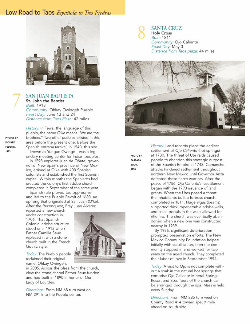
8 SANTA CRUZHoly CrossBuilt: 1811Community: Ojo CalienteFeast Day: May 3Distance from Taos plaza: 44 miles
PHOTO BY
BARBARA
ZOOK,
1990
History: Land records place the earliestsettlement of Ojo Caliente (hot springs) at 1730. The threat of Ute raids causedpeople to abandon this strategic outpostof the Spanish Empire in 1748. Comancheattacks hindered settlement throughoutnorthern New Mexico until Governor Anzadefeated these fierce warriors. After thepeace of 1786, Ojo Caliente’s resettlementbegan with the 1793 issuance of landgrants. When the Utes posed a threat, the inhabitants built a fortress church,completed in 1811. Huge vigas (beams)supported thick impenetrable adobe walls,and small portals in the walls allowed forrifle fire. The church was eventually aban-doned when a new one was constructednearby in 1939.
By 1986, significant deteriorationprompted preservation efforts. The NewMexico Community Foundation helpedinitially with stabilization, then the com-munity stepped in and worked for twoyears on the aged church. They completedtheir labor of love in September 1994.
Today: A visit to Ojo is not complete with-out a soak in the natural hot springs thatcomprise Ojo Caliente Mineral SpringsResort and Spa. Tours of the church canbe arranged through the spa. Mass is heldevery Sunday.
Directions: From NM 285 turn west onCounty Road 414 toward spa; 1⁄4 mileahead on south side.
9 SAN JUAN NEPOMUCENOSaint John NepomukBuilt: 1832Community: El Rito Feast Day: May 16Distance from Taos Plaza: 52 miles
History: The Hispanic settlement of El Rito(the little river) began in 1808 when inhabi-tants of Abiquiu purchased farmland fromthe original Spanish land grant holders.Separated from their mother church inAbiquiu—a difficult 14-mile ride on horse-back—the people began constructing theirown church in 1827. Changes occurred in1869 when Bishop Lamy (the subject ofWilla Cather’s Death Comes for the Arch-bishop) appointed El Rito as the area’smother church. Under Lamy, the Frenchpriests, dissatisfied with the look of thisHispanic church, added French architec-tural elements, including a pitched roof.
In 1979 the decision to restore the churchto its original state brought unforeseen disaster. It was discovered that water hadseeped in under the hard plaster addedin the 1940s and dissolved the adobe,which led to a series of collapses. Architec-tural consultants advised using a wood andsteel frame for support and cement mortarto secure the adobe bricks. CompletedDecember 1981, the new structure provedstrong enough to support the church’stwo-ton bell. When it rang in the inaugu-ral mass, parishioners shed tears of joy.
Today: Mass is held every Sunday. Otherthan at this time, the church is only view-able from the outside.
Directions: From NM 285 turn west onNM 111 then south on County Road 554;12 miles to center of El Rito.
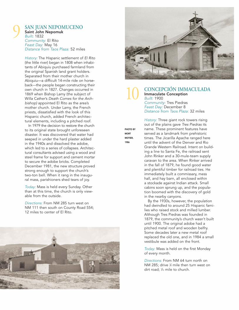
10 CONCEPCIÓN IMMACULADAImmaculate ConceptionBuilt: 1900Community: Tres PiedrasFeast Day: December 8Distance from Taos Plaza: 32 miles
History: Three giant rock towers rising out of the plains gave Tres Piedras itsname. These prominent features haveserved as a landmark from prehistorictimes. The Jicarilla Apache ranged hereuntil the advent of the Denver and RioGrande Western Railroad. Intent on build-ing a line to Santa Fe, the railroad sentJohn Rinker and a 30-mule-team supplycaravan to the area. When Rinker arrivedin the fall of 1879, he found good waterand plentiful timber for railroad ties. Heimmediately built a commissary, messhall, and hay barn, all enclosed within a stockade against Indian attack. Smallcabins soon sprung up, and the popula-tion boomed with the discovery of gold in the nearby canyons.
By the 1930s, however, the populationhad dwindled to around 25 Hispanic fami-lies who raised stock and milled lumber.Although Tres Piedras was founded in1879, the community’s church wasn’t builtuntil 1900. The original adobe had apitched metal roof and wooden belfry.Some decades later a new metal roofreplaced the old one, and in 1984 a smallvestibule was added on the front.
Today: Mass is held on the first Mondayof every month.
Directions: From NM 64 turn north onNM 285; drive 1⁄4 mile then turn west ondirt road; 1⁄10 mile to church.
PHOTO BY
MORT
MOTIER,
1986

12 NUESTRA SEÑORA DE LOS DOLORESOur Lady of SorrowsBuilt: 1892Community: Pilar Feast Day: September 15Distance from Taos Plaza: 23 miles
History: Originally, Jicarilla Apaches farmedin the community now known as Pilar(pillar), on the east bank of the Rio Grande.In 1795 Governor Fernando Chacóngranted the land to 25 Spanish families in the community then named Cienaguilla(little marshes). Over the next five decadesrelations between the peoples deterio-rated, finally resulting in conflict. In 1854Picurís and Ute Indians routed 60 dragoonsfrom the Ft. Burgwin cantonment nearTaos in the battle of Cienaguilla.
The adobe church was built in 1892 witha pitched roof and an entry portico toppedby a belfry. (The colorful red metal panelroof replaced the old one in 1986.) Withthe advent of a post office in 1912, thecommunity acquired the name Pilar. Al-though the origin of this place name is notclear, one possibility derives from one ofSpain’s principal religious sites, NuestraSeñora de Pilar in Zaragoza.
Today: Take time to enjoy the Orilla VerdeRecreation Area along the Rio Grande inPilar. Artists’ studios are often open to thepublic, however the chapel is private.
Directions: From NM 68 turn northwest on570; 1⁄2 mile along the river; right at church.
PHOTO BY JAKE RODRIGUEZ, 1986
Central Taos Area Velarde to Taos Pueblo
11 NUESTRA SEÑORA DE GUADALUPEOur Lady of GuadalupeBuilt: 1817Community: VelardeFeast Day: December 12Distance from Taos Plaza: 32 miles
PHOTO BY
JAKE
RODRIGUEZ,
1986
History: Some of the first arrivals to thisarea descended from Juan Pérez Velarde,a Spaniard who settled in Guadalupe delPaso in 1725. By the 1770s JoaquinVelarde family members had migrated tonorthern New Mexico to a place called La Joya (the basin) because of the land’ssuitability for hortalizas (gardens). In therich soil along the Rio Grande, grains,chile, and corn grew in abundance. In theearly 1900s when a post office was estab-lished in La Joya, it was renamed afterthen-postmaster David Velarde.
Church signage dates Nuestra Señorade Guadalupe to 1817. Its size—approxi-mately 40 by 80 feet—and four-foot-thickadobe walls would have provided protec-tion from Indian attack.
Sometime between 1900 and 1920, apitched tin roof replaced the flat one. In2006 the community replaced the tin witha new corrugated metal roof and a yearlater they removed the hard plaster andreplastered with adobe.
Today: Velarde is famous for its cherries,apricots, pears, and apples, sold through-out the summer at roadside stands.
Directions: From NM 68 turn west onCounty Road 53; 1⁄3 mile to fork, thennorth 500 yards to church.

518
150
518
76
75
503
64
64
434
285
285
76
68
68
522
522
567
196
378
■
■
110
442
84
84
NNN
➤➤➤
98
544
64
518502501
4
30
84
64
17
17
96
j
x
x
x
64
115
519111
240
516
159
38
B-143
285
493
75
570
111
285
544
TAOS
QUESTA
TAOS SKI VALLEY
EAGLE NEST
ANGEL FIRE
DIXON
TAOS JUNCTION
COSTILLA
RED RIVER
ARROYO SECO
ARROYO HONDO
RANCHOS DE TAOS
EagleNestLakeR
i o
Gr
an
de
ValleVidal
TAOS PUEBLO
PICURÍSPUEBLO
TRES PIEDRAS
Rio GrandeGorge Bridge
C A R S O N
N A T I O N A L
F O R E S T
OJO CALIENTE
MORAESPANOLA˜
SA
NG
RE
DE
CR
I ST
O
M
OU
NT
AI N
S
C O L O R A D O
N E W M E X I C O
AMALIA
SipapuSki Area
Orilla VerdeRec. Area
D.H.Lawrence
Ranch
Wild Rivers National
Recreation Area
HorseshoeOverlook
R e d R i v e r
PILAR
WilliamsLake
Enchanted Forest
VietnamVeteransNationalMemorial
Taos
Box
PENASCO˜
SAN CRISTOBAL˜
C A R S O N N A T I O N A L
F O R E S T
TA
OS
MO
UN
TA
I NS
+Wheeler Peak
13,161’
T A O S M O U N T A I N S
LamaFdn.
Elizabethtown
TRES RITOS
TRUCHAS
CHIMAYÓ
LatirLakes
■ NAMBE PUEBLOLOS
ALAMOS
OHKAY OWINGEH
PUEBLO■
POJOAQUE PUEBLO
CHAMA
ANTONITO
S A N T A F E
N A T I O N A L
F O R E S T
P E C O S
W I L D E R N E S S
HopewellLake
TIERRAAMARILLA
EL RITO
S A N T A F E
N A T I O N A L
F O R E S T
CLEVELAND
LA CUEVA
Cumbres & ToltecScenic Railroad
La CuevaMill
ClevelandRoller Mill
+Truchas Peak
13,103 ’
R i o
G
r an
de
■SANTA CLARA
PUEBLO
Bandelier Nat’l. Monument
+Ute Mountain
10,093 ’
+Latir Peak
12,078 ’
■
■TESUQUE PUEBLO
■
SANILDELFONSO
PUEBLO
AbiquiuResv.
Ghost Ranch
Ojo CalienteHot Springs Ft. Burgwin
Center
ABIQUIUEMBUDO
C A R S O N
N A T I O N A L
F O R E S T
VALDEZ
+Little Costilla
Peak12,583’
Penasco Amarillo10,072’
+
˜
+Big Costilla
Peak12,739’
CU
LE
BR
A
RA
NG
E
+Picurís Peak
FishHatchery
b 2
b24
b7b3
b14
b5
b8b12
b18
b20
b22
b23
b21
LASTRAMPAS
CORDOVA
b9
VALLECITOS
LA MADERA
b10
CERRO
b6
b1
b4
LA TABLAS
b11
b19
VELARDE
GARCIA
RIOLUCIO
TALPAb13
CAÑON
CUNDIYO
SANTACRUZ
(See inset below)
HOLMAN
+U.S. Hill
+Cerro Montoso
8,655’
b
Paved RoadsUnpaved RoadsHistoric Churches
A r e a L e g e n d
■
HISTORIC CHURCHES
■■ HIGH ROAD TO TAOSFrom Española to Picurís
1 Santa Cruz de la Cañada2 El Santuário de Chimayó3 Nuestra Señora del Rosario4 San José de Gracia de las Trampas5 Sagrado Corazón de Jesus6 San Lorenzo de Picurís
■■ LOW ROAD TO TAOSFrom Española to Tres Piedras
7 San Juan Bautista8 Santa Cruz9 San Juan Nepomuceno10 Concepción Immaculada
■■ CENTRAL TAOS AREAFrom Velarde to Taos Pueblo
11 Nuestra Señora de Guadalupe12 Nuestra Señora de los Dolores13 San Francisco de Asís14 Nuestra Señora de San Juan
de los Lagos15 Nuestra Señora de los Dolores16 San Antonio de Padua17 Nuestra Señora de Guadalupe18 San Gerónimo de Taos
■■ NORTHERN TAOS COUNTYFrom Arroyo Seco to Costilla
19 Santisima Trinidad20 Nuestra Señora de los Dolores21 San Cristóbal22 San Antonio de Padua23 Nuestra Señora de Guadalupe24 Sagrado Corazón
Map
s b
y B
urre
ll B
renn
eman
© 2
011
Web
b D
esig
n In
c., T
aos.
CARSON
RD.
LA P
LAC
ITA
SALA
ZAR
ST. SILER
RANCHITOSb16
b17TaosPlaza
64
240
64
68
KIT
DOWNTOWNTAOS
SANANTONIO
MA
NZA
NA
RES
b15
WITT R
D.

14
13 SAN FRANCISCO DE ASÍSSaint Francis of Assisi Built: circa 1810Community: Ranchos de Taos Feast Day: October 4Distance from Taos Plaza: 4 miles
History: San Francisco de Asís is one of thefinest examples of Franciscan architecture.Its massive walls, broad planes and gentlyrounded apse buttresses have inspiredworks by painters and photographers like Georgia O’Keeffe and Ansel Adamssince the 1880s. Like many other Spanishchurches, it has a long history. The plazaat Ranchos de Taos (“ranchos” referringto military outposts dating back to the1680s) was completed in 1779, making itthe oldest settlement in the Taos Valley.
The community obtained license to builda church in 1803. It took forty years andtens of thousands of adobe bricks to createthe 120-foot-long structure with its twintowers, six-foot-thick walls, and adobeabutments. Damage sustained from hardplaster applied in the 1960s brought thecommunity together to restore their church.
Today: Two weeks every June, the mayor-domos (church stewards) direct their parish-ioners in the annual enjarre (remudding)of this iconic Spanish Colonial structure.The church is open for visitors daily andmass is held several times each day. Allowtime to enjoy the galleries and shops thatsurround the church.
Directions: On NM 68, 1⁄4 mile south of NM 518.
NUESTRA SEÑORA DE SAN JUAN DE LOS LAGOSOur Lady of Saint John of the LakesBuilt: 1828Community: Talpa Feast Day: October 7Distance from Taos Plaza: 5 7⁄10 miles
History: Established in 1823, El Barrio(the neighborhood) de Nuestra Señora de San Juan de los Lagos de Rio Chiquitowas once a district of Ranchos de Taos. By1827 the new village’s citizenry numbered30 families. That year Bernardo Duran peti-tioned Padre Martínez, the parish priest,for the right to build a chapel in honor ofOur Lady of San Juan. Duran, one of thevillage’s prosperous residents, providedthe funds to build a small church, com-pleted in 1828.
In the early 19th century annual cordons(trading expeditions) departed from theTaos Valley and other parts of the NuevoMexico colony to exchange hides, wool,and woven goods in Mexico. At the greattrade fairs in Jalisco, the New Mexicansvisited two famous pilgrimage shrines:Our Lady of San Juan de los Lagos andOur Lady of Talpa. Sometime afterwardsthe community became known as Talpa.
Today: Now, as in days past, importantevents in the lives of Hispanic villagers—baptisms, marriages, and funerals—centeraround their private chapels. This chapelis not open to visitors but the view of theexterior makes the trip worthwhile.
Directions: On NM 518, 17⁄10 miles east of NM 68.
PHOTO BY
ROBERT
NESTOR,
1986
WEST SIDE OF CHURCH, n.d.
NATIONAL HISTORIC LANDMARK

16
15
SAN ANTONIO DE PADUASaint Anthony of PaduaBuilt: circa 1860Community: La Loma Plaza, in Taos Feast Day: June 16Distance from Taos Plaza: 1⁄2 mile
History: La Loma (the hill) has the distinc-tion of being one of two fortified plazas inNew Mexico that remains residential. Likethe adjacent original settlement of Taos,La Loma Plaza was constructed on a hillas a fortress against Indian attacks. Low,flat-roofed adobe houses with shared wallsfaced onto the open plaza (square) in thecenter. The rear walls faced outwards withno windows, forming an unbreachablebattlement much like the centuries-oldwalled Spanish town of Avila. Residentscould walk on the rooftops and guardsposted there had the added advantage of the hill’s height to keep watch from.
According to records kept by DollyValdez-Mondragón, her great-grandfatherInocencio Valdez, Sr. owned the northwestsection of the plaza and donated the landfor a family chapel. Built in the 1860s, itwas named after the village’s patron saint,San Antonio de Padua. The families usedthe chapel for devotions, rosary recitation,velorios (wakes), and occasionally for mass.
Today: This is another private chapel, opento villagers but not to visitors. Do strollaround the residential placita (little plaza)and imagine how life must have been whenIndian raids occurred.
Directions: San Antonio Street at La Loma Plaza.
NUESTRA SEÑORA DE LOS DOLORESOur Lady of SorrowsBuilt: 1873, reconstructed in 1917Community: Cañon near TaosFeast Day: September 15Distance from Taos Plaza: 11⁄2 miles
History: In 1796, the Spanish Fernando de Taos land grant included two plazas:one of them in Taos, the other in Cañon.The plaza of Nuestra Señora de los Doloreslies one-and-a-half miles southeast of TaosPlaza at the mouth of the canyon for whichthe village is named.
In spring 1847 Lewis Garrard accompa-nied a party of mountain men riding outof Taos Canyon into the Taos Valley. Hedescribed what he saw: “The valley, inevery direction, was cultivated, and in thetotal absence of fences, presented theunusual sight of one large field, stretchingaway for miles, intersected by numberlessditches.” Today many old families still holdlarge parcels of land in this area.
Landowners Pablita and Elizardo Madriddonated a parcel for building their com-munity’s church, completed in 1873 andremodeled in the 1950s.
Today: Parishioners celebrate the SorrowfulMother’s feast day with vespers and a pro-cession, followed by a mass the next day.Mass is also held on the first Wednesdayof each month.
Directions: 830 Witt Road, 1⁄4 mile southeast of NM 64 (Kit Carson Road).
PHOTO BY ROBERT NESTOR, 1986
NATIONAL REGISTER OF HISTORIC PLACES

18
17
SAN GERÓNIMO DE TAOSSaint Jerome of TaosBuilt: 1850Community: Taos PuebloFeast Day: September 30Distance from Taos Plaza: 3 miles
NUESTRA SEÑORA DE GUADALUPEOur Lady of GuadalupeBuilt: 1802, present church (below)
completed in 1962Community: TaosFeast Day: December 12Distance from Taos Plaza: 1⁄10 mile
History: In 1801 construction started onan adobe church with a flat roof and wallsthree to four feet thick. From 1826 to 1857it served as the local priest Padre AntonioJose Martínez’s headquarters. In 1833 itbecame the Taos Valley’s parish church, andin honor of the Hispanic community’s ven-erated priest was referred to as “the PadreMartínez church.” Over a century later itwas torn down due to poor condition andreplaced by a second Guadalupe church(pictured here at top). When a fire in June1961 destroyed the second church, theparishioners decided to rebuild for thethird time.
The new church, located on a site adja-cent to the former one, was designed withcurved lines and rounded walls, a depar-ture from the traditional straight lines ofsouthwestern adobe architecture. Theparish dedicated their modern-style church,
“unlike any other inthe Archdiocese,” inDecember 1962, withthe words “May OurLady of Guadalupehelp us preserve it formany years to come.”
Today: Masses areheld daily. Note the painting of Our Ladyof Guadalupe to the right of the altar. It waspainted in 1674 by Jose Santiago, and waslater a gift to Padre Martínez from Mexico.It has hung in all three churches.
Directions: 205 Don Fernando Street.
SECOND
CHURCH,
EARLY 1900s
PHOTO BY
JANET BURNS,
2011
PHOTO BY
BURRELL
BRENNEMAN,
2011
NATIONAL REGISTER OF HISTORIC PLACES
TAOS PUEBLO: NATIONAL HISTORIC LANDMARK AND WORLD HERITAGE SITE
History: Although the Tiwa-speaking peo-ple of Taos Pueblo have occupied this sitesince around 1350, ancestral Puebloanslived in neighboring pithouses about three hundred years earlier. Hernando deAlvarado from the 1540 Coronado expe-dition was the first European visitor to thisfamous northern New Mexico landmark,now the only World Heritage Site in NorthAmerica.
Sometime after his arrival in 1598, Oñatesent Fray Zamora to the pueblo to estab-lish a mission. In 1640 and again in 1680,Taos Pueblo peoplerevolted against theSpanish, both timeskilling the oppressiveFranciscan priests anddestroying their missionchurches. Relationsimproved in the 1700sand another adobe mission church wasbuilt by 1726. It stood until the Taos Revoltagainst American occupation in 1847.Artillery fire from U.S. troops left thatchurch in ruins, still visible today. Around1850 building began on the present adobechurch located closer to the plaza. Remod-eling done in 1920 included the additionof the belfry.
Today: A visit to Taos isn’t complete without a visit to Taos Pueblo. Note thereis an entrance fee and a fee for cameraequipment. Be sure to visit artisans’ shopsaround the pueblo’s plaza.
Directions: At the entrance of Taos Pueblo.

20 NUESTRA SEÑORA DE LOS DOLORESOur Lady of SorrowsBuilt: early 1830sCommunity: Arroyo Hondo Feast Day: September 15Distance from Taos Plaza: 12 miles
History: Settlement in Arroyo Hondo (deepvalley) officially began in 1815 when theSpanish government approved Nerio Sisnero’s petition for land to support somefifty householders. In 1823, 100 varas(approximately 300 sq. ft.) were set asidefor a central plaza, around which the villageand the church were built.
When Bishop Jean Baptiste Lamy madehis first visit in 1852, Padre Martínez per-suaded him to establish the area’s firstparish there. The original flat-roofed adoberemained intact until 1916 when the Frenchpriest Father Girard, who disliked the localarchitecture, undertook extensive remodel-ing. Changes included the removal ofmassive corner buttresses and the additionof a pitched shingle roof and a wood-shingled belfry; the original windows werereplaced with neo-Gothic windows. Soonthe church resembled the French architec-ture of Girard’s homeland.
In 1990 parishioners discovered rootsgrowing in the mud walls after strippingaway the exterior hard plaster. Guided bytheir own restoration committee, the peo-ple raised funds with annual fiestas and inten years completed the renovation.
Today: Now the interior and exterior arepreserved, along with the prayers of theancestors. Mass is held every Sunday.
Directions: From NM 522 east on B-143 (Hondo Seco Road) 1 mile.
SANTISIMA TRINIDADHoly TrinityBuilt: completed 1834Community: Arroyo SecoFeast Day: September 15Distance from Taos Plaza: 9 miles
19
PHOTO BY
SAM BACA,
1990
PHOTO BY
SAM BACA,
1988
Northern Taos County Arroyo Seco to Costilla
History: The community of Arroyo Secotakes its name from “dry watercourse.”Three years prior to establishing homesthere in 1807, Cristóbal Martínez and JoseGregorio Martínez farmed in this narrowvalley nestled in the mountains. Othersettlers soon joined them.
Church construction may have startedas early as 1820 and was completed in1834. The massive size of the structure—30 by 70 feet with thick adobe walls—inproportion to the small placita (little plaza)where it stands provided a defensivesanctuary during Indian raids, common at the time. In 1911 after the railroadsmade new materials accessible, a pitchedroof was added.
In 1965 a new church was built nearbyto accommodate Arroyo Seco’s populationgrowth. The original historic church even-tually fell into disrepair and in the 1990sthe New Mexico Community Foundationbegan stabilization efforts. From 1995 to1997 parishioners, aided by Habitat forHumanity and AmeriCorps, fully restoredLa Santisima Trinidad.
Today: The church sits just off the mainstreet of “Seco,” a thriving artists’ com-munity filled with shops and cafés. Thechurch is seldom open to the public, butwalk around its exterior and marvel athow it was built before the days of heavymachinery. Mass is held every Tuesdayevening in summer.
Directions: Behind north side shops onNM 150.

22
21
SAN ANTONIO DE PADUASaint Anthony of PaduaBuilt: 1840Community: Questa Feast Day: June 13Distance from Taos Plaza: 25 miles
History: Several attemptspreceded the official found-ing of the San Antonio delRio Colorado communityin 1842. Indian attacksthwarted Francisco Laforet’sfirst efforts in 1829, forcinghim to move to a cuesta(ridge) near the foothills of the Sangre deCristos that offered more protection. Thenext pobladores (settlers) arrived in 1835,only to be dispersed again by bands ofraiding Indians. By the 1850s conditionschanged to allow the construction of achurch, first mentioned in the Santa FeArchdiocese records in 1860 after BishopJean Baptiste Lamy visited the area. Hereported a “beautiful new chapel on thenorth side of the Rio Colorado plaza.”
That church was replaced by the presentone, completed sometime between 1865and 1875, which served as the motherchurch for the surrounding communitymissions until 2008. It had become evidentthat capillary action of water beneath hardplaster had caused cracking and bowingin the east wall and nave and recently thewest wall gave way.
Today: Questa residents are currentlynegotiating the reconstruction of theirbeloved church. Visit the community’s artgalleries, cafés, and shops.
Directions: Behind Parish Center on NM 522, just north of NM 38.
SAN CRISTÓBALSaint ChristopherBuilt: 1935-37Community: San CristóbalFeast Day: Last weekend of JulyDistance from Taos Plaza: 17 miles
History: In the early 1800s populationgrowth in Taos accelerated and led to theestablishment of new communities north-west of Taos Pueblo. On land that was orig-inally farmed by Arroyo Hondo residents,the agricultural community of San Cristóbalwas founded in about 1860.
The village was too small to support achurch and for decades the inhabitantsattended mass in Arroyo Hondo. In the1930s the community grew large enoughto warrant building their own church. TheSilva family donated land and the peoplemade enough adobe bricks to beginbuilding in 1935. When the San Cristóbalchurch was completed in 1937, it hadonly a wood stove for heat and no water.Since then the parishioners have installedgas, electricity, and running water. Thepitch-roofed church with its concrete belfry is built in the simple nave style and falls under the jurisdiction of the Holy Trinity Parish in Arroyo Seco.
Today: As with other adobe churches, San Cristóbal requires constant mainte-nance; most recently majordomos andparishioners repaired the ceiling. Mass is held on the first and second Saturdaysof each month.
Directions: From NM 522, east on Forest Road 493; 9⁄10 mile to Camino de Medio.
PHOTO BY
JOHN WATSON,
1998
PHOTO BY
JANET BURNS,
2011
PHOTO BY ROBERT NESTOR, 1986

23 SAGRADO CORAZÓNSacred HeartBuilt: circa 1890Community: Costilla Feast Day: First Friday of JulyDistance from Taos Plaza: 45 miles
History: Just one mile from the state border, Costilla lies at the southernmostend of Colorado’s San Luis Valley, a richhigh-elevation farming region. Accordingto one source, the first settlers accompa-nied Juan de Jesus Bernal from ArroyoHondo in 1852. The pioneering familiesbuilt their homes around four plazas thatdefined the original Costilla community.The adobe church, cruciform in shape, wasbuilt on the Plaza de Arriba (upper plaza).The community land was split up when theU.S. government redrew New Mexico’snorthern boundary in 1861. Families withhomes in the Plaza de Abajo (lower plaza)found themselves living in Colorado Terri-tory (now known as Garcia, Colorado).Then as now, the faithful living in Coloradohad to cross the state line to attend serv-ices at their community church in Costilla.
Today: Mass is held the first Friday of eachmonth, the second and fourth Saturdays,and on Sundays. Costilla is located near theprotected Valle Vidal wildlife refuge area.
Directions: From NM 522 turn west onOld State Route 516; 3⁄4 mile to church.
NUESTRA SEÑORA DE GUADALUPEOur Lady of GuadalupeBuilt: circa 1940Community: CerroFeast Day: December 12Distance from Taos Plaza: 40 miles
History: Settlers from Taos and Questaestablished this farming community, namedafter the Cerro Guadalupe Mountains, in 1854. The villagers built a church onCabresto Creek some time later.
When Father Smith came to serve atCerro in 1940, however, the old adobebuilding was crumbling and leaking. Thepriest asked his parishioners if they wanteda new church, cautioning they wouldreceive no outside assistance. Under hisadministration, the determined congrega-tion made plans to replace the old church.Some of the veterans returning from WorldWar II began making adobes. The peoplecame together to finance and constructtheir new place of worship. The resultingcruciform structure, built along the road-side, has a lofty, two-story profile wheredistinctive walled-in double towers framea bell suspended between the two. Thebuilding stands as a testament to the vil-lagers’ willpower and their love of the Lord.
Today: Mass is held on Tuesdays. Cerro is near Wild Rivers Recreation Area alongthe Rio Grande. Stop by the Visitors Center(10 miles west) for recreational and geo-logical information, Memorial Day toLabor Day.
Directions: From NM 522 turn west on NM 378; 11⁄3 miles to church.
24
PHOTO BY ROBERT NESTOR, 1986
PHOTO BY
ROBERT
NESTOR,
1986

■
PHOTOS COURTESY OF
Cornerstones Community Partnerships, Santa Fe: 3, 4, 6 (Woodward photo), 8, 13, 19, 20, 21.
New Mexico State Historic Preservation Division,Santa Fe: 5, 7, 10, 11, 12, 14, 15, 22, 23, 24.
Palace of the Governors Photo Archives, New Mexico Museum of History, Santa Fe:1 (Neg. # 031493), 2 (Neg. # 014375), 9 (Neg. # 124387).
Taos Historic Museums: 6 (old church), 16, 17 (old church), 18.
On the cover: San Francisco de Asís Church,Ranchos de Taos, New Mexico, n.d. Image No.62863 from the Historical Society of New MexicoCollection. Courtesy of New Mexico State RecordsCenter & Archives.
ACKNOWLEDGMENTS
Published by Taos County Lodgers Association and the Town of Taos.
Designed and produced in Taos by Webb Design Inc.
Compiled by Elizabeth J. Cunningham with assistance from the Archdiocese of Santa Fe, the parish churches of Northern New Mexico,Cornerstones Community Partnerships, NewMexico State Historic Preservation Division,Palace of the Governors Photo Archives, FrayAngélico Chávez History Library, Museum of New Mexico History, New Mexico State RecordsCenter & Archives, and Taos Historic Museums.
Special thanks to the funding sponsors listed on the back cover for their financial support of this project.
Printed in Albuquerque by Starline Printing.
© 2011 Taos County Lodgers Association
Arroyo HondoNuestra Señorade los Dolores20
Arroyo Seco Santisima Trinidad19
Cerro Nuestra Señorade Guadalupe23
Chimayó El Santuário de Chimayó2
Costilla Sagrado Corazón24
El Rito San Juan Nepomuceno9
EspañolaSanta Cruz de la Cañada, Santa Cruz 1
Las Trampas San José de Gracia de lasTrampas4
Ohkay Owingeh Pueblo San Juan Bautista7
Ojo CalienteSanta Cruz8
Picurís PuebloSan Lorenzo de Picurís6
Pilar Nuestra Señorade los Dolores12
Questa San Antonio de Padua22
Ranchos de TaosSan Francisco de Asís13
Rio LucioSagrado Corazónde Jesus5
San CristóbalSan Cristóbal21
Talpa Nuestra Señorade San Juan de los Lagos14
TaosNuestra Señorade los Dolores,Canón 15
Taos San Antonio de Padua,La Loma Plaza 16
TaosNuestra Señorade Guadalupe17
Taos Pueblo San Gerónimo de Taos18
Tres Piedras ConcepciónImmaculada10
Truchas Nuestra Señoradel Rosario3
Velarde Nuestra Señorade Guadalupe11
CHURCHES BY COMMUNITY (with map locator number)
■
As part of a visitor education program, the Town of Taos has developed many travel
itineraries, including this driving tour of historic churches and a walking tour of historic sites within the downtown district. Stop by Taos Visitor Center
or download the tours online, TAOS.org.
TOWN OF TAOS VISITOR CENTER1139 Paseo del Pueblo Sur
(NM 68 at NM 585)800-348-0696 • 575-758-3873