Embed Size (px)
Citation preview
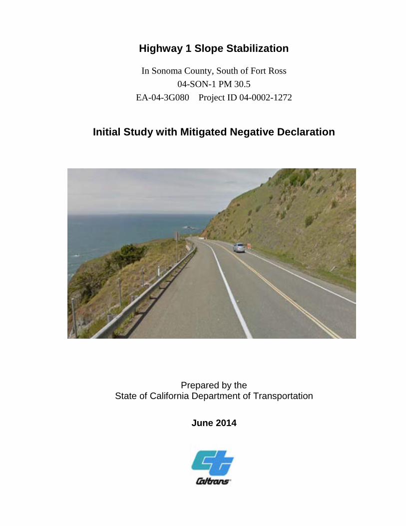
Highway 1 Slope Stabilization
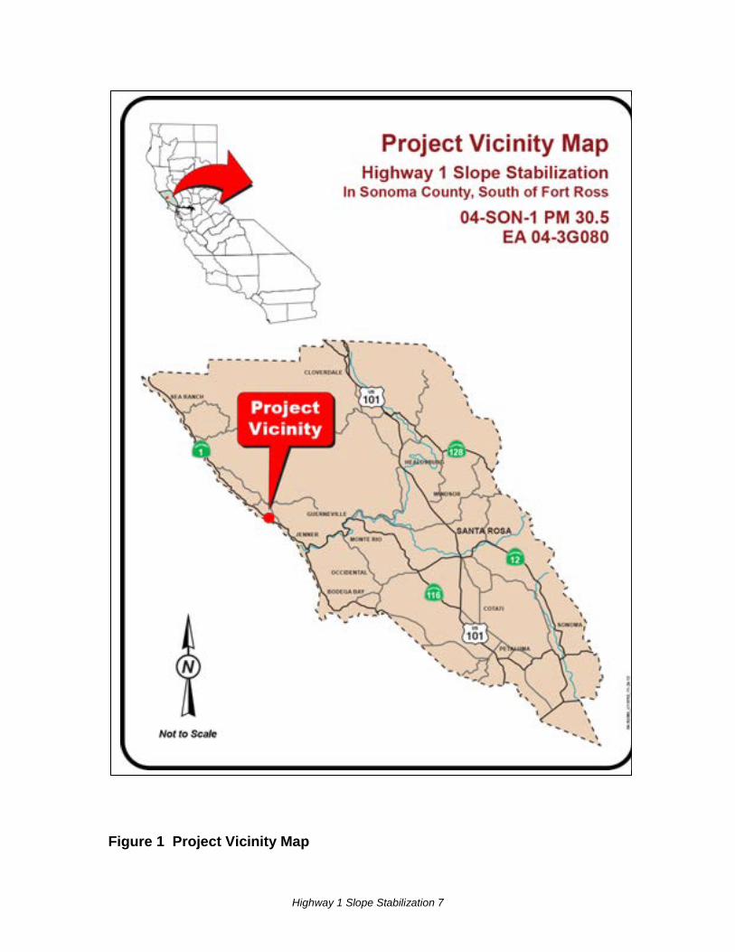
In Sonoma County, South of Fort Ross 04-SON-1 PM 30.5
EA-04-3G080 Project ID 04-0002-1272
Initial Study with Mitigated Negative Declaration
Prepared by the State of California Department of Transportation
June 2014
General Information About This Document
What’s in this Document: This document contains a Mitigated Negative Declaration, which examines the environmental effects of a project on Highway 1 in Sonoma County.
The Initial Study with Proposed Mitigated Negative Declaration circulated to the public from April 30 to May 30, 2014. Responses to agency comments on the circulated document are shown in Appendix E of this document (no comments were received from the public). Elsewhere throughout this document, a vertical line in the margin indicates a content change made since the draft document circulation. Minor editorial changes and clarifications have not been so indicated.
What happens after this: The proposed project has completed environmental compliance after the publication of this document, and filing of the Notice of Determination with the Office of Planning and Research, State Clearinghouse. Once funding is approved, the California Department of Transportation can design and construct the project.
Additional copies of this document are available at:
• Caltrans District 4, Public Information Office, 111 Grand Avenue, Oakland, CA
• Sonoma County Library, Central Branch, 211 E Street, Santa Rosa, CA
• Sonoma County Library, Guerneville Branch, 14107 Armstrong Woods Road, Guerneville, CA
Questions about the project may be directed to:
Michelle Ray, Senior Environmental Planner
California Department of Transportation 855 M Street, Suite 200 Fresno, CA 93721 Phone: (559) 445-5286 Email: [email protected]
This document can be accessed electronically at the following website: http://www.dot.ca.gov/dist4/envdocs.htm
For individuals with sensory disabilities, this document can be made available in Braille, in large print, on audiocassette, or on computer disk. To obtain a copy in one of these alternate formats, please call or write to Caltrans, Attn: Michelle Ray, Senior Environmental Planner, Sierra Pacific Environmental Analysis Branch, 855 M Street, Fresno, CA 93721, phone (559) 445-5286, (Voice), or use the California Relay Service 1 (800) 735-2929 (TTY), 1 (800) 735-2929 (Voice), or 711.
Highway 1 Slope Stabilization 1
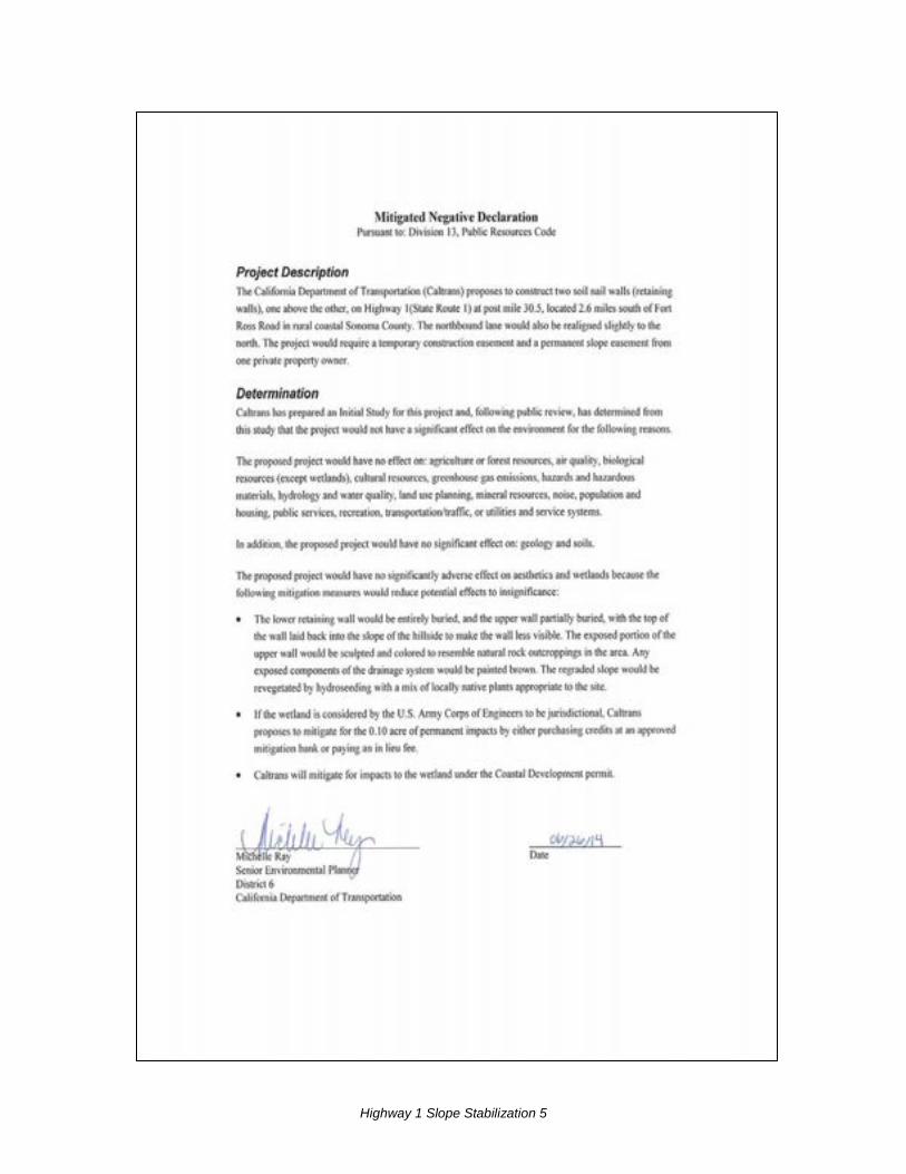
PROJECT DESCRIPTION AND BACKGROUND
Project Title: Highway 1 Slope Stabilization South of Fort Ross
Lead agency name and address: California Department of Transportation (Caltrans) 111 Grand Avenue, Oakland, CA 94612
Contact person and phone number:
Michelle Ray, Senior Environmental Planner Sierra Pacific Environmental Analysis Branch Caltrans District 6 855 M Street, Suite 200, Fresno, CA 93721 (559) 445-5286 Email: [email protected]
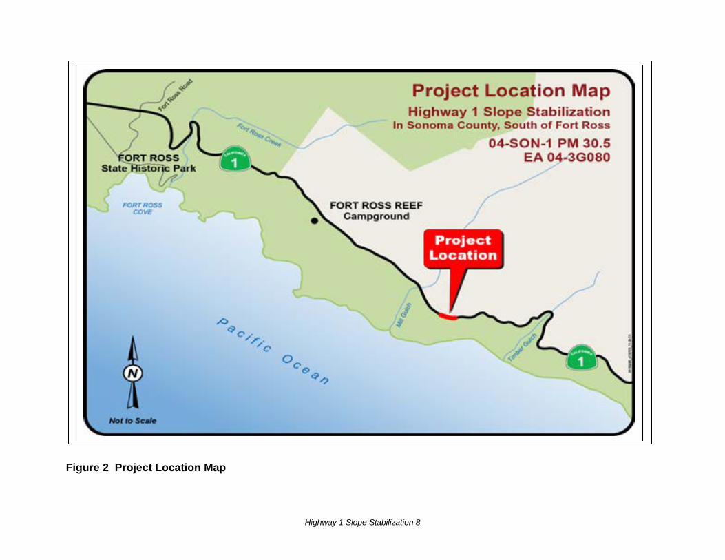
Project location: Highway 1 in rural Sonoma County, 2.6 miles south of Fort Ross Road at post mile 30.5. The location is on the northern edge of an area known as Blue Slide.
General plan description: Sonoma County General Plan – Land Use Element: Roughly paralleling the San Andreas Fault Zone, the rugged Sonoma Coast is a scenic area of regional, state, and national significance, with nearly vertical sea cliffs and sea stacks along the shoreline, dunes, marine terraces, coastal uplands, and headlands. Rural settlement is very sparse. The region’s economy is primarily oriented to recreation and tourism, commercial fishing, timber production, and sheep ranching.
Zoning: The project area is within a Coastal Resource Zoning District. The land use designation of the parcel from which construction and slope easements would be needed is Resources and Rural Development zoned as TP CC Timberland Production. The parcel west and south of the Caltrans right-of-way is Public land (Fort Ross State Historic Park), and is Zoned PF CC Public Facilities District.
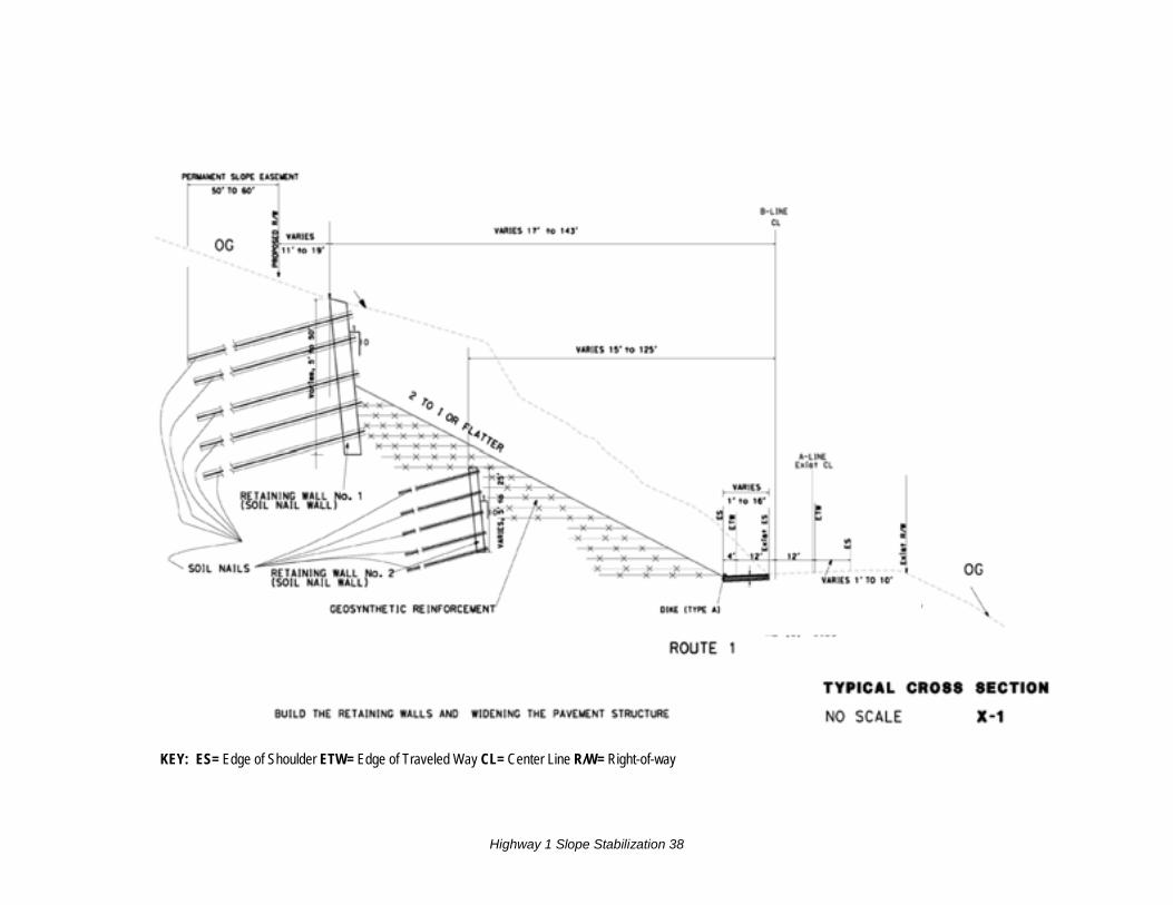
Description of project: Caltrans proposes to construct two soil nail walls (retaining walls), one above the other. The northbound lane of Highway 1 would also be realigned slightly to the north. First, the highway would be widened on the north side from 1 to 16 feet for a distance of approximately 400 feet. When completed, the roadway would have two 12-foot-wide travel lanes, widened from approximately 10 feet. The northbound lane would have a 4-foot-wide paved shoulder; the southbound lane paved shoulder width would vary from 1 to 10 feet.
The lower retaining wall, approximately 300 feet long and up to 25 feet high, would be completely buried after its construction. The higher retaining wall, approximately 430 feet long and up to 50 feet high, would be partially buried; the exposed portion, 25 feet tall at its highest and tapering to either end, would be textured and colored to resemble a natural rock cliff face. The slope would be graded to 2:1 and would include geosynthetic fabric
Highway 1 Slope Stabilization 2
reinforcement (see Appendix C Typical Cross Section). Following construction, the disturbed area would be revegetated by hydroseeding with a native seed mix appropriate to the site (see before and after photos in Appendix A).
The project would require a temporary construction easement and a permanent slope easement from one private property owner.
Surrounding land uses and setting
The project site is about 300 feet above sea level. The land across the highway is in Fort Ross State Historic Park: the land to the south drops steeply downward to the ocean; grassy slopes descend more gradually on coastal bluffs to the west and north. The steep land on the north and east sides of Highway 1, including the project footprint, is partially covered with non-native annual grasses and scattered shrubs and is part of a larger landslide complex. No timber trees are present.
Agency Permit/Approval Status
U.S. Army Corps of Engineers Section 404 Nationwide permit
If the isolated wetland is determined to be jurisdictional, this permit will be applied for and obtained during the Project Specifications & Estimates Phase
North Coast Regional Water Quality Control Board (Region 1) Section 401 permit
If the isolated wetland is determined to be jurisdictional by the U.S. Army Corps of Engineers, this permit will be applied for and obtained during the Project Specifications & Estimates Phase
California Coastal Commission Coastal Development Permit
Will be applied for and obtained during the Project Specifications & Estimates Phase
Caltrans
NPDES (National Pollutant Discharge Elimination System) Statewide Storm Water Permit
Order No. 99-06-DWQ, effective in 1999, will apply to this project
Note: Pursuant to: (State) Division 13, California Public Resources Code - This project documentation has been prepared in compliance with the California Environmental Quality Act (CEQA). A Categorical Exclusion has been signed for National Environmental Policy Act (NEPA) compliance.
Highway 1 Slope Stabilization 3

Highway 1 Slope Stabilization 4
Highway 1 Slope Stabilization 5

Highway 1 Slope Stabilization 6
Highway 1 Slope Stabilization 7
Figure 1 Project Vicinity Map
Highway 1 Slope Stabilization 8
Figure 2 Project Location Map
Highway 1 Slope Stabilization 9
CEQA Environmental Checklist 04-SON-1 30.5 04-0002-1272 Dist.-Co.-Rte. P.M Project ID# This checklist identifies physical, biological, social and economic factors that might be affected by the proposed project. In many cases, background studies performed in connection with the projects indicate no impacts. A NO IMPACT answer in the last column reflects this determination. Where there is a need for clarifying discussion, the discussion is included either following the applicable section of the checklist or is within the body of the environmental document itself. The words "significant" and "significance" used throughout the following checklist are related to CEQA, not NEPA, impacts. The questions in this form are intended to encourage the thoughtful assessment of impacts and do not represent thresholds of significance. Potentially
Significant Impact
Less Than Significant with Mitigation
Less Than Significant Impact
No Impact
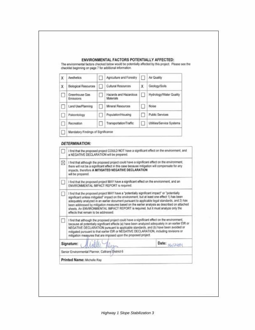
I. AESTHETICS: Would the project:
a) Have a substantial adverse effect on a scenic vista X
b) Substantially damage scenic resources, including, but not limited to, trees, rock outcroppings, and historic buildings within a state scenic highway
X
c) Substantially degrade the existing visual character or quality of the site and its surroundings?
X
d) Create a new source of substantial light or glare which would adversely affect day or nighttime views in the area?
X
See Additional Explanations following this checklist
II. AGRICULTURE AND FOREST RESOURCES: In determining whether impacts to agricultural resources are significant environmental effects, lead agencies may refer to the California Agricultural Land Evaluation and Site Assessment Model (1997) prepared by the California Dept. of Conservation as an optional model to use in assessing impacts on agriculture and farmland. In determining whether impacts to forest resources, including timberland, are significant environmental effects, lead agencies may refer to information compiled by the California Department of Forestry and Fire Protection regarding the state’s inventory of forest land, including the Forest and Range Assessment Project and the Forest Legacy Assessment Project; and the forest carbon measurement methodology provided in Forest Protocols adopted by the California Air Resources Board. Would the project:
a) Convert Prime Farmland, Unique Farmland, or Farmland of Statewide Importance (Farmland), as shown on the maps prepared pursuant to the Farmland Mapping and Monitoring Program of the California Resources Agency, to non-agricultural use?
X
b) Conflict with existing zoning for agricultural use, or a Williamson Act contract?
X
Highway 1 Slope Stabilization 10
Potentially Significant Impact
Less Than Significant with Mitigation
Less Than Significant Impact
No Impact
c) Conflict with existing zoning for, or cause rezoning of, forest land (as defined in Public Resources Code section 12220(g)), timberland (as defined by Public Resources Code section 4526), or timberland zoned Timberland Production (as defined by Government Code section 51104(g))?
X
d) Result in the loss of forest land or conversion of forest land to non-forest use?
X
e) Involve other changes in the existing environment which, due to their location or nature, could result in conversion of Farmland, to non-agricultural use or conversion of forest land to non-forest use?
X
III. AIR QUALITY: Where available, the significance criteria established by the applicable air quality management or air pollution control district may be relied upon to make the following determinations. Would the project:
a) Conflict with or obstruct implementation of the applicable air quality plan?
X
b) Violate any air quality standard or contribute substantially to an existing or projected air quality violation?
X
c) Result in a cumulatively considerable net increase of any criteria pollutant for which the project region is non- attainment under an applicable federal or state ambient air quality standard (including releasing emissions which exceed quantitative thresholds for ozone precursors)?
X
d) Expose sensitive receptors to substantial pollutant concentrations?
X
e) Create objectionable odors affecting a substantial number of people?
X
IV. BIOLOGICAL RESOURCES: Would the project:
a) Have a substantial adverse effect, either directly or through habitat modifications, on any species identified as a candidate, sensitive, or special status species in local or regional plans, policies, or regulations, or by the California Department of Fish and Game or U.S. Fish and Wildlife Service?
X
b) Have a substantial adverse effect on any riparian habitat or other sensitive natural community identified in local or regional plans, policies, regulations or by the California Department of Fish and Game or US Fish and Wildlife Service?
X
Highway 1 Slope Stabilization 11
Potentially
Significant Impact
Less Than Significant with Mitigation
Less Than Significant Impact
No Impact
c) Have a substantial adverse effect on federally protected wetlands as defined by Section 404 of the Clean Water Act (including, but not limited to, marsh, vernal pool, coastal, etc.) through direct removal, filling, hydrological interruption, or other means?
X
d) Interfere substantially with the movement of any native resident or migratory fish or wildlife species or with established native resident or migratory wildlife corridors, or impede the use of native wildlife nursery sites?
X
e) Conflict with any local policies or ordinances protecting biological resources, such as a tree preservation policy or ordinance?
X
f) Conflict with the provisions of an adopted Habitat Conservation Plan, Natural Community Conservation Plan, or other approved local, regional, or state habitat conservation plan?
X
See Additional Explanations following this checklist
V. CULTURAL RESOURCES: Would the project:
a) Cause a substantial adverse change in the significance of a historical resource as defined in §15064.5?
X
b) Cause a substantial adverse change in the significance of an archaeological resource pursuant to §15064.5?
X
c) Directly or indirectly destroy a unique paleontological resource or site or unique geologic feature?
X
d) Disturb any human remains, including those interred outside of formal cemeteries?
X
VI. GEOLOGY AND SOILS: Would the project:
a) Expose people or structures to potential substantial adverse effects, including the risk of loss, injury, or death involving:
i) Rupture of a known earthquake fault, as delineated on the most recent Alquist-Priolo Earthquake Fault Zoning Map issued by the State Geologist for the area or based on other substantial evidence of a known fault? Refer to Division of Mines and Geology Special Publication 42?
X
ii) Strong seismic ground shaking? X
iii) Seismic-related ground failure, including liquefaction? X
Highway 1 Slope Stabilization 12
Potentially Significant Impact
Less Than Significant with Mitigation
Less Than Significant Impact
No Impact
iv) Landslides? X
b) Result in substantial soil erosion or the loss of topsoil? X
c) Be located on a geologic unit or soil that is unstable, or that would become unstable as a result of the project, and potentially result in on- or off-site landslide, lateral spreading, subsidence, liquefaction or collapse?
X
d) Be located on expansive soil, as defined in Table 18-1-B of the Uniform Building Code (1994), creating substantial risks to life or property?
X
e) Have soils incapable of adequately supporting the use of septic tanks or alternative waste water disposal systems where sewers are not available for the disposal of waste water?
X
See Additional Explanations following this checklist
VII. GREENHOUSE GAS EMISSIONS: Would the project:
a) Generate greenhouse gas emissions, either directly or indirectly, that may have a significant impact on the environment?
If applicable, an assessment of the greenhouse gas emissions and climate change is included in the body of environmental document. While Caltrans has included this good faith effort in order to provide the public and decision-makers as much information as possible about the project, it is Caltrans determination that in the absence of further regulatory or scientific information related to greenhouse gas emissions and CEQA significance, it is too speculative to make a significance determination regarding the project’s direct and indirect impact with respect to climate change. Caltrans does remain firmly committed to implementing measures to help reduce the potential effects of the project. Necessary information is located in Technical Studies Bound Separately.
b) Conflict with an applicable plan, policy or regulation adopted for the purpose of reducing the emissions of greenhouse gases?
VIII. HAZARDS AND HAZARDOUS MATERIALS: Would the project:
a) Create a significant hazard to the public or the environment through the routine transport, use, or disposal of hazardous materials?
X
b) Create a significant hazard to the public or the environment through reasonably foreseeable upset and accident conditions involving the release of hazardous materials into the environment?
X
c) Emit hazardous emissions or handle hazardous or acutely hazardous materials, substances, or waste within one-quarter mile of an existing or proposed school?
X
Highway 1 Slope Stabilization 13
Potentially
Significant Impact
Less Than Significant with Mitigation
Less Than Significant Impact
No Impact
d) Be located on a site which is included on a list of hazardous materials sites compiled pursuant to Government Code Section 65962.5 and, as a result, would it create a significant hazard to the public or the environment?
X
e) For a project located within an airport land use plan or, where such a plan has not been adopted, within two miles of a public airport or public use airport, would the project result in a safety hazard for people residing or working in the project area?
X
f) For a project within the vicinity of a private airstrip, would the project result in a safety hazard for people residing or working in the project area?
X
g) Impair implementation of or physically interfere with an adopted emergency response plan or emergency evacuation plan?
X
h) Expose people or structures to a significant risk of loss, injury or death involving wildland fires, including where wildlands are adjacent to urbanized areas or where residences are intermixed with wildlands?
X
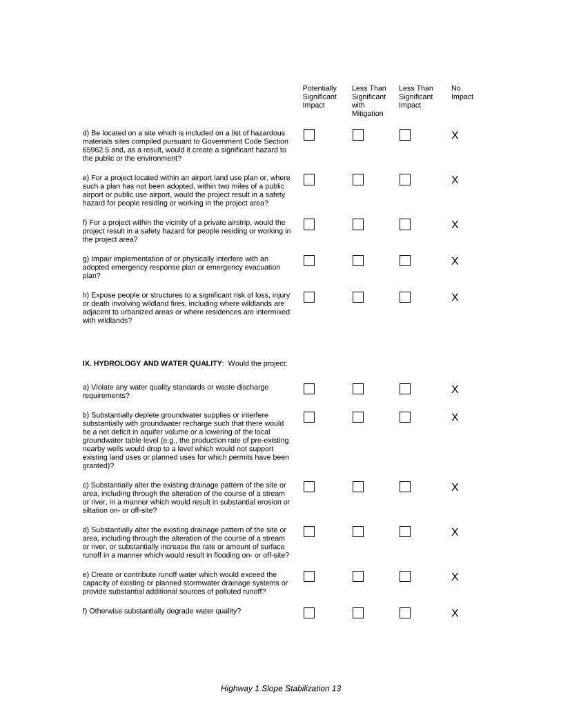
IX. HYDROLOGY AND WATER QUALITY: Would the project:
a) Violate any water quality standards or waste discharge requirements?
X
b) Substantially deplete groundwater supplies or interfere substantially with groundwater recharge such that there would be a net deficit in aquifer volume or a lowering of the local groundwater table level (e.g., the production rate of pre-existing nearby wells would drop to a level which would not support existing land uses or planned uses for which permits have been granted)?
X
c) Substantially alter the existing drainage pattern of the site or area, including through the alteration of the course of a stream or river, in a manner which would result in substantial erosion or siltation on- or off-site?
X
d) Substantially alter the existing drainage pattern of the site or area, including through the alteration of the course of a stream or river, or substantially increase the rate or amount of surface runoff in a manner which would result in flooding on- or off-site?
X
e) Create or contribute runoff water which would exceed the capacity of existing or planned stormwater drainage systems or provide substantial additional sources of polluted runoff?
X
f) Otherwise substantially degrade water quality? X
Highway 1 Slope Stabilization 14
Potentially
Significant Impact
Less Than Significant with Mitigation
Less Than Significant Impact
No Impact
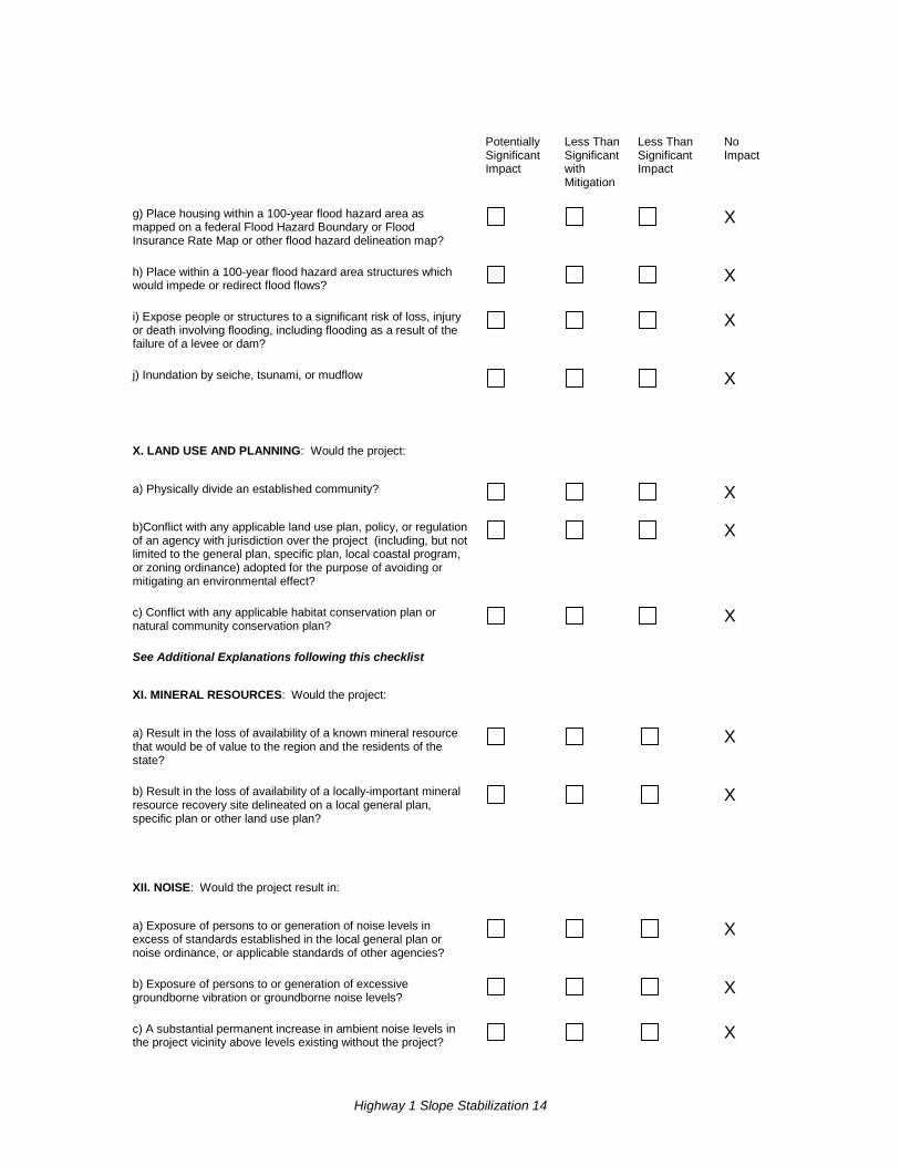
g) Place housing within a 100-year flood hazard area as mapped on a federal Flood Hazard Boundary or Flood Insurance Rate Map or other flood hazard delineation map?
X
h) Place within a 100-year flood hazard area structures which would impede or redirect flood flows?
X
i) Expose people or structures to a significant risk of loss, injury or death involving flooding, including flooding as a result of the failure of a levee or dam?
X
j) Inundation by seiche, tsunami, or mudflow X
X. LAND USE AND PLANNING: Would the project:
a) Physically divide an established community? X
b)Conflict with any applicable land use plan, policy, or regulation of an agency with jurisdiction over the project (including, but not limited to the general plan, specific plan, local coastal program, or zoning ordinance) adopted for the purpose of avoiding or mitigating an environmental effect?
X
c) Conflict with any applicable habitat conservation plan or natural community conservation plan?
X
See Additional Explanations following this checklist
XI. MINERAL RESOURCES: Would the project:
a) Result in the loss of availability of a known mineral resource that would be of value to the region and the residents of the state?
X
b) Result in the loss of availability of a locally-important mineral resource recovery site delineated on a local general plan, specific plan or other land use plan?
X
XII. NOISE: Would the project result in:
a) Exposure of persons to or generation of noise levels in excess of standards established in the local general plan or noise ordinance, or applicable standards of other agencies?
X
b) Exposure of persons to or generation of excessive groundborne vibration or groundborne noise levels?
X
c) A substantial permanent increase in ambient noise levels in the project vicinity above levels existing without the project?
X
Highway 1 Slope Stabilization 15
Potentially Significant Impact
Less Than Significant with Mitigation
Less Than Significant Impact
No Impact
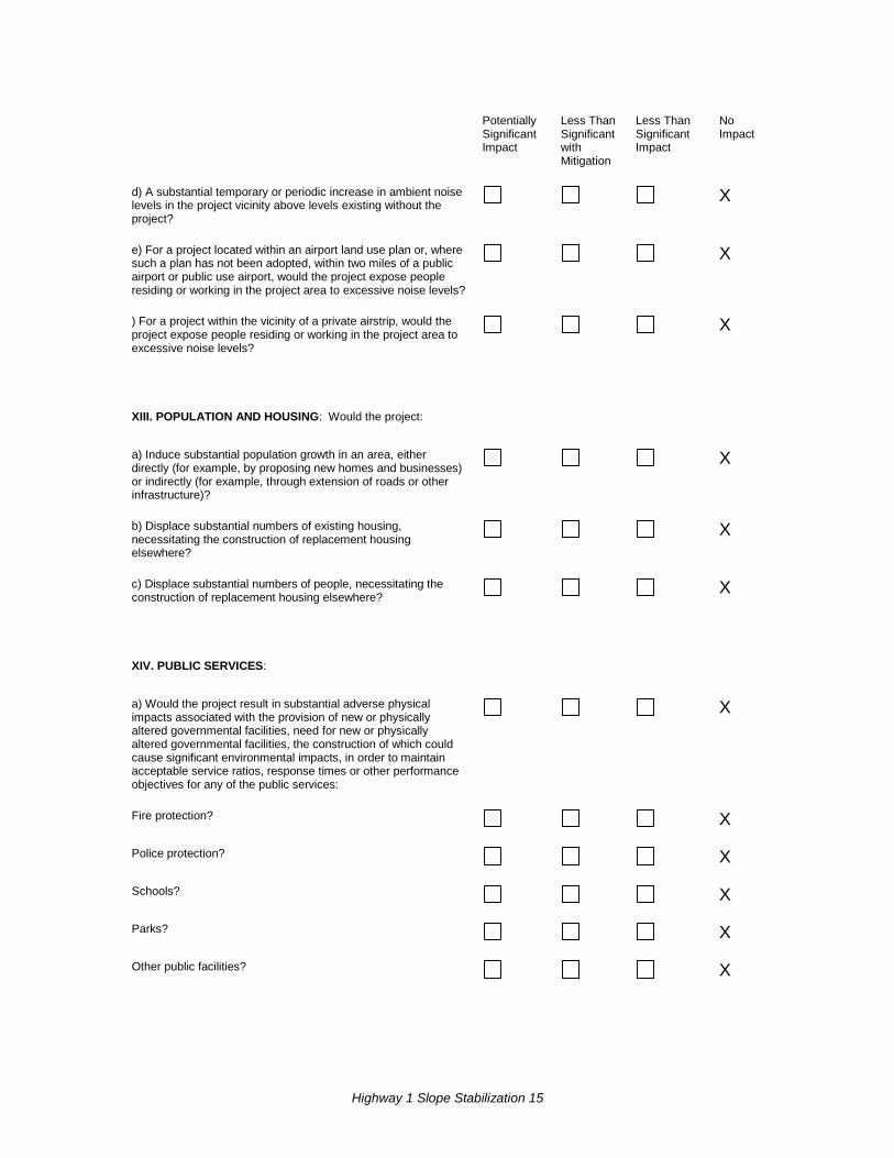
d) A substantial temporary or periodic increase in ambient noise levels in the project vicinity above levels existing without the project?
X
e) For a project located within an airport land use plan or, where such a plan has not been adopted, within two miles of a public airport or public use airport, would the project expose people residing or working in the project area to excessive noise levels?
X
) For a project within the vicinity of a private airstrip, would the project expose people residing or working in the project area to excessive noise levels?
X
XIII. POPULATION AND HOUSING: Would the project:
a) Induce substantial population growth in an area, either directly (for example, by proposing new homes and businesses) or indirectly (for example, through extension of roads or other infrastructure)?
X
b) Displace substantial numbers of existing housing, necessitating the construction of replacement housing elsewhere?
X
c) Displace substantial numbers of people, necessitating the construction of replacement housing elsewhere?
X
XIV. PUBLIC SERVICES:
a) Would the project result in substantial adverse physical impacts associated with the provision of new or physically altered governmental facilities, need for new or physically altered governmental facilities, the construction of which could cause significant environmental impacts, in order to maintain acceptable service ratios, response times or other performance objectives for any of the public services:
X
Fire protection? X
Police protection? X
Schools? X
Parks? X
Other public facilities? X
Highway 1 Slope Stabilization 16
Potentially Significant Impact
Less Than Significant with Mitigation
Less Than Significant Impact
No Impact
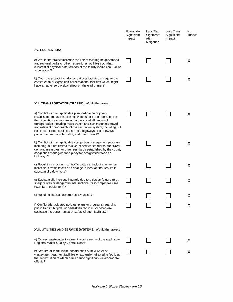
XV. RECREATION:
a) Would the project increase the use of existing neighborhood and regional parks or other recreational facilities such that substantial physical deterioration of the facility would occur or be accelerated?
X
b) Does the project include recreational facilities or require the construction or expansion of recreational facilities which might have an adverse physical effect on the environment?
X
XVI. TRANSPORTATION/TRAFFIC: Would the project:
a) Conflict with an applicable plan, ordinance or policy establishing measures of effectiveness for the performance of the circulation system, taking into account all modes of transportation including mass transit and non-motorized travel and relevant components of the circulation system, including but not limited to intersections, streets, highways and freeways, pedestrian and bicycle paths, and mass transit?
X
b) Conflict with an applicable congestion management program, including, but not limited to level of service standards and travel demand measures, or other standards established by the county congestion management agency for designated roads or highways?
X
c) Result in a change in air traffic patterns, including either an increase in traffic levels or a change in location that results in substantial safety risks?
X
d) Substantially increase hazards due to a design feature (e.g., sharp curves or dangerous intersections) or incompatible uses (e.g., farm equipment)?
X
e) Result in inadequate emergency access? X
f) Conflict with adopted policies, plans or programs regarding public transit, bicycle, or pedestrian facilities, or otherwise decrease the performance or safety of such facilities?
X
XVII. UTILITIES AND SERVICE SYSTEMS: Would the project:
a) Exceed wastewater treatment requirements of the applicable Regional Water Quality Control Board?
X
b) Require or result in the construction of new water or wastewater treatment facilities or expansion of existing facilities, the construction of which could cause significant environmental effects?
X
Highway 1 Slope Stabilization 17
Potentially Significant Impact
Less Than Significant with Mitigation
Less Than Significant Impact
No Impact
c) Require or result in the construction of new storm water drainage facilities or expansion of existing facilities, the construction of which could cause significant environmental effects?
X
d) Have sufficient water supplies available to serve the project from existing entitlements and resources, or are new or expanded entitlements needed?
X
e) Result in a determination by the wastewater treatment provider which serves or may serve the project that it has adequate capacity to serve the project’s projected demand in addition to the provider’s existing commitments?
X
f) Be served by a landfill with sufficient permitted capacity to accommodate the project’s solid waste disposal needs?
X
g) Comply with federal, state, and local statutes and regulations related to solid waste?
X
XVIII. MANDATORY FINDINGS OF SIGNIFICANCE
a) Does the project have the potential to degrade the quality of the environment, substantially reduce the habitat of a fish or wildlife species, cause a fish or wildlife population to drop below self-sustaining levels, threaten to eliminate a plant or animal community, substantially reduce the number or restrict the range of a rare or endangered plant or animal or eliminate important examples of the major periods of California history or prehistory?
X
ob) Does the project have impacts that are individually limited, but cumulatively considerable? ("Cumulatively considerable" means that the incremental effects of a project are considerable when viewed in connection with the effects of past projects, the effects of other current projects, and the effects of probable future projects)?
X
c) Does the project have environmental effects which will cause substantial adverse effects on human beings, either directly or indirectly?
X
Highway 1 Slope Stabilization 18
Additional Explanations for Questions in the Above Checklist I. Aesthetics (checklist questions a,b, and c) Affected Environment A Visual Impact Assessment was completed for this project in March 2014.
The proposed project is located on Highway 1 on the northern Sonoma County coast at the far northern extent of the San Francisco Bay area. It is approximately 60 miles north of the Golden Gate Bridge, 6 miles north of the Russian River and the town of Jenner, and 2.5 miles south of Fort Ross Road.
The landscape of the Sonoma Coast north of the Russian River is characterized by hillsides dropping steeply to the Pacific Ocean, covered with pasture, coastal sage scrub, and mixed coniferous and hardwood forest. Most locations include spectacular views of the Pacific Ocean and the Sonoma coast. From the project site, there are expansive ocean views, although unlike some locations these views do not include the rocky shoreline, except in the distance (see cover photo).
At the project site, the hillside where the wall is proposed was graded during prior slide repair work, resulting in an unnaturally even slope that does not match the natural contours of adjacent hillsides.
The project location and setting provide the context for determining the type of changes to the existing visual environment.
Visual Character and Visual Quality Visual resources of the project setting are defined and identified below by assessing visual character and visual quality in the project corridor. The project corridor is defined as the area of land that is visible from, adjacent to, and outside of the highway right-of-way, and is determined by topography, vegetation, and viewing distance.
Overall, the highway corridor through coastal Sonoma County has a high degree of vividness, meaning the landscape is highly memorable. It is distinctive primarily due to its setting above or within close proximity to the Pacific Ocean, with extensive and highly scenic views from the highway.
The intactness, or integrity of the visual order of the landscape and the extent to which the existing landscape is free of jarring visual intrusions, is considered to be very high. The concrete traffic barrier being used as a temporary retaining wall is currently the largest visual distraction at the site.
Highway 1 Slope Stabilization 19
The unity, or the aesthetic integration and visual coherence of the natural and developed environment, is high.
Resource Change Resource change is assessed by evaluating the visual character and visual quality of the visual resources that make up the project corridor before and after construction of the project. The visual character of the completed project would be compatible with the existing visual character of the corridor, and the visual quality of the project site would not be negatively altered. Changes to visual resources, as measured by changes in visual character and visual quality, would be low.
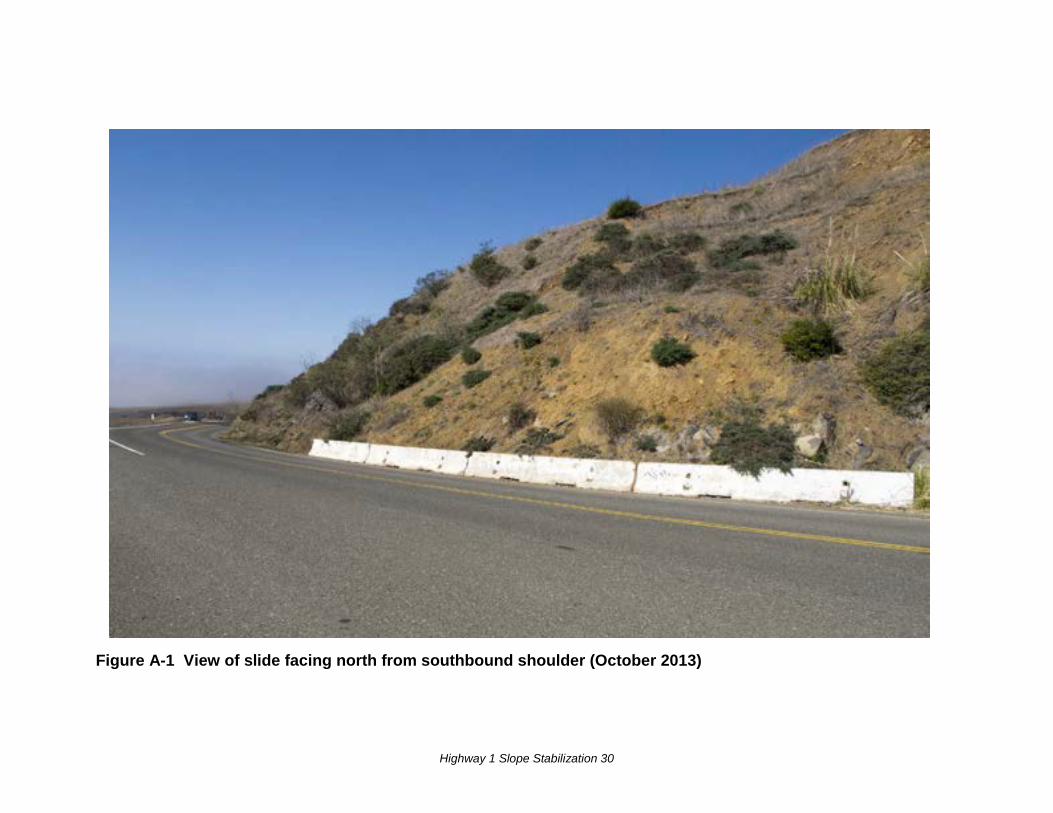
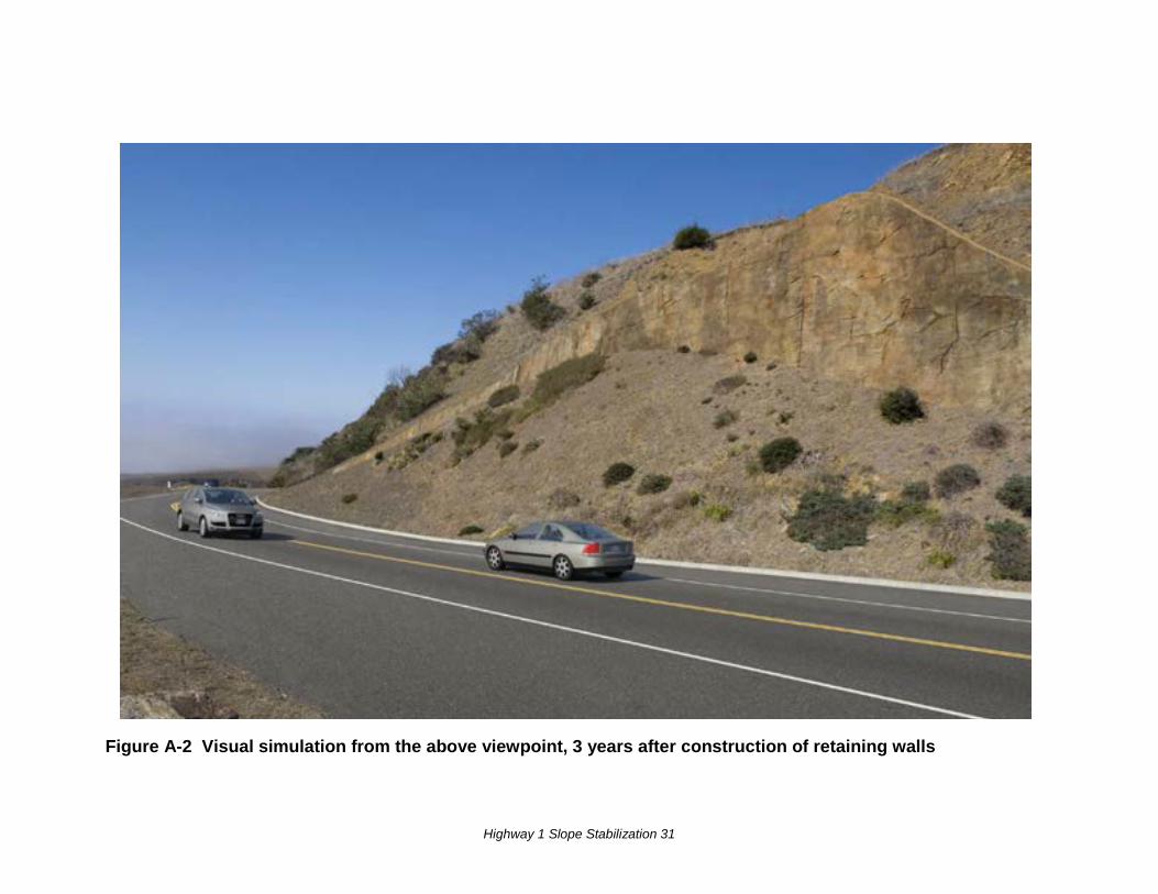
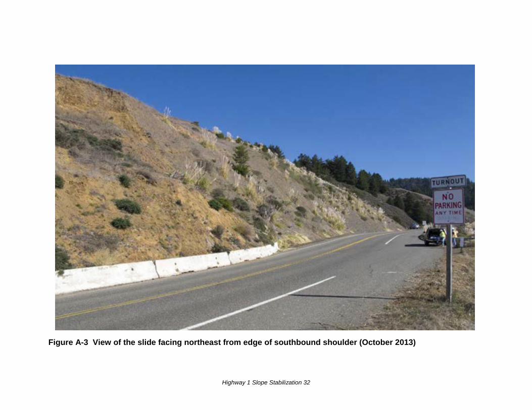
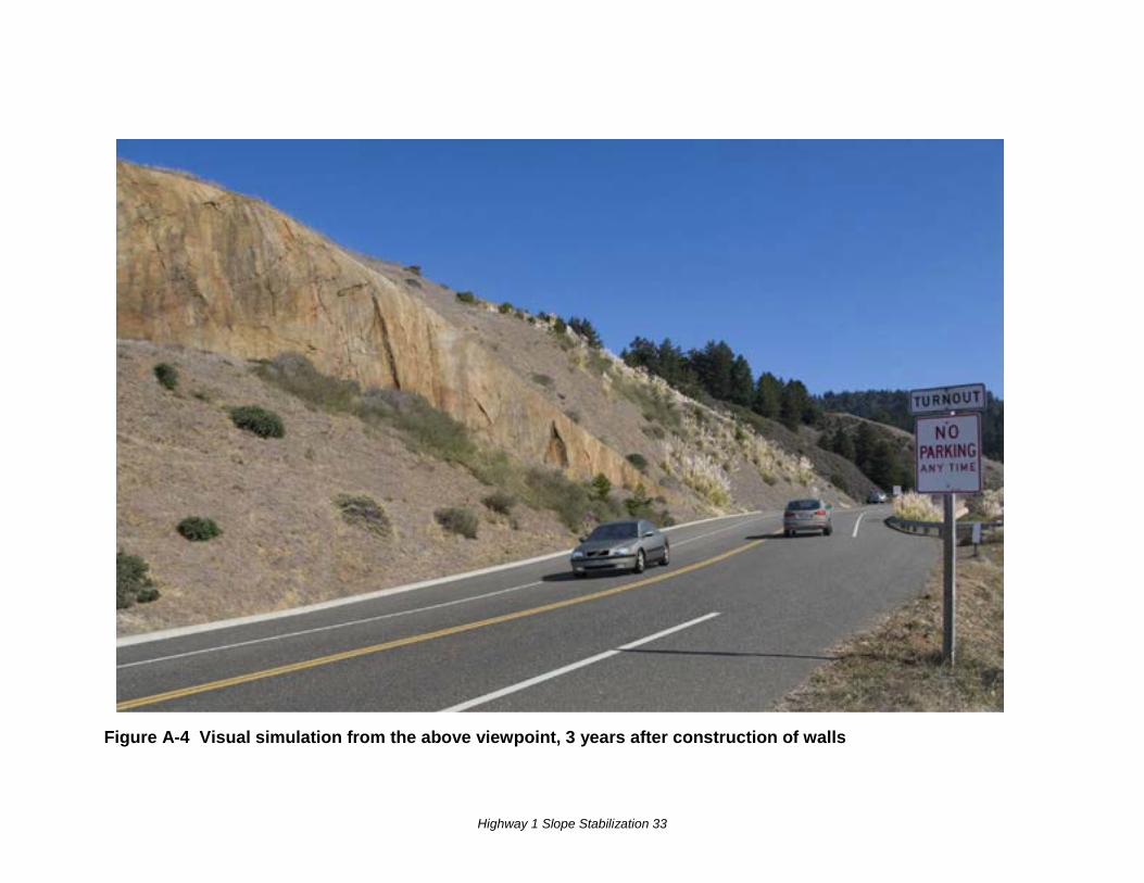
The regraded slope and upper proposed retaining wall would be a change to the visual resources of the area, but minimization measures would reduce the impact of that change. Surface landslides have created bare sections of exposed and loose soil which, combined with the presence of a temporary concrete barrier placed to keep loose soil from sliding onto the road, contribute to a slight reduction in the visual unity of the area. However, other than the graded uniform slope, the hillside is mostly vegetated and natural in appearance. Following construction, the irregular slope would be replaced by a uniform slope of 2:1, and the proposed sculpted rock wall would become a relatively prominent feature. The sculpting and coloring of the wall intended to mimic nearby rock outcroppings would serve to minimize disruption to the unity of the view, but would not entirely eliminate those impacts.
Because the lower proposed wall would be entirely buried, it would have no lasting impact to either unity or intactness. The upper wall would be buried to varying heights along its length, with 20 to 25 feet of wall height exposed at its center tapering to each side. Because the point at which the greatest amount of wall is exposed would be approximately 125 feet from the roadway, the degree to which it would reduce the unity and intactness of the area would be minimized.
While the project could potentially reduce visual unity, the sculpturing and coloring of the wall would minimize the reduction. The top of the wall would be laid back into the hillside rather than project from it. Because the hillside was graded to a uniform slope during previous slide repair work, the proposed grading and retaining wall would be less of a change to the visual landscape. Also, removal of the existing concrete barrier, in place as a temporary retaining wall, would improve visual unity.
Highway 1 Slope Stabilization 20
Viewers and Viewer Response Viewer sensitivity is considered to be high, and local values include preserving a high-quality visual landscape. Viewers of this landslide are limited to motorists and bicyclists. People with views to the road are distant and are not within view of the project location. There are no residences within view of the project site. Informal trails to the coast almost immediately drop pedestrians below view of the slide. The undeveloped coastal trail runs roughly parallel to the shoreline. Steep cliffs rise above the coastal trail, blocking views of the portion of the slide where the retaining wall would be.
Highway users, people with views from the road, would be minimally affected by the proposed project. Motorists traveling either north or south would have a view that would look down the length of the partially exposed wall, minimizing the viewer exposure to the wall face. The curving roadway and the cut and slope of the hillside all would minimize viewer exposure. In addition, motorists tend to look west and south toward the ocean views and away from the hillside.
Scenic Status Although the entire Sonoma County portion of Highway 1 is listed as being eligible for designation as a State Scenic Highway, no segment of the highway within the county is officially designated as a Scenic Highway.
The project site is within the area covered by the Sonoma County Local Coastal Plan, which includes a section on visual resources. That section states that the most important rural design issues are preservation of coastal views, and visual quality and compatibility of development with the natural landscape.
Environmental Consequences Visual Impacts Visual impacts of constructing the project would include a new sculpted and colored retaining wall, a regraded uniform slope, addition of a 4-foot-wide paved shoulder along the northbound lane, widened traffic lanes, and elements of the new drainage system. See Appendix A for photos from two viewpoints of the slide and visual simulations of the future appearance of the slide stabilization, aged about three years after construction.
Temporary visual impacts during construction would include the presence of construction equipment, equipment related to one-way traffic control, material stockpiling, and temporary traffic barriers.
Highway 1 Slope Stabilization 21
Scenic Status As stated above, Highway 1 is not an officially designated scenic highway in Sonoma County.
The project’s design would comply with the Sonoma County Local Coastal Plan’s goals, guidelines, and recommendations regarding visual resources, including recommendations for view preservation, minimization of visual degradation of natural landforms, and construction of roadways to fit the natural topography.
Avoidance, Minimization, and/or Mitigation Measures The following measures would mitigate the visual impact of the project:
1. The lower of the two retaining walls would be buried in its entirety.
2. The upper retaining wall would be buried to the extent feasible based on geotechnical limitations. The top of the wall would be laid back into the slope of the hillside rather than project from it. This would soften the visual transition from the wall to the hillside.
3. The exposed portions of the upper retaining wall would consist of spray-applied gunnite sculpted and colored to visually mimic a natural rock outcropping as found elsewhere on the Sonoma coast.
4. Exposed components of the drainage system would be painted brown.
5. The regraded slope would be revegetated by hydroseeding with a mix of locally native plants.
IV. Biological Resources (checklist question c)
Wetlands and Other Waters of the U.S. Affected Environment A Natural Environment Study-Minimal Impacts was completed for this project in December 2013.
To classify an area as a wetland (for purposes of the Clean Water Act), three parameters are used: presence of hydrophytic (water-loving) vegetation, presence of wetland hydrology, and presence of hydric soils (soils formed during saturation/inundation). All three must be present, under normal circumstances, for an area to be a jurisdictional wetland. The term “jurisdictional wetlands” refers to areas that are inundated or saturated by surface water or groundwater at a frequency and duration sufficient to support, and that under normal circumstances do support, a prevalence of vegetation typically adapted
Highway 1 Slope Stabilization 22
for life in saturated soil conditions. Jurisdictional wetlands generally include swamps, marshes, bogs, natural drainage channels, and seasonal wetlands.
A roadside ditch on the uphill (north and east) side of Highway 1 pools up with water seeping out of the hillside. This pooling water has created an isolated wetland that is 545 feet long, running the length of the project impact area (see map in Appendix B). The wetland is dominated by yellow monkey flower (Mimulus guttatus), field horsetail (Equisetum arvense), and umbrella sedge (Cyperus squarrosus).
Environmental Consequences The project would permanently impact 0.10 acre of an isolated wetland in a roadside drainage ditch on the northeast side of Highway 1.
A preliminary jurisdictional delineation was conducted on July 1, 2013, and will be submitted to the U.S. Army Corps of Engineers for verification.
Avoidance, Minimization, and/or Mitigation Measures If the wetland is considered by the U.S. Army Corps of Engineers to be jurisdictional, Caltrans proposes to mitigate for the 0.10 acre of permanent impacts by either purchasing credits at an approved mitigation bank or paying an in lieu fee.
VI. Geology and Soils (checklist questions a i, a ii, a iii, a iv and b and c) Affected Environment The project is located within the California Coast Range Geomorphic Province, on the northern California coast.
Based on the U.S. Geological Survey Fault and Fold database, published Lidar images (U.S.G.S., http://earthquake.usgs.gov/learn/kml.php ), and the Alquist Priolo Earthquake Fault Zone Map for the Fort Ross quadrangle (California Geologic Survey http://www.quake.ca.gov/gmaps/WH/regulatorymaps.htm ) and the Alquist Priolo Earthquake Fault Zone Map for the Fort Ross quadrangle (California Geologic Survey), the mapped trace of the 1906 event along the San Andreas Fault bisects the western end of the upper proposed wall. The fault could rupture along this pre-existing feature. The amount of offset (rupture) has not been quantified.
The bedrock at the site is mapped by the California Geologic Survey (formerly the Division of Mines and Geology) as Coastal Belt Franciscan Assemblage, a mixture of several rocks known as tectonic melange. The assemblage is characterized by rock mixture, fragments and blocks of all types and sizes in finer-grained material. The rocks
Highway 1 Slope Stabilization 23
are generally greywacke sandstone, mudstone and shale. At this location, landslide deposits overlie the bedrock.
This location has a very complicated landslide history. This site is located at the midpoint of a ridge that has been mapped as a landslide complex by the California Geologic Survey.
Environmental Consequences Construction of the project would reduce the risk of damage to the roadway and to the traveling public from landslides. The regraded slope would not become unstable as a result of the project. Building the soil nail walls would not increase potential damage from strong seismic ground shaking or increase the possibility of ground failure in the event of a major earthquake on the San Andreas Fault. The project would not expose the public to an increased risk of fault rupture.
Avoidance, Minimization, and/or Mitigation Measures The project would be designed to secure the two retaining walls into the hillside, taking into account the landslide formation geology and potential seismic stresses. Soil nail walls are a flexible system that can rupture and still maintain structural integrity. They perform very well under strong seismic shaking because they move with the shaking ground rather than against it.
Construction techniques used to stabilize the slide slope are expected to include the following:
1. First, a 5-foot vertical cut would be excavated and temporary bracing put in place. This is done with conventional earth-moving equipment and hydraulic drills.
2. Next, holes for the soil nails would be drilled at predetermined locations as specified by the design engineer. Equipment used for this step would depend on the stability of the material in which the soil nail wall is supporting. Rotary or rotary percussive methods using air flush or dry auger methods can be used with stable ground. For unstable ground, single tube and duplex rotary methods with air and water flush or hollow-stem auger methods are used.
3. With the holes drilled, the next step is to install and grout the nails into place.
4. After all nails are inserted, a drainage system would be put into place. Synthetic drainage mat is placed vertically between the nail heads, which are extended down to the base of the wall where they are most commonly connected to a footing drain.
Highway 1 Slope Stabilization 24
5. A framework of reinforcing bar (“rebar”) is then constructed to serve as the basis for the sculpted shotcrete wall.
6. A layer of shotcrete would be applied to the rebar framework, and bearing plates would be installed before a final facing is put in place to complete the soil nail wall.
7. These steps would be repeated in a top-down fashion in 5-foot lifts, or cuts, until the full height of the wall is completed.
The slide area would then be backfilled with soil and graded to a 2:1 slope, burying the lower wall completely; the upper wall would be partially exposed. The slope would be reinforced with geosynthetic fabric (see Appendix C, Typical Cross-Section). Finally, all disturbed areas would be restored using stockpiled native topsoil and would be hydroseeded with a seed mix of locally native plants appropriate to the site.
Appropriate Caltrans Best Management practices for erosion control would be used and adhered to during project construction.
X. Land Use and Planning (question b)
Coastal Zone Affected Environment This proposed project is located within the California Coastal Zone. Sonoma County developed its own Local Coastal Plan, which was adopted in 1981. This plan was amended to be consistent with the 1989 Sonoma County General Plan and certified by the California Coastal Commission in 2001. The county is in the process of updating the Local Coastal Plan. According to the county’s web site (http://www.sonoma-county.org/prmd/divpages/localcoastalplan.htm), issues to be updated include sea level rise/flooding, coastal erosion, public access to the coast, water quality, and biotic resources.
The project area is located on Highway 1 at post mile 30.5 between Timber Gulch and Mill Gulch. The purpose of the project is to stabilize a landslide so that the danger of soil and rocks sliding onto the existing highway would be minimized. This location is within the Sonoma County Coastal Plan Sub-Area designated as the Highcliffs Muniz-Jenner Sub-Area.
The project site sits about 300 feet in elevation, above the Pacific Ocean, so Highway 1 is not in danger of sea level rise there. Although coastal erosion is active in the area, the
Highway 1 Slope Stabilization 25
project would not affect it. The distance from the project location to the coastline is approximately 672 feet.
The project would not affect public access to the coast. The area below the highway is now part of Fort Ross State Historic Park. The planned California Coastal Trail runs along the coastline directly below the project site.
Aesthetics Highway 1 is designated as a scenic corridor by Sonoma County. The Local Coastal Plan notes the abundance of major views along the coast, defined as long views with unique visual interest, focus or variety. Recommendations in the plan include view protections and minimizing visual destruction of natural landforms.
Biological Resources There is no suitable habitat for Sonoma County coastal zone sensitive animal or plant species within the biological study area.
No special-status riparian or wetland habitats that occur in the Sonoma County coastal zone are present in or near the project impact area except for one small roadside wetland.
Water Quality The slide area is in the North Coast Watershed, within the Russian Gulch-Frontal Pacific Ocean sub-watershed. No Section 303(d) listed (impaired) water bodies are present in the vicinity.
Environmental Consequences Potential impacts to coastal resources that could occur with construction of the project are summarized in Table 1 on the following page.
Biological Resources Botanical surveys were conducted for Tidestrom’s lupine (Lupinus tidestromii) and Sonoma spineflower (Chorizanthe valida). No listed plant species were found in the biological study area.
Highway 1 Slope Stabilization 26
Table 1 Potential Impacts to Coastal Resources
Coastal Resource Build Alternative No-Build Alternative
Visual/Aesthetic
A new sculpted retaining wall, a regraded uniform slope, the addition of a 4-foot-wide paved shoulder along the northbound lane, widened traffic lanes, and elements of a new drainage system.
No change from existing condition until next landslide. Temporary concrete barrier would remain at edge of travel way (no shoulder on curve).
Wetland
Permanent impact to 0.10 acre of an isolated wetland in a roadside ditch along the northbound lane.
Water would continue to trickle out from under the slide and down the edge of the road before soaking in.
Water Quality
Potential temporary impacts to existing water quality that could occur during construction could be caused by the release of fluids, concrete material, sediment, and litter. Potential permanent impacts to existing water quality would be the deposition and transport of sediment and vehicular-related pollutants along the highway.
Soil would not be disturbed except by landslides. No new impervious surfaces would be built. Sediment and vehicular-related pollutants would continue to be deposited and transported along the highway.
Avoidance, Minimization, and/or Mitigation Measures Aesthetics The mitigation and minimization measures proposed for this project are consistent with Caltrans’ Draft Marin and Sonoma Highway 1 Repair Guidelines, which were developed with input from local and state agencies including Sonoma County, the California Department of Parks and Recreation, and the California Coastal Commission (see Aesthetics section, Avoidance, Minimization, and/or Mitigation Measures above). These measures are preliminary and subject to change pending both final design and coordination with Sonoma County and the California Coastal Commission.
Biological Resources Caltrans will mitigate for impacts to the wetland (roadside ditch) under the Coastal Act.
Water Quality For water quality minimization measures, please see the following section.
Highway 1 Slope Stabilization 27
IX. Hydrology, Water Quality and Stormwater Runoff Affected Environment A Water Quality and Stormwater Runoff Study was completed for this project in April 2014. A hydraulics study addressing the current situation at the landslide and providing design recommendations for a drainage system for the retaining walls has not yet been completed. The resulting report will include information on the direction of stormwater runoff when the project is completed, noting whether runoff will go northward to Mill Gulch, southward to the ocean, or in both directions.
The Sonoma County coastal region is characterized by warm summers and mild wet winters, with a rainy season between October 15 and April 15. The Western Regional Climate Center and National Climate Data Center of the National Oceanic Atmospheric Administration of U.S. Department of Commerce provide general climate information for the Fort Ross weather station (No. 043191; length of record from 1895 through 2012), which is about 2 miles northwest of the project site. The reported average annual minimum and maximum temperatures are 45.0 and 62.6 degrees Fahrenheit (°F.), with an annual average of 53.8°F. Average annual precipitation is 40.62 inches.
The project is located within the jurisdiction of the North Coast Regional Water Quality Control Board (Region 1), which is responsible for implementation of state and federal laws and regulations for water quality protection.
The project site is within CalWater planning watershed 113900001, Hydrologic Sub-Area (HSA) 113.90, and within the Russian Gulch–Frontal Pacific Ocean sub-watershed. According to the Water Quality Assessment Report prepared for the project, stormwater runoff from this location, in the present condition, flows along an unlined roadside ditch edging northbound Highway 1 for about 0.2 mile until discharging to Mill Gulch. Mill Gulch empties into the Pacific Ocean.
No Clean Water Act Section 303(d) listed water bodies are located near the project site.
Environmental Consequences Approximately 3,000 square feet of new impervious surface area would be constructed. The total disturbed soil area during construction is estimated at 1.2 acres.
Potential permanent impacts to existing water quality are the same as for the existing highway: the deposition and transport of sediment and vehicular-related pollutants. Vehicular-related pollutant sources include combustion products from fossil fuels, trash from motorists, and the wearing of brake pads.
Highway 1 Slope Stabilization 28
Temporary impacts to existing water quality have the potential to occur in staging areas and at the construction site. The release of fluids, concrete material, sediment, and litter beyond the perimeter of the site are examples of possible impacts to water quality.
Avoidance, Minimization, and/or Mitigation Measures Sediment control best management practices required during construction are likely to include drainage inlet protection, fiber rolls, and silt fencing. In addition, proper material handling and storage (for example, concrete washouts) and covering stockpiles of soil would be important considerations.
To prevent potential permanent water quality impacts that could be caused by sediment transport, best management practices directed at soil stabilization and sediment control would be incorporated as part of the project design. Examples of these types of measures are hydroseeding and fiber rolls.
Section 402 of the Clean Water Act establishes the National Pollutant Discharge Elimination System (NPDES) permit system, which directs that stormwater discharges are point-source discharges, and establishes a framework for regulating municipal and industrial stormwater discharges. To ensure compliance with the Clean Water Act Section 402, the State Water Resources Control Board has issued Caltrans a NPDES Statewide Stormwater Permit to regulate stormwater discharges from Caltrans facilities. Due to the starting date of this project (prior to July 2013), this project will comply with the 1999 NPDES permit.
The contractor must also comply with the provisions of the statewide Construction General Permit for construction activities issued to Caltrans by the State Water Resources Control Board that applies to all stormwater discharges from land where clearing, grading, and excavation result in a disturbed soil area of one (1.0) acre or greater. Prior to construction, a Stormwater Pollution Prevention Plan must be prepared by the contractor and approved by Caltrans.
Other Construction-Related Temporary Impacts One-way traffic control would be necessary for the construction of the project. Construction is expected to last approximately 130 working days. Traffic, including emergency response vehicles, could experience delays. Equipment staging would be in the closed lane and confined to the Caltrans right-of-way and a temporary construction easement.

Highway 1 Slope Stabilization 29
Appendix A Visual Observer Viewpoints
Highway 1 Slope Stabilization 30
Figure A-1 View of slide facing north from southbound shoulder (October 2013)
Highway 1 Slope Stabilization 31
Figure A-2 Visual simulation from the above viewpoint, 3 years after construction of retaining walls
Highway 1 Slope Stabilization 32
Figure A-3 View of the slide facing northeast from edge of southbound shoulder (October 2013)
Highway 1 Slope Stabilization 33
Figure A-4 Visual simulation from the above viewpoint, 3 years after construction of walls

Highway 1 Slope Stabilization 34

Highway 1 Slope Stabilization 35
Appendix B Map of Biology Project Impact Area and Wetland
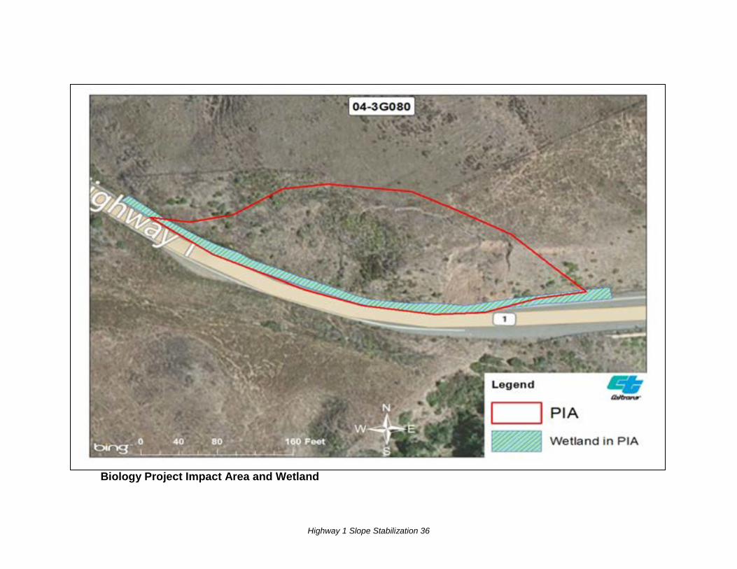
Highway 1 Slope Stabilization 36
Biology Project Impact Area and Wetland

Highway 1 Slope Stabilization 37
Appendix C Typical Cross Section of Project
Highway 1 Slope Stabilization 38
KEY: ES= Edge of Shoulder ETW= Edge of Traveled Way CL= Center Line R/W= Right-of-way
Highway 1 Slope Stabilization 39
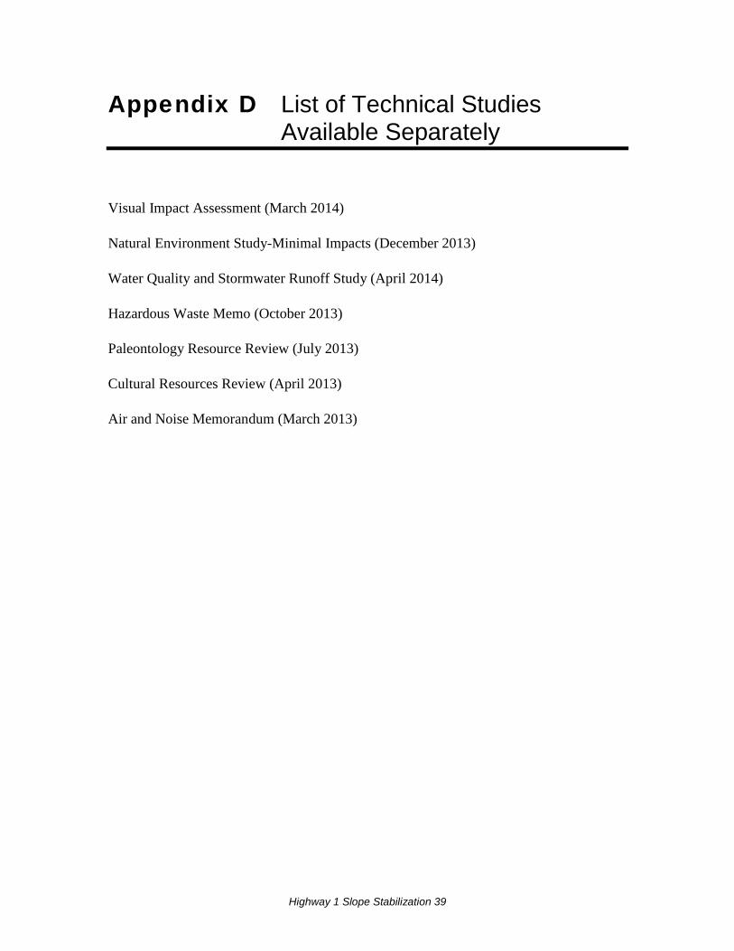
Appendix D List of Technical Studies Available Separately
Visual Impact Assessment (March 2014)
Natural Environment Study-Minimal Impacts (December 2013)
Water Quality and Stormwater Runoff Study (April 2014)
Hazardous Waste Memo (October 2013)
Paleontology Resource Review (July 2013)
Cultural Resources Review (April 2013)
Air and Noise Memorandum (March 2013)

Highway 1 Slope Stabilization 40

Highway 1 Slope Stabilization 41
Appendix E Comments and Responses
Highway 1 Slope Stabilization 42
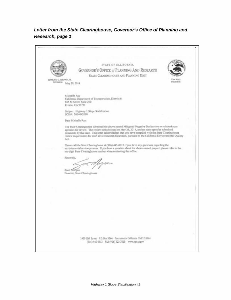
Letter from the State Clearinghouse, Governor’s Office of Planning and Research, page 1
Highway 1 Slope Stabilization 43
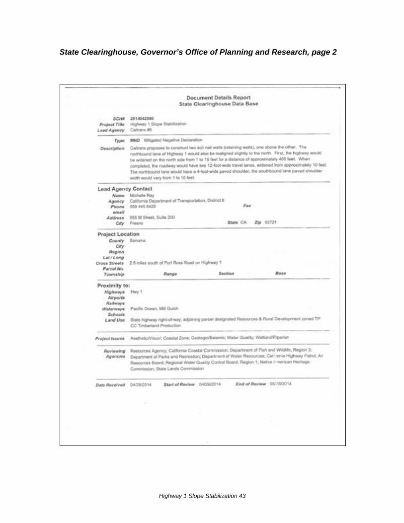
State Clearinghouse, Governor’s Office of Planning and Research, page 2
Highway 1 Slope Stabilization 44
Response to Acknowledgement from State Clearinghouse Thank you for this letter stating that Caltrans has complied with the State Clearinghouse review requirements pursuant to the California Environmental Quality Act.
Staff at the State Clearinghouse posted the draft environmental document information in the CEQAnet database indicating that Caltrans District 6 is the Lead Agency. The Lead Agency is Caltrans, and the project is located in District 4. Database searches for this project should not include the district in the query parameters; use the State Clearinghouse Number SCH # 2014042090.

Highway 1 Slope Stabilization 45
Highway 1 Slope Stabilization 46
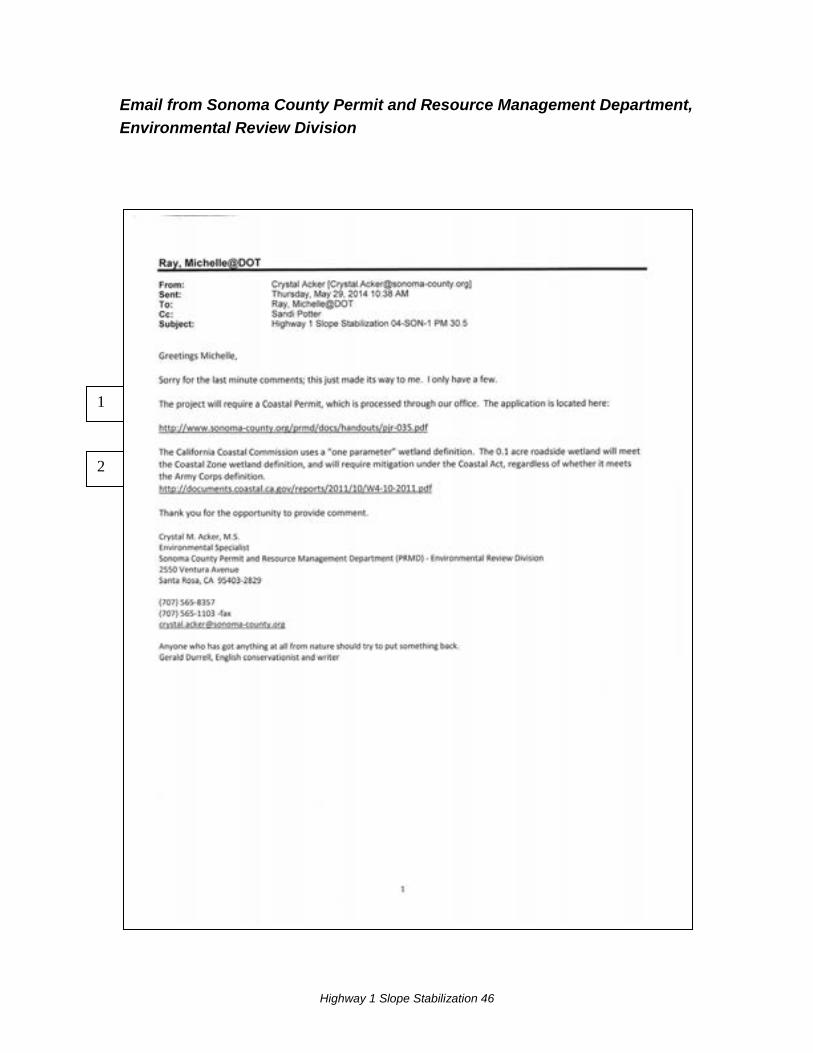
Email from Sonoma County Permit and Resource Management Department, Environmental Review Division
1
2
Highway 1 Slope Stabilization 47
Response to Email from Sonoma County Permit and Resource Management Department, Environmental Review Division 1 Caltrans will complete the Coastal Development Permit and submit it to the Sonoma County Permit and Resource Management Department.
2 Caltrans will re-evaluate the wetland delineation using the California Coastal Commission’s single-parameter criteria.
Highway 1 Slope Stabilization 48
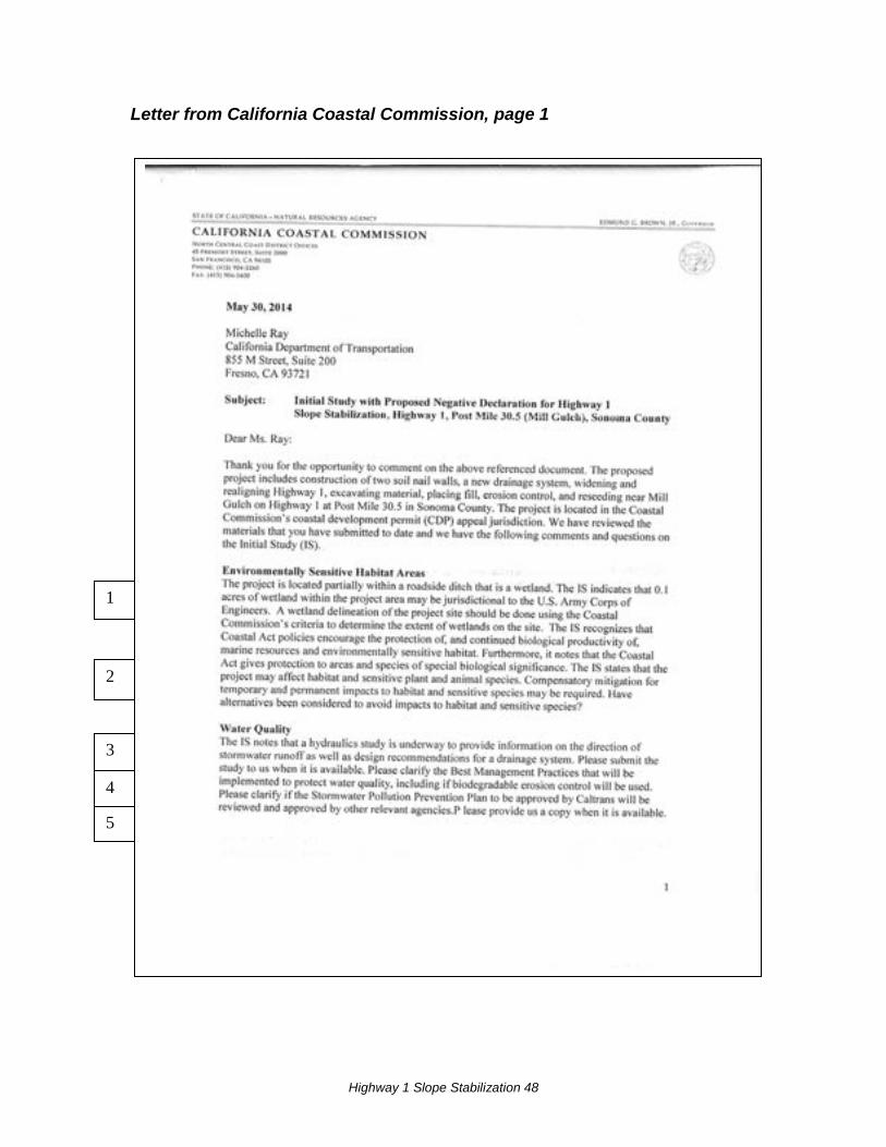
Letter from California Coastal Commission, page 1
2
3
4
1
5
Highway 1 Slope Stabilization 49
Letter from California Coastal Commission, page 2
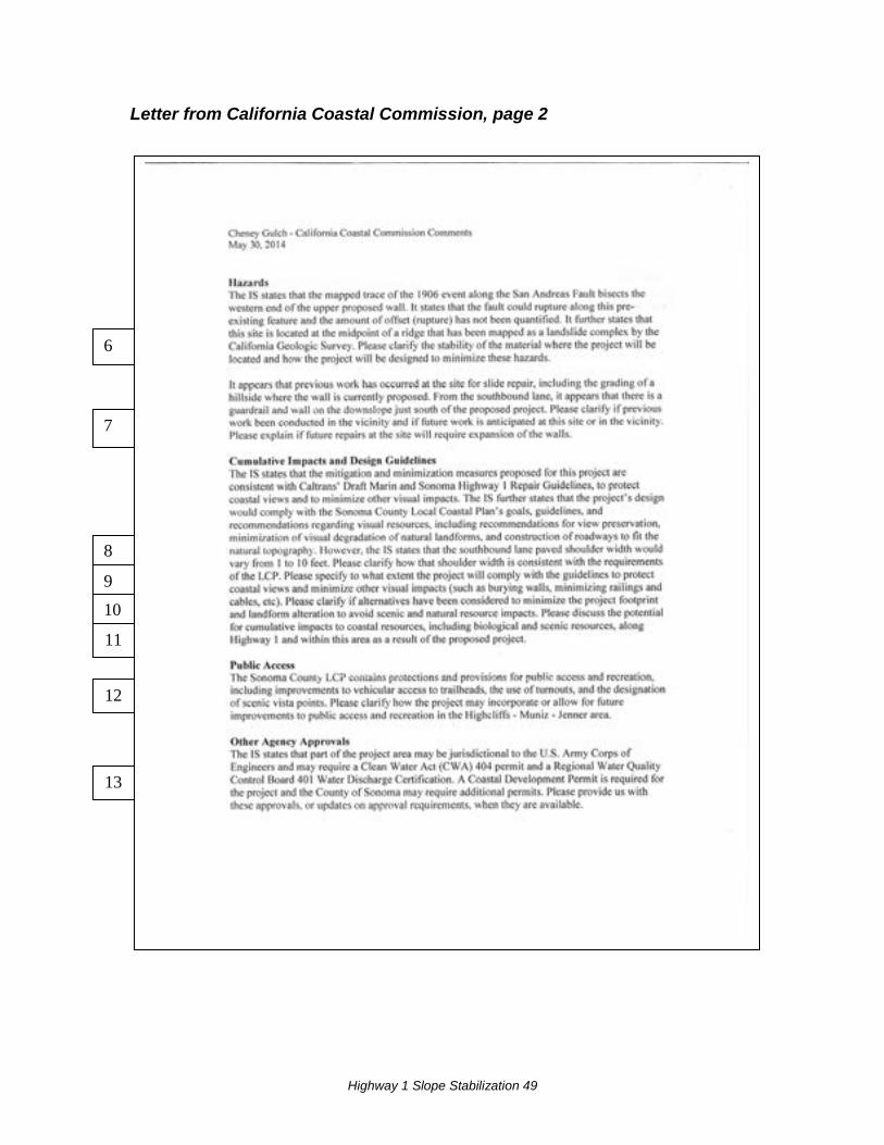
6
7
8
9
10
11
12
13
Highway 1 Slope Stabilization 50
Letter from California Coastal Commission, page 3
Highway 1 Slope Stabilization 51
Response to California Coastal Commission 1 Caltrans will re-evaluate the wetland delineation using the California Coastal Commission’s single-parameter criteria.
2 The Initial Study actually states that there is no habitat for sensitive species within the project study area. Botanical surveys were conducted but no sensitive species were found in the biological study area, including the wetland (roadside ditch). No mitigation for species is proposed. Therefore no alternatives have been considered to avoid impacts to habitat and sensitive species. It appears that the wording of this comment regarding sensitive species and mitigation may have come from the California Coastal Commission’s comment letter dated May 30, 2014 regarding Caltrans’ Cheney Gulch project, as suggested by the header that appears on pages 2 and 3.
3 The hydraulics study being prepared for this project will consist of design recommendations. Caltrans will provide this document to the Coastal Commission after it is completed, along with the other technical reports prepared for this project, including the Water Quality study.
4 Best Management Practices are still being developed, and will be included in the Storm Water Pollution Prevention Plan. Erosion control used in the project will be biodegradable, and, in the case of fiber rolls, may include photodegradable elements.
5 The Storm Water Pollution Prevention Plan for the project will be prepared by the contractor and reviewed and approved by Caltrans. The Plan will not be reviewed or approved by other agencies. A copy of the Storm Water Pollution Prevention Plan will be provided to the Coastal Commission after it is completed.
6 As stated in the environmental document landslide deposits overlay bedrock in the project location, this is why the project is needed to avoid future damage to the roadway. The project designers chose soil nail walls to address the slope instability because these retaining walls are flexible and can rupture and still maintain structural integrity. Soil nail walls are an ideal system along an active fault. These structures perform very well under strong seismic shaking because they move at the same frequency as the surrounding ground since they are physically attached to the ground.
7 A tieback wall (with guardrail) was constructed below the road on the down slope (southbound) side of Highway 1 in 1995. Prior to this, an earlier project had regraded the slopes and moved the road inland approximately 20 feet. During the construction of that
Highway 1 Slope Stabilization 52
project rock slope protection (placement of large rocks) was added to address a small failure in the approximately 1:1 cut slope on the uphill (northbound) side. It is unknown whether or not the walls would be extended or expanded in the future to repair future landslides.
8 The Sonoma County Local Coastal Plan recommends that paved shoulders along Highway 1 be a minimum of 4 feet wide to accommodate bicyclists and pedestrians. As stated in the project description the northbound lane will have a 4 foot-wide shoulder. The variation in width of the paved shoulder along the southbound lane (from 1-10 feet) is an existing condition. The entire project is about 600 feet long; 300 feet of the paved southbound shoulder is less than 4 feet wide.
Widening the southbound paved shoulder where it is narrower than 4 feet in width would require additional engineering studies to determine feasibility. One or more retaining walls would need to be constructed below the roadway, either a cantilever soldier pile wall and/or a tieback wall, depending on the amount of the widening and steepness of the side slope. The project is not funded to include construction of additional structures.
9 The Sonoma County Local Coastal Plan and the draft Marin and Sonoma Highway 1 Repair Guidelines each define the importance and preservation of coastal views and other coastal resources. Additionally, they describe measures for incorporation into projects to assist in the avoidance or minimization of impacts to these resources, and advance the established goals of visual preservation. In response to those documents, the project has incorporated the following design elements to minimize visual impacts and contribute to the cohesive and scenic nature of the highway corridor through coastal Sonoma County. Examples of these measures include:
• Burying in its entirety the lower of the two retaining walls • Burying to the extent possible the upper retaining wall, with exposed portions to
be sculpted and stained, mimicking a natural rock outcropping. This wall will be set back more than 120 feet from the roadway, further minimizing its visual impact to roadway users.
• Painting exposed drainage features, down-drains, etc., brown to recede visually and blend with the surrounding landscape
• Disturbed areas of the slope will be hydroseeded with locally native vegetation, allowing the revegetated site to blend with the surrounding landscape
The project will not introduce jarring visual elements or lessen the visual cohesiveness, unity, or intactness of the highway corridor.
Highway 1 Slope Stabilization 53
The repair of the slope will allow for the removal of the concrete traffic barrier adjacent to the northbound traffic lane, thus improving the visual quality of the roadside at the project site.
The project does not introduce elements that will block or limit coastal views in any way.
10 The project design originally selected in January 2013 proposed two soil nail walls with aesthetic treatment and hydroseeding of the graded slope. The lower wall, adjacent to the paved shoulder, was 338 feet long and 25 feet high. An upper wall, separated by a 15 foot wide or more terrace was 398 feet long and would be up to 55 feet high. In September 2013 the project team decided to modify this design, in order to reduce the visual impacts of the two large retaining walls. The new design, presented in this environmental document, causes the walls to visually recede into the landscape by entirely burying the lower wall and by partially burying the upper wall.
11 The use of design elements already in place on nearby roadway projects contribute to the visual cohesiveness of the highway corridor, lessening the cumulative visual impact of the projects. These elements include the sculpted rock wall, painted drainage elements, and native vegetation. The removal of 0.10 acre of wetland, an isolated narrow roadside ditch, does not rise to the magnitude of impacts to require cumulative impacts analysis for biological resources.
12 The project would not affect public access to the coast, either positively or negatively. No trailheads of official trails are present in or near the project area, only informal unmaintained trails down to the shoreline. An unpaved dirt shoulder area used by motorists as a pull-off area is located along the southbound shoulder near the north end of the project. Near the eastern end of the project the southbound paved shoulder widens to 10 feet, and just past this area is a paved turnout; parking is prohibited on the turnout and on the paved shoulder except in an emergency.
13 Caltrans will submit an application for a Coastal Development Permit to Sonoma County, and will send a copy of the application to the California Coastal Commission. No other local approvals are required for this project. Caltrans will provide copies of all permits and authorizations required for the project to Sonoma County prior to the start of construction. Copies of theses permits and authorizations can also be provided to the California Coastal Commission upon request.