Embed Size (px)
Citation preview
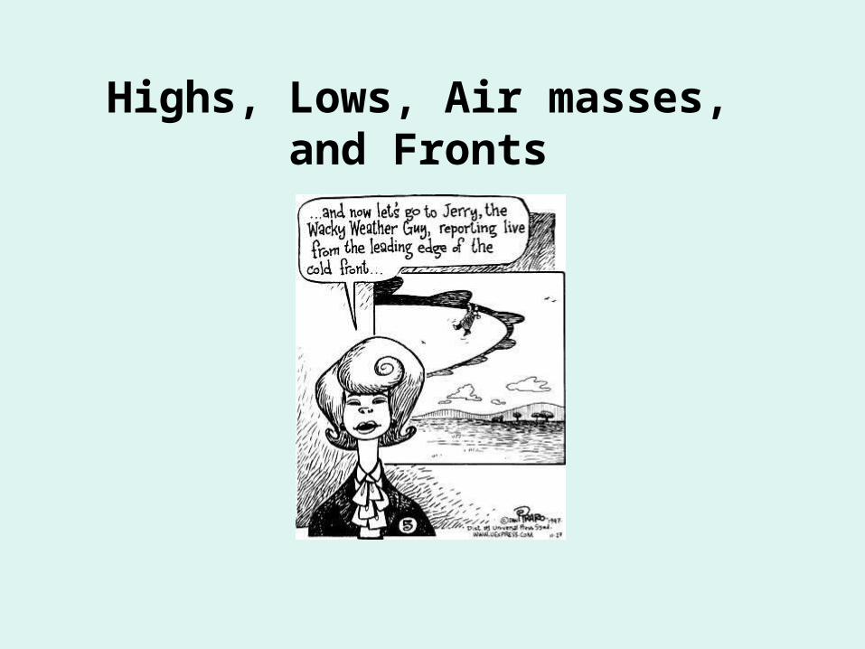
Highs, Lows, Air masses, and Fronts
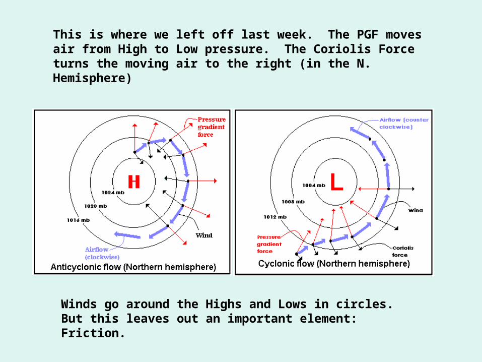
This is where we left off last week. The PGF moves air from High to Low pressure. The Coriolis Force turns the moving air to the right (in the N. Hemisphere)
Winds go around the Highs and Lows in circles. But this leaves out an important element: Friction.
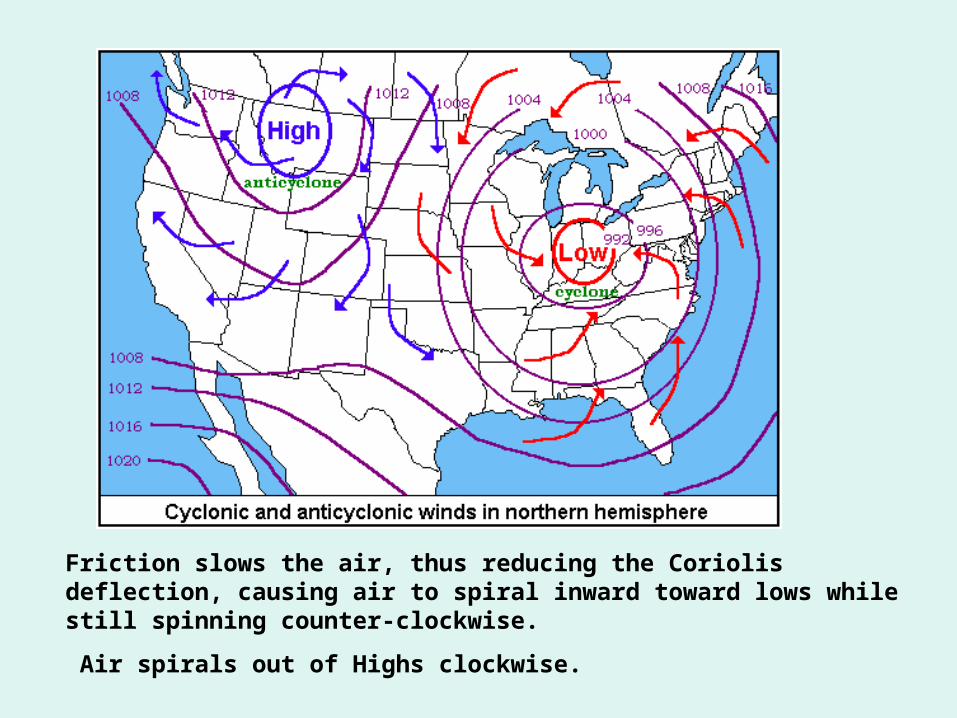
Friction slows the air, thus reducing the Coriolis deflection, causing air to spiral inward toward lows while still spinning counter-clockwise.
Air spirals out of Highs clockwise.
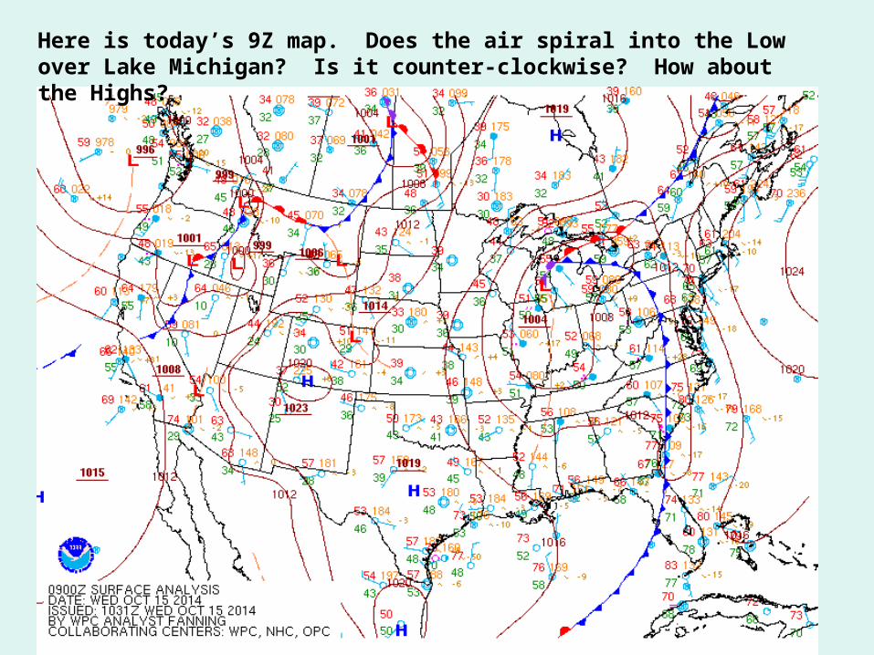
Here is today’s 9Z map. Does the air spiral into the Low over Lake Michigan? Is it counter-clockwise? How about the Highs?
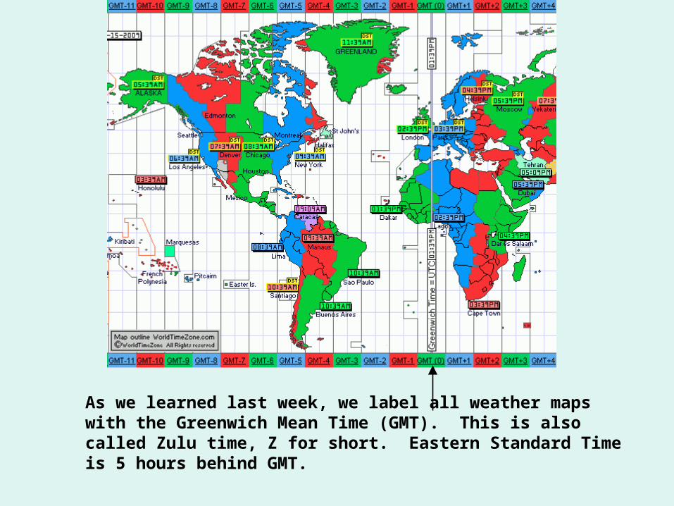
As we learned last week, we label all weather maps with the Greenwich Mean Time (GMT). This is also called Zulu time, Z for short. Eastern Standard Time is 5 hours behind GMT.
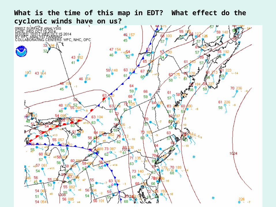
What is the time of this map in EDT? What effect do the cyclonic winds have on us?
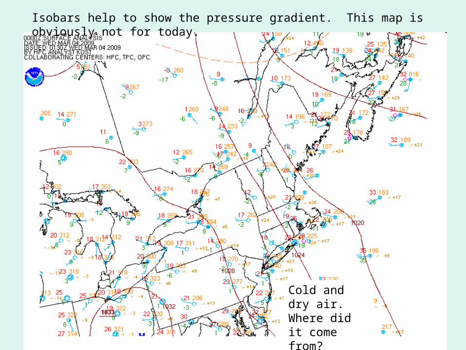
Isobars help to show the pressure gradient. This map is obviously not for today.
Cold and dry air. Where did it come from?
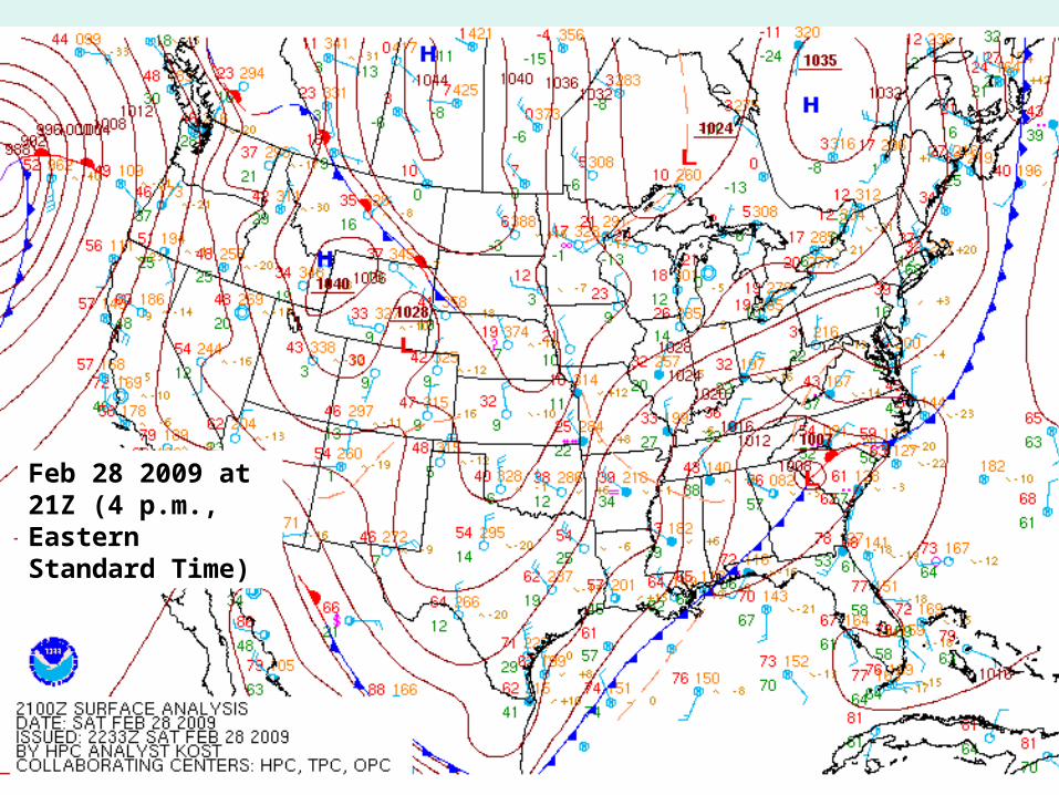
Feb 28 2009 at 21Z (4 p.m., Eastern Standard Time)
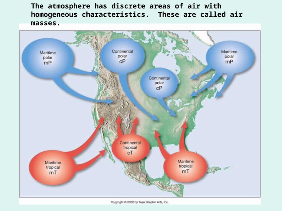
The atmosphere has discrete areas of air with homogeneous characteristics. These are called air masses.
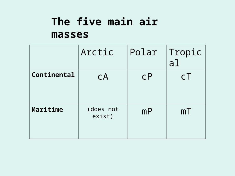
Arctic Polar TropicalContinental cA cP cT
Maritime (does not exist) mP mT
The five main air masses
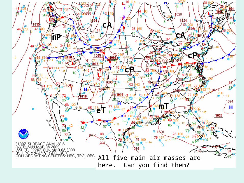
All five main air masses are here. Can you find them?
cP
mP
cAcA
cT mT
cP
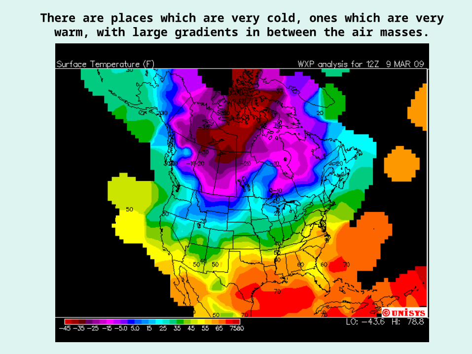
There are places which are very cold, ones which are very warm, with large gradients in between the air masses.
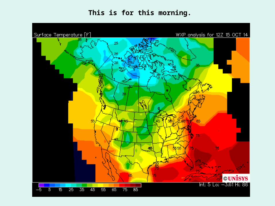
This is for this morning.
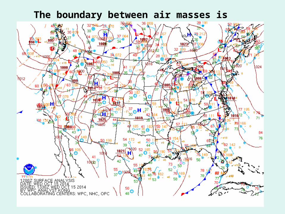
The boundary between air masses is a front
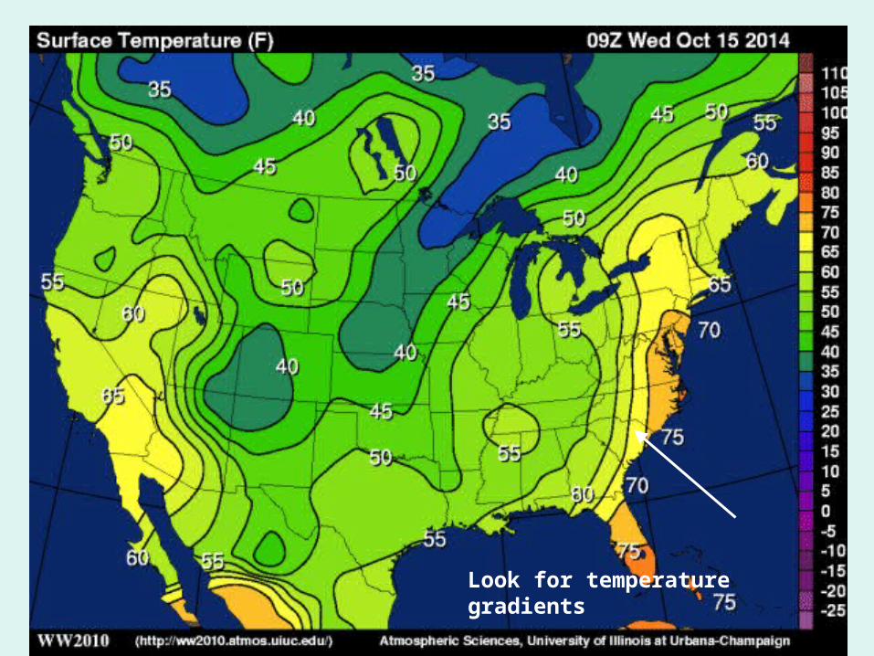
The fronts are at the temperature gradientsLook for temperature gradients
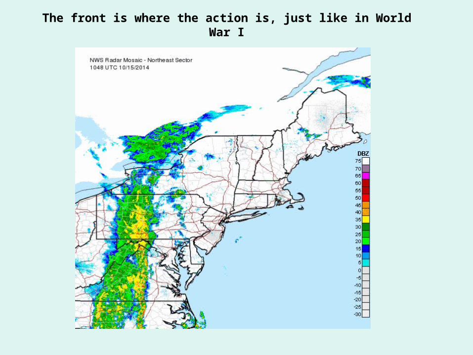
The front is where the action is, just like in World War I
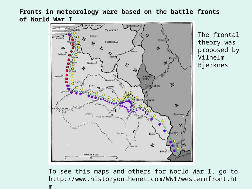
Fronts in meteorology were based on the battle fronts of World War I
The frontal theory was proposed by Vilhelm Bjerknes
To see this maps and others for World War I, go to http://www.historyonthenet.com/WW1/westernfront.htm
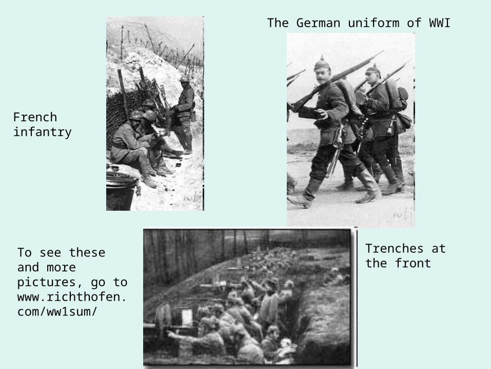
French infantry
The German uniform of WWI
Trenches at the front
To see these and more pictures, go to www.richthofen.com/ww1sum/
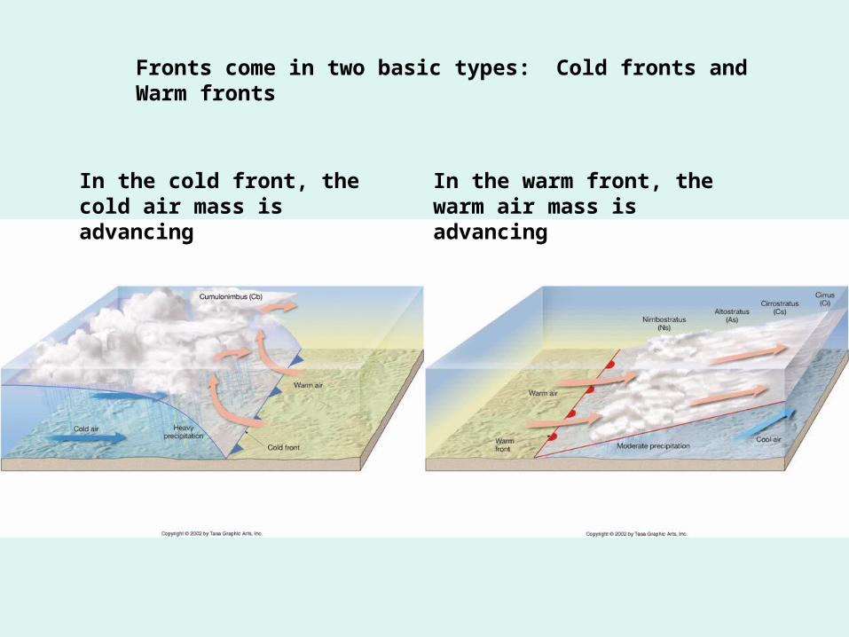
Fronts come in two basic types: Cold fronts and Warm fronts
In the cold front, the cold air mass is advancing
In the warm front, the warm air mass is advancing
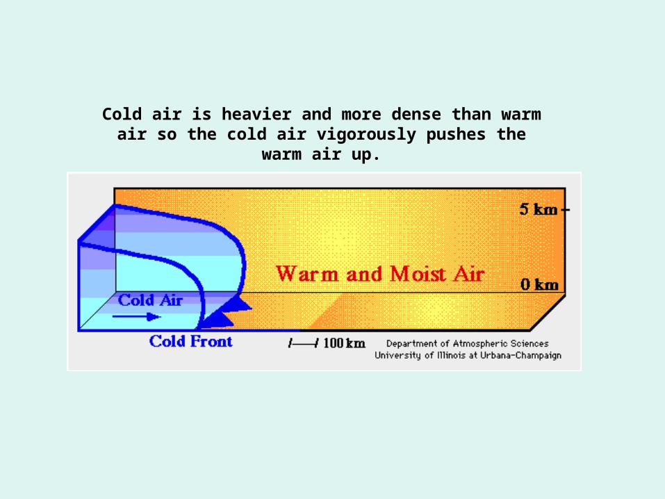
Cold air is heavier and more dense than warm air so the cold air vigorously pushes the warm air up.
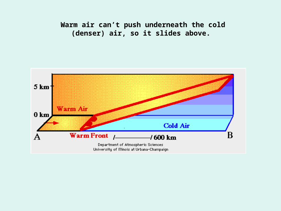
Warm air can’t push underneath the cold (denser) air, so it slides above.
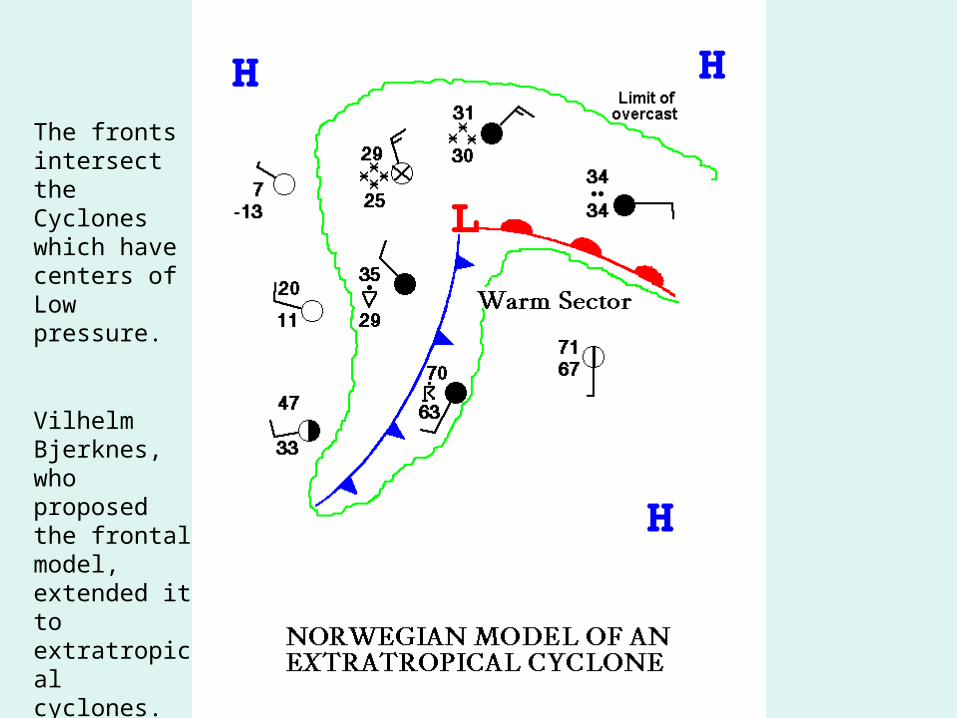
The fronts intersect the Cyclones which have centers of Low pressure.
Vilhelm Bjerknes, who proposed the frontal model, extended it to extratropical cyclones.
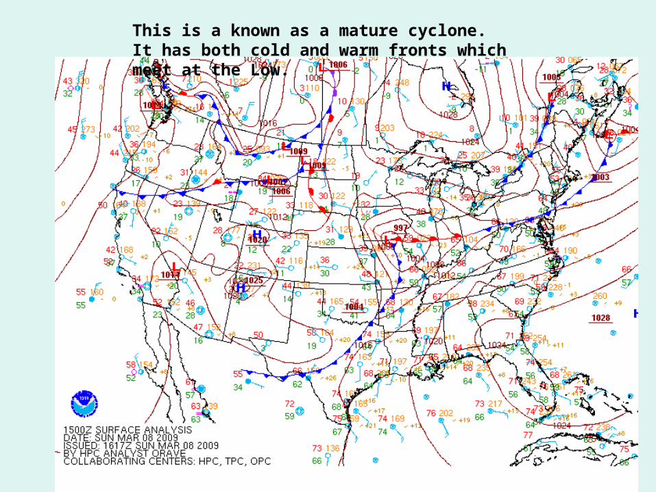
This is a known as a mature cyclone. It has both cold and warm fronts which meet at the Low.
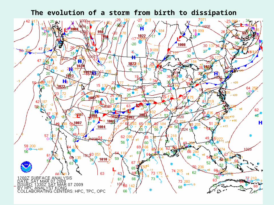
The evolution of a storm from birth to dissipation
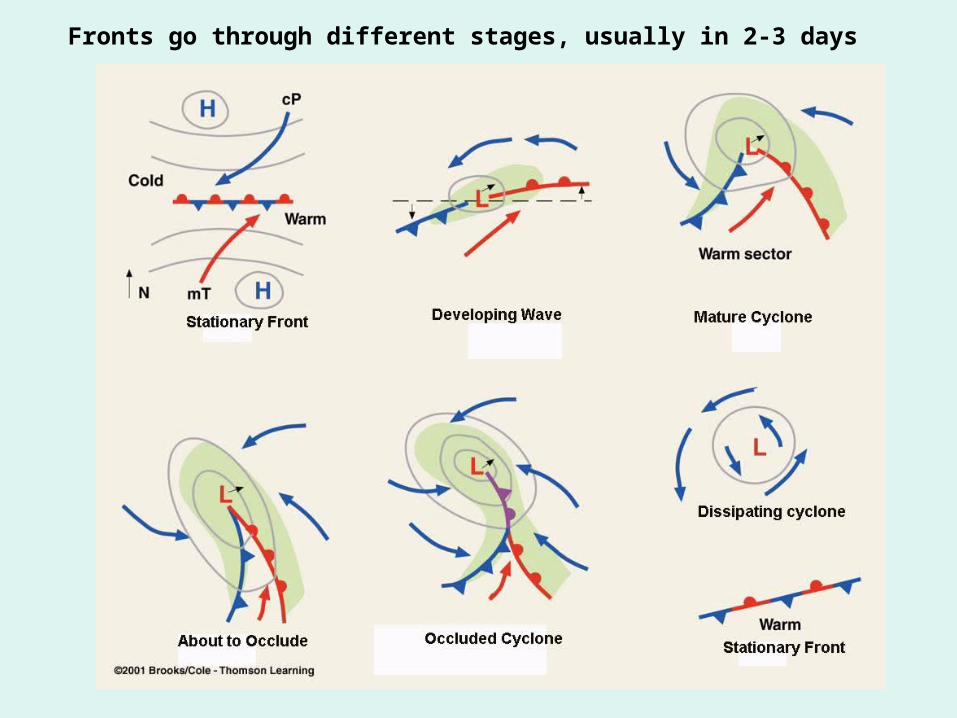
Fronts go through different stages, usually in 2-3 days
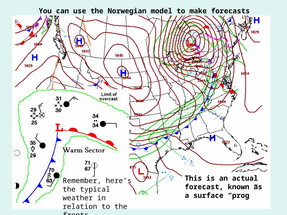
You can use the Norwegian model to make forecasts
Remember, here’s the typical weather in relation to the fronts
This is an actual forecast, known as a surface “prog”
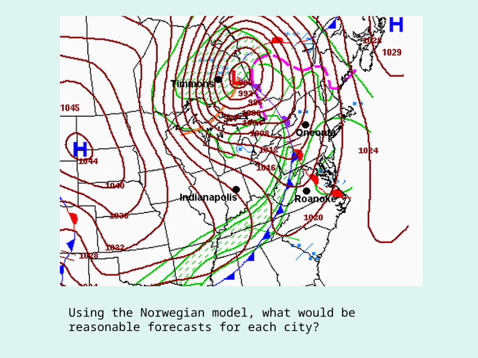
Using the Norwegian model, what would be reasonable forecasts for each city?
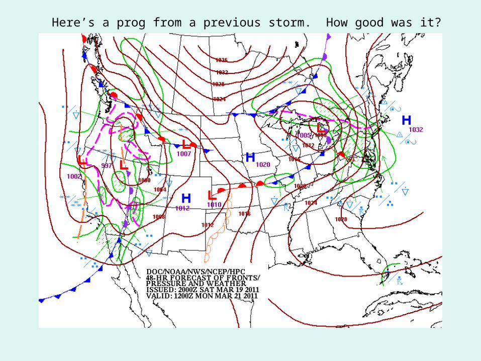
Here’s a prog from a previous storm. How good was it?
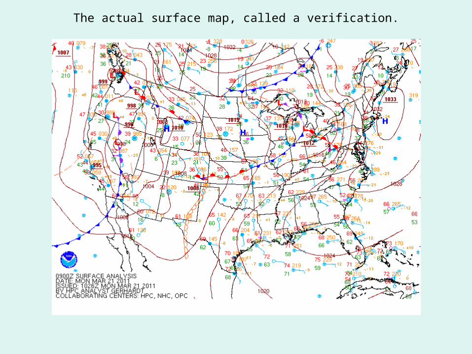
The actual surface map, called a verification.
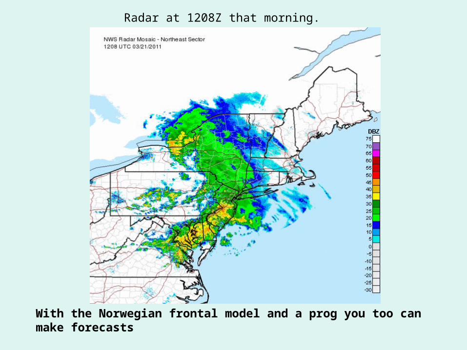
Radar at 1208Z that morning.
With the Norwegian frontal model and a prog you too can make forecasts
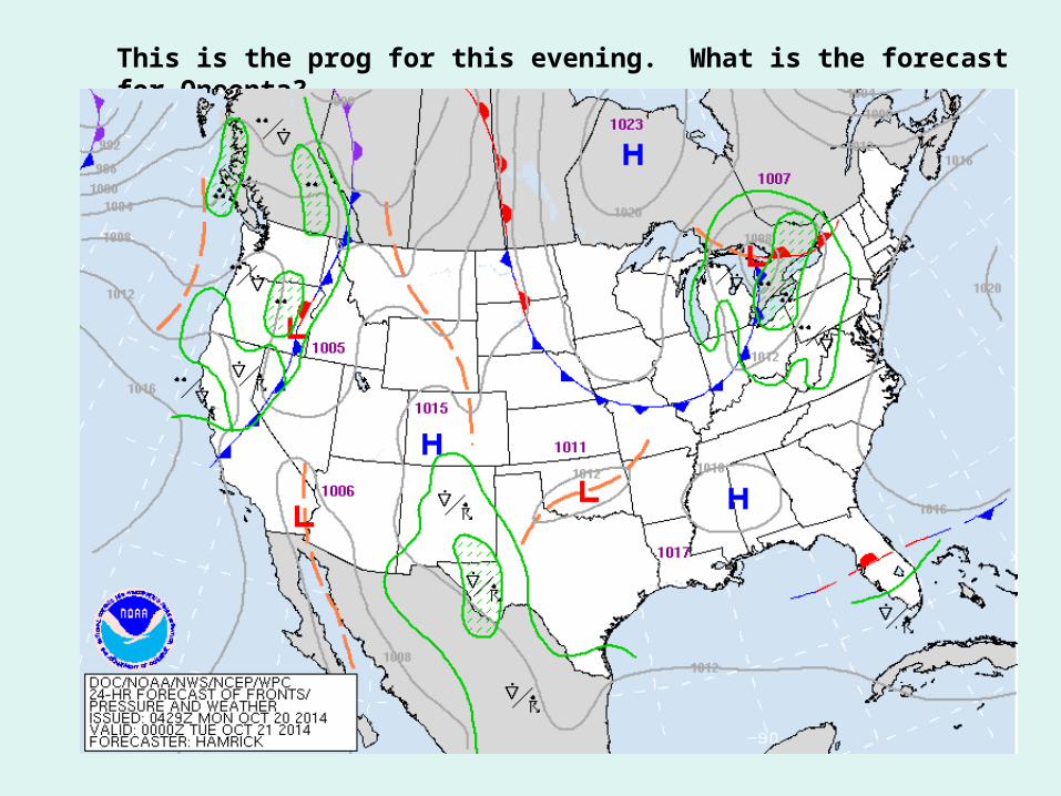
This is the prog for this evening. What is the forecast for Oneonta?
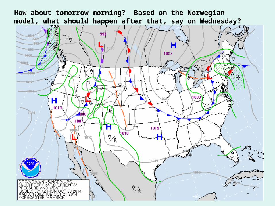
How about tomorrow morning? Based on the Norwegian model, what should happen after that, say on Wednesday?