Embed Size (px)
Citation preview

High Spatial Resolution RGB and NIR UAV Based Imagery for Detection of Ganoderma Disease in Oil Palm
NISFARIZA MOHD NOOR (PHD)
DEPARTMENT OF GEOGRAPHY UNIVERSITY OF MALAYA
KUALA LUMPUR, MALAYSIA
NADES 2016 National Drone Exhibition and Seminar 25 May 2016
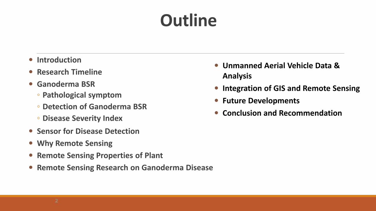
Outline
Introduction
Research Timeline
Ganoderma BSR
◦ Pathological symptom
◦ Detection of Ganoderma BSR
◦ Disease Severity Index
Sensor for Disease Detection
Why Remote Sensing
Remote Sensing Properties of Plant
Remote Sensing Research on Ganoderma Disease
Unmanned Aerial Vehicle Data & Analysis
Integration of GIS and Remote Sensing
Future Developments
Conclusion and Recommendation
2
Introduction
Oil palm (Elaeis guineensis Jacq.) the most important agriculture sector in Malaysia.
Damage and loss due to pests and diseases are considered serious problems and can reduce the profitability of the business and jeopardise the growth of the industry over time.
Three major oil palm threats for the crop losses can be classified into insects, vertebrates and diseases.
Monitoring agricultural areas are time and labour consuming – dealing with large area of homogenous crop.
3
Introduction
Remote sensing technology - synoptic view of the large plantation area - possibility to monitor the state of vigorousness and stress due to disease, pest and nutrient deficiency.
The use of remote sensing technology in detection and monitoring of existing infected area with Ganoderma BSR is possible and opens new horizon in Ganoderma BSR study.
Disease and pest detection and control are important phases in agricultural management. Cultural practices combined with biological and chemical control have been considered as the best approach for controlling diseases and pests. Remote sensing provides a possible solution to the intensive sampling required for site-specific pest management.
4

Research Timeline - Ganoderma Detection Using Remote Sensing Technology
2008 – Baseline study using handheld spectroradiometer (seedlings, young and mature palm).
2010 – Hyperspectral data acquisition using airborne carrier ( over ground thruthed area for young and mature palm).
2013 – UAV (RGB/NIR) data acquisition over ground thruthed mature palm)
201? – Baseline study using RADAR technology.
201? – Hyperspectral data acquisition using UAV (over ground thruthed data for young and mature palm).
5
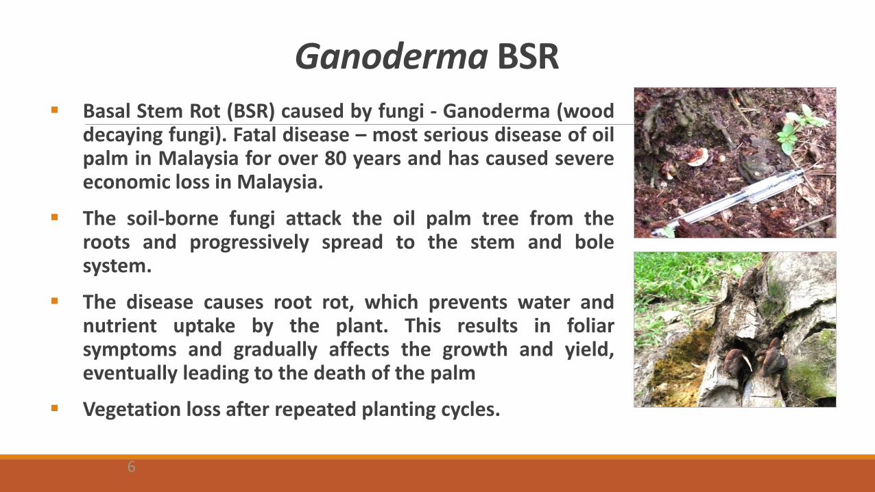
Ganoderma BSR Basal Stem Rot (BSR) caused by fungi - Ganoderma (wood
decaying fungi). Fatal disease – most serious disease of oil palm in Malaysia for over 80 years and has caused severe economic loss in Malaysia.
The soil-borne fungi attack the oil palm tree from the roots and progressively spread to the stem and bole system.
The disease causes root rot, which prevents water and nutrient uptake by the plant. This results in foliar symptoms and gradually affects the growth and yield, eventually leading to the death of the palm
Vegetation loss after repeated planting cycles.
6
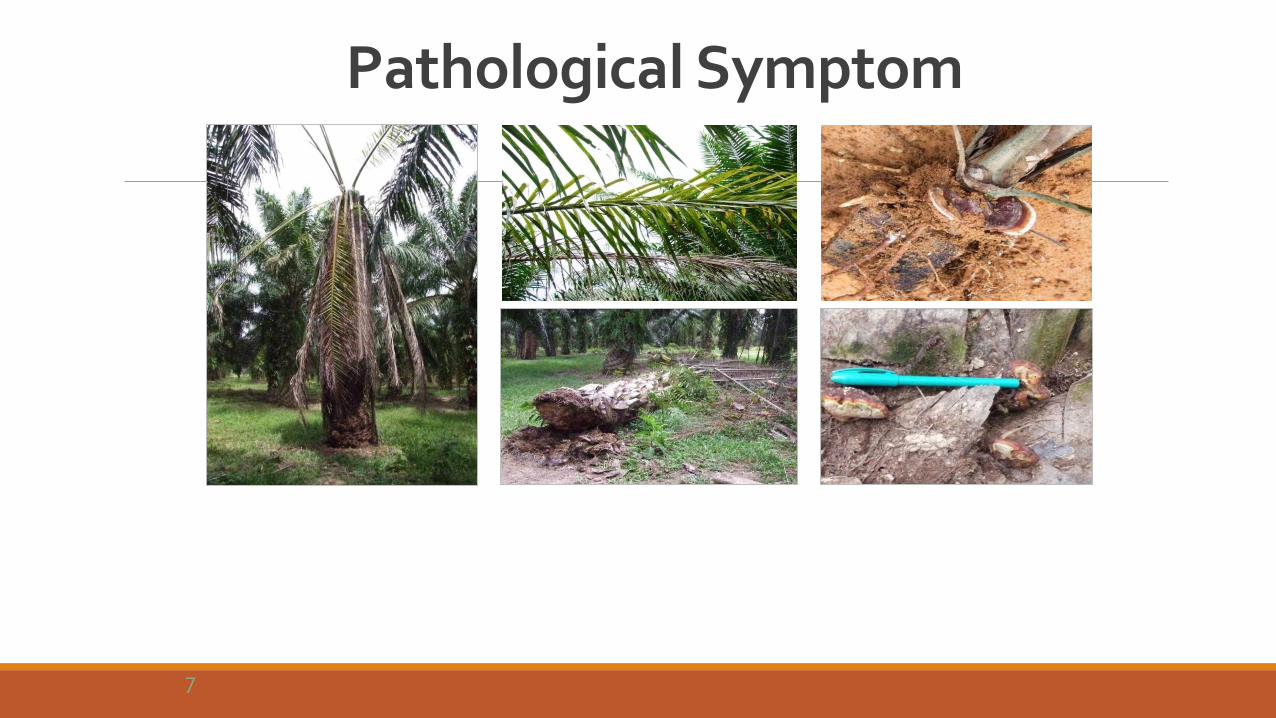
Pathological Symptom
7
Detection of Ganoderma BSR Visual interpretation - detect the mortality towards BSR, middle or late stages of
disease pathology. Stress diagnoses based on plant sampling and
physiochemical analysis using traditional methods are commonly time-
consuming, destructive and expensive.
Early detection / aerial detection – enable treatment at the early stage of the
infection and avoid more extensive damage and losses.
Detection of subclinical symptom of Ganoderma could be achieved through
GSM test, PCR-DNA molecular, ELISA-polyclonal antibody and GanoScan1
tomography (Idris, 2009).
8
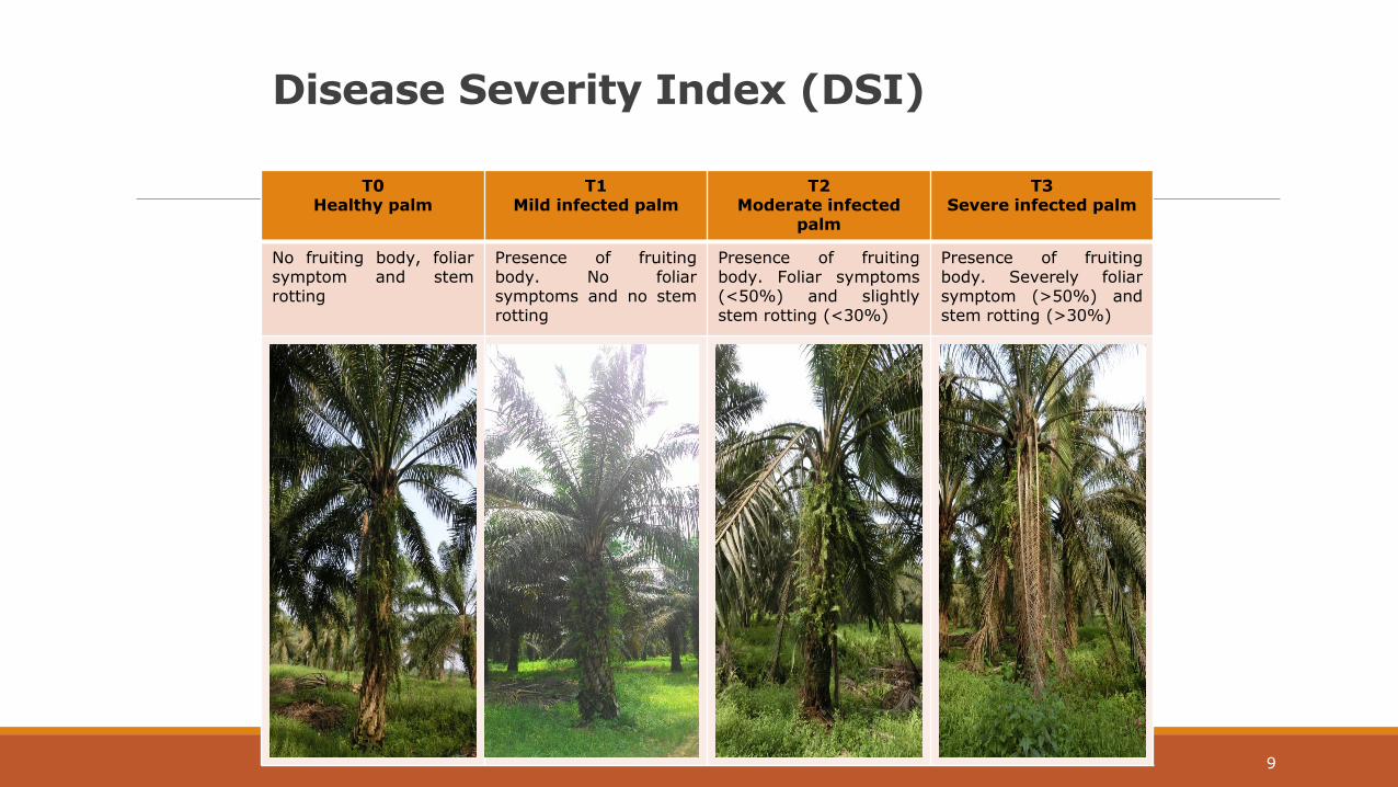
Disease Severity Index (DSI)
T0 Healthy palm
T1 Mild infected palm
T2 Moderate infected
palm
T3 Severe infected palm
No fruiting body, foliar symptom and stem rotting
Presence of fruiting body. No foliar symptoms and no stem rotting
Presence of fruiting body. Foliar symptoms (<50%) and slightly stem rotting (<30%)
Presence of fruiting body. Severely foliar symptom (>50%) and stem rotting (>30%)
9
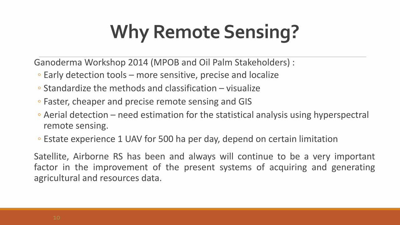
Why Remote Sensing?
Ganoderma Workshop 2014 (MPOB and Oil Palm Stakeholders) : ◦ Early detection tools – more sensitive, precise and localize
◦ Standardize the methods and classification – visualize
◦ Faster, cheaper and precise remote sensing and GIS
◦ Aerial detection – need estimation for the statistical analysis using hyperspectral remote sensing.
◦ Estate experience 1 UAV for 500 ha per day, depend on certain limitation
Satellite, Airborne RS has been and always will continue to be a very important factor in the improvement of the present systems of acquiring and generating agricultural and resources data.
10
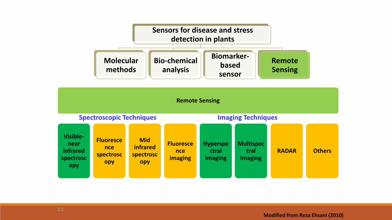
Sensors for disease and stress detection in plants
Molecular methods
Bio-chemical analysis
Biomarker-based sensor
Remote Sensing
Remote Sensing
Visible-near
infrared spectrosc
opy
Fluorescence
spectroscopy
Mid infrared
spectroscopy
Fluorescence
imaging
Hyperspectral
imaging RADAR
Multispectral
Imaging Others
Spectroscopic Techniques Imaging Techniques
Modified from Reza Ehsani (2010) 11
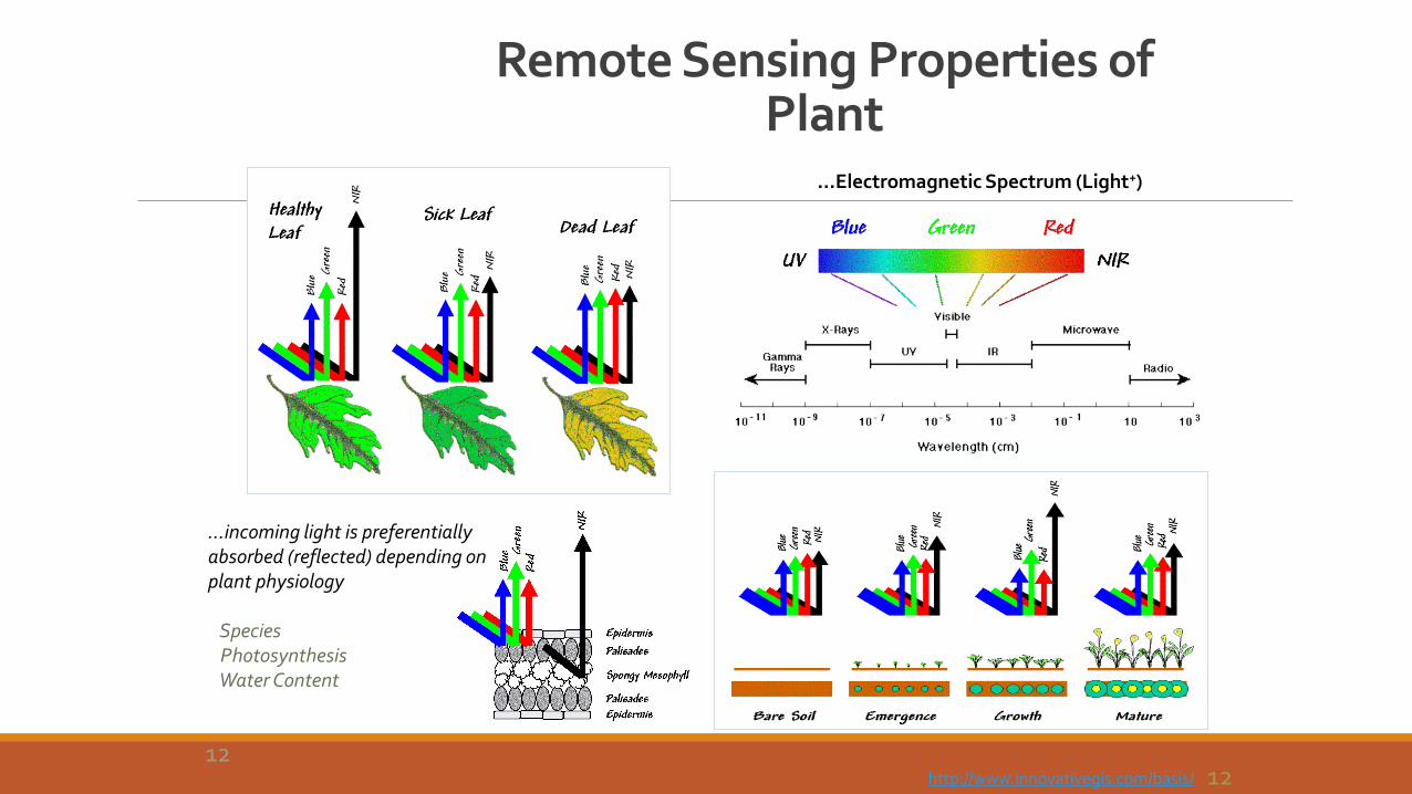
…Electromagnetic Spectrum (Light+)
…incoming light is preferentially absorbed (reflected) depending on plant physiology Species Photosynthesis Water Content
http://www.innovativegis.com/basis/
Remote Sensing Properties of Plant
12 12
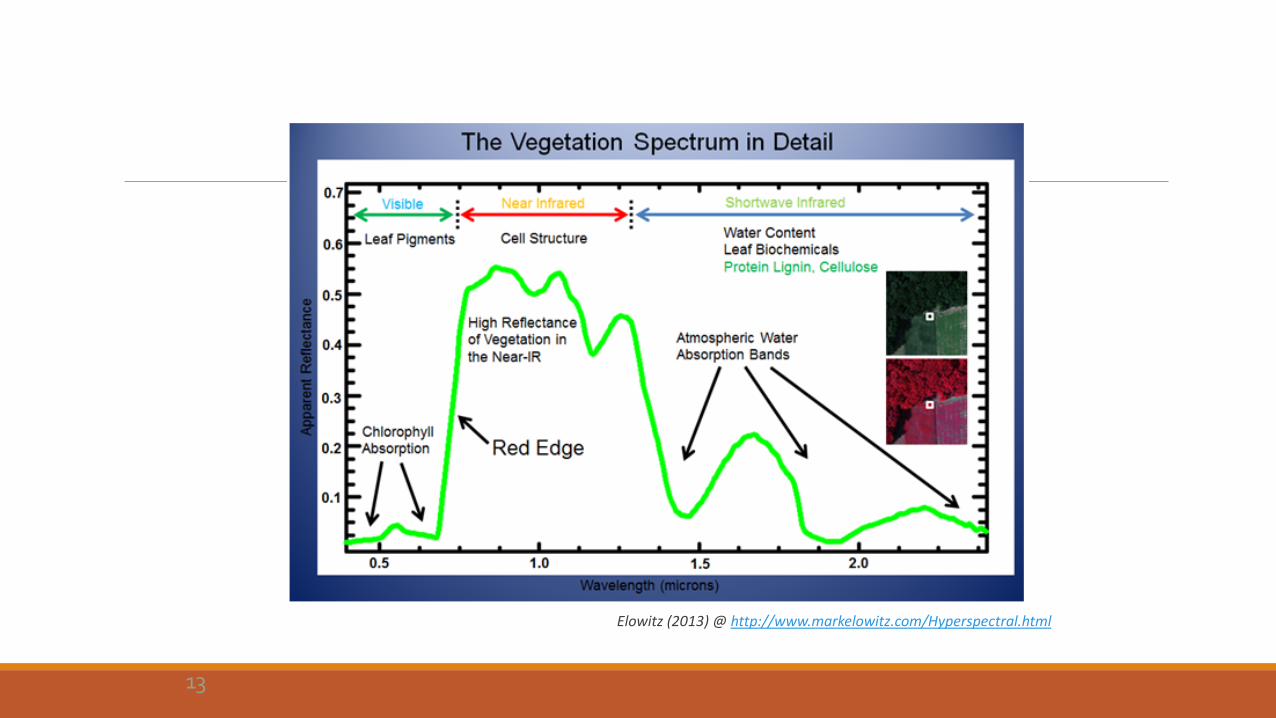
Elowitz (2013) @ http://www.markelowitz.com/Hyperspectral.html
13
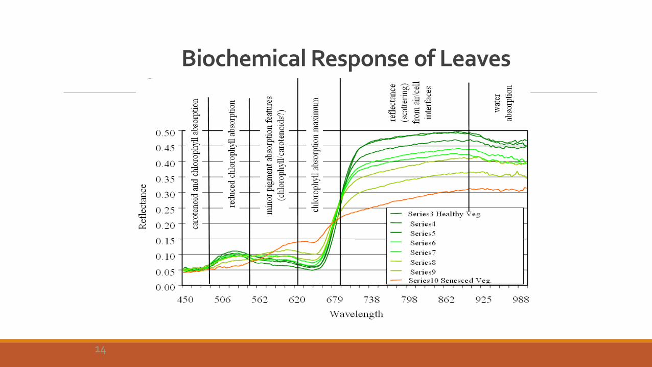
Biochemical Response of Leaves
Philpot, 2011
14
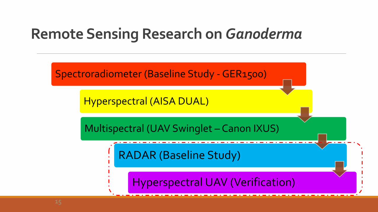
Remote Sensing Research on Ganoderma
Spectroradiometer (Baseline Study - GER1500)
Hyperspectral (AISA DUAL)
Multispectral (UAV Swinglet – Canon IXUS)
RADAR (Baseline Study)
Hyperspectral UAV (Verification)
15

Data Acquisition & Equipment

Data Acquisition and Equipment
17
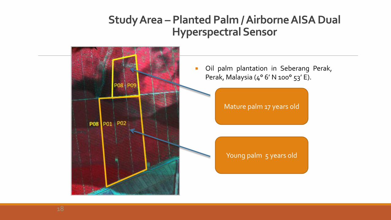
Study Area – Planted Palm / Airborne AISA Dual Hyperspectral Sensor
Mature palm 17 years old
Young palm 5 years old
Oil palm plantation in Seberang Perak, Perak, Malaysia (4° 6’ N 100° 53’ E).
18
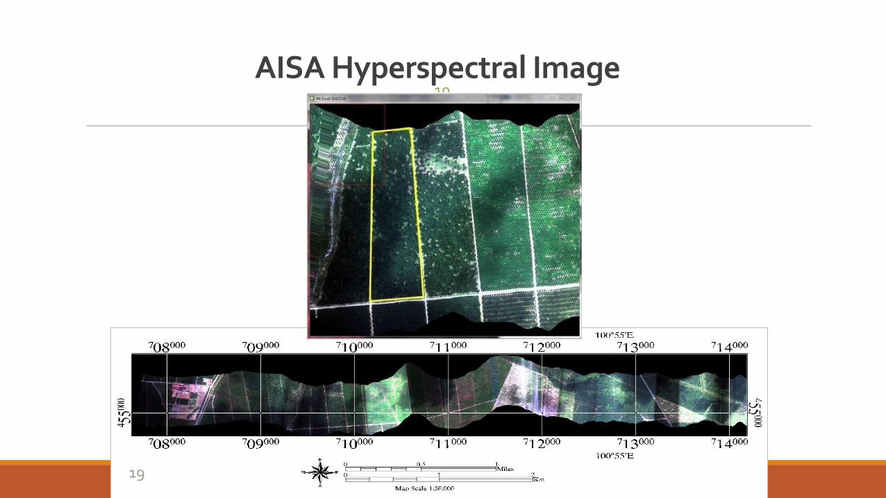
AISA Hyperspectral Image 19
19
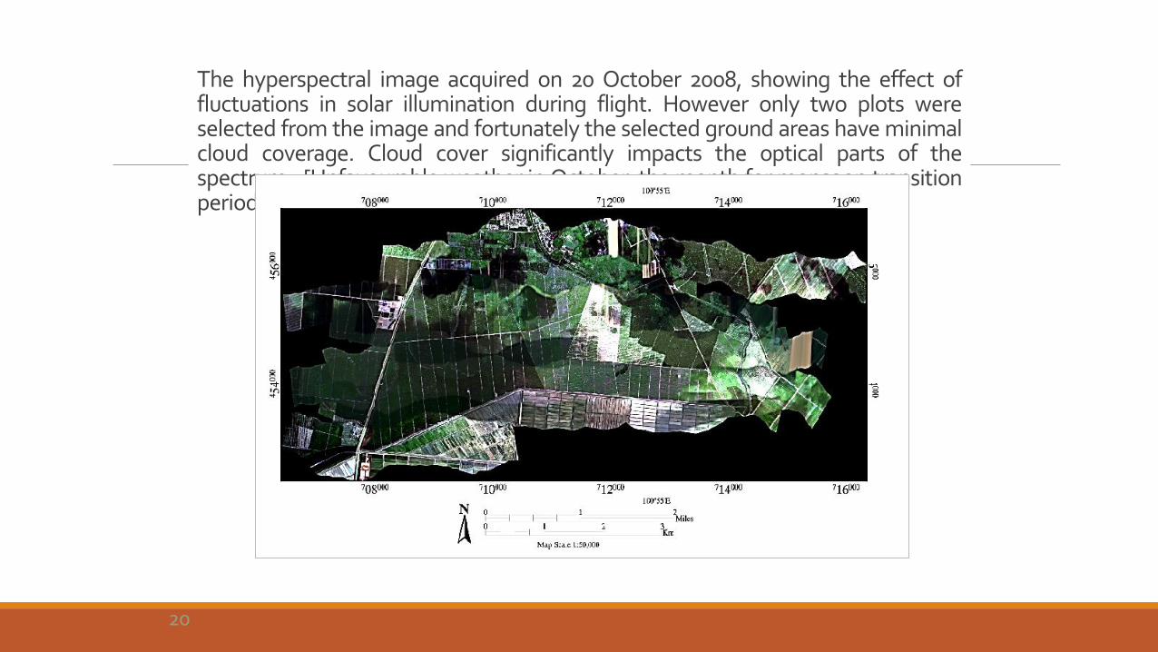
The hyperspectral image acquired on 20 October 2008, showing the effect of fluctuations in solar illumination during flight. However only two plots were selected from the image and fortunately the selected ground areas have minimal cloud coverage. Cloud cover significantly impacts the optical parts of the spectrum. [Unfavourable weather in October, the month for monsoon transition period in the country].
20
Unmanned Aerial Vehicle (UAV)
The advancement of remote sensing technology in providing a synoptic view – provides possibility to monitor a large plantation state of vigorousness and stress due to disease, pest and nutrient deficiency.
UAV has become commercially available nowadays – have the advantages of high spatial and temporal resolution characteristics compared to airborne and satellite platforms. Many interest due to the simplicity of the system.
UAV promotes the remote sensing technology in detection and monitoring of existing plot infected with Ganoderma BSR.
The foliar symptoms of Ganoderma BSR are prominent and visible at certain levels of infection and can be discerned through the human eyes.
21
Unmanned Aerial Vehicle (UAV)
Same visual detection concept is applied to the RGB image; since it corresponds to the optical concept of a human’s eye.
The use of NIR cameras in the UAV is additional whereby it implies the high reflectance of vegetation in the NIR region invisible to the human eye to demonstrate the health of the plant.
The RGB and NIR images are coupled with GIS analysis to achieve the aim to monitor Ganoderma BSR in oil palm plantation.
22

Data Acquisition and Equipment
23
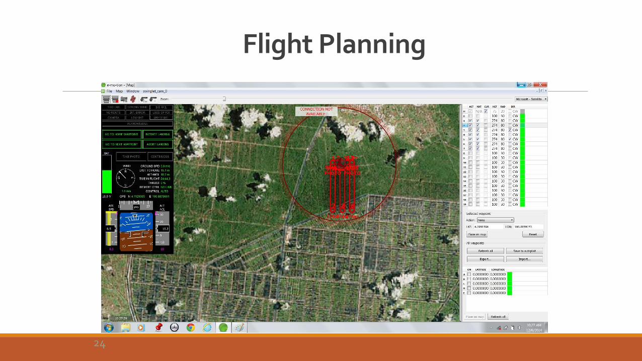
Flight Planning
24
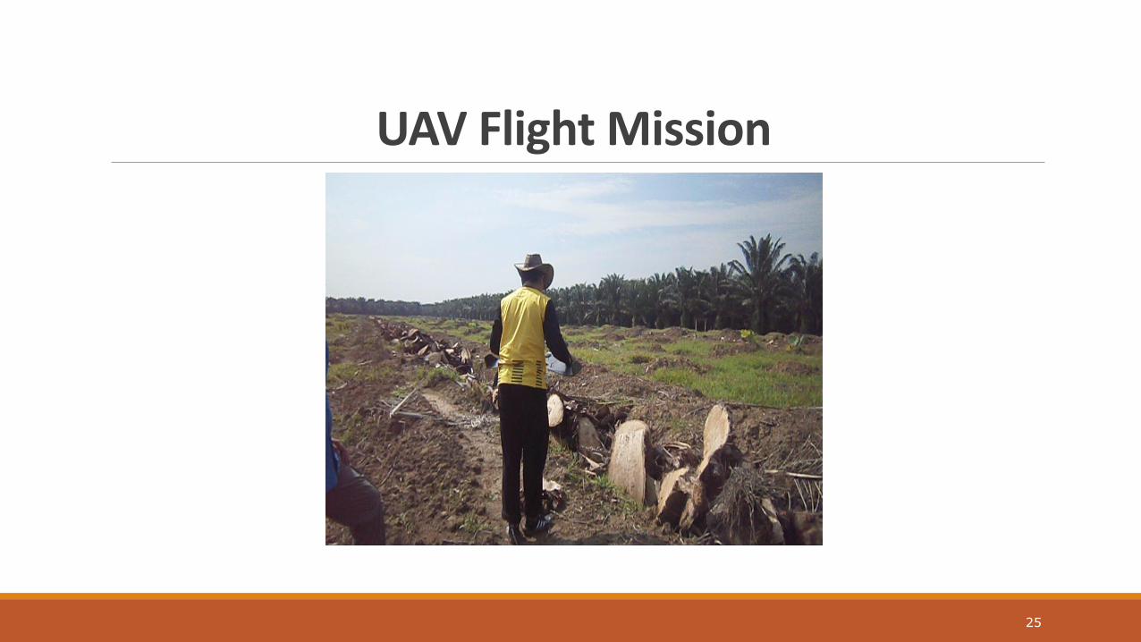
UAV Flight Mission
25

Image Acquired From UAV
26
RGB NIR
Band
Resolution
Spectral (nm)
Spatial (cm)
RGB 400-750 10
NIR 760-900 4
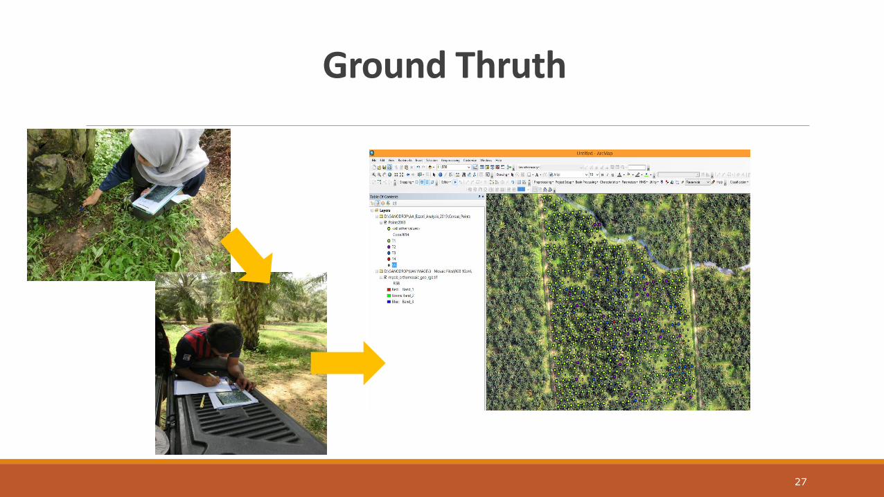
Ground Thruth
27
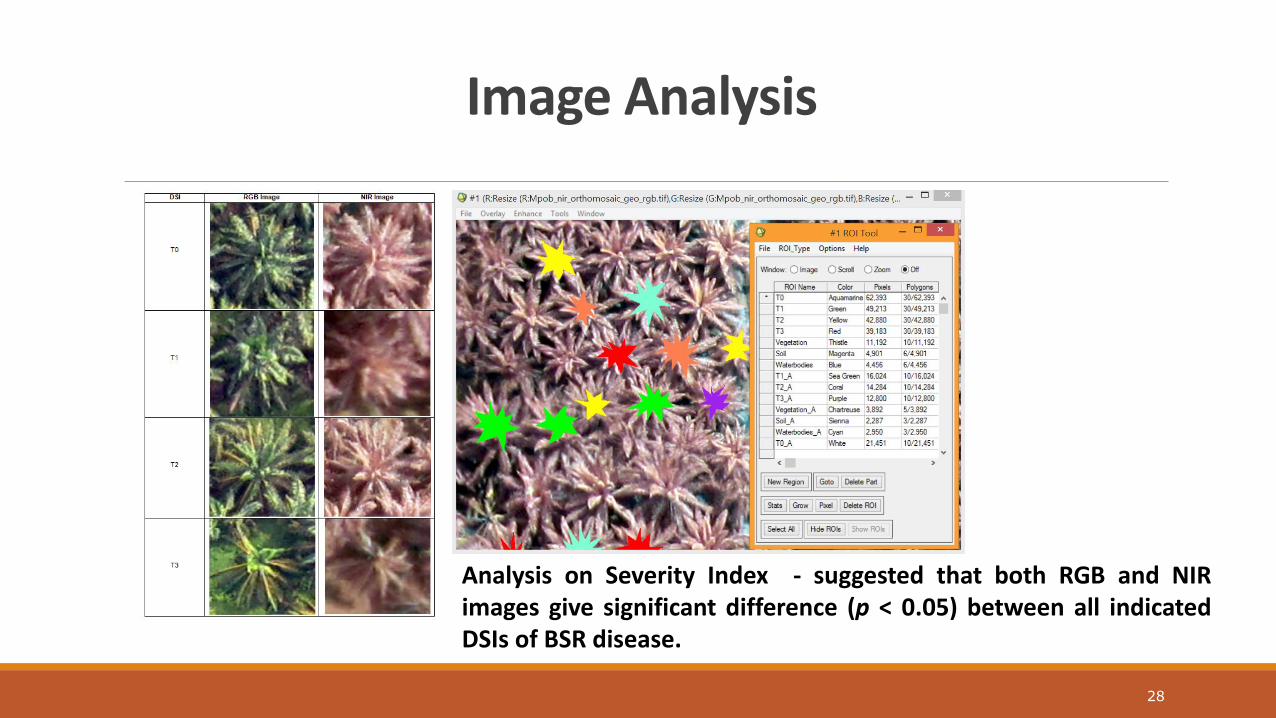
Image Analysis
28
Analysis on Severity Index - suggested that both RGB and NIR images give significant difference (p < 0.05) between all indicated DSIs of BSR disease.
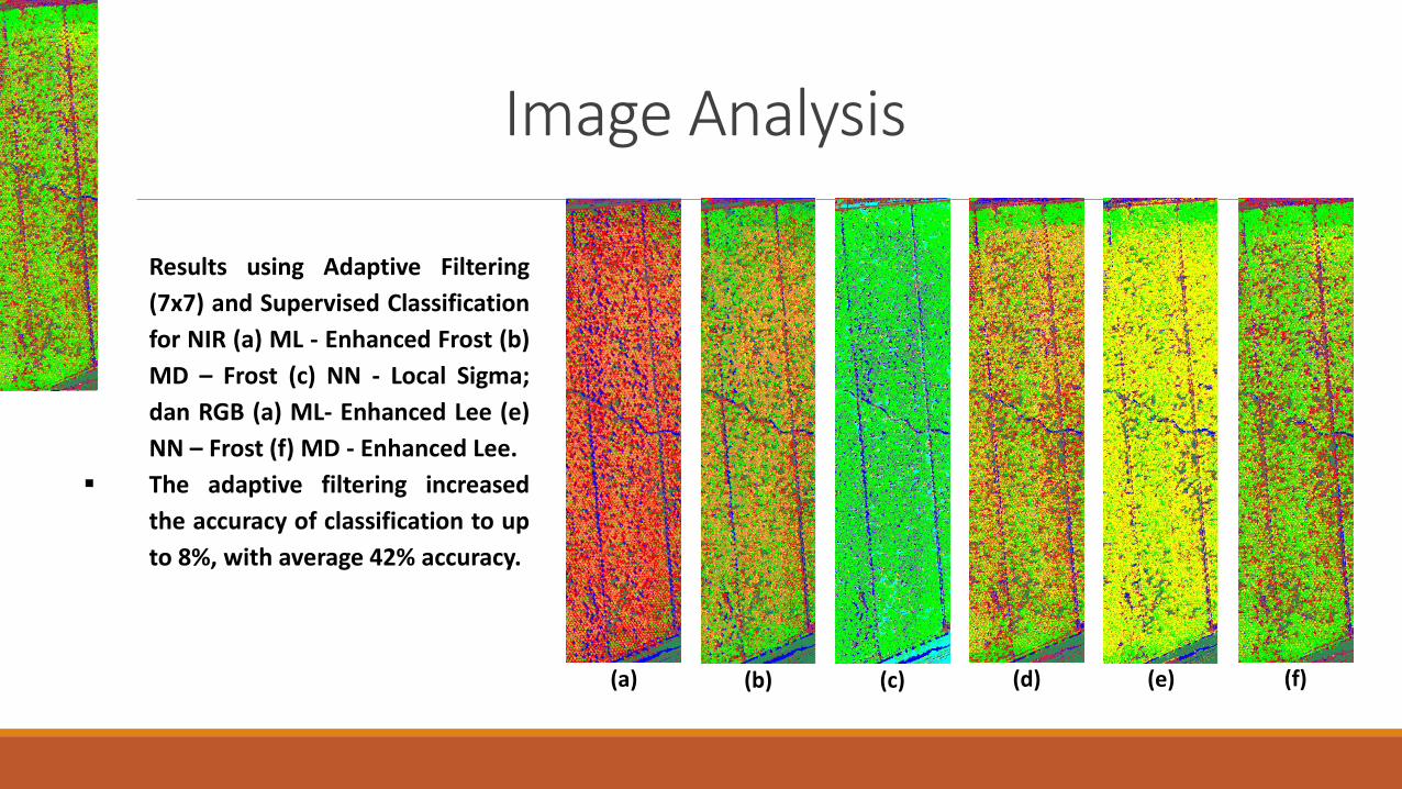
Image Analysis
(a) (b) (c)
(d)
(e)
(f)
Results using Adaptive Filtering
(7x7) and Supervised Classification
for NIR (a) ML - Enhanced Frost (b)
MD – Frost (c) NN - Local Sigma;
dan RGB (a) ML- Enhanced Lee (e)
NN – Frost (f) MD - Enhanced Lee.
The adaptive filtering increased
the accuracy of classification to up
to 8%, with average 42% accuracy.
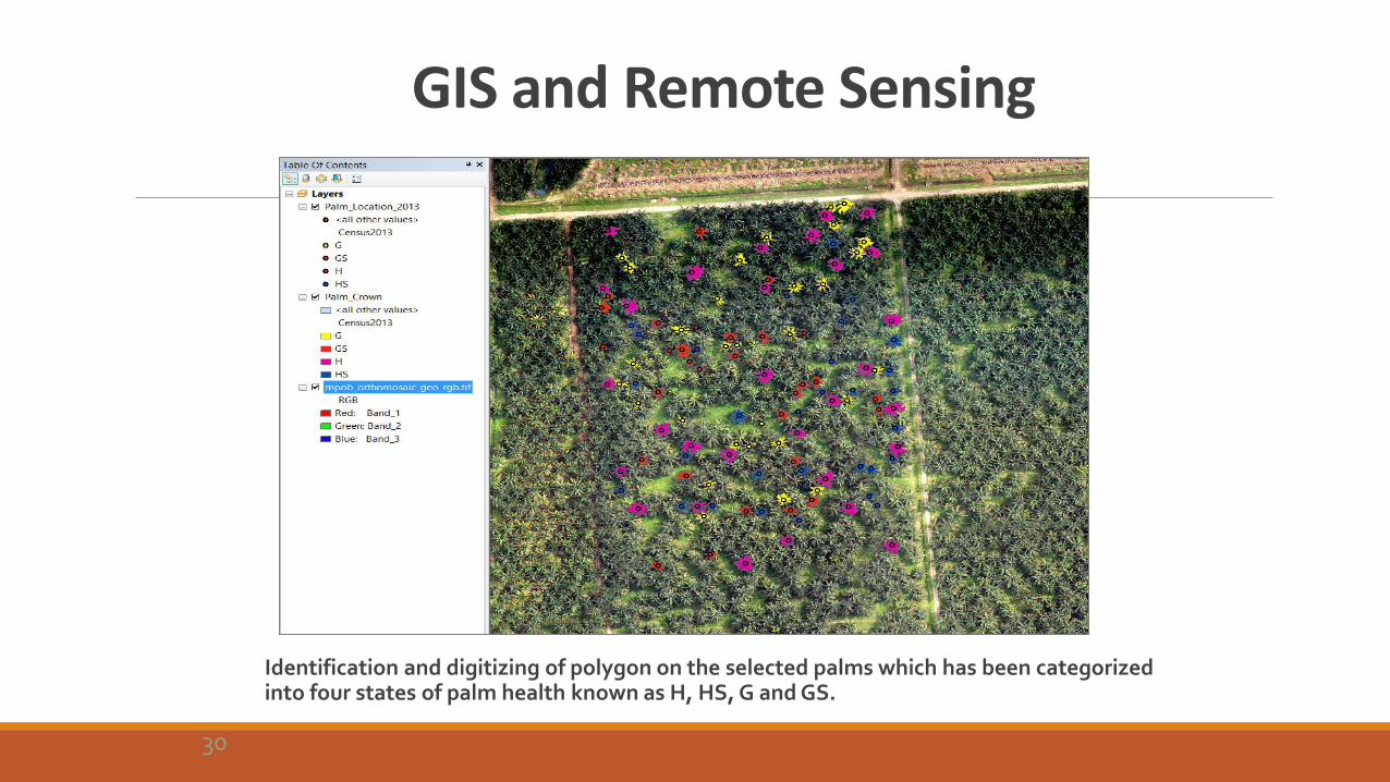
GIS and Remote Sensing
Identification and digitizing of polygon on the selected palms which has been categorized into four states of palm health known as H, HS, G and GS.
30

GIS Spatial - Temporal Analysis
To incorporate all data collected by remote sensing with the census to develop a time series of disease spread over time. Multi sensor and multi temporal.
31

Future Developments
Development of vegetation indices for oil palm for stress detection – based on band selection. Verification of index.
Modeling on the relationship of Ganoderma disease with factors such as soil type, moisture content, nutrient.
Areal detection based on percentage of disease based on pixel based analysis.
Index mapping of Ganoderma disease for areal based identification for management and planning purposes.
UAV hyperspectral system – a compact and, lightweight sensor can be fitted in UAV. Max sensor plus IMU – 3 kg.
GIS mapping, hotspots and prediction of disease dispersion.
RADAR (Radio Detection and Ranging) fusion with hyhperspectral imagery.
32
Conclusion and Recommendation
The detection (based on area – not on individual trees – percentage over total area) and assessment of the disease symptoms, especially early detection of the disease is vital for profitable agriculture business.
In view of plantation management, early identification of stress and diseases are decisive and could ameliorate on plan and strategy to overcome the problem in a cost effective manner.
Expands the Ganoderma BSR detection survey options available to plantation managers and a viable data source for detecting and monitoring damage due to pest and disease in oil palm plantation.
33
Conclusion
The detection (based on area – not on individual trees – percentage over total area) and assessment of the disease symptoms, especially early detection of the disease is vital for profitable agriculture business.
In view of plantation management, early identification of stress and diseases are decisive and could ameliorate on plan and strategy to overcome the problem in a cost effective manner.
Expands the Ganoderma BSR detection survey options available to plantation managers and a viable data source for detecting and monitoring damage due to pest and disease in oil palm plantation.
34

Acknowledgement
This research is funded by: ◦ Innovative Technology Research Cluster (ITRC), University of Malaya
http://itrc.um.edu.my
◦ Ganoderma and Disease Research of Oil Palm Unit (GANODROP) – Malaysian Palm Oil Board, MPOB
Many thanks to : ◦ Department of Geography, University of Malaya
◦ Malaysian Palm Oil Board
35

NISFARIZA MOHD NOOR MARIS*, ANUAR MOHAMAD IZZUDDIN*, IDRIS ABU SEMAN *, OMAR WAHID** AND EZZATI BAHROM*
High Spatial Resolution RGB and NIR UAV Based Imagery for Detection of Ganoderma Disease in Oil Palm
*Department of Geography, Faculty of Arts and Social Sciences, University of Malaya, 50603 Kuala Lumpur, Malaysia
**Malaysian Palm Oil Board (MPOB), 6, Persiaran Institusi, Bandar Baru Bangi, 43000 Kajang, Selangor,Malaysia.
Corresponding author: [email protected]/ [email protected]

Thank You


![Ganoderma therapy.pptx [autosaved]](https://img.pdfslide.us/doc/110x75/5552f9b2b4c90587048b50d6/ganoderma-therapypptx-autosaved.jpg)