Embed Size (px)
Citation preview
High-resolution, short-range, in-mine geophysical techniques for the delineation of South African orebodies
The CSIR Research and Innovation Conference
Natural Resources and the Environment
Michael van Schoor
Senior Research Geophysicist
28 February 2006
Slide 2 © CSIR 2006 www.csir.co.za
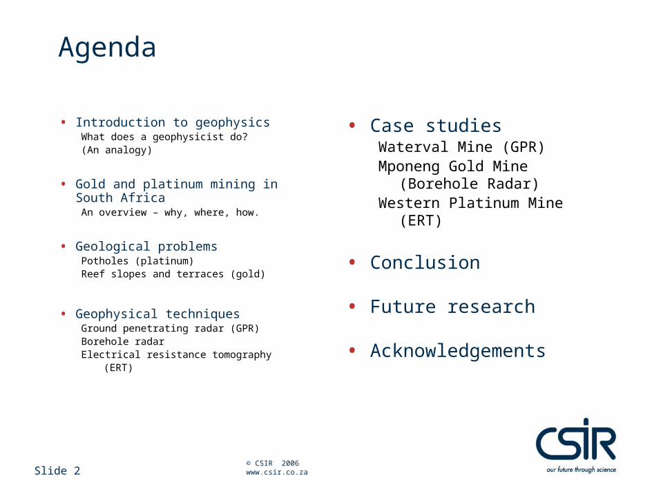
Agenda
• Introduction to geophysicsWhat does a geophysicist do?(An analogy)
• Gold and platinum mining in South AfricaAn overview – why, where, how.
• Geological problemsPotholes (platinum)Reef slopes and terraces (gold)
• Geophysical techniquesGround penetrating radar (GPR)Borehole radar Electrical resistance tomography
(ERT)
• Case studiesWaterval Mine (GPR)Mponeng Gold Mine (Borehole
Radar)Western Platinum Mine (ERT)
• Conclusion
• Future research
• Acknowledgements
Introduction to geophysics
An analogy…
Slide 4 © CSIR 2006 www.csir.co.za
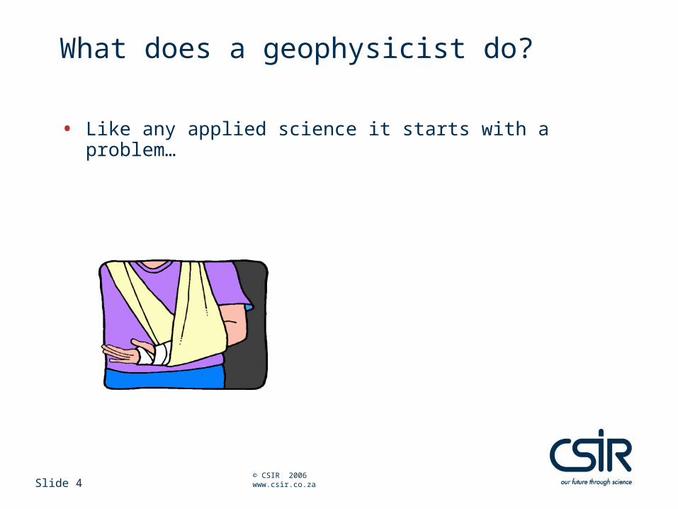
What does a geophysicist do?
• Like any applied science it starts with a problem…
Slide 5 © CSIR 2006 www.csir.co.za
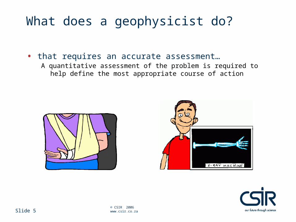
What does a geophysicist do?
• that requires an accurate assessment…A quantitative assessment of the problem is required to help define the most
appropriate course of action
Slide 6 © CSIR 2006 www.csir.co.za
What does a geophysicist do?
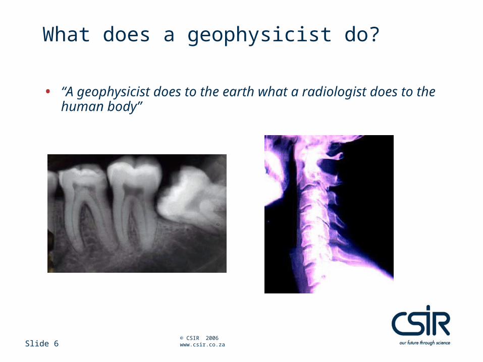
• “A geophysicist does to the earth what a radiologist does to the human body”
Slide 7 © CSIR 2006 www.csir.co.za
What does a geophysicist do?
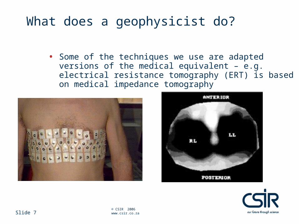
• Some of the techniques we use are adapted versions of the medical equivalent – e.g. electrical resistance tomography (ERT) is based on medical impedance tomography
Gold and platinum mining in South Africa
An overview
Slide 9 © CSIR 2006 www.csir.co.za
Gold and platinum mining in South AfricaEconomic impact
• South Africa produces approximately 75% of world’s platinum and 14.5% of world’s gold
• The bulk of the above Pt and Au is extracted from only two geological occurrences, the Bushveld Complex (Pt) and the Witwatersrand Basin (Au)
• Significant reserves and resources remain to be extracted
• Orebodies are relatively easy to mine because of their planar geometry
Slide 10 © CSIR 2006 www.csir.co.za
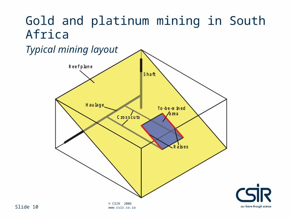
Gold and platinum mining in South AfricaTypical mining layout
S haft
H aulage
Raises
Reef plan e
To-be- min ed a rea
C rosscuts
Slide 11 © CSIR 2006 www.csir.co.za
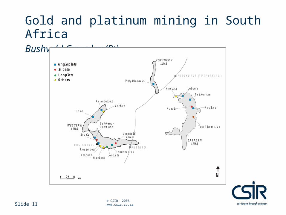
Gold and platinum mining in South Africa Bushveld Complex (Pt)
R UST E NBU RG
AngloplatsImpala
LonplatsOthers
N
PO LO K WAN E (P IET ER SBU RG )
Messina Lebow a
Twickenham
W ES TER NLIM B
Two R ive rs (JV)
Potgieters rus t
40 km
R ustenburg
K roondal Lonpla ts
Am andelbu lt
N ortham
Un ion
Bafokeng-R asimone
Im pa la
20
Marikana
M arula
PRE TO RIA
0
M od ikw a
N O R TH ER NLIM B
EASTE R NLIM B
C rocodileR iver
P andora (JV)
Slide 12 © CSIR 2006 www.csir.co.za
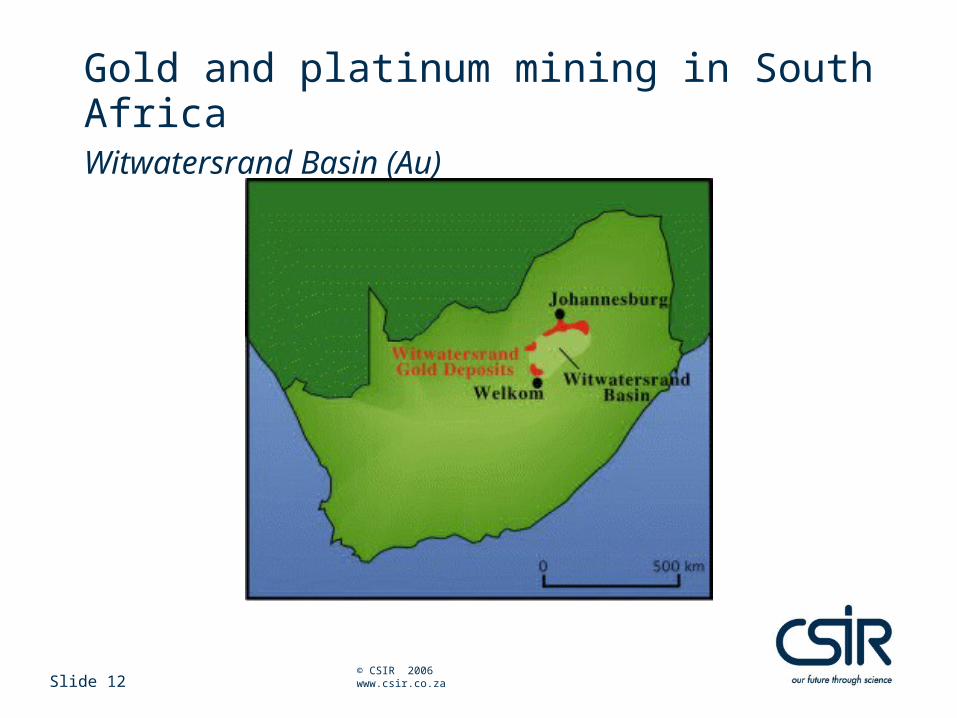
Gold and platinum mining in South AfricaWitwatersrand Basin (Au)
Geological problems
Slide 14 © CSIR 2006 www.csir.co.za
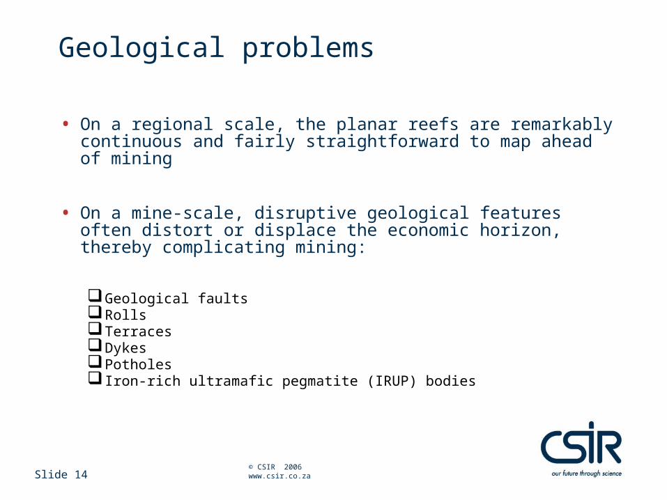
Geological problems
• On a regional scale, the planar reefs are remarkably continuous and fairly straightforward to map ahead of mining
• On a mine-scale, disruptive geological features often distort or displace the economic horizon, thereby complicating mining:
Geological faultsRollsTerracesDykesPotholes Iron-rich ultramafic pegmatite (IRUP) bodies
Slide 15 © CSIR 2006 www.csir.co.za
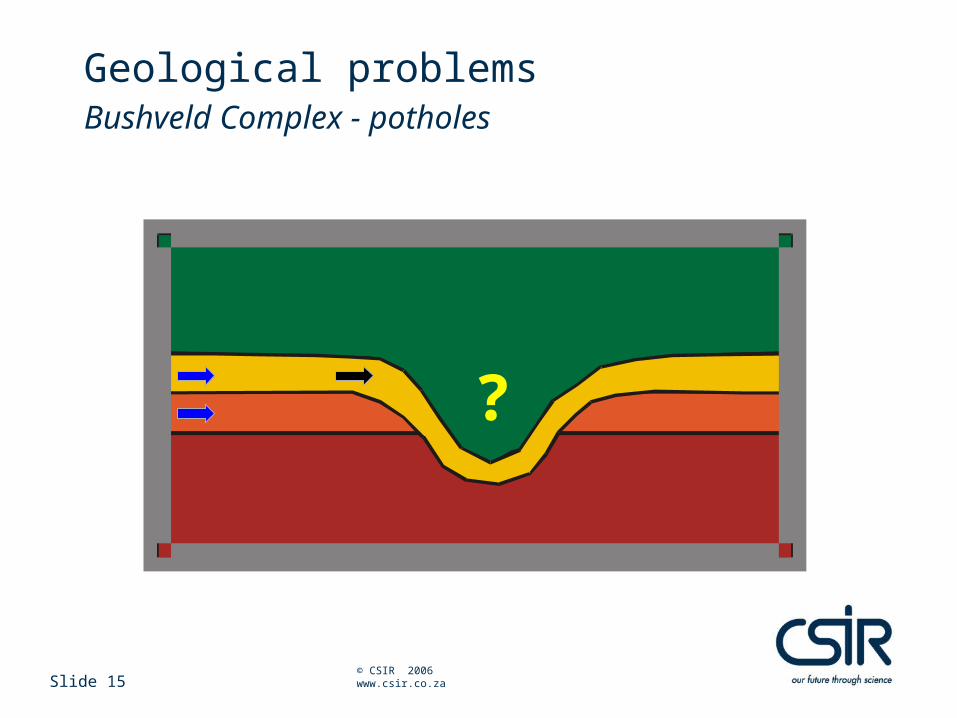
Geological problemsBushveld Complex - potholes
?
Slide 16 © CSIR 2006 www.csir.co.za
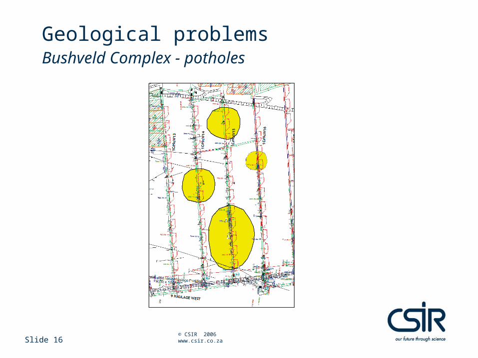
Geological problemsBushveld Complex - potholes
Slide 17 © CSIR 2006 www.csir.co.za
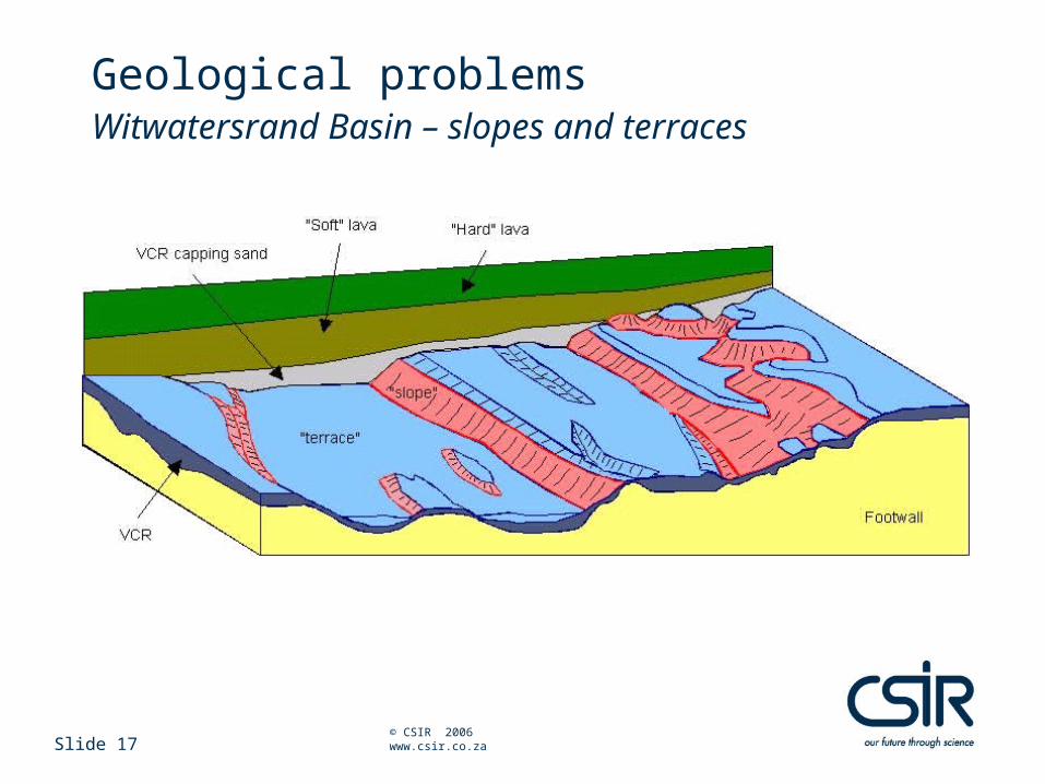
Geological problemsWitwatersrand Basin – slopes and terraces
Slide 18 © CSIR 2006 www.csir.co.za
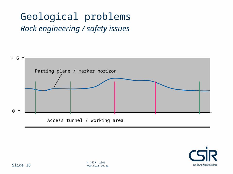
Geological problems Rock engineering / safety issues
Access tunnel / working area
Parting plane / marker horizon
0 m
~ 6 m
Slide 19 © CSIR 2006 www.csir.co.za
Geological problemsImpact
• Distorts / displaces the economic horizon
• Uneven grade distribution
• Poor ground conditions
• Compromises safety
• Hampers production
Geophysical techniques
Ground penetrating radar (GPR)
Borehole Radar
Electrical resistance tomography (ERT)
Slide 21 © CSIR 2006 www.csir.co.za
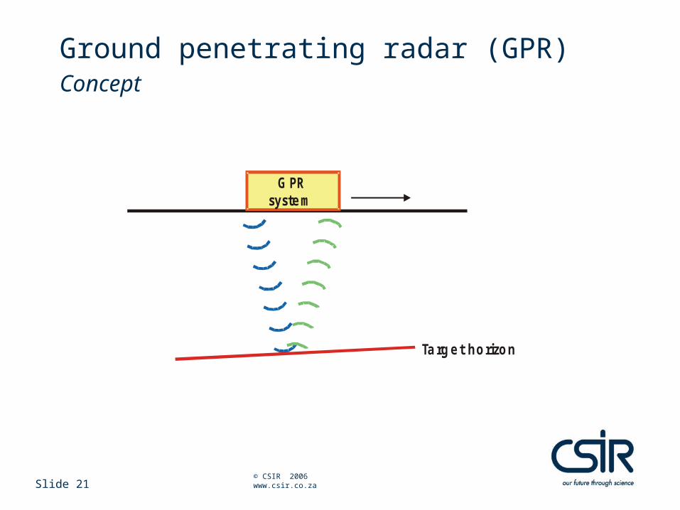
Ground penetrating radar (GPR)Concept
G PRsystem
Ta rg et ho rizo n
Slide 22 © CSIR 2006 www.csir.co.za
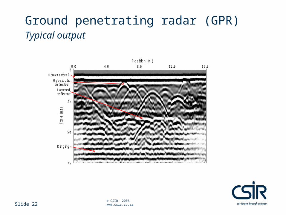
Ground penetrating radar (GPR)Typical output
P os ition (m )T
ime
(ns)
0.0 4.0 8.0 12.0 16.00
25
50
75
Direct arrival
Hyperbolicreflector
Layeredreflector
R inging
Slide 23 © CSIR 2006 www.csir.co.za
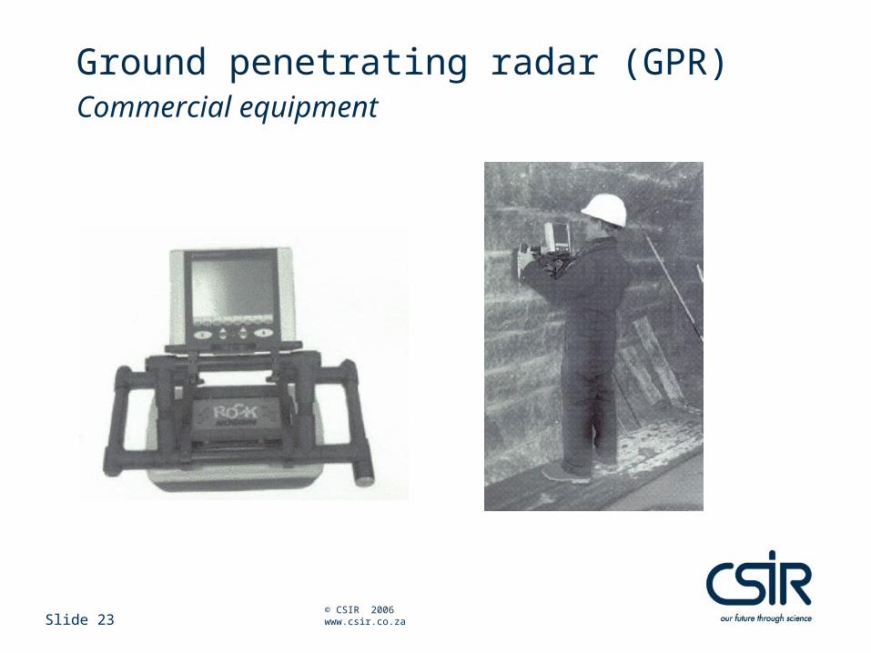
Ground penetrating radar (GPR)Commercial equipment
Slide 24 © CSIR 2006 www.csir.co.za
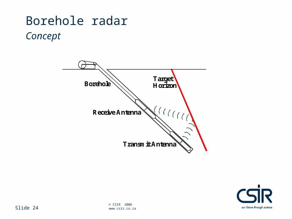
Borehole radarConcept
TargetHorizonBorehole
Receive Antenna
Transmit Antenna
Slide 25 © CSIR 2006 www.csir.co.za
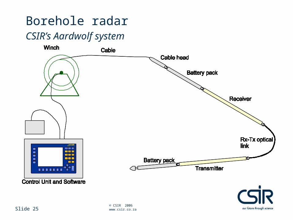
Borehole radarCSIR’s Aardwolf system
Slide 26 © CSIR 2006 www.csir.co.za
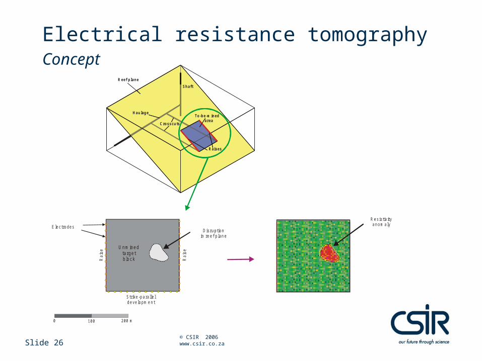
Electrical resistance tomographyConcept
0 100 200 m
R e s is tiv itya n o m a ly
Ra
ise
S t r ike -p a ra lle ld e ve lo pm e n t
Ra
ise
E le c tro de sD is ru pt io n
in re e f p lan e
Unmined targetblock
Shaft
Haulage
Raises
Reef plane
To-be-mined area
Crosscuts
Slide 27 © CSIR 2006 www.csir.co.za
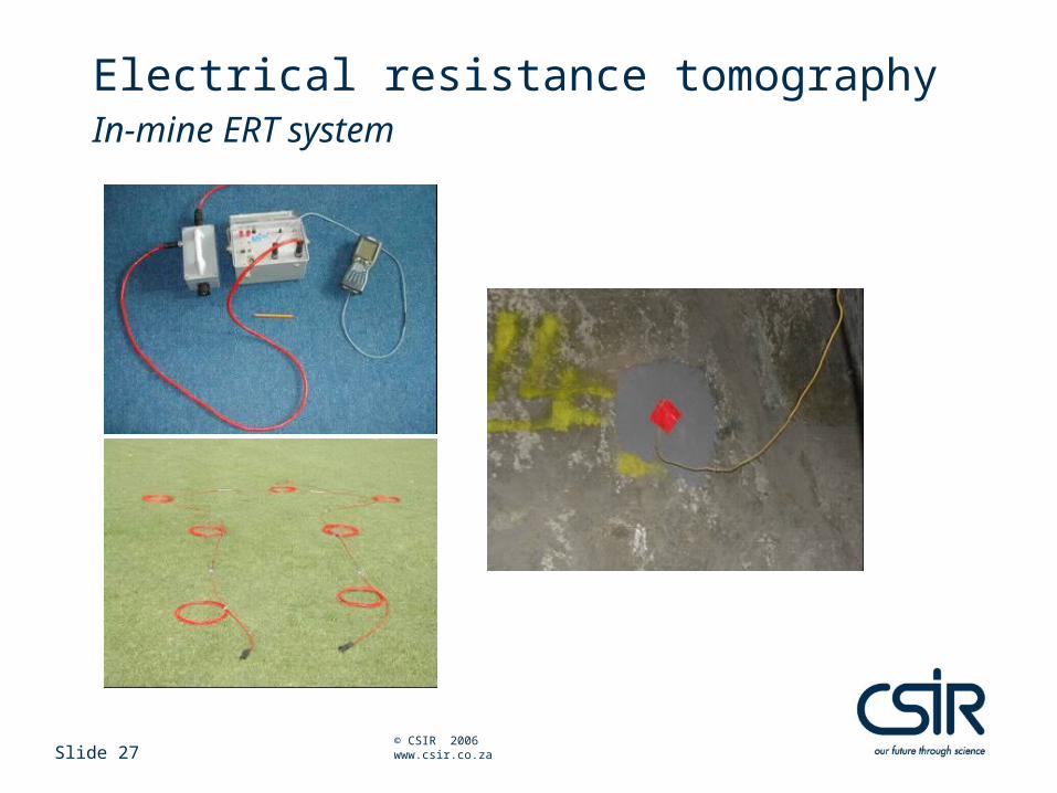
Electrical resistance tomographyIn-mine ERT system
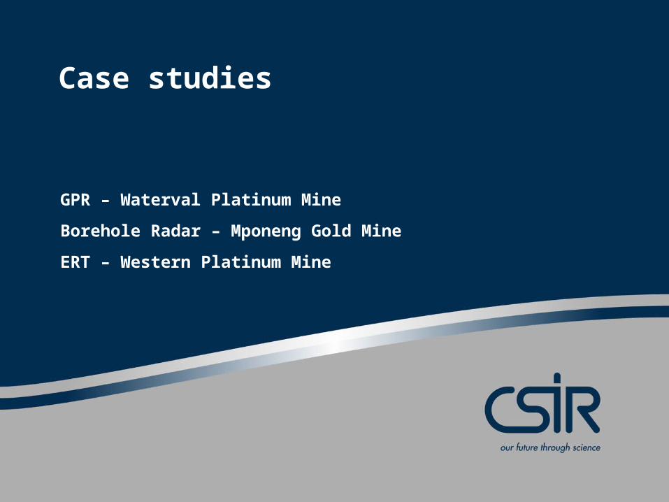
Case studies
GPR – Waterval Platinum Mine
Borehole Radar – Mponeng Gold Mine
ERT – Western Platinum Mine
Slide 29 © CSIR 2006 www.csir.co.za
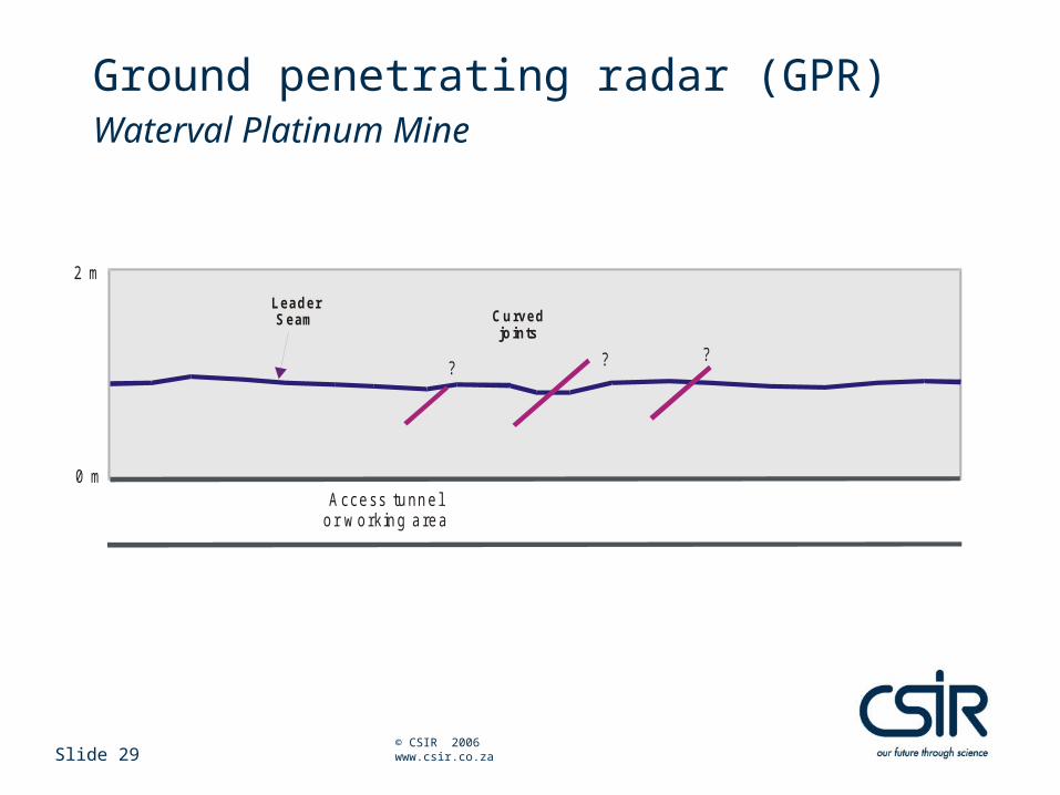
Ground penetrating radar (GPR)Waterval Platinum Mine
2 m
A ccess tunne lo r w o rk ing a rea
Curved jo ints
LeaderSeam
?
0 m
??
Slide 30 © CSIR 2006 www.csir.co.za
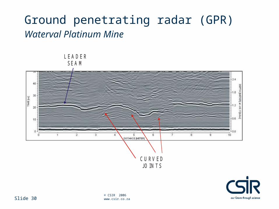
Ground penetrating radar (GPR)Waterval Platinum Mine
C U RV E DJO IN T S
L E A D E RS E A M
Slide 31 © CSIR 2006 www.csir.co.za
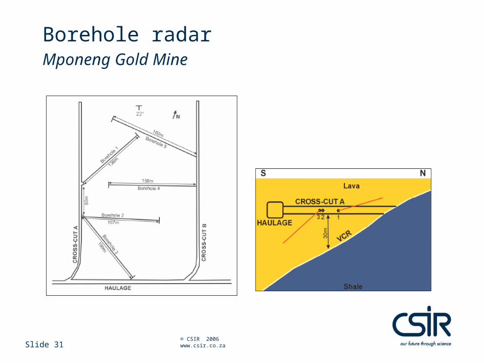
Borehole radarMponeng Gold Mine
Slide 32 © CSIR 2006 www.csir.co.za
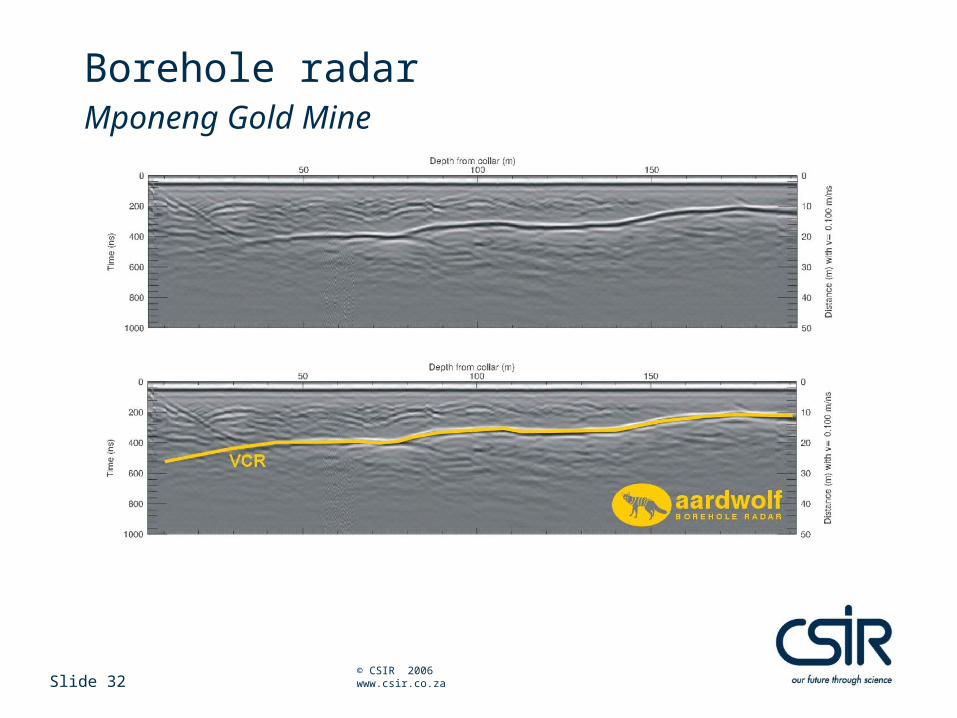
Borehole radarMponeng Gold Mine
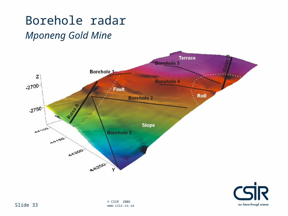
Slide 33 © CSIR 2006 www.csir.co.za
Borehole radarMponeng Gold Mine
Slide 34 © CSIR 2006 www.csir.co.za
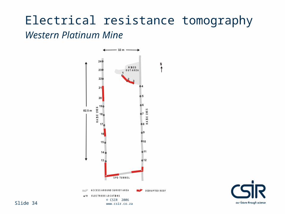
Electrical resistance tomographyWestern Platinum Mine
ACCESS AROU ND SURVEY AREA DISRUPTED REEF
RA
ISE
19
E6
SPD TUNNEL
RA
ISE
19E
5
ELECTRODE LOCATIONS
MINED OUT AREA
N

Slide 35 © CSIR 2006 www.csir.co.za
Electrical resistance tomographyWestern Platinum Mine
A
B
17
18
22
20
19
21
23
24
16
14
13
15
5
4
21
3
8
9
7
10
6
11
12
K N O W NIR U P
O C C U R R E N C E
K N O W NP O T H O LE
O C C U R R E N C E S
5.7
3 .0log a
~ 35 m
Slide 36 © CSIR 2006 www.csir.co.za
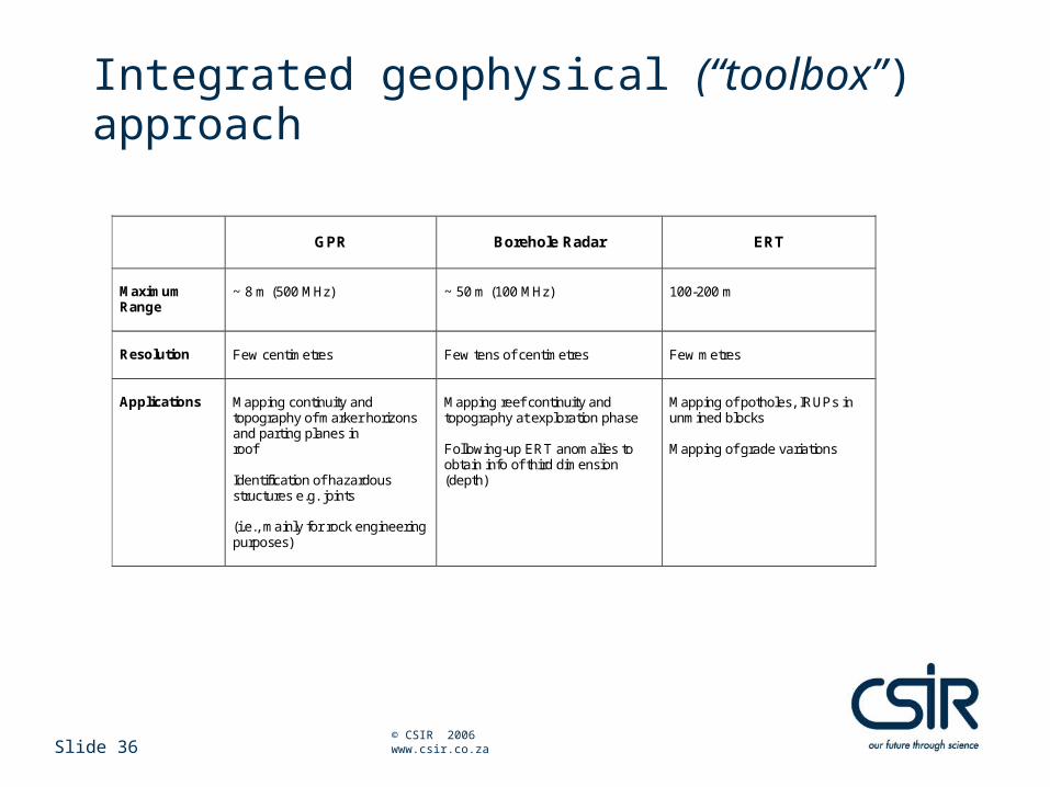
Integrated geophysical (“toolbox”) approach
GPR
Borehole Radar
ERT
Maximum Range
~ 8 m (500 MHz)
~ 50 m (100 MHz)
100-200 m
Resolution
Few centimetres
Few tens of centimetres
Few metres
Applications
Mapping continuity and topography of marker horizons and parting planes in roof Identification of hazardous structures e.g. joints (i.e., mainly for rock engineering purposes)
Mapping reef continuity and topography at exploration phase Following-up ERT anomalies to obtain info of third dimension (depth)
Mapping of potholes, IRUPs in unmined blocks Mapping of grade variations
Conclusions
Slide 38 © CSIR 2006 www.csir.co.za
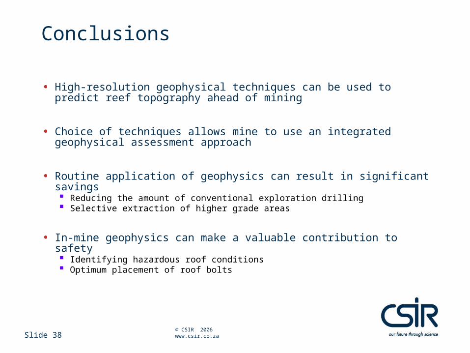
Conclusions
• High-resolution geophysical techniques can be used to predict reef topography ahead of mining
• Choice of techniques allows mine to use an integrated geophysical assessment approach
• Routine application of geophysics can result in significant savings Reducing the amount of conventional exploration drilling Selective extraction of higher grade areas
• In-mine geophysics can make a valuable contribution to safety Identifying hazardous roof conditions Optimum placement of roof bolts
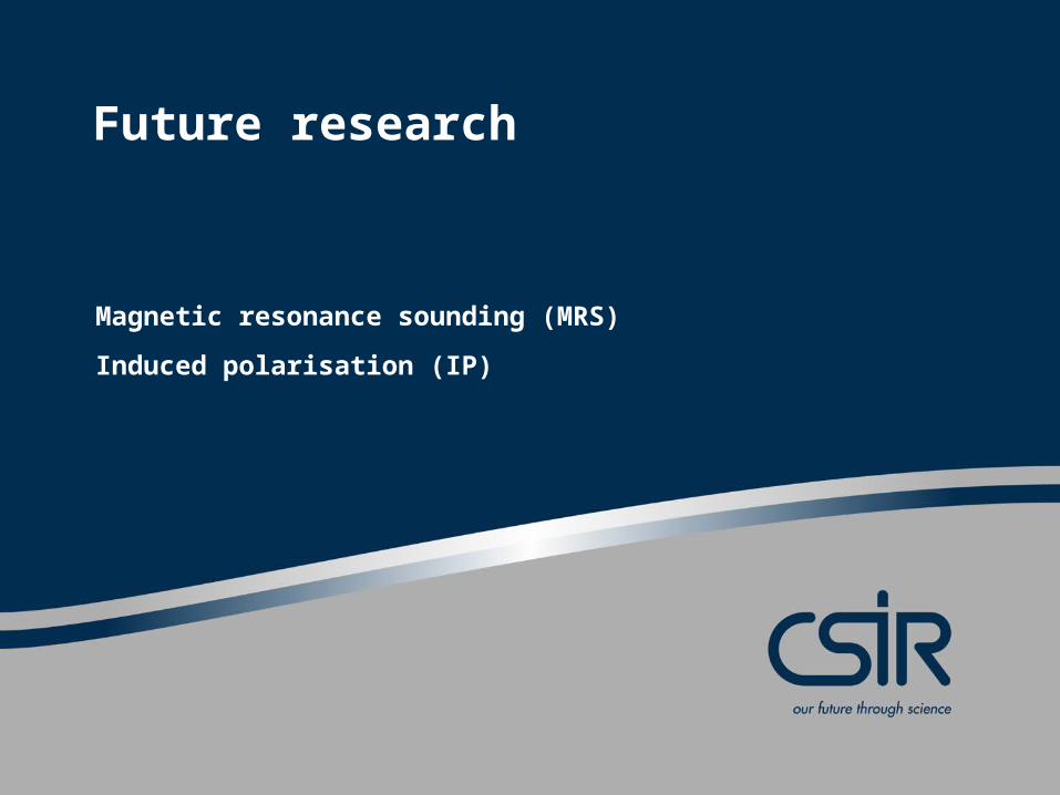
Future research
Magnetic resonance sounding (MRS)
Induced polarisation (IP)
Slide 40 © CSIR 2006 www.csir.co.za
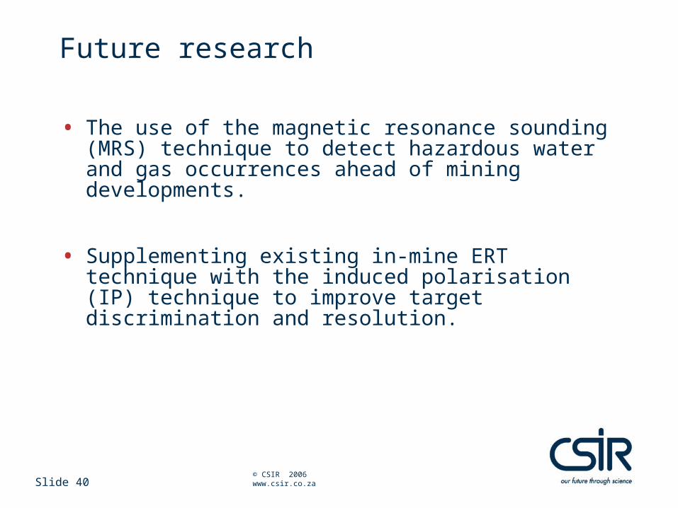
Future research
• The use of the magnetic resonance sounding (MRS) technique to detect hazardous water and gas occurrences ahead of mining developments.
• Supplementing existing in-mine ERT technique with the induced polarisation (IP) technique to improve target discrimination and resolution.
Acknowledgements
Slide 42 © CSIR 2006 www.csir.co.za
Acknowledgements
• PlatMine Collaborative Research Programme• AngloGold Ashanti Ltd.• Mponeng Gold Mine
• Co-authors and colleagues: Petro du Pisani Declan Vogt Mpho Nkwana Stepens Letlotla Johann Haarhoff Reinhard Bilgeri Karlo Walker Liam Candy