Embed Size (px)
Citation preview

High Resolution and Advanced High Resolution and Advanced SystemsSystems
Lecture 3Lecture 3
Prof. Dr. Scott Madry
Research Associate Professor,
University of North Carolina, USA

High Resolution and High Resolution and Advanced SystemsAdvanced Systems
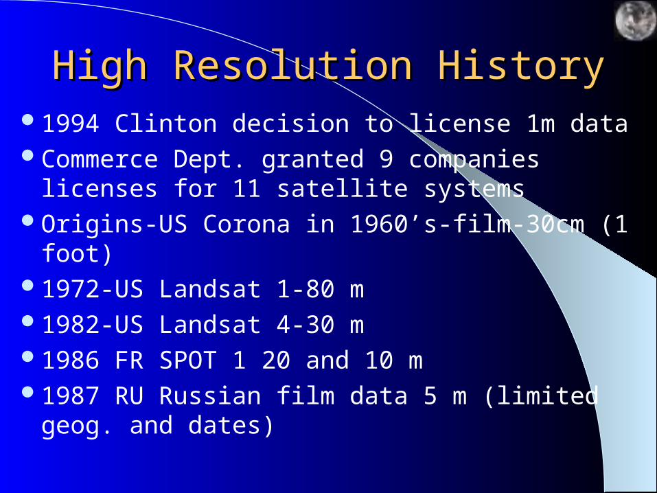
High Resolution HistoryHigh Resolution History1994 Clinton decision to license 1m dataCommerce Dept. granted 9 companies licenses for
11 satellite systemsOrigins-US Corona in 1960’s-film-30cm (1 foot)1972-US Landsat 1-80 m1982-US Landsat 4-30 m1986 FR SPOT 1 20 and 10 m1987 RU Russian film data 5 m (limited geog. and
dates)

High Resolution HistoryHigh Resolution History1992 RU Russian film data 2m1993-US Bush admin. eases barriers to allow 3 m 1994-US Clinton admin. eases barriers to allow .8 m
with “shutter control” in war and to certain countries1996-India launches 5 m satellite2000-Commerce Dept. licenses three .5 meter
systems

U.S. Private Remote Sensing U.S. Private Remote Sensing SatellitesSatellites
U.S. policy supports a competitive U.S. commercial remote sensing industry for several reasons
U.S. companies are authorized to develop and launch commercial remote sensing satellites under:– Land Remote Sensing Policy Act of 1992– PDD 23: US Policy on Foreign Access to Remote Sensing
Space Capabilities (President Clinton, 1994)– U.S. Commercial Remote Sensing Policy (President Bush,
2003) Replaces PDD23 but similar
Military and civil agencies to rely on U.S. commercial systems for imaging needs
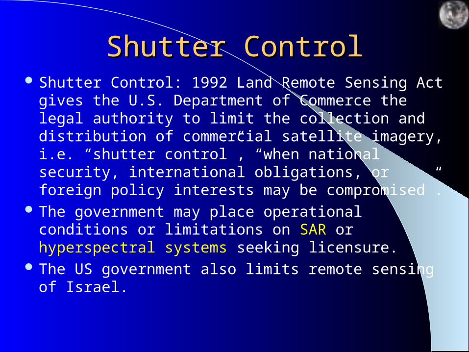
Shutter ControlShutter Control Shutter Control: 1992 Land Remote Sensing Act gives
the U.S. Department of Commerce the legal authority to limit the collection and distribution of commercial satellite imagery, i.e. “shutter control”, “when national security, international obligations, or foreign policy interests may be compromised”.
The government may place operational conditions or limitations on SAR or hyperspectral systems seeking licensure.
The US government also limits remote sensing of Israel.
US LicenseUS License The Licensee is obligated to “operate the system in a manner that
preserves the national security and observes the international obligations and foreign policies of the United States.”
Maintain and make available to the US government a record of all satellite tasking operations for the previous year
Data collection and/or distribution may be limited by the US government during periods when “national security or international obligations and/or foreign policies may be compromised.”. This restriction is commonly known as “shutter control”
The government of any country has the right to unenhanced data and images of territory under their jurisdiction.
US LicenseUS License The US government has the right to unenhanced data
for archival purposes. These data would be available to public after a reasonable period of time
Data to be purged by a licensee must be offered to the US government for archival purposes and would be immediately available to the public
The US government must be notified of any substantial agreements that the licensee intends to enter with any foreign nation, entity or consortium. The foreign party must comply with license regulations
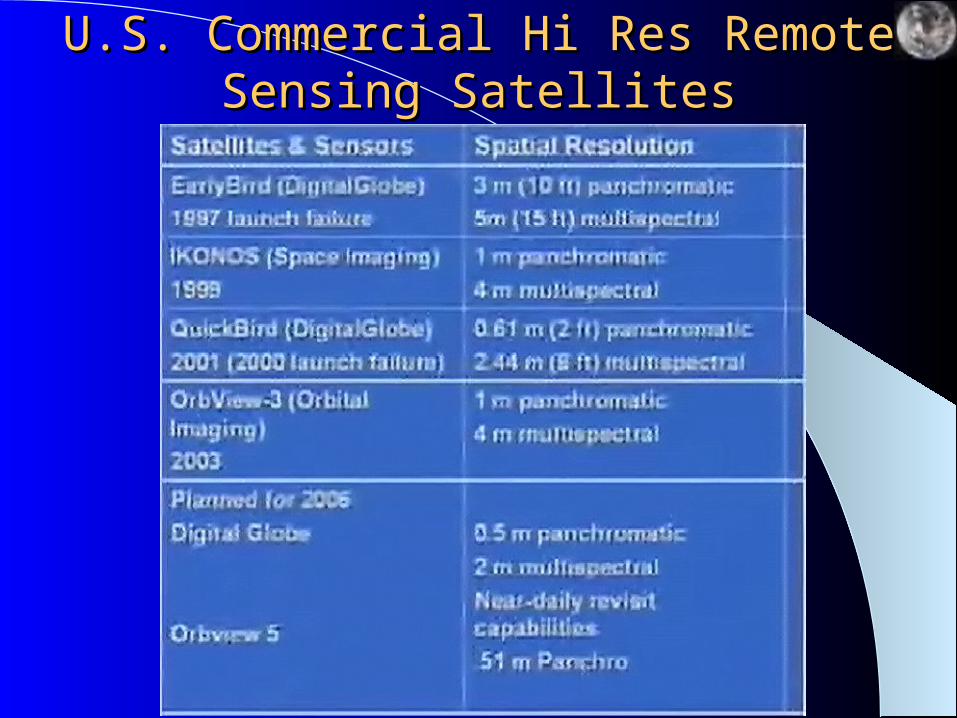
U.S. Commercial Hi Res Remote U.S. Commercial Hi Res Remote Sensing SatellitesSensing Satellites
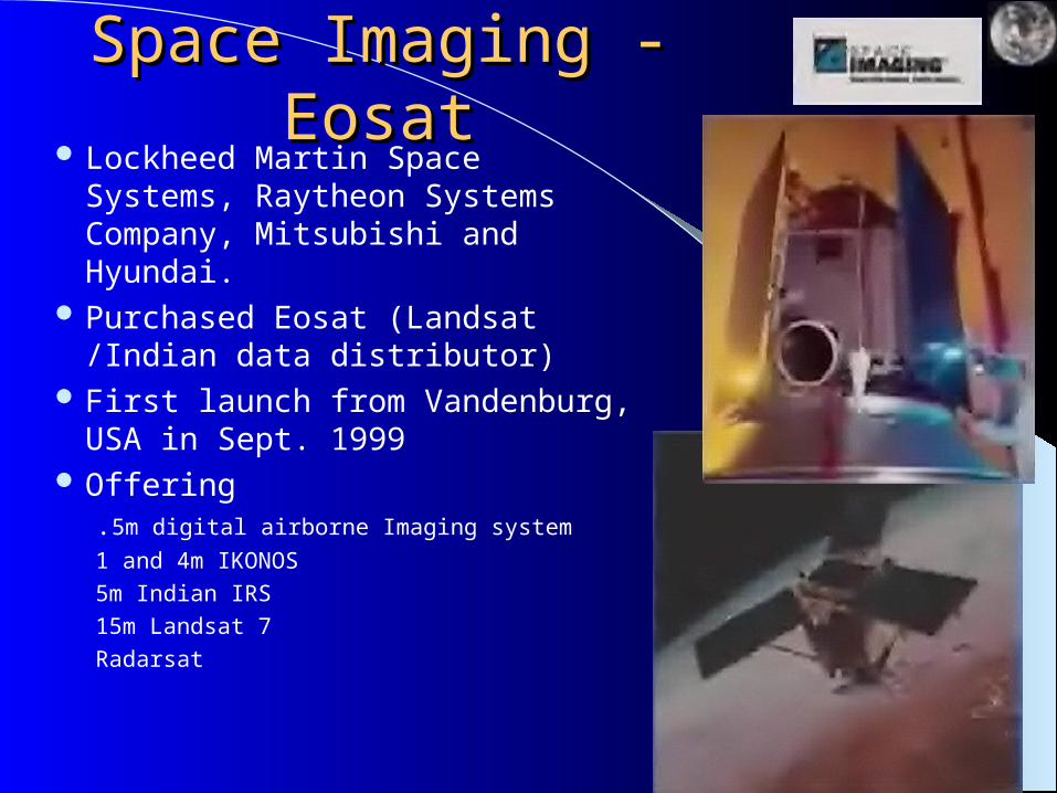
Space Imaging - EosatSpace Imaging - Eosat Lockheed Martin Space Systems,
Raytheon Systems Company, Mitsubishi and Hyundai.
Purchased Eosat (Landsat /Indian data distributor)
First launch from Vandenburg, USA in Sept. 1999
Offering.5m digital airborne Imaging system
1 and 4m IKONOS
5m Indian IRS
15m Landsat 7
Radarsat

Space ImagingSpace Imaging

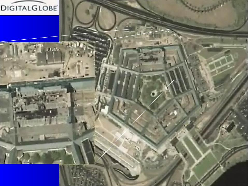
Ikonos ImagesIkonos Images

DigitalGlobe DigitalGlobe (EarthWatch) Earlybird(EarthWatch) Earlybird Pixel size 3 m (at Nadir) Image size 3 km x 3 km per 30 degree
inline and 28 cross track pointing Starting array sensor-stereo capable Sensor characteristics: Panchromatic
sensor Multispectral sensor Exposure 15 km x 15 km per exposure 15 m (at nadir) 470 km orbit First launch failed in 1999 Decision not to re-launch and develop
1 meter system
Ball Aerospace and Hitachi

Digitalglobe, Quickbird-2001Digitalglobe, Quickbird-2001 Launch date October, 2001 Earlier launch in 2000 failed Sensor characteristics
Panchromatic sensor Multispectral sensor
Image size 17 or 32 km 11 bit data (up to 2048
levels of gray scale) Pixel size 0.61 m (at nadir)
2.5 m (at nadir)

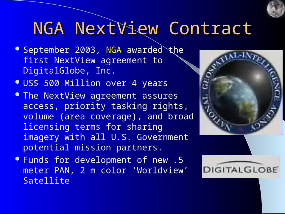
NGA NextView ContractNGA NextView Contract September 2003, NGA awarded the first
NextView agreement to DigitalGlobe, Inc.
US$ 500 Million over 4 years The NextView agreement assures access,
priority tasking rights, volume (area coverage), and broad licensing terms for sharing imagery with all U.S. Government potential mission partners.
Funds for development of new .5 meter PAN, 2 m color ‘Worldview’ Satellite
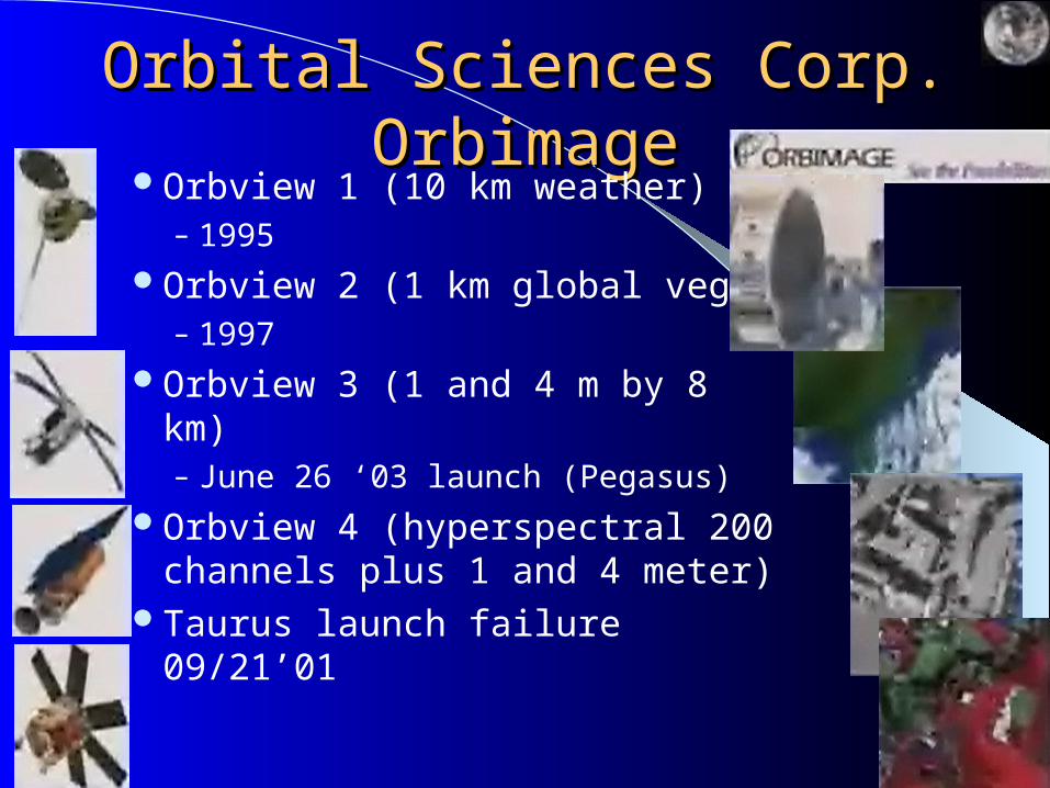
Orbital Sciences Corp. OrbimageOrbital Sciences Corp. OrbimageOrbview 1 (10 km weather)
– 1995Orbview 2 (1 km global veg)
– 1997Orbview 3 (1 and 4 m by 8 km)
– June 26 ‘03 launch (Pegasus)Orbview 4 (hyperspectral 200
channels plus 1 and 4 meter)Taurus launch failure 09/21’01
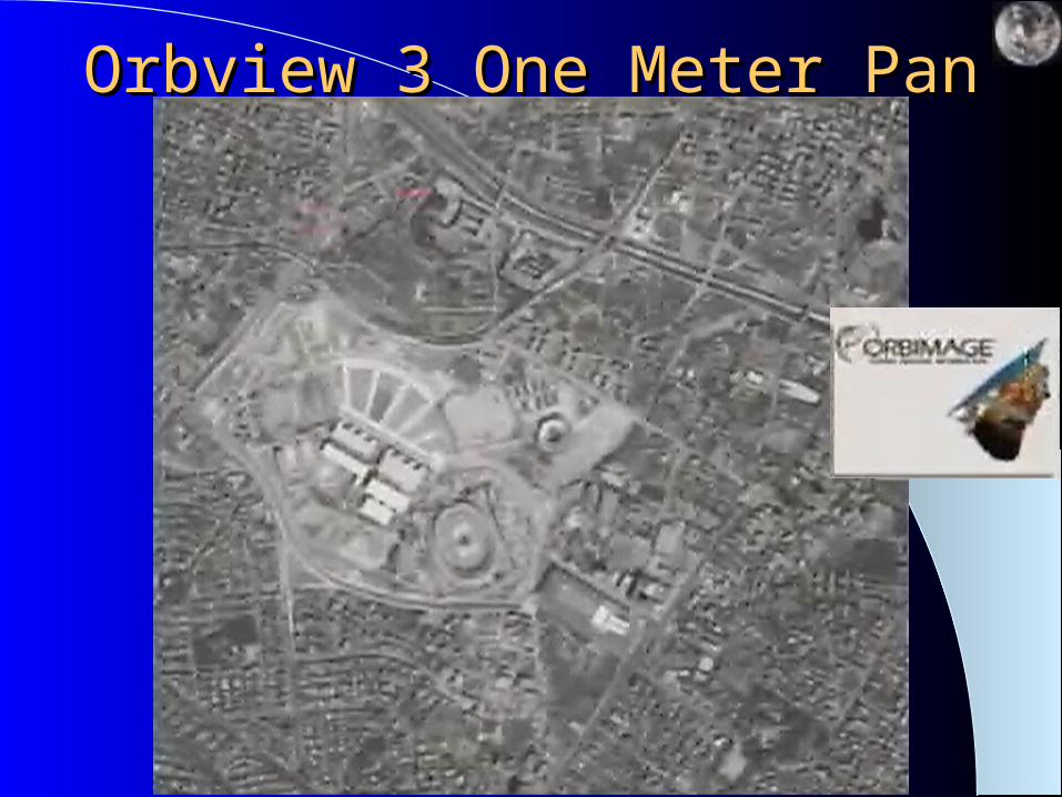
Orbview 3 One Meter PanOrbview 3 One Meter Pan
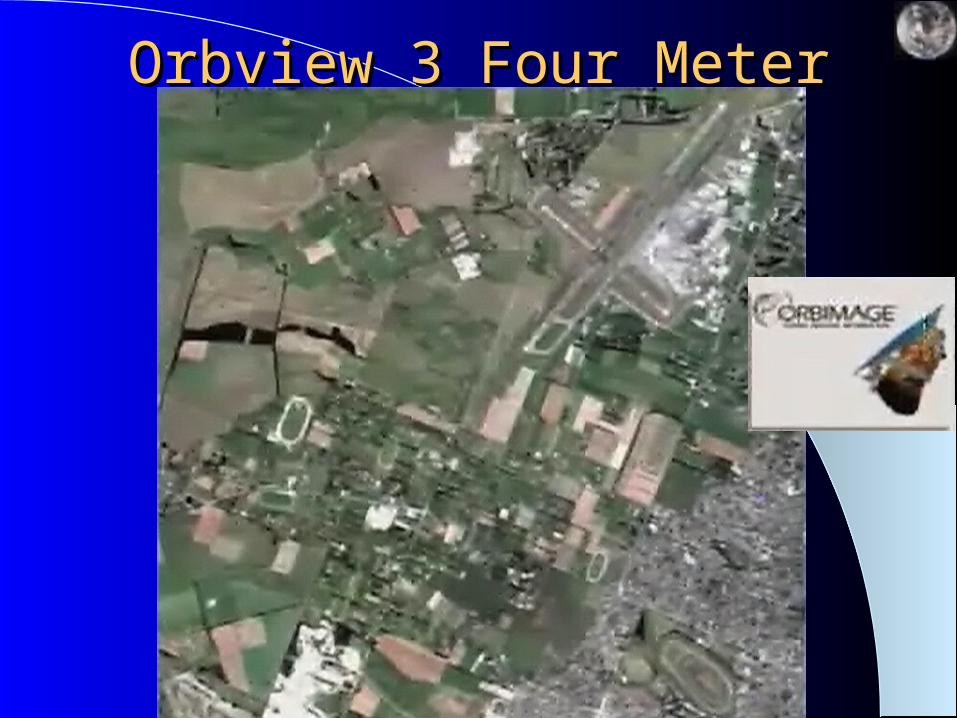
Orbview 3 Four MeterOrbview 3 Four Meter
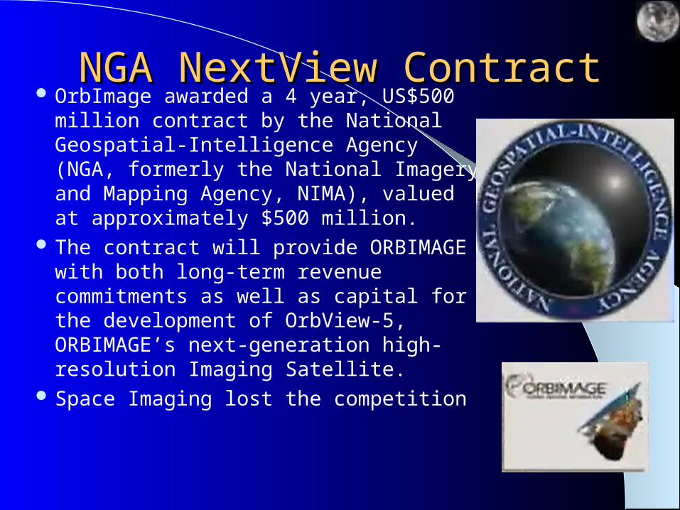
NGA NextView ContractNGA NextView Contract OrbImage awarded a 4 year, US$500
million contract by the National Geospatial-Intelligence Agency (NGA, formerly the National Imagery and Mapping Agency, NIMA), valued at approximately $500 million.
The contract will provide ORBIMAGE with both long-term revenue commitments as well as capital for the development of OrbView-5, ORBIMAGE’s next-generation high-resolution Imaging Satellite.
Space Imaging lost the competition
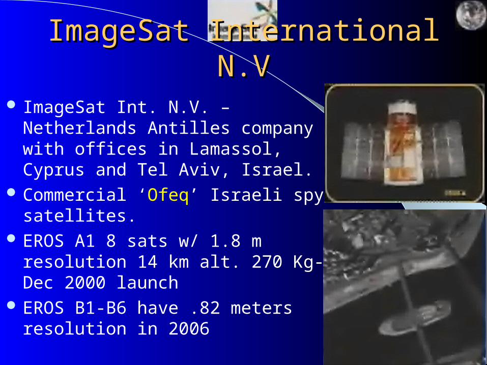
ImageSat International N.VImageSat International N.V
ImageSat Int. N.V. – Netherlands Antilles company with offices in Lamassol, Cyprus and Tel Aviv, Israel.
Commercial ‘Ofeq’ Israeli spy satellites.
EROS A1 8 sats w/ 1.8 m resolution 14 km alt. 270 Kg- Dec 2000 launch
EROS B1-B6 have .82 meters resolution in 2006

Surrey Satellite Technology, Ltd.Surrey Satellite Technology, Ltd. Founded 1985 by Surrey University, UK Earth Observation Microsatellites range
from 35-70 kg. 50m 3-spectrum band remote sensing
and NIR meteorological imagery 30m 4-spectrum band remote sensing 15m panchromatic remote sensing 100m resolution 4-spectrum band, 800
km swath waves, providing images/2 days
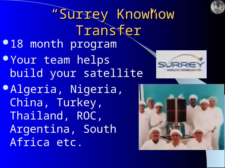
““Surrey Knowhow Transfer”Surrey Knowhow Transfer”
18 month programYour team helps build
your satelliteAlgeria, Nigeria, China,
Turkey, Thailand, ROC, Argentina, South Africa etc.
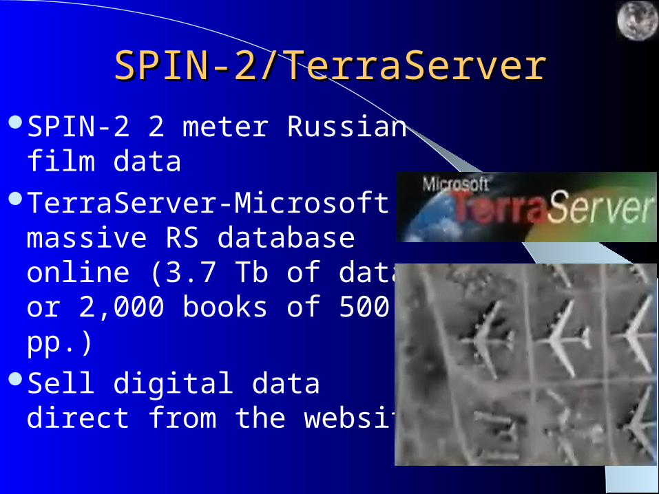
SPIN-2/TerraServerSPIN-2/TerraServerSPIN-2 2 meter Russian film
dataTerraServer-Microsoft
massive RS database online (3.7 Tb of data or 2,000 books of 500 pp.)
Sell digital data direct from the website
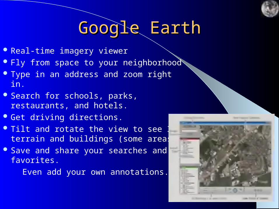
Google EarthGoogle Earth Real-time imagery viewer Fly from space to your neighborhood Type in an address and zoom right in. Search for schools, parks, restaurants, and
hotels. Get driving directions. Tilt and rotate the view to see 3D terrain
and buildings (some areas). Save and share your searches and favorites.
Even add your own annotations.

The Future of the FutureThe Future of the Future MEMS-Microelectromechanical systems and
nano technology will begin to impact remote sensing
“Smart Dust” – Sensors so small they float in the air (Kris Pister-U.Cal Berkeley) self-powered smart sensors with a 5 sq mm computer (asprin tablet), costing 10 cents now (down to dust size for a penny)
Intelligent multitasking, sensors that communicate and make “group decisions” with on-board processing and linked with in-situ systems to trigger when, where and what to acquire, process, and distribute
In ConclusionIn ConclusionUltra high resolution systems are
opening new areas of space remote sensing applications
“Dual Use” issues are importantNew technologies like hyperspectral
systems will become the norm and improve data extraction and analysis
Micro technologies are on the horizon
Major questionsMajor questions How many of these do we need? What are the
drivers? Archiving/storage/protection/retrieval of data Open skies vs. national interests and national
security “Global good” vs. national interests/private profit Is more really better? Global .1 meter/256
channels/12 bit daily data? How can we handle this? Who will use it?
It’s just a tool, the use of the tool is in human hands, we will decide how they are used.

AssignmentAssignment
Q1. Define the YELLOW highlighted terms in this presentation


![arXiv:2007.08489v1 [cs.CV] 16 Jul 2020Ashish Kapoor akapoor@microsoft.com Microsoft Research Aleksander Madry˛ madry@mit.edu MIT Abstract Transfer learning is a widely-used paradigm](https://img.pdfslide.us/doc/110x75/5ff9f729c8ab21326b618e67/arxiv200708489v1-cscv-16-jul-2020-ashish-kapoor-akapoor-microsoft-research.jpg)