Embed Size (px)
Citation preview
Instrument# 17042039 Number of Pages: 19 Filed and Recorded: 11/30/2017 2:57 PM Liz a. Gonzalez, Hays County Clerk, Texas Rec $98. 00 Deputy Clerk: KHOBBS
CITY OF DRIPPING SPRINGS
ORDINANCE NO. 1803.91
HERITAGE ANNEXATION ORDINANCE
AN ORDINANCE OF THE CITY OF DRIPPING SPRINGS, TEXAS TO VOLUNTARILY ANNEX UNDERCHAPTER212OFTHETEXAS LOCAL GOVERNMENT CODE APPROXIMATELY 189 ACRES IN THE CITY'S EXTRATERRITORIAL JURISDICTION IN HAYS COUNTY, TEXAS COMMONLY KNOWN AS HERITAGE SUBDMSION, INTO THE INCORPORATED MUNICIPAL BOUNDARIES OF THE CITY OF DRIPPING SPRINGS, TEXAS INCLUDING THE FOLLOWING: FINDINGS OF FACT; EFFECTIVE DATE; REPEALER; SEVERABILITY; AND PROPER NOTICE AND MEETING.
WHEREAS, the City of Dripping Springs ("City") is a Type-A, General Law municipality with the rights and privileges thereto; and
WHEREAS, pursuant to Chapter 212 of the Texas Local Government Code, a city may enter into a development agreement with a landowner providing for terms of annexation upon agreement of all involved parties; and
WHEREAS, the terms of the voluntary annexation of the area described in "Exhibit A" are described in the Heritage Annexation and Development Agreement, entered into by and between the City and SLF IV - Dripping Springs JV, L.P and BobWhite Investments, LP, adopted by the City on October 17, 2017; and
WHEREAS, the area identified in Exhibit "A,., commonly known as Heritage Subdivision, are adjacent and contiguous to the city limits; and
WHEREAS, the City Council of the City of Dripping Springs ("City Council") has conducted two public hearings on August 15, 2017 regarding annexation of the area and passed Resolution No.2017-59 instituting annexation proceedings on August 15, 2017 and has provided all required notices within the timeframes established underChapter43 of the Texas Local Government Code; and
WHEREAS, the City has prepared a service plan for the area to be annexed in accordance with Section 43.065 of the Texas Local Government Code providing for full municipal services to such area, which service plan was made available to the public and is attached hereto as Exhibit "B"; and
WHEREAS, the City Council deems it to be in the best interest of the citizens of the City to annex said territory into the City.
City of Dripping Springs Ordinance No. 1803.91
Heritage Annexation Page I of 19
NOW, THEREFORE, BE IT ORDAINED BY THE CITY COUNCIL OF THE CITY OF DRIPPING SPRINGS, TEXAS:
1. FINDINGS OF FACT
All of the above premises are hereby found to be true and correct legislative and factual findings of the City Council of the Dripping Springs, Texas, and are hereby approved and incorporated into the body of this Ordinance as if copied herein in their entirety.
2. ANNEXATION OF TERRITORY
A. The properties in the area described in Exhibit ''A", which is attached hereto and incorporated herein for all purposes, is hereby annexed and brought into the municipal boundaries (i.e., corporate limits) of the City of Dripping Springs, and is made an integral part, hereof.
B. The official map and boundaries of the City of Dripping Springs are hereby amended and revised so as to include the area annexed, and to reflect the expansion of the City's extraterritorial jurisdiction resulting from such annexation.
C. A service plan prepared in accordance with applicable provisions of state law pertaining to annexation is attached hereto as Exhibit "B" and map of the service plan area attached as Attachment '~A·', and incorporated herein for all intents and purposes.
D. The owners and inhabitants of the area herein annexed are entitled to all of the rights and privileges of other citizens of the City of Dripping Springs and are hereby bound by all acts, ordinances and other legal actions now in full force and effect and those that may be hereafter adopted or enacted.
3. EFFECTIVE DATE
This ordinance is effective and the annexation achieved herein shall be final and complete upon adoption of this Ordinance on the date set forth below.
4. FILING
A. The City Secretary is hereby instructed to include this Ordinance in the records of the City.
B. The City Secretary is hereby instructed to have maps prepared depicting the new municipal boundaries and extraterritorial jurisdiction.
C. The City Secretary is hereby instructed to file a certified copy of this Ordinance with the Hays County Clerk.
City of Dripping Springs Ordinance No. 1803.91
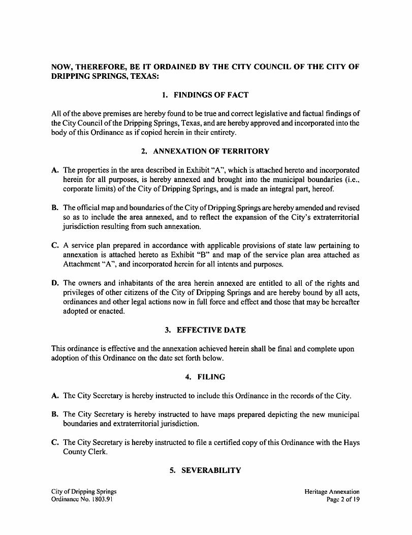
5. SEVERABILITY
Heritage Annexation Page 2 of 19
It is hereby declared to be the intention of the City Council that the phrases, clauses, sentences, paragraphs and sections of this Ordinance be severable, and if any phrase, clause, sentence, paragraph or section of this Ordinance shall be declared unconstitutional by the valid judgment or decree of any court of competent jurisdiction, such unconstitutionality shall not affect any of the remaining phrases, clauses, sentences, paragraphs or sections of this Ordinance, and the remainder of this Ordinance shall be enforced as written.
6. PROPER NOTICE AND MEETING
It is hereby officially found and determined that the meeting at which this Ordinance was passed was open to the public as required and that public notice of the time, place and purpose of said meeting was given as required by the Open Meetings Act, Chapter 551 of the Texas Government Code. Notice was also provided as required by Chapter 52 of the Texas Local Government Code.
PASSED AND APPROVED this the / l t!- day of 0tJ10P.> ~ ~ 2017, by a vote of '3 (ayes) to dt..._ (nays) to _I_ (abstentions) of the City Council of the City of Dripping Springs, Texas.
City o f Dripping Springs Ordinance No. 1803.9 1
THE CITY OF DRIPPING SPRINGS:
ATTEST.
Heritage Annexation Page 3 of 19
Tract One:
Exhibit "A"
DESCRIPTION OF AREA TO BE ANNEXED
HERITAGE SUBDIVISION
34.247 acres in the Philip Smith Survey, Abstract 415, Hays County, Texas, being a portion of a 34.29 acre tract conveyed to John Marcus Baird by deed dated January 13, 1993 and recorded in Volume 971, Page I 16 of the deed of records of Hays County, Texas.
Tract Two: 50.206 acres in the Philip Smith Survey, Abstract 415, Hays County, Texas, being a portion of a tract called the East Part of 152.4 7 acres conveyed to John Marcus Baird by general warranty deed dated May 9, 1978 and recorded in Volume 310, Page 718 of the deed of records of Hays County, Texas, same being a portion of a 152.4 7 acre tract conveyed to Edna Earl Baird by deed dated February 19, 1937 and recorded in Volume 154, Page 59 of the deed of records of Hays County, Texas.
Tract Three: 94.695 acres (approx. 4,124,910 sq. ft.) in the Philip Smith Survey, Abstract 415, Hays County, Texas, being a portion of a 119.7 acre tract conveyed to Nelson M. Davidson and Doris Breed Davidson by deed dated June 23, 1952 and recorded in Volume 154, Page 290 of the deed ofrecords of Hays County, Texas, and being a portion of Tract 1, P.I. Turner Subdivision, a subdivision of record in Volume 133, Page 444 of the deed ofrecords of Hays County, Texas.
Tract Four: 8.119 acres (approx. 353,664 sq. ft.) in the Philip Smith Survey, Abstract 415, Hays County, Texas, being a portion of a 9.008 acre tract conveyed to Mickey Davidson Kroll, Nelson M. Davidson, Jr., and wife Barbara Watkins Davidson by warranty deed with vendors lien dated November 7, 2002 and recorded in Volume 2102, Page 453 of the official public records of Hays County, Texas, and being a portion of Tract 1, P.I. Turner Subdivision, a subdivision of record in Volume 133, Page 444 of the deed of records of Hays County, Texas.
Tract Five: 1.676 acres (approx. 73,006 sq. ft.) in the Philip Smith Survey, Abstract 415, Hays County, Texas, being a portion of a 119.7 acre tract conveyed to Nelson M. Davidson and Doris Breed Davidson by deed dated June 23, 1952 and recorded in Volume 154, Page 290 of the deed of records of Hays County, Texas, and being a portion of Tract 1, P.l. Turner Subdivision, a subdivision ofrecord in Volume 133, Page 444 of the deed records of Hays County, Texas.
City of Dripping Springs Ordinance No. 1803.91
Heritage Annexation Page 4 of 19
City of Dripping Springs Ordinance No. 1803.91
Metes and Bounds Description
Tlt-\CTl:
A DESCP.:pf!ON OF ;.:_:.r:- ACF.ES~ THE ?H:LIP SMim S-1.,"RVEY .• .\BSTRACT 415. HAi"'S COi.,-.n·. 1'£..'X.~S. B~u A POP.TIO~ OF A;.:~ ACRE TRACT COh"\'E\"E TO :OID: ~t.utCUS BAIRD BY DEED CA!ED JA.,1:ARY H. 199: A.'"rD P.ECOP.DED ~.; VOLt.1-!E m. PAC:£ ll~ Of THE DEED P.ECOPXS Of HAYS COt.."NTY. TEXAS. SAID 3~~-P ACF.IS BEING ~{ORE ?AP.11CtiLAlU.Y DESCP.!BED BY METES A.'-1:: BOt1'-:)S ASFOUOU'S
BIGl'~1SG JI ;, l · :!- reoar :o-.ir..d fm the southHit con:er of the said 34 ~9 am tnet ~:r.! al.o the nonb!a~ ,~ of a l O 11 aae tri>Ct :iescnt,td :n \'o!umt 34-=4. ?age ~-:- of dlt Offaai ?.it-bi.: Rtcordi of&, Cotmr\·. Tnll. ar.d bein! m the we.t lme ofTrm l o!lbe PL Tun:.er Subdmgon. 3 rubcniuon of R«ord ic Vol-.ime-133. ?age w of !l:.e :>eed Record; of H.iys C~·. Teu;;
THESC£ v.-;lh the ;c;Jth Im! oflbe 3·L!9 acre axt. ':>em .lliO the nanh 1:u of!l:.e 10 ll !ere cnct. the !o!lowtn.J m ( ~l ,our.es me duw:.c~. -
South spg,Js· u·~.t. 3 dmu:.ceof 3~7 3:! !eet co 3 l ~··re-;.uwtthc~ op !.et
:! Soutl1S4":!.:\Jl' u·~-i. ;idm:uxeof'.'9-feertoa l 1-re-bar!OUlld.
SOUTh s;• 19'1 -:-· "·~- 3 ~.wxe of "'S 51 feet ro 1 fw:e post fowut
4 South 3~56'.:7• u·& a dlicm:e of 9"' 35 !fft ro al.:- reNr fc,Jnd for th! c.on:lnnu comer o! tb 10 ll zae ttan b-emg ilio the ~.m comer of Lot 3 of B-.mow; Sub:in"1S1on. a subdnisioc a! ncor~ m Bock i. 5. Pa~ 69 of tht ?.at R.ecor.h of Hr,·; C~·. Teo-a,. - .
THESC'£ Wl!h tt.e urJth !lll! of !be ;.: :!~ ?ae tniel. ~mz also th! ccrth :me of Bum,w. S·Jlxi..'\"15iOn. th! !olloV."lllf four (4) CO'..UWi and CJ,Wl:ei -
2 South ,9.15T'• u·est II dm.mce o: ".'6 64 !M to 3 o.u. !o-.m:i 1e 11 :i,-e o.ii for me nonhwt."t comer of I.« 3. '!>elllJ also the nwelit comer of Lot 2.
SOllthS1'55'2l' u·e;t.1 datmceof I:!6.6S &etto a 11·· rehuWlth 139$.: c.t;, four.d for the c«thweu con:s o! Lot 2. be tr.g al 50 the llOJ1he21;1 con:.er of Lot l .
Heritage Annexation Page 5 of 19
City of Dripping Springs Ordinance No. 1803.91
4 5oum S1'56:3" \\"est a ch,;tm::e of 1:~ ~: !Ht to 1 1 1- reou !ow:.d :or the c.onhn.t cmrs of Lot 1. bemJ also the nonhtast ccrra o: .1 : 1 o-:- aae tract de.cnl:+:i m \' ohm:.t :s.:o. ?3ge 3•)0 of the Offi.:U: Mlle P.ec«d.i ofHa~·s Cour.~·. Tnu:
~CI coam1.%1Dg mlh the iOUtb line o! !he ; .. ~ acre nan. °Oell18 mo the tclth w o: th! 1 10- acre aan. the fo~ two(:) co-.int'i md dlswirn,:
~ s:•31·1-1· ,;rm 21 db--wiceo:1-1: 51 feet to 21 o!1l foUDd ID i1 hnoak.
: 5omb w:--.w u·tst . .1 chsrmce of 16') 55 fH1 to .1 1 :·· retw- :our..i :o. the r.ortln\~n ccm:s of th! : 10-:- ilcn tract be~ mo !ht nmtbea com& of Lot l o: Sparnple,. S:1bdn·u10n ~o 1. .1 su'bd.Jt-uto& of record m Book •. i4ie 15''.' o: the Plat Recorlii of Rl~·i Coumy. Te~s.
TBE.~Cl: 'otnllil.Ull mr.h the .o-.:m iir.t of mt :-1 ~9 acre met. oe~ ilio the nc:nh line of Lot l. the fo:J0\1'U1g tW0 (. I COtlr>!i ar.d c!utmc es·
~ s~·3.:'l5" \\"est . .1 dlstmc:e of -:-5_,: .. feet 21 1 :- relm found !or th! r.mthwtst ccm:.er ofl.ot 1. bemJ i:r. the mt w ofSpomple,. Dm·e. deiOlotd m \'o:11me -s-t P.1~ :1 ~ o:the Deed P.ec01lii o::b), C~·. Te...as.
~Cl: 'il1Ih th! tast l1ll2 of Spomple,. Dm-e. aoiilllg th! 3419 aae tract d:e followmg rwo (:;, co-Jr>fi .md diitmCes:
~:uh ii c-.in·e to the left. hn~ 1 radlm o! 3~ ~· feet a dtlu mpe of 1.i•55·,n-. .1urc :eurh of so 6C• ffft. mi 1 ch«d wh1ch ~ };cmh ~,·on:- u·e;t a dmm:e of SC· 3S feet to .1 calc-.uted pow:.
: ~cmh 7.;•1-·1r u·est. ~ disrmce of 19 :4 feet to 1 calc-.uted pow~ the cecra o: a road. beJn! m r.he 1Rit lme o: the 34 .:9 !CI! met.
TBE.~CI -;nm the we5t !J&e o! tile 34.:!? .1ae net.:;· from a&d pm!:el to the east~ of ll !O 51S am tna ~bed m \'olume '."S4. i4ee :10 of the ~ ~ards of lb\; Courr.·. Trw. tl:.t ~ U"- (~ counes a&d dmmces: · ·
~onh 15' 3:'.'l 3 • E.lst. a c!uunce o: • 31 !ff! to a c.llciuted pou:.t.
: ~anb 1 .. •5:·4-1· East. ll dlirmce o! 1·0 09 ffft to a ~ru.Llted ?Omt
~onh -i1•1:·5c,· Etta dliWJCe of:~- 7~ !Ht io a c.llcu.Ll~ pomt.
.. ~cmh 3~'Fl3 • E.1st. a dm.mce o: :99 4- !ff! to a c.llcu.Llted ~
Heritage Annexation Page 6 of 19
City of Dripping Springs Ordinance No. 1803.91
Pap3 c:!ll
~ ~om:. 43•11·1s· ust. 1 dtswice of 469 ":4 fHt to a 11- rebar w:tb Chapmal cap 5-!t for the mmh-w!.t comer o: the 34.29 me tract. from 'ili'.:d a 1 ~- ~bJ.r .11th Zml0l!3 \\"ama Ais«UteS cap found fol the c.onhtast come1 o: me 11).!lS am tt1ct. bear: Soutt g9•1:·ss·· u·est. l duw:.ce of34.~ !Ht.
TBISCE ?;orth s9•1:·ss· East. 'ilrltl:. tl:e c.orth ~ oftb 3~ 29 acre tnct. a :mtm:e o: -:-~ ~5 feet to a l ~- m>.1r !ouDrl. fer the nonheait comer of tbe 34 :!~ aae ll'Xt. bemg .uo in lhe \nit
l:J:.e of s.ud Tract l.
TBISCE 'il-ul! the t~t lJU o: the 34.29 acre tna. boem! .i:io tm west liD! o: Trai:1 l. tb :o:lowin! two (2) counM m:1 dmm:e,: -
I. SoUII: Ol'0Ci24" \1:m a dlst;mceof-:91 S2 f~to a ti.ill ma fence post found.
:! Soud:. w5-·2r u·eu. a lllitm:e o: :..o.:-:: :eet to lbe POL'"T OF BEG.L'~lSG.. ccmammg 34.2-r'.' aae; o::mi !DOte ar ~eis
lll..\CT 2:
A DESCR.!PT.O~ Of 502·'6 ACF.ES !N THE PHIL!? S.\C!n Si.:'R.\"EY. ABSTltAC1' ~15. HAYS Cot1'.'TY. TEXAS. BEING A ?OP.T:O~ OF A TP,.ACT CAll.ED 1HE EAST :?ART OF 152.47 ACllS C~'"\'EYED TO JOHN MARCL"S B..\.IR.D BY Ge."EJL.\l WAPJtA.'!\TI DEED ::>ATED MAY 9. WS A.1'":> RECORDED D: \'OLt~ 310. ?AGE ".'}S OF THE DEED RECOF.DS OF HAYS COt~Ti'. TEXAS. SA.\IE BOK, A PORTION OF A l52.·P • .\CP..E TRACT CONVEYED TO ED}:A E.ARl BAIRD BY DEED DATED FEBRt""ARY 19. 193'.' A.'"'D RECORDED !N \'Ol':.,"ME 15.!. PAuE 59 OF !HE DEED R!CORDS Of HAYS COt.1'TI. TEXAS; ~ 5-0 1~ ACRES BE-:G }{OR! PAP.TictUPJ.. Y DESCR!BED BY :METES A.,::> BOL~~S AS FOLLOWS·
BEC."L'~lSC. .it ar. au found. for iu ~t cor:DB oftbe wd 1524: we trilCt. bein! a:r. qlt pc.ut m th! .o-Jth !Jc.+ o: TrilCt ·6 A-1. R.ep:at of the ~ of Tnct "76A S~e mi Sub,·m::3'ono:ReedAcreu:e. a ru~'llioc.o!reccrd i& Boak 9. Pa.te ~~ of the P'~tRec~ o:H.l~, C-ow:.ty. Teus; - -
TBISCE S<lurh oo:16"33" Wtit. mth the e.i.t ime o:the 15:! ~'7 am tract.~ a ;rutJ:.l:Jle of wd Tract -6 A-l. a dlitiu:.ce o! 70 ".'J ffft ro a :er.ce po-."t found form angle pomt m me~ ~ of !net :5 A-1. for the oortl:wen comer of .1 tract of lu.d deicnbed m Volume 130. PaEe 131 of tm Cted F.e<:ordi of Hay; ::·ou.tr)·. Tei..u: -
TBI.~CE SoU1h 02•57·:r Weit wuh the Hit llct o: the 15~.4': 11cre tract md w:!h me west !mt of a 2 m-e a-w. d!.cn~ in Vol~ 130. Pap 131. .m4. Volume 16SS. Pap l~".' o: ~ Ofiioal Pllbl!c R!,cord; of Ha:,-s Coumy. T~. 2 distmce o: J 7 4 -H fM to fence post ~=- :or tbe soumn.t comer of th! ~ a.ere tnct. bo!mg: !l;.o thl cort!nn,t comer o: Tnct 1 of th! ? L T-..ims S:im-uion. 1 s,J;d1,u100 of F.ecor:i m Vol':J!'lle 133. ?.m ~ of tl:.t Deed Records of Hay. Co~·- Te1'.U; •
Heritage Annexation Page 7 of 19
City of Dripping Springs Ordinance No. 1803.91
Pap_. ofll
TB£SCE mth tt.e mt~ ofth! 15:.-'· 1cn trll:t ~ the west :mt o!Trm !. w:th the f!'llCt. the !o~ :i\·e (5: coune5 ar.d dmmcu:
So:ith o.:•-4s·c,3" ·1irest. a dmu:ceof-4! I 51 feet to 1 calc-Jl.lted pou:r.
• Soot!! ,J:•5-1·13 .. u:ei.t. 1 dmai:ce of .;s~ 1-' feet to .1 cllk.i!.zted pou:r:.
So-J?h o:•03 ·c~" \\' est. ! dnw:.ce of~ 59 so fee{ to 1 cocJl.lted pom;
Ser.uh 01:.c,:~9· We-st 1 dl.w:.:e o! 353 lil feet to a 1 :- mar found for tte nonhwest comer of .1 3·t~9 am tra:t de;cnbfd .c \'ohm:.e 971. ?:\re 11~ oftbf Dffd P..KGT-h of Hiys CO"~·. Teu ..
TB£SCE Ser.uh S9' 11 ~S" \\'est aim the c'1%th Im! of tile 3~ ~ acre tna. over and 300SS the 1514-:- aae inct a dliwxe of -:-6-4 65 fM to a 1 ~- mar wilh Cbapmll cap .et fer the nonlnmr comer o! the :.4 ~o roe tnct l>em! u: !be dn'1SI01: w:e of the 15~ .:-:: acre ax1 desaibed m \'~.m:.e 310. ?il!e ·1s m:1 VoLmlie 3 lv. Page .,:1 o! tll-! Dff-i Record5 of~. Courr:,. Teu,.
THL'iCE So-Jth s~·t:'5s· \\'est. cor.m:.~ aao» the 151.47 xre tract Wlth the ;an d,j\is10r. llne. a amnce of 3.: -:-9 feet io a l r Rb.11' wtth 2.uoom u·mu:k As!i0Ci1tes =a;, !ow:.d fer the nonhRSt comer oh ~·15 IS J:cre tnct de.en~ 1r. \'ol!lllle ·s4. Pa!l! : 10 of the Dffd P..oeord3 of Ha~, Ccum:,·. Trw. -
TB£SCE Ser.Ith S9'l~'49' West. a,tb th! nonb llr..-e o! the 11518 aae met -a,d:. th! ,m d."\"luon lil:.i!. 1 dmmce o! 196.16 fHt r.o a fen:e po~ !ow:.d !or d:.-e so-Jtheast corns o! a .:553 ?CR tr3Ct :L~'bed ill Vo:.ime ~953. P;,~ lSl o!tlle 05cial P.Jbll: Records of Hay; County. Te~i.
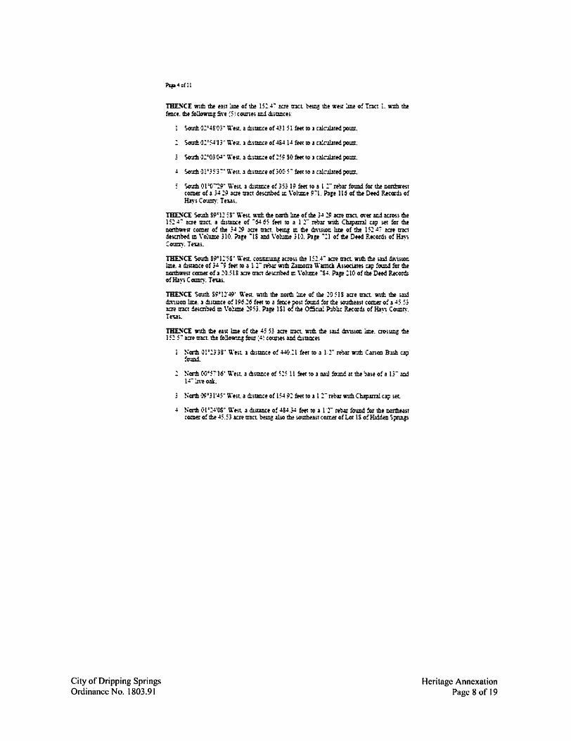
TB£SCE wtth me east lme of tM 45 53 lC't tract r.th the s.ud dnistoc lint. aossmg the 151 5-:- acretnct the fo::l~fou? ,:~~ ,cums wi r!unn:es
Narth O!':l3B" u·m 1 distmce o! 4-1-0 :1 fw ro a 1:- mar r.tl:: C.mon B-J.3!1 c.ljl !o-.mi
" Narth c~•5-:-·J6' u·e,t. a d:l,tmte of 515 l l feff to 1 nall !o-.md ~t tbe b,ue of a 1;- mj 1.:- ll,-eollk.
N<ril ·~·31'45" u·,.it. a ~.w:.ce of 154 9: feff to 1 11- rew \\"Uh Cbap.iml c~ set.
-' Narth C•l •:4•05• u·.,t a d.Liwite o! ~S4.;.: feft co 1 1 ·1- m~ found :or the rmthHst comero!The45 ~; Jae tract l>emg also th! ,outb-ea;.tcon:sofLor lS o!Hlddm S~
Heritage Annexation Page 8 of 19
City of Dripping Springs Ordinance No. 1803.91
i>'i? '.iafll
P.ar.dl S«ncn n. 3 ;'Jbdni.uon o! record m Book 14. P!Je 69 of the ?lat F.ecordi o: H.l~,c~·- Tnn
rm.~cr wm:. the m1 !me o: Hidden s~ F..mch Secnoc. :. cocnnuir.g wnb the .a..t dm.,100 ::int. crornni tht 15:: 5· zcn tract the foUow-.q fa·e (5J coune-s .md dliwices·
Nonh01°1::?'J:· \\"tit a d1m1r:ce o! 155 30 fHf to 3 n.ulfoun.d mcoaxrete.
1 Nonh 15•13·51· E.lit 3 dmm:e of IS 43 !fft to al :-fet\u :o-.mi. '!\onh o,•c.:~y \\"est 1 dis1m::e of 1"." 45 feet to .1 l :·· nt...u with .µ(1o1 c.r., found for the oortbea .t comer o: Lor l S. t-emg ilio tte soutbe-ist comer o! Lot 1-. •
4 Nonh o:•1s·43" West a dJrunce of 19'· "."O ~ t0 a 1 :- rebar mm .s5.s:, c.ip found for the oortbwt Canl!J o:Lot l ~-~mo tte .outbNst comer o!l.OI J.s.
Nonh o l "01'4.:!'' u· e."t a d.mmce of 5C· ·J~ !ff? co m aw :ow:d for :c. ~e pomr !t. the nonh !me o!tht 151.S~ acre tract. bf~ llso th! ;outbwe.t COtllfI o!Tnct -:15 A-l.
rm.~cr ~cmh rsoo5· E.1s'.. wuh th! conhl:r.f of the 15:.4"." acretran. bel!lgllsothe s«ith :.ut! o! Tract ~~ A-1. 1 ~e of 114 l s: feet to lbe POL', or BE~"ISG. CODWC.CZ 50 10~ !C'e, of lard mort or Jes; •
TRACT J:
A DE.SCRI?TIO!\ OF P46~5ACP.IS ,A7'>ROX. 4.11.S.91') SQ. FT) IN THE PHII.J> S~ St:1t\:U .• -u3S11lACT 415. HA\'"5 ~ot.1-.n·. !!.\:AS. BE:NG A PORTION OF A m "." ACRE Tit.\.::1' CO},VE'\D TO ~USON M DA\1DS0}. A.'"D :x)Rl'S BREED ::::>A\'IDSO~ BY DEED DATED J'L~°E 13.195:: .~-0 RECORDED~ VOLt"}fE 154. ?AGE ::9-J OF THE DEED RECOP..DS OF HAYS ::Ot"S11". TE..'\'.AS. A.'\1) BID:C: A PORT:O~ OF TRACT 1.? L Tu"R..'U St"BDI\1SION. A Sl13D!\'5ION OF RECOR:,~ \'Oli,,"}IE 133. ? • .\GE W OF THE DEED RECORCS OF HAYS cot1--n·. TEX.AS. S.AJ:i 94 @5 ACRES BE;u ~IORE PARTICtUP.l. y DESCRIBED BY ~IETES A.;.'-0 BOt~"DS AS FOll0\\0 S:
COlflG'...~a:sc;. at a l ::- rebar wuh 39S4 c2j> found m ?ht wen lD:.e of Old Fredencksburg lload (r.gbt-o!-way nfth. nrai). fer the r.«the.tir comtr of the Dom Brffd Dmdson Silt>d."\'twon. a 1.~bdms.00 of record m Book 10. Pap :P5 oftJ:.t P-2t Recordi ofHll~, C~·Tni,.
~CI ~wo1•;ei·,3:-w~t. -a-uh the west ~o!Old Fredmcks.~F..o.1d. iaoss Tract!. .1 dlstmce oi 4::?516 !eet to a 1 :· rebar wilb ::·1'.3parnl cap ,et for the PO£\, OF BEG.L'')i"ISG.
Heritage Annexation Page 9 of 19
' 'i\"ith .i run:e to the left. ha\-mg .iradnu o:9-:o,)Ci !!et. a delta.mteo:06°~·33·· . .iz.a.-c teum of !03 43 ft.et . .ind a chord whlcll bean South W45'3!)'' U'ts?. a dmm::t o! 1Qf3S fH<to a 11' m.ir'lll"'..tbCh.l~cap wi
~ So-Jm oo•:.BO" \\'e;t ! disrmce of SF-:-S fe-et to al:· reou wltb Cbapaml cap iet in the r,otth l1l'lf o! a 9.C-)S am tract descibed m Vol'.zme :IO:!. Page 453 of !he Offiw.l Public P..ecOl'IU o! Htyi Counry. Teui. from \\"htdl a 11- reb.u Wllb 39S-' op !oun:1 m the nonb :me of the 9 •)08 aae um. for the souil:.wtit comer of the Doris Brm D1\ld5oc S\i,dn"lil.OC. ounNonhs-:-cc~·31· wt a dmar.ceof20PS M
nn:SC'E Sout& S':"'Ofll~ Welt witt tl:.e nonb ::me oftb! ~ ·J•)S l<R tnct. coumwng ~nm Tmt 1. a dls1ance o! ~04 5S !eer to 1 l : ·· rebar fOU&d w th.t 00ru:1n,t comer o! tla P C<lS ac..-e net
THE~CE Sowb c~•5s·13• \\'est. w.th tte west !:u of tbe 9.C•:lS acre Ct3ct. ccmtu:wq .?.aOu Tom I. a dl.~e of 1318 37 feet ro a call i:l coc.mte found far me s<ruthwtst con»r of the 9.0C•S xn tract. bew .11)0 m the oonh llt.e of 1 6 3S aae ttllct ~.cn'boed ill Volume l4S~. Pate 3~ l of u O5.aa.; P-~bht Recordi o: Rl~'l C oumy. Teut !er an ;mg1e pomr :r. tb e.,st ~ of Tnet l:
TBE.~CE ~ l3"5S'09" u·ti-t mm the e.,sr l:ne o: Traer l. bemr ~ the we~ JD1 o! th.t BS am tmt .i duw:ce o! -:-43 -:-s fw. to a 1 ~- mar -a1th 39$-$ cip !o'.m.i !er me ~O'Jrhmr comer of Toa l. bemg also tte so-.ahweSt comer of the 6 .3S llCle inc,. mi bemg in the tonh !me of a HJ we net dtscr.',fd m V~'lm:.e :!~. Page 1:-s o: the Deed Recor.is of Rl~·; ~ount)·. Teus.
THESCI: So'Jth ss·-~·1s" ~\:eit. wlth ti:.~ ,O".a.h !lLeo!!raet l. ti,.-mi alio tl:.enont :me of the 3.91 acre rnn. a dl.ttmce of JC,l ~ ffft ro l IWl ~~a 6- pou far the nottlnn.it comer o! ti:! 3.Pl iae tnct. bfmg al>o the appuea nonllNSt con:.er ofa d k?f tract d+icn~ u:. \'ol-:mie 110. Page 563 o!tl:.t C-Hd F.ec:ordi o!~. Couay. Te-us:
THL"iCE }';ext!:. S9.3:!:5S" u·est. llith tbe south ~t o!Tr.ict 1. ~ a:so d:e lpplmlt c.onh line of the 6 !O'e tracr. a d.i~e o: 15 :! 30 !eet to a fence ~t fouul for th! app.umi oorth\\"e;.t c<rtDS of tte 5 3m tnct. lltd bem! a. Dfflhea;t comer o! thi' :-s '.'3 aae trKt dtscnW m \'o.iume l:!4. ?age 515 of the DffdR.ecord. o:~. C~·. !eus.
THESCT So'Jth 89"S:'Z5" U'eu. W1th tl:.-e s.u.a.h !lJ:.e o!!raet 1. ~JO! alio tl:.e nonh ;.lili oi the 76 ~; am inct. dl..ui::e of 31 l 97 ~ to a feoce ?O>t found :or the ,oothnit con:er of Tna l. ~mg m mlpt pomr m the nit line o!th! -:-15_~3 acre !I3Ct:
THESCE Nonh 01°40'35' East -aith the we.t !me o: Traet !. ~em al>0 the ~;t ::me of the '."6 :3 me trut a diumce of 550.51 fHt to 1 t T ret.lr foUJ:d far the 00..•1!:.e,m com!r o: the
City of Dripping Springs Ordinance No. 1803.91
Heritage Annexation Page 10 of 19
Pa?·=::
".' o "3 we tnict. bein! also th! w.llhNst comer of .1 Hll l we tn-."t dt;mbed m V 0:1.lm! :~. Page 3~: oflhe 0:5aal P.ir.,:U: R.e-:ord; of~. C~·. Teus.
THE.~CE North vl =5; .w East r.lb the we;r !.iD! of Tnct l. beir.! mo the ea>t hr.e of me 10 11 acre tnct. ! dmmce of I!«· 61 {ff( to .1 1 1·· rebar fOUDd. for tt.i! ~ con:.er of the l •J 11 !at tract. ~ aho the southea~ comer of 1 3~ 29 we trJCt de.aibed m \'ohm:.e ~".' l P~ 116 oflhe Deediecords of~-. Co-~·- Tn.ii.
THE.~CE wiil! th.! wt;t hr.e of !net 1. ~ ~so the H.it 1me of the 3~ 19 ~ trnt. the !ouo'il"Ulg nro c:: courw. md d:;.m:.cl". •
1 Nfflb 01°00·14· East 3 dllw:.ct of '.'91 s: ffft to l l :·· re).)U found :or the nmtbwt comer of lhe 3419 am tract.~ m the tiiit lm! of a l51A" 2ae met descnbed m \'ol=e31Ct. ?3p ~IS o!the DeedRKordi o:Hly; C~·. Tnat.
TBESCE 'll'lth the wut :W o! Tr3Ct l. ~ the Nit line of 11:t iS:.:.4: ~ tnct. with the :eo::e. thf fo~ m~ (5} cour.e; mi dm~e.·
~ !-:onb 01•54·13 • Eait a dlitmce of 484. l~ fHt to a o!awted point
!-:onh 02".!S'03 • East. a du13J'.Ce of .!31 51 !fff to a ferice po,t found fer th! c.art.h~.r ,~~ of Tnct l. ~Ul! lhe .outl.we-st comer o! i 1 am tl'JC1 d&r~ed in \'o!uce BO Pip 131 o!tte Deed PKor.is o:Hays C~·. Te-w.
THE.~CE Nottt W5:' 5S' E.ut with lhe Donh lm! o! Tract 1. being mo il!t >OIJlh line o! the : acre ton II dmmce of 1145 .!S feet to a !eo::e post found for the rmthnu comer o! 3 • ".'.!9 mt ttllct dticr.oed m Volume 37~. ~ -:~3 o:the Deed ?.Kords o:HJ}-s Coumy. Te~.
THE.~Cl: SaJth 01=19-ss· E.lit. wuh the ,;a·eu 1me of tbt ~ 7.!9 aae tn-."t. O\·et wi aao1.s Tna 1. a dmmxe of 39v 11 feet to I l :- iron pipe !or.u:d !or tl:.f scuthwe;t comer of the~ -::.!9 Jae tnct. be~ mo d:.e nonhwen comer of a l 50 zcn met ce;cr..;ed m \'o~ :c:. ?1p 49 of the Deed P.1caru ofH.t)~ C~·. Tn.ti.
TBESCE Ser.1th,:;:• l ~d" wt WU& lht Wtit ~ o! the l SC acre tmt. COI:tlllUlll! ~s; Tnet 1. a dmaDte of 108 99 !eet to a I :- uo~ :;izpe found :or th! ;outl.west Cort.er o!il:.t 1 5-0 :1ae !net.
City of Dripping Springs Ordinance No. 1803.91
Heritage Annexation Page 11 of 19
TBL"C'E ~Mt! s;•c•S'·W E.m. mm tb! so-.tth ~ of thf 150 ~! triet. cot.tinuiu llmm, Tna l. a dlitm:e of 1·3~ 15 CW. to a 3.4·· reNr !oimd form m~e pomt ic. die N.t lice of Tract l. bem also w oonhwest comer of a I 00 acre tnct (»;cnl:-ed in Vo:.ime 1914. Pa2e 3S5 of the :)H.:1 P...ecor:h of Ha~-s C~·. Teu;. wt~ ±e corthwest comM o! 1lt Tliner Tract as shown on tb!p!Jtof;ald P.L Turner 'luM.-,,1.:on.
THE."C'E So'Jth o:•o5'13'' £.tit. Wlth the east hr.e of Tract l. bemg al;o rheWHt lineoftht l -Jtj acre trro. tfl..f Tume- Tn.c1. ,1 l 00 .icn met desmoed iD Vo~-ume 275. P~ 4~9 of the Deed Recoris o! Hln COUU\". Te~s. md the we-s: :me of!~, .t of ,J.id PL Tomer Subdn"i.ion. a distanee of S6.~5 feet to .1 l 1• ~ with (hap,mal cap SIM. from wblch .1 fence corner ar a Jr ::l\'e oak for the ;oatl:we:.t comer of the I C-J lefe tract. bett.¥ also the ;ollth\nsr ecru: of Tl'ilCl -t. and be~ i.l: the oorth ~ o! ,1 Ct93S acre net fficn"'Jed m \'olumf 391. Pa~ 123 of the Deed F.«cnu ofH.l)i Cow:.~·. Teus. bear. c;o-.im o:••J5'l3'' u,t. a diitai:.ce a! rn: ~2 :m
TBL"C'E O\'fr md aao,s Tna 1. tte !ollo'll'lq ~ i:s·, c~e. lild distmce~
5-o!J!h S"1 s:·16· West a duWICe of l 19.99 fe.ft ro al 2' ret-.ir with CbJpma,1 cap*<:
l ~ 02•0·: .. ~· E.lst a durm::e of 330 :.; !Hl 10 a! 1· re'tw with-~ Cl? set;
Sou!b g-:-•5:·16' West II diswice of :5 I! fett to 1 11' reliar with~ cap ;et.
~ S01.l!ho:•c-:-·34· East a distm:eof2S·U~ fe.et ro al:· rebl:with Cbap.lmlcai) ,!t;
u·1m a cun-e ro the Left ha\,ng a n:hm cf 15 C•) ffft. a ~a~ cf 91°03'll" . .m arc lenm of 39.73 feet. wt a chord wludl bear, South ~-:-•3911~ E.l,t II diiwxe of 3; 6S !eei to a 1 :· ~;ar wttb 1:hapmal ci-;, ser.
~ u·1m a c-.m·e to tht ri!hr- h.\\,nr; a Ddi-JS of lC•30 C-) fe.et. a deltll angle of02°59'-!1'. azi
uc 1~ of 53 s.: :eet. md a chord \Thxh be.m ~onh ss=19~" £.ut. a dilt&ce cf 53 8.$ feet to .i 11' m-arw:tb Chlpmal cap set.
• ~ortb S9'4S'5 5 • E.lst. a dis~e of 40 -:-3 feet 10 a I : • re:iar wi:t ~ c.tp >ff.
~orth ~·4S'55'' E.1.st a dmmce of 21 '.' !6 !Ht to a 1 2~ reb.u With Cbap:sm.l cap ;~ m the wen r.thr-of-ln,. ~ o! Old F?idenclsl7.irz Road from which .i l : ~ ~bar !OWld iD tb west r.~r-of-wiy lme of 0:d Fr~;~ F..oad. :'Ol' the i<JlltbNit comer cf 1
0.93S acre tract dt,mbtd ic \'ohzme 391. Pap ::3 oftbt DE-ed F.«onu o!H.ly~ Cocr.ty. Teus. beus ~cnh 01 :3c,·02~ \re.t . .1 dl,~e of 1·3S 46 fe«:
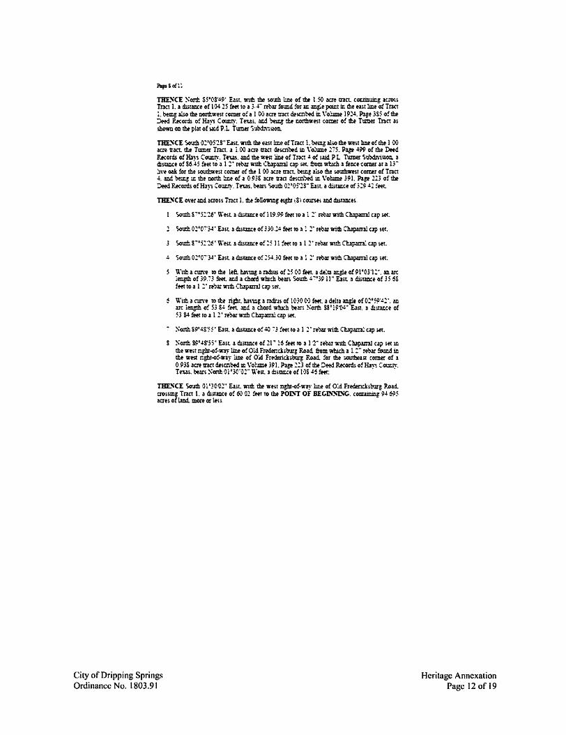
THE."C'E So-Jth Ol '3C•02" wt. 1;11th the we;r npn-of-w~· ut.f of Old Fredenck;11Jrg P..oad. cro;smg Tr.ta 1. a chiunce o: 63 01 !Ht to the POL', OF BEG-t\~"ISG. comainiri; 94 S5 aaes oft.mi more ar l.e.s.
City of Dripping Springs Ordinance No. 1803.91
Heritage Annexation Page 12 of 19
City of Dripping Springs Ordinance No. 1803.91
~i>o!ll
TR.-\CT J:
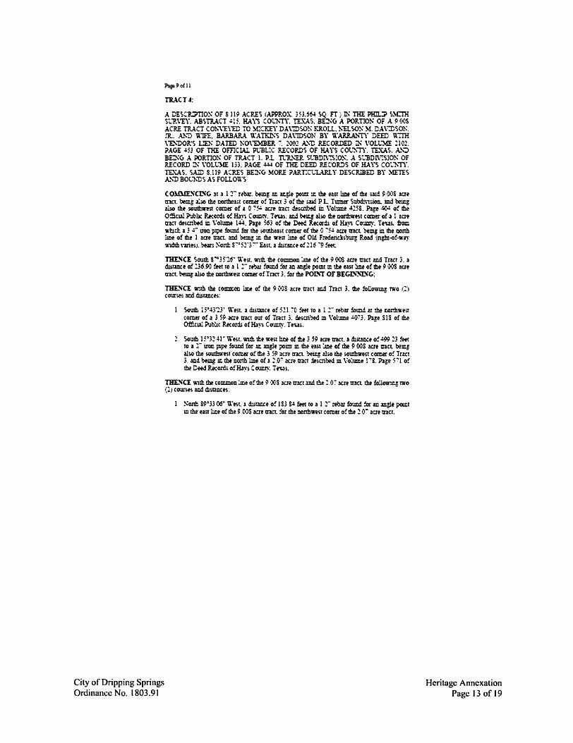
A DES::R:PTIO~ OF S 119 ACRES (APPROX. 35H64 SQ Fr) IN ra:E PHiw> s~cra St1>sE'Y. ABSTRACT ~15. HAYS COt1'"TY. I!..'\:..\.5. B~C, • .\ PORTION Of A 9 oc~ ACP..E Til.\C! C<Th"\'E1E TO }CCKEY DA\'!DSO!-: KR.Ott.. ?-.USO~ }f. DA\::DSOK ..'R.. A.'-"D U"lFE. B.A.RBAP-.\. u.·A~S DA\1D50N BY u·ARRANTY DEED U7IH \"B1'0R'S UD: DATED NO\"DfBElt :. 100.:! A.'\"D RECORDED~ VOLL~ 210.:!. ?AGE .m OF THE omcw. PL"BLIC R.ECOF.DS Of HA \"5 cot~-rr. TEXAS. _.u,.:, BCKC, A PORTION OF TRACT 1. P.l. n.it.'-a'. st"BD!\~:OK A Stl3D1\~5!ON OF RECORD IN \·ott'}IE 133. PAG-E ~ Of THE DEED P.ECOJU)S OF HAYS COt.1-."TY. TEXAS.~ S.119 ACF.ES BE:NG MORE ? • .utr:C-l,1...\RLY DESCR!BED BY }!EuS A.'\'D BOCNDS AS FOLLOWS
COMllE..'iCDiC. lt a 1 T rel>ar. bemr: m ~e pou:t ~ the e-ut line of the ,.u:i ~.00S aae tran. bem! also the nonbmt comer o! Tmt 3 o: the wd P L. Tumer Subd."."tiion. md bei&!: 41so the southwest comer of 1 0 ".'~ ilC.'l' trac d!icnb!d in Vohmie 4.15S. Paze ~.: of !hf O::iclAl ?-J~bc F.eccrd, o: Ha~-. Co-.mry. !e,.as. ac.i l'-fq al!oO tM ccmhwest comer of l l aae tra..1 d!scn"btd in \'olume 144. Page 563 o! tbt Deed Recor..; of Ha~. Co-Jmy. re-.as. !roe wl:ld a : ~- !?OD p~ !oUDd far the ;.outhmt comer of~ 0. 75~ we IIllCl btmg in lb! oonh !me of the 1 aae tnct. aJ:d be~ :.r. mt nit lmt of Old F:ederia,burJ P.m.:i (n~-o:-w~· ,ndth \-art~). b-eMi ~cm s-:-•51·3 7·· East. a dmat.ce o! 215 "9 !He
~CE So-.uh r=35·26'' \\'tit. wim the comcon JD! of the 9.00S we tnct and Traer 3. a dlswice of 136.~ !!et to a 1 :- rebar fom:.d :or an ~e pomt ill the esr !ine of the 9 00S acre tract. ~ uso me corthwe.t comer of Tr.ict 3. for me POL', OF BECL'~lSG;
~CE w:th the cOmD:.ac w o! the 9 C>JS acre tract a.c.d Tmt 3. the follc,mng t"l\·o (:) cour.es mi distmces:
South i.5'43~3' \\0
til. 1 dmmce of 5.:!l '.'C, :eer to al 2" rebu !olllld at th! tcrih'Sl·est comer o: a 35!) me tnct out of Tract 3. descri,ed m Vol-.une ~73. Pue SlS of t:be Offcw Pu~c Record. ofH.1~"> Ca-&~·. Tew. •
~. Soutb 15'3.:!41" West with mt we~ 1u:e ofll:.f 3 59 acre tract. a ~e o! ~9'? 23 feet to a :- iron ppe foucd !01 ~ mgle pomt m the wt :me of the 9 OOS acre aan bezj also the soumwesr con:er of~ 3 5!l acre tra:t. be1U also the soutlnnst comer o: Tr~ 3. and being u:. the no.Tth 1:nf of l ::.o~ 3Cre tract »i'oibed m Vo::ume l :&. Paie 571 o: th! Cffd Record. o!Hayi C~·. Teus;
lllE.~C'I 'i11tk w common lme of the 9 OOS .iae tnct and the: 07 xte tl!Ct th! follOW"".ll! two (1) co;ines wl distilll:es: -
!'-:onb s9•33 06~ u·est 1 d:iw:ce of 1S3 S-' fe@t ro a 1 2- rebM !ow:d :er an .m:Ie pomt m the nu la:.t of the 9 C-JS acre tract for the nonbweit comer of the :: O'." acre tract;
Heritage Annexation Page 13 of 19
h9 lC:iill
' So-Jth ci9•15·3c,· u·est a diitm:e o! :1546 :eetto a zwl found man is- J\'i! oak :o: tlle soutbweit con:er o: !he .:! o-:- icn tr.let b-eill aho ?t.t ;v.JtheMt come,r o: lb! P •XtS we tnct w1 bem.! u:. th! north !me of a 5 31= am tr.let de;.:n1>ed m \'obm:.e l4S.C:. Plze 391 of the 0:5aa1 Public P..ecord. of Ha~; C~-- Teus. -
THL._CE North sp=:5·et9• trest. r.th the iOUth :me o!tl:e P ·X•S acre tract. bem! ~o tb! corth !me of w 5 3S am tract a dJ;tmce of 53 15 !eet to .J Dall m coram !v.m:i foi the .oumwtst comer of me 9. OCi we t:'3et:
THESCE Nonb O -:-• 5S' 13 • wt. u."l?h the we.t lme o! tl:e i: C,OS acre tnct. :10,.u2 .a;d Tract l. 1 duwxe of 131 S . .: ~ !eet to ;i l .:!- rtbar found !OI r.he oo:ihwtst comes of me~ OOS acre tract.
THESCE ~cmh S 7°06'31 • £,1,t wnh 11:.e c~ !me o! tl:.e P Ol)S acre tract aos~g ~d Tr:.-:1 1. 1 dmmce of 304 SS feet to a 1 .:!" mar wut Ct.lpaml cap sK from \\iuth a 1 :·· rebu Wllh 39B-' ap found for th! SCYJih'lnit con:.er of tl:e Dor.s BrHd Subdl,ux,n. 1 subdnu1oc of record m Book 10. Paee 395 o!tl» ?lat P.ecocl.; ofHJ\1 Count\·. !n.u. bean North S".:'"0531" E3.t. a dmm:e of .:!05 -~s !Ht: · ·
So-Jlil oo=-H3•Y"U-~t ,1 ::u~e ofl:P •J6:eetto 1 l ~-rew.nth ChApunl c.i;: ;et
' Ncnh s-:-01,J-15· E,m. 21 distm:e o: 61 6S fff1 to the POL', OF 81:GL'~lSG.. c~Sll9.!atio::acd..D!«ecrlM;
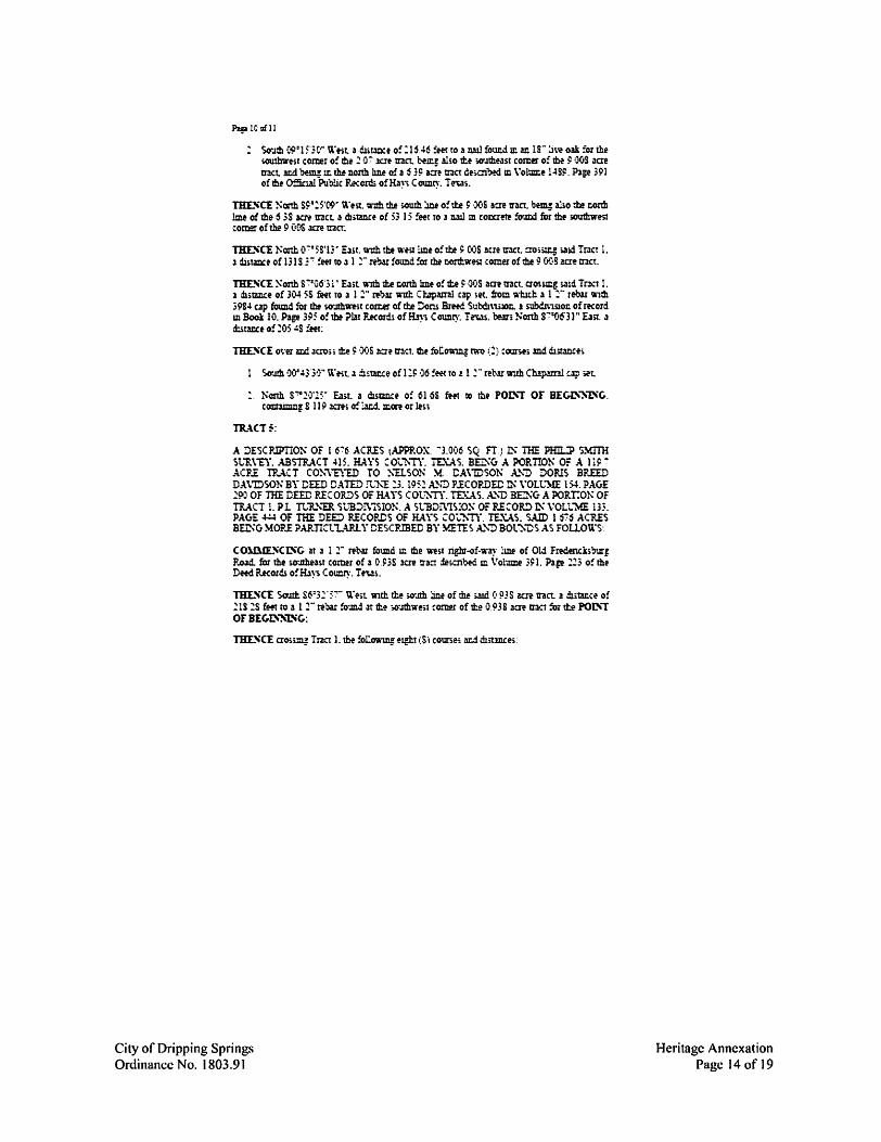
TRACT~:
A :)ESCP.IPTION OF I tS"'.'6 ACRES tAPPP.OX. -3.0,:16 SQ FT J ~ lHE PHil.!P SY.Im St.'R.\'EY. ABsntACT m. HAYS ~Ot1'"TY. '!D.:A'S. BED:<; A PORTION o:= Am".' ACP.E !? .. ACT CO!-.'VE'\"ED TO ~"'ELSON M CA\1D50N A.'"D DOPlS BREED DAVI:>SON BY DEED DATED !"CJ,'£:,. 195! ~o P.ECOF.D:EI:: !N \·ou.;}!E: I 54. ?AGE ~9'J OF mE DEED RECOR:)S OF HAYS COu~n·. TEXAS. A.'\"D B:Q;G A PORT:ON Of TltACT l. PL n.iu,.u %"B:>!\-'!SION. A St"BDi\'lS:o~ Of RECOR:) D: \'OL'l..'ME m. PAGE +:.i OF THE DEE:> RECORDS OF HAYS ~O';.."?."!i'. TEXAS. SAID 1 6:6 ACRES B~G ~lOP.E ?AP.TKt"l..-UU-Y DESCRIBED BY Y.ET£S A.'-.-:) BOt~"DS AS FOllOU·s:
COU!.(£.~CISG at J l 1- m-u found m the wtst nght-of-",I*~- lUI! of OlJ fredendi':IUl'J P.o~ for the iO'JthNst comer of a 0.93S acre ?ra=t de.aibed m \'ol.une 3~1. Pue .:!23 o!the Deed P..ecords o:HJ~-s Cotl:lly. Teu~. -
THL'iCI Sc,Jth s6=,_:!·57- u·~t '11th the .o-Jih ~ of th! ;!Id c, 93S aat tract. a dlitu:.ce of .:! l S 1S Lllf-1 to a l :- re·c,ar :o~ at ~ ,.crJdnrut romei of~ 0 !> 38 llae tnc1 !or the POL', OF BEG.L'~"l!iG.:
City of Dripping Springs Ordinance No. I 803.91
Heritage Annexation Page 14 of 19
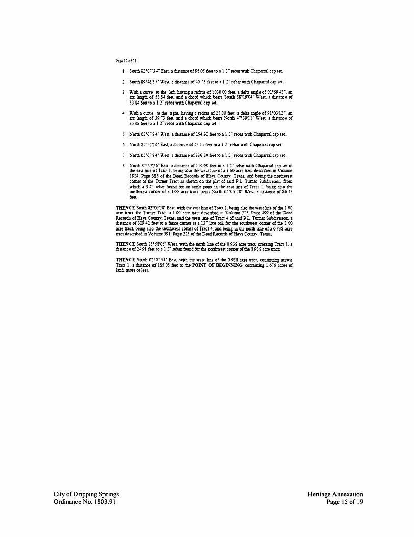
South o~·F 3~- East .1 dlitm:e of ~j 05 fHt to a l 2- n',M 'intt Cbparn:. cap :.et.
2 South 89°4S'55 • WeSt. a distance o: .:.) ~3 feet ro a I :- rt")ar Wlth Ch3p.unl cip ,et.
With a cum to the le:t h.1\ing a radrli of 1030 C•3 !eet.1 delta an.gie o: c,:,•5942•. ~ arc !en~ of 5354 ~t. w!. a chord whlcl:. bear, )-OUth SS'l9'CW U'tst. 1 d.u.tm:e of 53 S4 feet to .1 l 2- reb.lr wtth Cmp.ml.l ci;, SH •
.: u·,m 1 cun·e ro the n~. h.1\'ing a r3dr.n of :s •:•J fffl . .1 de:tt.:i mg-le of 91'03'12'', .m arc len~ of 39.73 feet . .md a chord wl:id:. t--w. !-:onh 47•39·}l' t\"tit. 1 d.utm:e of 35 6S fffcto a 1 2- reb.lrwirhC~ a;> set.
~ont S"::''52'26" East. a dtnlllCe of l lil 99 fM to .1 l 2- aw \\1th C1Llp.unl cap ,et m tht east jne of Tuct I. being .:i:so tM w~>t J&e of .1 1.00 acre tna ~;m)ed in Vohm:i! 1924. i>ap 3S5 of the Deed P..Kotds of&~-. Cow:.ty. TR.U. mi be~ the nonhs;n;t co~ of the Tumer Tr.ict l.i :hon-n on tte p~t o! s.1:d P.L. Tumet S·Jbdi\15.to&. :rOIC. a-bet a 3 J- rebar !a'JM :or ar. ~ pou:t ~ the n,t lmt o: Tnct l. bti.q al;o th! oom.west comM of a HtC· aae tran b<w; Nanh o~•c,5·,2g- ~;est a distm!e of S645 fffc:
THE.~C'E So.tth ·J2•05·2s· we. 'ilith me east 11.tit of Tract l. bem also the west ~e of the l 00 acre tract. the Tumtr Tr!et. 1 1 00 we ttact dw..noed ~ Vo:.mie 275. P~~ 499 of th! ::>eed Records of H.ly. c~-- T eus. and ?be msr l.m! of Tna 4 o: w:i P L Tumer Subdl\1S10&. a .iiitmee of 329 4: !eet k> a !u:.ce comer at a 13- u\~ w !o: the k1Ulhwest comer of 11:.e 1 OQ am tract bem! also the ~out!nmt con:er of Tract 4. acd b,emz in me i:.orth tit.e o! a o.i:;s acre trzct d!s-:nbedm Vo:.ime 391. Pagt .:!23 of the Deed Records of Ha), COWl~'. Texa,:
TBE.~CE South s5•5s·~· \\'est -a,th tte oo:tb line oftte o 93S !(It tract aos~ TnC1 1. a dutmce of 24 91 feet to a 1·2- n-bar found !or me oonhwest comer of the O 938 acre tr.let:
TBE.~CE Sc,Jth 01•0-:-34• E.lst llirh !be west w of the O 938 aae tract. con.tilr.Jm! aero» Tract 1. .1 dlita::.:e o! 1S5 05 ffft to tll~ ron-, or B£C.L'~1SC. cootau:.in! l.676 ~aes of i.md. more or tess. -
City of Dripping Springs Ordinance No. 1803.91
Heritage Annexation Page 15 of 19

Exhibit "B"
ANNEXATION SERVICE PLAN FOR PROPERTY ANNEXED BY ORDINANCE 1803.91
CITY OF DRIPPING SPRINGS, TEXAS
HERITAGE MUNICIPAL SERVICE PLAN
A. INTRODUCTION
The City of Dripping Springs has been petitioned to voluntarily annex into the City of Dripping Springs the property described below, commonly known as Heritage:
1. 34.247 acres in the Philip Smith Survey, Abstract 415, Hays County, Texas, being a portion of a 34.29 acre tract conveyed to John Marcus Baird by deed dated January 13, 1993 and recorded in Volume 971, Page 116 of the deed ofrecords of Hays County, Texas.
2. 50.206 acres in the Philip Smith Survey, Abstract 415, Hays County, Texas, being a portion of a tract called the East Part of 152.47 acres conveyed to John Marcus Baird by general warranty deed dated May 9, 1978 and recorded in Volume 310, Page 718 of the deed ofrccords of Hays County, Texas, same being a portion of a 152.47 acre tract conveyed to Edna Earl Baird by deed dated February 19, 1937 and recorded in Volume 154, Page 59 of the deed ofrecords of Hays County, Texas.
3. 94.695 acres (approx. 4,124,910 sq. ft.) in the Philip Smith Survey, Abstract 415, Hays County, Texas, being a portion of a 119.7 acre tract conveyed to Nelson M. Davidson and Doris Breed Davidson by deed dated June 23, 1952 and recorded in Volume 154, Page 290 of the deed ofrecords of Hays County, Texas, and being a portion of Tract 1, P.I. Turner Subdivision, a subdivision ofrecord in Volume 133, Page 444 of the deed of records of Hays County, Texas.
4. 8.119 acres (approx. 353,664 sq. ft.) in the Philip Smith Survey, Abstract 415, Hays County, Texas, being a portion of a 9.008 acre tract conveyed to Mickey Davidson Kroll, Nelson M. Davidson, Jr., and wife Barbara Watkins Davidson by warranty deed with vendors lien dated November 7, 2002 and recorded in Volume 2102, Page 453 of the official public records of Hays County, Texas, and being a portion of Tract 1, P.I. Turner Subdivision, a subdivision of record in Volume 133, Page 444 of the deed of records of Hays County, Texas.
5. 1.676 acres (approx. 73,006 sq. ft.) in the Philip Smith Survey, Abstract 415, Hays County, Texas, being a portion ofa 119.7 acre tract conveyed to Nelson M. Davidson and Doris Breed Davidson by deed dated June 23, 1952 and recorded in Volume 154, Page 290 of the deed of records of Hays County, Texas, and being a portion of Tract 1, P.I. Turner Subdivision, a subdivision of record in Volume 133, Page 444 of the deed records of Hays County, Texas.
B. MUNICIPAL SERVICES TO BE PROVIDED
City of Dripping Springs Ordinance No. 1803.91
Heritage Annexation Page 16 of 19
1. POLICE PROTECTION The City does not provide municipal police protection, but police protection is provided by the Hays County Sheriff's Office. The City has an agreement for traffic enforcement with Hays County through the Hays County Sheriffs Office.
2. FIRE SERVICE The City does not provide municipal fire services but this area is served by the Hays County Emergency Services District Number 6 (North Hays County Fire/Rescue for fire services and fire prevention activities.
3. BUILDING INSPECTION/CODE ENFORCEMENT SERVICES The Building Inspection Department will provide Code Enforcement Services upon annexation. This includes issuing building, electrical, mechanical and plumbing permits for any new constmction and remodeling, and enforcing all other applicable codes which regulate building construction within the City of Dripping Springs.
4. LIBRARIES The City does not own a municipal library. A community library is provided by the Dripping Springs Community Library.
5. ENVIRONMENT AL HEAL TH & HEAL TH CODE ENFORCEMENT SERVICES The City has a septic system/on-site sewage facility ordinance. Complaints of ordinance or regulation violations within this area will be answered and investigated by City personnel, beginning with the effective date of the annexation ordinance.
6. PLANNING & ZONING The planning and zoningjurisdiction of the City will be extended to this area on the effective date of the annexation ordinance. All services provided by the City wil1 be extended to the area on the effective date of the annexation ordinance.
7. PARKS & RECREATION All services and amenities associated with the City's Parks and Recreation activities will extend to this area on the effective date of the annexation ordinance.
AdditionalJy, the area wil1 contain its own network of parks, recreation, and open space, details of which are included in the Heritage Parks and Open Space Plan, attached as Exhibit '"C" of Planned Development District No. 5 ("POD- 5"), Ordinance No. 1220.124.
8. STREET & DRAINAGE MAINTENANCE The City will provide street and drainage maintenance to public streets in the area in accordance with standard City Policy as the area develops.
9. STREET LIGHTING The City will provide street lighting to the area in accordance with standard City Policy as the area develops.
City of Dripping Springs Ordinance No. 1803.91
Heritage Annexation Page I 7 of 19
10. TRAFFIC ENGINEERING The City will provide, as appropriate, street names signs, traffic control devices, and other traffic system design improvements to the area. Traffic improvements may be identified in the Traffic Study and Traffic Impact Analysis for the Heritage Project.
11. SANITATION/SOLID WASTE COLLECTION & DISPOSAL The City does not directly provide municipal sanitation/solid waste collection and disposal services. However, the City has granted an exclusive franchise for these services to Progressive Waste Solutions ofTX d/b/a Waste Connections ofTexas, which will be notified of all newly-annexed parcels.
12. WATERSERVICE The area to be annexed is within the CCN of the Dripping Springs Water Supply Corporation. The Dripping Springs Water Supply Corporation has the exclusive right to provide water service to the annexed area. The City may not provide for a municipal water supply and distribution system in an area serviced by CCN except through written agreement with the Dripping Springs Water Supply Corporation.
13. SEWER SERVICE The City municipal sewage collection treatment and disposal system is limited in geographic scope and ability to serve. Newly-annexed parcels wiJI be included in the Capital Improvements Plan as appropriate, and extended services when deemed feasible in light of topography and other relevant factors. The area proposed for annexation is subject to the Heritage Wastewater Utility Agreement, which provides for the terms of wastewater service for the area.
14. MISCELLANEOUS All other applicable municipal services will be provided to the area in accordance with policies established by the City of Dripping Springs.
The area is also subject to the following regulations and agreements entered into by and between the City of Dripping Springs and the subject area's Owner(s):
a. Planned Development District No 5 ('"POD - 5") b. Heritage Annexation and Development Agreement c. Heritage Wastewater Utility Agreement d. Offsite Road and Trail Agreement
City of Dripping Springs Ordinance No. 1803.91
Heritage Annexation Page 18 of 19
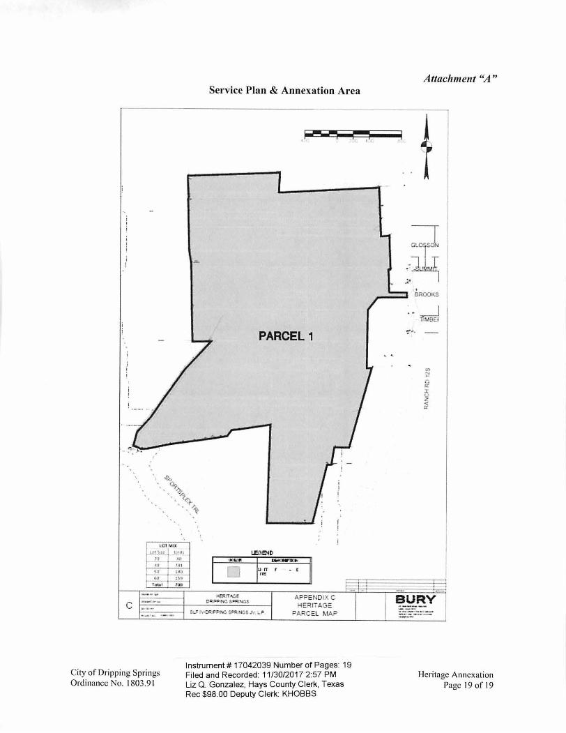
I 101 M U(
1"11_~ ... _t_:11 . n1_ ~ IIJ JAi
r.iD l il) _ ,.,_ :s,
Tob i 100
C
City of Dripping Springs Ordinance No. l 803.91
Service Plan & Annexation Area
Hffirr...-:.E o.c-_---=-t.c.. S ~f\1,4.:.S.
PARCEL 1
APPENDIX C -iE"llTAGE
"ARC=.L r,.tA?
Instrument# 17042039 Number of Pages: 19 Fi led and Recorded: 11/30/2017 2:57 PM Liz Q . Gonzalez, Hays County Clerk, Texas Rec $98.00 Deputy Clerk: KHOBBS
.:
Attachment "A"
\ .
. BROOKS
.. _J Tlw.!EI
BURY ----...... ···------.... __
Heritage Annexation Page 19 of 19