Embed Size (px)
Citation preview
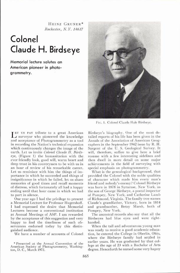
HEINZ G R U N E R * Rochester, N. Y. 14617
Colonel Claude Memorial lecture salutes an American pioneer in photo- grammetry.
ET US PAY tribute to a great American L surveyor who pioneered the knowledge and acceptance of Photogrammetry as a tool in recording the Nation's technical expansion which continuously changes the image of the earth. Let us invite Colonel Claude H. Birds- eye, (Figure 1) the humanitarian with the ever friendly look, good will, warm heart and deep trust in his countrymen to be with us in a n hour of review of his remarkable career. Let us reminisce with him the things of im- portance in which he succeeded and things of insignificance in which he failed, let us share memories of good times and recall moments of distress, which fortunately all had a happy ending until tha t hour came in which we had to part in silence.
One year ago I had the privilege to present a Memorial Lecture for Professor Hugershoff. I had expressed the desire tha t Memorial Lectures become a conventional institution a t Annual Meetings of ASP. I am rewarded by the acceptance of this suggestion and very happy to find the timeliness of such ob- servances endorsed today by this distin- guished audience.
We have a number of accounts of Colonel
*Presented a t the Annual Convention of the American Society of Photogrammetry, Washing- ton, D. C., March 1972.
FIG. 1. Colonel Claude Hale Birdseye.
Birdseye's biography. One of the most de- tailed reports of his life has been given in the Annals of the Association of American Geog- raphers in the September 1942 issue by R. H. Sargent of the U. S. Geological Survey. I t will, therefore, suffice to give here a brief resume with a few interesting sidelines and then dwell in more detail on some major achievements in the field of surveying with special emphasis on photogrammetry.
What is the genealogical background, tha t provided the Colonel with the noble qualities of character which made him every man's friend and nobody's enemy? Colonel Birdseye was born in 1878 in Syracuse, New York, as the son of George Birdseye, a postal inspector of Pompey, New York, and Catherine Lamb of Richmond, Virginia. The family tree names Claude's grandfather, Victory, born in 1814 and grandmother, Betsy Marsh, both of Pompey, New York.
The ancestral records also say tha t all the Birdseyes had blue eyes and were right- handed.
When the tall and adventurous young man was ready to receive a good academic educa- tion, he entered the College in Oberlin, Ohio, where the Birdseye family had settled in earlier years. He was graduated by tha t col- lege a t the age of 23 with a Bachelor of Arts degree. Henceforth he nursed some very hapny
GRAND CANYON
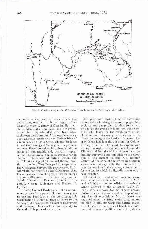
FIG. 2. Outline map of the Colorado River between Lee's Ferry and Needles.
memories of the campus times which, two years later, resulted in his marriage to Miss Grace Gardner Whitney of Oberlin. Her mer- chant father, also blue-eyed, and her grand- father, both right-handed, stem from Mas- sachusetts and Vermont. After supplementary post-graduate studies a t the Universities of Cincinnati and Ohio State, Claude Birdseye joined the Geological Survey and began as a rodman. He advanced rapidly through all the ranks of topographic aid, assistant topog- rapher, topographic engineer, geographer in charge of the Rocky Mountain Region, and in 1919 a t the age of 41 reached the top posi- tion as the first Chief Topographic Engineer of the Geological Survey. His predecessor, R. B. Marshall, had the title Chief Geographer. And his successors up to the present whose names are so well-known to us became John G. Staak, Thomas P. Pendleton, Gerald Fitz- gerald, George Whitmore and Robert H. Lyddan.
In 1929, Colonel Birdseye left the Govern- ment service for a period of about two years to become President of the Aerotopograph Corporation of America, then returned to the Survey and was appointed Chief of Engraving and Printing. He served in this capacity to the end of his professional career.
The profession that Colonel Birdseye had chosen to be a life-long surveyor, topographer, explorer and geographer is ideal for a man who loves the great outdoors, the wide hori- zons, who longs for the excitement of ex- ploration and discovery, and wants to be where the going is the hardest. I t seems that providence had just that in store for Colonel Birdseye. In 1913 he went to explore and survey the region of the active volcano Mt. Kilauea and its lake of fire. A year later we find him surveying and establishing the eleva- tion of the ancient volcano Mt. Rainier. Caught a t the edge of the crater in a terrific snowstorm, history tells that his sense of nature made him find a crevice, a steam vent, for shelter, in which he literally sweat out a near disaster.
The next hard and adventuresome lesson was learned when he volunteered in 1923 to lead a USGS survey expedition through the Grand Canvon of the Colorado River. Al- ready widely known for his survey accom- plishments on volcanos and as experienced organizer of expeditions, Mr. Birdseye was regarded as an inspiring leader to command his crew in arduous work and daring adven- ture. Lewis Freeman, one of his chosen boat- men, added a new qualification to the publicly
COLONEL CLAUDE H. BIRDSEYE
cited virtues of their chief with these words: "He showed a natural water sense and took to the river like a duck."
Six previous expeditions beginning with J. W. Powell's two voyages through the can- yon half a century ago had produced partial topographic information along the course of the river with exception of the Grand Canyon Section, which is the most dangerous because of uncounted rock-strewn rapids and tur- bulent waters. The main objective of the expedition was, therefore, to establish a con- tinuous river line from a geographically known point near Lee's Ferry (Figure 2) to a monumented station below the mouth of Diamond Creek, a downstream distance of 251 miles. A second objective was to bring home supplementary information on topog- raphy, hydrography and geology on a number of dam sites, which were parts of the gigantic project to control the then wasted a i d de- structive waters of the Colorado, to use their inherent energy to generate electric power and to irrigate vast arid areas of six states bordering on the river and including Cali- fornia and Mexico.
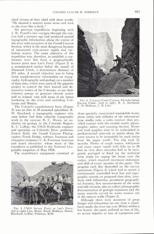
The Colonel's expeditionary force (Figure 3) was an elite of 10 seasoned specialists: R. W. Burchard, a topographic engineer who once before had done valuable topographic work in the canyon; R. C. Moore, an au- thority on geology in the Colorado Region; E. C. LaRue, the USGS Hydraulic engineer and specialist on Colorado River problems; Emery Kolb, the Grand Canyon Photog- rapher; Frank Dodge, rodman, boatman and champion swimmer; C. R. Freeman, boatman and noted chronicler, whose story of this expedition is published in the National Geo- graphic magazine of May 1924.
The expedition's equipment consisted of
FIG. 3. USGS Survey Party at Lee's Ferry: (left to right) Lint, Blake, Word, Birdseye, Moore, Burchard, LaRue, Freeman, Kolb.
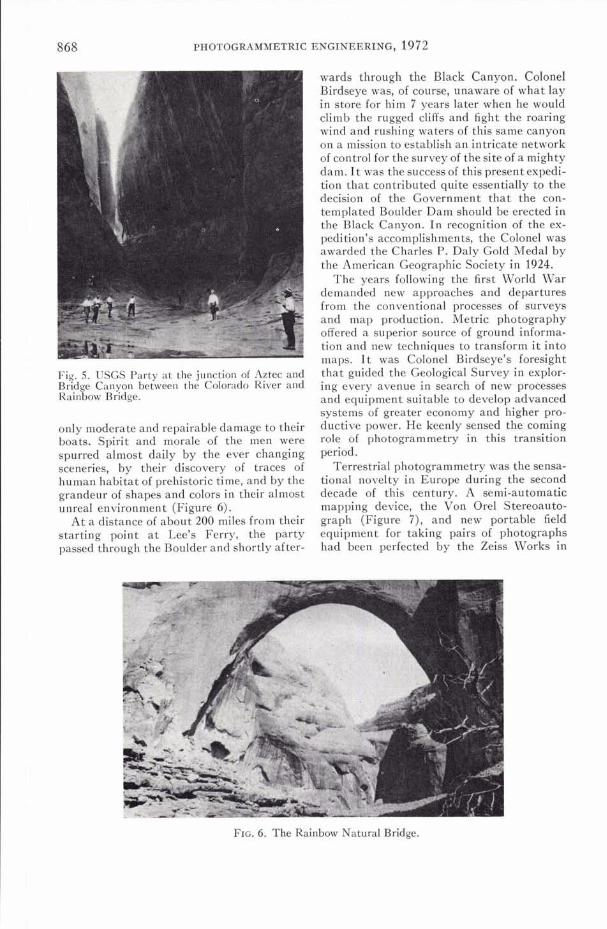
FIG. 4. Cataract Creek Canyon, 9.6 miles below Havasu Creek. (Left t? right), R. A. Burchard, C. H. Birdseye, L. B. L~nt.
three specially constructed unsinkable boats, plane tables and alidades of the micrometer type, stadia rods, a radio receiver that pro- vided contact with the outside world, photo- graphic, safety and camping devices. Water and food supplies were to be replenished in predetermined intervals a t points along the route known to be accessisble by pack trains from the upper world. The trip took 2; months. Plenty of rough waters, whirlpools and many major rapids with falls up to 20 feet on very short stretches had to be navi- gated, portaged or lined (as the technical term reads for roping the boats over the rocks), which required enormous endurance and skill of every member of the party. The progress each day depended on the survey operations (Figure 4) which had to secure a continuously controlled level line and topo- graphic records on proposed dam sites, junc- tions with tributaries, prominent geographi- cal features, flow measurements of the main and side streams, also to collect photographic documentation of geologic exposures and the many marvels carved by water erosion out of the canyon walls (Figure 5).
Although there were moments of great danger and exhaustion (at one time a cloud- burst made the river rise over 20 feet within a few hours), the party suffered no loss of life, no severe injuries or loss of equipment and
wards through the Black Canyon. Colonel Birdseye was, of course, unaware of what lay in store for him 7 years later when he would climb the rugged cliffs and fight the roaring wind and rushing waters of this same canyon on a mission to establish an intricate network of control for the survey of the site of a mighty dam. I t was the success of this present expedi- tion tha t contributed quite essentially to the decision of the Government tha t the con- templated Boulder Dam should be erected in the Black Canyon. I n recognition of the ex- pedition's accomplishments, the Colonel was awarded the Charles P. Daly Gold Medal by the American Geographic Society in 1924.
The years following the first World War demanded new approaches and departures from the conventional Drocesses of survevs and man ~roduction. ~ e t r i c DhotoeraDhv ~ ~~ ---
1- A- - ~ ~ - - - ~. u . -
offered a superior source of ground informa- tion and new techniques to transform i t into maDs. I t was Colonel Birdseve's foresirrht
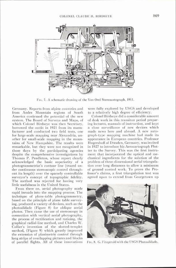
Fig. 5. USGS Party at the junction of Aztec and Bridge Canyon between the Colorado River and Rainbow Bridge.
only moderate and repairable damage to their boats. Spirit and morale of the men were spurred almost daily by the ever changing sceneries, by their discovery of traces of human habitat of prehistoric time, and by the grandeur of shapes and colors in their almost unreal environment (Figure 6).
A t a distance of about 200 miles from their starting point a t Lee's Ferry, the party passed through the Boulder and shortly after-
tha't guided the Geological sur;ey in expior- ing every avenue in search of new processes and equipment suitable to develop advanced systems of greater economy and higher pro- ductive power. He keenly sensed the coming role of photogrammetry in this transition period.
Terrestrial photogrammetry was the sensa- tional novelty in Europe during the second decade of this century. A semi-automatic mapping device, the Von Ore1 Stereoauto- graph (Figure 7) , and new portable field equipment for taking pairs of photographs had been perfected by the Zeiss Works in
FIG. 6 . The Rainbow Natural Bridge.
COLONEL CLAUDE H. BIRDSEYE
FIG. 7. A schematic drawing of the Von Orel Stereoautograph, 1911.
Germany. Reports from alpine countries and from Andes Mountain regions of South America confirmed the potential of the new system. T h e Board of Surveys and Maps, of which Colonel Birdseye was then Secretary, borrowed the outfit in 1921 from i ts manu- facturer and conducted two field tests, one for large-scale mapping near Alexandria, an- other for small-scale mapping in the moun- tains of New Hampshire. T h e results were remarkable, b u t they were not recognized i n those days by the participating agencies despite the comprehensive investigations by Thomas P. Pendleton, whose report clearly acknowledged the basic superiority of a photogrammetrist's contour line (traced un- der continuous stereoscopic control through- ou t i ts length) over the sparsely controllable surveyor's concept of topographic fidelity. T h e method was reiected for having verv
were fully explored by USGS and developed t o a relatively high degree of efficiency.
Colonel Birdseye did a considerable amount of desk work in this transiton period prepar- ing lectures, manuals of instruction, and kept a close surveillance of new devices which made news here and abroad. A new auto- graph-type mapping machine had made i ts appearance in European countries. Professor Hugershoff of Dresden, Germany, was invited in 1927 t o introduce his Aerocartograph Plot- ter t o the Survey. This was the first instru- ment t h a t incorporated the optical and me- chanical ingredients for the solution of the problem of three-dimensional aerial triangula- tion over long distances t o allow a minimum of ground control work. T o prove the Pro- fessor's claims, a first triangulation test was agreed upon to extend from Georgetown u p
little usefulness in the United States. From there on, aerial photography made
rapid inroads into the mapping process. T h e a technique of plane-table photogrammetry, based on the nrincinle of nlane table survev- ing, produced a variety of devices, such as the photoalidade (Figure 8) for oblique aerial photos. Then came the use of stereoscopy in connection with vertical aerial photography, the process of rectification and ratioing, the graphical radial-line method, and Charles \\'. . Collier's invention of the slotted-ternplet method, (Figure 9 ) which greatly improved the extension of planimetric control through long strips of overlapping pictures and blocks of paralie1 flights. Ail of- these innovations FIG. 8. G. Fitzgerald with the USGS Photoalidade.
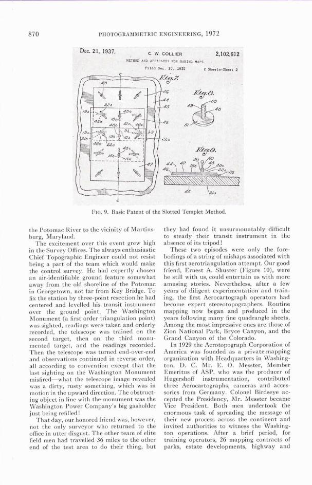
FIG. 9. Basic Patent of the Slotted Templet Method.
the Potomac River to the vicinity of Martins- burg, Maryland.
The excitement over this event grew high in the Survey Offices. The always enthdsiastic Chief Topographic Engineer could not resist being a part of the team which would make the control survey. He had expertly chosen an air-identifiable ground feature somewhat away from the old shoreline of the Potomac in Georgetown, not far from Key Bridge. To fix the station by three-point resection he had centered and levelled his transit instrument over the ground point. The Washington Monument (a first order triangulation point) was sighted, readings were taken and orderly recorded, the telescope was trained on the second target, then on the third monu- mented target, and the readings recorded. Then the telescope was turned end-over-end and observations continued in reverse order, all according to convention except that the last sighting on the Washington Monument misfired-what the telescope image revealed was a dirty, rusty something, which was in motion in the upward direction. The obstruct- ing object in line with the monument was the Washington Power Company's big gasholder just being refilled!
That day, our honored friend was, however, not the only surveyor who returned to the office in utter disgust. The other team of elite field men had travelled 36 miles to the other end of the test area to do their thing, but
they had found i t unsurmountably difficult to steady their transit instrument in the absence of its tripod!
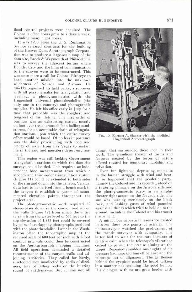
These two episodes were only the fore- bodings of a string of mishaps associated with this first aerotriangulation attempt. Our good friend, Ernest A. Shuster (Figure lo), were he still with us, could entertain us with more amusing stories. Nevertheless, after a few years of diligent experimentation and train- ing, the first Aerocartograph operators had become expert stereotopographers. Routine mapping now began and produced in the years following many fine quadrangle sheets. Among the most impressive ones are those of Zion National Park, Bryce Canyon, and the Grand Canyon of the Colorado.
In 1929 the Aerotopograph Corporation of America was founded as a private mapping organization with Headquarters in Washing- ton, D. C . Mr. E. 0. Messter, Member Emeritus of ASP, who was the producer of Hugershoff instrumentation, contributed three Aerocartographs, cameras and acces- sories from Germany. Colonel Birdseye ac- cepted the Presidency, Mr. Messter became Vice President. Both men undertook the enormous task of spreading the message of their new process across the continent and invited authorities to witness the Washing- ton operations. After a brief period, for training operators, 26 mapping contracts of parks, estate developments, highway and
COLONEL CLAUDE H. BlRDSEYE
flood control projects were acquired. The Colonel's office hours grew to 7 days a week, including many night hours.
I t was 1930 when the U. S. Reclamation Service released contracts for the building of the Hoover Dam. Aerotopograph Corpora- tion was to produce a large-scale map of the dam site, Brock & Weymouth of Philadelphia was to survey the adjacent terrain where Boulder City and the lines of communication to the canyon were to be constructed. This was once more a call for Colonel Birdseye to head another mission into the unknown wilderness of Nevada and Arizona. He quickly organized his field party, a surveyor with all paraphernalia for triangulation and levelling, a photogrammetrist with the Hugershoff universal phototheodolite (the only one in the country) and photographic supplies. He left his office early in July for a task that probably was the roughest and toughest of his lifetime. The first order of business was an exhausting search, mostly on foot over treacherous cliffs in boiling sand- storms, for an acceptable chain of triangula- tion stations upon which the entire survey effort would be based. Of no less importance was the daily provisioning with food and plenty of water from Las Vegas to sustain life in the arid and merciless desert environ- ment.
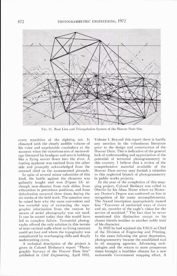
This region was still lacking Government triangulation stations to which the dam-site surveys could be tied. This required an inde- pendent base measurement from which a second- and third-order triangulation system (Figure 11) could be extended to both sides of the rim and down into the canyon. Vertical data had to be derived from a bench mark in the canyon to establish a system of monu- mented elevation points throughout the project area.
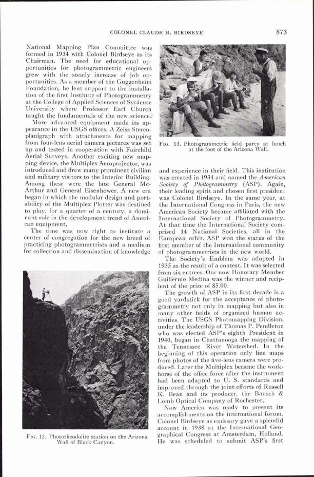
The photogrammetric work required 32 stereo-bases down in the canyon and up on the walls (Figure 12) from which the entire terrain from the water level of 655 feet to the top elevation of 1,375 feet could be covered by pairs of overlapping photographs produced with the ~hototheodolite. Later in the Wash- ington office the topographic map a t the required scale of 600 feet per inch with 5-foot contour intervals could then be constructed on the Aerocartograph mapping machines. All field operations demanded a detailed reconnaissance of the canyon walls and ad- joining territories. They called for hardy, surefooted men unaffected by spells of dizzi- ness, fear of falling rocks or the buzzing sound of rattlesnakes. But i t was not all
FIG. 10. Earnest A. Shuster with the modified Hugershoff Aerocartograph.
danger that surrounded these men in their work. The grandiose theater of forms and features created by the forces of nature offered reward for temporary hardship and privation.
Even fun lightened depressing moments in the human struggle with wind and heat. I t so happened that the geodetic party, namely the Colonel and his recorder, stood on a towering pinnacle on the Arizona side and the photogrammetric party in an amphi- theater right across on the Nevada side. The sun was burning mericlessly on the black rock, and lashing gusts of wind pounded against all things which tried to hold on to the ground, including the Colonel and his transit instrument.
A miraculous acoustical resonance existed between these two points of activity. The photosurveyor watched the predicament of the transit surveyor with sympathy. The latter had to wait for the rare instants of relative calm when the telescope's vibrations ceased to permit the precise aiming a t the target. Repeatedly sudden onslaughts of air pressure had knocked him off balance and the telescope out of alignment. The gentlemen behind the eyepiece could be heard talking in a manner not sounding like good humor. His dialogue with nature grew louder with
PHOTOGRAMME rRIC ENGINEERING, 19 72
FIG. 11. Base Line and Triangulation System of the Hoover Dam Site.
every repetition of the sighting act. I t climaxed with the clearly audible volume of his voice and unprintable vocabulary a t the moment when the victorious arm of meteorol- ogy liberated his headgear and sent i t bobbing like a flying saucer down into the river. A roaring applause was emitted from the other side and promptly acknowledged from the stunned chief on the monumented pinnacle.
In spite of several minor calamities of this kind, the battle against the elements was gallantly fought and won (Figure 13) al- though near-disaster from rock slides, from exhaustion in precarious positions, and from dehydration occurred three times during the six-weeks of the field work. The question may be raised here why the more convenient and less eventful way of extracting the topo- graphic information from the canyon by means of aerial photography was not used. I t can be stated today tha t this would have led to complete failure. Terrestrial photog- raphy offered the only solution in this terrain of near-vertical walls where no living creature could set foot and where the topography was complicated by overhanging cliffs and deeply undercutting caves.
A technical description of the project is given in Colonel Birdseye's report "Photo- graphic Surveys of the Hoover Dam Site" published in Civil Engineering, April 1931,
Volume I. Beyond this report there is hardly any mention in the voluminous literature prior to the design and construction of the Hoover Dam. This is indicative of the general lack of understanding and appreciation of the potential of terrestial photogrammetry in this country. I believe tha t a review of the comprehensive material available of the Hoover Dam survey may furnish a stimulus t o this neglected branch of photogrammetry in public works projects.
In the year of the completion of this map- ping project, Colonel Birdseye was called to Oberlin by his Alma Mater where an Honor- ary Doctor's Degree was conferred on him in recognition of his many accomplishments. The Award inscription appropriately named him "Traverser of uncharted ways of rivers and air, recorder of the eagle's vision for the service of mankind." The fact tha t he never mentioned this distinction except to his closest friends testifies to another noble trait of his character.
In 1932 he had rejoined the USGS as Chief of the Division of Engraving and Printing. I n the years following the great depression, photogrammetry became the established tool in all mapping agencies. Advancing tech- nologies and the return to more prosperous times brought a healthier climate for a new nationwide Government mapping effort. A
COLONEL CLAU
National Mapping Plan Committee was formed in 1934 with Colonel Birdseye as its Chairman. The need for educational op- portunities for photogrammetric engineers grew with the steady increase of job op- portunities. As a member of the Guggenheim Foundation, he lent support to the installa- tion of the first Institute of Photogrammetry a t the College of Applied Sciences of SyrBcuse University where Professor Earl Church taught the fundamentals of the new science&
More advanced equipment made its ap- pearance in the USGS offices. A Zeiss Stereo- planigraph with attachments for mapping from four-lens aerial camera pictures was set up and tested in cooperation with Fairchild Aerial Surveys. Another exciting new map- ping device, the Multiplex Aeroprojector, was introduced and drew many prominent civilian and military visitors to the Interior Building. Among these were the late General Mc- Arthur and General Eisenhower. A new era began in which the modular design and port- ability of the Multiplex Plotter was destined to play, for a quarter of a century, a dorni- nant role in the development trend of Ameri- can equipment.
The time was now right to institute a center of congregation for the new breed of practicing photogrammetrists and a medium for collection and dissemination of knowledge
FIG. 12. Phototheodoli n on Arizona Wall of Black Canyon.
DE H. BIRDSEYE
, FIG. 13. Photogrammetric field party at lunch
at the foot of the Arizona Wall.
and experience in their field. This institution was created in 1934 and named the American Society of Photogrammetry (ASP). Again, their leading spirit and chosen first president was Colonel Birdseye. In the same year, a t the International Congress in Paris, the new American Society became affiliated with the International Society of Photogrammetry. A t that time the International Society com- prised 14 National Societies, all in the European orbit. ASP won the status of the first member of the International community of photogrammetrists in the new world.
The Society's Emblem was adopted in 1935 as the result of a contest. I t was selected from six entrees. Our now Honorary Member Guillermo Medina was the winner and recip- ient of the prize of $5.00.
The growth of ASP in i ts first decade is a good yardstick for the acceptance of photo- grammetry not only in mapping but also in many other fields of organized human ac- tivities. The USGS Photomapping Division, under the leadership of Thomas P. Pendleton who was elected ASP's eighth President in 1940, began in Chattanooga the mapping of the Tennessee River Watershed. In the beginning of this operation only line maps from photos of the five-lens camera were pro- duced. Later the Multiplex became the work- horse of the office force after the instrument had been adapted to U. S. standards and improved through the joint efforts of Russell K. Bean and its producer, the Bausch & Lomb Optical Company of Rochester.
Now America was ready to present its accomplishments on the international forum. Colonel Birdseye as emissary gave a splendid account in 1938 a t the International Geo- graphical Congress a t Amsterdam, Holland. He was scheduled to submit ASP's first
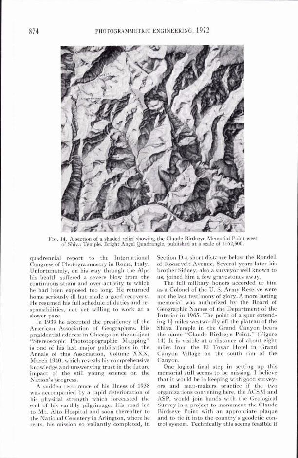
FIG. 14. A section of a shaded relief showing the Claude Birdseye Memorial Point west of Shiva Temple. Bright Angel Quadrangle, published at a scale of 1 :62,500.
quadrennial report to the International Congress of Photogrammetry in Rome, Italy. Unfortunately, on his way through the Alps his health suffered a severe blow from the continuous strain and over-activity to which he had been exposed too long. He returned home seriously ill but made a good recovery. He resumed his full schedule of duties and re- sponsibilities, not yet willing to work a t a slower pace.
In 1939 he accepted the presidency of the American Association of Geographers. His presidential address in Chicago on the subject "Stereoscopic Phototopographic Mapping" is one of his last major publications in the Annals of this Association, Volume XXX, March 1940, which reveals his comprehensive knowledge and unswerving trust in the future impact of the still young science on the Nation's progress.
A sudden recurrence of his illness of 1938 was accompanied by a rapid deterioration of his physical strength which forecasted the end of his earthly pilgrimage. His road led to Mt. Alto Hospital and soon thereafter to the National Cemetery in Arlington, where he rests, his mission so valiantly completed, in
Section D a short distance below the Rondell of Roosevelt Avenue. Several years later his brother Sidney, also a surveyor well known to us, joined him a few gravestones away.
The full military honors accorded to him as a Colonel of the U. S. Army Reserve were not the last testimony of glory. A more lasting memorial was authorized by the Board of Geographic Names of the Department of the Interior in 1965. The point of a spur extend- ing 14 miles westwardly off the plateau of the Shiva Temple in the Grand Canyon bears the name "Claude Birdseye Point." (Figure 14) I t is visible a t a distance of about eight miles from the El Tovar Hotel in Grand Canyon Village on the south rim of the Canyon.
One logical final step in setting up this memorial still seems to be missing. I believe that i t would be in keeping with good survey- ors and map-makers practice if the two organizations convening here, the ACSM and ASP, would join hands with the Geological Survey in a project to monument the Claude Birdseye Point with an appropriate plaque and to tie i t into the country's geodetic con- trol system. Technically this seems feasible if
COLONEL CLAUDE H. BIRDSEYE /
modern means of transportation and geodetic equipment are used.
In concluding, I wish to thank my listeners for reminiscing with me things that we had forgotten or never have been aware of. I want to thank you for the honor accorded to me by the presence of members of the Birdseye family, Colonel and Mrs. Bert Sweigart, and their children.
I t is also my pleasant duty to express my sincere thanks for the remarkable help I have
received in the search for historical data and latern slides to Miss Nell Carico of the Chief's Office of the Topographic Survey Depart- ment, as well as to the great Institution to which Colonel Birdseye has devoted his en- tire professional life. This Institution was created in 1879 under President Ulysses Grant. For almost a full century i t bears the honored name "The United States Geological Survey."
(Continued from page 842)
Intersociety Liaison
American Association for Advancement of Science American Society of Civil Engineers D. C. Council on Engineering and Architectural Societies Inter-Society Color Council National Research Council (Earth Science Division) Optical Society of America Photographic Industry Council U.S.A. Standards Institute
(Concluded o n page 899)
Meetings
March 11-16, 1973,* Washington Hilton, Washington, D. C.
March 1974,* Chase-Park Plaza, St. Louis, Mo.
March 7-12, 1975,* Washington Hilton, Washington, D. C.
FALL TECHNICAL MEETINGS
Oct. 11-14, 1972,* Columbus, Ohio; Neil House Motor Hotel; Wm. Prescott, 4822 East Livingston, Columbus, Ohio 43227.
1973* (open), Disneyland East, Orlando, Florida; Jon S. Beazley, Florida Dept. of Transportation, H. Burns Bldg., Talla- hassee, Florida 32304.
Sept. 8-13,1974,t Washington Hilton, Wash- ington, D. C.
1975,* (open), Phoenix, Arizona. Sept. 28-Oct. 1, 1976,* Olympic Hotel,
Seattle, Wash.; C. E. Buckner, 803
*Jointly with the American Congress of Survey- ing and Mapping.
t To be held as part of the International Con- gress of FIG.
Schedule
A. Dipentima F. 0. Diercks J. J. Thorsen J. T. Smith, Jr. F. J. Doyle S. J. Friedman L. P. Jacobs W. P. Tayman
Seattle Municipal Bldg., Seattle, Wash. 98104.
Oct. 18-21, 1977, Little Rock, Arkansas.
SEMINARS AND SYMPOSIUMS
Jan. 18-20, 1973, San Jose, Calif. July 1973, Univ. of Maine, Orono, Maine.
Fourth Biennial WorkshorColor Aerial Photography in the Plant Sciences.
October 1973, Sioux Falls, S. Dak. Manage- ment & Utilization of Remote Sensing Data. Convention Center and USGS EROS Data Center. Cosponsored by AIAA, IEEE and AGI. Dr. Harold T. Rib, 10129 Glen- mere Road, Fairfax, Va. 22030.
INTERNATIONAL MEETINGS
July 1973, Mexico City, Mexico. Joint Tech- nical Meeting with the Mexican Society of Photogrammetry.
Sept. 9-16, 1974, Washington Hilton, Wash- ington, D. C., 14th Congress of the Inter- national Federation of Surveyors, (FIG) ; Jeter P. Battley, Jr., P.O. Box 14262, Washington, D. C. 20044.