Embed Size (px)
Citation preview
5/17/2016
1
DATES TO REMEMBER
On-going: Course evaluation period. Check your Hunter e-mail for instructions. Use your Hunter netID and password: Smartphone: www.hunter.cuny.edu/mobilete Computer: www.hunter.cuny.edu/te
PAST: Last day to hand in Required Landscape Exercise without penalty was May 13.
TODAY: Last class lecture and last day to submit pre-approved extra credit research paper or other exercise
May 24: Exam III: The Final Exam – From 9 to 11 AM << note different time from class
– Same format as exams I and II.
– Last day to hand in Exam III extra credit exercise and “Landscape Road Trip” extra credit option.
Regional Landscape Studies<<<For each region:
1. Know its physical geography.
2. Identify its unique characteristics.
3. Be able to explain the human imprint.
4. Discuss its sequence occupancy and eco-nomic development.
NORTHLANDS
NORTHEAST COAST
MEGALOPOLIS
CANADA’S NATIONAL CORE
AMERICA’S HEARTLAND
APPALACHIA and the OZARKS
THE SOUTH
GREAT PLAINS and PRAIRES
MOUNTAINS, PLATEAUS and BASINS: The Empty Interior
DESERT SOUTHWEST
NORTH PACIFIC COAST
HAWAII
2
Regional Landscapes of the United States and Canada
HAWAIIAN ISLANDSProf. Anthony Grande
©AFG 2016
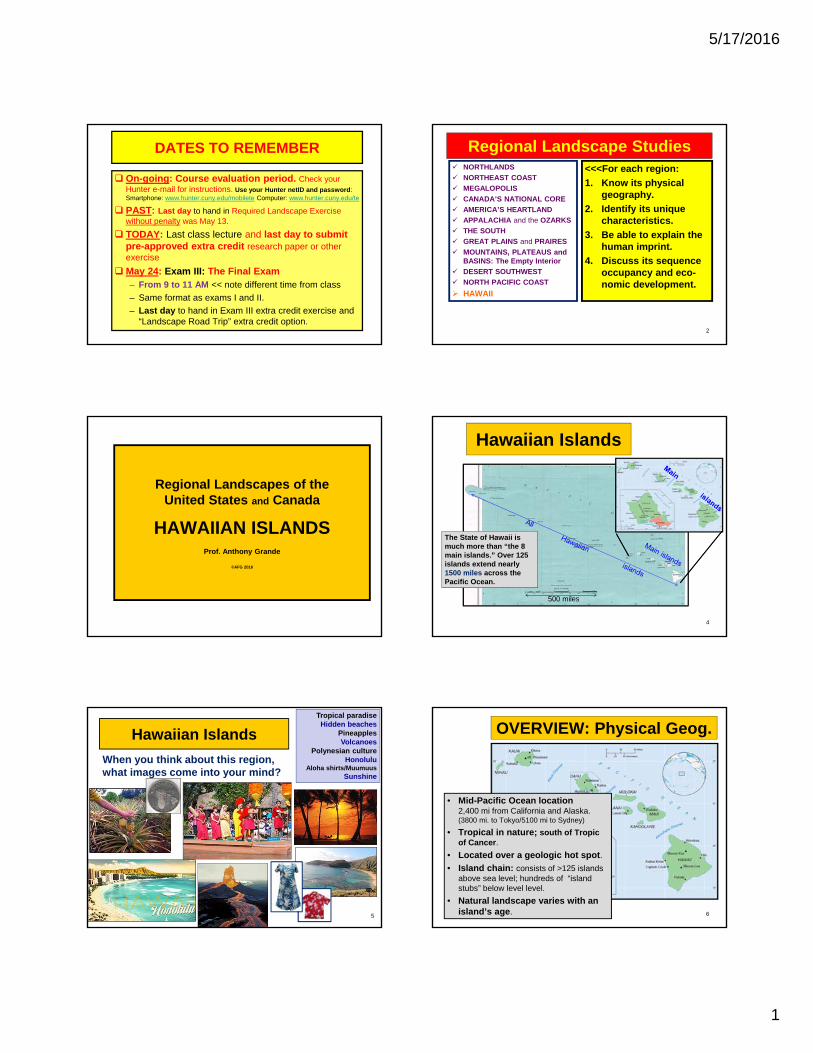
Hawaiian Islands
The State of Hawaii is much more than “the 8 main islands.” Over 125 islands extend nearly 1500 miles across the Pacific Ocean.
500 miles
4
5
Hawaiian Islands
When you think about this region, what images come into your mind?
Tropical paradiseHidden beaches
PineapplesVolcanoes
Polynesian cultureHonolulu
Aloha shirts/MuumuusSunshine
OVERVIEW: Physical Geog.
• Mid-Pacific Ocean location2,400 mi from California and Alaska. (3800 mi. to Tokyo/5100 mi to Sydney)
• Tropical in nature; south of Tropic of Cancer.
• Located over a geologic hot spot.
• Island chain: consists of >125 islands above sea level; hundreds of “island stubs” below level level.
• Natural landscape varies with an island’s age. 6
5/17/2016
2
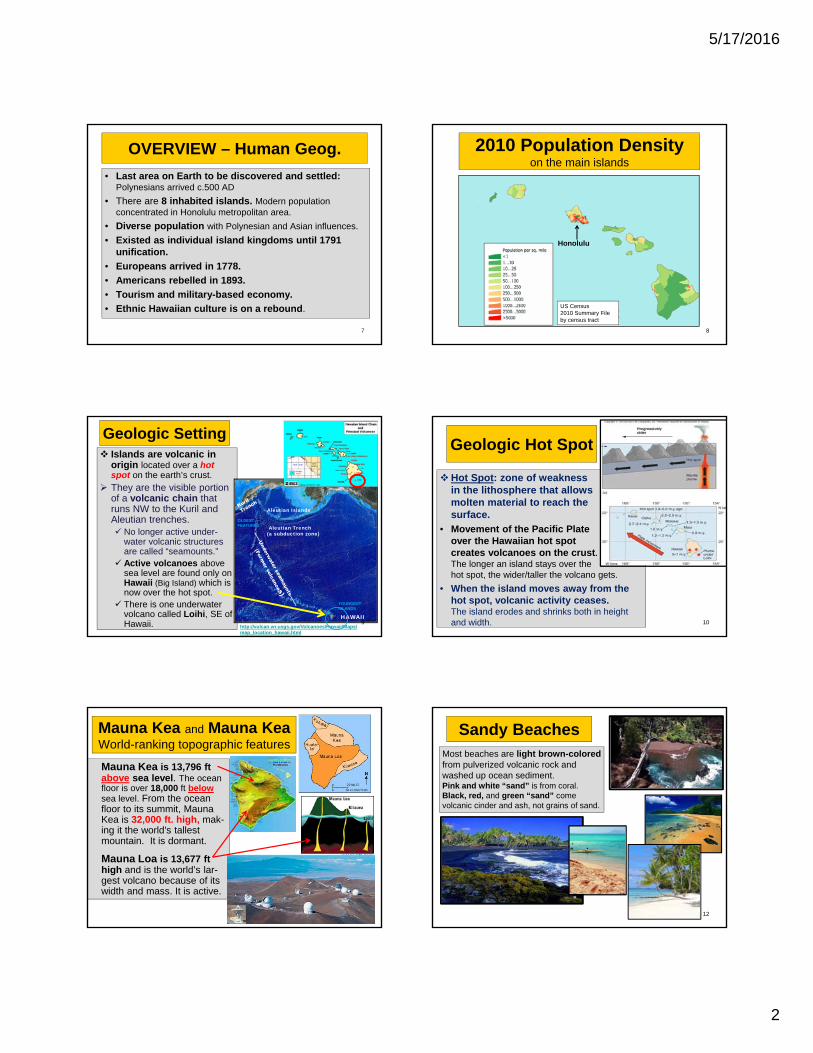
OVERVIEW – Human Geog.
• Last area on Earth to be discovered and settled: Polynesians arrived c.500 AD
• There are 8 inhabited islands. Modern population concentrated in Honolulu metropolitan area.
• Diverse population with Polynesian and Asian influences.
• Existed as individual island kingdoms until 1791 unification.
• Europeans arrived in 1778.
• Americans rebelled in 1893.
• Tourism and military-based economy.
• Ethnic Hawaiian culture is on a rebound.
7
2010 Population Densityon the main islands
Honolulu
8
US Census 2010 Summary File by census tract
Islands are volcanic in origin located over a hot spot on the earth’s crust.
They are the visible portion of a volcanic chain that runs NW to the Kuril and Aleutian trenches. No longer active under-
water volcanic structures are called “seamounts.”
Active volcanoes above sea level are found only on Hawaii (Big Island) which is now over the hot spot.
There is one underwater volcano called Loihi, SE of Hawaii.
Aleutian Islands
Aleutian Trench(a subduction zone)
HAWAII9
Geologic Setting
http://vulcan.wr.usgs.gov/Volcanoes/Hawaii/Maps/map_location_hawaii.html
OLDESTFEATURES
YOUNGESTISLANDS
Geologic Hot Spot
Hot Spot: zone of weakness in the lithosphere that allows molten material to reach the surface.
• Movement of the Pacific Plateover the Hawaiian hot spot creates volcanoes on the crust. The longer an island stays over the hot spot, the wider/taller the volcano gets.
• When the island moves away from the hot spot, volcanic activity ceases. The island erodes and shrinks both in height and width. 10
Mauna Kea and Mauna KeaWorld-ranking topographic features
Mauna Kea is 13,796 ftabove sea level. The ocean floor is over 18,000 ft belowsea level. From the ocean floor to its summit, Mauna Kea is 32,000 ft. high, mak-ing it the world's tallest mountain. It is dormant.
Mauna Loa is 13,677 ft high and is the world’s lar-gest volcano because of its width and mass. It is active.
11
Sandy Beaches
12
Most beaches are light brown-colored from pulverized volcanic rock and washed up ocean sediment. Pink and white “sand” is from coral. Black, red, and green “sand” come volcanic cinder and ash, not grains of sand.
5/17/2016
3
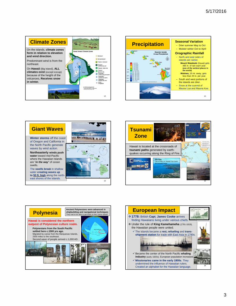
Climate ZonesOn the islands, climate zones form in relation to elevation and wind direction.
Predominant wind is from the northeast.
On Hawaii (Big Island), ALL climates exist (except icecap)because of the height of the volcanoes. Receives snow in winter.
13
PrecipitationSeasonal Variation– Drier summer May to Oct
– Moister winter Oct to April
Orographic Rainfall– North and east sides of
islands are rainier.Mount Waialeale (Kauai) gets
485 in. of rain each year (one of the wettest places in the world)
Waimea, 15 mi. away, gets less than 20 in. per year.
– South and west portions of the islands are drier.
– Snow at the summit of Mauna Loa and Mauna Kea
14
Giant Waves
Winter storms off the coast of Oregon and California in the North Pacific generate waves by wind action.
Northeasterly winds push water toward mid-Pacific where the Hawaiian Islands are “in the way” of ocean swells.
The swells break in shallow water creating waves up to 50 ft. high along the north-east shores of the islands.
15
Hawaii is located at the crossroads of tsunami paths generated by earth-quakes occurring along the Ring of Fire.
16
Hilo Bay.City of Hilo on Hawaii has been devastated twice
Tsunami Zone
Kona Coast, Hawaii 2011
PolynesiaHawaii is considered the northern outpost of Polynesian culture realm.
Polynesians from the South Pacific settled here c.1500 yrs ago.Migrated by canoe from the Marquesas Islands, 2500 miles to the southeast.Second wave of people arrived c.1,000 AD.
17
Ancient Polynesians were advanced in shipbuilding and navigational techniques They had to be able to get back to their home island!
European Impact1778: British Capt. James Cooke arrives
finding Hawaiians living under various chiefs.
Under the rule of King Kamehameha (1791-1819),
the Hawaiian people were united. The islands became a rest, refueling and trans-
shipment station for trade with East Asia in 1790s.
Became the center of the North Pacific whalingindustry (early 1820s). European population increased.
Missionaries came in the early 1800s. They undermined the influence of Hawaiian rulers. Created an alphabet for the Hawaiian language.
18
5/17/2016
4
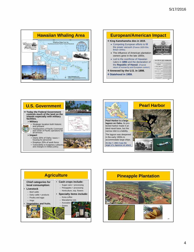
Hawaiian Whaling Area
19
European/American Impact King Kamehameha dies in 1819.
Competing European efforts to fill the power vacuum (France 1820-50s; Britain 1840s).
The influence of American plantation owners grew in the late 1800s.
Led to the overthrow of Hawaiian rulers in 1893 and the declaration of the Republic of Hawaii. (Feared return of monarchy and European control.)
Annexed by the U.S. in 1898.
Statehood in 1959.
20
U.S. Government Today the Federal Government
controls much of the land on the islands especially with military facilities.Military
• Strategic location both historic and present
• Headquarters of Pacific Command and center of Pacific operations for all services.
Impact• Owns 25% of Oahu: bases +
housing for personnel• Employs 25% of work force• Vulnerability to budgetary cutbacks
and changes in military policy.21
Pearl Harbor
Pearl Harbor is a large lagoon on Oahu. Its pro-tected harbor made it an ideal naval base, but the narrow inlet is a liability.
The lagoon was deepened in the early 1900s to accommodate large ships.
On Dec 7, 1941 it was the target of a Japanese air attack.
22
Agriculture
Chief categories for local consumption:
• Livestock– Beef cattle
– Dairy cattle + products
– Poultry and eggs
– Hogs
• Vegetables and fruits.
• Cash crops include:– Sugar cane + processing
– Pineapples + processing
– Horticulture, esp. flowers
• Specialty items include:– Kona coffee
– Macadamia nuts
– Avocados
– Guava
23
Pineapple Plantation
24
5/17/2016
5
Sugar Cane Field and Mill
25
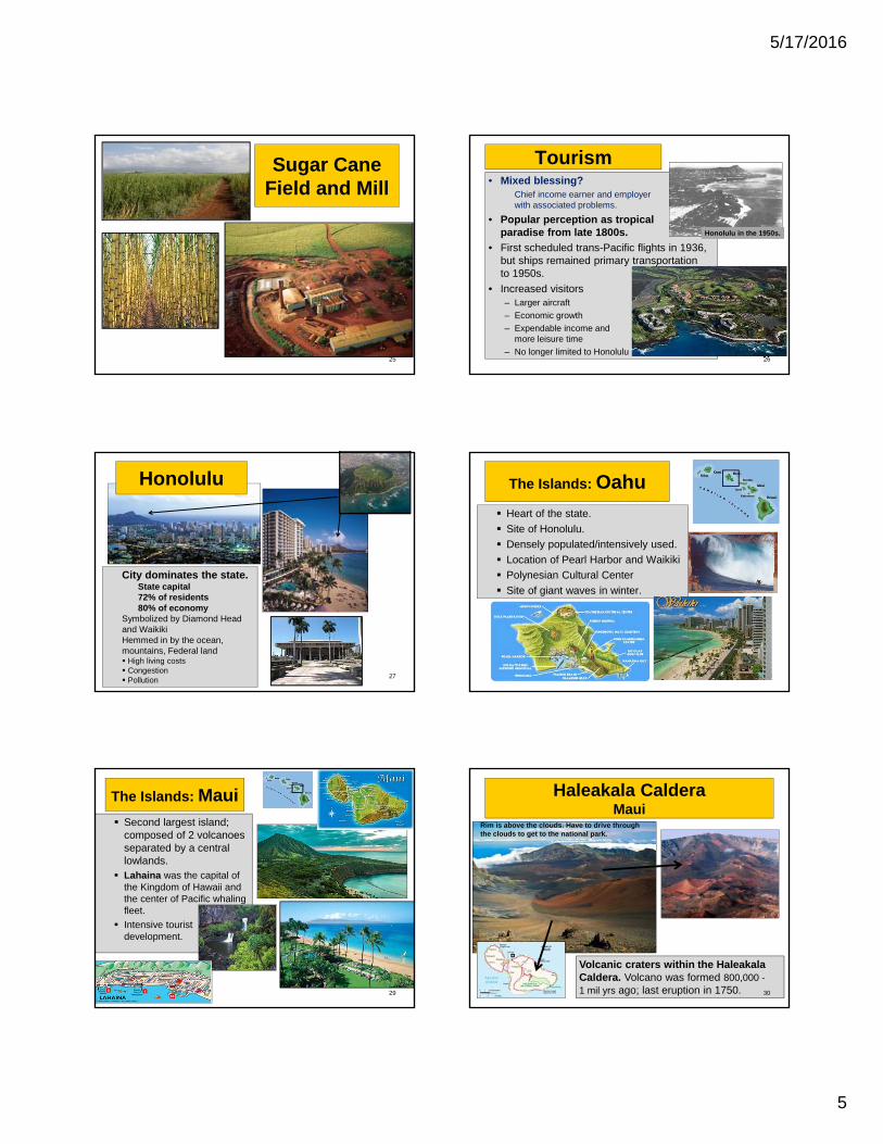
Tourism• Mixed blessing?
Chief income earner and employer with associated problems.
• Popular perception as tropical paradise from late 1800s.
• First scheduled trans-Pacific flights in 1936, but ships remained primary transportation to 1950s.
• Increased visitors– Larger aircraft
– Economic growth
– Expendable income and more leisure time
– No longer limited to Honolulu
Honolulu in the 1950s.
26
City dominates the state.State capital72% of residents80% of economy
Symbolized by Diamond Head and WaikikiHemmed in by the ocean, mountains, Federal land High living costs Congestion Pollution
27
Honolulu The Islands: Oahu
Heart of the state.
Site of Honolulu.
Densely populated/intensively used.
Location of Pearl Harbor and Waikiki
Polynesian Cultural Center
Site of giant waves in winter.
28
The Islands: Maui Second largest island;
composed of 2 volcanoes separated by a central lowlands.
Lahaina was the capital of the Kingdom of Hawaii and the center of Pacific whaling fleet.
Intensive tourist development.
29
Haleakala CalderaMaui
Volcanic craters within the Haleakala Caldera. Volcano was formed 800,000 -1 mil yrs ago; last eruption in 1750. 30
Rim is above the clouds. Have to drive through the clouds to get to the national park.
5/17/2016
6
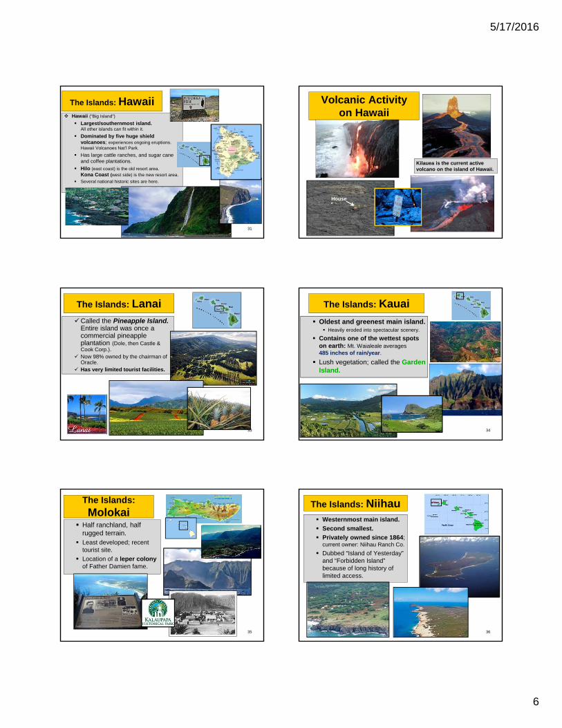
The Islands: Hawaii Hawaii (“Big Island”)
Largest/southernmost island. All other islands can fit within it.
Dominated by five huge shield volcanoes; experiences ongoing eruptions. Hawaii Volcanoes Nat’l Park.
Has large cattle ranches, and sugar cane and coffee plantations.
Hilo (east coast) is the old resort area. Kona Coast (west side) is the new resort area.
Several national historic sites are here.
31
Volcanic Activityon Hawaii
Kilauea is the current active volcano on the island of Hawaii.
House
32
The Islands: LanaiCalled the Pineapple Island.
Entire island was once a commercial pineapple plantation (Dole, then Castle & Cook Corp.).
Now 98% owned by the chairman of Oracle.
Has very limited tourist facilities.
33
The Islands: Kauai
Oldest and greenest main island. Heavily eroded into spectacular scenery.
Contains one of the wettest spots on earth: Mt. Waialeale averages 485 inches of rain/year.
Lush vegetation; called the Garden Island.
34
The Islands:
Molokai Half ranchland, half
rugged terrain. Least developed; recent
tourist site.
Location of a leper colony of Father Damien fame.
35
The Islands: Niihau Westernmost main island.
Second smallest.
Privately owned since 1864; current owner: Niihau Ranch Co.
Dubbed “Island of Yesterday” and “Forbidden Island” because of long history of limited access.
36
5/17/2016
7
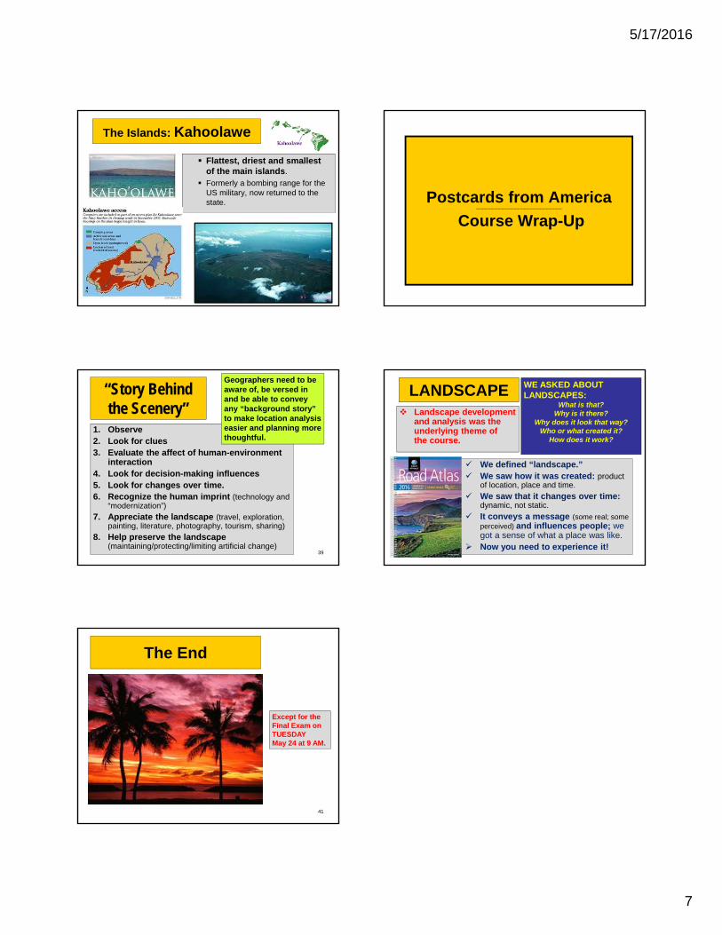
The Islands: Kahoolawe
Flattest, driest and smallest of the main islands.
Formerly a bombing range for the US military, now returned to the state.
37
Postcards from America----------------------------------------------------------------------
Course Wrap-Up
“Story Behind the Scenery”
1. Observe2. Look for clues3. Evaluate the affect of human-environment
interaction4. Look for decision-making influences5. Look for changes over time.6. Recognize the human imprint (technology and
“modernization”)
7. Appreciate the landscape (travel, exploration, painting, literature, photography, tourism, sharing)
8. Help preserve the landscape (maintaining/protecting/limiting artificial change)
39
Geographers need to be aware of, be versed in and be able to convey any “background story” to make location analysis easier and planning more thoughtful.
40
LANDSCAPE Landscape development
and analysis was the underlying theme of the course.
WE ASKED ABOUT LANDSCAPES:
What is that? Why is it there?
Why does it look that way? Who or what created it?
How does it work?
We defined “landscape.” We saw how it was created: product
of location, place and time.
We saw that it changes over time: dynamic, not static.
It conveys a message (some real; some perceived) and influences people; we got a sense of what a place was like.
Now you need to experience it!
The End
Except for the Final Exam on TUESDAYMay 24 at 9 AM.
41