Embed Size (px)
Citation preview
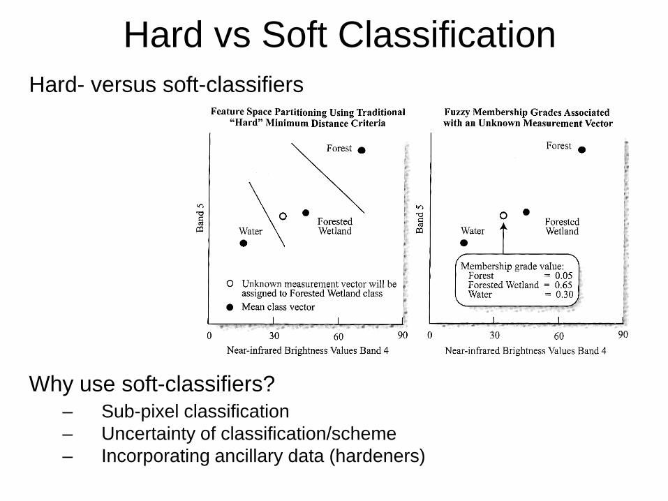
Hard vs Soft ClassificationHard- versus soft-classifiers
Why use soft-classifiers?– Sub-pixel classification– Uncertainty of classification/scheme– Incorporating ancillary data (hardeners)
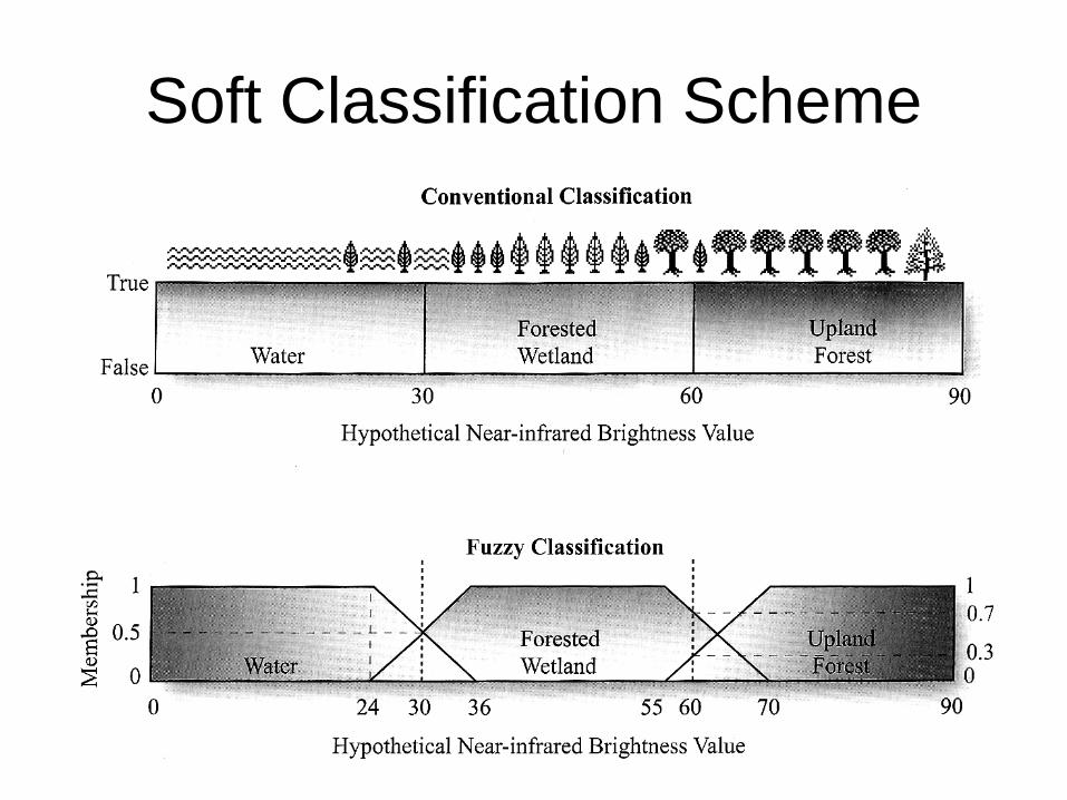
Soft Classification Scheme
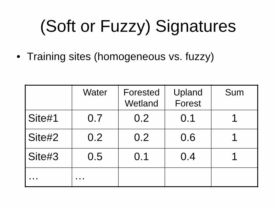
(Soft or Fuzzy) Signatures
• Training sites (homogeneous vs. fuzzy)
Water Forested Wetland
Upland Forest
Sum
Site#1 0.7 0.2 0.1 1
Site#2 0.2 0.2 0.6 1
Site#3 0.5 0.1 0.4 1
… …
•Several hard and soft classification techniques exist for land cover classification. •The hard classification techniques for example, Maximum Likelihood classification (MLC), classify the image on a pixel-basis into different categories. •These algorithms automatically categorize all pixels in an image into land cover classes or themes. •The spectral pattern present within the data for each pixel is used to perform the classification and the spectral pattern present within the data for each pixel is used as the numerical basis for categorization.•MODIS have a spatial resolution of 250 m, 500 m and 1 km.•MODIS pixels, having coarse spatial resolution, contain more than one class or endmember in a single pixel, called mixed pixel, covering more than one land cover type, as is present in reality due to the heterogeneous presence of features on the earth’s surface.•Unmixing of these mixed pixels is required for estimation of individual class representation in the pixel. Spectral unmixing is generally described as a quantitative analysis procedure used to recognize constituent ground cover materials (or endmembers) and obtain their mixing proportions (or abundances) from a mixed pixel. That is, the sub-pixel information of endmembers and their abundances can be obtained through the spectral unmixing process. Hence, land cover mapping can be carried out at a sub-pixel level.
•The spectral unmixing problem has caused concerns and has been investigated extensively for the past two decades.• A general analysis approach for spectral unmixing is first to build a mathematical model of the spectral mixture. Then, based on the mathematical model, certain techniques are applied to implement spectral unmixing.•Two sample mathematical models for spectral unmixing include: linear mixture model (LMM) and nonlinear mixture models (NLMM). •The LMM assumes that each ground cover material only produces a single radiance, and the mixed spectrum is a linear combination of ground cover radiance spectra.•The NLMM takes into account the multiple radiances of the ground cover materials, and thus the mixture is no longer linear. The NLMM typically has a relatively more accurate simulation of physical phenomena, but the model is usually complicated and application dependent. Typically there is not a simple and generic NLMM that can be utilized in various spectral unmixing applications. This disadvantage of the NLMM greatly limits its extensive application. •In contrast, the LMM is simpler and more generic, and it has been proven successful in various remote sensing applications, such as geological applications and forest studies.
•It is because of the advantage of simplicity and generality that the LMM has become a dominant mathematical model for the spectral unmixing analysis. •Another major reason why the LMM has been broadly accepted for the spectral unmixing analysis is that the linear mixture assumption allows many mature mathematical skills and algorithms, such as least squares estimation (LSE), to be easily applied to the spectral unmixing problem. •One requirement for implementing the abundance estimation using the LSE method is that the number of spectral bands must be greater than the number of endmembers. This is called the “condition of identifiability”. •To a certain extent, the “condition of identifiability” limits the use of multispectral data for the linear spectral unmixing problem. Multispectral data typically have only a few spectral bands. Thus, when the number of endmembers increases, the “condition of identifiability” no longer holds and the LSE method fails. •One solution to this problem is to utilize hyperspectral data, which typically have high number of spectral bands (MODIS - 36 Bands). The problem of “condition of identifiability” seems to be easily solved by utilizing hyperspectral data
•Another soft classifier: is a linear spectral unmixing classifier and it characterizes the scene being processed by a carefully selected set of n representative scene materials, where n is less than or equal to the number of spectral bands in the sensor. Each image pixel is assumed to be some mixture of these n component materials. •The user is asked to select and create training sets for the n component materials. The process then reports the fraction of each component material in each pixel. The output takes the form of a set of n fraction planes, with each fraction plane reporting the amount (fraction)of one of the component materials in each pixel.•In contrast, IMAGINE Subpixel Classifier characterizes the scene being processed by the amount (fraction) of one specific material, rather than n materials, in each image pixel. •The user is asked to create a training set for only one specific material of interest, not for n scene-characteristic materials. The process performs a search for that specific material in each pixel, and it reports the amount of material it finds.•The output takes the form of a single fraction plane for the material of interest, rather than n fraction planes for n characteristic scene materials. If the user wishes to classify more than one material, the process is repeated for each material.
•The linear spectral unmixing approach has been found to have utility only for imagedata with five or more spectral bands. This is because each pixel is modeled as some combination of n scene materials, and n cannot exceed the number of sensor bands. One of these materials is typically set aside for “shade,” requiring that the scene be represented by only n - 1 representative materials.
•Except for the most uniform of scenes, such as desert and snow-covered scenes,fewer than four materials is generally an inadequate representation. Among thecommon multispectral sensors, Landsat Thematic Mapper imagery can be effectivelyused, but SPOT, the Indian IRS sensor, and Landsat Multispectral Scanner imagerygenerally cannot be used. Hyperspectral sensor imagery can be used, but it has been found that the practical upper limit to n is 6 - 8, even though this is well below the theoretical number of materials that could be used with hyperspectral image data.
•IMAGINE Subpixel Classifier can be used with any of the common multispectral andhyperspectral sensors. The number of spectral bands affects the minimum amountof material that can be detected in a pixel, but the process can be used effectivelywith sensors having three or more spectral bands.
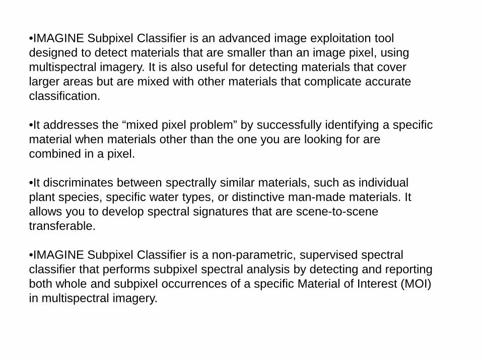
•IMAGINE Subpixel Classifier is an advanced image exploitation tool designed to detect materials that are smaller than an image pixel, using multispectral imagery. It is also useful for detecting materials that cover larger areas but are mixed with other materials that complicate accurate classification.
•It addresses the “mixed pixel problem” by successfully identifying a specific material when materials other than the one you are looking for are combined in a pixel.
•It discriminates between spectrally similar materials, such as individual plant species, specific water types, or distinctive man-made materials. It allows you to develop spectral signatures that are scene-to-scene transferable.
•IMAGINE Subpixel Classifier is a non-parametric, supervised spectral classifier that performs subpixel spectral analysis by detecting and reporting both whole and subpixel occurrences of a specific Material of Interest (MOI) in multispectral imagery.
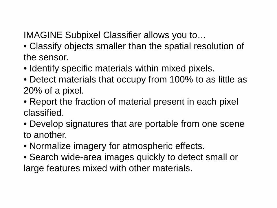
IMAGINE Subpixel Classifier allows you to…• Classify objects smaller than the spatial resolution of the sensor.• Identify specific materials within mixed pixels.• Detect materials that occupy from 100% to as little as 20% of a pixel.• Report the fraction of material present in each pixel classified.• Develop signatures that are portable from one scene to another.• Normalize imagery for atmospheric effects.• Search wide-area images quickly to detect small or large features mixed with other materials.
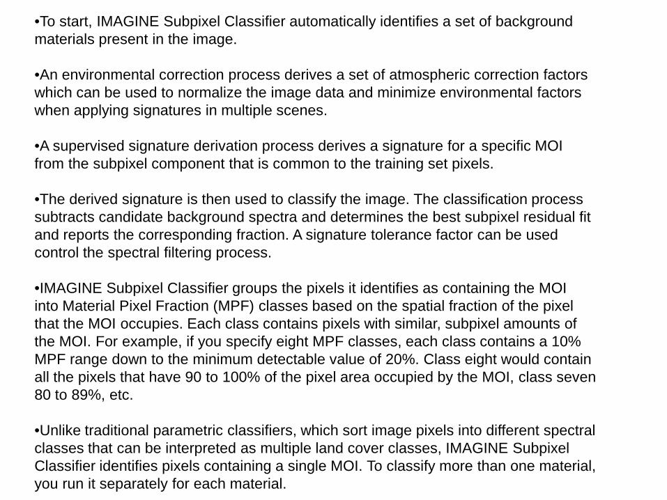
•To start, IMAGINE Subpixel Classifier automatically identifies a set of backgroundmaterials present in the image.
•An environmental correction process derives a set of atmospheric correction factors which can be used to normalize the image data and minimize environmental factors when applying signatures in multiple scenes.
•A supervised signature derivation process derives a signature for a specific MOIfrom the subpixel component that is common to the training set pixels.
•The derived signature is then used to classify the image. The classification process subtracts candidate background spectra and determines the best subpixel residual fit and reports the corresponding fraction. A signature tolerance factor can be used control the spectral filtering process.
•IMAGINE Subpixel Classifier groups the pixels it identifies as containing the MOIinto Material Pixel Fraction (MPF) classes based on the spatial fraction of the pixelthat the MOI occupies. Each class contains pixels with similar, subpixel amounts ofthe MOI. For example, if you specify eight MPF classes, each class contains a 10%MPF range down to the minimum detectable value of 20%. Class eight would containall the pixels that have 90 to 100% of the pixel area occupied by the MOI, class seven80 to 89%, etc.
•Unlike traditional parametric classifiers, which sort image pixels into different spectralclasses that can be interpreted as multiple land cover classes, IMAGINE SubpixelClassifier identifies pixels containing a single MOI. To classify more than one material,you run it separately for each material.
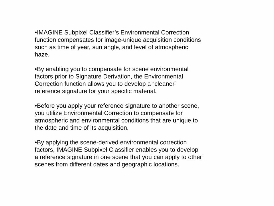
•IMAGINE Subpixel Classifier’s Environmental Correction function compensates for image-unique acquisition conditions such as time of year, sun angle, and level of atmospheric haze.
•By enabling you to compensate for scene environmental factors prior to Signature Derivation, the Environmental Correction function allows you to develop a “cleaner” reference signature for your specific material.
•Before you apply your reference signature to another scene, you utilize Environmental Correction to compensate for atmospheric and environmental conditions that are unique to the date and time of its acquisition.
•By applying the scene-derived environmental correction factors, IMAGINE Subpixel Classifier enables you to develop a reference signature in one scene that you can apply to other scenes from different dates and geographic locations.
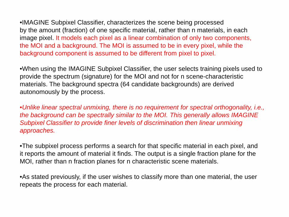
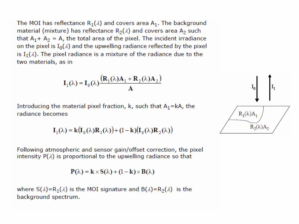
•IMAGINE Subpixel Classifier, characterizes the scene being processedby the amount (fraction) of one specific material, rather than n materials, in eachimage pixel. It models each pixel as a linear combination of only two components,the MOI and a background. The MOI is assumed to be in every pixel, while thebackground component is assumed to be different from pixel to pixel.
•When using the IMAGINE Subpixel Classifier, the user selects training pixels used to provide the spectrum (signature) for the MOI and not for n scene-characteristic materials. The background spectra (64 candidate backgrounds) are derived autonomously by the process.
•Unlike linear spectral unmixing, there is no requirement for spectral orthogonality, i.e., the background can be spectrally similar to the MOI. This generally allows IMAGINE Subpixel Classifier to provide finer levels of discrimination then linear unmixingapproaches.
•The subpixel process performs a search for that specific material in each pixel, andit reports the amount of material it finds. The output is a single fraction plane for theMOI, rather than n fraction planes for n characteristic scene materials.
•As stated previously, if the user wishes to classify more than one material, the user repeats the process for each material.
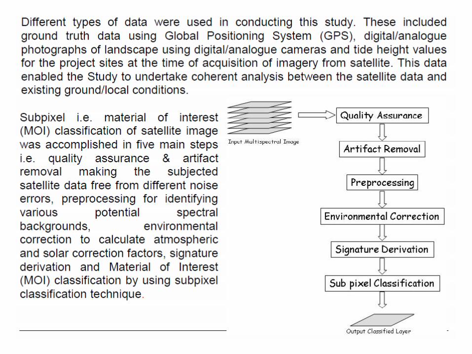
IMAGINE Subpixel Classifier Process•IMAGINE Subpixel Classifier consists of one optional and four required processingfunctions. Quality Assurance is optional. Preprocessing, Environmental Correction, Signature Derivation, and MOI Classification are required functions. Each plays an important role in the development and application of subpixel signature derivation and classification. You must run each in the order described.
Data Quality Assurance•Quality assurance is an optional automatic artifact removal process that identifies and removes data artifacts commonly found in Landsat and other imagery. This process improves the reliability of the results and saves manual labor. •A utility is also provided to check images for the occurrence of Duplicate Line Artifacts (DLAs). These sometimes occur when a row of recorded satellite information is duplicated during resampling by the data supplier to fill gaps in data. Depending on their frequency and location, DLAs may compromise the integrity of the image or the classification results.
Preprocessing•Preprocessing is the first required process. It automatically surveys the image togenerate candidate backgrounds which are compared to image pixel in the scene.These candidate backgrounds are used during Signature Derivation and MOIClassification to generate a residual for each pixel that is a candidate MOI spectrum.There are no results to view from Preprocessing.
Environmental Correction•Environmental Correction prepares imagery for Signature Derivation and MOIClassification. It automatically calculates a set of factors to compensate for variationsin atmospheric and environmental conditions during image acquisition. The finaloutput is a file containing environmental correction factors that are applied to animage during Signature Derivation and MOI Classification.•By compensating for atmospheric and environmental variations, signatures developed using IMAGINE Subpixel Classifier may be applied to scenes of differing dates and geographic regions, making the signature scene-to-scene transferable. Environmental correction is also needed for in-scene situations, since the energy detected by the sensor is not the same as the energy actually reflected from the MOI due to atmospheric scattering, absorption by water vapor, and other atmospheric distortions.
Signature Derivation•The Signature Derivation function allows you to develop an IMAGINE SubpixelClassifier signature for a particular MOI. The signature contains not only the materialreflectance spectrum but also additional information required for subpixelclassification and scene-to-scene use.

Signature Derivation•You derive a signature using a training set defined by an IMAGINE Area of Interest(AOI) tool; or by a classification derived using a traditional IMAGINE classificationtool, together with the source image, an environmental correction file, and the MPFin the training set.•You can develop an IMAGINE Subpixel Classifier signature using either a whole-pixelor subpixel training set. The Signature Derivation process extracts the subpixel partof the material signature that is common to all pixels in the training set. The resultingsignature is equivalent to a whole pixel signature of that common material. Therefore,regardless of the training set you use, the signature you develop can classify the MOIat either wholepixel or subpixel levels.
MOI Classification•The last step in the IMAGINE Subpixel Classifier process is MOI Classification.The function applies a spectral signature to an image to locate pixels containing theMOI. Inputs include the image, preprocessing output file, environmental correctionfile, signature file, and a signature tolerance number to control the number of falsedetections.•Output from MOI Classification is an overlay image that contains the detectedlocations of the MOI. The classification output may be displayed using an IMAGINEViewer. The total number of pixels detected and the MPF for each pixel classified arereported in the IMAGINE Raster Attribute Editor histogram.

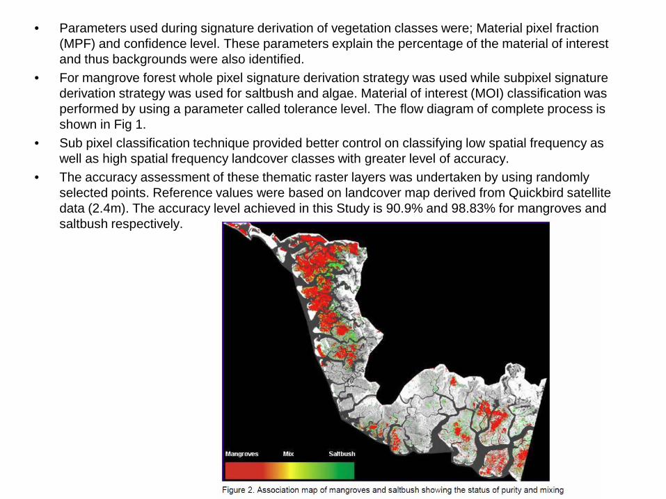
• Parameters used during signature derivation of vegetation classes were; Material pixel fraction (MPF) and confidence level. These parameters explain the percentage of the material of interest and thus backgrounds were also identified.
• For mangrove forest whole pixel signature derivation strategy was used while subpixel signature derivation strategy was used for saltbush and algae. Material of interest (MOI) classification was performed by using a parameter called tolerance level. The flow diagram of complete process is shown in Fig 1.
• Sub pixel classification technique provided better control on classifying low spatial frequency as well as high spatial frequency landcover classes with greater level of accuracy.
• The accuracy assessment of these thematic raster layers was undertaken by using randomly selected points. Reference values were based on landcover map derived from Quickbird satellite data (2.4m). The accuracy level achieved in this Study is 90.9% and 98.83% for mangroves and saltbush respectively.
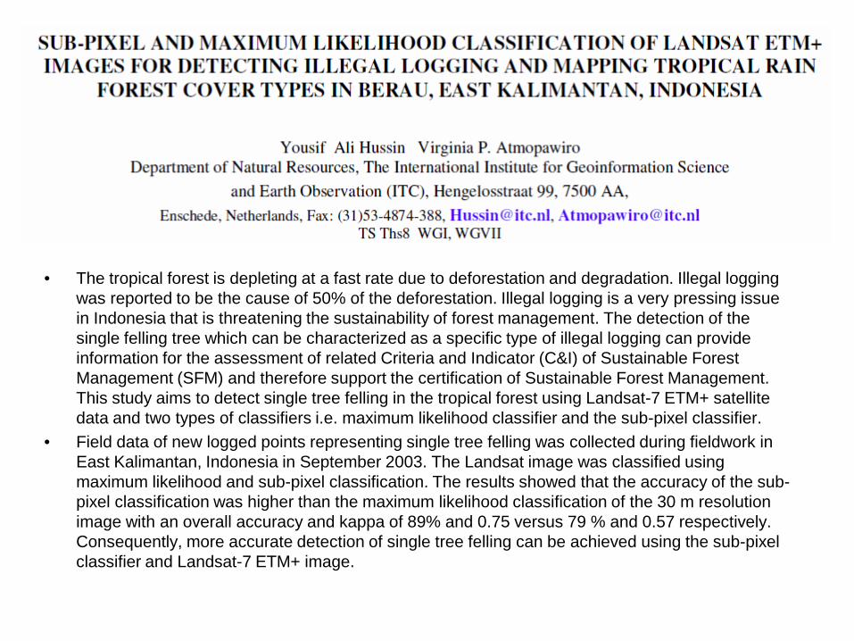
• The tropical forest is depleting at a fast rate due to deforestation and degradation. Illegal logging was reported to be the cause of 50% of the deforestation. Illegal logging is a very pressing issue in Indonesia that is threatening the sustainability of forest management. The detection of the single felling tree which can be characterized as a specific type of illegal logging can provide information for the assessment of related Criteria and Indicator (C&I) of Sustainable Forest Management (SFM) and therefore support the certification of Sustainable Forest Management. This study aims to detect single tree felling in the tropical forest using Landsat-7 ETM+ satellite data and two types of classifiers i.e. maximum likelihood classifier and the sub-pixel classifier.
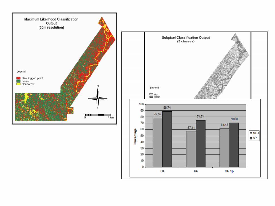
• Field data of new logged points representing single tree felling was collected during fieldwork in East Kalimantan, Indonesia in September 2003. The Landsat image was classified using maximum likelihood and sub-pixel classification. The results showed that the accuracy of the sub-pixel classification was higher than the maximum likelihood classification of the 30 m resolution image with an overall accuracy and kappa of 89% and 0.75 versus 79 % and 0.57 respectively. Consequently, more accurate detection of single tree felling can be achieved using the sub-pixel classifier and Landsat-7 ETM+ image.


![Hard [numbers, plans] is Soft. Soft [people/relationships] is Hard](https://img.pdfslide.us/doc/110x75/56812cee550346895d91b5a6/hard-numbers-plans-is-soft-soft-peoplerelationships-is-hard.jpg)