Embed Size (px)
Citation preview
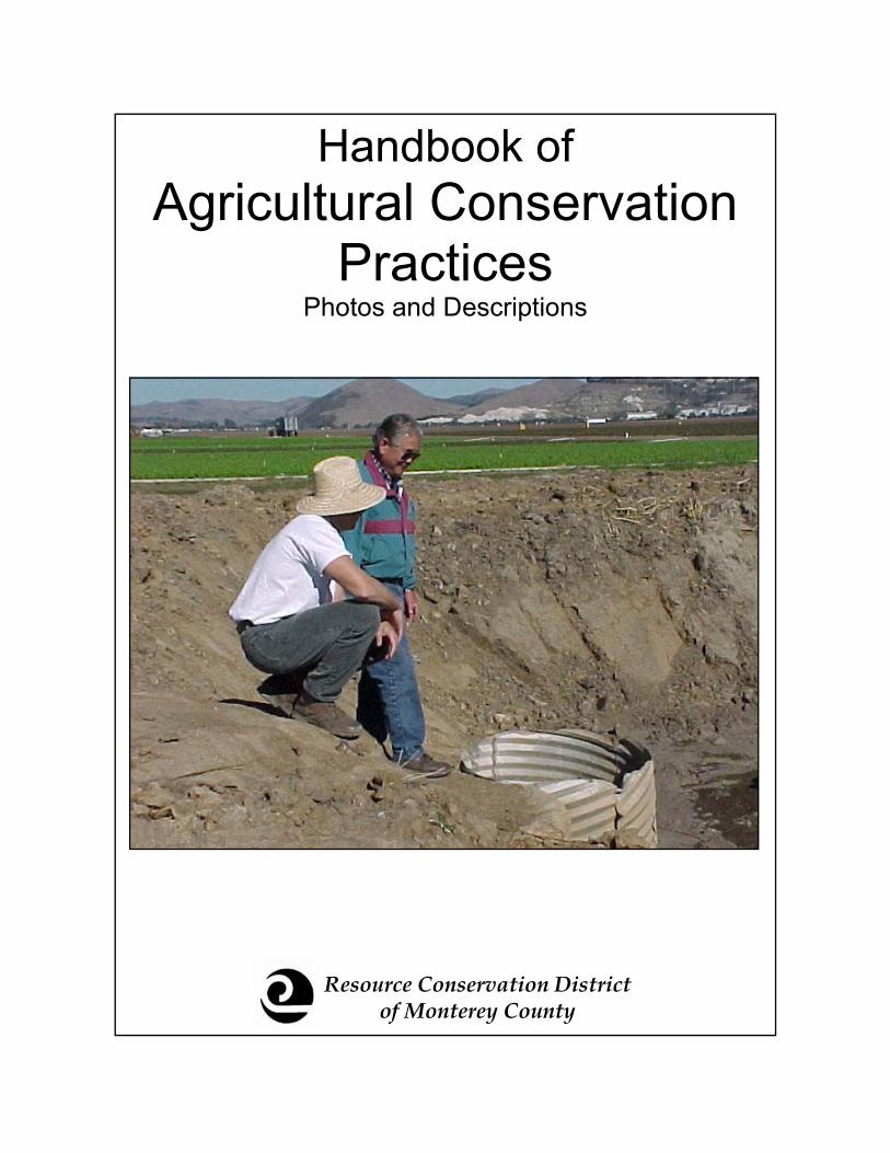
Resource Conservation District of Monterey County
Handbook of Agricultural Conservation
Practices Photos and Descriptions
Handbook of Agricultural Conservation Practices
Photos and Descriptions
1st Edition, Spring 2003
Designed and edited by Alicia Parker. Many thanks to all those who provided support and generously offered their
time to review and provide comments and suggestions throughout the production of this booklet.
For additional copies, please contract:
Resource Conservation District of Monterey County 744 La Guardia Street, Building A
Salinas, CA 93905 Phone: 831-424-1036 ext. 124
Fax: 831-424-7289 Email: [email protected]
Table of Contents Engineered * Introduction 5 Grade Stabilization Structure 7 Row Arrangement 8 Stream Bank Protection 9 Tailwater Recovery System 10 Underground Outlets 11 Vegetated Waterway 12 Water and Sediment Control Basin 13 Non-Engineered * Cover Crops 14 Critical Area Planting 15 Filter Strips 16 Hedgerow 17 Irrigation Water Management 18 Nutrient Management 19 Road Seeding 21 Cattle Trough 20 Fence 22 Technical Assistance Contacts 23 *Individual practices must meet minimum standards and comply with local laws and regulations

Introduction Agriculture on the Central Coast is the foundation of this region’s economy, with
agricultural products totaling approximately $3 billion dollars annually and exports reaching
over 50 countries world wide. Agriculture provides jobs for thousands of local residents.
Numerous threats to agricultural resource sustainability exist including impaired water
quality associated with nonpoint source pollution such as nutrient, sediment and pesticide
loading.
The Monterey Bay National Marine Sanctuary Action Plan IV: Agricultural and Rural
Lands is the product of collaboration between numerous landowners, growers and federal,
state and local agencies to address water quality and resource sustainability concerns on the
Central Coast. This handbook is a product of section two of this plan, which calls for the
compilation and distribution of a Technical Tool-Kit of information. This handbook is a
compilation of 16 commonly recommended conservation practices, however, is not an ex-
haustive list of conservation practices used to improve resource management.
The information presented in this handbook is meant as a first step to exploring resource
conservation management options. It is not intended as a how to manual. Serious property
damage, injury or death may result from installing an engineered practice without a design
signed by an engineer. Details and assistance for implementing conservation practices are
available at your local resource conservation agencies such as the Resource Conservation
District of Monterey County and the USDA Natural Resource Conservation Service, both of
which are non-regulatory agencies providing free services.


Grade Stabilization Structure
Gully head cut
Repaired landscape after grade stabilization structure installation
Definition: Grade stabilization structures are used to control the grade and head cutting in earthen channels.
Purpose: To safely convey water from the top of a headcut to a stable outlet for maximum grade stabilization structural integrity.
Criteria: The structure must be designed for stability. The outlet must be designed and built to prevent damage to the structure, or downstream areas.
*This is not intended as a how to guide. Individual practices must meet minimum standards and comply with local laws and regulations.
For more information contact your local RCD or NRCS office.
1
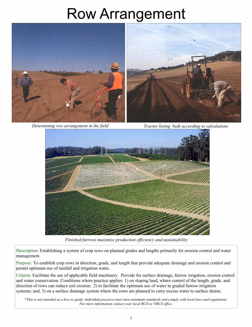
Row Arrangement
Determining row arrangement in the field Tractor listing beds according to calculations
Finished furrows maximize production efficiency and sustainability
Description: Establishing a system of crop rows on planned grades and lengths primarily for erosion control and water management.
Purpose: To establish crop rows in direction, grade, and length that provide adequate drainage and erosion control and permit optimum use of rainfall and irrigation water.
Criteria: Facilitate the use of applicable field machinery. Provide for surface drainage, furrow irrigation, erosion control and water conservation. Conditions where practice applies: 1) on sloping land, where control of the length, grade, and direction of rows can reduce soil erosion; 2) to facilitate the optimum use of water in graded furrow irrigation systems; and, 3) on a surface drainage system where the rows are planned to carry excess water to surface drains.
*This is not intended as a how to guide. Individual practices must meet minimum standards and comply with local laws and regulations. For more information contact your local RCD or NRCS office.
1
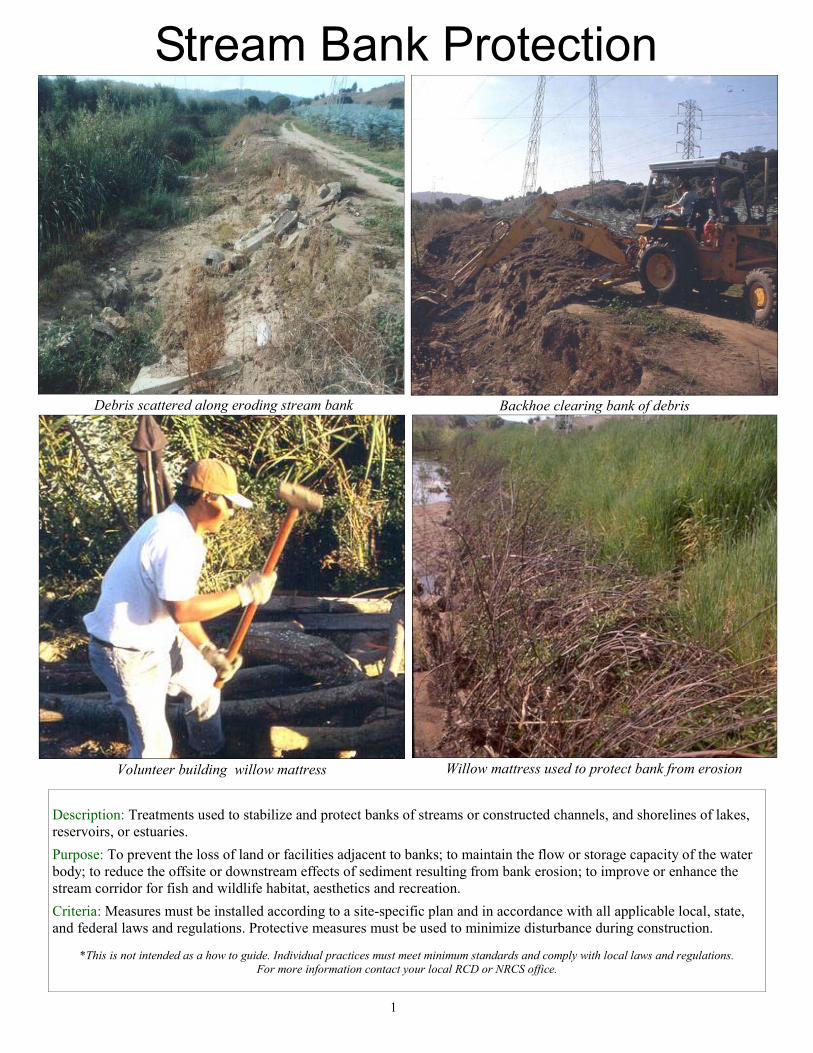
Debris scattered along eroding stream bank Backhoe clearing bank of debris
Volunteer building willow mattress
Description: Treatments used to stabilize and protect banks of streams or constructed channels, and shorelines of lakes, reservoirs, or estuaries.
Purpose: To prevent the loss of land or facilities adjacent to banks; to maintain the flow or storage capacity of the water body; to reduce the offsite or downstream effects of sediment resulting from bank erosion; to improve or enhance the stream corridor for fish and wildlife habitat, aesthetics and recreation.
Criteria: Measures must be installed according to a site-specific plan and in accordance with all applicable local, state, and federal laws and regulations. Protective measures must be used to minimize disturbance during construction.
*This is not intended as a how to guide. Individual practices must meet minimum standards and comply with local laws and regulations.
For more information contact your local RCD or NRCS office.
1
Willow mattress used to protect bank from erosion
Stream Bank Protection
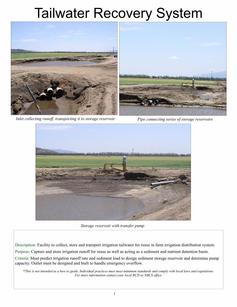
Description: Facility to collect, store and transport irrigation tailwater for reuse in farm irrigation distribution system.
Purpose: Capture and store irrigation runoff for reuse as well as acting as a sediment and nutrient detention basin.
Criteria: Must predict irrigation runoff rate and sediment load to design sediment storage reservoir and determine pump capacity. Outlet must be designed and built to handle emergency overflow.
*This is not intended as a how to guide. Individual practices must meet minimum standards and comply with local laws and regulations.
For more information contact your local RCD or NRCS office.
1
Inlet collecting runoff, transporting it to storage reservoir
Storage reservoir with transfer pump
Pipe connecting series of storage reservoirs
Tailwater Recovery System
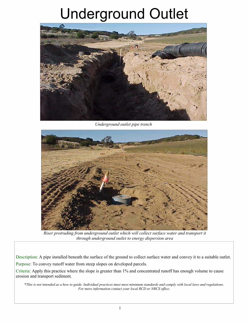
Underground Outlet
Underground outlet pipe trench
Riser protruding from underground outlet which will collect surface water and transport it through underground outlet to energy dispersion area
Description: A pipe installed beneath the surface of the ground to collect surface water and convey it to a suitable outlet.
Purpose: To convey runoff water from steep slopes on developed parcels.
Criteria: Apply this practice where the slope is greater than 1% and concentrated runoff has enough volume to cause erosion and transport sediment.
*This is not intended as a how to guide. Individual practices must meet minimum standards and comply with local laws and regulations.
For more information contact your local RCD or NRCS office.
1
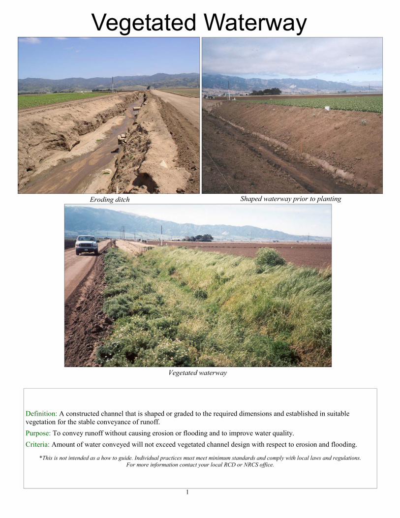
Definition: A constructed channel that is shaped or graded to the required dimensions and established in suitable vegetation for the stable conveyance of runoff.
Purpose: To convey runoff without causing erosion or flooding and to improve water quality.
Criteria: Amount of water conveyed will not exceed vegetated channel design with respect to erosion and flooding.
*This is not intended as a how to guide. Individual practices must meet minimum standards and comply with local laws and regulations. For more information contact your local RCD or NRCS office.
1
Vegetated waterway
Shaped waterway prior to planting Eroding ditch
Vegetated Waterway
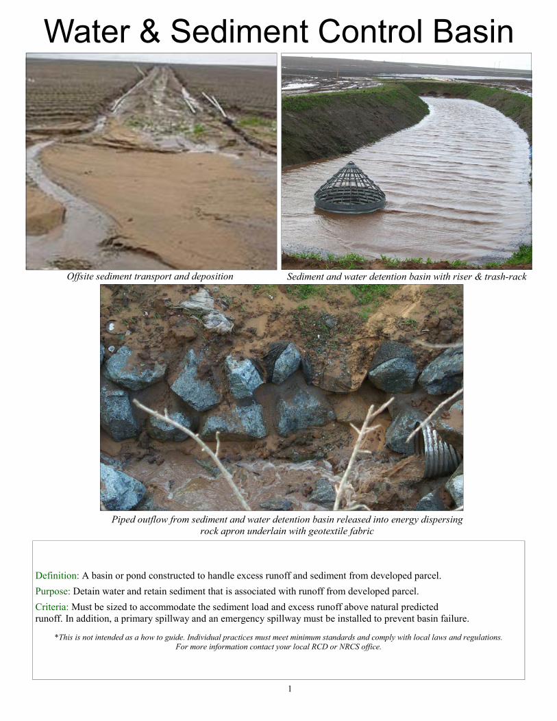
Sediment and water detention basin with riser & trash-rack
Piped outflow from sediment and water detention basin released into energy dispersing rock apron underlain with geotextile fabric
Offsite sediment transport and deposition
Water & Sediment Control Basin
Definition: A basin or pond constructed to handle excess runoff and sediment from developed parcel.
Purpose: Detain water and retain sediment that is associated with runoff from developed parcel.
Criteria: Must be sized to accommodate the sediment load and excess runoff above natural predicted runoff. In addition, a primary spillway and an emergency spillway must be installed to prevent basin failure.
*This is not intended as a how to guide. Individual practices must meet minimum standards and comply with local laws and regulations.
For more information contact your local RCD or NRCS office.
1
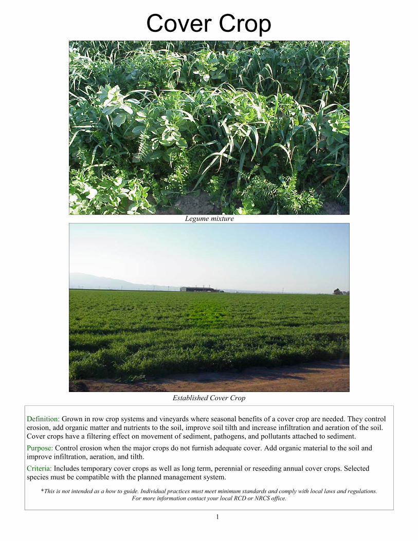
Cover Crop
Legume mixture
Established Cover Crop
Definition: Grown in row crop systems and vineyards where seasonal benefits of a cover crop are needed. They control erosion, add organic matter and nutrients to the soil, improve soil tilth and increase infiltration and aeration of the soil. Cover crops have a filtering effect on movement of sediment, pathogens, and pollutants attached to sediment.
Purpose: Control erosion when the major crops do not furnish adequate cover. Add organic material to the soil and improve infiltration, aeration, and tilth.
Criteria: Includes temporary cover crops as well as long term, perennial or reseeding annual cover crops. Selected species must be compatible with the planned management system.
*This is not intended as a how to guide. Individual practices must meet minimum standards and comply with local laws and regulations. For more information contact your local RCD or NRCS office.
1
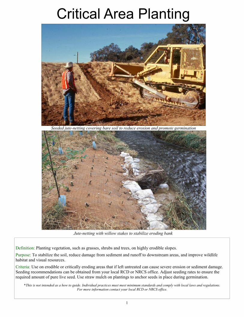
Critical Area Planting
Seeded jute-netting covering bare soil to reduce erosion and promote germination
Jute-netting with willow stakes to stabilize eroding bank
Definition: Planting vegetation, such as grasses, shrubs and trees, on highly erodible slopes.
Purpose: To stabilize the soil, reduce damage from sediment and runoff to downstream areas, and improve wildlife habitat and visual resources.
Criteria: Use on erodible or critically eroding areas that if left untreated can cause severe erosion or sediment damage. Seeding recommendations can be obtained from your local RCD or NRCS office. Adjust seeding rates to ensure the required amount of pure live seed. Use straw mulch on plantings to anchor seeds in place during germination.
*This is not intended as a how to guide. Individual practices must meet minimum standards and comply with local laws and regulations.
For more information contact your local RCD or NRCS office.
1
Filter Strip
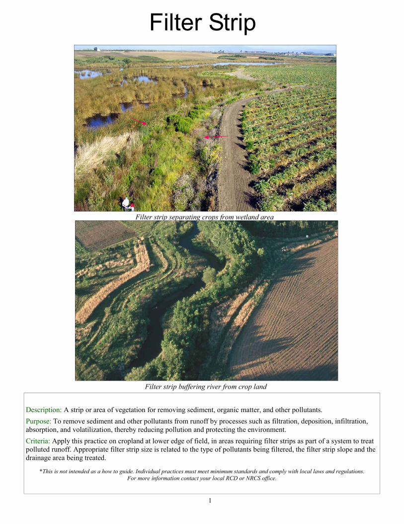
Filter strip separating crops from wetland area
Description: A strip or area of vegetation for removing sediment, organic matter, and other pollutants.
Purpose: To remove sediment and other pollutants from runoff by processes such as filtration, deposition, infiltration, absorption, and volatilization, thereby reducing pollution and protecting the environment.
Criteria: Apply this practice on cropland at lower edge of field, in areas requiring filter strips as part of a system to treat polluted runoff. Appropriate filter strip size is related to the type of pollutants being filtered, the filter strip slope and the drainage area being treated.
*This is not intended as a how to guide. Individual practices must meet minimum standards and comply with local laws and regulations. For more information contact your local RCD or NRCS office.
1
Filter strip buffering river from crop land
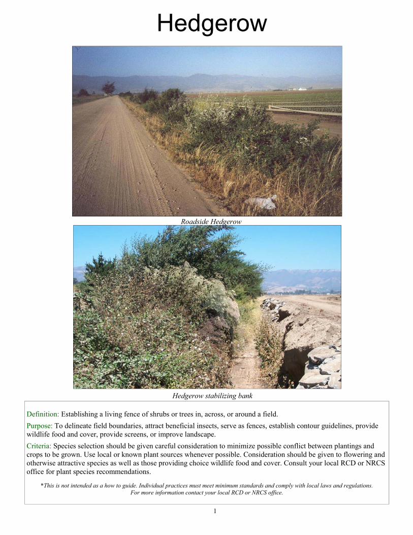
Hedgerow
Roadside Hedgerow
Hedgerow stabilizing bank
Definition: Establishing a living fence of shrubs or trees in, across, or around a field.
Purpose: To delineate field boundaries, attract beneficial insects, serve as fences, establish contour guidelines, provide wildlife food and cover, provide screens, or improve landscape.
Criteria: Species selection should be given careful consideration to minimize possible conflict between plantings and crops to be grown. Use local or known plant sources whenever possible. Consideration should be given to flowering and otherwise attractive species as well as those providing choice wildlife food and cover. Consult your local RCD or NRCS office for plant species recommendations.
*This is not intended as a how to guide. Individual practices must meet minimum standards and comply with local laws and regulations. For more information contact your local RCD or NRCS office.
1
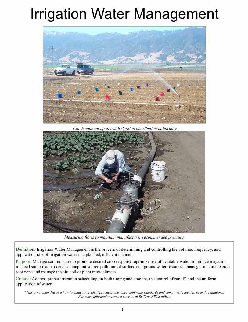
Definition: Irrigation Water Management is the process of determining and controlling the volume, frequency, and application rate of irrigation water in a planned, efficient manner.
Purpose: Manage soil moisture to promote desired crop response, optimize use of available water, minimize irrigation induced soil erosion, decrease nonpoint source pollution of surface and groundwater resources, manage salts in the crop root zone and manage the air, soil or plant microclimate.
Criteria: Address proper irrigation scheduling, in both timing and amount, the control of runoff, and the uniform application of water.
*This is not intended as a how to guide. Individual practices must meet minimum standards and comply with local laws and regulations. For more information contact your local RCD or NRCS office.
1
Catch cans set up to test irrigation distribution uniformity
Measuring flows to maintain manufacturer recommended pressure
Irrigation Water Management
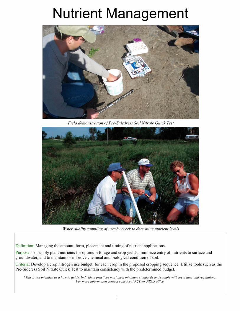
Definition: Managing the amount, form, placement and timing of nutrient applications.
Purpose: To supply plant nutrients for optimum forage and crop yields, minimize entry of nutrients to surface and groundwater, and to maintain or improve chemical and biological condition of soil.
Criteria: Develop a crop nitrogen use budget for each crop in the proposed cropping sequence. Utilize tools such as the Pre-Sideress Soil Nitrate Quick Test to maintain consistency with the predetermined budget.
*This is not intended as a how to guide. Individual practices must meet minimum standards and comply with local laws and regulations.
For more information contact your local RCD or NRCS office.
1
Field demonstration of Pre-Sidedress Soil Nitrate Quick Test
Water quality sampling of nearby creek to determine nutrient levels
Nutrient Management
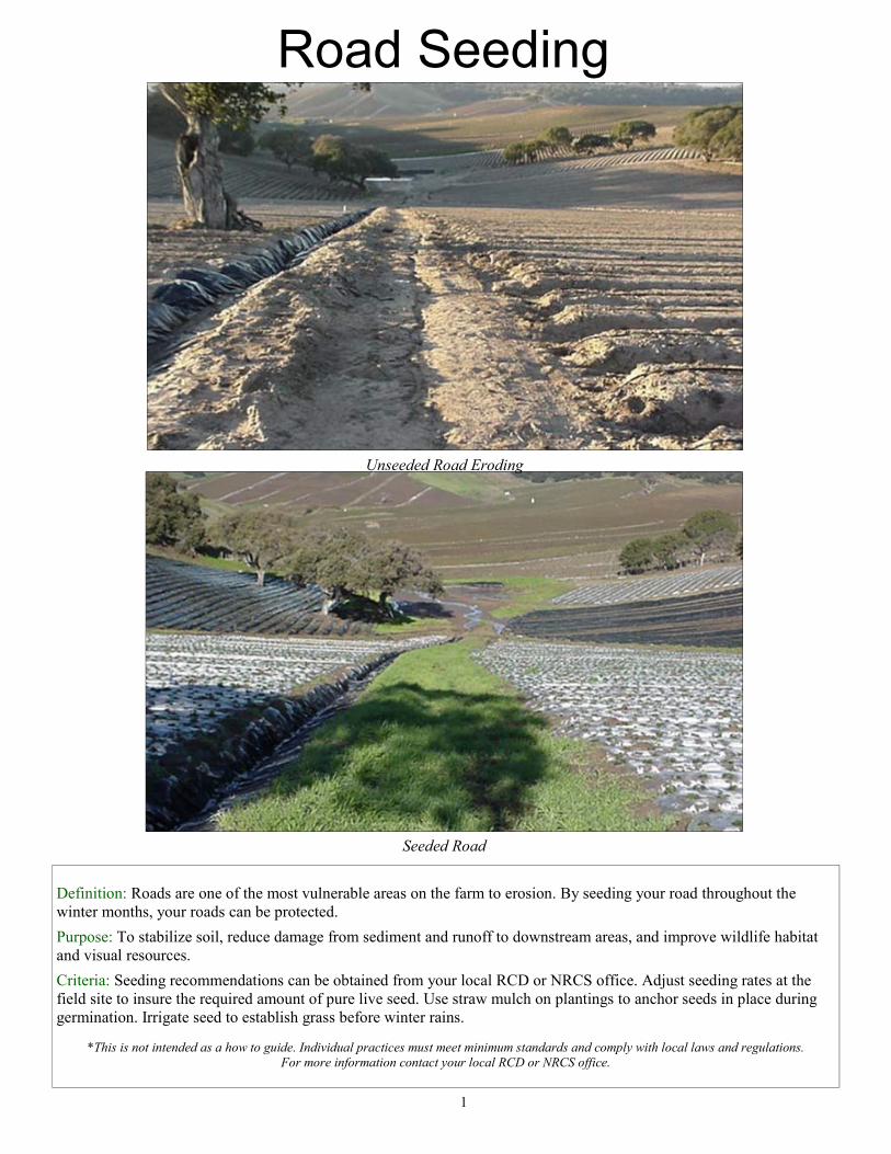
Road Seeding
Seeded Road
Unseeded Road Eroding
Definition: Roads are one of the most vulnerable areas on the farm to erosion. By seeding your road throughout the winter months, your roads can be protected.
Purpose: To stabilize soil, reduce damage from sediment and runoff to downstream areas, and improve wildlife habitat and visual resources.
Criteria: Seeding recommendations can be obtained from your local RCD or NRCS office. Adjust seeding rates at the field site to insure the required amount of pure live seed. Use straw mulch on plantings to anchor seeds in place during germination. Irrigate seed to establish grass before winter rains.
*This is not intended as a how to guide. Individual practices must meet minimum standards and comply with local laws and regulations. For more information contact your local RCD or NRCS office.
1
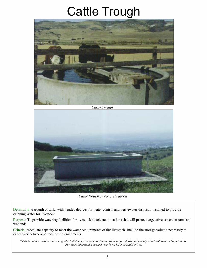
Definition: A trough or tank, with needed devices for water control and wastewater disposal, installed to provide drinking water for livestock
Purpose: To provide watering facilities for livestock at selected locations that will protect vegetative cover, streams and wetlands
Criteria: Adequate capacity to meet the water requirements of the livestock. Include the storage volume necessary to carry over between periods of replenishments.
*This is not intended as a how to guide. Individual practices must meet minimum standards and comply with local laws and regulations. For more information contact your local RCD or NRCS office.
1
Cattle Trough
Cattle Trough
Cattle trough on concrete apron
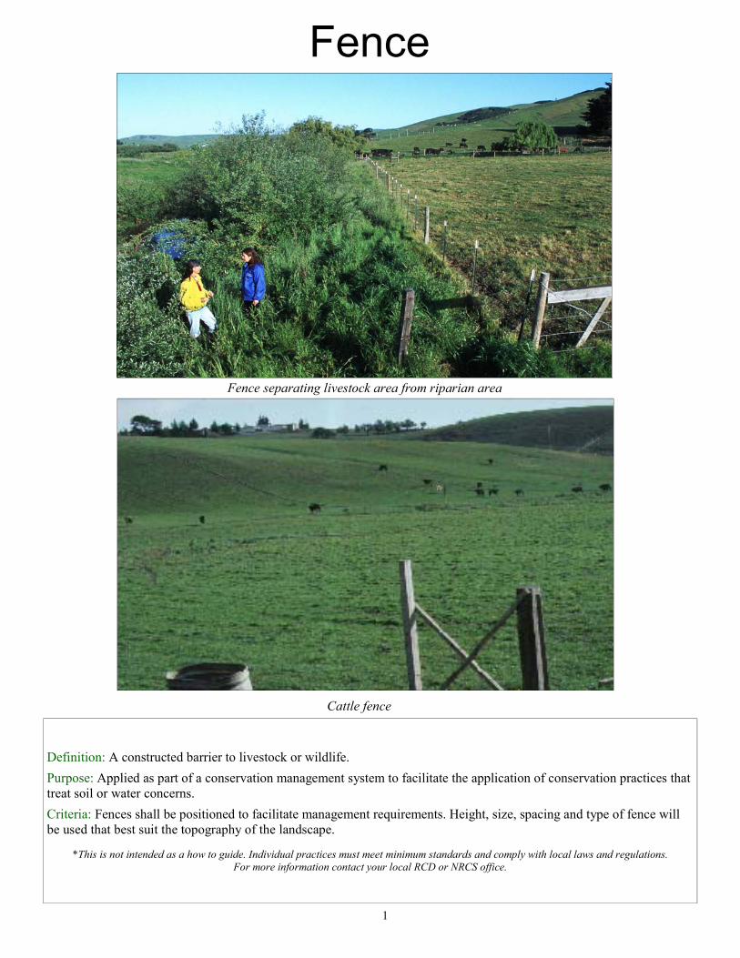
Fence separating livestock area from riparian area
Fence
Definition: A constructed barrier to livestock or wildlife.
Purpose: Applied as part of a conservation management system to facilitate the application of conservation practices that treat soil or water concerns.
Criteria: Fences shall be positioned to facilitate management requirements. Height, size, spacing and type of fence will be used that best suit the topography of the landscape.
*This is not intended as a how to guide. Individual practices must meet minimum standards and comply with local laws and regulations.
For more information contact your local RCD or NRCS office.
1
Cattle fence
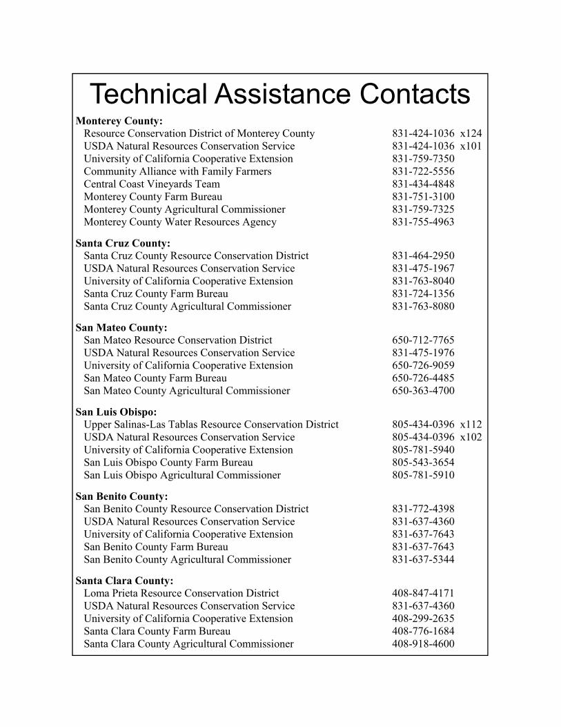
Technical Assistance Contacts
Monterey County: Resource Conservation District of Monterey County 831-424-1036 x124 USDA Natural Resources Conservation Service 831-424-1036 x101 University of California Cooperative Extension 831-759-7350 Community Alliance with Family Farmers 831-722-5556 Central Coast Vineyards Team 831-434-4848 Monterey County Farm Bureau 831-751-3100 Monterey County Agricultural Commissioner 831-759-7325 Monterey County Water Resources Agency 831-755-4963
Santa Cruz County: Santa Cruz County Resource Conservation District 831-464-2950 USDA Natural Resources Conservation Service 831-475-1967 University of California Cooperative Extension 831-763-8040 Santa Cruz County Farm Bureau 831-724-1356 Santa Cruz County Agricultural Commissioner 831-763-8080
San Mateo County: San Mateo Resource Conservation District 650-712-7765 USDA Natural Resources Conservation Service 831-475-1976 University of California Cooperative Extension 650-726-9059 San Mateo County Farm Bureau 650-726-4485 San Mateo County Agricultural Commissioner 650-363-4700
San Luis Obispo: Upper Salinas-Las Tablas Resource Conservation District 805-434-0396 x112 USDA Natural Resources Conservation Service 805-434-0396 x102 University of California Cooperative Extension 805-781-5940 San Luis Obispo County Farm Bureau 805-543-3654 San Luis Obispo Agricultural Commissioner 805-781-5910
San Benito County: San Benito County Resource Conservation District 831-772-4398 USDA Natural Resources Conservation Service 831-637-4360 University of California Cooperative Extension 831-637-7643 San Benito County Farm Bureau 831-637-7643 San Benito County Agricultural Commissioner 831-637-5344
Santa Clara County: Loma Prieta Resource Conservation District 408-847-4171 USDA Natural Resources Conservation Service 831-637-4360 University of California Cooperative Extension 408-299-2635 Santa Clara County Farm Bureau 408-776-1684 Santa Clara County Agricultural Commissioner 408-918-4600
Funding for the development of this booklet has been provided in part by the US Environmental Protection Agency pursuant to Assistance Agreement No C9-989268-99-0 and any amendments thereto which has been awarded to the State Water Resources Control Board for the implementation of California’s Nonpoint Source Pollution Control Program. The contents of this document do not necessarily reflect the views and policies of
the USEPA or the SWRCB.
The Resource Conservation District of Monterey County prohibits discrimination in all its programs and activities on the basis of race, color, national origin, sex, religion, age, disability, political beliefs, sexual
orientation, or marital or family status. Equal opportunity provider and employer.