Embed Size (px)
Citation preview

v - 1
Handbook
For The
Descendants Of
John Allison, The Elder
The
Scotch-Irish
Emigrate From
Londonderry, Ireland
By:
Mel Allison
Updated: Jan. 15, 2015

v - 2
General Family History
I have traced my Ancestry, to John Allison the Elder who I believe is a first generation of
immigrate to America. Engle’s Notes and Queries; Series 3, Volume III Page 164, 1896, give
his birth place as Londonderry, Northern Ireland. Some Allison families and families associated
with the Allisons are listed as from Derry, Tyrone, Donegal, and Antrim Counties of northern
part of Ireland. The Mease family is from Strabane. Londonderry is a seaport, however both
Londonderry and Strabane are both on the River Foyle. With what little information is available,
the Allison and Mease families may have been more associated with commerce and seafaring
enterprises than farming. Upon their arrival those more interested in commerce remained in
Philadelphia-New Castle area and the those interested in agricultural eventually moved to
locations of cheap land in the hinterlands. The family may have originally settled in the New
Castle area before moving to Chester County.
By circa 1720 John Allison, the Elder had settled in Donegal Township, of Chester County.
Form the History of Lancaster and Dauphin Counties in appears that John Allison, Jr., James,
and Robert, were the first group to arrive with and Patrick, John Allison, Sr., and William
arriving later. Most of them settled in Donegal Township of Lancaster County (John Allison
Sr.’s farm later became a part of Derry Township of Dauphin; and William eventually settled in
what was to become Cumberland County.
Coming to America
The story of the Allison’s and the Scotch-Irish immigration to Pennsylvania started long before
their arrival in Lancaster County in the 1720’s. The dislike between the English and the Scotch
Presbyterians had been brewing for some time, however the issues that brought the Scotch
Presbyterians to America has a detour through Ireland. A military feud between the English and
Irish had existed for centuries, the Irishman always being the underdog. Still, the English were
never able to gain control much farther into Ireland than the districts which came to be known as
the "English Pale”--the districts of Drogheda, Dublin, Wexford, Waterford, and Cork. The areas
outside the English Pale were referred to as “Beyond the Pale”, see Figure 1.
The situation became worse, in 1534 when Henry VIII of England broke from the Catholic
Church and attempted to force the Church of England upon Ireland. Henry VIII and his prodigy
Edward VI, Mary I, and Elizabeth I continued the crowns attempts to militarily control Ireland.
Lord Mountjoy, Queen Elizabeth's lieutenant sent to Ireland, suppress a revolt led by Hugh
O'Neill in the north of Ireland. The O'Neills, Earls of Tyrone, had for generations been at odds
with the English, and Hugh O'Neill and his father Shane O’Neill over extended period of time
would bring the conflict to a climax. By 1600, Lord Mountjoy, only militarily controlled the area
a few miles around Dublin, and it took three years of fighting with the sword before Mountjoy
was triumphant.
In 1610, James I who followed Elizabeth I, tried to strengthen English rule by attempting again
to bring English religion to Ireland, he started a program known as the Plantation of Ireland. The

v - 3
northern part of Ireland was
confiscated by the crown as
result of the O’Neill revolt;
and the lands gained were
allotted to new settlers of
Scotch and English
extraction, see Figure 1. The
program was a means to
dilute the Irish spirit by
transplanting within the Irish
population a more neutral
element. James I, set up
feudal states, he divided
Ulster into small portions,
which he leased to settlers.
Scotch Presbyterians were
predominant in the
colonization of the
confiscated part of Ulster,
almost six entire counties.
They settled principally in the
counties of Down, Antrim,
and Londonderry. They
crossed the North Channel in
great numbers, the principal
migration route was from the
northeastward, over the
narrow strait that divides
Scotland from Ireland. The
Scotch Protestants, took
refuge from persecution,
abandoned the land of their birth, and sought asylum among their countrymen who had preceded
them to Ulster. Some crossed the narrow sea in open boats, carrying their household goods with
them. The plan was a brilliant success economically, farms and homesteads, churches and mills,
rose fast amidst the desolate wilds of Tyrone. The confiscation of 1610, raised the economic
prosperity of Ulster high above the rest of Ireland. The evicted natives withdrew sullenly to the
lands which had been left them by the spoiler.
With the rise to power in 1685 of the English King James II, a Catholic, peace between the
English, Irish and the Scotch Presbyterians deteriorated even further. With James II,
Presbyterians in Scotland had no peace; so many came across the channel into Northern Ireland,
not to settle but to hide; and it can seem that the American immigrants of that period from
Ireland came mainly from these Scottish refugees, rather than from those Scots who had settled
in Ulster under James I. The record shows that Scotch Presbyterians in Ulster and the entire
realm, eventually became the target of English persecution. The Irish seem to have improved
their condition during this period.

v - 4
After a period of time James II was challenged by William of Orange for the throne of England
and in 1689 he was forced to seek refuge in France. Irish Catholics were glad to conspire with
him to overthrow the government of William of Orange and the Church of England. James II
planned to use an Irish Army to invade England. However, the plan was distasteful to the Irish,
as they viewed the plan; they were only interested in an opportunity to regain Ulster for the Irish
and to drive Englishmen and Scotchmen out of Ireland. Beyond that, they were not willing to
fight. So James had to amend his plans, and the attack upon the Ulsterites developed. The
Catholic Irish under James II spent their force in a futile effort to take Londonderry, so heroically
defended; and when the siege was lifted, James temporarily fell back on Dublin. However, the
dominion of James II in Ireland was brief. In 1690, William of Orange himself landed at
Carrickfergus, and with his forces encountered the Irish and French armies at the Battle of the
Boyne, there winning a brilliant victory. However, it soon became evident that Presbyterians
were as much "beyond the Pale" as the Catholics, after the victory of William of Orange. The
Church of England was to be the only tolerated religion in Ireland; and Presbyterians found
themselves "shut out by law from all civil, military and municipal offices." Furthermore, Scotch
settlers in Ulster, after they had held land for thirty-one years, found themselves evicted. The
new regime thereafter exacted such high rentals that life in Ulster became impossible for the
tenants. Their ministers were forbidden to solemnize marriages, and the children of such
marriages were treated as illegitimate, the partners subject to punishment for fornication, and
forbidden to educate their children in their own faith.
The Plantation of Ireland never achieved its social goals. There was probably some degree of
intermarriage, but the Protestant Ulsterites and Catholic Irish never harmoniously merged. From
1660 to 1688 no less than eighteen thousand Scotch Presbyterians were put to death in various
ways in defense of their religion. In looking over the list of those put to death one is forcibly
struck with the fact that among them are the very surnames of the Scotch-Irish emigrants to
Pennsylvania -- Allison, Stewart, Gray, Thompson, Murray, Robinson, Rutherford, McCormick,
Mitchell, Kerr, Todd, Beatty, Johnston, Hamilton, Finley, McCord, McEwen, Hall, Boyd, Clark,
Sloan, Elder, Forster, Montgomery, Robertson and others. These people are lineal descendants
of those who shed their blood in defense of the religious liberties and privileges we enjoy today.
They were determined to seek a home where the long arm of the English was too short to reach
them. This is when the Scotch-Irish Presbyterians began the emigration to America. From 1718
to 1750, the counties of Down, Antrim, Armagh and Derry were emptied of Protestant-
inhabitants. It is estimated that in two years following the Antrim evictions, 30,000 Protestants
left Ulster. The reason why there was not also an exodus of Catholic Irish to America at this
time is probably that they were so much poorer than the Scots of Ulster and perhaps they saw in
the departure of the Scots a sign that their own lot was brightening; that they would again come
into their own. Perhaps they had such inherent hatred of the Ulsterites that, even for their own
good, they would not follow a lead set by the Scots. The "Scotch-Irish" term is American in
origin, and unknown in Ireland, it does not denote an admixture of the Scotch and Irish races, the
Presbyterians in Ulster were always Scots to Catholic Irishmen. The Scotch moved to Ireland in
about 1610, and then departing Ireland over the period from1718 to 1773, for many it
represented a century and a half of Scottish people that were born and raised in Ireland. It was
not the home of their ancestors, it was not endeared to them by traditions, and they sought and
obtained in the wilds of Pennsylvania a better home than they had in the Old World.

v - 5
Some Presbyterians came to Pennsylvania and to Lancaster County as mentioned earlier as
refugees from the mainland, but the first migration of Ulsterites did not reach appreciable
volume until 1718. The Toleration Act stopped emigration for a while, but it began anew in
about 1728, "and ships could not be procured to carry the emigrants as fast as they desired to
emigrate." It was estimated that from 1729 to 1750 twelve thousand persons a year came from
Ulster to America. Six thousand Scotch-Irish Presbyterians had settled in Pennsylvania by the
year 1729. "In September, 1736, alone, one thousand families sailed from Belfast on account of
the difficulty of renewing their leases." The basic cause of the second exodus, which began in
1771, was like the first; leases had expired and could not be renewed except at extortionate
rentals.
When one appreciates what difficulties were experienced by those who crossed the seas, in those
days of small ships and appalling conditions of life on shipboard, disease sometimes taking a
death-toll of one-half of the passengers during the voyage, one can understand why the
Presbyterians were the backbone of the Revolution. They were American Patriots almost before
landing in America. Their grievances were directly against England. King George III is said to
have characterized the American Revolution as "a Presbyterian war." It was mainly the weight
of the 25,000 Ulster Presbyterians of the 1771-73 exodus that "changed the Delegates in the
Continental Congress and caused the vote of Pennsylvania to be cast in favor of the Declaration
of Independence." The emigration of Catholic Irish did not commence until the nineteenth
century was dawning, following the suppression by Cornwallis of the Irish revolt of 1798.
The first public voice in America for dissolving all connections with Great Britain came from the
Scotch-Irish Presbyterians. Whereas the other settlers were differently situated, Mennonites,
Germans, Swiss, Huguenots, settled here in most cases with feelings of gratitude toward
England, and accepted the rigorous conditions in their wilderness homes with feelings of relief
and thankfulness that they had escaped with their lives from their homeland; Presbyterians, on
the other hand, could not think of their hard lot in the New World without feelings of bitterness
against the government which had made it necessary for them to emigrate. The Scotch-Irish
emigrants landed principally at New Castle and Philadelphia, save a handful who had settled on
the Kennebec River in Maine, and of these the greater portion eventually came into
Pennsylvania. Settling on the frontiers from the Susquehanna and the Potomac, the steady
stream of emigrates continued south to Virginia and the Carolinas.
Lancaster County, Pennsylvania
From 1682 to 1722 the Providence of Pennsylvania was comprised of three county; Bucks,
Chester and Philadelphia. As emigration to Philadelphia and New Castle increased, starting in
the early 1700’s, the land near these ports filled first, by 1722 emigrates where leaving what is
now Chester County and moving into what would become Lancaster County. Lancaster County
was organized in 1729 comprising most of the territory west of present day Chester County. In
1722 several Allison’s are listed as tax payers in that portion of Chester County that later became
Lancaster County. Robert Allison, Patrick Allison. James Allison, and John Allison (Jr.), took
up land in Donegal Township of Lancaster County. John Allison the Elder the father of the
John Allison, Esq. settled in Derry Township of Lancaster County in 1725 across Conewago

v - 6
Creek from Donegal Township. Derry Township later became part of Dauphin County. There
was also an Andrew and Richard Allison living in Lancaster County in 1722. The Pennsylvania
patent records, lists the Allison families that patented land on the east side of the Susquehanna
River.
The following is the portion from Morrison’s Book that discusses a group of six brothers and a
sister that started in Donegal Township of Lancaster County, Pennsylvania and later moved to
North Carolina. I have added annotations to pages 144, that I think add clarity to his original
discussion. The original text will be in bold text, information added for clarity and additional
information from other places will be in italic.
Page 144 CHAPTER VII.
Allison’s Of North Carolina--Five Branches—Allison’s Of Glas-
gow, Scotland, North Carolina, And Virginia. 1
Five brothers by name of Allison, born in Pennsylvania (one account says in Ireland), lived on the Yellowstone river in that state, and between 1760 and 1770; and before the War of the Revolution, they moved to North Carolina, while their brother, James Allison, remained in Pennsylvania. I have not found a Yellowstone River in Pennsylvania, however , a stream by the name of Yellow Breeches Creek running eastward south of Carlisle and entering on the west side of the Susquehanna River across the river form Harrisburg is the most probable stream. James who remained in Pennsylvania lived near by. The land in this area could be in present York, or Cumberland County. Settlers first entered the Cumberland Valley between 1725 and 1727. By 1730 there were a number of settlers there, but because the proprietors had not yet consummated a treaty with the Indians, they were considered illegal residents. Before 1729, they were part of the Indian Lands of Chester County. From 1729 to 1750, they were part of Lancaster County becoming a part of Cumberland County in 1750. In 1755 when the Indian incursions began, the population of 3,000 settlers dropped to about 300 people. It was not until the Treaty of 1764, when the Indians agreed to relinquish ownership of all lands east to the Muskingum River in Ohio, then the settlers returned. I assume James lived on the east side of the Susquehanna River and therefore received a deed for his property, whereas the remainder of the family that lived on the west side could not receive a deed. Probably the main reason for moving to North Carolina. They were of that strong Scotch stock which went from Scot- land to Ireland, and later to Pennsylvania, New Hampshire, and the southern states, and who have been such magnificent builders of states and commonwealths. They settled in Iredell and Mecklenburgh counties, where the name to-day is very common. The names of these emigrants to North Carolina were:

v - 7
This group and several others, I believe are related to John Allison the Elder, but as of yet, I have
not found information that verifies these conclusion. The Pennsylvania patent records list the
Allisons that patented land on the east side of the Susquehanna River. No listing is made of
Allison’s that lived on the west side of the Susquehanna River and later moved to North
Carolina, except for William Allison son of John the Elder. The Allisons that settled on the west
side of the Susquehanna River were on property still owned by Indians, and were evicted by the
colonial government or by Indian attacks circa 1755. The land came into Pennsylvania
ownership in 1764.
Another likely or closely related groups are the John the Elder and Francis Allison family, they
seemed to interact frequently, with John the Elders grandchildren attending Frances Allison’s
school and later taught in the school. All the families located in an area between Chester and
Harrisburg upon there arrival in North America.
As will be seen in a latter part of this History, Patrick son of John the Elder, states he had and
aunt the lived in Cecil County Maryland. At this point, I do not know if this aunt was John the
Elders sister or a sister of Patrick mother.
Richard Allison came to Pennsylvania and settled in Donegal Township at the same time as John
the Elder’s children, I assume Richard and John the Elder are brothers. The genealogy of
Richard is included the appendix.
William Allison lived in Philadelphia and became the second husband of Grace Allison the
daughter of the aforementioned Patrick Allison son of John the Elder. In a book concerning her
son-in-law James McHenry, the book states Grace Allison married her cousin William Allison.
In conclusion it appears that William Allison’s father and John the Elder are also brothers or
cousins. William Allison of Philadelphia was the executor of the will of John Mease of
Philadelphia; the will states that William Allison and John Mease were cousins.
Movement
As we proceed though the first two chapters, the dispersion of 2nd and 3rd generations of the
Allison family though the colonies will be explained by the following section. The colonies
were populated in a fairly uniform density along the costal areas in the early 1700’s. As
emigrants to this country became ever increasing and various ports became centers for new
arrivals, the lands near these ports became more expensive as the population increased. Cheaper
lands were more available the greater the distance from the point of entry. The construction of
new roads from these ports to the hinder lands dictated the immigration patterns to cheap land.
Long before the Europeans came to America, Native Americans and migrating herds had found
the most direct and the easiest routes over the Allegheny and Appalachians Mountains. As early
European explorers edged west, they followed these paths, eventually clearing them, widening
them, and grading them. Beginning first as an Indian and buffalo trail, the Great Warrior Path
ran north and south through the Shenandoah Valley, extending from New York to the Carolinas.
The mountain ranges to the west of the valley are the Alleghenies, and the ones to the east
constitute the Blue Ridge chain. Other Indian and buffalo trails used in Pennsylvania included

v - 8
the “Old Trading Path” and “The Rays Town Path”. Rays Town would become known as
Bedford.
In 1681 King Charles II granted a charter to William Penn creating the Province of Pennsylvania.
As early as July 11 of that year, an agreement in England between Penn and various purchasers
of land in the new province stipulated that “Great roads from City to City not to contain less than
forty feet in breadth, shall be first laid out and declared to be for highways”.
In the 1730's the road conditions were poor and travel grew heavier; about 30 miles per day was
the limit a traveler could go. By the early 1740s, a road beginning in Philadelphia (sometimes
referred to as Lancaster Pike) connected the Pennsylvania communities of Lancaster, crossing

v - 9
the Susquehanna at Wright's Ferry, and continuing to York, and Gettysburg. The road then
continued on to Chambersburg and Greencastle and southward to Winchester. This was the main
road to the West even in the days when the West lay just across the Susquehanna. In those days
before the Alleghenies had been penetrated the road struck south to the Shenandoah Valley, See
Figure 2.
Until the 1750’s the roads in southeastern Pennsylvania had received the majority of the
attention. Goods could be transported by wagon in the eastern part of the Province, but west of
Lancaster or (later) Carlisle the roads were generally inadequate. West of Carlisle there were for
a time only packers' paths through the mountains. At Carlisle, which was the eastern terminus of
the packhorse trains, there were sometimes as many as five hundred pack horses assembled at
one time, ready to start their trek west with loads of iron, salt, sugar, and other necessities.
Goods for the “back county” were transferred from wagons to pack horse trains, usually of
twelve to fifteen horses each. This greatly increased the cost of both imports and exports, and it
was inevitable that the westward push of settlement would bring pressure for better roads in this
region. There was, however, another factor, the military’s needs arising from the French and
Indian War (1754–1763) bought about improvement in roads to transport war supplies.
The first wagon road into western Pennsylvania was opened in 1752 by Virginians from what is
now Cumberland, Maryland, to the Youghiogheny River. The road started as a path from Fort
Cumberland, Maryland to a trading post of the Ohio Company of Virginia at present-day
Brownsville, PA (Fort Redstone). The governor of Virginia sent Major George Washington to
expel the French from British territory near present day Pittsburgh. He widened the trail to
accommodate his supply wagons and that portion became known as Washington's Road. In 1755
it was improved and extended to the Monongahela River by several hundred troops of the British
under General Edward Braddock during the French and Indian Wars, and thereafter it was
known as Braddock’s Road. Braddock’s Road or The Cumberland Road and its extension west
later became also known as the National Road and today is called U.S. Route 40. It was the first
highway built entirely with federal funds, see figure 2.
The first great road across the Alleghenies, from Shippensburg to the summit of the Allegheny
Ridge, was opened in 1755 under the supervision of James Burd. Three years later, troops under
Brigadier General John Forbes reopened it to near Bedford and from there opened a road along
the Indians’ Rays Town Path to about ten miles West of Ligonier and on to the forks of the Ohio.
At Bedford it joined the old road cleared by James Burd running east through Chambersburg and
Shippensburg to Carlisle. Forbes Road was a military road guarded by forts at strategic points to
protect supplies from the French and Indians. During the remainder of the war, Forbes Road and
other routes were protected and maintained by the British forces to transport military supplies,
but with the coming of peace they were allowed to deteriorate. In 1785 the State of Pennsylvania
authorized 'The Pennsylvania Road” from Harrisburg to Pittsburgh following the old Forbes
Road.
Just as important as roads, if not more so, was the price of land in determining emigration
destinations. The tidewater areas of Maryland, Virginia, Delaware and the eastern coasts of
Pennsylvania and New York were already well established. The price of land was high
compared to just a few more miles down the road; and as the immigration progressed, a few
v - 10
miles down the road became a few more miles. The Great Wagon Road led directly to the fertile
valleys of Virginia and even to the Carolina Piedmont.
Most of the early Scotch-Irish arrivals in America landed at Philadelphia and set up farms in
Pennsylvania and Maryland. As these lands filled, some had to take up land in Virginia. In
addition, the Scotch-Irish soon encountered competition from German immigrants. Indeed,
wrote one English observer, the Scotch-Irish, "not succeeding so well in Pennsylvania as the
more frugal and industrious Germans settled in, they sold their lands in that province to the latter,
and took up new ground in the remote counties in Virginia, Maryland, and North Carolina.”
Many of the Scotch-Irish who moved to North Carolina were actually the younger children of
immigrants who had settled land in Pennsylvania in earlier years. By the 1730s there was simply
not enough land to go around. By 1735 the Scotch-Irish had begun entering North Carolina in
significant numbers. They would continue to do so until the American Revolution.
By the 1750’s, Pennsylvania Germans began joining the Scotch-Irish on the long journey down
the Great Wagon Road to North Carolina. For several decades after the early German
settlements, few Germans had entered the southern colonies. But, by 1748, Germans too were
being forced southward by the shortage of land in Pennsylvania. In the years 1754-1763 (French
and Indian War) a great many Pennsylvanians who had followed the Great Wagon Road and
settled in Virginia and some still living in Pennsylvania moved further southward into North
Carolina because of French and Indian attacks in the north. When Rev. Craighead, a minister
from Augusta County, moved his family from Staunton, Virginia one of his daughters is quoted
by E. W. Caruthers as saying,” as they went out at one door the Indians came in at the other”,
and Caruthers adds: “Meaning that when they left the house the Indians were close at hand; and
that they narrowly escaped with their lives without being able to take any of their property or
furniture with them.” The Reverend Craighead was at one time the minister of the Presbyterian
in Cecil County, Maryland and in Lancaster County, Pennsylvania. When General Braddock
was defeated on July 9, 1755 near Pittsburg, all the frontier was thrown into a state of disorder.
The western parts of Pennsylvania, Maryland and Virginia, were left exposed to the incursions of
the warring parties. During the French and
Indian Wars, many inhabitants of the frontier
areas moved to the cities which proved
protection for their families.
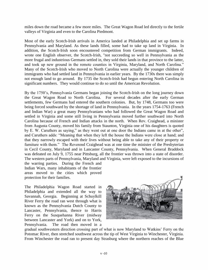
The Philadelphia Wagon Road started in
Philadelphia and extended all the way to
Savannah, Georgia. Beginning at Schuylkill
River Ferry the road ran west through what is
known as the Pennsylvania Dutch County to
Lancaster, Pennsylvania, thence to Harris
Ferry on the Susquehanna River (midway
between Lancaster and York) and on to York,
Pennsylvania. The road then moved in a
gradual southwestern direction crossing part of what is now Maryland to Watkins’ Ferry on the
Potomac River, then stretched southwest across the tip of West Virginia to Winchester, Virginia.
From Winchester the road ran to present day Strasburg where the northern reaches of the Blue

v - 11
Ridge suddenly open to expose the mouth of the great valley of Virginia lying between the
Appalachian on the west and the Blue Ridge on the east.
Much of Virginia Highway Route 11 running through the Valley follows the bed of the Old
Wagon Road. Entering the Valley and hugging close to the Blue Ridge the road ran from
Strasburg to Staunton. From Staunton the road ran through the Lexington area to Buchanan
where the James River was crossed at Looneys Ferry. Moving toward the present site of
Roanoke, the road turned eastward through the Staunton Gap.
The Carolina Road portion of the Great Wagon Road begins at Roanoke and continues south
through Boone's Mills and Rocky Mount to Martinsville and into the Carolina Colony. Then
goes southward crossing the Blackwater, Irvine and Dan Rivers and on to Wachovia, North
Carolina on a tributary of the Yadkin River. Carolina Road then came almost directly south to
Salem (now Winston- Salem, North Carolina). It then followed down the Yadkin River to
Lexington and Salisbury (North Carolina 8 and U.S. 29). The Carolina Road left the Yadkin at
Salisbury and swung west to the Broad River at Charlotte, North Carolina. The road continues
across South Carolina though Rock Hill, Chester, and Newberry arriving at the Savannah River
and Augusta, Georgia. In York County, South Carolina, the Road seems to have split, one
branch going westward to Chester and south to Columbia, South Carolina (U.S. 321), the other
branch staying nearer the river to Columbia (U.S. 21). Both routes of The Great Wagon Road
ended at Augusta, Georgia, but feed most of the State of Georgia with emigrates.
The Great Wagon Road became the main artery for feeder trails and roads. Before the French
and Indian Wars, a road ran west from Baltimore, to Frederick, Maryland, to Fort Cumberland
crossing Great Wagon Road near Watkins’ Ferry on the Potomac. This arm allowed travel to
Cumberland, Maryland and beyond on Braddock’s Road during the War. In the late 1700’s, the
Great Wagon Road became the highway to Kentucky, for in southern Virginia it joined the
Wilderness Road, which Daniel Boone had blazed in 1774-1775. Crossing the mountains at
Cumberland Gap, the Wilderness Road led across Kentucky to the falls of the Ohio, where
Louisville now stands. In the decades when Braddock's Road across the Alleghenies was
growing up in brush and when the Indians barred the way across Pennsylvania, the road down
the Shenandoah to Cumberland Gap was the most practical route to the West. Used at first by
pioneers on horseback eager to cross the passes into Kentucky, it was soon crowded with
covered wagons, almost by the thousands. Many settlers heading west visited Lancaster, York,
or Carlisle first to acquire a Conestoga wagon, a Kentucky rifle or other equipment. From 1775
to 1800 more than three hundred thousand settlers traveled this road to the West. It was the use
of this route rather than the one across the Pennsylvania mountains that was the main factor in
the settlement of Kentucky at a time when Ohio was still Indian territory.
In the later part of the 1700’s, members of the Pennsylvania Allison's could be found in
Lancaster, Dauphin and Washington Counties, Pennsylvania; Cecil and Kent Counties,
Maryland; Augusta and Fairfax Counties Virginia; and Cabarrus, Iredell, and Mecklenburg
Counties, North Carolina. Many of these locations can be found on the Great Wagon Road or
the Pennsylvania Road. Patrick Allison apparently worked on the Pennsylvania Road in late the
1750’s.

v - 12
The Allison’s are a very difficult group to research from a genealogical standpoint; they must
have a dominant nomadic gene, which does not allow an Allison to live in one place for more
than a couple of decades. Good genealogical records are generated by people living in one place
for a long period of time. Beginning with John the Elder, the family members through time have
an average stay of about 15 years in one location. This could mean only one census record for
some locations. The availability of cheaply priced land and spirit of adventure were always at
hand.
ert Allison