Embed Size (px)
Citation preview
52C11NE0057 OM90-060 HALKIRK 010
PRELIMINARY EXPLORATION REPORT
ON
HALKIRK AND WATTEN TOWNSHIP PROPERTIES
FOR
NOR-NOROCK MINING COMPANY LIMITED
J.E.Steers 4 Associates Inc. 219 Vance Drive Oakville, Ontario L6L 3K9
June l , 1 990
J.E. Steers ^ Associates Inc.
SUMMARY
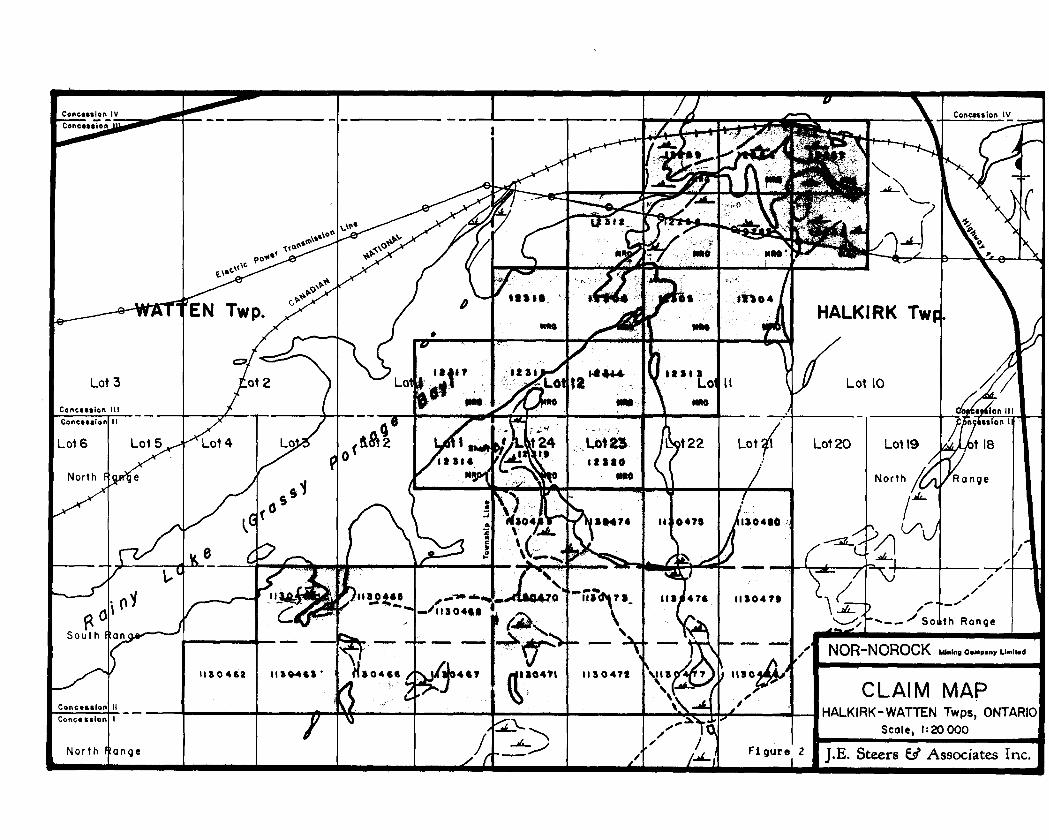
Nor-Norock Mining Company Limited (NNMCL) holds a 100* interest in 18
contiguous, leased mining claims and will acquire a 100* interest in 19
additional staked mining claims (1480 acres) in Halkirk and Watten Townships,
Kenora Mining Division, Ontario. The group is readily accessible by paved and
gravel roads from Fort Frances some 20 miles to the west.
The property is largely underlain by a simple, slightly overturned, gabbro-
anorthosite sill known to host copper-nickel and copper occurrences. The
leased claims host a substantial drill indicated tonnage of copper-nickel
mineralization in a number of lenses, at relatively shallow depth. The
mineralized horizon is open along strike to the northeast, down plunge to the
west and at depth.
It is concluded that some basic exploration work is required to further
define the mineralized horizon and define some as yet unresolved or partially
resolved ground and airborne electromagnetic responses before additional
diamond drilling is undertaken.
It is recommended that geophysical and geochemical surveys, prospecting and
field location of drill collars and previously established grids be carried out.
It is estimated that a four man crew can accomplish the recommended program in
approximately 30 days at an estimated cost of $45,000.
J. E. Steers ^ Associates Inc.
52C11NE0057 OM90-060 HALKIRK Q-1
TABLE OF CONTENTS
SUMMARY . . . . . . . . . . . . . . . . . . . . . . . . . . . . . . . . . i
1.0.0 INTRODUCTION . . . . . . . . . . . . . . . . . . . . . . . . . . . l1.1.0 NATURE and SCOPE of REPORT . . . . . . . . . . . . . . . . . 21.2.0 METHOD of INVESTIGATION . . . . . . . . . . . . . . . . . . . 21.3.0 RESULTS and LIMITATIONS . . . . . . . . . . . . . . . . . . . 21.4.0 PROPERTY DESCRIPTION . . . . . . . . . . . . . . . . . . . . 4
2.0.0 LOCATION and ACCESS . . . . . . . . . . . . . . . . . . . . . . . . 52.1.0 TOPOGRAPHY . . . . . . . . . . . . . . . . . . . . . . . . . 52.2.0 HISTORY . . . . . . . . . . . . . . . . . . . . . . . . . . . 5
3.0.0 REGIONAL GEOLOGY . . . . . . . . . . . . . . . . . . . . . . . . . 83.1.0 GRASSY PORTAGE INTRUSION . . . . . . . . . . . . . . . . . . 8
3.1.1 MINERALIZATION . . . . . . . . . . . . . . . . . . . . 9
4.0.0 CONCLUSIONS . . . . . . . . . . . . . . . . . . . . . . . . . . . . 12
5.0.0 RECOMMENDATIONS . . . . . . . . . . . . . . . . . . . . . . . . . . 135.1.0 BUDGET DETAIL . . . . . . . . . . . . . . . . . . . . . . . . 14
SELECTED REFERENCES . . . . . . . . . . . . . . . . . . . . . . . . . . . 15
CERTIFICATE . . . . . . . . . . . . . . . . . . . . . . . . . . . . . . . 16
J.E. Steers ^ Associates Inc.

LIST OF FIGURES
FIGURE l Location Map
FIGURE 2 Claim Map
FIGURE 3 Topographic Map
FIGURE 4 Air Photo
FIGURE 5 EM Compilation Map
FIGURE 6 Aeromagnetic Interpretation Map
FIGURE 7 Regional Geology
FIGURE 8 Generalized Geology of Grassy
Portage Intrusion
FIGURE 9 General Geology 175 Foot Drive
LIST OF TABLES
Table l Composition of Grassy Portage
Intrusion
LIST OF MAPS
PLATE l Compilation Map Scale 1:5000
Plate 2 North Rock Explorations Ltd. Plan of Diamond Drill Holes
Froritpiece
after page l
after page 3
after page 4
after page 5
after page 6
after page 7
after page 8
after page 9
after figure 8
after page 8
in pocket
in pocket
J.E. Steers Jb? Associates Inc.
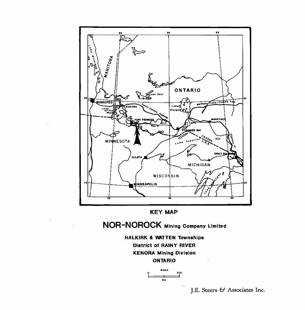
j wiscorINNEAPOLIS
KEY MAP
NOR-NOROCK M ining Company L imited
HALKIRK A WATTEN TownshipsDistrict of RAINY RIVERKENORA M ining Division
ONTARIO•••i* 200
J.E. Steers ^ Associates Inc.
1.0.0 INTRODUCTION
Nor-Norock Mining Company Limited, (NNMCL) a privately held mining company
with offices at Suite 321, 3701 Chesswood Drive, Downsview, Ont., M3J 2P6
holds a 100* interest in 18 contiguous, leased mining claims located in
Halkirk and Watten Townships, Kenora Mining Division of Ontario and has the right to acquire a 1QO\ interest in an additional 19 recently staked,
unpatented mining claims also located in Halkirk and Watten Townships
currently registered in the name of Mr. A.J. Lewis, President of both Nor-
Norock Mining Company Limited and Kalrock Developments Limited (KDL) and being
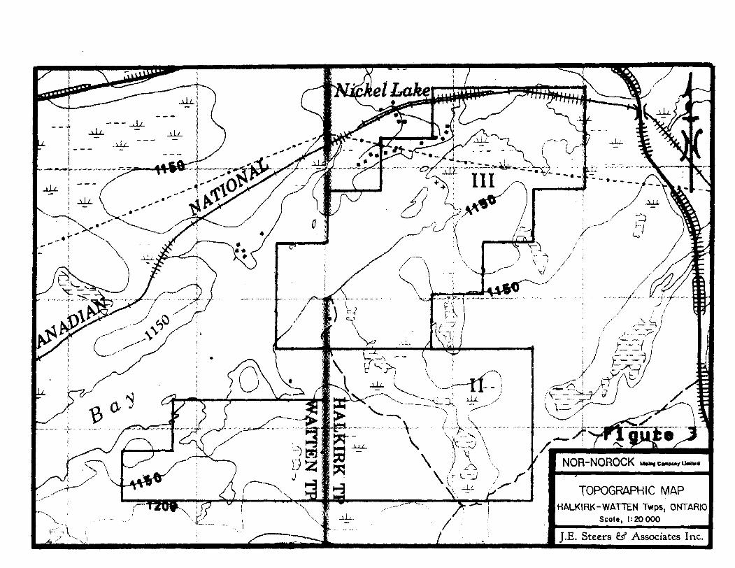
held in trust for NNMCL (figure 2).
Exploration and development work carried out on the leased claims has
established the presence of a number of lenses of disseminated to massive
pyrrhotite-pyrite-chalcopyrite mineralization which have been variously
estimated to contain l million tons averaging 1.17% copper over a strike
length of 1200 feet or 300,000 tons of about 2% copper over a strike length of
900 feet (Poulsen Hodgson, 1984).
An underground development program which consisted of the sinking of a 200
foot shaft and 700 feet of lateral drifting on the 175 foot level partially
explored two of the lenses over a total strike length of about 300 feet
(Poulson and Hodgson, 1984).
A number of geological, geophysical (including an Ontario Government sponsored airborne electromagnetic and magnetic survey) and diamond drill campaigns have been carried out over the subject claims, or parts of the claims by a variety
of operators since the discovery of copper mineralization in 1958.
J.E. Steers fi Associates Inc. were requested by Mr. A. J. Lewis, President of
NNMCL and KDL to review the extant data, the recommendations for further work; and, if deemed warranted, recommend a program of further work for 1990.
No property visit was made since the underground workings are all flooded,
none of the drill core is available for examination at the property and it is believed that an adequate written record is available. The basis of this
report and the accompanying conclusions and recommendations is a thorough
J.E. Steers &SJ" Associates Inc.
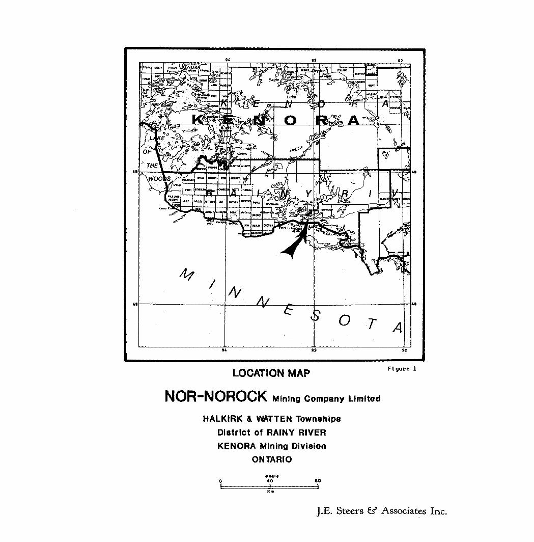
LOCATION MAP
NOR~NOROCK M ining Company Limited
HALKIRK 4 WATTEN TownshipsDistrict of RAINY RIVERKENORA M ining Division
ONTARIO
Figure l
• ••i*40 80
Km
J. E. Steers fef Associates Inc.
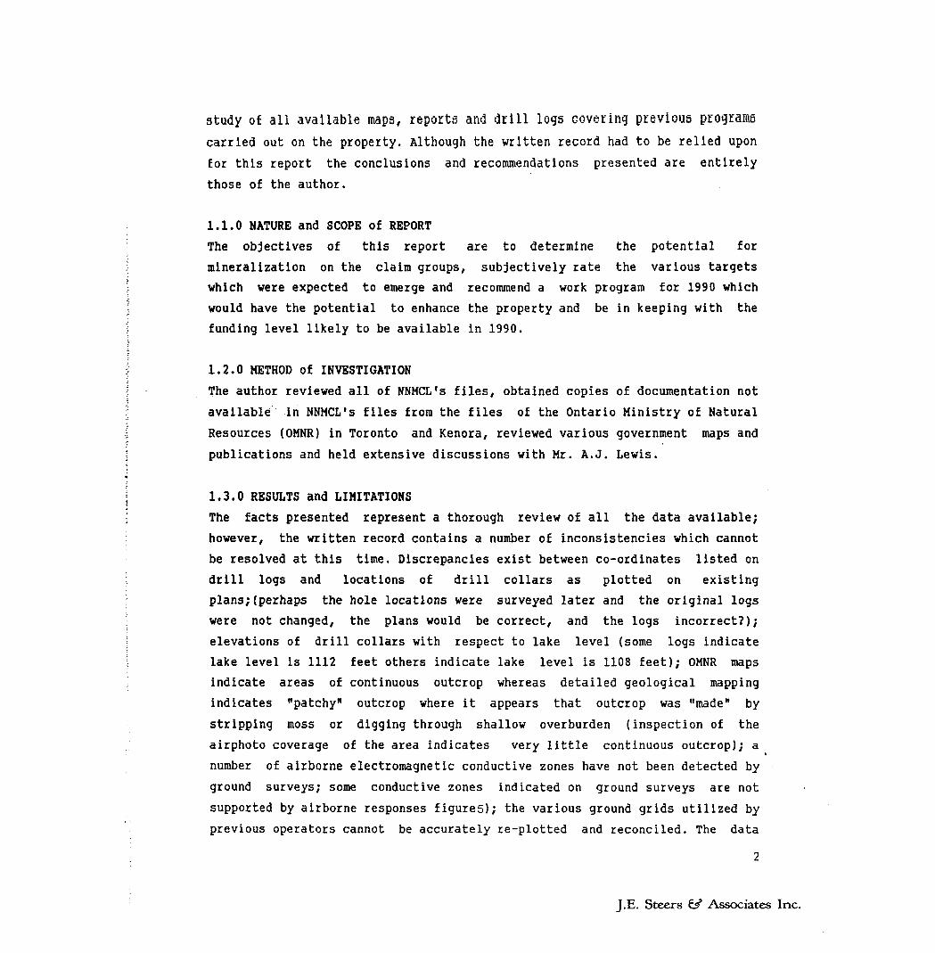
study of all available maps, reports and drill logs covering previous programs
carried out on the property. Although the written record had to be relied upon for this report the conclusions and recommendations presented are entirely those of the author.
1.1.0 NATURE and SCOPE of REPORT
The objectives of this report are to determine the potential for
mineralization on the claim groups, subjectively rate the various targets which were expected to emerge and recommend a work program for 1990 which
would have the potential to enhance the property and be in keeping with the funding level likely to be available in 1990.
1.2.0 METHOD of INVESTIGATION
The author reviewed all of NNMCL's files, obtained copies of documentation not
available in NNMCL's files from the files of the Ontario Ministry of Natural
Resources (OMNR) in Toronto and Kenora, reviewed various government maps and
publications and held extensive discussions with Mr. A.J. Lewis.
1.3.0 RESULTS and LIMITATIONS
The facts presented represent a thorough review of all the data available;
however, the written record contains a number of inconsistencies which cannot
be resolved at this time. Discrepancies exist between co-ordinates listed on
drill logs and locations of drill collars as plotted on existing
plans;(perhaps the hole locations were surveyed later and the original logs
were not changed, the plans would be correct, and the logs incorrect?);
elevations of drill collars with respect to lake level (some logs indicate
lake level is 1112 feet others indicate lake level is 1108 feet); OMNR maps
indicate areas of continuous outcrop whereas detailed geological mapping
indicates "patchy" outcrop where it appears that outcrop was "made" by
stripping moss or digging through shallow overburden (inspection of the
airphoto coverage of the area indicates very little continuous outcrop); a
number of airborne electromagnetic conductive zones have not been detected by
ground surveys; some conductive zones indicated on ground surveys are not
supported by airborne responses figures); the various ground grids utilized by
previous operators cannot be accurately re-plotted and reconciled. The data
J.E. Steers S/ Associates Inc.
available has been compiled on a "best fit" basis and the final
reconciliations will have to await the results of field checks.
For the purposes of this report no attempt was made to recalculate the tonnage
and grade of the known zones as it is believed that the prior calculations
were carried out by competent professional engineers and that considerable additional exploration is required to substantially increase the known tonnage
and grade to create an economically viable project. The tonnages and grades
quoted are considered to be drill indicated. There are no proven or probable
reserves on the property.
*Note: the use of the terms "ore grade, grey ores, black ores" are the
terms of the authors being quoted and not this author's terms.
J.E. Steers ^ Associates Inc.
EN Twp. HALKIRK Twp.
Lotast no
x— i—'11304*4
-----.-^ Soilth Range
NOR-NOROCK
CLAIM MAPHALKIRK-WATTEN Twps, ONTARIO
Scale, 1:20000
J.E. Steers fef Associates Inc.
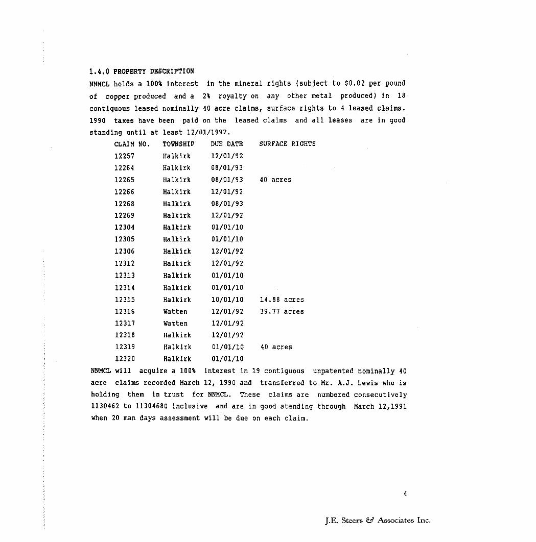
1.4.0 PROPERTY DESCRIPTION
NNMCL holds a 100* interest in the mineral rights (subject to $0.02 per pound
of copper produced and a 2* royalty on any other metal produced) in 18
contiguous leased nominally 40 acre claims, surface rights to 4 leased claims.
1990 taxes have been paid on the leased claims and all leases are in good
standing until at least 12/01/1992.
CLAIM NO.
12257
12264
12265
12266
12268
12269
12304
12305
12306
12312
12313
12314
12315
12316
12317
12318
12319
12320
NNMCL will acquire a 100* interest in 19 contiguous unpatented nominally 40
acre claims recorded March 12, 1990 and transferred to Mr. A.J. Lewis who is
holding them in trust for NNMCL. These claims are numbered consecutively
1130462 to 11304680 inclusive and are in good standing through March 12,1991
when 20 man days assessment will be due on each claim.
TOWNSHIP
Halkirk
Halkirk
Halkirk
Halkirk
HalkirkHalkirk
Halkirk
Halkirk
Halkirk
Halkirk
Halkirk
Halkirk
Halkirk
Watten
Watten
Halkirk
Halkirk
Halkirk
DUE DATE
12/01/92
08/01/93
08/01/93
12/01/92
08/01/93
12/01/92
01/01/10
01/01/10
12/01/92
12/01/92
01/01/10
01/01/10
10/01/10
12/01/92
12/01/92
12/01/92
01/01/10
01/01/10
SURFACE RIG!
40 acres
14.88 acres
39.77 acres
40 acres
J.E. Steers 6s? Associates Inc.
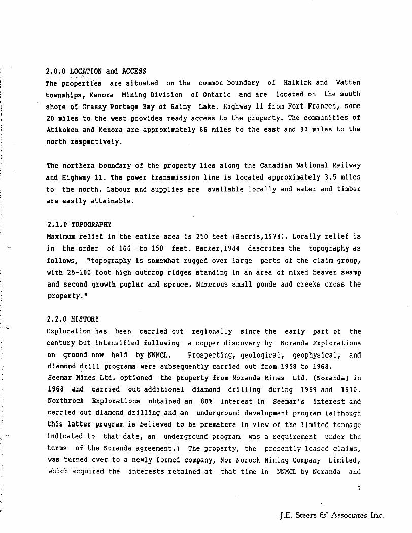
fake t Lake
~ * - -—~ y ^
\ H \ \ l - ~ NOR-NOROCK U^C^-
TOPOGRAPHIC MAPHALKIRK-WATTEN Twps. ONTARIO
Scale, 1:20000
J.E. Steers 65* Associates Inc.
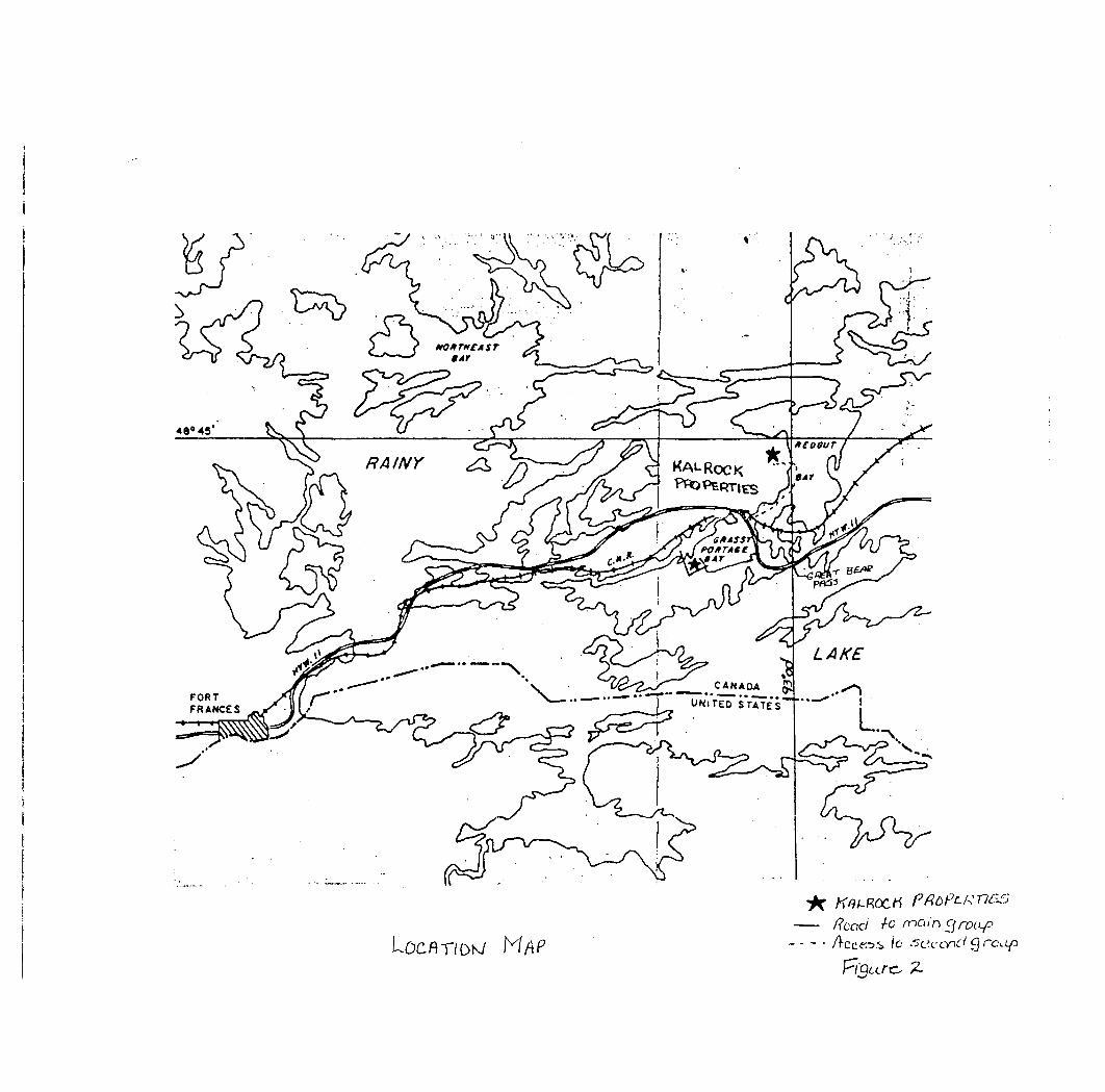
2.0.0 LOCATION and ACCESSThe properties are situated on the common boundary of Halkirk and Watten
townships, Kenora Mining Division of Ontario and are located on the south
shore of Grassy Portage Bay of Rainy Lake. Highway 11 from Fort Frances, some
20 miles to the west provides ready access to the property. The communities of
Atikoken and Kenora are approximately 66 miles to the east and 90 miles to the
north respectively.
The northern boundary of the property lies along the Canadian National Railway
and Highway 11. The power transmission line is located approximately 3.5 miles
to the north. Labour and supplies are available locally and water and timber
are easily attainable.
2.1.0 TOPOGRAPHY
Maximum relief in the entire area is 250 feet (Harris,1974). Locally relief is
in the order of 100 to 150 feet. Barker,1984 describes the topography as
follows, "topography is somewhat rugged over large parts of the claim group,
with 25-100 foot high outcrop ridges standing in an area of mixed beaver swamp
and second growth poplar and spruce. Numerous small ponds and creeks cross theproperty."
2.2.0 HISTORY
Exploration has been carried out regionally since the early part of the
century but intensified following a copper discovery by Noranda Explorations
on ground now held by NNMCL. Prospecting, geological, geophysical, and diamond drill programs were subsequently carried out from 1958 to 1968. Seemar Mines Ltd. optioned the property from Noranda Mines Ltd. (Noranda) in
1968 and carried out additional diamond drilling during 1969 and 1970. Northrock Explorations obtained an 80% interest in Seemar's interest and
carried out diamond drilling and an underground development program (although
this latter program is believed to be premature in view of the limited tonnage
indicated to that date, an underground program was a requirement under the
terms of the Noranda agreement.) The property, the presently leased claims, was turned over to a newly formed company, Nor-Norock Mining Company Limited, which acquired the interests retained at that time in NNMCL by Noranda and
J.E. Steers ^ Associates Inc.
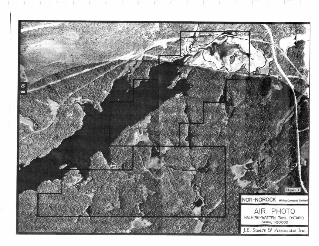
f r r t
NOROCK MJnlng Company Llmfwd
PHOTOHALKIRK-WATTEN Twps, ONTARIO
Scale, 1 = 20000
.E. Steers t/ Associates Inc.
Seemar.
The adjacent newly acquired claims have previously been held (in part) by
Noranda(1958), Corainco(1966) and Kalrock Mines Limited(1980), an outline of
the work conducted by these groups will follow.
The Ontario Geological Survey (OGS) mapped the area at a scale of l inch to
1/4 mile in 1968 and 1969 and published the results as Geological Report 115
(Harris, 1974). Harris's map indicates large areas of nearly continuous
outcrop south of Grassy Portage Bay whereas more detailed mapping by Noranda
(Hodgson,1959) on picket grids indicates very patchy outcrop, much of which
appears to have been "made" by the stripping of moss or thin soil cover.
Inspection of airphotographs supports this conclusion. An excellent regional
database ,is provided by an OGS sponsored INPUT electromagnetic and magnetic
survey, published in 1980 as OGS Geophysical/Geochemical Series Maps 80496,
80497. These maps show a number of conductive zones on the NNMCL properties,
only some of which have been detected by surface geophysical surveys conducted
to date. It is noteworthy that the short strikelength lenses of massive and
disseminated sulphides on NNMCL ground were not detected by this survey.
Hansen (1981) in an interpretive report for Kalrock Mines Limited (KLM) states
that the INPUT system requires a minimum strike length of 100 metres to detect
massive sulphides and can detect conductive material to depths of 200 metres.
(This author has had experience with INPUT detecting conductive material at
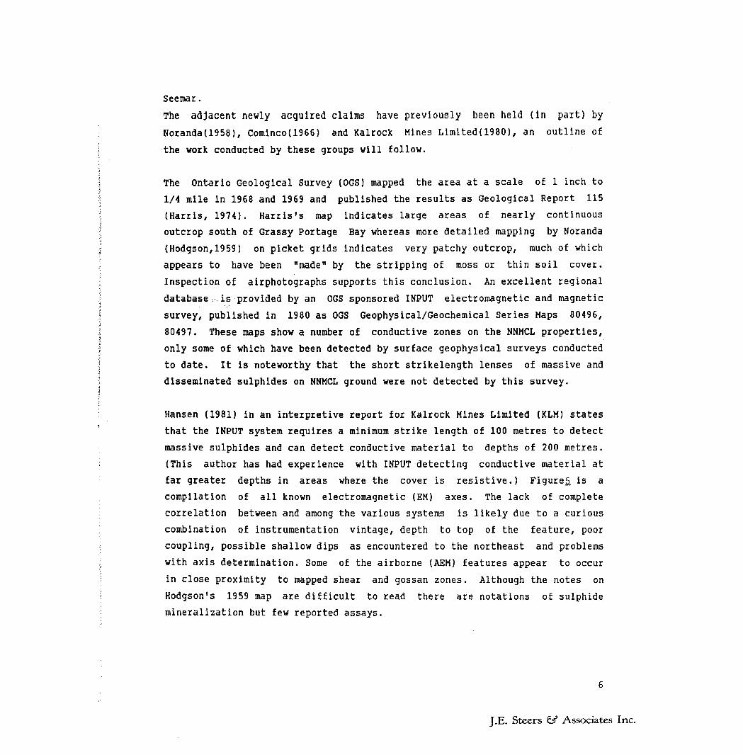
far greater depths in areas where the cover is resistive.) Figures, is a
compilation of all known electromagnetic (EM) axes. The lack of complete
correlation between and among the various systems is likely due to a curious
combination of instrumentation vintage, depth to top of the feature, poor
coupling, possible shallow dips as encountered to the northeast and problems
with axis determination. Some of the airborne (AEM) features appear to occur
in close proximity to mapped shear and gossan zones. Although the notes on
Hodgson's 1959 map are difficult to read there are notations of sulphide mineralization but few reported assays.
J.E. Steers ^ Associates Inc.
~1 i r i p 1 —j ™1
WATTEN
'l NOR-NOROCK w.** c*w
EM COMPILATIONHALKIRK-WATTEN Twps, ONTARIO
Scale, i:20OCX)
I.E. Steers esr Associates Inc.
During 1981-2 K,H, Poulsen of the OGS carried out geological studies of the
setting of the mineralization in the Mine Centre Fort Frances area, including
the subject area. Subsequently (1984) with Hodgson they published a paper
entitled Mineralization Associated with Archean Gabbro-Anorthosite Intrusions,
Rainy Lake area, Northwestern, Ontario in which they presented a new
structural interpretation, compared the area to other metalliferous gabbro-
anorthosite complexes of the Superior Province and pointed out the association
of copper(Cu)-nickel(Ni) deposits with the basal part of the layered intrusive
complex (NNMCL setting) and iron-titanium deposits and copper deposits with
the upper portion of the intrusion. It is their structural interpretation that
is used here rather the previous interpretations which suggest the complex was
a large synform.
Prior surveys carried out over all or part of the claim groups include
prospecting, geological mapping, magnetometer Junior EM (JEM: a very early and
low powered version of Crone Geophysics shootback system) and apart from the
main mineralized zones on the leased claims, 2 drill holes: N20, N83, which
obtained no significant values.(Noranda 1958-62)(plate 1)
Over the southern portion of the new claims Cominco(1966) carried out
geological mapping and induced polarization and resistivity surveys. Of
several features detected one was drilled by Hupchuck and Armstrong, holes H-
10,H-11. The best result was from hole H-ll which intersected 30 feet of 10*
pyrrhotite containing disseminated chalcopyrite and sphalerite, 10 ft. of
which assayed Q.11% Cu. 2.53* Zn.and trace Ni.
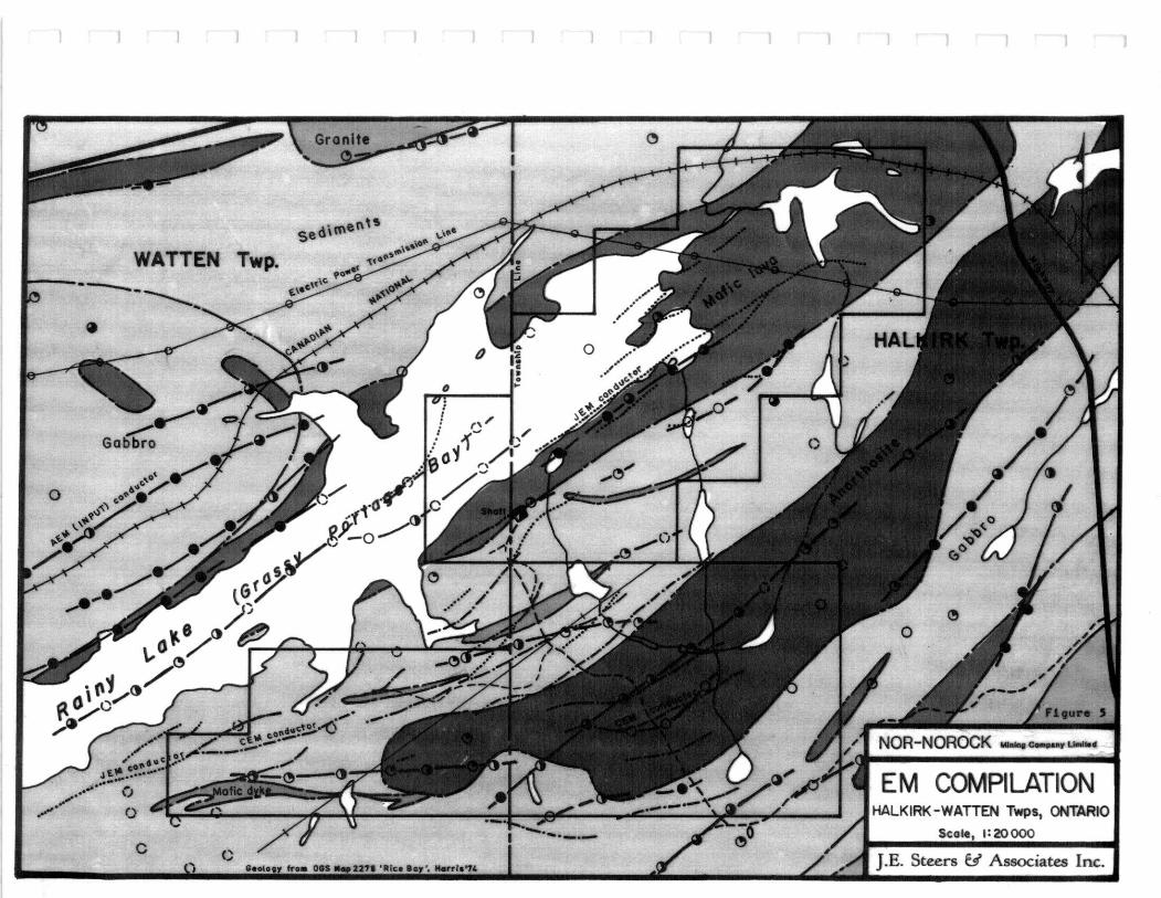
Kalrock Developments Limited acquired a group of twenty claims, essentially
the same group as the new claims, established a metric grid with 060 0
astronomic baseline with lines at 100 metre spacings and stations at 25 metre
intervals. Magnetic and EM surveys were carried out using a fluxgate
magnetometer and a Crone GEM unit in the horizontal shootback mode, a system
suited to detecting wide conductive zones in rugged terrain. 3 main zones of
conductivity were detected (A,B,C,) as well as numerous weaker features
(Barker,1982). Zone A was further profiled with a MaxMin horizontal loop EM
unit. This feature is in the vicinity of holes H-10, and 11 mentioned above.
J.E. Steers 63" Associates Inc.
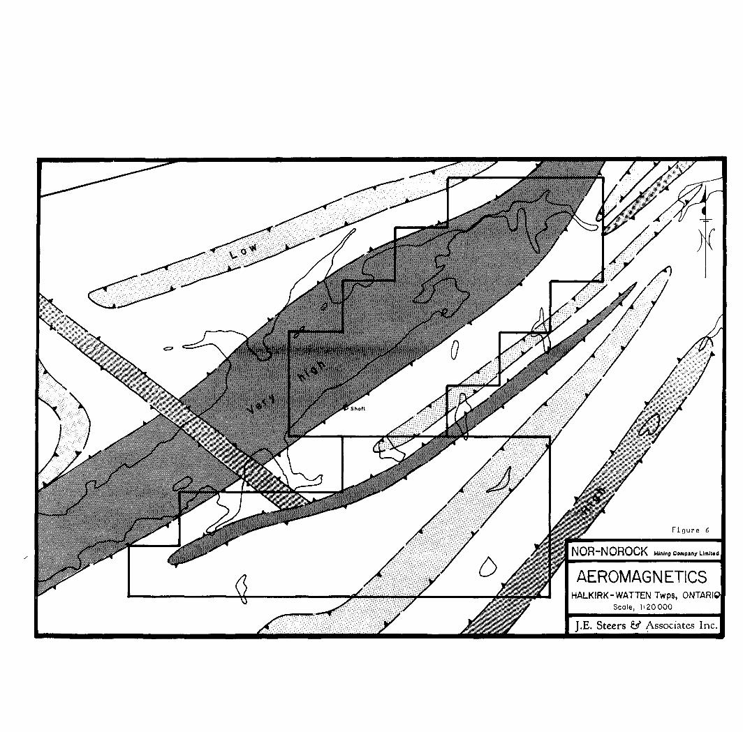
Figure 6
NOR-NOROCK Mining Compile Llmll.d
AEROMAGNETICSHALKIRK-WATTEN Twps, ONTARIO
Scale, 1 = 20000
J.E. Steers 8^ Associates Inc.
leaoMiended field work, prospecting, re-location of the old collars and
vertical loop (VLEM) or VLF surveys to pin-point the individual conductor axes
before attempting to drill these targets. This author is entirely in agreement
with this exploration approach for this area, a point of view born out by a
subsequent attempt to drill test 3 anomalies two of which failed to intersect
a satisfactory explanation for the conductivity. It is believed that all holes
either overshot or stopped short of the intended targets due to an inability
to properly "pick" the conductive axes. VLEM surveying would have helped
immensely in resolving this problem.
Hole 83-2 designed to test anomaly B intersected 7 feet of 2(^ sulphides
(pyrite, pyrrhotite, minor chalcopyrite) is considered to be a successful
test. Anomaly C has not been drill tested. (Plate 1)
3.0.0 REGIONAL GEOLOGY
The following account of the regional geology comes from Poulsen and Hodgson,
(1984).
"The Archean rocks at Rainy Lake occupy the southern margin of the Wabigoon
Subprovince, a granite-greenstone terrane, at its contact with the Quetico
Subprovince a metasedimentary-gneissic terrane (Fig.7) Here, the subprovince
margin consists of a wrench zone bounded by two dextral transcurrent faults.
Between the faults metavolcanic, metasedimentary and plutonic rocks occur in several distinctive lithostratigraphic domains which are separated from one
another by narrow shear zones. Layered, gabbro-anorthosite sills occur in the
three adjacent domains and may represent either individual intrusions or
dismembered segments of a single larger body. The westernmost Grassy Portage
intrusion is conformable with pillow basalts and metasedimentary biotite
schists in a domain characterized by amphibolite facies metamorphic
assemblages. The intrusions have been deformed with the enclosing rocks by
folding on a regional scale but the most common deformational features within
the intrusions, at a local scale, are ductile shear zones a few centimetres to
a few metres wide. Apart from the schists produced by this localized
deformation, metamorphism has elsewhere resulted only in recrystallization of
minerals without development of strong crystallographic reorientation."
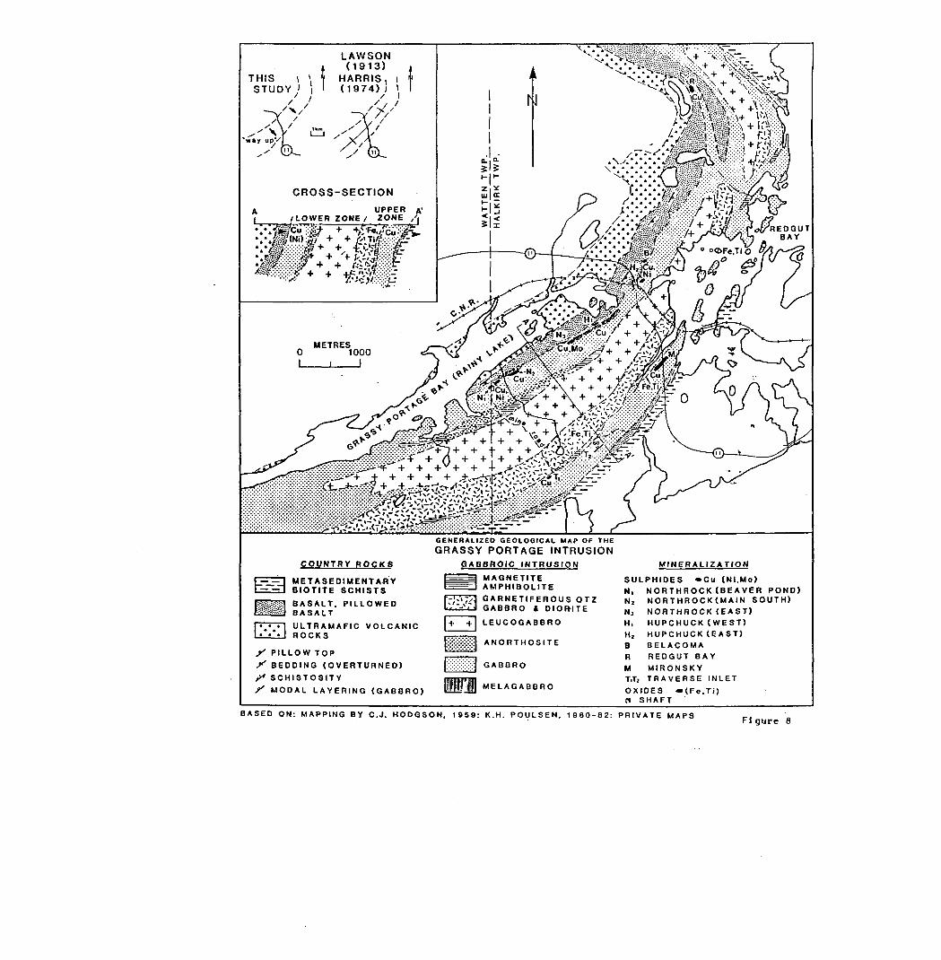
3.1.0 GRASSY PORTAGE INTRUSION
Poulsen and Hodgson make a strong case for the intrusion to be a simple
J.E. Steers Gs? Associates Inc.
Gabbro-anorthosite O O0 Cu Sulfide deposits, occurrence etc.
* Fe.Ti Oxide deposits, occurrences etc. D Au.Cu Quartz vein mineralization
---— Lithological contactsFrom Poumn t Hod^tttn '83
Figure 7
REGIONAL GEOLOGY
NOR"NOROCK M ining Company Limited
HALKIRK A WATTEN TownshipsDistrict of RAINY RIVERKENORA Mining Division
ONTARIO
J.E. Steers ^ Associates Inc.
Table l Composition of the Grassy Portage Intrusion
UPPER ZONEGABBRO; QUARTZ-GABBRO; DIORITE - up to 250 m thick; medium grained
equigranular amphibolite; locally well developed modal layering. QUARTZ-PLAGIOCLASE SCHIST - leucocratic rock with less than 2096 actinolite and
biotite; 30 to 4096 quartz; rock occurs as lenses and blocks up to 20 m thick. MAGNETITE-APATITE AMPHIBOLITE - actinolite, anthophyllite, talc, Mg-chlorite
and apatite with 5-5096 magnetite; local rutile-bearing masses. GARNETIFEROUS QUARTZ DIORITE - medium grained black amphibolite composed
of hornblende, plagioclase (An 30 to 38) and quartz eyes; garnets up to l cm arecommon; also abundant apatite, epidote; average 250 m thick.
LOWER ZONELEUCOGABBRO - 60-9096 plagioclase (An 48 to 52) as framework grains commonly
poikilitically enclosed by hornblende oikocrysts; locally contains xenoliths ofanorthosite; up to 750 m thick.
ACTINOLITIC AMPHIBOLITE - lenses of actinolite with 5-2096 magnetite and localdiopside, clinozoisite, phlogopite, sphene, plagioclase.
ANORTHOSITE - narrow members composed of 9596 medium grained plagioclase(An 40); local epidote and minor biotite; xenoliths of gabbro observed; possibleautointrusion.
GABBRO — medium to coarse grained, equigranular to locally porphyritic andglomeroporphyritic; 5096 interstitial hornblende, 5096 plagioclase (An 50 to 55); localMg chlorite and biotite; averages 300 m thick.
MELAGABBRO - 15 m thick lenses at or near the base of the intrusion; 8096hornblende, 1096 plagioclase (An 50) + b iotite and sulfides.
From Poulsen ft Hodgson '83
J.E. Steers ^ Associates Inc.
layered gabbroic sill, with an exposed strike length of 20 km, overturned to
the southeast. They state that the mean dip is to the northwest, the contacts
are broadly concordant with those of the enclosing volcanic and sedimentary
rocks, layering attitudes are consistent with bedding markers in the enclosing
rocks, and they present evidence to show that modal and chemical trends across
the intrusion are asymmetric to what be expected if the intrusion were
isoclinally folded. Additionally they provide detailed stratigraphic
descriptions of a 5 unit lower zone and a 4 unit upper zone. (Table 1)
3.1.1 MINERALIZATION
The following account of the mineralization is also taken from the above
authors; however in the interest of brevity certain paragraphs have been
deleted (those not considered pertinent to this report and those describing
the magnetite-ilmenite associations and those describing the magnetite-apatite
occurrences).
"Copper sulphides occur in three distinct settings: as lenses of disseminated
to massive pyrrhotite-chalcopyrite at the base of the intrusion, as
disseminations and stringers in the felsic quartz-plagioclase schist member in
the upper zone and as disseminations and stringers, in and near, gabbroic
dykes which cut the mafic and ultramafic volcanic rocks beneath the sill. This
last type is not of economic significance.
Basal sulphide accumulations occur at several localities along the northern
margin of the intrusion. The largest, and most economically significant, is
the Beaver Pond Zone on the Northrock leased claims which is composed of
several subsidiary lenses. This lenticular form and the variability of grades
results in a variety of tonnage-grade estimates for the deposit (Bergman,
1973). These range from 900,744 tonnes grading 1.17* Cu over a strike length
of 400 metres to 240,613 tonnes grading 2.08* over a strike length of 300 metres.
High grade (3* Cu) "grey" ores and lower grade "black" ( <l\) ores are present.
The black ores consist of coarse gabbro with disseminations of chalcopyrite,
pyrrhotite and pentlandite and a typical diamond drill intersection from the
East Zone averages Q.43% Cu, 0.29* Ni over 16 metres. Molybdenite occurs
J.E. Steers ^ Associates Inc.
A UPPER A'i /LOWER ZONE l ZONE '
COUNTRY ROCKS
METASEDIMENTAflY BIOTITE SCHISTS
BASALT. PILLOWED BASALTULTRAMAFIC VOLCANIC ROCKS
f' P ILLOW TOP^ B EDDING (OVERTURNED)f S CHISTOSITY^ M ODAL LAYERING (GABBRO)
GENERALIZED GEOLOGICAL MAP OF THEGRASSY PORTAGE INTRUSION
GABBROIC INTRUSION
MAGNETITE AMPHIBOLITEGARNETIFEROUS OTZ GABBRO t OIOFHTE
LEUCOGABBRO
ANORTHOSITE
GABBRO
MELAGABBRO
MINERALIZATION
SULPHIDES -Cu (NI.Mo)Ni NORTHROCK (BEAVER POND)N, NORTHROCK(MAIN SOUTH)N3 NORTHROCK (EAST)Hi HUPCHUCK (WEST)H, H UPCHUCK(EAST)B BELACOMAR REDOUT BAYM MIRONSKYT,T2 TRAVERSE INLET
OXIDES (Fe.Ti)B SHAFT
BASED ON: MAPPING BY C .J. H ODGSON. 19S9: K.H. POULSEN. 1980-82: PRIVATE MAPSFigure 8
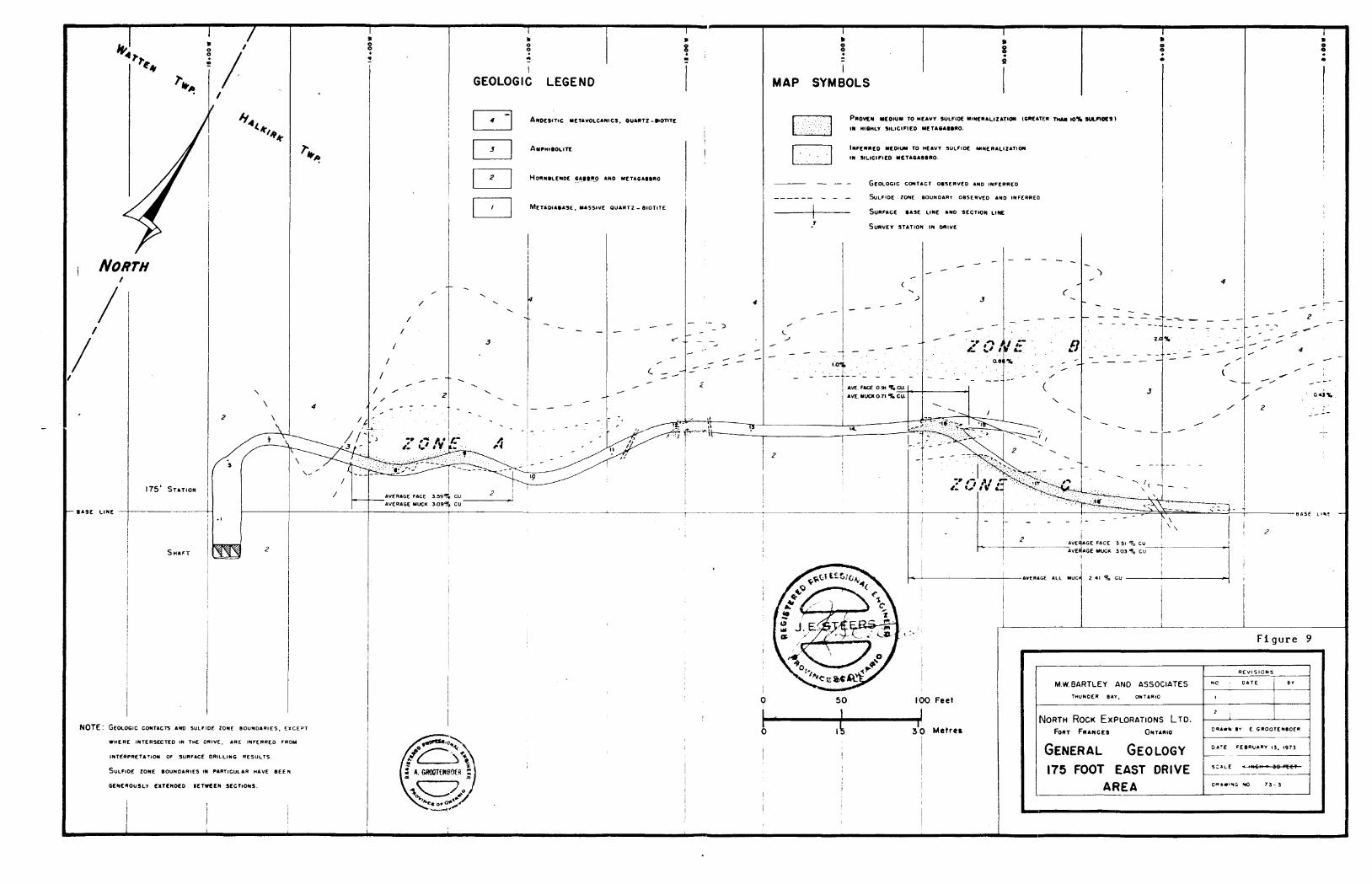
NORTH
— B ASE L INE
175' STATION i
SHAFT
GEOLOGIC LEGEND
ANOESITIC METAVOLCANICS. OUARTZ-BIOTITE
AMPHIBOLITE
HORNBLENDE CABBRO AND METACABBRD
METADUBASE. MASSIVE QUARTZ - BIOTITE
MAP SYMBOLS
PROVEN MEDIUM TO HEAVY SULFIDE MINERALIZATION (GREATER THAN ioX suLnotsi IN HISHLY SILICIFIED METASABBBO
INFERRED MEDIUM TO HEAVY SULFIDE MINERALIZATION IN SILICIFIED METAOA8BRO
— GEOLOGIC CONTACT OBSERVED AND INFERRED
— SULFIDE ZONE BOUNDARY OBSERVED AND INFERRED
— SURFACE BASE LINE AND SECTION LINE
SURVEY STATION IN DRIVE
NOTE: GEOLOGIC CONTACTS AND SULFIDE ZONE BOUNDARIES, EXCEPT
WHERE INTERSECTED IN THE DRIVE, ARE INFERRED FROM
INTERPRETATION OF SURFACE DRILLING RESULTS
SULFIDE ZONE BOUNDARIES IN PARTICULAR HAVE BEEN
GENEROUSLY EXTENDED BETWEEN SECTIONS.
AVERAGE FACE J.39% CU AVERAGE MUCK 3-O9*fy CU
84SE nut —
50 100 Feet
j 30 Metres
i
Figure
M.W. BARTLEY AND ASSOCIATESTHUNDER BAY, ONTARIO
NORTH ROCK EXPLORATIONS LTD.FORT FRANCES ONTARIO
GENERAL GEOLOGY 175 FOOT EAST DRIVE
AREA
REVISIONS
NC . DATE
'2 ;
1
BY
D*A**N 0Y C GROOTENtoe*
DATE FEBRUARY 13, 1973
DRAWING HO 7 3- 3
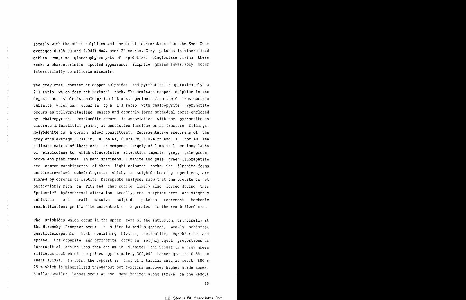
locally with the other sulphides and one drill Intersection from the East zone
averages Q.43% cu and 0.044* MoSa over 22 metres. Grey patches In mineralized
gabbro comprise glomerophynocrysts of epidotized plagioclase giving these
rocks a characteristic spotted appearance. Sulphide grains invariably occur
interstitially to silicate minerals.
The grey ores consist of copper sulphides and pyrrhotite in approximately a
2:1 ratio which form net textured rock. The dominant copper sulphide in the
deposit as a whole is chalcopyrite but most specimens from the C lens contain
cubanite which can occur in up a 1:1 ratio with chalcopyrite. Pyrrhotite
occurs as pollycrystalline masses and commonly forms subhedral cores enclosed
by chalcopyrite. Pentlandite occurs in association with the pyrrhotite as
discrete interstitial grains, as exsolution lamellae or as fracture fillings.
Molybdenite Is a common minor constituent. Representative specimens of the
grey ores average S.74% Cu, Q.05% Ni, D.02% Co, Q.02% Zn and 110 ppb Au. The
silicate matrix of these ores is composed largely of l mm to l cm long laths
of plagioclase to which clinozoisite alteration imparts grey, pale green,
brown and pink tones in hand specimens. Ilmenite and pale green fluorapatite
are common constituents of these light coloured rocks. The ilmenite forms
centimetre-sized euhedral grains which, in sulphide bearing specimens, are
rimmed by coronas of biotite. Microprobe analyses show that the biotite is not
particularly rich in Ti0 2 and that rutile likely also formed during this
"potassic" hydrothermal alteration. Locally, the sulphide ores are slightly
schistose and small massive sulphide patches represent tectonic
remobilization: pentlandite concentration is greatest in the remobilized ores.
The sulphides which occur in the upper zone of the intrusion, principally at
the Mironsky Prospect occur in a fine-to-mediura-grained, weakly schistose
quartzofeldspathic host containing biotite, actinolite, Mg-chlorite and
sphene. Chalcopyrite and pyrrhotite occur in roughly equal proportions as
interstitial grains less than one mm in diameter: the result is a grey-green
siliceous rock which comprises approximately 300,000 tonnes grading Q.8% Cu
(Harris,1974). In form, the deposit is that of a tabular unit at least 600 x
25 m which is mineralized throughout but contains narrower higher grade zones.
Similar smaller lenses occur at the same horizon along strike in the Redgut
10
I.E. Steers S/ Associates Inc.
Bay area. There the bodies are assimilated metasedimentary blocks within the
sequence of modally layered gabbros. The siliceous blocks, if sedimentary,
must have been entirely reconstituted; diagnostic sedimentary textures and
structures, common in overlying biotite schists, are lacking and oxide ratios
are somewhat different for the two rock types.
11
[.E. Steers jf Associates Inc.
4.0.0 CONCLUSIONS
NNMCL's current land holdings cover parts of both of the favourable upper and
lower contact zones of the Grassy River Intrusion.
Significant copper-nickel and copper occurrences have been demonstrated to
occur on NNMCL's leased claims where limited underground drifting on the 175
foot level have returned somewhat better grades than drill indicated grades
although the underground work did not expose the full width of the
mineralization. The following two paragraphs are taken directly from the 1973
Summary Report by M.W. Bartley and Associates for North Rock Explorations.
"The East Drive encountered and partially explored two of three apparently
separate mineralized zones in he eastern portion of the property. The zones
are individual lenses of intense siliceous alteration in hornblende gabbro
mineralized with copper-bearing sulfides of economic interest. The underground
work has confirmed and in some instances improved surface diamond drill
results.
The average of the face samples cut in Zone A is 3.59^ Cu. The average of the
face samples cut in Zone C is 3.51^ Cu. The average of the muck samples from
the two zones is 3.09* and 3.03* respectively.
Because of the restricted nature of the new information, no attempt to revise
previous tonnage estimates has been attempted."
Several reserve calculations have been made utilizing various grade cut-off
parameters and strike lengths. Regardless of which grade-tonnage figure is
accepted the bulk of the drill indicated tonnage is above the 300 foot level
(Bergman,1973) although significant mineralized intercepts have been obtained
at much greater depths (SE-28 1.65% Cu over 7 ft. at a vertical depth of about
797 ft; SE-6 2.21* Cu over 36.5 ft. at a vertical depth of about 557 ft.)
All previous workers agree that the zones are open along strike to the
northeast, possibly to the southwest, down apparent plunge to the southwest
and down dip.
Although considerable effort has been expended over time on this project there
has been little in the way of a sustained, comprehensive exploration effort
and no use of modern surface or in-hole geophysical techniques.
12
I.E. Steers ^ Associates Inc.
Unexplained ground geophysical targets in the central part of the layered
sequence remain to be explained.
Linear airborne EM anomalies, strike parallel, parallel to interpreted ductile
shears and transgressive to stratigraphy remain to be detected and
examined.(fig.5)
Several authors have recommended additional prospecting and the use of soil
geochemistry where applicable.
A phased, systematic exploration program is warranted and recommended.
5.0.0 RECOMMENDATIONS
It is recommended that a 4 man geophysical, prospecting team equipped with a
vertical loop EM unit be employed to:
conduct orientation work both geophysical and geochemical over the known
mineralization.
locate collar locations of drill holes in the field.
establish the axes of the various conductors in the field.
where possible prospect and map the conductive zones and where
applicable collect both humus and B-horizon soil samples.
make recommendations for anomaly follow-up based on topographic considerations
and probable overburden depths (hand trench, powerstrip, diamond drill).
It is also recommended that all previous work be carefully compiled to common
scales: l" to 200 ft. where detail is required and l" to 400 ft. where less is
required. Additionally consideration should be given to entering all drill
records into a computer program to generate new cross sections, level plans
and longitudinal sections before additional drilling is contemplated for the
known mineralized areas.
In view of the strong magnetic permeability effects it would be advisable to
post the ground magnetic data and produce some computer generated maps to
provide a sound basis for EM and geological interpretation.
It is estimated that the above program will require 30 crew days.
13
J.E. Steers J Associates Inc.
5,1,0 BUDGET DETAIL
30 crew days (^700.00
Equipment Rental
Travel and accommodation
Food
Assay
Field Supplies
Magnetic data processing
Total
Contingency lO'fc
TOTALSAY
S21,000 5,000
2,000 3,600 4,000 2,400
2,600$40,600
4,000$44 < 600
,000
Res
14
J.E. Steers ^ Associates Inc.
SELECTED REFERENCES
Barker, A.L., 1982, Geophysical Report on the Halkirk-Watten claims, Grassy
Portage Bay Property, for Kalrock Developments: OGS Assessment Files
Harris,F,R., 1974, Geology of the Rainy Lake Area, District of Rainy Rlver;0ntario Division of Mines Geol, Report 115, 94p,
Hansen, J.E., 1981 Report on 12 claims Property, No's K556571 to K556582
Incl., Halkirk and Watten Townships, Fort Frances Mining Division; OGS
Assessment Files
Hodgson, C.J., 1959, Geological Report on the South Grassy Property, Halkirk
and Watten Townships, for Noranda Mines Limited; OGS Assessment Files
Hodgson, C.J., 1961, The Watten-Halkirk Copper Prospect, Rainy Lake Area,
unpublished M.Se. thesis, McGill University, Montreal; OGS Mines Library
Poulsen, K.H., 1981 The Geological Setting of Mineralization in the Mine
Centre-Fort Frances Area, District of Rainy River, in Summary of Field
Work, 1981; OGS Misc. Paper 100, p 190-195
Poulsen, K.H., and Hodgson, C.J., 1984, Mineralization Associated With Archean
Gabbro Anorthosite Intrusions, Rainy Lake Area, Northwestern Ontario;
Chibougamau-stratigraphy and Sedimentation, CIM Special Vol 34, p329-
344.
OGS Geophysical/Geochemical Series Maps 80496, 80497, scale 1:20,000.
15
J.E. Steers fef" Associates Inc.
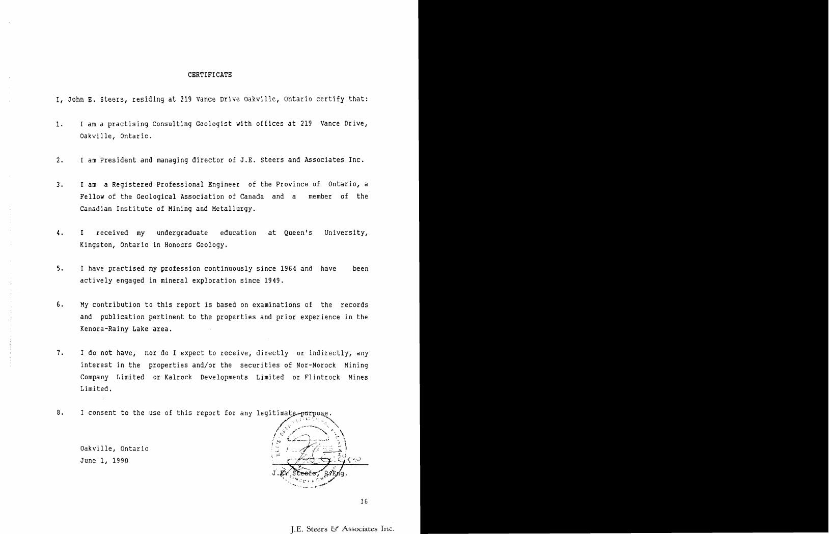
CERTIFICATE
I, John E. Steers, residing at 219 Vance Drive Oakville, Ontario certify that:
1. I am a practising Consulting Geologist with offices at 219 Vance Drive,
Oakville, Ontario.
2. I am President and managing director of J.E. Steers and Associates Inc.
3. I am a Registered Professional Engineer of the Province of Ontario, a
Fellow of the Geological Association of Canada and a member of the
Canadian Institute of Mining and Metallurgy.
4. I received my undergraduate education at Queen's University,
Kingston, Ontario in Honours Geology.
5. I have practised my profession continuously since 1964 and have been
actively engaged in mineral exploration since 1949.
6. My contribution to this report is based on examinations of the records
and publication pertinent to the properties and prior experience in the
Kenora-Rainy Lake area.
7. I do not have, nor do I expect to receive, directly or indirectly, any
interest in the properties and/or the securities of Nor-Norock Mining
Company Limited or Kalrock Developments Limited or Flintrock Mines Limited.
8. I consent to the use of this report for any legitimate^-parp&s^e.
Oakville, Ontario
June l, 1990 'O
16
J.E. Steers y Associates Inc.
.—. —....,. ....,.i m mim mi H ill Hill Hill52C11NE0057 OM90-060 HALKIRK
020
REPORT ON
AEM INVESTIGATIONS
IN
HALKIRK and WATTEN TOWNSHIPS
DISTRICT OF RAINY RIVER
FOR
KALROCK RESOURCES LIMITED
November, 1990 H. Z. Tittley
Paue
NUMMARY CONCLUSIONS
The g round investigation of 10 airborne electromagnetic anomalies located 4 massive sulphide zones containing minor to significant amounts of copper mineralization and massive pyrrhotite sections.
These iron formation-type deposits are associated with gabbroic intrusions and., in two cases (anomalies 21B and 1.5). are similar to nearby zinc-rich occurrences.
A l l warrant ootent ia l .
further examination to determine width and economic
One anomaly which could not be explained by trenching (anomaly 16) and a well situated weaker conductor (anomaly 23). should also be investigated further to determine their cause.
METHODS
ofThe nature of recent en mi neralizat i on i nter layered mi neral i 2a t i on
i nvestiga11 on '. n t h e
t h e ;tivityassociated with with gabbroic occurs along the
Portage Bay sill, the writer believes that untested conductors could represent a combination of both types of mineralization.
was based primarily on the studyarea which focused on zinc
thin dark sedimentary bandssills. Since fair copper
west margin of the main Grassy
Based on this concept, anomaly 21 which is covered by Kalrock Resource's Redgut bay property was tested first. Fortunately or unfortunately. the east-west interpretation was found to be invalid and instead. it consists of 4 northwest and north northwest-trending conductors.
All six channel AEM anomalies that are permeability were readily detected and portable vertical loop electromagnetic basically a Crone JEM unit operated in the
not due to magnetic traced out with theapparatus which is
vertical loop mode.Strong signal interference originating from a power transmission line north of the Redgut Bay property and a second line running along highway 11 precluded detection of some of the weaker single and two channel anomalies. In quieter areas where a wider transmitter-receiver separation is possible, weak anomalies can usually be traced.
Navigating to AEM response sites was aided by air phoLos. Once a cross over was obtained, a new set-up was made from which two x- overs were obtained, thus providing a strike direction. A blazed control line was then driven through the x-over points and short profiles were read. Cross-over points were also located where trenching seemed possible.
Page ?.
Trenching and especially sampling becomers the most difficult toskfj owing to the e l ecti- ochemi ea l ] y active nature o f t he sulphide mineralization. Once the bedrock is reached through r ool L; and a thin layer o f soil, an equally thick layer of gossan must be removed with chisels and sledges. Sampling of the fresh lower material is tedious and not always successful. At one site, a second trench was reguired to obtain representative samples of the conductive material.
INVESTIGATIONSt
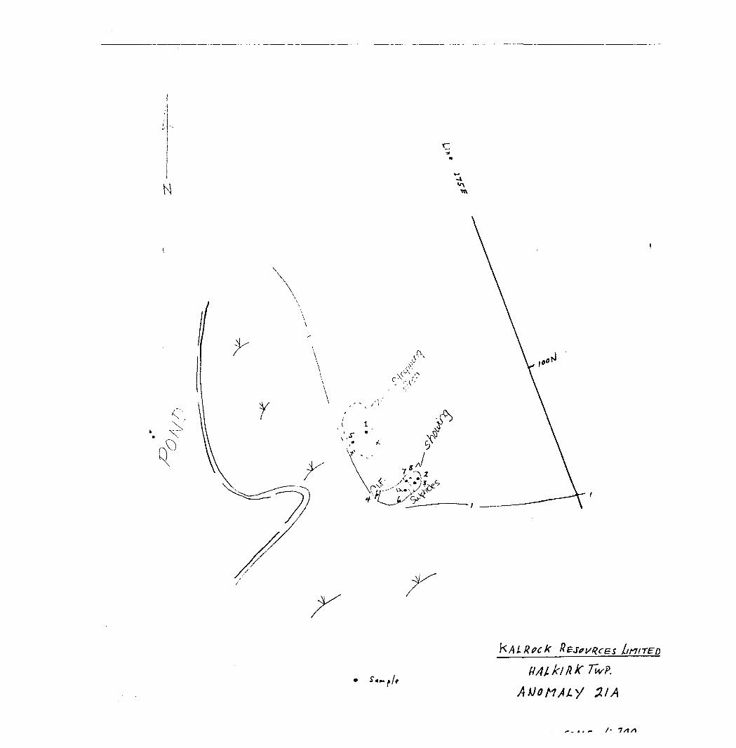
ANOMALY 21A
The anomaly lies in the western part of the Redgut Bay property. It was located and traced over 300 metres in a north nor i. hw*.;:.;ter ly direction. As a broad muskeg covers the southern part. the anomaly was traced over an area of shallow outcrop along the east edge of a small pond.
Stripping and trenching revealed a 5 m wide zone of sulphide and magnetite iron formation bounded in gabbroic rock. Chalcopyrite ranging up to 13; was observed in a silicified '50 on pyrrhotilerous section. Based on x-over shifts between north and south transmitter set-ups, the zone is expected to be more than double the 5 m width exposed in the trenches. The dip of the formations varies between 80" and 50' west which is supported by the HM data.
Though ground positioning is very accurate, relative to the lakes and ponds, the true location of the lot line (and the property boundary) could not be ascertained. Trenching was carried out 10 m west of the Kalrock claim line and 30 m east of the eastern boundary of the adjoining property. Pending a survey, it is assumed that the stripping is on Kalrock ground but that the northwest part of the conductor is not (see sketch).
Page 3
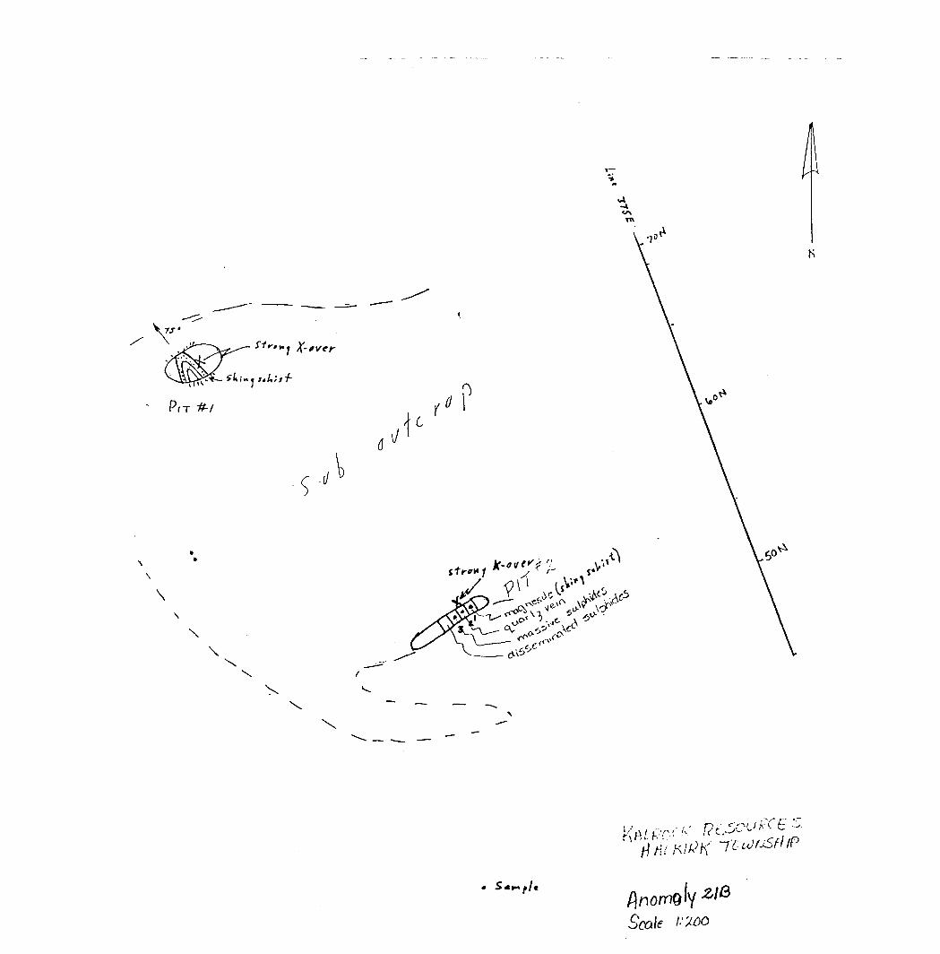
ANOMALY 2 IB
fr.i mi l a r l y . this anomaly was traced ovor 250 rn in e. northwesterly d i root i on. Although a very sharp x-over wa-.j obi" a i no d along t lie crent of a nuh-outcrop ridge, stripping revealed a sharp fold plunging 75" north, but no conductive material. In A second pit. only 2S m fur 'her east., fm R rn wide gossan zone was exposed. Some conductive material consists of. disseminated pyrrhotite in a dark sooty _ matrix and massive pyrite across 20 cm rind 30 cm respectively. Again, the overall zone is expected to bo at least
wider than the exposed portion.
A grey shiny schist was encountered at both sites. Hand specimens are tentatively identified as magnesite, largely because of its sparkle and slippery texture. Minor hydrothermal quartz is present also.
Away from folds, the foliation is vertical. The formations appear derived from mafic volcanics. Since conductors 21A and 21B would converge to the -north, they are possibly one and the same.
Dark sooty material of a sedimentary nature is also present at the Pocket Pond occurrence where it is intimately associated with the zinc mineralization.
ANOMALY 21C
This anomaly consists of 2 two channel AEM responses. It was encircled by a 100 m search traverse and crossed by a north-south profile, but no measurable dips were obtained.
The area is south of a major outcrop ridge which consists primarily of well foliated grey-green schistose hornblende. The abundance of large granitoid glacial erratics suggests that the felsic intrusive rocks, seen in outcrops to the east, extend into this area.
Ground conditions do not favour an overburden type response. The anomaly should be tested further using grid lines and electromagnetic units equipped with 60 cycle filters such as the Geonics EM-17 or Parametrics Max-Min IT.
Page 4
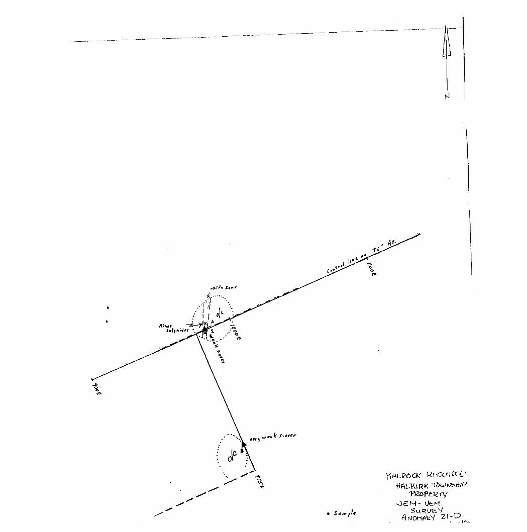
ANOMALY 2ID
Anomaly 21P consists of 2 and possibly 3 two channel responses. At its position along the control line, there is an outcrop ridge with a runty zone which contains a 5 mm seam of massive- sulphides. The rocks are mainly hornblende schist striking 170".
From a transmitter set-up on traverse was read across the area x-over was obtained but on a conductive response was observed set-up or this second site no control line.
the mineralization. a search south of the control line. No
closer short profile, a weak over nn outcrop ridge. From a x-over was obtained along the
The wide
bulk of this anomaly lies to the south-southeast towards adrift-covered area. Although some outcrops are -shown on the
geological map. additional follow up seemed too time owing to the 3.2 km trek to highway 812. Any of the property should include this anomaly.
consuming systematic coverage
ANOMALY 23
This 3 km string of 1.2 and 3 channel anomalies lies along the east boundary of the Redgut Bay property. Towards the south it becomes more central to main Grassy Portage Bay Sill.
Unfortunately, after closer scrutiny of the aerial photos it is evident that our search from two transmitter set-up was conducted on an adjoining pond to the one we had targeted. Actually, our marked trail which extends from a series of old roads intersected the anomaly south of the patented claim. In retrospect however the weak response on the Kalrock claim might not have been detectable.
The writer strongly recommends this anomaly for its grade copper-nickel potential with possibility of PGE should be examined south of the patented claims with noise-rejecting equipment.
large low metals. It power line
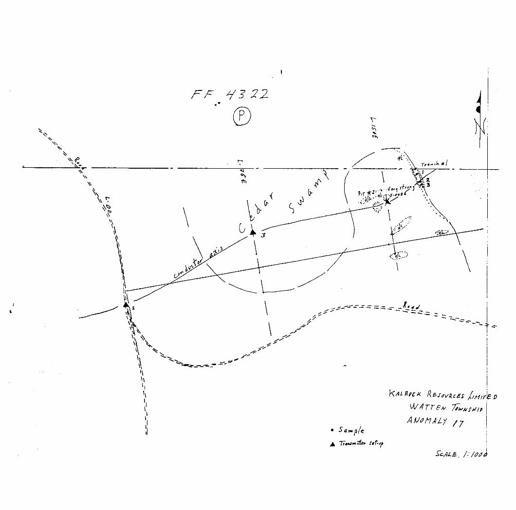
ANOMALY 17
This anomaly consists that are central to gabbro.
of an 800 m string of a northeast-trending
6 channel anomalies sill of hornblende
An original x-over was detected 100 m east of a transmitter set up located near the boundary between lots 17 and 18. From this x over site, a strong response was obtained farther east along the south margin of a broad cedar swamp. Again. 75 m to the east, very strong x-overs were obtained on, the apex of. and the east slope of, an outcrop ridge. ; "s: ?f
Page 5
Stripping at the latter site uncovered a broad rusty zone and a black sooty schist or sediment carrying 7 Cn, medium-grained and fine-grained pyrrhotite. The maternal which i L; magnetic and highly conductive corresponds to the description of certain zinc zones in the Pocket Pond occurrence to the northeast.
'J'he conductor is covered by a block of 7 new claims and until a survey is carried out. the amount of strike length lying across
rmtheast corner of a patented claim is unknown. It appears be very near the stripping area.
the to
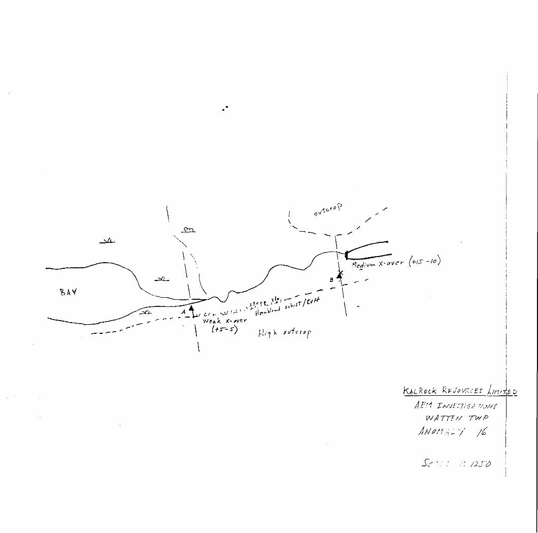
ANOMALY 16
This anomaly consists of *an elongated string of l to 6 channel responses that lie along a slough located at the base of a 10 rn ridge of mafic volcanic rocks.
From a set-up located at the bottom of a grassy bay. noisy x-over was obtained at the base of t.he ridge's A second transmitter set-up at this location failed proper response near the original set-up; probably high level of power line interference.
a med i urn hn tnort h s l ope.to locate adue to the
The conductor appears confined to the drift- and talus-covered part of the slope and could not be examined with the available prospecting tools.
Ninety percent of the conductor's strike is covered by a block of 7 claims that were staked on behalf of Kalrock Resources.
This conductor which lies along the volcanic-gabbro contact should be examined by drilling to determine the cause and potential.
ANOMALY 15B
This anomaly is a single 100 m north of anomaly 15.
6 channel response located in lot 16,
A circular 100 m traverse was made but no significant dip angles were encountered. suggesting that the response may be a paired peak associated with the very strong anomaly 15.
The area is along a high outcrop ridge where control is more difficult. It may have been improperly covered. The whole presentation of this anomaly should be re-examined and the results considered when carrying out further investigations in this area.
Page 6
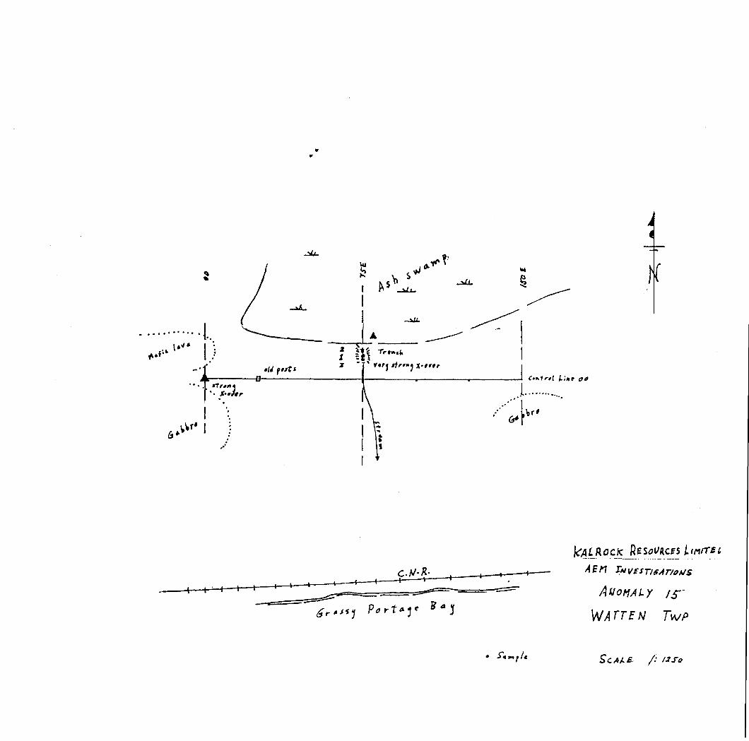
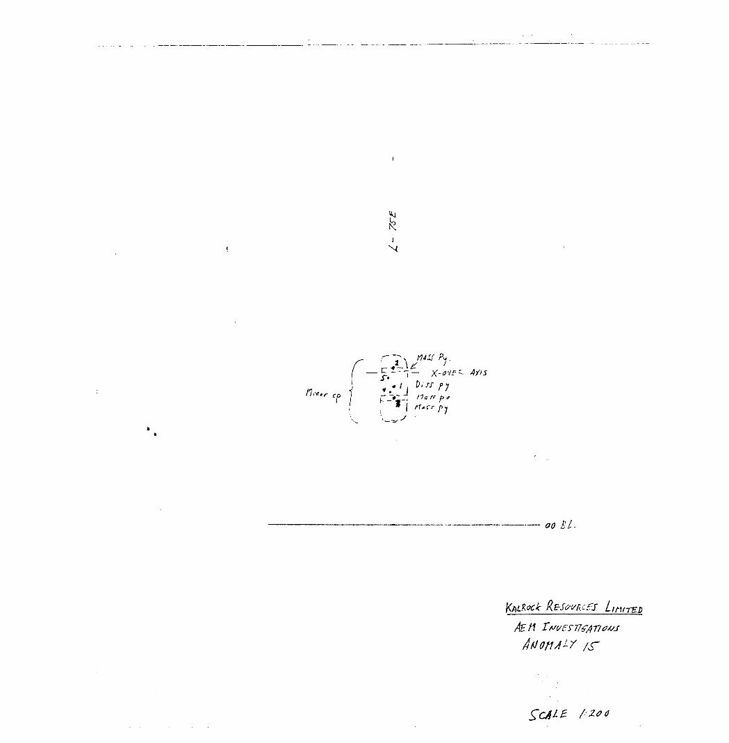
ANOMALY 15
The anomaly which consist of an 2200 m string of 6 channel AEM anomalies was readily located in the area of lot 15.
The first set--up was made on the south margin of an ash swamp and a profile was read to the west. Although very strong x-overs were obtained near the original set-up, they were always at the edge of low outcrops.
Finally, it was decided to trench the bottom of a small stream that normally drains the swamp. Though the bedrock was found to be very irregular and very irregularly weathered, good samples of highly massive pyrrhotite occurring over a 20 cm width, were extracted. Minor chalcopyrite is visible with most of the sulphides. ,As elsewhere, the overall zone is expected to be at least 3 times wider than the 1.6 m section exposed in the trench.
The anomaly occupies the contact between mafic lavas to the north and a sill of medium-grained gabbro to the south. It is strongly recommended that l. h i a anomaly be examined further as a possible source of combined copper-nicke l-2:iiic mineralization.
ANOMALY 5
This anomaly was investigated in the area of a 6 channel response located west of the township line in the western part of the anonia l y .
Although dip angles ranging up to 6 degrees were measured on both high and low frequencies, no x-over could be located from the first set up. A second transrnitter set-up was made higher on the rocky ridge but no dip angles were observed.
The effects of magnetic susceptibility are the suspected cause.Examination of ground geophysical data in this area providessupport, for this view.
The anomaly but not necessarily the area is of no further interest.
H. zTnTttfey P.Eng.
•nv
Reset/zees Li tt ir E
•"f/t H A L klR k TwP. 2/A
L'.*'
\o
Jl
7/
//
\
1 -D
•A
Sy
r- 50
d O
v A-
T!
O
S!
o!
o I b!iIt I
Ht
UtoSO!
eab
m k.
fff
B
p.T*~ . Haff p e f
cfS L int-rep
L' C *- D
1928
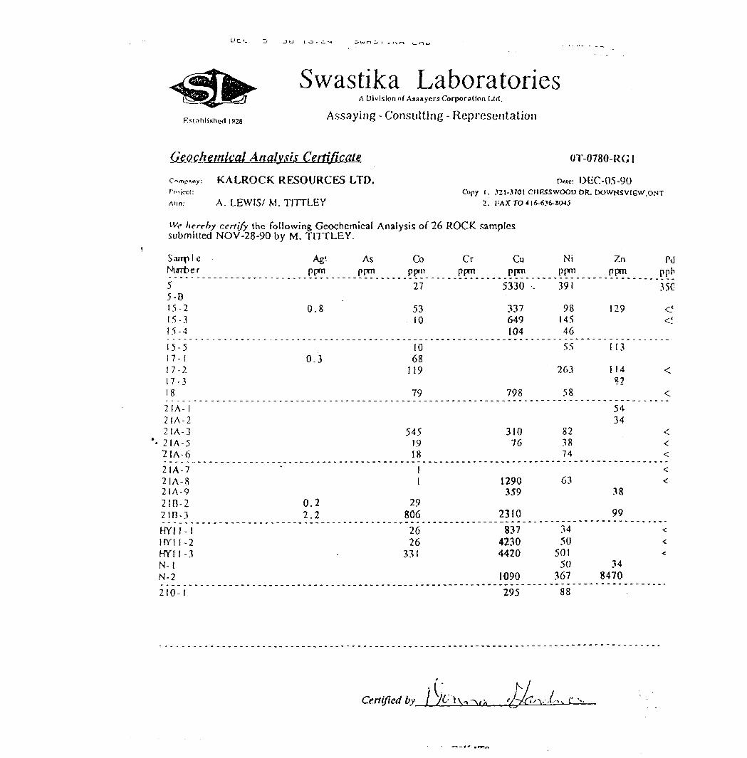
Swastika LaboratoriesA Division of Assayers Corporation Url.
Assaying - Consulting - Representation
Geochemical Analysis Certificate c^p.ny: KALROCK RESOURCES LTD.Pn.ic^t:
Ann: A. LEWIS/ M. TITTLEY
OT-0780-RG l
DEC-05-90 Copy l. .121-3701 CHF,SSWOOD DR. DOWNSVIEV/.ONT
2. TAXTO416-636-S045
We herehy certify the following Geochemical Analysis of 26 ROCK, samples submitted NOV-28-90 by M. TITTLEY.
Sampl eNmtter55-B15-215-315-415-517-117-217-?182IA- 12IA-22IA-3
*- 2IA-5"21A-6
21A-72IA-82IA-921D-22IB-3HYII-Iirm -2HYI 1 -3N-lN-2210-1
Ag'. As Coppm ppm ppm
27
0.8 5310
100.3 68
119
79
5451918
11
0.2 292.2 806
2626
331
Cr Cuppm PP01
5330 -.
337649104
798
31076
1290359
2310837
42304420
1090295
Nippm391
981454655
263
58
823874
63
3450
50150
36788
Zn Pdppm ppb
35C
1 29 ^^'
113
1 14 <82
<5434
<<<<<
38
99<<<
348470
Certified by
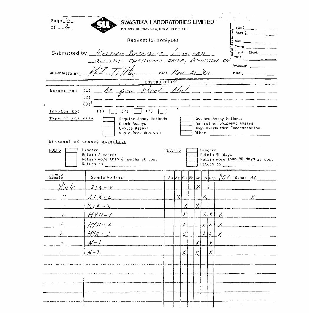
SWASTIKA LABORATORIES LIMITEDP.O. BOX 10. SWASTIKA. ONTARIO POK ITO
Request for analyses
Submitted by AQg/ Atffc l\erni
-3^1^=3204- —C^BSJj^^z^-
AUTHORIZED BY
. fi/1" t/f t/s f K/
^ LABiLl K EPT 4
SOtto
— Carrier __ ^^ o
, U wd. O col.WBtf
DATE
PROJECTU
P.O.*
INSTRUCTIONS
Report to: (1)
(2)
(3)'.
Invoice to:
Type of analysis
(2) i iRegular Assay Methods Check Assays Umpire Assays Whole Rock Analysis
lleochein Assay Methods Cuulrol o r Shipment Assays Deep Overburden Concentration Other
Disposal of unused materials
PULPS Discard RCJL'CISRotain 6 monthsRet.airi more than 6 months at costReturn to
Type of Sample
l\ (?L If
,,
,,
ft
hA
,,
*/
*
SciniplR Nuinlicr:;
2.\A~ 9
Jl * ~z
X / ^ - "S
/////- 7
W- zHi /i - J/v — x
/t/ ~~ Z-
Au Ap
^
Cu
x*x.
X
X
Pb
Discard Retain 90 days Retain more than 90 days at cost Return to
Zn
X
x
X
A
Co
^
X
,
K
Ni
t
/C
XX
—-
- P(? E: O ther /j-f
X
KA
11ST
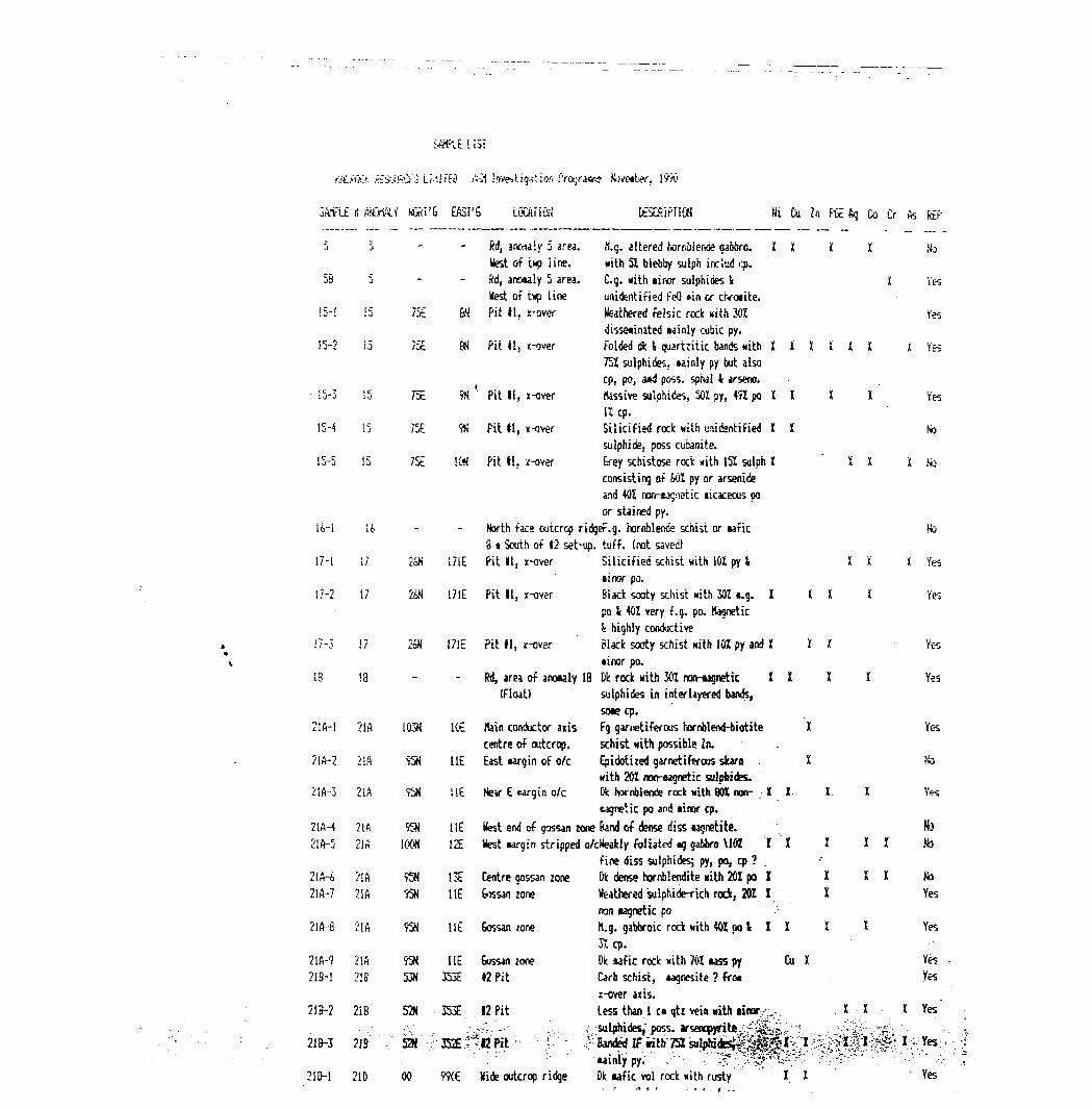
KALmt; kEiJGiJSCfo LM!fEO i.-;1 :nveiriq;i!:iQri -Vograaft? November, lYrO
SAhfih i) &JGHALV MOST'6 EAST'S iOCATiCfi DESCHiPriON Hi Cu Zn fix Aq Co Cr As REP
55 M, anwa'.y 5 area. K.g. altered hornblende gabbro. l l l l Notest of tup iine. with 51, b lebby sulph incitid op.
5B 5 - Sd, anowly 5 area. C.q. with tiror sulphides i I Yestest of t*p line unidentified i-'eQ *in or chromite.
!5-l !5 75E SJ Pit li, x-aver feathered felsic reck *ith 301 Yesdissetinated lainly cubic py.
15-2 15 75E SN Pit 41, K^ver Folded die i, quartzitic bands with l l l l l l i Yes751 sulphides. *ainly py but also cp, po, a*d poss. sphal i arseno.
- 15-3 15 75E 9K '- Pit 11, x-over rUssive sulphides, 501 py, 491 po K l l l Yes1Z cp.
15-4 15 75E 9JJ Fit H, x-over Silicified rock with unidantified I I fosulphide, poss cubanite.
15-5 15 75E ION Pit 11. /-over Erey schistose rock Kith 151 sulph i X X X fcconsisting of fcOl py or arsenide and 401 ran-tagnetic licaceous po or stained py.
16-1 ( k - - North face outcrop ridger.q. hornblefide schist or tafic HoS t South of 12 set-up, tuff, (not saved)
17-1 17 2oN I/IE Pit li, x-over Silicified schist nith 101 py l H X X YKmnor po.
17-2 17 2&N 171E Pit H, x-over Black sooty schist with 301 *.g. X l i l Yespo i 40Z very f. g. po. tognetic i highly conductive
17-3 17 2bM 17IE Pit 11, x-over Slack sooty schist nith 101 py and X XX Yest i nor po.
18 18 - Rd, area of arouly 18 Dk rock with 301 non-iagnetic l l l l Yes(Float) sulphides in interlayered bands,
SDK cp. 21A-1 21A 103H ICE Kain conductor axis Fg garnetiferous hornblend-biotite X Yes
centre of outcrop. schist with possible Zn. 21A-2 2!A SjN HE East margin of o/c Epidotized garnetiferous skarn . X No
with 201 nofl-ugnetic sulphides. 21A-3 21A 95N HE Nev E wrgin o/c Dk hornblende rock with flbl non- ; X X X l Yes
cagnetic po and tinor cp.21/H 21 A 931 l (E West end of gossan zone Band of dense diss lagnetite. ' No 21A-5 21A lOC* 12E test targin stripped o/cKeakly foliated tq gabbro M01 II l X X Na
fine diss sulphides; py, po, cp ?21A-A 21A W 1 3E Centre gossan zone Dk dense hornblendite nith 201 po I X XX No 21A-7 21A m H E fossanzone Weathered sulphide-rich rock, 201 I x Yes
ran lagnetic po 21A-8 21A 9Sfl lit Gossan zone M.g. gabbroic rock nith 401 po l I I X X Yes
3Xcp.21A-9 21A 95N HE Gossan zone Dk *afic rock nith 701 MSS py Cu l Yes 21B-1 21B 53N 353E 12 Pit Carb schist, *agnesite ? fro. . Yes
x-over axis. 21B-2 2iB 52H 353E 12 Pit Less than l c. qtz vein nith iinor-... , X X X Yes'
•'•:- - :.-7,'. ---' . . ; sulphides," poss. arsenopyrite:. -r -.Ki : . "•"••^••••^:- ' ~ 21&-3 21B 52M -r352E:;1.l2Pit-- ^. :' '.J: Banded If iit^75lsilphi(tei^^^i^X - ^jt^l-^'l^.
'- ''''-- ; ' wi' - v ' : " -'".' ' ; --'" ' -" '-':';.-2I&-1 21D 00 WE Hide outcrop ridge Dk iafic vol rock *ith rusty " l . X ' Yes
iVvlE US!
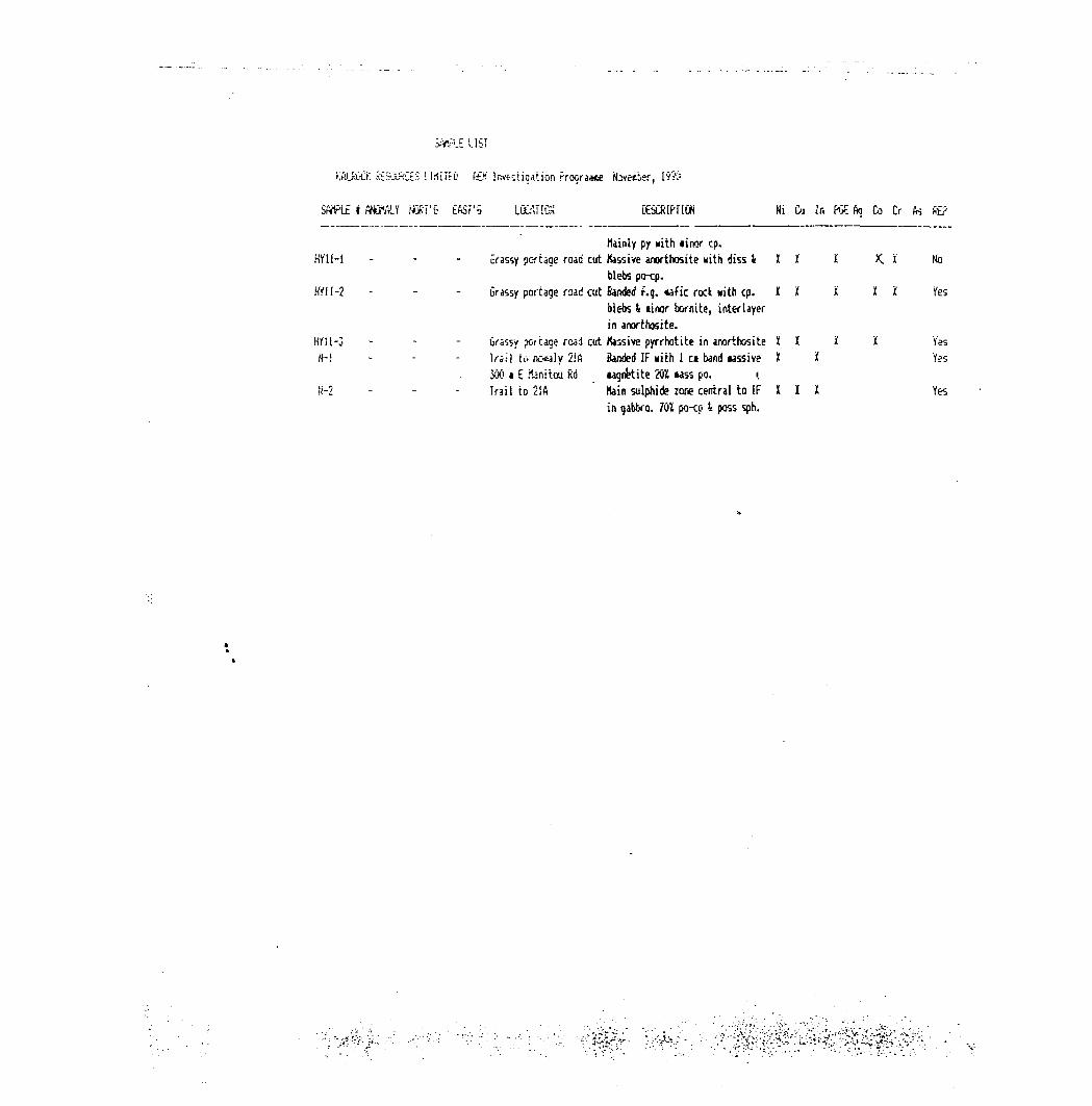
KAlRiSCK SESJU3CE5 Ll.iilEO fth Investigation rroqra*ce Novelier, 19?5
SArFLE i WttttLY Nufii'G EfiSr'b LOuUIGX KSCKIPriGN Mi Cu Jn FGE to Co Cr te Rf?
Mainly py Nith *inor cp. HY11-1 - C-rassy portage road cut Massive anorthosite with diss i ll i X. i No
blebs po-cp. tffll-2 - - - Grassy portage road cut Banded f.g. tafic rock Kith cp. KX X l i Yes
blebs l linor bornite, interlayerin anorthosite.
HYSl-j - Grassy pa cage road cut Massive pyrrhotite in anorthosite l i 'i l Yes W-1 Trail to nc*dy 2!A Banded IF with l ci band lassive K it Yes
30(i t E fenitoa Rd wgnttite 20Z iass po. . { ii-2 - - - Trail to 21A Main sulphide zone central to IF X I X Yes
in gabbro. 701 po-cp i poss sph.
September
J.G. Salo
52C11NE0057 OM90-060 HALKIRK 030
GEOLOGICAL
OBSERVATIONS of
WATTEN TOWNSHIP
and
HALKIRK TOWNSHIP
PROPERTIES
for
KALROCK RESOURCES
52C11NE0057 OM90-060 HALKIRK 030C
I. Introducti on II. Property Location and Access
III. Previous (jork History
IV. Current Prospecting
i} Introduction
ii} Topography
i i i} Findings
Recommendations
Figure la- Kalrock Resources- Main Group
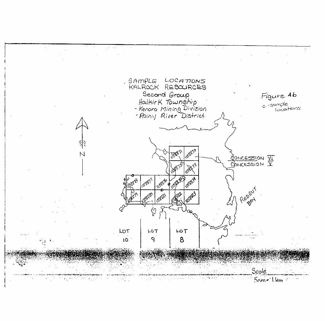
Lb- Kalrock Resources- Second Group
2 - Location flap
3- Past Explorations
Ma- Sample Locations- nain Group
Mb- Sample Locations- Second Group
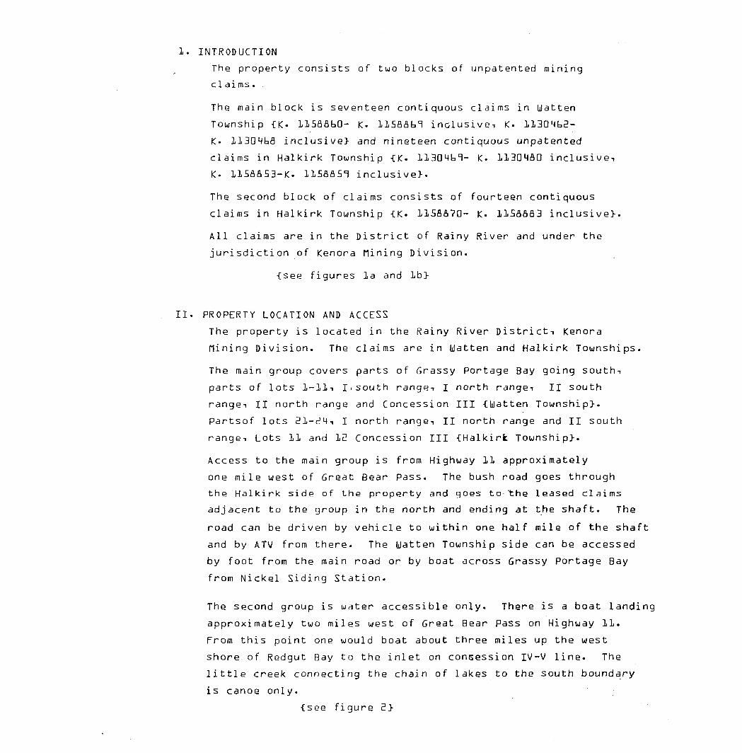
INTRODUCTION
The property consists of two blocks of unpatented mining
ci ai ms .
The main block is seventeen contiquous claims in Watten
Township -CK- HSflflbQ- K. HSflflbT inclusive! K. 11304b2-
K- llBOMbfi inclusive} and nineteen contiquous unpatented
claims in Halkirk Township {K. 113D4t,1- K. 113DMSD inclusive!
K. HSaaS3-K. llSaflS^ inclusive}.
The second block of claims consists of fourteen contiquous
claims in Halkirk Township -CK. 1158370- K- HSaaa3 inclusive}.
All claims are in the District of Rainy River and under the
jurisdiction of Kenora Nining Division.
-[see figures la and lb}
II. PROPERTY LOCATION AND ACCESS
The property is located in the Rainy River District-i Kenora
flining Division. The claims are in Watten and Halkirk Townships.
The main group covers parts of Grassy Portage Bay going southi
parts of lots l-ll-i I^south range-i I north range-i II south
range-i II north range and Concession III -[Watten Township}.
Partsof lots EH-SM-i I north rangei II north range and II south
range-i Lots 11 and 12 Concession III {Halkirfc Township}.
Access to the main group is from Highway 11 approximately
one mile west of Great Bear Pass. The bush road goes through
the Halkirk side of the property and goes to the leased claims
adjacent to the group in the north and ending at the shaft. The
road can be driven by vehicle to within one half mile of the shaft
and by ATV from there. The Watten Township side can be accessed
by foot from the main road or by boat across Grassy Portage Bay
from Nickel Siding Station.
The second group is water accessible only. There is a boat landing
approximately two miles west of Great Bear Pass on Highway 11.
From this point one would boat about three miles up the west
shore of Redgut Bay to the inlet on concession IV -V line. The
little creek connecting the chain of lakes to the south boundary
i s canoe only.
-[see fi gure E!}
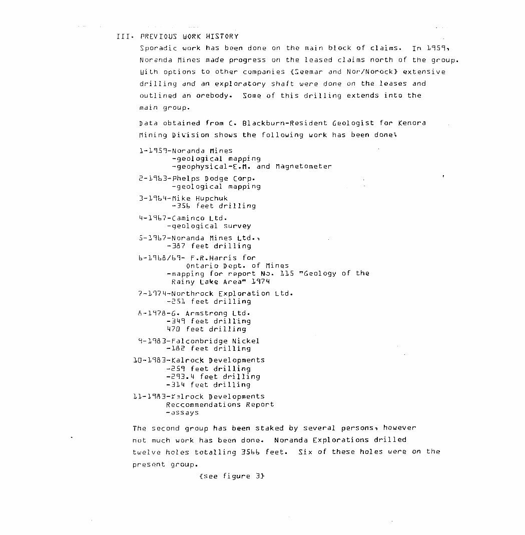
Ill- PREVIOUS WORK HISTORY
Sporadic work has been done on the main block of claims. In
Norsnda nines made progress on the leased claims north of the group.
With options to other companies -CSeemar and Nor/Norock} extensive
drilling and an exploratory shaft were done on the leases and
outlined an orebody. Some of this drilling extends into the
main group.
Data obtained from C. Blackburn-Resident Geologist for Kenora
[lining Division shows the following work has been donei
nines-geological mapping-geophysical-E- H. and flagnetometer
2-nb3-Phelps Dodge Corp. .-geological mapping
3-nt,4-nike Hupchuk-3Sb feet drilling
M-l cib7-Caminco Ltd.-geological survey
S-nbT-Noranda nines Ltd. -i-3fl7 feet drilling
b-llbfl/bl- F.R.Harris forOntario Dept. of nines
-mapping for report Mo. 115 "Geology of the Rainy Lake Area" 1^74
7-l ci74-Northrock Exploration Ltd.-251 feet drilling
fl-n7fl-G. Armstrong Ltd.-34^ feet drilling 470 feet drilling
T-na3-Falconbridge Nickel-IflE? feet drilling
k Developments feet drilling 4 feet drilling
-314 feet drilling
ll-nfl3-!T3lrock DevelopmentsReccommendati ons Report-assays
The second group has been staked by several personsn however
not much work has been done. Noranda Explorations drilled
twelve holes totalling 3Sbt, feet. Six of these holes were on the
present group.
-[see figure 3}
IV. CURRENT PROSPECTING
i} INTRODUCTION
Kalrock Resources contacted this writer in September aTTD to
do a general prospecting of the property. A perimeter
coverage was done on the two groups.
ii} TOPOGRAPHY
The main group of this property is extremely quick changing.
Due to the lack of trapping there are several very large
interconnected beaver ponds and swamps. flany of which are
quite difficult to cross or go around. The Halkirk side of this
group is approximately HS^ beaver swamps. The inclines out
of the swamps are steep and covered with heavy bruch-i the tops
of the inclines are mixed forest {birchi pinei spruce and.
Cedar} with a lot of windfall. The Watten side is more rolling
with less swamps. Access from Grassy portage Bay is always
straight up. The shores being steeply declining rock. The
shoeeline on claim K.llSflflbl at the place of the witness posts
is a lovely sandy beachi ideal for a camp set-up. There is an
old road leading to the location of the flNR Firetower that would
be winter use from the bay.
There are two visible drill roads that access the claims
interior however dry weather would be a neccisity due to the
swampyness of their condition.
The road to the shaft is in fair condition until it reaches the
main beaver pond. One sectioni on the north boundary needs
extreme repairs or a bypass if it is to be used anytime other
than winter.
The second group is topographically similar to the Watten side
of the main group. Being draws and rolling hills. The draws are
full of water and swamp due to beaver astivity. The inclines
are brushn the high ground is mixed forest.
iii} FINDINGS
The main block of claims is predominately described as the
Grassy Portage Bay gabbro sill -CHarri s i ODfl Report 115}. The
far west side of the Uatten/Halkirk group is medium grainedn
unaltered gabbro. The shoreline is very weathered and it is
difficult to tell where the alteration starts. Lot b starts to
show a change in the grain size to a more coarse grained gabbro.
In Lot 4 there is a large swamp. The outcrop coming out of the swamp
on the south side shows the gabbro starting its alteration.
Uest of the swamp on the same outcropi there is visible biotite
and horneblendite.
A major faulting zone on the east side of the. township line '
is seen by the lineal change in the directional dip of outcrops.
The east side of the group starts with mafic volcanics coming
out of the lake in the NE corner of the group. These volcanics
are \. -.-y folded and change quickly to gabbros. These gabbros
have blebs of molybdenum and limanite stain is present. This area
is magnetic enough to offset the compass.
Going south and coming out of the cedar swamp in II South Range
altered tuff with biotite is the bulk of this outcrop.
One quartz vein was seen on lot 21 II South Range. It is very
small and weathered on the surface with no visible sulphides.
The south boundary runs in bands NE-SU- The east side of the road
being sericite and mica schist. A low area seperates these
schisty rocks from the altered gabbros. Moving westerly in
bands of altered volcanics to coarse grained gabbros.
The second group off Redgut Bay was not widely covered due to
the weather making boating unsafe. The two days spent here
showed the southern portion 'of the group being very altered.
An old pit was found on claim K-llSflflflS. Although very weathered
there is visible chalcopyrite. Northwest of the pit is altered
schist. The exposed rock is very oxidized and rusty making it
difficult to define. Several small chalcopyrite veins crosscut
this rock. At a fresh exposure it looks to be a horneblende schist.
The southeast of the pit is altered gabbro and a small area which is
granite like syenite. The gabbro is typical of the Grassy
Portage Bay sill with horneblenden biotite epidote schist.
Visible pyrite and chalcopyrite can also be found,
-[see Sample Location flaps Ma and Mb}
RECOnriENDATIONS:
There is all the evidence necessary to suggest the
potential for massice mineralization! being copperi zinc
and possibly nickel.
After reading all the past reports on these properties and
those of the surrounding area it is recommended that
the following should be considered*!
Main Group
1- Geophysics on the newly acquired claimsi and detailed
gridding on the north-central Halkirk side.
2- Drilling of the targets to a depth greater than MOD feet, i
Second Group
1- Line cuttingn geophysics and mapping
2- Drilling of targets.
' r\^txxi-4.——s
*!f
L.OOJ--
K P. u P oc -. p. ~ 2 ou R ci e , . /*i^o-r\ '.-5 rou c -Halkirk
pi'ou re /Q.
r4 - KenofQ ^r\r
,itv
^
r.\Kxroe*/ ™
^kn3e
x ^ '^~
^J
\
LOT ," i
^- —
Ac
.0,,/UO-r
10
1
xc/-"
LOT ci
LO 4-
k"\N^
•' " "" -
LO "T
8
^r
-^' o-' \p
'b
j
LOTi i
Lo-z
^-^
1 1
1
LOT
Lo
T)
r^V
\\^/r^
i^^ 1
1
l
LOT
5
LO'—i c^
^
6 ^
^^ ^
-;
LOT
H
-
7/p'
7^-'IJ^\\^
LOT
3
u^ orC*'
-tf-
/" \V
. .Ve
l
UO Tt *1
T 1^sjf 1 1
/'
1x\y
^
^
l o T
^, S "^clxx
x^' J^ *#;
^
')^
LOT
^ 'i : x. 4*
t l ^
,''"X'
C\ 'J^ V^\
^?
,/
^
-O""
W3 .A ''r.f-'li
i ;L1 I*-. Vii^^ 1
softT \^ x^^\
^
Wf\s\\l
x\f; y^
^
,Q-
1
-uf-V^'•x
,^^
/x x^'
'^ -^V '
X f\
\ \: \ XC1
i
r,7
IT. K
Sco\e
kfiLROOK
:.l?r i.^i'C--r,^
Ib
M
^
.OT
10
Wfl zPis'-
i/r-?-
A
J
Scalcn^ ' i km
—— Read lo h

rO Y-
^c: o t
27 o V-, 1.1K
*
l * ^1
LL(/0;
il
~ -r
\ -A
S?~
Bjw
-i
D ^
o-
*
-T
U
^ 5
d-0 O
O)'
-f-
^ -T
-
R r m
?- s
. w^
03
,
O "O
H) r*
STATEflENT OF QUALIFICATIONS
li Joe-Anne G- Salo of Lot E C on. tn German Township! in the
Village of Connaught! the City of Timmins-, the District of
Cochrane! do hereby declare and put forth the following
qualifications for demonstrating Professional Competence
Equivalence concerning Watten and Halkirk Townships-t for
Kalrock Resources and dated September! ilTTO.
1. I am a graduate of grade thirteen from Dunbarton High School
in Pickering! Ontario! n?h.i
2. I am an (I.R.C. graduate from Centennial College in Scarborough!
Ontario! n?fl.
3. Geological-Technical Course- Ingamar Explorations
M. Geological Drafting Course- Hollinger Mines Ltd.i
S. Field School in [lining Geophysics- Haileybury School of nines
mo.b. I am a self taught prospector! studying geology and working
continuously since flay ITfld.
7. I have filed two affidavidts attesting to Prof fessional
Competence with the Ontario Department of flinesi (lining Lands
Section,
fl. I have no interest in the Kalrock Resources Property! Watten
and Halkirk Townships and will receive no further payment other
than my fees.
Joe-Anne G. Salo
K A L R O C K RESOURCES LIMITED 321 - 3701 CHESSWOOD DRIVE, DONSVIEW, ONTARIO
M3J 2P6 PHONE (416) 633-5820 FAX 636-8045 __________Re: OMIP File OM90-060__________
1 AG SAMPLE*: ppm
5
5-B
15-2
15-3
15-4
15-5
17-1
17-2
17-3
18
21A-1
21A-2
21A-3
21A-5
21A-6
21A-7
21A-8
21A-9
21B-1
21B-2
21B-3
HY11-1
HY11-2
HY11-3
N-1
N-2
JL
JL
1 .80
m
JL
JL m JL
1 .30
.JL
JL
JL
. JL .
. JL
JL
JL
JL
. J. .
-L
V
JL
1
JL
1 .20
1 2.20
JL
JL
JL
JL
JL
JL
1 AS
JL
JL
JL
J-m
J-
JL
JL
JL
JL * JL
JL
JL .
JL
JL
J.
JL
JL
JL
JL
. JL .
JL
B
JL
1*
JL
JL
JL
JL
JL
JL
JL
JL
2 1JL
. JL
w JL
1 1
*
JL
420 i
JL
.
. JL .
JL
JL .
JL
. JL
JL
. JL
JL .
JL
J.
. JL.
JL
JL
JL
JL
JL .
JL
GR i
M
JL
JL
39 i.
JL. .
J-
JL
JL
JL.
J.
JL
-S.
.
41 i
110 i
JL
JL *
JL
JL
JL
201
9 1
J-
JL
JL
00 i
27 1
53 1m
*
10 i
-s-
10lJ.
68 i
119 ia JL
79 i
j-
m
545 i
19 lm
18 i
1 i
1 1
* JL
JL
29 l
806 i
26 l
26 i*JL
331 i.
JL
JL
JL
CU ippm :
5330 i
JL
337 i
649 i
104 im
JL
JL
M
JL
JL
JL
m
m JL
798 i
JL
310 i
76 i
JL
;1290 i
359 i
295 iw
m JL
2310 i
837 i
4230 lJL
4420 l
JL
1090 lJL
NI iram :
391 I
98 ij.
145 i
46 i
55 ij.iJL
263 lJL
JL
58 im
*
JL
82 i
38 i
74 l
*
m
63 lK
88 i
JL
341
50iJL.
501 i
50 i
367 iJL
ZN i ram
JL
-S.
J.
129 iJL
-*-
j-
1131
-*-
114 i
82 l
-*-
54i
34 i
JL
JL .
*
* JL
38 i
JL
. JL
99i*
m JL
m
m JL
JLM
JL
34 i
8470 i
PD rab
350
tr
tr
tr
tr
:ROCK ALTERATION AND LOCATION OF SAMPLES*
img altered hornblend gab/5% bleb S+cp rroad to anomaly 5 west of two. lineic. g. minor sulph/FeO or chromite -.road to anomaly 5 west of twp. lineifolded dark a quartzitic bands 75* sulphides imainly py with cp,po and possibly sphal A arseno :pit #1 cross over geophysics 75E 8N:mass sulph, 50* py,49* po 1*cp. :oit #1 crossover- 75E 9N:silicified rock+unidentified sulph, cubanite? :oit #1 x-ovr 75E 9Nigrey schistose/15* sulph 60* py or arsenide .plus 40* non-mag micaceous po or stained py :pit #1 x-ovr 75E 10Nisilicified schist 10* py * minor po :oit #1 crossover- 26N 171Eiblack, sooty schist 30* mg po+40* f .g. po. :magnetic ft highly conductive .Pit #1 crossover- 26N 171E.black sooty schist 10* py 4 minor po. :pit #1 crossover 26N 171Eidark rock 30* non-mag sulp inter layrd bands ^ :road area anomaly 18 - float
JL
j.
j..JL
JL
JL
-S.
JL
J.
J-
.
J.
J.
L
JL
'
JL
ifg garnetiferous hornblenchbiotite schist poss zni :main conductor axis centre outcrop 103N 10E :
tr
tr
tr
tr
tr
tr
tr
tr
lepidotized garnetiferous skarn 20* non-mag sulph .east margin outcroo/c 95N 11Eidark hornblend with 80* non-mag po *Ccp -.east margin outcrop/c 95N 11E
1
. JL
L
iweak foliat mg gab 10* fine dissem sulf py,po,cp?i :west end 21A anomaly stripped overburdenidark dense hornblendite with 20* po :centre gossan zone 21A anomaly. 95N 13Eiweathered sulph-rich rock 20* non-mag po:gossan zone anomaly 21A 95N 13Eimg gabbroic rock with 40* po+SXcp : gossan zone anomaly 21A 95N 13Eidark mafic rock with 70* mass py : gossan zone anomaly 21A 95N 13E:carb schist, magnesite O from crossover- axis :pit #2 53N 353E:wein with minor sulph, possible arsenopyrite :pit #2 52N 353Eibanded IF with 75* sulphides mainly py :pit #2 52N 352Eimassive anorthosite with diss/blebs po-cp : grassy portage road cutibanded f .g. mafic with cp. blebs ft minor bornite linter layer in anorthosite ;qrassy portage road cutimassive pyrrhotite in anorthosite -.grassy portage road cutibanded IF/ 1cm band massive mag 20* massive po :300 metres Manitou Rd-trail anomaly 21Aimain sulphide central zone to IF in gabbro l70* po/cp with poss sphalerite : trail to anomaly 21A
JL
J. .
.. '
J,
'
JL
...JL
J,
f
1.
.Jt.. JL
J. .
. '
J,
JL
JL
JL
. '
JL
JL
1
** 80RSURV **
~~su"RSE Y D A T A AN o" 'c A L c u L A T E D CO-ORDINATES
PROPERTY: GB DATE: 03/04/59HOLE NO: 59-01 SURVEY BY:Data in feet INSTRUMENT:
DEPTH INCLINATION BEARING EASTINGS NORTHINGS ELEVATION0.00 -50.00 150.00 44.000 13.000 1108.000
452.00 -50.00 150.00 189.270 -238.615 761.748
Page l of l ** BORSURV **
SURVEY DATA AND CALCULATED CO-ORDINATES
PROPERTY: GB DATE: 03/04/59HOLE NO: 59-01 SURVEY BY:Data in feet INSTRUMENT:
DEPTH INCLINATION BEARING EASTINGS NORTHINGS ELEVATION0.00 -50.00 150.00 44.000 1.3.000 1108.000
452.00 -50.00 150.00 189.270 -238.615 761.748
Page l of lBORSURV
SURVEY DATA AND CALCULATED CO-ORDINATES
PROPERTY: GB D All: 03/09/59HOLE NO: 59-02 SURVEY BY:Data in feet INSTRUMENT:
DEPTH INCLINATION BEARING EASTINGS NORTHINGS ELEVATION0.00 -50.00 ISO..©'!:? 2 400.800 1 520.000 1108.000
452.00 -50.00 1 50.00 2545.270 1268.385 761.748
Page l of l
SURVEY DATA AND CALCULATED CO-ORDINATES
PROPERTY: GB DATE: 03/04/59HOLE NO^59-01 SURVEY BY:Data in feet INSTRUMENT:
DEPTH INCLINATION BEARING EASTINGS NORTHINGS ELEVATIONq. go -5Q.OO so.oo 44.000 13.000 iioa.opo
"~4'5Y.W~~""""~"-: 50TO~b 150.00 189.270 -238.615 761.748
Total Holes: O -Total depth: 0.00 Total assays: O
SUMMARY OF DRILL DATA ON BORSURV FILES AT G
Grid Litho No. of Averaged ZonesJKole No. Grid Namei66-21
67-01 G
67-09
69-10
69-11
69-12
69-13
70-14
70-15
70-16
70-17
; 70-18
70-19
70-20
70-21
71-22
71-23
71-24
71-25
71-26
71-27
71-28
71-29
71-30
Eastings
-200.00
-1500.00
-1900.00
-1700.00
-1800.00
-1350.00
-1350.00
-1100.00
-900.00
-900.00
-1650.00
-1648.00
-1750.00
-1741.00
-1350.00
100.00
200.00
150.00
-275.00
-50.00
-200.00
-1340.00
-1200.00
-600.00
Northings
-137.00
275.00
379.00
300.00
-400.00
217.00
370.00
-200.00
-225.00
48.00
375.00
-300.00
-300.00
-375.00i
440.00
-275.00
-275.00
-200.00
0.00
-225.00
-250.00
620.00
280.00
330.00
Elevation
1148.20
1131.90
1122.70
1125.00
1104.00
1126.70
1114.20
1107.60
1107.60
1105.00
1126.21
1104.60
1105.50
1104.00
1113.00
1169.00
1161.00
1160.00
1170.00
1165.00
1159.00
1139.00
1115.00
1110.50
Units
feet
feet
feet
feet
feet
feet
feet
feet
feet
feet
feet
feet
feet
feet
feet
feet
feet
feet
feet
feet
feet
feet
feet
feet
Dip
-45.00
-50.00
-50.00
-51.00
-55.00
-45.00
-45.00
-50.00
-55.00
-45.00
-55.00
-55.00
-55.00
-57.00
-45.00
-50.00
-50.00
-50.00
-50.00
-50.00
-50.00
-50.00
-50.00
-50.00
Bearing
330.00
150.00
150.00
150.00
330.00
150.00
150.00
330.00
330.00
330.00
150.00
330.00
330.00
330.00
150.00
330.00
330.00
330.00
330.00
330.00
330.00
150.00
150.00
150.00
Depth
244.00
448.00
588.00
448.00
902.00
291.00
488.00
501.00
586.00
180.00
272.00
691.00
677.50
745.00
526.00
422.00
416.00
275.00
410.00
365.00
423.00
950.00
450.00
550.00
Hedges
0
0
0
0
0
0
0
0
0
0
0
0
0
0
0
0
0
0
0
0
0
0
0
0
Units
0
0
0
0
0
0
0
0
0
0
0
0
0
0
0
0
0
0
0
0
0
0
0
0
Assays
8
11
10
30
13
14
19
19
26
15
0
27
23
13
14
10
10
7
8
2
0
3
6
7
Total
0
0
0
0
0
0
0
0
0
0
0
0
0
0
0
0
0
0
0
0
0
0
0
0
Named
0
0
0
0
0
0
0
0
0
0
0
0
0
0
0
0
0
0
0
0
0
0
0
0
Eleients
1(CU)
KCU)
2(CU, NI)
2(cu, ni)
l(cu)
2(cu, ni)
i(cu)
2(cu, ni)
2(cu, ni)
2(cu, ni)
2(cu, ni)
2(cu, ni)
2(cu, ni)
l(cu)
KCU)
KCU)
2(cu, ni)
KCU)
KCU)
KCU)
KCU)
2(cu, ni)
SUMMARY OF DRILL DATA ON BORSURV FILES AT GB
Grid Lith: Ho. of Averaged ZonesHole Mo. Grid Nase Eastings
59-0!
59-02
59-10
59-11
59-12
59-13
59-14
59-15
59-16
59-17
59-18
59-19
59-20
59-21
59-22
44.
2400.
800.
1500.
1900.
2500.
3300.
3300.
97.
0.
-125.
-255.
-710.
908.
-1170.
00
00
00
00
00
00
00
00
00
00
00
00
00
00
00
Northings
13.00
1520.00
4200.00
4200.00
5000.00
4600.00
300.00
0.00
-165.00
-145.00
-250.00
-180.00
-30.00
9.00
-127.00
Elevation
1108,00
1108.00
1170.00
1150.00
1150.00
1150.00
1160.00
1165.00
1121.00
1160.00
1165.00
1115.00
1115.00
1113.00
1118.00
Units
feet
feet
feet
feet
feet
feet
feet
feet
feet
feet
feet
feet
feet
feet
feet
Dip Bearing
-50.00
-50.00
-90.00
-90.00
-70.00
-70.00
-52.50
-47.50
47.50
-52.50
-52.00
-51.50
-50.00
-50.00
-63.00
150.00
150.00
0.00
0.00
90.00
90.00
330.00
330.00
300.00
300,00
330.00
330.00
310.00
310.00
310.00
Oepth Wedges
452.00
452.00
256.00
210.00
307.00
305.00
375.00
302.00
329.00
307.50
300.00
300.00
300.00
251.00
496.00
0
0
0
0
0
0
0
0
0
0
0
0
0
0
0
Units
0
0
0
0
0
0
0
0
0
0
0
0
0
0
0
Assays Total
0
0
1
1
1
1
0
16
19
15
12
0
t
0
0
0
0
0
0
0
0
0
0
0
0
0
0
0
0
0
Naaed
0
0
0
0
0
0
0
0
0
0
0
0
0
0
0
Eleaents
1(CU)
2(CU, NI)
2(CU, NI)
2(CU, NI)
2(CU, NI)
2(CU, NI)
2(CU, CU)
2(CU, NI)
2(CU, NI)
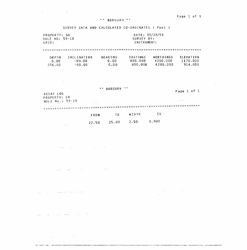
Page l of l :" :" BORSURV
SURVEY DATA AND CALCULATED CO-ORDINATES ( f eet )
PROPERTY: G8 DATE: 05/29/59HOLE NO: 59-10 SURVEY BY:GRID: INSTRUMENT:
DEPTH INCLINATION BEARING EASTINGS NORTHINGS ELEVATION0.00 -90.00 0.00 800.000 4200.000 1170.000
256.00 -90.00 0.00 800.000 4200.000 914.000
** BORSURV **Page l of l
ASSAY LOGPROPERTY: GBHOLE No. : 59-10 '
FROM TO WIDTH CU
22.50 25.00 2.50 0.900
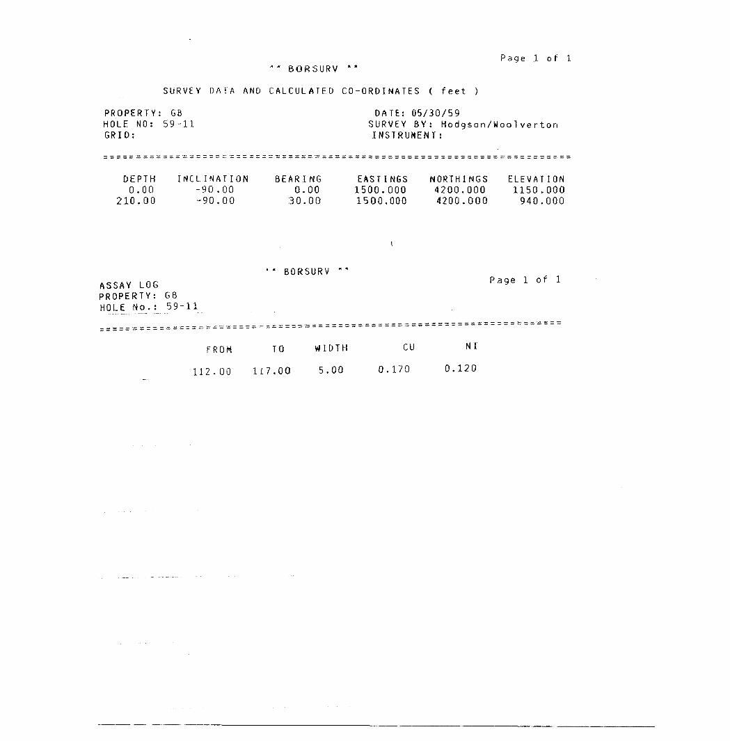
Page l of l"* BORSURV **
SURVEY DATA AND CALCULATED CO-ORDINATES ( feet )
PROPERTY: GB HOLE NO: 59-11 GRID:
DATE: 05/30/59SURVEY BY: Hodgson/Woo1 ve r ton INSTRUMENT:
DEPTH0.00
210.00
INCLINATION-90.00-90.00
BEARING0.0030.00
EASTINGS1500.0001500,000
NORTHINGS4200.0004200.000
ELEVATION1150.000940.000
ASSAY LOG PROPERTY: G8 HOLE No.: 59-11
BORSURVPage l of l
FROM TO
112.00 117.00
WIDTH
5.00
cu
0.170
NI
0.120
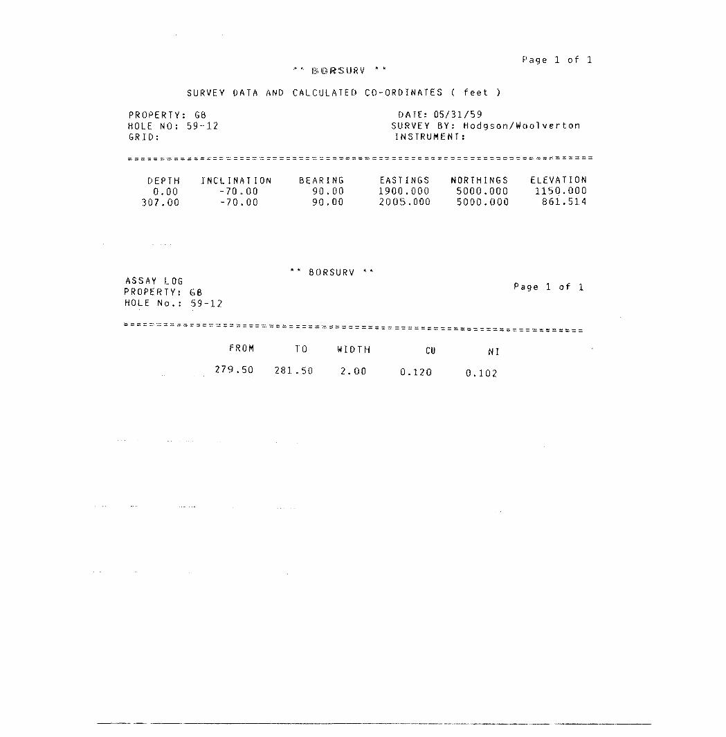
Page l of l
SURVEY DATA AND CALCULATED CO-ORDINATES ( feet )
PROPERTY: G8 DATE: 05/31/59HOLE NO: 59-12 SURVEY BY: Hodgson/WoolvertonGRID: INSTRUMENT:
DEPTH INCLINATION BEARING EASTINGS NORTHINGS ELEVATION0.00 -70,00 90.00 1900.000 5000.000 1150.000
307.00 -70.00 90.00 2005.000 5000.000 861.514
** BORSURV ** ASSAY LOG 0 , ,PROPERTY: GB P age : o f
HOLE No. : 59-12
FROM TO WIDTH CU NI
279.50 281.50 2.00 0.120 0.102
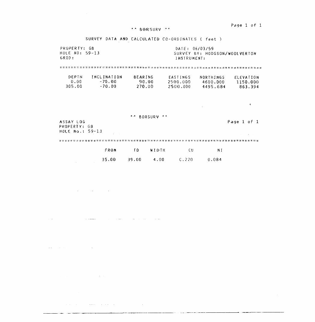
* :" BORSURV
SURVEY DATA AND CALCULATED CO-ORDINATES ( feet )
Page l of l
PROPERTY: G8 HOLE NO: 59-13 GRID:
OATEs 06/03/59SURVEY 8Y: HODGSON/WOOLVERTON INSTRUMENT:
DEPTH0.00
305.00
INCLINATION -70.00 -70.00
BEARING 90.00 270.00
EASTINGS 2500.000 2500.000
NORTHINGS 4600.000 4495.684
ELEVATION 1150.000 863.394
ASSAY LOG PROPERTY: G8 HOLE No,: 59-13
BORSURV *Page l of l
FROM
35.00
TO
39.00
W I D T H
4.00
CD
0.220
NI
0.084
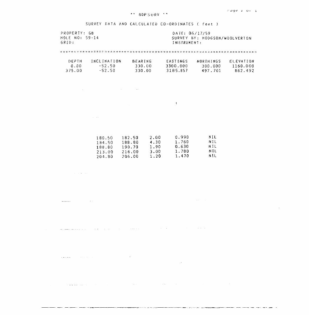
" il y t: J o i
URV
SURVEY DATA AND CALCULATED CO-ORDINATES ( feet )
PROPERTY: G6 DATE: 06/17/59HOLE NO: 59-14 SURVEY 8Y: HODGSON/WOOLVERTONGRID: INSTRUMENT:
DEPTH INCLINATION BEARING EASTINGS NORTHINGS ELEVATION0.00 -52.50 330.00 3300.000 300.000 1160.000
375.00 -52.50 330.00 3185.857 497..701 862.492
180.50 182.50 2.00 0.990 NIL184.50 188.80 4.30 1.760 NIL188.80 190.70 1.90 0.630 NIL213.00 216.00 3.00 1.780 NIL204.80 206.00 1.20 1.470 NIL
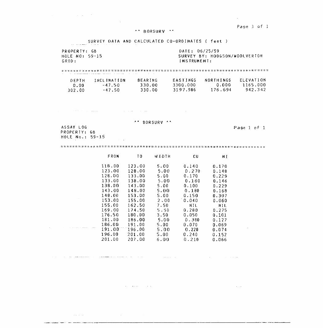
Page l of l ** BORSURV *"
SURVEY DATA AND CALCULATED CO-ORDINATES ( feet )
PROPERTY: GB DATE: 06/25/59HOLE NO: 59-15 SURVEY BY: HOOGSON/WOOLVERTONGRID: INSTRUMENT:
DEPTH INCLINATION BEARING EASTINGS NORTHINGS ELEVATION0.00 -47.50 330.00 3300.000 0.000 1165.000
302.00 -47.50 330.00 3197.986 176.694 942.342
** BORSURV **
ASSAY LOG Page l of l PROPERTY: GB HOLE No.: 59-15
FROM TO WIDTH CU NI
118.00 123.00 5.00 0.140 0.170123.00 128.00 5.00 0,270 0.148128.00 133.00 5.00 0.170 0.229133.00 138.00 5.00 0.160 0.146138.00 143.00 5.00 0.100 0.229143.00 148.00 5.00 0.180 0.168148.00 153.00 5.00 0.150 0.3071ST. 00 155.00 2.. 00 0.040 0.060155.00 162.50 7.50 NIL. NIL.169.00 174.50 5,50 0.280 0.275176.50 180.00 3.50 0.050 0.101181.00 186.00 5.00 0.380 0.127186.00 191.00 5.00 0.070 0.069191.00 196.00 5.00 0.220 0.074196.00 201.00 5.00 0.240 0.152201.00 207.00 6.00 0.210 0.066
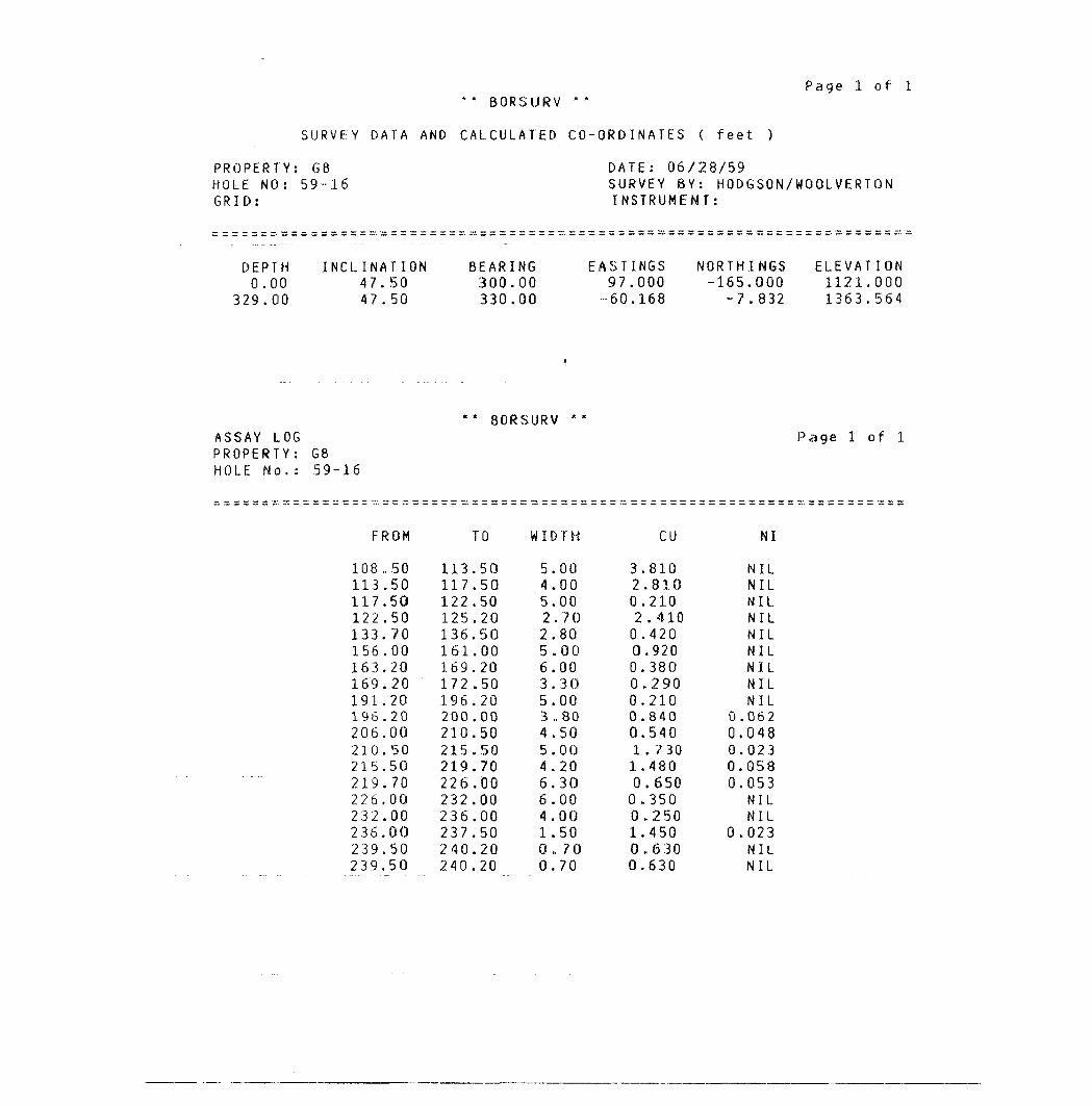
Page l of l ** BORSURV
SURVEY DATA AND CALCULATED CO-ORDINATES ( feet )
PROPERTY: G8 DATE: 06/28/59HOLE NO: 59-16 SURVEY BY: HODGSON/WOOLVERTONGRID: INSTRUMENT:
DEPTH INCLINATION BEARING EASTINGS NORTHINGS ELEVATION0.00 47.50 300.00 97.000 -165.000 1121.000
329.00 47.50 330.00 --60.168 - 7.832 1 363.564
** BORSURV **
ASSAY LOG Page l of l PROPERTY: G8 HOLE No.: 59-16
FROM TO WIDTH CU NI
108,50 113.50 5.00 3.810 NIL113.50 117.50 4.00 2.8.10 NIL117.50 122.50 5.00 0.210 NIL122.50 125.20 2.70 2.410 NIL133.70 136.50 2.80 0.420 NIL156.00 161.00 5.00 0.920 NIL163.20 169.20 6.00 0.380 NIL169.20 172.50 3.30 0.290 NIL191.20 196.20 5.00 0.210 NIL196.20 200.00 3,80 0.840 0.062206.00 210.50 4.50 0.540 0.048210.50 215.50 5.00 1.730 0.023215.50 219.70 4.20 1.480 0.058219.70 226.00 6.30 0.650 0.053226.00 232.00 6.00 0,350 NIL232.00 236.00 4.00 0.250 NIL236.00 237.50 1.50 1.450 0.023239.50 240.20 0 .70 0 .630 NIL239.50 240.20 0.70 0.630 NIL
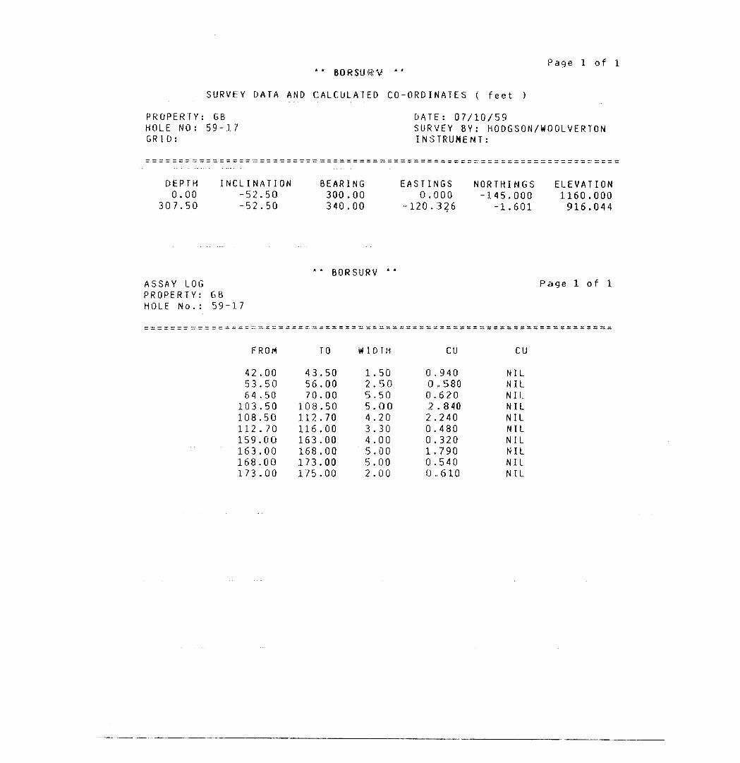
Page l of l ** 80RSUiR:V **
SURVEY DATA AND CALCULATED CO-ORDINATES ( feet )
PROPERTY: GB DATE: 07/10/59HOLE NO: 59-1.7 SURVEY BY: HODGSON/WOOLVERTONGRID: INSTRUMENT:
DEPTH INCLINATION BEARING EASTINGS NORTHINGS ELEVATION0.00 -52.50 300.00 0.000 -145.000 1160.000
307.50 -52.50 340.00 -120.326 -1.601 916.044
BORSURVASSAY LOGPROPERTY: G8HOLE No. : 59-17
Page 1 of 1
FROM TO WIDTH CU CU
42.00 43.50 1.50 0.940 NIL53.50 56.00 2.50 G.. 580 NIL64.50 70.00 5.50 0.620 NIL
103.50 108.50 5.00 2,840 NIL108.50 112.70 4.20 2.240 NIL112.70 116.00 3.30 0.480 NIL159.00 163.00 4.00 0.320 NIL163.00 168.00 5.00 1.790 NIL168.00 173.00 5.00 0.540 NIL173.00 175.00 2.00 0,610 NIL
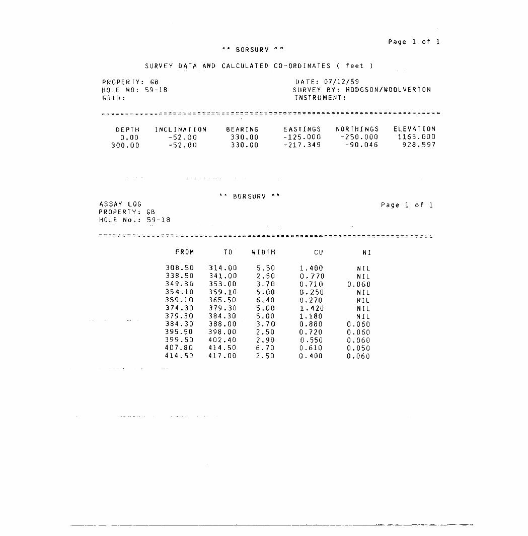
Page l of l* * BORSURV " "
SURVEY DATA AND CALCULATED CO-ORDINATES ( feet )
PROPERTY; HOLE NO: GRID:
DEPTH 0.00
300.00
: GB 59-18
INCLINATION -52.00 -52.00
BEARING 330.00 330.00
DATE: 0 SURVEY B INSTRUMf
EASTINGS -125.000 -217.349
NORTHINGS-250.000-90.046
ELEVATION1165.000928.597
BORSURVASSAY LOG PROPERTY: GB HOLE No. : 59-18
Page l of l
FROM TO WIDTH
308338,349.354359,374,379.384.395.399,407.414.
505030101030303050508050
314341353,359365,379384.388,398,402,414.
0000001050303000004050
417.00
.50,50.70.0040.0000705090
6.702.50
5 2 3.5.6. 5, 5. 3, 2. 2,
l O O O O l l O Oo o o
cu
,400.770.710.250270.420180880720.550610.400
NI
NIL NIL 060 NIL NIL NIL NIL 060 060 060 050
0.060
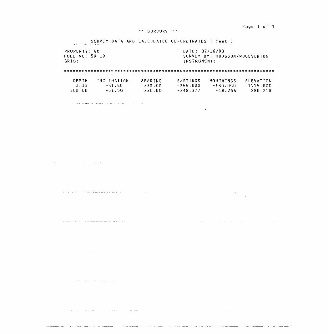
Page l of l ** 80RSURV
SURVEY DATA AND CALCULATED CO-ORDINATES ( feet )
PROPERTY: GB DATE:: 07/16/90HOLE NO: 59-19 SURVEY BY: HODGSON/WOOLVERTONGRID: INSTRUMENT:
DEPTH INCLINATION BEARING EASTINGS NORTHINGS ELEVATION0.00 -51.50 330.00 -255.000 -180.000 1115.000
300.00 -51.50 330.00 -348.377 -18.266 880.218
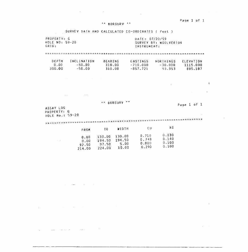
Page l o f l ** BORSURV **
SURVEY DATA AND CALCULATED CO-ORDINATES ( feet )
PROPERTY: G DATE:: 07/20/59HOLE NO: 59-20 SURVEY BY: WOOLVERTONGRID: INSTRUMENT:
DEPTH INCLINATION BEARING EASTINGS NORTHINGS ELEVATION0.00 -50.00 310.00 -710.000 -30.000 1115.000
300.00 -50.00 310.00 -857.721 93.953 885.187
ASSAY LOG PROPERTY: G HOLE No.: 59-20
BORSURV ** iPage l
FROM TO WIDTH CU NI
0.00 130.00 130.00 0.710 0.0300.00 194.50 194.50 0.748 0.140
Q? 50 97.50 5.00 0.800 0.10000 224.00 10.00 0.290 0.100
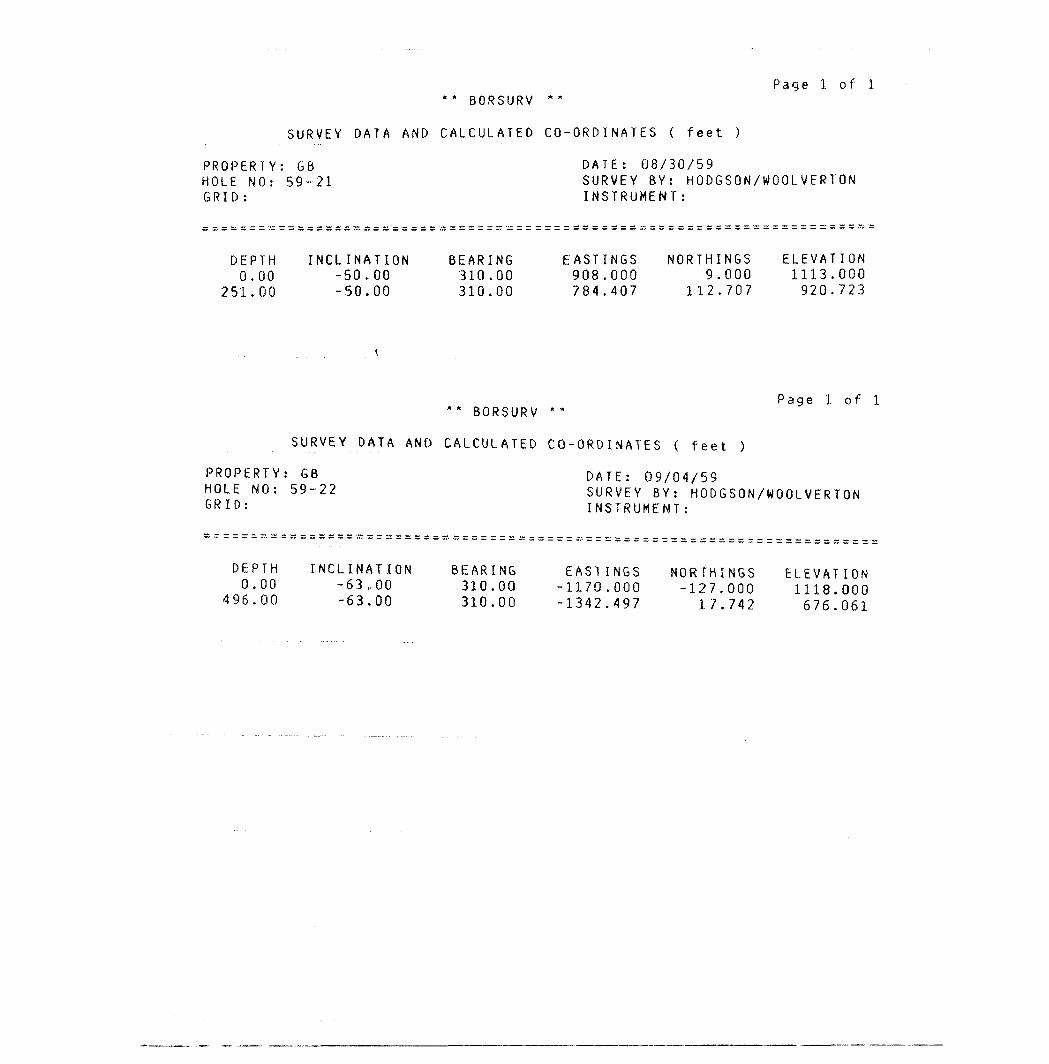
Page l of l ** BORSURV
SURVEY DATA AND CALCULATED CO-ORDINATES ( feet )
PROPERTY: GB DATE: 08/30/59HOLE NO: 5 9-21 S URVEY 8Y: HODGSON/WOOLVERTONGRID: INSTRUMENT:
DEPTH INCLINATION BEARING EASTINGS NORTHINGS ELEVATION0.00 -50.00 310.00 908.000 9.000 1113.000
251.00 -50.00 310.00 784.407 112.707 920.723
Page l of l ** BORSURV * :"
SURVEY DATA AND CALCULATED CO-ORDINATES ( feet )
PROPERTY: GB DATE: 09/04/59HOLE NO: 59-22 SURVEY BY: HODGSON/WOOLVERTONGRI[): INSTRUMENT:
DEPTH INCLINATION BEARING EASTINGS NORTHINGS ELEVATION0.00 -63,00 310.00 -1170.000 -127.000 1118.000
496.00 -63.00 310.00 -1342.497 17.742 676 061
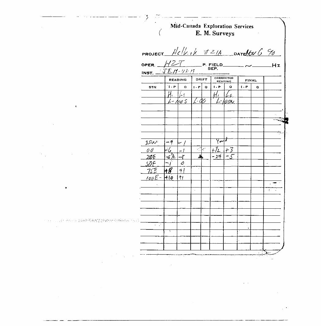
cPROJECT
OPER.
Mid-Canada Exploration Services E. M. Surveys
f It
He f!/, i k rf Z- f A DArJtot/ 6 /^HZ^T P. FIELD -^ UTl t S EP.
*
STN
y^S~(sJ-
odl&tSfiF7f?lovt-
READING
1 - P
H-A/
-iri,-S'JL-ytfHo
Qf
16 S
- f
^\~\
a4|
t(
DRIFT
1 - P
/"^
A
Q
^
••'
l
CORRECTED READING
I - P
/r//' ^-~/
v^f'/L
-rt
o
A^A/
rf ———
f?-J"
FINAL
1 - P
.
Q
i
"^"^^'\W
^
-
. — '
-
J
l
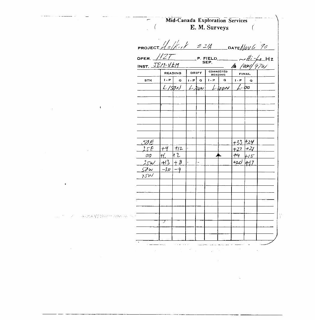
Mid-Canada Exploration Services ( E . M. Surveys f
PROJECT./!^,
//C*, S .DATE
OPERTF/M/M
P. FIELD SEP.
.Hz
READING DRIFT CORRECTED RE/VDING FINAU
STN I - P l - P Q 1 - P 1 - P
t- 70
f/i-00 tf, fi -hr K rr*/ t
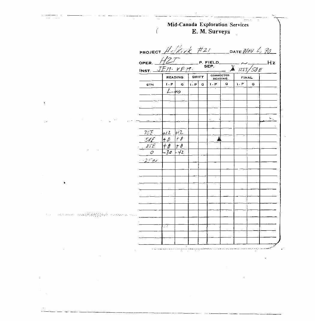
Mid-Canada Exploration Services E. M. Surveys
/xy t/f,
OPER.
J? tt'P. FIELD
SEP..Hz
STN
7sT?Stf
. . Iff0
- J t~As
READING
I - P
L~
Vi-ttft-3*
Q
ro
f 2.t Std-li
DRIFT
1 - P Q
CORRECTED READING
1 - P
^
4
Q
FINAL
1- P Q
^ v
s
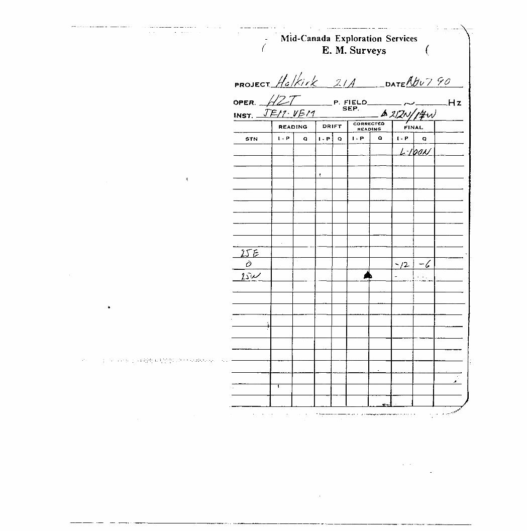
Mid-Canada Exploration Services E. M. Surveys
\
PROJECT
OPER. .
0
P. FIELD. -HZ
STN
IS'frd
ZiW^
READING
1 - P
t
Q
DRIFT
1 - P
,
Q
CORRECTED READING
1 - P
i
O
\
•~^-
rFINAU
I - p
Ir 'f
"/2-
-
.
Q
?^X/
-C
•Jf
A
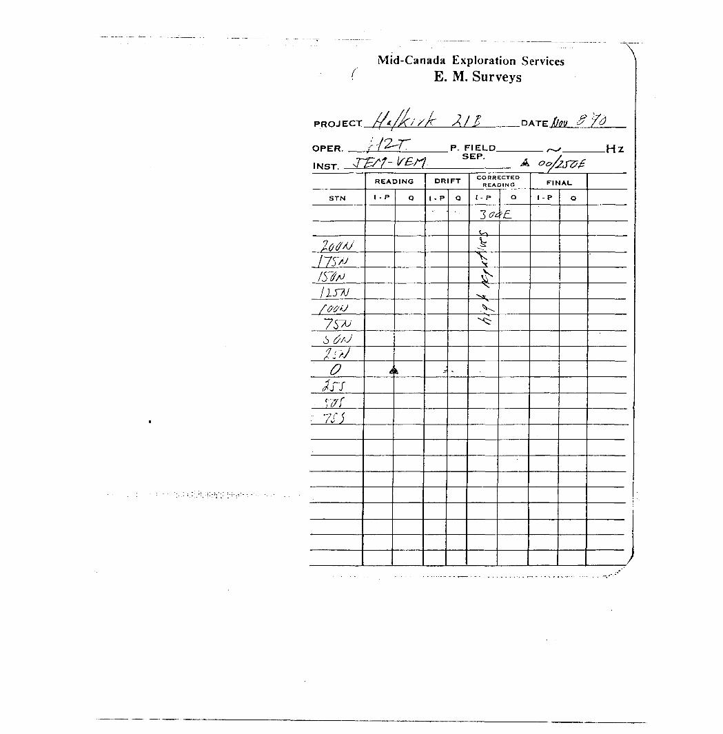
Mid-Canada Exploration Services ( E . M. Surveys
\
PROJECT.
OPER. .-—
.DATE'/d
P. FIELD SEP.
.Hz
STN
iQtfAJ/75/v/S'faIISTJf&fffj
' 7S7U6 6'J
•T r, J^. ~ r J
o/r/w r
: 7S1
READING
1 - P
t
Q
!,
DRIFT
1 - P
-
Q
-
CORRECTED READING
I - P
3^.^^^
^^.v.^r
Q
•'^
FINAL
I - P Q
J
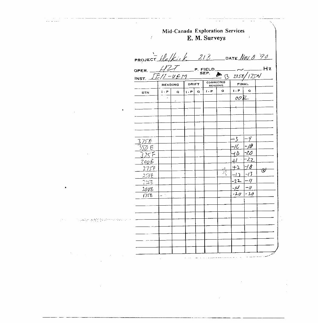
Mid-Canada Exploration Services ^ E. M. Surveys
PROJECT tf#fJc;t L 2.1 Z D ATE /fel/^ ^
OPER. f^-f P . FIELD —— , H 7
iMcrr 7/5/7 '^/-7
STN
!7J^Ijze3 ?C r?^2751?337 EIliT^7^5I7re
READING
1 - P
;
—
Q
SEP. J^ J^ Q zz^v/ZrVDRIFT
I - P Q
CORRECTED READING
1 - P Q
. ~ r,."s i-
FINAL
1 - P
00,
—— 1 ———
-3-/i1*+11-^-11-22-
^-J-a
Q
L.
-r-fi-Z6-2-7--18-t t-f!-l/-LO
~® ——
)
Mid-Canada Exploration Services ( E . M. Surveys
\
PROJECT.
OPER. .
INST. -;
li B
P. FIELD SEP.
STN
READING
1 - P
DRIFT
l - P Q
CORRECTED READING
1 - P
FINAU
I - p
-lv-fr.s
-1
.Hz

Mid-Canada Exploration Services ( E . M. Surveys
PROJECT.
OPER.
INST. .
21 1-2. 9 1P. FIELD
SEP..Hz
STN
-ttri
Utt3StB17&?o*f
Wrt-i&etirf
READING
1 - P O
DRIFT
I-P
fr
"t
-It
-i-lirib^
Q
to
-L-li
3--7
t3fCT
CORRECTEDREADING
I - P O
fFINAL
t - P
/-'#
A
1
Q
9/J
k
A
J
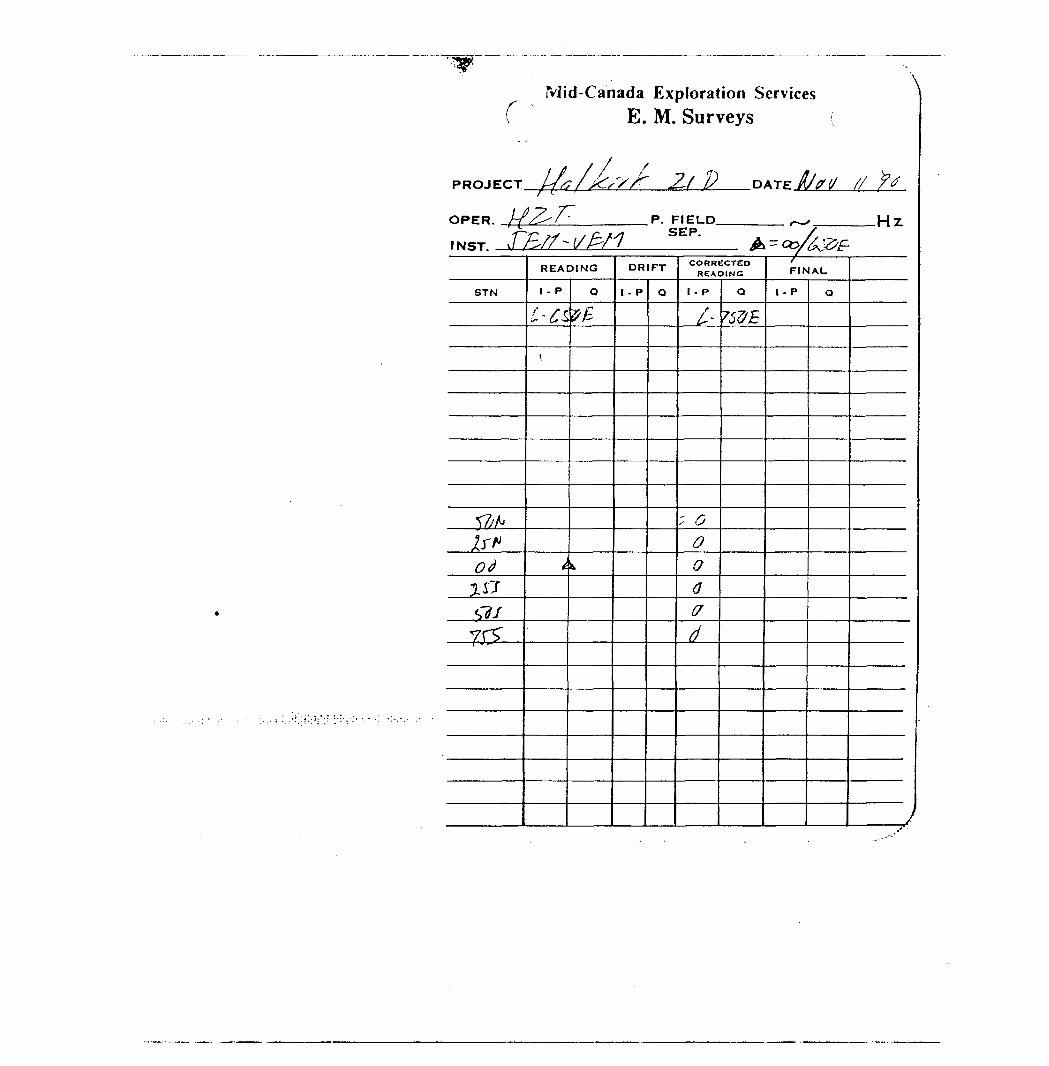
r - Mid-Canada Exploration ServicesE. M. Surveys
PROJECT Z, DATE A/* i/ i/t ' - '
OPER. //X^-/-
1 N ST. J fa? ~~ l/ P* f '
STN
•f/,/,
?j-^i
#^
JJ7S7/7F*
P. FIELD —— - W-ySEP.
A
READING
I - P
i-'C^
(.
^
Q
V h-
^,
DRIFT
1 - P Q
CORRECTEDREADING
1 - P
/.
; ^0o0ffd
Q
rfflB
^cc/t&frf FINAL
t - P Q
y
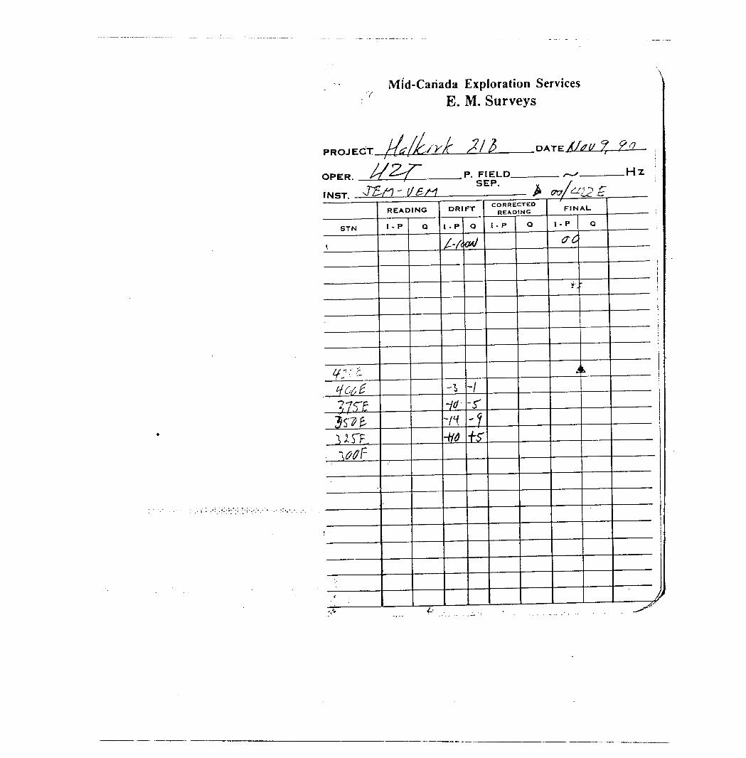
Mid-Canada Exploration Services E.M. Surveys
PROJECT. 90
OPER. /7 /f P- FIELD ^ H T
INC!T J^A? - V&M
STN
t
4^ci:^ c?, eIf ST Ettl"UTF
WF
;
*
READING
1 - P Q
SEP. y 7^ 02/^12 Z
DRIFT
1 - P
/Y*
-\10--/f
^
Q
a*J
-1-r^fr
CORRECTED READING
1 -P Q
FINAL.
I - P
(TC
s.
i
Q
k
———————— ii 1 ———————— i
1
i
1 ————————— i
it
———— i
———— i
)^'
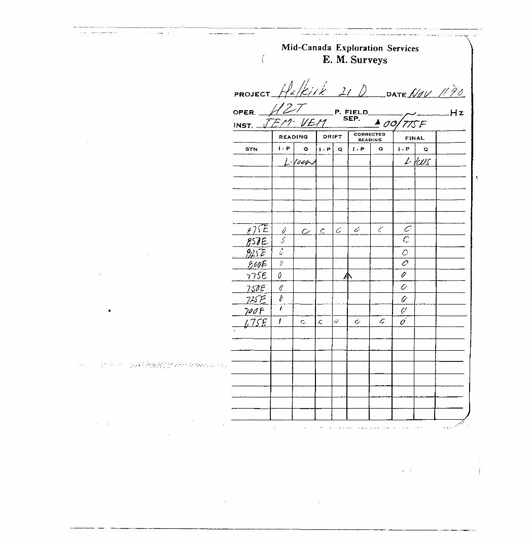
PROJECT/lZJl
Mid-Canada Exploration Services E. M. Surveys
AOPER. fi ^'
IN^T \f fcSf' l/F^rl
P. FIELD ^ M TSEP. .* m
STN
tl^tOC"7C
fjltf*
frtffc
ii seiweV&L7*0?-1,1 Z ti-
. : . / ..-T.;-; ;. /: • .-.•.- - - .-.r.-.-.-. .-. -
READING
1 - P
^
jr
y0
00di1
Q
ftrt^t
c,
r.
DRIFT
1 - P
C
C
Q
c
^
#
CORRECTED READING
I - P
^
'v
O
Q
S'
c
1/77? FFINAL
I - P
i-
C-co.oa0GfGJ
d
Q
^J/f
y
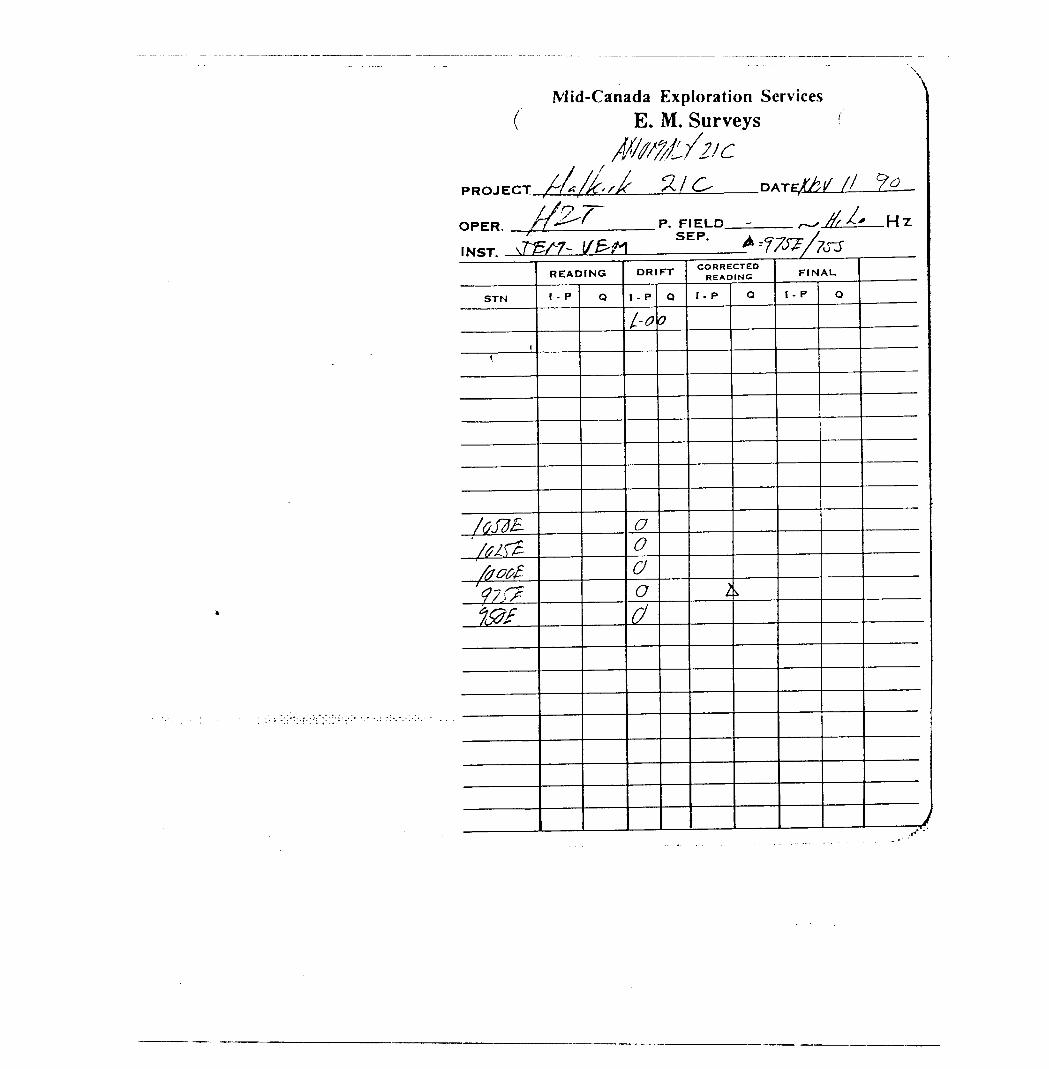
Mid-Canada Exploration Services E. M. Surveys
x
PPQJECT
OPER.
lf 21 Crf A /K 'S K st! C^
P. FIELD.
DATE//./ /l
^tit* H Z
STN
l1
/oSdB-fctfZfoot*'47 r?l&f
READING
1 - P Q
DRIFT
I - P
L-o
o0oo
CJ
Q
0
CORRECTED READING
I - P
i
Q
FINAU
1 - P Q
V
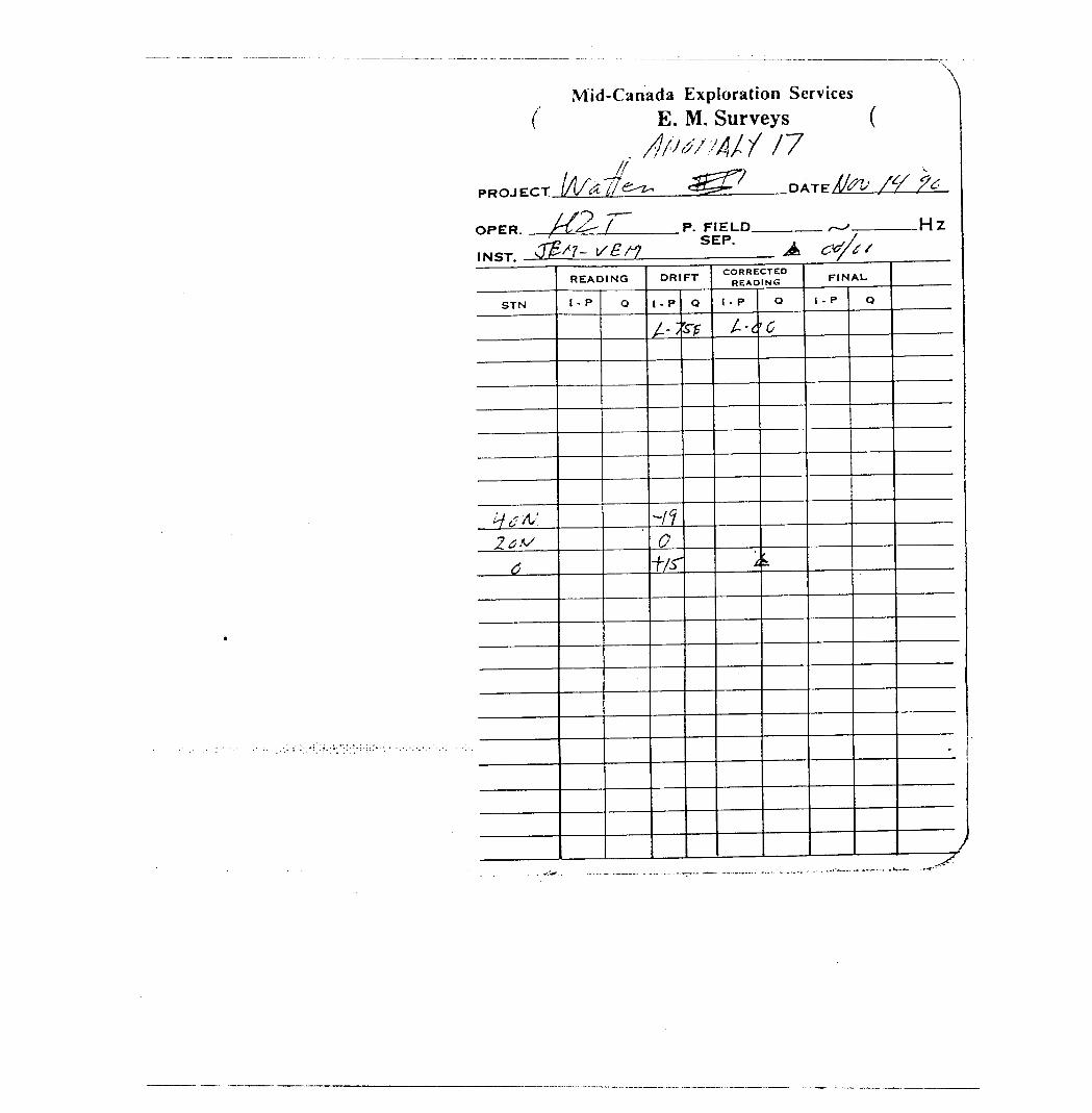
Mid-Canada Exploration Services C E . M. Surveys (
. dfw/Atf 17PROJECT lA/Atfe^, &S& DATE/^ /V ?6
OPER /~t^ f P . FIELD —— . W
IMQT J^/7- sBrt
STN
^/^•^:2&V
4
READING
1 - P Q
SEP. . ,/^ ctf/tfDRIFT
1 - P
t--~'
-n0t/^
Q
rp
CORRECTED READING
I - P
^
i
Q
G
L
FINAL
l - P Q
^
)
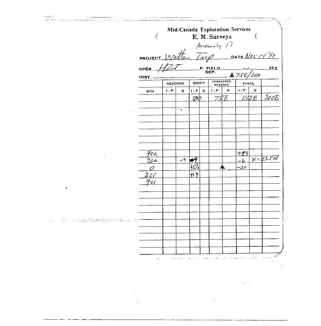
Mid-Canada Exploration Services ( E . M. Surveys (
/rv-itf-vv^* t~j l l (f
PROJECT [Afesfilt-^ /^^
OPER. /-/^--f-/ f
IN ST.
STN
pju?X'K0
Zeef-tfi
READING
1 - P Q
t
^
^ DATE A&V/*/ ~f*
P. FIELD r-, H 7SEP 7
A TT^/1?*^DRIFT
I - P
0?
r^fKAn-
Q
7
CORRECTED READING
I-P
75
j
Q
"5
k.
FINAL
1- P
/S
-fj^
-^
-3.0
Q
^
x--
-Z^^fi
^.J-A/
1
7
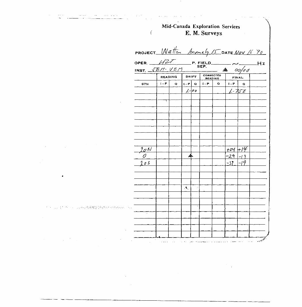
PROJECT.
OPER. ——.
INST. .
Mid-Canada Exploration Services E. M. Surveys
/T~DATE fjff(/
"\
P. FIELD SEP.
oo/ad.Hz
STN
Iff**
c)lo*
READING
I - P
1
j
Q
DRIFT
l - P
JL-
A
.\,
Q
00
i
CORRECTED READING
l - P Q
FINAU
1 - P
A/
+L1-2.1-37
Q
iTY
^/f-rt-/f
it
J
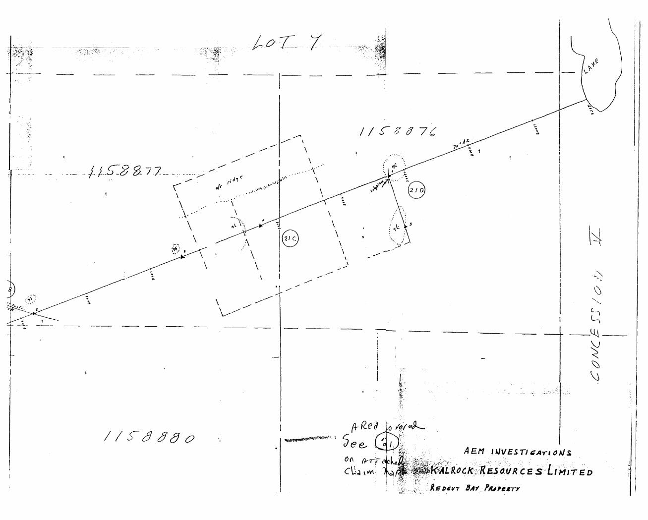
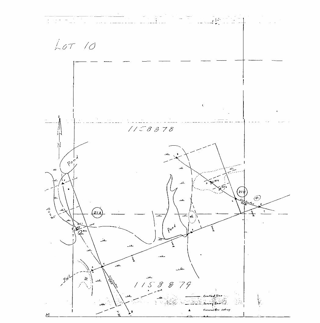
r' .
o
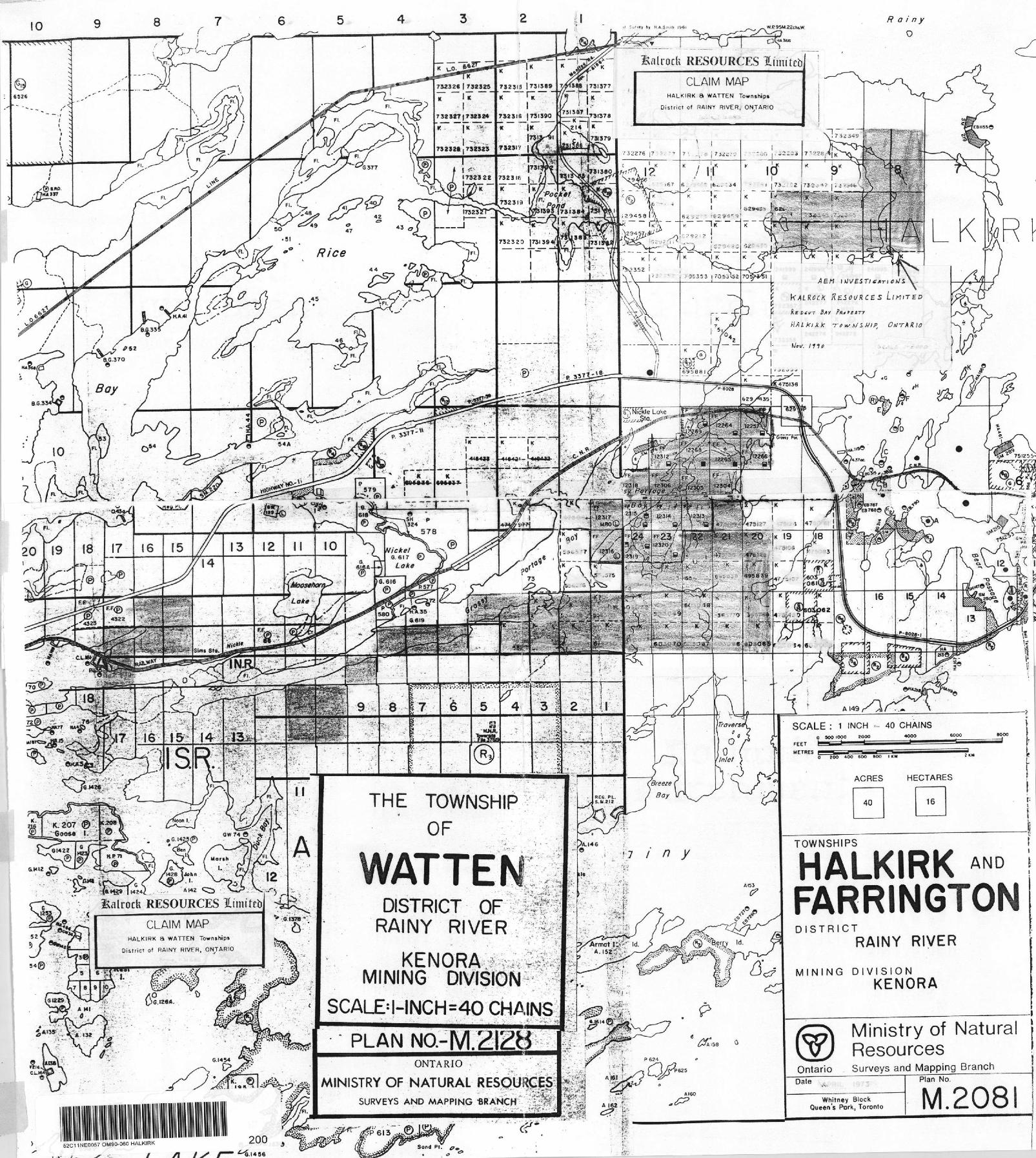
Xalrock RESOURCES l imitchCLAIM MAP
HALKIRK a WATTEN Townships
Dislricl of RAINY R IVER, O NTARIO
75Z320 1 731394^
ri A i K) k fc -r c *s M l Hipt
Y-fJ^fT. . A, c, ',
SCALE : 1 INCH - 40 CHAINS
THE TOWNSHIP,*OF ^i
TOWNSHIPS
WATTE'"JC*.t-s* * iji*^1w
* - Salrocb RESOURCES l imttrt' :'\
CLAIM MAPHALKIRK a WATTEN Townihip*
Disfricl of RAINY HIVFR, ONTARIO
S. 1264.
s**3?;
DISTRICT l: RAINY RIVER"
KENORA ife; MINING DIVISION
SCALEM-INCH^40 CHAINS
PLAN NO.-M.
•i?
l uwiN^niro
HALKIRK FARRINGTONDISTRICT
RAINY RIVER
c^ l MINING DIVISIONKENORA
ONTARIO
MINISTRY OF NATURALSURVEYS AND MAPPING -BRANCH :
111 111 l mn Hi—i i... i,......,.-..— ... -.52C11NEOQ57 OM9O-060 HALKIRK 200
•"G.I456
158
Ministry of Natural Resources
A leo
Ontario Surveys and Mapping BranchPlan No.Dale
Whitney Block Queen's Park, Toronto M.208
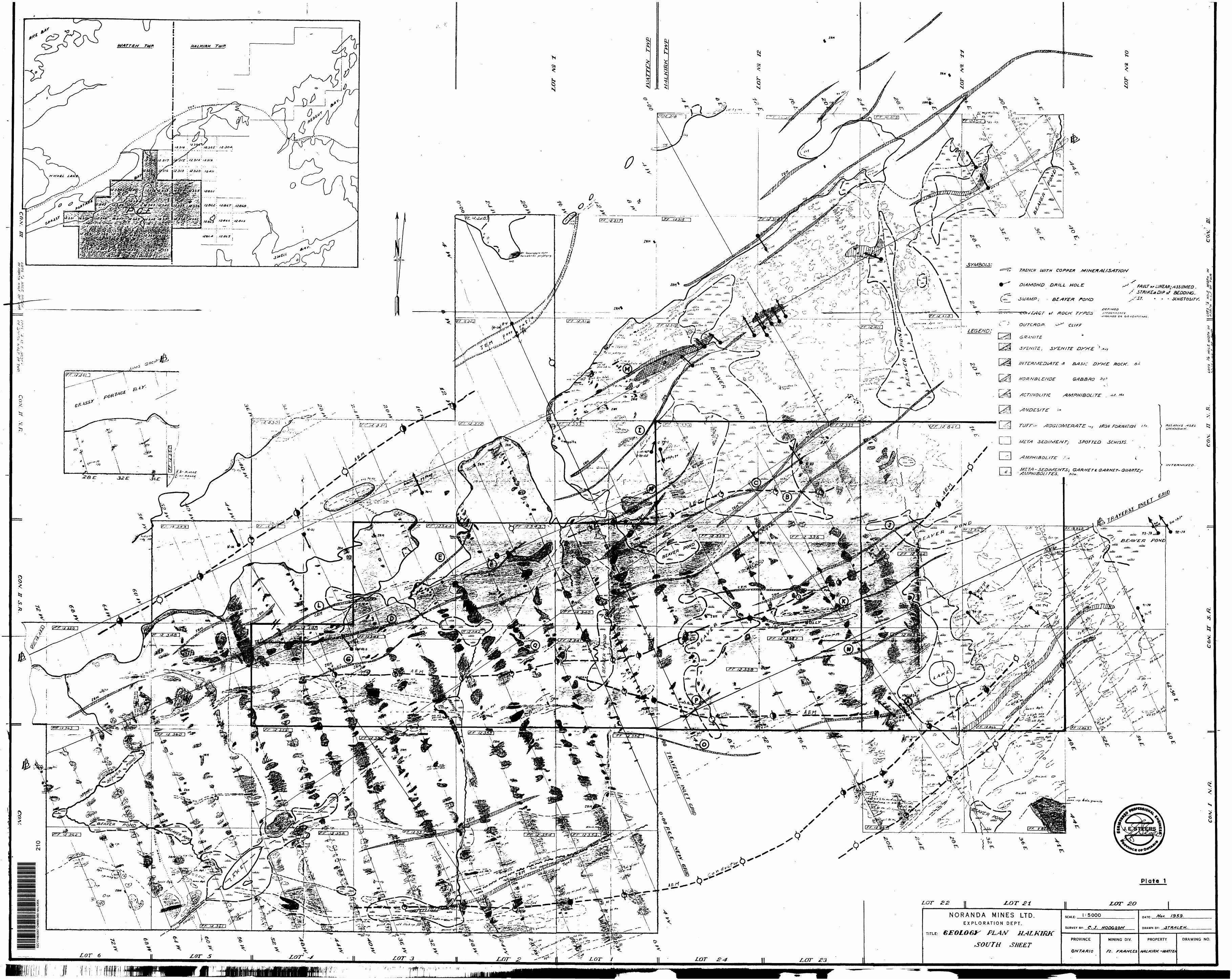
rfcW
4 'T
U vj-w
fc**
.-''
\ ^f
^^N
'
^
(-t\
WM
'Js-
—ri—
— —
—
— —
- —
5*-
^l:
ei
^ L
\\
\ t
i P
X
V l
,
*- l
^-^
ji'
\
M H
Lors
X
t M
ILS
MOT
H in
IM
f/r,
/"*
n""-
?.-v
..r,
,/.
* r
o^-C
^y"
/VJ/
P.'/V
/,
/./-
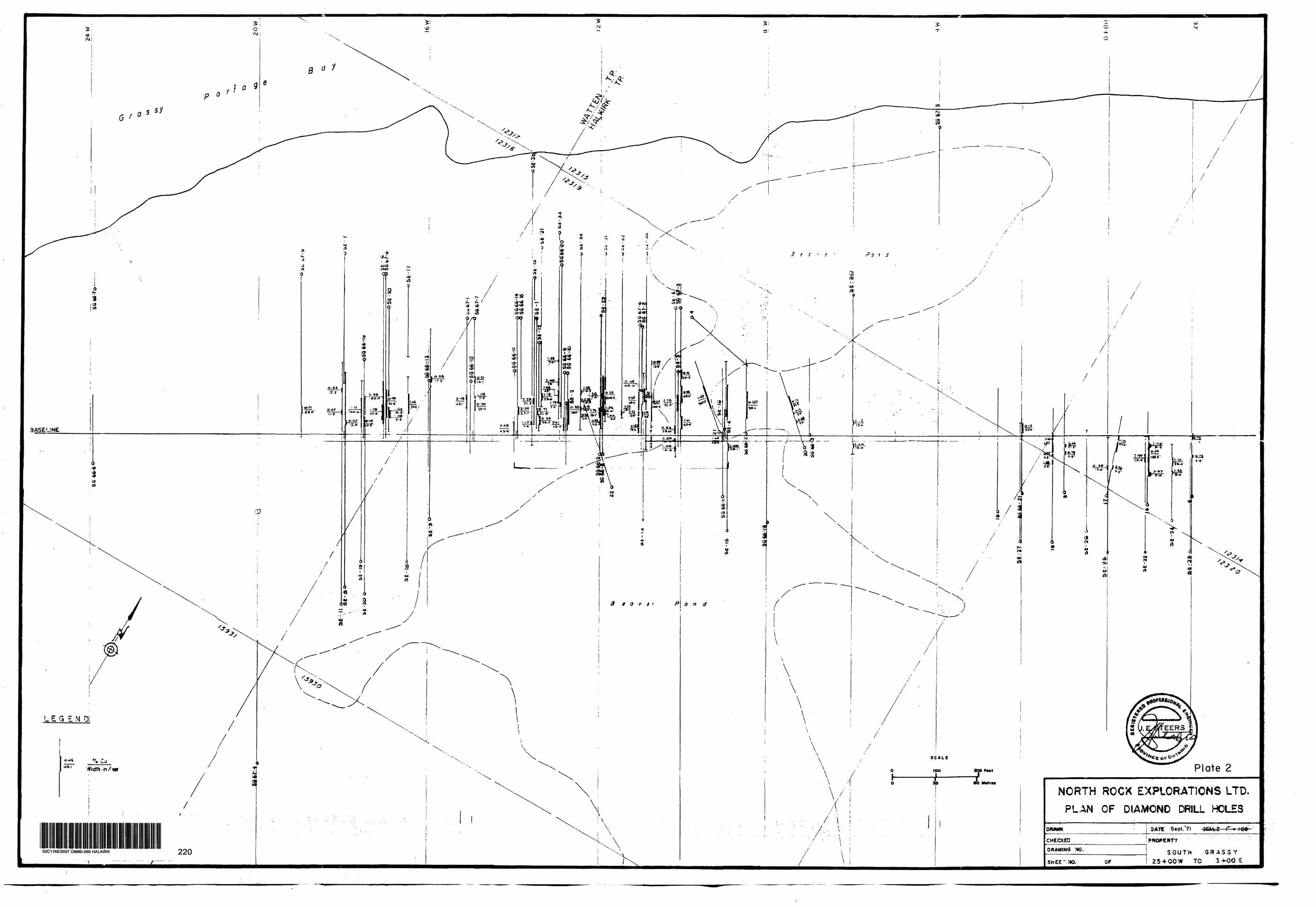
52C11NE0057 OM90-060 HALKIRK 220
\
NORTH ROCK EXPLORATIONS LTD.
PLAN OF DIAMOND DRILL HOLES
DRAWN BATE Sept.'71 3CH.5 l* *
CHECXEODRAWING NO.
SWEE~ MO.SOUTH GRASSY
25 + OOW TO 3-J.OO S
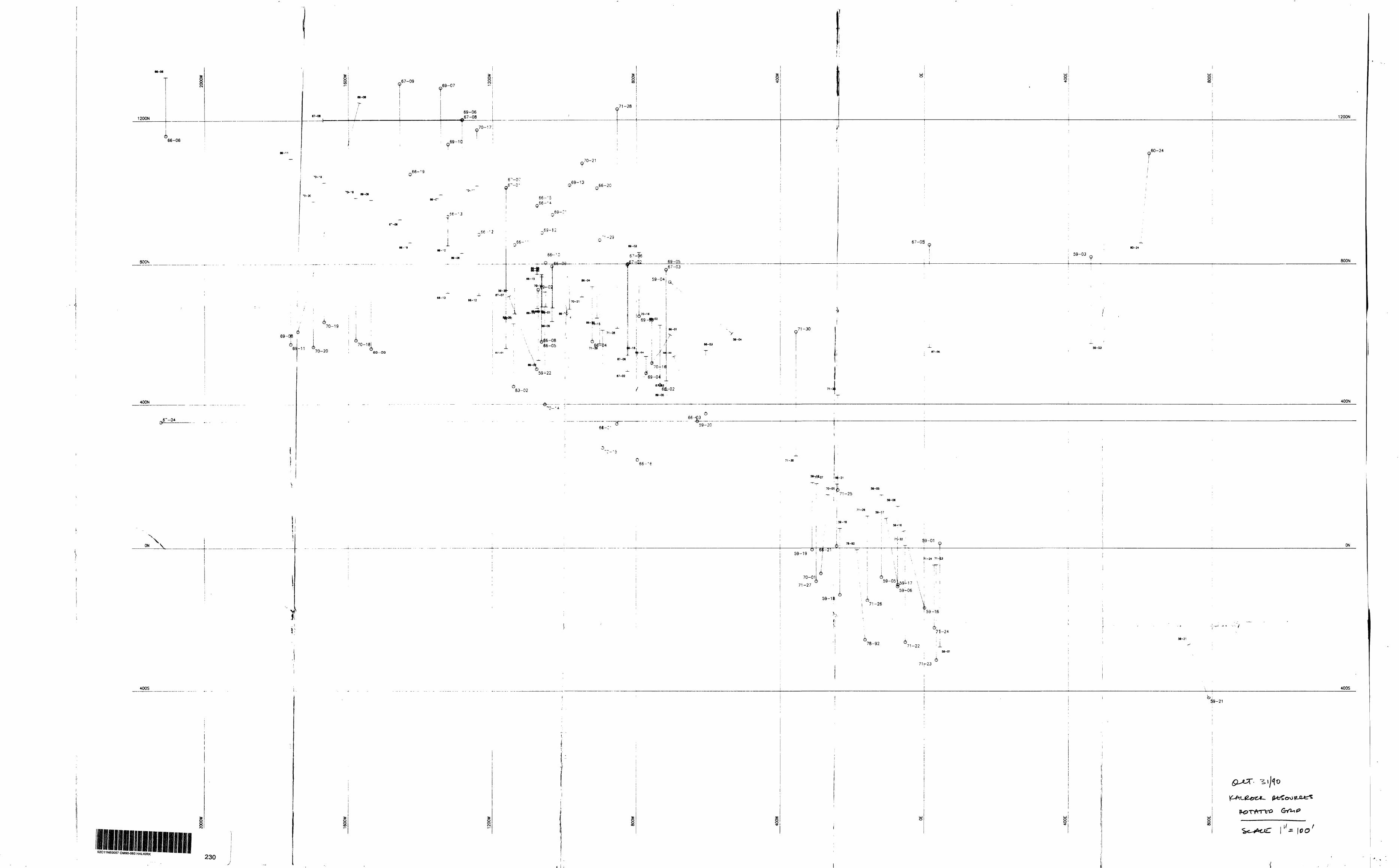
3008
300t
30MOOt
M009
COCN lo-
CM
lO
(OG
——
-—..
O-- —
Ol (J)m
G—
TTJOl
3 R
orolG—
——
—
—
8 h
en trr
8S!
in(VIl
- *
h. —
__
__
__
__
_ ^v
ofN ltO
UD
CMlO
G-
len to
l en(OO
lIO
COG
r- .
o o
l l
r r
to to
MO
OZL
(O co
en r^(O
ID
r-- oen
enolr-.G—
—
M009L
l or-.G—
o
' |A
n l in
to to
O
iii i to
—O
ien in
r- to
•- o
-4- . i
en en
- in
(N
CMl
- 1-r~-
-o
in o
——
——
OO
)in
(OCMlCM
O
SlOD
— —
—O
len in
len in
O
O
CMlO)
3008
300*
30MOO*
MOOS
M0021
Ien to
UJ
'fi—
\
en lG
CI
o2o
—O
.i .
. — . —
.M
0091
l o-e
oCMlO—
——
e
MOOOZ
fOo(O
(O
oCO CM
MOOOZ
C)/
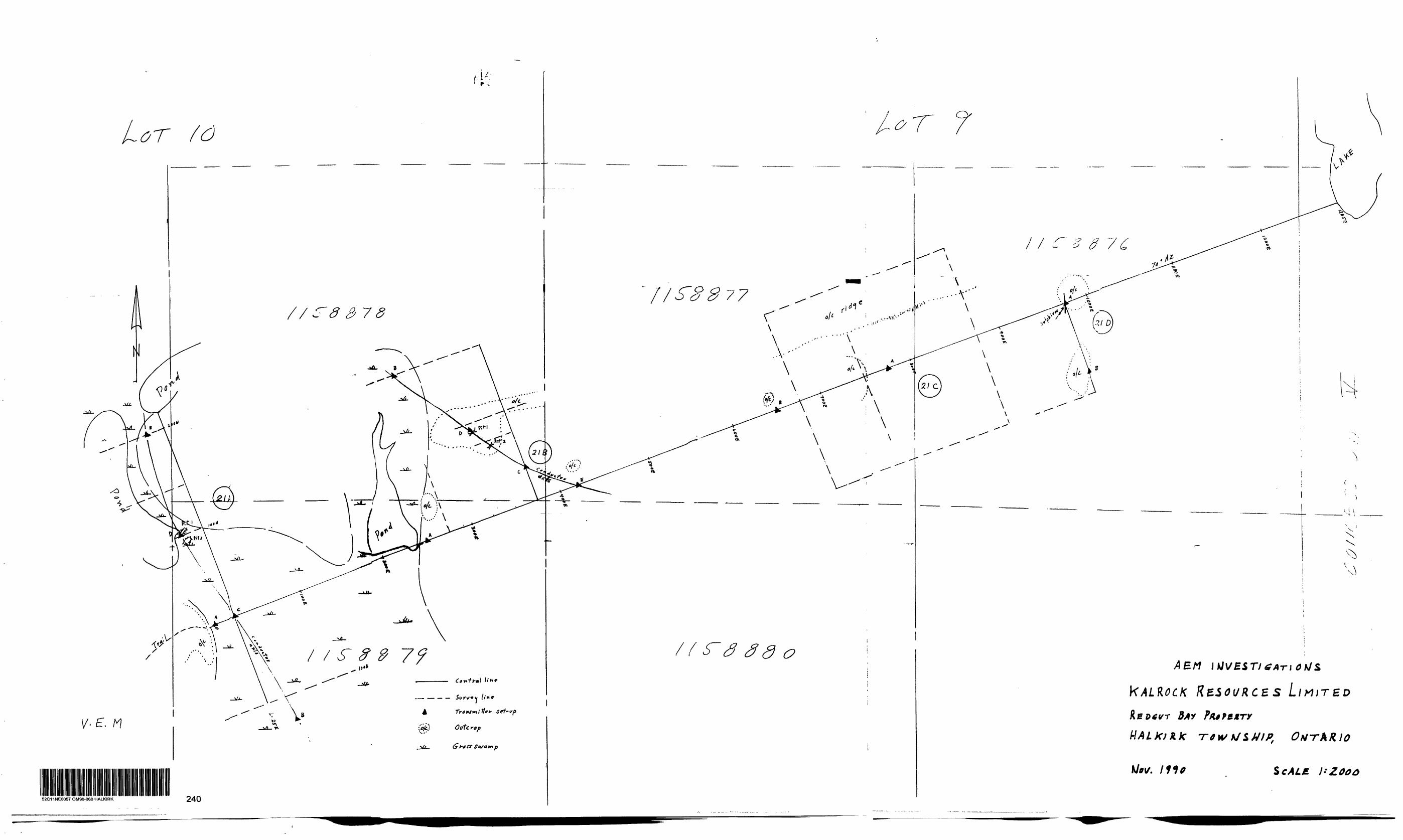
,tf-l f,t
or #O
82 7 S
N
X 'x
^
RESOURCES LIMITED
S cAL f
52C11NE0057 OM90-060 HALKIRK 240