Embed Size (px)
Citation preview
Guidelines for Developing a Successful and Sustainable Higher Education GIS Program
An ESRI
® White Paper • August 2002
ESRI 380 New York St., Redlands, CA 92373-8100, USA • TEL 909-793-2853 • FAX 909-793-5953 • E-MAIL [email protected] • WEB www.esri.com
Copyright © 2002 ESRI All rights reserved. Printed in the United States of America. The information contained in this document is the exclusive property of ESRI. This work is protected under United States copyright law and other international copyright treaties and conventions. No part of this work may be reproduced or transmitted in any form or by any means, electronic or mechanical, including photocopying and recording, or by any information storage or retrieval system, except as expressly permitted in writing by ESRI. All requests should be sent to Attention: Contracts Manager, ESRI, 380 New York Street, Redlands, CA 92373-8100, USA. The information contained in this document is subject to change without notice.
U.S. GOVERNMENT RESTRICTED/LIMITED RIGHTS Any software, documentation, and/or data delivered hereunder is subject to the terms of the License Agreement. In no event shall the U.S. Government acquire greater than RESTRICTED/LIMITED RIGHTS. At a minimum, use, duplication, or disclosure by the U.S. Government is subject to restrictions as set forth in FAR §52.227-14 Alternates I, II, and III (JUN 1987); FAR §52.227-19 (JUN 1987) and/or FAR §12.211/12.212 (Commercial Technical Data/Computer Software); and DFARS §252.227-7015 (NOV 1995) (Technical Data) and/or DFARS §227.7202 (Computer Software), as applicable. Contractor/Manufacturer is ESRI, 380 New York Street, Redlands, CA 92373-8100, USA. @esri.com, 3D Analyst, ADF, AML, ARC/INFO, ArcAtlas, ArcCAD, ArcCatalog, ArcCOGO, ArcData, ArcDoc, ArcEdit, ArcEditor, ArcEurope, ArcExplorer, ArcExpress, ArcFM, ArcGIS, ArcGrid, ArcIMS, ArcInfo Librarian, ArcInfo, ArcInfo—Professional GIS, ArcInfo—The World's GIS, ArcLogistics, ArcMap, ArcNetwork, ArcNews, ArcObjects, ArcOpen, ArcPad, ArcPlot, ArcPress, ArcQuest, ArcReader, ArcScan, ArcScene, ArcSchool, ArcSDE, ArcSdl, ArcStorm, ArcSurvey, ArcTIN, ArcToolbox, ArcTools, ArcUSA, ArcUser, ArcView, ArcVoyager, ArcWatch, ArcWeb, ArcWorld, Atlas GIS, AtlasWare, Avenue, BusinessMAP, Database Integrator, DBI Kit, ESRI, ESRI—Team GIS, ESRI—The GIS People, FormEdit, Geographic Design System, Geography Matters, Geography Network, GIS by ESRI, GIS Day, GIS for Everyone, GISData Server, InsiteMAP, MapBeans, MapCafé, MapObjects, ModelBuilder, MOLE, NetEngine, PC ARC/INFO, PC ARCPLOT, PC ARCSHELL, PC DATA CONVERSION, PC STARTER KIT, PC TABLES, PC ARCEDIT, PC NETWORK, PC OVERLAY, Rent-a-Tech, RouteMAP, SDE, SML, Spatial Database Engine, StreetEditor, StreetMap, TABLES, the ARC/INFO logo, the ArcAtlas logo, the ArcCAD logo, the ArcCAD WorkBench logo, the ArcCOGO logo, the ArcData logo, the ArcData Online logo, the ArcEdit logo, the ArcEurope logo, the ArcExplorer logo, the ArcExpress logo, the ArcFM logo, the ArcFM Viewer logo, the ArcGIS logo, the ArcGrid logo, the ArcIMS logo, the ArcInfo logo, the ArcLogistics Route logo, the ArcNetwork logo, the ArcPad logo, the ArcPlot logo, the ArcPress for ArcView logo, the ArcPress logo, the ArcScan logo, the ArcScene logo, the ArcSDE CAD Client logo, the ArcSDE logo, the ArcStorm logo, the ArcTIN logo, the ArcTools logo, the ArcUSA logo, the ArcView 3D Analyst logo, the ArcView Business Analyst logo, the ArcView Data Publisher logo, the ArcView GIS logo, the ArcView Image Analysis logo, the ArcView Internet Map Server logo, the ArcView logo, the ArcView Network Analyst logo, the ArcView Spatial Analyst logo, the ArcView StreetMap 2000 logo, the ArcView StreetMap logo, the ArcView Tracking Analyst logo, the ArcWorld logo, the Atlas GIS logo, the Avenue logo, the BusinessMAP logo, the Data Automation Kit logo, the Digital Chart of the World logo, the ESRI Data logo, the ESRI globe logo, the ESRI Press logo, the Geography Network logo, the MapCafé logo, the MapObjects Internet Map Server logo, the MapObjects logo, the MOLE logo, the NetEngine logo, the PC ARC/INFO logo, the Production Line Tool Set logo, the RouteMAP IMS logo, the RouteMAP logo, the SDE logo, The World's Leading Desktop GIS, Water Writes, www.esri.com, www.geographynetwork.com, www.gisday.com, and Your Personal Geographic Information System are trademarks, registered trademarks, or service marks of ESRI in the United States, the European Community, or certain other jurisdictions. Other companies and products mentioned herein are trademarks or registered trademarks of their respective trademark owners.
J-8949
Guidelines for Developing a Successful and Sustainable Higher Education GIS Program
An ESRI White Paper Contents Page I. Introduction ................................................................................. 1 II. How to Use This Guide............................................................... 1
Sections .................................................................................... 2 Appendixes............................................................................... 2 Do You Fall Under Any of These Categories? ........................ 2
III. GIS in an Academic Setting ........................................................ 3
What Is GIS? ............................................................................ 3 Why Is GIS Important to the Higher Education Community?. 4 Who Uses GIS? ........................................................................ 5 How Is GIS Used in Higher Education? .................................. 6
IV. Developing a GIS Program ......................................................... 6
1. Planning Phase: Initial Considerations When Developing a GIS Program.................................................................... 7
2. Acquisition Phase: Technical Considerations ................... 10 3. Managing Phase: Implementation Considerations............ 12
V. GIScience Research..................................................................... 16
Leading Organizations in GIScience Research........................ 17 Importance of GIScience Research .......................................... 18
VI. GIS Curriculum and Teaching .................................................... 19
Teaching Concepts and Skills............................................................ 20 Importance of GIS Curriculum.......................................................... 20 Successful Design of a GIS Curriculum............................................ 21 Types of Teaching Programs ............................................................. 22 How to Integrate GIS Into the Curriculum ........................................ 24
ESRI White Paper i
Guidelines for Developing a Successful and Sustainable Higher Education GIS Program
J-8949
Contents Page VII. GIS Training Opportunities......................................................... 24 VIII. GIS Funding Opportunities ......................................................... 25 IX. GIS Resources ............................................................................. 25 X. Conclusion................................................................................... 25 Appendix A: GIS Facility Wish List................................................... 26 Appendix B: Site Licenses .................................................................. 28 Appendix C: ESRI Training and Educational Resources.................... 30 Appendix D: GIS Funding Sources..................................................... 32 Appendix E: GIS Resources................................................................ 33 Appendix F: Case Studies ................................................................... 34 Higher Education White Paper 2002 References................................. 35
August 2002 ii
J-8949
Guidelines for Developing a Successful and Sustainable Higher Education GIS Program
I. Introduction Geographic information system (GIS) software is an expanding and evolving technology that has become an essential tool in government and business. Many educational professionals believe that GIS acts as a catalyst for creative thought and problem-solving skills and facilitates spatial reasoning that supports higher levels of learning among students. School administrators are beginning to understand and use GIS for the business of education—facilities management, campus security, student and alumni tracking, and fund-raising. There has been a tremendous growth of GIS programs in the educational sector over the past 15 years. Demand by the workforce for GIS education and training and the spread of GIS as a tool across disciplines are two of the factors driving this growth. While this rapid growth has presented educators with exciting challenges and opportunities, it has also added logistical, administrative, pedagogical, and curriculum demands that must be considered when implementing a GIS program. The guidelines that follow are intended to support educators, researchers, and administrators at colleges and universities in developing a successful and sustainable GIS program. The paper defines fundamental GIS concepts, describes procedures and methods for planning and maintaining a GIS program (including hardware, software, faculty training, and laboratory needs), and provides links to funding and other resources helpful for long-term management and maintenance of a GIS program. These guidelines were compiled from a variety of documents and anecdotal interviews with GIS professionals and educators and are intended to provide suggestions on how to develop a GIS program. The ESRI Higher Education Team (Ann Johnson at [email protected] and Milton Ospina at [email protected]) wishes to thank Genevieve Healy, University of North Carolina, Charlotte, for her valuable assistance in developing this white paper and Christine Crown, California State University Chico and Oroville–Wyandotte Irrigation District, for her help in reviewing this document.
II. How to Use This Guide
The focus of this guide is to provide information, resources, and support to educators, researchers, and administrators at colleges and universities in developing a successful and sustainable GIS program. In many instances, those responsible for developing the GIS
ESRI White Paper
Guidelines for Developing a Successful and Sustainable Higher Education GIS Program
J-8949
program play many different roles at their respective institutions. For example, a professor developing an introductory GIS course in his/her discipline may be asked to establish a GIS certificate or degree program at the same time. Or, the GIS program coordinator may need to establish a GIS center or lab facility from scratch and find the funding to accomplish this task. Ideally, the process of developing a successful GIS program should occur in a timely and orderly fashion. However, the "ideal" situation occurs very rarely in reality. In fact, many GIS programs have grown from simple research topics or courses to large GIS centers or research institutes as GIS use spreads across the campus and across all academic disciplines. GIS coordinators often enter after the process has started. Therefore, this guide may be used as a shortcut in finding the needed information no matter where you are in the process. This guide is divided into sections including six appendixes. The questions below may help to guide you to the information you need.
Sections I. Introduction II. How to Use This Guide III. GIS in an Academic Setting IV. Developing a GIS Program
1. Planning Phase: Initial Considerations When Developing a GIS Program 2. Acquisition Phase: Technical Considerations 3. Managing Phase: Implementation Considerations
V. GIScience Research VI. GIS Curriculum and Teaching VII. GIS Training Opportunities VIII. GIS Funding Opportunities IX. GIS Resources X. Conclusion
Appendixes Appendix A: GIS Facility Wish List Appendix B: Site Licenses Appendix C: ESRI Training and Educational Resources Appendix D: GIS Funding Sources Appendix E: GIS Resources Appendix F: Case Studies
Do You Fall Under Any of These
Categories?
Do you want general information about GIS in the higher education community? See Section III.
Are you a university administrator interested in learning about the benefits of a GIS program? See Sections III and IV.
Are you setting up a GIS lab?
See Section IV and Appendixes A and B. Are you interested in learning more about GIS as an interdisciplinary science?
See Sections V and VI.
August 2002 2
Guidelines for Developing a Successful and Sustainable Higher Education GIS Program
J-8949
Are you developing curriculum for an introductory GIS course?
See Section VI. Are you interested in learning more about GIS training opportunities?
See Section VII and Appendix C. Are you looking for potential funding sources?
See Section VIII and Appendix D. Do you need additional information on GIS data, exercises, and other resources?
See Section IX and Appendix E. Are you looking for examples of other successful higher education GIS programs?
See Appendix F.
III. GIS in an Academic Setting
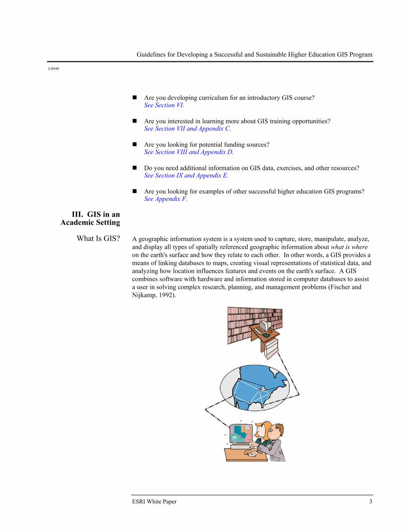
What Is GIS? A geographic information system is a system used to capture, store, manipulate, analyze,
and display all types of spatially referenced geographic information about what is where on the earth's surface and how they relate to each other. In other words, a GIS provides a means of linking databases to maps, creating visual representations of statistical data, and analyzing how location influences features and events on the earth's surface. A GIS combines software with hardware and information stored in computer databases to assist a user in solving complex research, planning, and management problems (Fischer and Nijkamp, 1992).
ESRI White Paper 3
Guidelines for Developing a Successful and Sustainable Higher Education GIS Program
J-8949
With its well-established history of more than 30 years, GIS is still considered a technological innovation in this age of rapidly changing and emerging technologies. Among the benefits of using a GIS system to solve problems is its ability to easily store, retrieve, query, manipulate, send, receive, copy, and display spatial and attribute information. Traditional methods can be and still are used to perform complicated problem-solving procedures; however, the process is usually very tedious and slow. For instance, paper maps make it difficult to handle, store, send, receive, and copy large amounts of information. A GIS makes all of these operations easier and more practical by having one common data storage location for all kinds of information (Goodchild, 1997).
Why Is GIS Important
to the Higher Education
Community?
The impact and demand for GIS education has experienced tremendous growth in colleges and universities throughout the past two decades and is beginning to emerge more often in the K–12 environment (EdGIS, 1994). One of the greatest factors driving this growth is the demand from the private and public sectors for workers who can apply GIS in the workplace. This growing demand for working professionals trained in the use of GIS has helped a variety of university departments that offer GIS. These programs range from simply offering courses in GIS and using GIS as a tool in other disciplines to offering GIS certificates; minors in GIS; GIS distance education; and associate's, bachelor's, master's, and Ph.D. degrees. This demand will only continue to grow as more careers require some GIS knowledge and as GIS expands at the K–12 level. K–12 programs have grown significantly in the last five years and now reach thousands of students annually (www.esri.com/k-12). The new ESRI Press book, Mapping Our World: GIS for Educators, which is aligned with national geography standards and contains complete teaching modules, will help educators reach even more students. As these students enter higher education programs, they will be ready and eager to apply GIS to their educational program. This will increase the pressure for program development at universities to accommodate these GIS-aware students. Several factors have helped support the successful integration of GIS into higher education. Rapid advancement of computer technology, cost-effective computer hardware and software, user-friendly and powerful software, and the widespread availability of spatial data have made integrating GIS into higher education affordable. The pedagogical applications and benefits of GIS have also contributed to the widespread use of GIS in higher education. The development of a GIS core curriculum by the National Center for Geographic Information and Analysis (NCGIA) in 1990 and the development of GIS teaching materials by publishers, educators, and ESRI have paved the way for GIS use in multiple disciplines. Many educational professionals believe that GIS acts as a catalyst for creative thought and problem-solving skills and facilitates spatial reasoning that supports higher levels of learning among students. Although some of these skills are easy to visualize both qualitatively and quantitatively by observing students' successfully solving spatial problems in the classroom, a significant amount of research is still needed to validate which spatial skills and learning processes are affected by the integration of GIS and how many students actually benefit from the technology. The National Science Foundation (NSF) has supported numerous grants to educators and institutions for the development and use of GIS. Some of the grants have been to develop curriculum, train the trainers,
August 2002 4
Guidelines for Developing a Successful and Sustainable Higher Education GIS Program
J-8949
and provide funding for acquisition of the necessary hardware and software for GIS programs. One NSF Advanced Technological Education (ATE) grant, GIS Access, combined actively learning pedagogy and GIS. Many of the projects created by the educators who participated in this multiyear grant are available online at ArcLessons (esri.com/arclessons).
Who Uses GIS? The use of GIS continues to increase across business, industry, academic, and
government sectors. In its early life, primary users of GIS software included landscape architects, planners, engineers, and land use managers. As software and hardware became more cost-effective and user-friendly, and the benefits and applications of GIS technology became better understood, its popularity and usegradually spread to other disciplines and professions. Today, this powerful technology is used in almost every field one can imagine. Water management uses GIS to identify contamination sources; police departments use GIS for crime analysis; school administration uses GIS to manage their facilities, do site selections for new campuses, track students and alumni for target marketing, and route school buses; precision agriculture uses GIS to analyze crop yields, track pesticide and fertilizer use, and analyze crop health; fire departments use GIS to dispatch emergency vehicles and track and manage wildfires; epidemiologists use it to track and analyze the spread of diseases. The events of September 11, 2001, provided stark evidence of the critical need for spatial information and usefulness of GIS, and since then, many colleges and universities have used GIS technology to review and update their disaster plans. The use of GIS for immediate rescue, response, and long-term recovery efforts has provided sound evidence to local and federal governments of the need to have plans, processes, data, and trained personnel in place prior to any type of emergency. Among the most common fields using GIS technology are Utilities Business Communications Natural resources Transportation Engineering Forestry Health care Precision agriculture Law enforcement Fire science Journalism Land use planning Environmental studies Emergency preparedness "Project-based" programs Education Libraries and museums Federal, state, and local government agencies Homeland security
ESRI White Paper 5
Guidelines for Developing a Successful and Sustainable Higher Education GIS Program
J-8949
For more information on different uses of GIS, go to the links listed on the Industry/Specialty Solutions page at http://www.esri.com/industries/index.html.
How Is GIS Used in Higher Education?
Currently, more than 2,000 colleges and universities in the United States and 6,500 colleges and universities worldwide use ESRI® GIS software for teaching, research, and administrative purposes. A list of more than 300 GIS programs is available on the ESRI Higher Education Searchable Database at http://gis.esri.com/university/ onlinedb.cfm. A listing of all institutions with a campuswide Site License is available at http://www.esri.com/industries/university/site_license.html. More than 70 disciplines and departments at colleges and universities incorporate GIS into their teaching and/or research. These include geography, geology, sociology, archaeology, computer science, forestry, agriculture, engineering, environmental science, business, biology, drafting, economics, surveying, engineering, political science, journalism, public health, history, urban planning, and many more. Modules are included in many subject areas that show how GIS is used as an analysis tool in those disciplines. Types of programs range from vocational or workforce programs, which focus on entry-level technology education and training, to traditional academic courses with in-depth mathematical and scientific foundations in GIScience. Courses are also provided in various settings including on-campus and distance education courses of varying lengths including hands-on technology workshops, short courses, certificate programs, and degree programs. GIScience provides researchers in numerous disciplines advanced methods to analyze and display data, develop and test models, and integrate data from multiple fields to solve problems. GIScience programs also allow biologists, geologists, geographers, epidemiologists, hydrologists, meteorologists, archaeologists, computer scientists, and many other scientific researchers to advance the science of GIS. College and university administrative departments use GIS for a variety of logistical solutions (e.g., marketing and outreach; sponsored programs for fund-raising and endowments; facilities management for location of facilities, buildings, grounds maintenance, allocation and classroom utilization, and campus growth; student affairs for student distribution and statistics; campus police for campus safety, crime reporting, and other mandated governmental regulations).
IV. Developing a GIS Program
The process of developing a GIS program at a college or university shares many elements with the development of an enterprise GIS program at a small city. This is especially true for the administrative use of GIS at an educational institution. While many universities are using GIS in administration, much needs to be done to document the process and best practices to effectively combine development programs for teaching, research, and administrative purposes. The GIS Development Guide series developed through the Local Government GIS Demonstration Grant project, jointly produced by participants from government in New York, the State University of New York at Buffalo, and the National Center for Geographic Information and Analysis at Buffalo, provide some insight and practical guidance for development of a GIS program (www.geog.buffalo. edu/ncgia/sara/). While much of the guide's information needs to be altered for use by an educational institution, the materials can serve as a starting point for the development of a campuswide GIS program. As more universities document the development of GIS at their institutions, it is anticipated that a GIS Development Guide for Educational
August 2002 6
Guidelines for Developing a Successful and Sustainable Higher Education GIS Program
J-8949
Institutions can begin to take shape. Many papers on the subject can be found by doing a search on the online bibliography and other links at the ESRI Virtual Campus Library (http://campus.esri.com/campus/library/).
1. Planning Phase: Initial Considerations
When Developing a GIS Program
A well carried out planning phase is vital to the ultimate success of a GIS program in higher education. The planning phase should include a needs assessment that clearly defines the program objectives as well as the university support structure and existing resources.
Establish an Advisory Committee
An advisory committee is a selected group of representatives from the university, local government agencies, school systems, private consulting firms, and other institutions that help provide a broad perspective on the goals, needs, and success of the GIS program. This committee should be set up early in the planning process. Other subcommittees may also need to be formed from time to time to deal with specific tasks. One of these may be a "technical committee" that has specific expertise in technical aspects of the program while another committee may be formed that specifically addresses the curriculum needs. Some of the responsibilities and decisions the committee can assist with include Determining program needs Determining local GIS needs Designing curriculum to meet needs Maintaining realistic timetable and goals Determining available resources of each institution Determining what equipment and facilities exist Determining what faculty and support staff exist Establishing an advertising and marketing campaign Determining available funding Supporting a GIS coordinator or manager
Members of the advisory committee should rotate every year or two to include representatives from other local businesses, industries, educational institutions, and government agencies. This will generate new energy, enthusiasm, and ideas for long-term success of the GIS program.
Establish a Needs Assessment
The GIS needs assessment is a task that justifies the establishment of the GIS program. A thorough GIS needs assessment should include (1) program objectives and purpose, (2) market analysis, (3) database survey, and (4) university support structure. The needs assessment helps to foster cooperation and communication among departments toward a set of common goals. In addition, it serves as a learning tool for potential users by describing what GIS is and how it can benefit their department. Without a complete needs assessment, it is possible that individual departments might proceed in adopting their own set of objectives that may duplicate those of other departments.
ESRI White Paper 7
Guidelines for Developing a Successful and Sustainable Higher Education GIS Program
J-8949
Objectives/Purpose of the Program
The first step in designing a needs assessment is to define the objectives, function, and design of the GIS program and the center or lab facility. Some important questions to ask are Who are the users (faculty, staff, students) and what are their needs (occasional use,
set class times per semester, free access at all times)?
Are you offering modules within courses, courses within existing degree programs, a degree or certificate program, or a mix of these offerings?
Will the GIS center or lab facility be a single or multipurpose facility?
Will the GIS center or lab facility be open or restricted to particular users at set times?
Will the computers be networked or stand alone?
How will software, computer, and facility security be provided?
What type of technical support exists on campus and how will technical support be provided to the center or lab facility?
The answers to these questions will impact the goals for the program and the physical design, priorities, and access policies of the GIS facility. For example, if a certificate program is offered, there may be a need for evening access for professionals as opposed to a program strictly designed for lecture and teaching. The physical layout of the lab facility must take into consideration the type of use of the facility. If it is primarily a teaching lab, desk and computer arrangement must take into account the line of sight for students and instructors to view computer demonstrations. If the facility is to be multipurpose where many different activities and groups will be using the lab, the ability to reconfigure the lab to meet varying needs may be advisable (see Appendix A: GIS Facility Wish List). A multipurpose facility also will require more security and continual monitoring.
Market Analysis Both Within and Outside
the University
Prior to establishing your GIS program, it is important to conduct a benchmark analysis of your competition both within and outside the university including documenting the need for such a program. As to competition, it is important to determine who will be potential users and if there is a competing program. Are there any local universities that have GIS programs established? What are their goals? Who are their users? Are there other departments on campus with GIS facilities? How many individual groups are using GIS? What other disciplines and departments can benefit from a GIS facility? What kinds of distance education programs (at your institution or other institutions) may aide or compete with your program? To analyze the need for such a facility or program, supporting documentation should be gathered that includes any local, regional, or national workforce needs including job descriptions, salary surveys, or other documentation from a GIS-related professional organization that demonstrate the need for education or training in GIS.
August 2002 8
Guidelines for Developing a Successful and Sustainable Higher Education GIS Program
J-8949
Database Planning GIS is highly dependent on data access and accessibility. This is true for educational programs in GIS. A GIS center or lab facility must include a plan for securing, maintaining, and managing a GIS database for educational and research purposes. This is also vitally important for the administrative use of GIS. The first step in planning the database is finding and utilizing the appropriate data that will support the objectives and function of the facility. A survey should be performed to analyze and inventory available data and to identify potential sources of data. A master data list should then be compiled. The task of developing the GIS database should be the responsibility of all interested departments. The database eventually will become a universitywide resource that is created and managed according to the objectives and purpose established in the needs assessment. As data needs and sources are identified and acquired, expansion of the database becomes an important consideration. Be sure to plan for expansion (see Section IV.3, Managing Phase).
Types of Data The types of data needed for the GIS program is an important consideration. There are many types of data that can be utilized by a GIS, and each type has its own unique potential for contributing to the goals and objectives established in the facility needs assessment. Various data types include mapped data, which includes published maps that may be already digitized into a vector data structure; attribute data tables, which are available from many organizations and agencies and can readily be input into a GIS; and image data, which includes remotely sensed images in the form of aerial photographs to satellite data. Many of these images can be displayed in a GIS, but for analysis purposes, these images need to be georeferenced or rectified so they can be overlaid on similarly georeferenced images or data. Other types of data that should be considered for the GIS database include scanned images or pictures, hard-copy maps, digital orthophotography, and digital elevation models (DEM).
Finding and Acquiring Data
Significant data sets are available from local, state, and federal agencies either free of charge or at reasonable costs. Two agencies that store large amounts of geographic data include the U.S. Geological Survey (USGS) and the Census Bureau. The USGS supplies free digital line graphs (DLG) that are national in coverage while the Census Bureau supplies free Topologically Integrated Geographic Encoding and Referencing (TIGER®) data. A complete list of government sources can be accessed over the Internet or in the Survey of Available Data Guide. This data can form the initial GIS database. Another wealth of geographic data can be found at ESRI's Web site (www.esri.com), at the Geography NetworkSM (www.geographynetwork.com) and at ESRI Business Information Solutions at www.esribis.com. Private data firms also house useful geographic data usually developed for a local government. Depending on the guidelines of the contract work, some of this data may be available for free, purchased through the firm, or proprietary and completely unavailable. In many situations, small universities do not have the revenue to purchase large amounts of data. In these cases, it is highly recommended that these institutions partner with other universities, government agencies, vendors, and private interests that may assist in supplying or sharing needed data. Participating in or organizing data sharing cooperatives can lead to acquiring shared data or reducing purchase costs. All partners
ESRI White Paper 9
Guidelines for Developing a Successful and Sustainable Higher Education GIS Program
J-8949
will benefit from the coordinated support infrastructure while improving GIScience education.
University Support Structure
It is a wise investment of time to establish a university support structure that will help to ensure the long-term success of a GIS program. In many public and private institutions, financial support for start-up costs is available via interdepartmental grants. These grants are helpful for short-term benefits, but without administrative support and commitments, facilities may become vulnerable in the long term. Administrators often assume that facilities are self-sustaining with little required upkeep or need for ongoing funding. If at all possible, obtain a financial commitment from the administration by clearly identifying the benefits and sources of revenue that can be obtained from developing the GIS program. Securing annual line-item budget support from the university would be the ideal situation. If the facility is expected to become self-supporting, strategies for creating revenue should be carefully evaluated. In all cases, attempts should be made to familiarize university deans, department chairs, and other administrators with GIS and the benefits it brings to the campus. These benefits include academic excellence and research programs, but the use by administrators should also be emphasized. Tours of the facility, software demonstrations, and miniworkshops to give administrators a chance to use the facility first hand can help achieve this goal. Having the GIS center serve as the campus mapping center with students actively involved in creation and maintenance of this resource including an ArcIMS® Internet site for the campus can provide added support for funding of the facility. If the facility is intended to be used by various departments, there must be a fair distribution of financial support that is contributed by each participating department. However, the management and oversight of the process should be by one department. This can be a very difficult and time-consuming process, and it is suggested that the optimum method of financial support would be to have the program funded by the institution's administrative body rather than multiple or single academic departments.
Funding Assuming there is a positive consensus among university administration and faculty from several departments in establishing a GIS program, the next major step is securing the necessary funds to purchase equipment, software, and support personnel. Both internal and external sources of funding should be explored. Internal funding may be available through university grants, capital equipment funds, or laboratory fees. External funding can be obtained through private and federal grants, contracts, and donations. A list of funding sources is located in Appendix D: GIS Funding Sources and as part of the Higher Education CD obtainable from the Higher Education Web page (www.esri.com.highered).
2. Acquisition Phase: Technical
Considerations
A necessary consideration in the development of a GIS program is the establishment of a GIS center or lab facility and acquisition of the infrastructure. The purpose of the program, however, should drive the design of the center or lab facility. The following information addresses the importance of determining the most practical hardware, software, data, and personnel needed to successfully implement the desired purpose and outcomes of a higher education GIS program.
August 2002 10
Guidelines for Developing a Successful and Sustainable Higher Education GIS Program
J-8949
Equipment Needs Rapidly changing technology directly impacts equipment requirements and suggestions. These changes need to be frequently monitored and updated to meet the needs of the current technological demands. Therefore, it is imperative to build into the GIS program a method to keep laboratory facilities and curriculum current.
Space Requirements Do you have a place to house the GIS center or lab facility? The location of the facility may depend on whether it will be single or multipurpose. Ideally, the facility should be located at or near the department that is solely responsible for the management of the lab. However, take into consideration the location and number of potential users. A centrally located center or lab facility will attract more students. Also, remember to take into consideration the disabilities and accommodation laws and acts that must be followed if building and/or remodeling. With new wireless technology and increasing laptop computer capabilities, there may be advantages to setting up a lab that can easily be altered depending on the needs of the course. New desktop tables, servers, and other technology now can make this type of classroom more cost-effective than one that is hardwired for electrical and Internet use and is difficult to reconfigure. See the lab and classrooms that can be reconfigured to fit varying needs as developed at Murray State University, Kentucky (http://campus.murraystate.edu/classrm.html and http://campus.murraystate.edu/confrm.html). You may also want to visit Computer Comforts—a company dedicated to providing furniture solutions for electronic classrooms (http://www.computercomforts.com/), and Appendix A: GIS Facility Wish List. Other space considerations include the following: How big should the lab be? The number of lab stations will depend on the size of
the space and the intended function of the facility. Do not overcrowd the lab with too much equipment.
Which way do the computer monitors face? Is the lab for teaching or research? If it is a teaching lab, the instructor facing them from the back of the room during demos works well. All students should be able to easily view demos.
Extra shut-off switches that limit what the students can do while the instructor is working.
Ability to run videos through the computer monitors or a VCR.
Room to walk between rows of desks and computers.
Lighting dimmers to avoid glare and for overhead and computer demos.
Electrical supply and easy access to electrical outlets and cables.
Air conditioning system—quiet and self controlled.
Lab security—some method to protect software and hardware from theft or tampering. Note: This includes physical theft as well as digital tampering by
ESRI White Paper 11
Guidelines for Developing a Successful and Sustainable Higher Education GIS Program
J-8949
students; remember that students will need to be able to save their work. Limit or track access, but students must still have access for saving projects and downloading data.
System Requirements The power and performance of computer systems are changing so quickly that any
specific suggestions will most likely be outdated within a few months of this publication. In addition, system requirements will vary depending on the short- and long-term goals of each facility. Therefore, it is recommended that individuals purchasing GIS equipment discuss their wish list with either the advisory committee or with a well-qualified computer specialist at the university or at ESRI. A general rule of thumb for starting new laboratories is the notion that "more is always better." The highest processor speed and the largest amount of RAM and hard drive space will at least keep the laboratory at the cutting edge for a couple of years. Also, new wireless technology should be investigated to see if it would fit the needs of the program.
Other Considerations Technical support is a vital part of any GIS center or lab facility. In fact, it is one of the most important factors in a sustainable program. It is suggested too that the technical support have some level of GIS training for the most effective use of the facilities. The other important factor in setting up and sustaining a GIS center or lab facility is an ongoing program of hardware upgrades. This includes computers, servers, printers, global positioning system (GPS) units, cameras, and other devices that are needed or will become important to GIS programs.
Wish List The Wish List (Appendix A) was developed through instructors' suggestions during GIS workshops. The list is current as of August 2001. This list is a guide to establish the customized lab for each institution's specific needs and goals. The comprehensive list is not necessary for a successful GIS program or GIS lab but can serve as a guide. In addition, the list may not contain all of the items that must be acquired by a GIS program. It should be used for reference only and as a starting point for instructors to make their own decisions on what is needed by their specific programs (ESRI, 2001).
3. Managing Phase: Implementation Considerations
The planning and acquisition phases are vital components in the successful development of a GIS program; however, the management plan guides the GIS coordinator in fulfilling the objectives and potential of the program. Careful consideration of the program function, design, equipment, time, personnel, and monetary resources can eliminate potential management headaches down the road. An active rather than a passive management strategy is recommended if the program is to meet its goals and avoid university politics.
Personnel
GIS Program Coordinator
The coordinator is the glue that holds all parts of a GIS program together. The GIS coordinator should be a faculty or senior research staff member in the department who manages and oversees the program operations. Unfortunately, most faculties interested in coordinating the GIS program and facility are younger, untenured faculty. The disadvantage of having an untenured faculty coordinate the GIS program presents the risk of burdening the coordinator with service responsibilities that are not considered equal to teaching and research at tenure promotion. Therefore, for higher education institutions to
August 2002 12
Guidelines for Developing a Successful and Sustainable Higher Education GIS Program
J-8949
expect a successful GIS program and the needed effort that is required to accomplish the program goals and objectives, the traditional reward structure must be modified to fully acknowledge the time dedication of the untenured faculty GIS coordinator. Alternatively, the GIS coordinator should be given release time or compensation to perform duties. The GIS coordinator may be someone with a master's degree that can be hired as a senior research staff member. In this case, the tenure issue becomes obsolete and the individual can focus his/her attention on the development of the facility. Responsibilities of the GIS coordinator include Coordinating short- and long-term plans Keeping program and facility cutting edge Training of faculty Developing, obtaining, or modifying curriculum as technology evolves Promoting program Outreach—preparing and releasing advertisements In House—coordinating workshops for faculty Attending conferences relevant to program Coordinating/Controlling technical support Serving on and/or leading advisory committee
GIS Manager/Lab
Technician Staffing a GIS facility is a critical issue in the success of the lab. A GIS coordinator alone does not have the time to deal with many technical, access, and daily maintenance issues that arise. A GIS manager who may, in turn, hire a work-study student as a lab technician should handle these daily responsibilities. Responsibilities of the GIS manager and lab technician include Creating a universitywide database Maintaining the database Developing and maintaining the master data list Installing software Upgrading and updating hardware and software Maintaining performance of equipment Maintaining user passwords and access privileges Maintaining lab schedule for teaching, research, and so forth
Student Assistants If funding is not dedicated to staff positions, student work-study assistants may be an
alternative for many of the basic lab management tasks. Student interns from local high school programs are another source of reasonable lab management task assistance.
GIS Center or Lab Facility Management
As discussed previously, the function of a GIS center or lab facility is an important management decision that needs to be made early on in the planning phase. The GIS coordinator needs to communicate these issues to those directly involved in the implementation of the facility. The function of the laboratory for teaching, research, contractual, or practical work will ultimately determine who has access and how the
ESRI White Paper 13
Guidelines for Developing a Successful and Sustainable Higher Education GIS Program
J-8949
facility will be managed. Alternatively, staffing and funding may influence how the facility will function. Three main areas require management attention: data, hardware, and software. Most university computer facilities have support staff to help troubleshoot basic hardware and software problems. If there is not a reliable support system in place, service contracts and maintenance agreements are available from vendors, usually at a cost. Some vendors offer limited no-cost telephone assistance. If there are no funds to provide on-site professional support, a good alternative is to cultivate knowledge of existing GIS staff by learning from experienced colleagues already running computer facilities or subscribing to Internet user group e-mail lists.
Lab Fees Collecting laboratory fees is a wise mechanism for obtaining funds to support ongoing maintenance and upgrades. Inquire with the appropriate university administrators about how these funds are dispersed and if fees can be adjusted to keep pace with increasing costs.
Access Most access questions come down to personnel, security, and time management issues. Without the personnel to be on hand for troubleshooting and security reasons, access to the facility will be affected. It may be necessary for lab managers or coordinators to play dual roles in order to provide more open lab schedules. If lab assistants are put in charge, policies should be established regarding access (who gets keys), shutting down computers and monitors, emergency contacts, and so forth.
Data Management There are three driving components involved in GIS center or lab facility maintenance. These are (1) security, (2) database expansion, and (3) system upgrades. Users will ultimately be affected by these changes but, at the same time, the system changes should be subjected to user review and evaluation.
Security The most important security issues deal with hardware theft, tampering with computers, backing up the database, and virus protection. These issues can be dealt with by having in place physical or digital security systems and following processes and procedures to be sure they are effectively used. Rooms housing GIS programs need to have some form of security including security for doors and windows as well as access security systems (keypads or other devices). Also needed is some form of security (locks or locked cabinets) for computers and other hardware within the room or facility. Security for computer operating systems, programs, and files are also vital. These can include efficient password policies, antivirus software, and backup and restore software and procedures to be sure these are used effectively. How many times have we heard or said the day a hard drive crashes or the system acquires a virus, "I was going to back up my files yesterday"? A reliable backup system for the GIS center or facility database should be a top priority in maintaining the GIS database. A dependable backup system will restore the backup database to another computer and be operational again in minutes. A schedule for regular backups depends on the size of the database and the number of changes being made to it. The GIS manager or lab technician should be responsible for these regular backups.
August 2002 14
Guidelines for Developing a Successful and Sustainable Higher Education GIS Program
J-8949
Computer viruses need to be viewed as a "when" not an "if" situation. Viruses and security issues go hand in hand. There are several excellent virus detection software programs available at very reasonable costs. University computer facilities most likely have site licenses for most of these programs of which university faculty and labs should be entitled. However, the software is only effective if continual virus updates are performed to keep the detection program current. This can be done directly through the Internet. Since it is difficult at times to keep up with the number of viruses being created, the best security is a system backup. In addition, policies should be established to limit the use of floppy disks in the lab and to screen any floppy before it is accessed by a program as well as limiting the downloading of material from the Internet.
Database Expansion The expansion of the database should be viewed as an ongoing process as technology improves and becomes more cost-effective and as increased sources and types of data become available. Keeping in mind the goals and objectives of the GIS program will help to prepare for the expansion. The GIS coordinator should consult with other departments to determine their data needs and request financial support for ongoing expansion from these departments if necessary. When expanding the database, considerations should focus on estimated new data, conversion of old data, disk space, main memory, and server capacity.
Upgrades Typically, initial start-up funding does not take into account additional monies needed for upgrades and maintenance. This may impact the management of the facility. Any state- of-the-art GIS facility will want to stay on the cutting edge of latest hardware and software. Operating systems, RAM, hard drive capacity, and the processor speed are all basic components that are continually changing. Inability to upgrade these components can create undo strain on the user, manager, and the system. With respect to software, vendors usually provide software and maintenance agreements that ensure they will automatically provide upgrades as they become available (see Appendix B: Site Licenses).
Hardware and Software
Management
To reduce intentional or unintentional damage to hardware or software, the coordinator should institute limitations for unauthorized access to the system. Depending on the users, options can be set to restrict access to printers, files, use of particular programs or data sets, loading software, and downloading data from the Internet. These preventative maintenance measures will eliminate many headaches and promote the efficiency of the facility. However, it must be remembered that students need access to data, the Internet, and space on servers for GIS projects. Thus, security must be provided but should not unduly restrict the user to most effectively learn and use GIS.
Potential Problems and Pitfalls
Any venture that thrives to be successful will face hurdles along the way. The most qualified and enthusiastic faculty and staff are the ones that see the potential and benefit of a GIS program for the university and the students. These visionary and interested individuals should be made aware of the potential problems and pitfalls that may be encountered as they develop the program and facility. Some of the common barriers that others have encountered are listed below. Turf wars—"where" does GIS fit into the curriculum? Long-term funding of program, lab, and center
ESRI White Paper 15
Guidelines for Developing a Successful and Sustainable Higher Education GIS Program
J-8949
Academic, vocational, or continuing education Undergraduate or graduate Single- or multidisciplinary coordination Finding and retaining faculty Training for full-time faculty Adjunct faculty coordination Advertising for program, content, timetables Hardware and software upgrades Lack of accreditation and articulation No standards for course or curriculum content
Advertising and
Marketing An important part of the success and sustainability of a GIS program is the time and effort dedicated toward advertising and marketing the program. This is a task that many faculties either overlook or avoid. This is the business side of the job that requires a significant amount of time, thought, and money but one that will pay off in the long run. Initially, it is important to host lab open houses and faculty and student workshops to let people know who you are and what your program has to offer. Develop a Web site for the program that can be linked to the department Web site. Once the facility is established, attend professional conferences and present research. Develop brochures and carry business cards that you can distribute. Offer short courses through the facility. You can depend on advertising via word of mouth only after the program has been established for a couple of years and has a good reputation. Prior to that time, it is vital to work with the institution's outreach system, the GIS program advisory committee, and outside user community to promote the program.
V. GIScience Research
Geographic information science is a new science with vast opportunities for growth and an undetermined potential. GIScience research refers to the advancement of innovative applications for this emerging technology by various disciplines. As the powerful tool of the GIS became more cost-effective and user-friendly to an overwhelming audience, GIScience began to emerge as the discipline to understand, focus, and direct this technological revolution. Thus, GIScience seeks to provide the theoretical foundation of GIS. There is currently a focused effort being undertaken in the GIS research community to integrate the science and the systems of GIS to improve the theory and applications of this rapidly evolving new discipline.
August 2002 16
Guidelines for Developing a Successful and Sustainable Higher Education GIS Program
J-8949
Leading Organizations in
GIScience Research
Three of the organizations that are leading the way in advancing research and education in the field of geographic information science are NCGIA, University Consortium for Geographic Information Science (UCGIS), and The Association of Geographic Information Laboratories for Europe (AGILE). Their research priorities focus on supporting infrastructure, emerging technologies, professional education, and education policies. National Center for Geographic Information and Analysis http://www.ncgia.ucsb.edu/education.html The National Center for Geographic Information and Analysis is an independent research consortium dedicated to basic research and education in geographic information science and its related technologies including geographic information systems. The three member institutions are the University of California, Santa Barbara; the University at Buffalo; and the University of Maine. The consortium was formed in 1988 in response to a competition for funding from the National Science Foundation and continues to receive much of its funding from that source. The three main topics of current research include Accuracy and uncertainty in spatial data Cognition Modeling and representation
University Consortium for Geographic Information Science http://www.ucgis.org The rapid growth in the field of geographic information has encountered diverse notions concerning which direction the field should take. To ensure that a coherent view emerges, a broad representation of universities and professional associations has come together to form the University Consortium for Geographic Information Science. UCGIS has three primary purposes: To serve as an effective, unified voice for the geographic information science
research community
To foster multidisciplinary research and education
To promote the informed and responsible use of geographic information science and geographic analysis for the benefit of society
The University Consortium for Geographic Information Science, established in 1994, is a nonprofit organization of more than 100 universities, research institutions, professional organizations, and government affiliates dedicated to advancing GIScience through improved theory methods, technology, and data (UCGIS, 1997). The main research priorities of UCGIS include Spatial data acquisition and integration Distributed computing Extensions to geographic information
ESRI White Paper 17
Guidelines for Developing a Successful and Sustainable Higher Education GIS Program
J-8949
Cognition of geographic information Interoperability of geographic information scale Spatial analysis in a GIS environment Model curricula for GIScience and technology The future of the spatial information infrastructure Uncertainty in spatial data and GIS-based analyses
The Association of Geographic Information Laboratories for Europe http://agile.uni-muenster.de/index.htm The Association of Geographic Information Laboratories for Europe was established in early 1998 with the mission to promote academic research and teaching on geographic information science in Europe and to facilitate networking activities between geographic information laboratories at the European level. AGILE is composed of 58 member laboratories from 20 nations that collaborate toward a true European research agenda in matters related to the definition, production, and exploitation of geographic information. The research interests and activities of the member laboratories have been mapped and grouped around key themes to promote networking and to build critical mass in research activities of common interest. The AGILE working groups, which are seen as central to undertaking research activities, have only recently come into existence and have yet to realize their full potential. Four working groups have been established by the AGILE members to promote research activities in the following fields: Data policy Environmental modeling and planning Interoperability Education
Importance of
GIScience Research As science becomes increasingly interdisciplinary, the potential for using geographic information by various scientists continues to be recognized, and new technological innovations emerge, there will continue to be a greater need to integrate and advance GIScience research in order for this new discipline to reach its potential. Advances in the field of GIScience have the potential to change the way science is performed, expand scientific capabilities, influence how and what we teach, and, ultimately, change the way we think. We are living in a technological revolution that is far from over.
Advancing Technology
Recent innovations in information technologies are beginning to have an important impact on education in GIScience both inside and outside the university. The Internet and WWW, for example, are rapidly changing the ways in which GIS educators, researchers, and professionals gather raw data, engage in background research, collaborate and communicate with colleagues, and share the results of their investigations. Multimedia and hypertext capabilities are currently being integrated into GIS (UCGIS, 2001). These innovations have led to an outpouring of experiments in using some of these technologies in higher education. Numerous higher education institutions are using ESRI Virtual Campus courses. These courses are being used in several different ways. Some institutions use them as prerequisite courses to their own offerings, the laboratory section for courses, part of a GIS distance education program, and a way for educators to learn the latest technology and keep up to date. In addition, materials for courses in GIS,
August 2002 18
Guidelines for Developing a Successful and Sustainable Higher Education GIS Program
J-8949
cartography, and remote sensing have appeared on the Internet. These include very large projects, from the Geographer's Craft to prototype comprehensive electronic textbooks and laboratory manuals on the Web. International projects offer tutorials, courses, and certification programs in GIS via the Web. Some other examples of how GIS is being used to advance technology include the following: Advanced computer science and programming and database-related topics Advanced mathematical algorithms for use in GIS analysis Advanced modeling using GIS Spatial/Temporal applications Three-dimensional and virtual reality Spatial data structures Spatial statistics Computational cartography Spatial cognition Active spatial learning
Advancing GIScience Researchers in numerous disciplines are using GIS to help analyze and display their data.
For example, biologists track and define species and habitats, geologists map earthquake fault lines, hydrologists analyze watersheds and water quality, archaeologists map the location of artifacts and sites, agronomists evaluate crop yields, epidemiologists track diseases, and countless other scientists analyze data or test models in their fields or integrate data from multiple fields. UCGIS has identified the following emerging themes in GIScience research: Geospatial data mining and knowledge discovery Ontological foundations for GIScience Geographic visualization Analytical cartography Remotely acquired data and information in GIScience
VI. GIS Curriculum
and Teaching The priorities and importance of GIScience research have direct implications to educational pedagogy. Research plays an important supporting role for data, tools, and course content provided to students. In addition, research-based instruction helps to promote learning by introducing students to real-world problems that make information learned in the classroom more relevant. The potential of GIS as a tool to support scientific inquiry in all disciplines and at all educational levels has been described by many researchers (Alber, 1988; Audett and Abegg, 1996; Kerski, 2000).
ESRI White Paper 19
Guidelines for Developing a Successful and Sustainable Higher Education GIS Program
J-8949
Teaching Concepts and Skills
The rapidly growing field of GIS has caused instructors to question "what" and "how" to teach GIS. Some educators are using the inquiry-based learning approach where GIS is used as a tool to solve a problem. For example, a marine science student uses GIS as a tool to determine the effects of red tide on the manatee population. Others are teaching GIS as a discipline or topic in information technology or computer science. There is no pedagogical approach that satisfies every educational need; however, most programs should include the following concepts or topics in some depth depending on the level of instruction (ESRI, 2001). Map projections, datum, spheroids Cartography Scale Data structures and formats Data accuracy and acquisition Metadata Databases and database management Computer programming GIS planning Spatial analysis and modeling GIS management and implementation GIS project management Ethics and legal issues
It has been well documented that all students learn differently. Therefore, it is important that instructors incorporate several approaches when teaching GIS to reach the potential of their students include the following: a combination of demonstrations to illustrate a theory or a concept; controlled exercises that are led by the instructor; structured inquiry that requires students to develop their own procedures and interpretations; open inquiry that requires students to identify a problem, formulate procedures, and interpret results; and research projects that are based on a long-term experiment or series of experiments (NCGIA, 92).
Importance of GIS Curriculum
The growing demand for GIS-related courses by students and professionals in the late 1980s prompted the need for the education community to design a GIS core curriculum. The NCGIA developed the first GIS Core Curriculum (GISCC) in 1990, which is an excellent guideline for the fundamental concepts of GIS. However, one of the greatest obstacles that has contributed to the lack of widespread integration of GIS across disciplines is the lack of teacher training and curriculum (Bednarz, 1994). The instructor must develop the GIS curriculum, which includes a combination of topics, lecture notes, exercises, delivery methods, and assessment procedures for the specific content area. This is a very time-consuming task but is necessary for the advancement and understanding of the interdisciplinary capabilities of the technology.
NCGIA Core Curriculum
The NCGIA Core Curriculum is a working document that was initially developed in 1992 by Dr. Karen Kemp and Dr. Michael Goodchild. It was considered one of the most ambitious geography higher education projects ever undertaken. The continuing demand for copies of the original 1992 GISCC, the rapid development of the technology, and the awakening of the concept of geographic information science warranted the decision for NCGIA to make some major revisions to the original version. As access to materials is
August 2002 20
Guidelines for Developing a Successful and Sustainable Higher Education GIS Program
J-8949
rapidly increasing, there continues to be a community interested in having resources such as the GISCC readily available.
Successful Design of a GIS Curriculum
There are several general teaching resources available to the GIS community (see Appendix E: GIS Resources). However, even with the recent development of new teaching materials focused on GIS education, there are many curriculum issues that remain unresolved. Factors, such as the appropriate level of instruction, GIS background and skills of students, delivery approach, and defined learning outcomes, affect the curriculum design (Unwin, 1997). Consequently, there is no such thing as one ideal curriculum. The GIS education constituencies must recognize that each learning situation has specific needs with respect to educational activities (Miller et al., 1997). If a GIS content-specific curriculum is to be successful, a design model that suits local circumstances, resources, and student needs should be incorporated and followed as well as a careful student evaluation to determine the success of the curriculum (Goodchild, 1998). The UCGIS Model Curricula for GIScience and Technology could serve as the basis for a localized curriculum. Unfortunately, the proposed grant to support development of the Model Curricula did not receive funding from the NSF. While the lack of funding had slowed the progress on this vital model, the work is continuing with support of educators from UCGIS and the GIS industry. More information about the Model Curricula and ways you can participate in its development can be found from links on the UCGIS Web page (www.ucgis.org). The University of Southern Mississippi has carried out one project that can serve as a resource for input into the design of a curriculum for programs aimed at the workforce. The National Workforce Development Education and Training Initiative "Geospatial Technology Competency Model" project includes the competencies, work roles, and key deliverables for workers in geospatial technology. This project has been funded by the National Aeronautics and Space Administration (NASA) in an effort to increase geospatial education and provide workers trained in GIS, remote sensing, and GPS (http://www.geowdc.usm.edu/research/research.htm). Several important questions to consider when designing a curriculum are What is the purpose for teaching this course? What new knowledge and skills do I expect from the students? How do I assess student achievement? What are the available resources? How do I assess course progress and success?
Many possible approaches can be used as guides in designing the curriculum. As each instructional situation may vary, it is important for the instructor to know and understand the needs of the student audience prior to deciding on the best curriculum design approach to pursue. These are Designing through aims and objectives Designing by subject matter Designing for knowledge Designing on instructor motivations Designing for individual needs
It is also important to be aware of the potential dilemmas that may arise when designing a GIS curriculum. One critical problem is the lack of qualified GIS instructors. The speed
ESRI White Paper 21
Guidelines for Developing a Successful and Sustainable Higher Education GIS Program
J-8949
of GIS development and technological advances has caused a shortage of faculty and instructors who can teach the most current trends in GIS. Another problem is the conflict between education in GIS versus training in GIS. The industry is pushing the training side to produce more qualified GIS technicians to support the needs of the workforce, leaving a gap in qualified individuals who understand the nuts and bolts of GIS. Other dilemmas that GIS educators must consider when designing a curriculum include whether to use GIS as a subset of a current discipline or as a discipline of its own and whether to teach with or about GIS (Unwin, 1997). Fortunately or unfortunately, there is no single best GIS curriculum design or instructional methodology out there. The best design is the one that considers the needs of each specific educational situation. Student evaluations remain one of the best ways to determine the success of a curriculum design.
Types of Teaching Programs
The rapid growth of GIS use in society has created a demand for education to offer programs on the use of GIS in many academic disciplines, industries, and research fields. There is a growing recognition that GIS can enhance students' experience in learning almost any academic subject. More important, GIS helps develop students' critical thinking and problem-solving skills so they will become more involved in their community and more responsible global citizens. Below are several types of GIS teaching programs offered at higher education institutions. Distance learning http://cem.uor.edu/users/kemp/certificates.html Certificate programs http://cem.uor.edu/users/kemp/certificates.html Workshops/Short courses Degree programs http://gis.esri.com/university/results.cfm Interdisciplinary
Distance learning has become a widely used teaching and learning resource over the past few years. The Internet and Web (World Wide Web) have changed the way educators, researchers, students, and professionals gather information and data and collaborate and communicate with each other. With approximately 75 percent of students in two-year and extension programs being working professionals, the need for distance learning courses has soared. In addition, many individuals are looking for ways to upgrade their skills or simply acquire more knowledge in related fields to keep their jobs. Many jobs are now requiring some knowledge of GIS, which has increased the demand for distance education courses as well as the need for faculty to be trained to teach or develop these courses. UCGIS is continually evaluating the success of learning through the advancement of emerging technologies to stimulate new ideas and techniques in distance education. When developing distance education courses for GIS, keep a design with students' needs and time/location restrictions in mind. Certificate programs from colleges and universities have become popular and necessary as a way of providing working professionals with the GIS skills and knowledge most valued by employers. There are approximately 200 certificate programs in the United States (see searchable database of GIS programs at www.esri.com/highered). These programs typically require a student to complete 12 to 30 semester or quarter hours and focus on very practical issues such as basic concepts used in GIS and the use of specific GIS software. Many universities view certificate programs as a continuing or
August 2002 22
Guidelines for Developing a Successful and Sustainable Higher Education GIS Program
J-8949
supplemental education that can be acquired through distance education courses or via extension programs. A few universities give students the option of acquiring a certificate in GIS as they work toward a more traditional academic degree. Those who benefit the most from certificate programs are generally those individuals with an academic degree in the discipline or knowledge domain but lack expertise in GIS. Individuals who do not have a degree but are faced with using the technology in their workplace or who are just entering the workforce also benefit from these programs and can acquire the skills necessary for entry-level employment. Certificate programs can help employers identify a set of skills and knowledge base required to consider an individual competent in an area of specialization (Obermeyer and Onsrud, 1997). Workshops and short courses are offered by numerous universities as well as private businesses and government organizations to suit specific user needs. ESRI offers a host of GIS training courses at locations throughout the United States and internationally. Other organizations, such as the Center for Image Processing in Education (http://www.cipe.com) and The Polis Center at Indiana University Purdue University Indianapolis (IUPUI) (http://www.thepoliscenter.iupui.edu/polis/home.htm), offer GIS workshops for educators. An excellent resource to find out more about who offers higher education courses and workshops is the UCGIS Web site (http://www.ucgis.org). Degree programs remain a viable source of GIS training and education, and more programs are being introduced. Few programs are available that provide doctorate degrees that focus on GIS. Individuals interested in GIS usually find courses within geography, computer science, and geology departments at universities. Although many students and professionals are working toward master's degrees in various disciplines needing expertise in geospatial technologies, such as planning, landscape architecture, forestry, civil engineering, environmental science, or another discipline, to get advanced education in the use of GIS technology, there is a great demand for people who hold master's degrees in GIS. The shortfall of individuals with advanced degrees in GIS in the United States is estimated at 3,000 to 4,000 graduates per year. The demand overseas is even greater due to the lack of GIS teaching programs in many parts of the world. Worldwide, approximately 6,500 colleges and universities are involved in some way with GIS, with 2,000 of those institutions located in the United States. Though the number of institutions appears large, most of these schools are offering only a few courses in GIS. Interdisciplinary programs are those that include GIS as a required component in the overall mix of information that is necessary for successful completion of the degree. Such programs are common in geography, geology, engineering, architecture, computer science, and many other disciplines. Examples of courses offered in GIS program are listed below. Introduction to GIS Fundamentals and hands-on software use Cartography and GIS Spatial awareness course (often an introductory course in geography/geology) Databases—building and managing Intermediate and advanced applications Projects, analysis, and software customization
ESRI White Paper 23
Guidelines for Developing a Successful and Sustainable Higher Education GIS Program
J-8949
Computer course(s)—programming and data Remote sensing and aerial photography GPS and field data collection Internships
How to Integrate GIS
Into the Curriculum
Process As spatial literacy continues to be emphasized as a national education goal, the
incorporation of GIS in the classroom as an instructional tool is also likely to increase. However, modifications in instructional delivery methods must be fostered to observe improvements in student learning. The traditional teaching environment must be modified into a learning environment. Several instructional processes should be considered to encourage a learner-oriented classroom: (1) focus on problem-solving over technology, (2) incorporate GIS skills and technology as background tools, and (3) develop an active and bona fide learning environment. Sui (1995) describes the differences in learning with GIS versus learning about GIS. Both methods have their role in different learning situations; however, the former is preferred to increase problem-solving skills and geographic reasoning.
Curriculum Committee
A curriculum committee that includes faculty from all departments teaching or utilizing GIS technology should be established. This committee will be critical in helping to generate ideas for a program of study, courses, degrees, certificate programs, and other possibilities that will attract students to enroll in GIS classes. It is critical that members of the curriculum committee are involved in the current trends in GIS so that new courses or programs of study are up-to-date to attract students. A voice from each cooperating department will also help to generate money from department budgets to support GIS facility expenses.
Time Line Be patient! It may take several years to successfully integrate GIS as an active and authentic tool into an established university curriculum. It takes time for various departments to establish their specific courses or GIS programs of study. The curriculum committee will be critical in dictating how long it will take to fully integrate the program. Encourage the curriculum committee to develop the program in stages and to set quarterly and annual goals for all departments to meet.
Advancing GIS Education
Many new projects are changing the face of GIS education. A few of these include the Digital Library for Earth System Education (DLESE), the Instructional Management System, and the ESRI Virtual Campus. Distance education has become the emerging theme over the past few years and has just begun to realize its potential use and benefits to the educational community. The Internet and the WWW are rapidly changing the way GIS educators, researchers, and professionals gather data, engage in research, collaborate on projects, and share information.
VII. GIS Training Opportunities
ESRI is committed to supporting education across disciplines. In the last few years, ESRI has developed a number of programs whose primary goal is to support academic institutions and the use of GIS in disciplines that will have a positive impact in
August 2002 24
Guidelines for Developing a Successful and Sustainable Higher Education GIS Program
J-8949
supporting the needs of an ever-growing technological workforce in the 21st century. A list of these training opportunities can be found in Appendix C: ESRI Training Courses.
VIII. GIS Funding Opportunities
Whether you are looking for funds for equipment, software, GIS research, or curriculum projects, grant writing is usually a requirement. A list of several different federal, state, and local organizations that fund a variety of GIS-related needs are listed in Appendix D: GIS Funding Sources.
IX. GIS Resources Helpful GIS resources such as Web sites, white papers, abstracts, publications, conferences, and case studies can be found in Appendixes C, E, and F.
X. Conclusion It remains a challenge to successfully build, implement, and maintain a GIS program at any educational institution. Inevitably, questions arise concerning the importance of a GIS in applied and basic research, how to successfully develop a curriculum, where to find funding to support the facility, who will teach the courses, what technology is needed to stay at the cutting edge, and many others. There is no doubt that the impact and demand for GIS will continue to experience tremendous growth in the educational sector over the next decade. Progress continues to be made toward determining the most effective and efficient pedagogical methods to enhance geographic problem-solving and spatial reasoning skills. GIS as a science has helped to facilitate these skills by providing students with a real-world interface between the technology and the content in a variety of subject areas. It is ESRI's goal to continue to support the progress of GIS research and education at all levels to increase the discovery and understanding of people, places, and things throughout the world. The more we understand about this planet and its inhabitants, the more educated and appropriate our decisions will become when solving important global and local problems.
ESRI White Paper 25
J-8949
Appendix A: GIS Facility Wish List Hardware
Computers—This is an area that changes rapidly, so think minimum to maximum with the maximum being best.
Processor speed—The faster the better—800 MHz or faster Pentium® III or the "latest" speeds is best. Hard drive—20 GB or larger; if networked for data storage, the smaller amount may be okay. CD–ROM drive—24X or better. RAM—512 MB RAM minimum—512–1,024 MB is better. Internet access (ISDN, T1)—speed of downloads. CD–RW drive. 17-inch monitor—19- or 21-inch monitor is better. Graphics card—usually 32 MB graphics RAM or better. If using ArcGIS™ 3D Analyst™, a true OpenGL card with 64 MB or better is required. Networked if using a server. Floppy drive. Microsoft® Office 2000, NT, or XP—Professional Edition. Anti-virus software. Laptops with two batteries. Transmitters and receivers for wireless capabilities (8011.a if possible). Cabinet for computers with plug-in recharges. Tables that lock together and are on wheels. Good chairs on rollers. Smart board. Overhead projector that can be swiveled in various directions.
Software
ESRI software—ArcView®, ArcView Spatial Analyst, 3D Analyst*, ArcView Image Analysis*, Tracking Analyst*, Network Analyst*, Geostatistical Analyst, ArcInfo™*, ArcEditor™*, and ArcPad™ Internet browser WinZip software Operating system—Windows® 95 or better—use Windows NT®, 2000, or XP for ArcGIS software ----------------------- * ArcView 3.x can use the suggested minimums, but remember that adding
extensions and capabilities means that the level should be toward the maximum requirements for hardware. ArcGIS 8.x should be closer to maximum.
ESRI White Paper

Guidelines for Developing a Successful and Sustainable Higher Education GIS Program
J-8949
Data
University database—universitywide shared data resource location Geography Network (www.geographynetwork.com) Local, state, and federal government agencies (USGS, EPA, NOAA, etc.) Private data vendors Additional sources available in the ESRI GIS Higher Education Resource CD.
Materials
Chairs—chairs get hard use in a computer lab, so think sturdy with wheels Desks—large surface for maps and other needed materials Material supplies—paper, cartridges for printers, plotter paper Cabinets—for supplies and security for equipment (cameras, GPS units, etc.) White board—for lectures and notes Smart board—very helpful, but not mandatory
Peripherals
One color laser printer per eight to 10 computers with PostScript® support One black-and-white printer per five computers with PostScript support Oversized plotter—needed only after program is going and really requires this as it is expensive—Hewlett–Packard® DesignJet™ large format printers Digitizer—GTCO—12 x 12 is good for initial program, table later if necessary Scanner—flatbed 8 l/2" x 11" okay for initial program with scanner software Overhead projection system—necessary for demos of exercises and projects Laptop or PDAs—for field work; good if this is in long-term plan and field work is required
Miscellaneous
Digital camera—great for fieldwork and student projects GPS equipment and software (differentially correcting is best) with compatible software Windows CE demo—use with ArcPad Extension power cords and cables Surge protectors Adequate power for all the system's needs Security for hardware and software
ESRI White Paper 27
J-8949
Appendix B: Site Licenses
GIS Education Across Campus and
Around the World
ESRI is committed to supporting education across disciplines. In the last few years, ESRI has developed a number of programs whose primary goal is to support academic institutions and the use of GIS in disciplines that will have a positive impact in supporting the needs of an ever-growing technological workforce in the 21st century. ESRI has developed the ESRI Virtual Campus with courses in the areas of GIS technology, GIS applications, and GIScience; also included is a content-rich online GIS research library. ESRI has also expanded the GIS titles in ESRI Press and has formed the Geography Network to support easy access to geographical data. Geographical databases can support the use of GIS across numerous academic disciplines. ESRI encourages and supports the use of GIS in education and research. Its primary goal is to create a more spatially literate society. To support this, ESRI makes available to educational institutions many software and data items at affordable prices with special licensing options. Educational prices for desktop software programs are offered to accredited universities and colleges as well as their students and faculty, library, and museum staff.
Campuswide Higher Education ArcGIS
Site License Program
The ArcGIS Site License program is designed for institutions that need large quantities of ESRI software licenses. It provides these institutions with an alternative to establishing separate LAB KITs in individual departments, which can achieve substantial savings in license fees and annual maintenance fees as it allows unlimited use of ESRI software listed below for a single annual fee. Licenses can be negotiated to cover university systems that consist of multiple campuses. Also included is unlimited access to the Virtual Campus Training Subscription courses authored by ESRI. These courses can be used by faculty, staff, and students. The ArcGIS Site License provides unlimited use of ESRI software and includes these product and features: ArcInfo, ArcEditor, ArcView 8.x, and extensions to ArcGIS ArcView GIS 3.x and extensions MapObjects® NetEngine™ ArcIMS ArcSDE™ ArcPad Five User Conference passes Unlimited registrations to the Virtual Campus training subscription courses authored
by ESRI
Campuswide Higher Education ArcView
Site License Program
In addition to the ArcGIS Site License described in the preceding section, ESRI also offers an ArcView Site License for selected ArcView software. The ArcView Site License provides unlimited use of ESRI software and the Virtual Campus courses at an institution and includes ArcView 8.x and extensions to ArcGIS and ArcPad
ESRI White Paper
Guidelines for Developing a Successful and Sustainable Higher Education GIS Program
J-8949
ArcView 3.x and extensions ArcPad Two User Conference passes Ten hardware keys ArcIMS Data Automation Kit Unlimited registrations to the Virtual Campus training subscription courses authored
by ESRI
Higher Education ArcGIS LAB KIT
The ArcGIS Master LAB KIT is designed to support the use of GIS software on a per-seat basis for the software listed below. These are "concurrent" licenses for 8.x products. Up to nine additional ArcGIS LAB KIT licenses can be purchased for each Master LAB KIT. ArcInfo, ArcEditor, ArcView 8.x, and extensions to ArcGIS ArcView GIS 3.x and extensions ArcPad One User Conference pass One hundred registrations to the Virtual Campus training subscription courses
authored by ESRI
ArcView and Extensions and
Higher Education LAB KITs and LAB
KIT PAKs
ArcView and its extensions ArcView Spatial Analyst, 3D Analyst, Network Analyst, Geostatistical Analyst, or ArcView Image Analysis (domestic only) can be purchased on a per-seat basis for versions 3.x or 8.x (as available) and used for education and research anywhere on campus. In addition, ArcView or its extensions can each be purchased as a LAB KIT PAK, which provides one set of software and documentation and 25 licenses that can be installed on up to 25 computers in one lab room (that is, one physical location and not an "across the campus use").
ArcView Business Analyst
ESRI offers licenses of ArcView Business Analyst to educational institutions. These licenses are limited to educational (teaching) purposes and do not permit research or commercial use. There are two options by which ArcView Business Analyst can be obtained. The Business Analyst LAB KIT option includes one set of media, data CDs, documentation, and one seat license. Additional licenses can be purchased. The Business Analyst LAB PAK for teaching option includes licenses for up to 25 seats in one lab location (cannot be used across the campus)—no CD data sets included—and other restrictions apply.
ESRI White Paper 29
J-8949
Appendix C: ESRI Training and Educational Resources Virtual Campus
http://campus.esri.com/ ESRI has developed the Virtual Campus with courses in the areas of GIS technology, GIS applications, and GIScience, which includes a content-rich online GIS research library. ESRI has also expanded the GIS titles in ESRI Press and has formed the Geography Network to support easy access of geographical databases to enable the use of GIS across numerous academic disciplines.
ATP Program http://www.esri.com/industries/k-12/atp/authoriz.html GIS is a powerful technology that students from college to elementary school can put to good use. Frequently, however, students do not have the chance to use the tools because their instructors do not know enough about how to engage the technology within their curriculum. To this end, ESRI has created an Authorized Training Program (ATP) for K–12 educators known as the "ESRI K–12 ATP." This program provides a suite of courses that teachers may take with a selection of trainers authorized by ESRI to lead these courses. The training program requires a strong understanding of the administrative and pedagogical challenges teachers face, curriculum design, and a host of other issues above and beyond GIS.
ESRI Press
http://www.esri.com/library/esripress/
ESRI Press publishes award-winning books about the science, application, and technology of GIS. You can purchase these books directly from ESRI. They are also available at better bookstores worldwide.
ESRI Virtual Campus Library
http://campus.esri.com/campus/library ESRI publishes the most comprehensive guide to GIS literature on the Internet, with more than 17,000 GIS references. The Virtual Campus Library has also published an Undergraduate Research Guide. The Undergraduate Research Guide is a brief, friendly, online introduction by the Virtual Campus librarian to the research process. The guide helps students form a plan for their research, taking them through the steps of choosing a topic, finding
ESRI White Paper
Guidelines for Developing a Successful and Sustainable Higher Education GIS Program
J-8949
good references, and locating materials. It outlines strategies for narrowing down broad topics using appropriate keywords and finding authoritative sources by subject experts. Designed for the typical undergraduate paper assignment, the guide touches on some ways to use the advanced search capabilities of the Virtual Campus Library to find the materials needed. The Undergraduate Research Guide is located at the Virtual Campus Library at http://campus.esri.com/campus/library/research/researchgd_undergraduate.cfm.
ESRI White Paper 31
J-8949
Appendix D: GIS Funding Sources Federal The National Science Foundation—http://www.nsf.gov/home/grants.htm National Institutes of Health (NIH)—http://grants.nih.gov/grants/oer.htm The U.S. Department of Education—http://www.ed.gov/funding.html United States Geological Survey—http://www.usgs.gov/contracts/grants National Aeronautics and Space Administration—
http://www.nas.nasa.gov/About/Working/grants.html National Association of Federal Education Program Administrators
(NAFEPA)—http://www.nafepa.org/ School Grants—http://www.schoolgrants.org/Links/fed_agencies.htm National Education Association—http://www.nea.org/grants/free.html Office of Educational Technology—http://www.ed.gov/Technology/index.html Environmental Protection Agency—http://www.epa.gov/enviroed/ The U.S. Department of Agriculture—
http://www.usda.gov/rus/telecom/dlt/2001pr.htm State
State departments of education (varies from state to state) State departments of natural resources (varies from state to state) U.S. Department of Education—http://www.ed.gov/
Private Orton Foundation—http://www.orton.org/ Ford Foundation—http://www.fordfound.org/ Turner Foundation—http://www.turnerfoundation.org/turner Gates Foundation—http://www.gatesfoundation.org BellSouth Foundation—http://www.bellsouthfoundation.org/ Hewlett Foundation—http://www.hewlett.org/ Intel Foundation—http://www.intel.com/education/grants/k12/grants.htm
ESRI White Paper
J-8949
Appendix E: GIS Resources Helpful Web Sites for Educational Materials ESRI K–12 Program—http://www.esri.com/industries/k-12/ ESRI Higher Education Program—
http://www.esri.com/industries/university/index.html Careers in cartography and GIS—http://www.acsm.net/cagis/CaGISCareerWeb/ GIS.com—http://www.gis.com/ ESRI Virtual Campus—http://campus.esri.com/ ESRI Virtual Campus Library—http://campus.esri.com/campus/library/ GIS Internet resources—http://sunsite.berkeley.edu/GIS/gisnet.html The GIS Gateway—http://www.census.gov/geo/www/gis_gateway.html The Edinburg GIS Server—http://www.geo.ed.ac.uk/home/gishome.html GIS gradschool directory—
http://www.gradschools.com/listings/menus/geoinfosys_menu.html ESRI's searchable database—http://gis.esri.com/university/onlinedb.cfm NCGIA—http://www.ncgia.ucsb.edu/cctp/ncgia.html UK Computers in Teaching Initiative Center for Geography—
http://www.geol.le.ac.uk/cti GIS White Papers UCGIS white papers—
http://www.ncgia.ucsb.edu/other/ucgis/ed_priorities/contents.html NCGIA White Papers http://www.ncgia.ucsb.edu/pubs/pubslist.html#varenius
GIS Publications and Abstracts ESRI Publications and Abstracts—
http://campus.esri.com/campus/library/index.cfm?CFID=1652526&CFTOKEN=5100081
GIS Conferences and User Groups ESRI events—http://www.esri.com/events/index.html
ESRI White Paper
J-8949
Appendix F: Case Studies University of California, Santa Barbara http://www.geog.ucsb.edu/research/aff_research_orgs.htm University of South Carolina, Center for GIS and Remote Sensing http://www.cla.sc.edu/geog/cgisrs/ Penn State University http://www.gis.psu.edu/ University of Redlands http://institute.redlands.edu/msgis American River College http://www.arc.losrios.cc.ca.us/~earthsci/classes.html Central Oregon Community College http://www.cocc.edu/gis/
ESRI White Paper

J-8949
Higher Education White Paper 2002 References Abler, Ronald, 1988. "Awards, Rewards, and Excellence: Keeping Geography Alive and Well." The Professional Geographer, 40: 135–140. Audet, R., 1996. "A Convergence of Themes in Educational Reform." EdGIS Conference Report. Audett, R.H., and G.L. Abegg, 1996. "Geographic Information Systems: Implications for Problem Solving." Journal of Research in Science Teaching, 33(1): 21–45. Bednarz, S., 1995. "National Geography Education Standards." First National Conference on the Educational Application of GIS (EdGIS), Cambridge, Massachusetts: TERC Communications, 40–41. Bednarz, Sarah W., 1996. "The Variable Meaning of Curricula: A Texas Case Study." International Research in Geographical and Environmental Education, 5(2): 98–106. EdGIS, 1994. First National Conference on the Educational Applications of GIS, Cambridge, Massachusetts: TERC Communications. ESRI, 2001. "Learning With GIS." ESRI Higher Education Web Site, http://www.esri.com/news/arcuser/0700/umbrella11.html. Fischer, M.M., and P. Nijkamp, 1992. "Potentials and Bottlenecks." Geographic Information Systems and Spatial Modelling, WSG 19/92. Goodchild, M.F., 1997. "Towards a Geography of Geographic Information in a Digital World." Computers, Environment and Urban Systems, 21(6): 377–391. [287] Hepner, G.F., 1985. "Considerations in the Development of a Computer Mapping Laboratory." Journal of Geography, 84: 64–67. Kemp, K. and M. Goodchild, 1991. "Developing a Curriculum in GIS: The NCGIA Core Curriculum Project." Journal of Geography in Higher Education, 15(2): 121–132. Kemp, K., M. Goodchild, and R. Dodson, 1992. "Teaching GIS in Geography." The Professional Geographer, 44: 181–191. Kerski, J., 2000. The Implementation and Effectiveness of Geographic Information Systems Technology and Methods in Secondary Education. Thesis (Ph. D.), University of Colorado. Lloyd, William, 2001. "Integration GIS Into the Undergraduate Learning Environment." Journal of Geography, 100: 158–163.
ESRI White Paper

Guidelines for Developing a Successful and Sustainable Higher Education GIS Program
J-8949
Longley, P., M. Goodchild, D. Maguire, and D. Rhind, 2001. Geographic Information Systems and Science. John Wiley and Sons, Ltd.: West Sussex, England. Macey, Susan, 1988. "Managing a Computer Teaching Laboratory." Journal of Geography, 97: 13–18. Miller, Gary E., and Donald J. Zeigler, 1994. "Geo-Technology and Geography Teaching." Europe and the World in Geography Education, Edited by Hartwig Haubrich. Nürnberg, Germany: International Geographical Union Commission on Geographical Education, 353–363. NCGIA, 1992. Research Agenda for the NCGIA Renewal 1993–1996. Technical Report 92-7. Santa Barbara, California: National Center for Geographic Information and Analysis, University of California. Nellis, Duane, 1994. "Technology in Geographic Education: Reflections and Future Directions." Journal of Geography, 93: 36–39. Obermeyer and Onsrud, 1997. "Educational Policy and GIS: Accreditation and Certification." UCGIS White Paper, www.ncgia.ucsb.edu. Palladino, S., and M. Goodchild, 1993. "A Place for GIS in the Secondary Schools? Lessons from NCGIA Secondary Education Project." Geo Info Systems, 3(4): 45–49. Raper, J, and N. Green, 1992. "Teaching the Principles of GIS: Lessons From the GISTutor Project." International Journal of Geographic Information Systems, 6(4): 279–290. Raper, J., 1991. "Using Computer Demonstrators and Tutors in GIS Teaching: Lessons From the Development of Geographic Information Systems Tutor." Cartographica, 28(3): 75–87. Sui, D. Z., 1995. "A Pedagogic Framework to Link GIS to the Intellectual Core of Geography." Journal of Geography, November/December, 578–591. UCGIS, 1997. "UCGIS Identifies GIScience Education Priorities." UCGIS White Paper, http://www.ncgia.ucsb.edu. UCGIS, 2001. "Distance Learning in GIScience." UCGIS White Paper, http://dusk.geo.orst.edu/disted/, 6 October 2001 revision. Unwin, Duane, 1997. "Curriculum Design for GIS." NCGIA Core Curriculum in GIScience, http://www.ncgia.ucsb.edu/giscc/units/u159/u159.html. Walsh, S., 1988. "Geographic Information Systems: An Instructional Tool for Earth Science Educators." Journal of Geography, 87(1): 17–25. White, K., and M. Simms, 1993. "Geographic Information Systems as an Educational Tool." Journal of Geography, 92(2): 80–85.
August 2002 36
No. GS-35F-5086H
Printed in USA
Place ESRI business partner or distributor address here.
For more than 30 years ESRI has been helping people manage and analyze geographic information. ESRI offers a framework for implementing GIS technology in any organization with a seamless link from personal GIS on the desktop
to enterprisewide GIS client/server and data management systems. ESRI GIS solutions are flexible and can be customized to meet the needs of our users. ESRI is a full-service GIS company, ready to help you begin, grow, and build success with GIS.
International Offices
Regional Offices
ESRI
380 New York Street
Redlands, California
92373-8100, USA
Telephone: 909-793-2853
Fax: 909-793-5953
For more information
on ESRI, call
1-800-447-9778(1-800-GIS-XPRT)
or contact an ESRI reseller near you.
Send e-mail inquiries to
Visit ESRI’s Web page at
www.esri.com
Corporate
Outside the United States,
contact your local ESRI distributor.
For the number of your distributor,
call ESRI at 909-793-2853,
ext. 1235,
or visit our Web site at
www.esri.com/international
ESRI–Minneapolis 651-454-0600ESRI–Olympia
360-754-4727
ESRI–Boston 978-777-4543
ESRI–California909-793-2853 ext. 1-1906
ESRI–Denver 303-449-7779
ESRI–San Antonio 210-499-1044
ESRI–Charlotte704-541-9810
ESRI–Washington, D.C.703-506-9515
ESRI–St. Louis 636-949-6620
ESRI–Philadelphia 610-337-8380
Australia613-9867-0447
Belgium/Luxembourg32-2-460-7480
Bulgaria359-2-964-0850
Canada416-441-6035
France33-1-46-23-6060
Germany/Switzerland49-8166-677-041-1-360-2460
Hong Kong852-2730-6883
Hungary361-428-8040
India91-11-620-3802
Indonesia/Malaysia62-21-570-7685603-7874-9930
Italy39-06-406-96-1
Japan81-3-3794-6681
Korea82-2-571-3161
Netherlands31-10-217-0700
Poland 48-22-825-9836
Portugal351-2-1-781-6640
Romania40-1-231-13-81
Singapore65-742-8622
Spain34-91-559-4375
Sweden46-23-755-400
Thailand66-2-678-0707
United Kingdom44-1296-745-500
Venezuela58-212-285-9394