Embed Size (px)
Citation preview
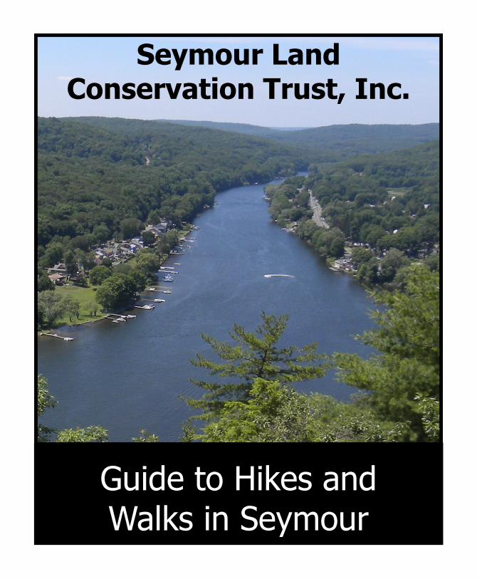
Seymour Land Conservation Trust, Inc.
Guide to Hikes and Walks in Seymour
2
Table of Contents
4 Seymour Calendar of Events 5 Land Owned by the Seymour Land Trust 6 Ten Essentials for a Safe Hike 7 Key to Map Symbols 8 Fountain Lake Reservoir 10 French Memorial Park 12 Gary Park 14 Keith Mitchell/ Naugatuck State Forest/ Rockhouse Hill Sanctuary 16 Legion Pool and Chatfield Park 18 Little Laurel Lime 20 Pine Hill 22 Quillinan Reservoir 24 Rolling Hills 26 Sochrin’s Pond Park
This trail guide is a project of the
Seymour Land Conservation Trust, Inc.
The Seymour Land Conservation Trust, Inc. is dedicated to the conservation of wilderness and wildlife through land acquisition for preservation. It is a privately owned organization that is not affiliated with the town of Seymour or any government organization. The Seymour Land Conservation Trust is made up of your neighbors acting to preserve the Naugatuck and Housatonic Valley's natural heritage through wise and responsible management of local woodlands, open spaces, and water resources.
The creation of this trail guide has been generously funded by the
Katharine Matthies Foundation
The Katharine Matthies Foundation is the legacy of Miss Katharine Matthies, a lifelong Seymour resident and benefactor. Katharine Matthies was an extremely generous individual and benefactor of her community. The Foundation, established in 1987 following the death of Miss Matthies, was left in trust in her estate to support programs that meet social and community needs. Since its’ creation, the Foundation has awarded grants totaling more than $5.5 million to fund projects that serve the towns of Seymour, Oxford, Beacon Falls, Ansonia, Shelton and Derby.
This guide has been developed, created, and edited by
Justin Coppola and Janet Cunningham (203) 906-2795

3
4
Seymour Calendar of Events
Educational Programs at Legion Pool Sponsored by Seymour Land Conservation Trust, Inc.
Self-Defense Classes, weekly at Legion Pool Sponsored by Seymour Land Conservation Trust, Inc.
Sledding & Hot Chocolate at Chatfield Park Sponsored by Seymour Land Conservation Trust, Inc.
Fishing Season Legion Pool
Fountain Lake
Fishing Bonanza, two-day event in spring at Legion Pool Sponsored by Seymour Land Conservation Trust, Inc.
Scholarships Sponsored by Seymour Land Conservation Trust, Inc.
Founders Day, 1st weekend in June on Main Street Sponsored by the Founder’s Day Association
Summer Concert Series at French Memorial Sponsored by the Town of Seymour
Cruise Nights, July and August at Legion Pool Sponsored by Seymour Land Conservation Trust, Inc.
Movies Under the Stars, July and August at Chatfield Park Sponsored by Seymour Land Conservation Trust, Inc.
Pumpkin Festival, September at French Memorial Park Sponsored by the Town of Seymour
Food Booth, Sponsored by the Seymour Land Conservation Trust
Halloween Haunted Trail Festival, October at Chatfield Park Sponsored by Seymour Land Conservation Trust, Inc.
Santa and Fireworks, December at Legion Pool

5
Land Owned by the Seymour Land Trust
5 Bayberry Lane 1.64 acres
143 Botsford Rd 4.30 acres
70A Brookdale Rd 16.00 acres
23A Bungay Rd 4.77 acres
42 Bungay Rd 1.62 acres
65 Bungay Rd 8.89 acres
169 Bungay Rd 3.41 acres
13 Chatfield St 2.30 acres - Walking Trails
24 Chucta Rd 6.52 acres
185 Day St 2.27 acres
20A Edward Rd 2.95 acres
12 Emily Lane 5.08 acres
2 Greenwood Circle .53 acres
178 Roosevelt Dr 1.36 acres
13 Ross Dr 19.51 acres
21 Terrace Rd 1.69 acres,
7 White Deer Lane 3.70 acres
Parker Pond Area: Benz St-Mountain View Rd-Cascio St 16.399 acres in Ansonia
6
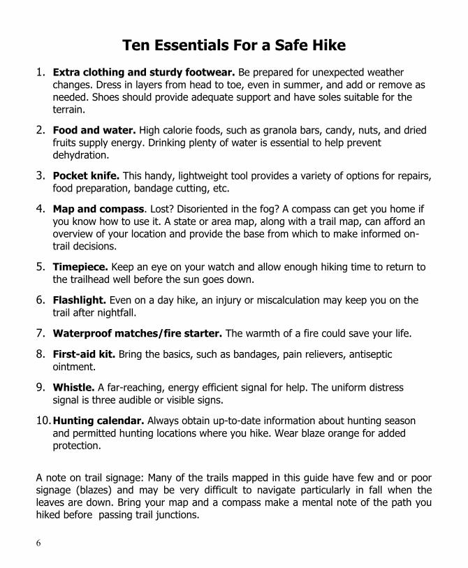
Ten Essentials For a Safe Hike
1. Extra clothing and sturdy footwear. Be prepared for unexpected weather
changes. Dress in layers from head to toe, even in summer, and add or remove as needed. Shoes should provide adequate support and have soles suitable for the terrain.
2. Food and water. High calorie foods, such as granola bars, candy, nuts, and dried
fruits supply energy. Drinking plenty of water is essential to help prevent dehydration.
3. Pocket knife. This handy, lightweight tool provides a variety of options for repairs,
food preparation, bandage cutting, etc.
4. Map and compass. Lost? Disoriented in the fog? A compass can get you home if
you know how to use it. A state or area map, along with a trail map, can afford an overview of your location and provide the base from which to make informed on-trail decisions.
5. Timepiece. Keep an eye on your watch and allow enough hiking time to return to
the trailhead well before the sun goes down.
6. Flashlight. Even on a day hike, an injury or miscalculation may keep you on the
trail after nightfall.
7. Waterproof matches/fire starter. The warmth of a fire could save your life.
8. First-aid kit. Bring the basics, such as bandages, pain relievers, antiseptic
ointment.
9. Whistle. A far-reaching, energy efficient signal for help. The uniform distress
signal is three audible or visible signs.
10. Hunting calendar. Always obtain up-to-date information about hunting season
and permitted hunting locations where you hike. Wear blaze orange for added protection.
A note on trail signage: Many of the trails mapped in this guide have few and or poor signage (blazes) and may be very difficult to navigate particularly in fall when the leaves are down. Bring your map and a compass make a mental note of the path you hiked before passing trail junctions.

7
Key to Map and Guide Symbols
Hiking Trail Cross Country Skiing
Handicap Accessible Trail
Ice Skating
View Sledding
Playground Basketball Court
Wetlands Baseball Diamond
Fishing Soccer Field
Bicycling Water
Public Land Private Land
P Parking Point of Interest
Wheelchair access Major Trail
Road Minor Trail
1

8
9

10
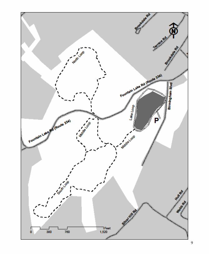
Fountain Lake Reservoir Owned, by, the Town of Seymour and the City of
Ansonia
Trail Length and Difficulty: Lake Loop: 0.5 miles, easy, handicap accessible South Loop: 1.75 miles, easy to moderate Middle Loop: 1.25 miles, easy North Loop: 2.85 miles, easy to moderate
Directions: Exit 19 off Southbound Route 8. take a left at the end of the ramp onto Derby Ave. Turn right onto Route 334. Drive 0.5 miles, then turn left onto Birmingham Blvd. Parking lot is on the right. GPS Location (N41 21.273251 W-73 5.934251)
Highlights: Lake Loop Trail This is a handicap accessible trail with multiple access points for fishing in the lake. There is a wheelchair ramp up to a dock near the parking lot to accommodate those with limited mobility. A stroll around the lake will take you over a covered bridge above the dam at the northeast corner of the lake. South, Middle, and North Loop Trails These trails offer an enjoyable experience of our native woodlands. They are not as traveled as the lake loop trail, so they are perfect for a quiet contemplative hike.
Red Oak Chestnut Oak White Oak
11
12
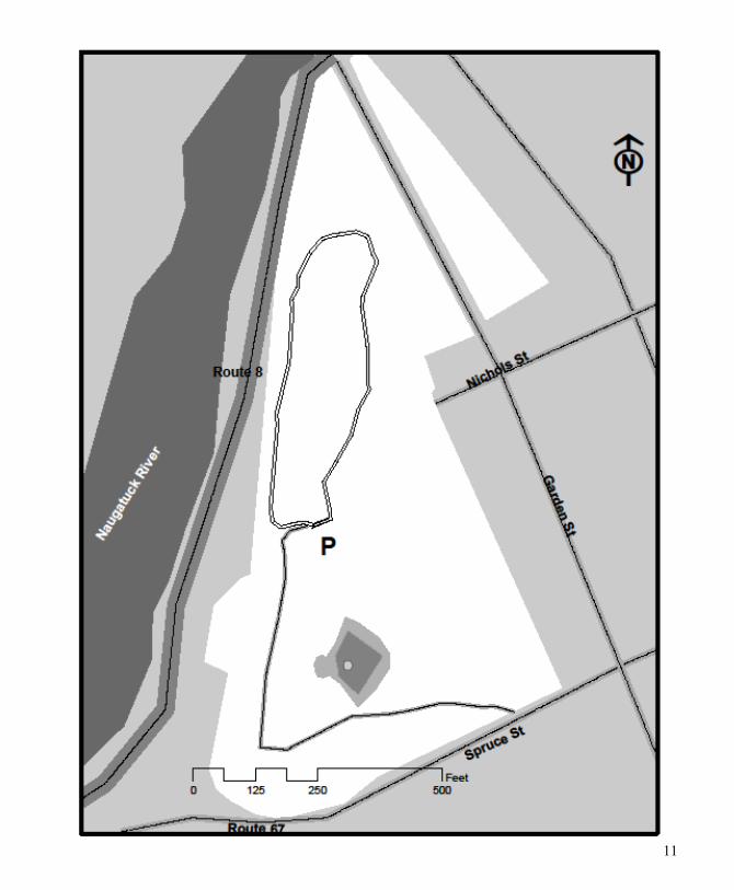
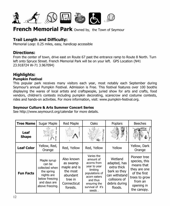
French Memorial Park Owned by, the Town of Seymour
Trail Length and Difficulty: Memorial Loop: 0.25 miles, easy, handicap accessible
Directions: From the center of town, drive east on Route 67 past the entrance ramp to Route 8 North. Turn left onto Spruce Street. French Memorial Park will be on your left. GPS Location (N41 23.918724 W-71 3.967094)
Highlights: Pumpkin Festival This popular park receives many visitors each year, most notably each September during Seymour’s annual Pumpkin Festival. Admission is Free. This festival features over 100 booths displaying the wares of local artists and craftspeople, juried show for arts and crafts, food vendors, children’s contests including pumpkin decorating, scarecrow and costume contests, rides and hands-on activities. For more information, visit: www.pumpkin-festival.org. Seymour Culture & Arts Summer Concert Series See http://www.seymourct.org/calendar for more details.
Tree Name Sugar Maple Red Maple Oaks Poplars Beeches
Leaf Shape
Leaf Color Yellow, Red,
Orange Red, Yellow Red, Yellow Yellow
Yellow, Dark Orange
Fun Facts
Maple syrup can be
collected when the spring nights are
below freezing and days are
above freezing.
Also known as swamp
maple and is the most abundant
tree in Connecticut
forests.
Varies the amount of
acorns from year to year
limiting populations of acorn eaters
and thus ensuring the
survival of it’s seeds .
Wetland adapted, has extra thick
bark so they can withstand collisions of
debris during floods.
Pioneer tree species, this means that they are one of the first
trees to grow from an
opening in the canopy.

13

14
Gary Park Owned by, the Town of Seymour
Trail Length and Difficulty: Gary’s Loop Trail: 0.27 miles, easy
Directions: From the corner of South Main Street and Main Street, travel south on South Main Street. Take a left onto West Broad Street, slight right onto West Street, left at West Church Street. The road name changes to Bungay Road. Go straight onto Botsford Road. Turn left at Davis Road. Turn Right at Gary Park Road. GPS Location (N41 21.920346 W-73 6.40901)
Highlights: Gary Park is primarily an outdoor sports recreation area. Gary’s Loop Trail does offer an alternative to group sports. You may want to warm up before the game, or cool down after the game on this easy wooded trail. Look for the coppiced trees and the abundant, if hidden, life in the brook and wetland.
Coppiced Trees—A Will to Live Coppicing is a traditional method of woodland management which takes advantage of a trees ability to regrow after being cut down. After the tree is cut much of it’s energy remains in its roots. The bark surrounding the stump is stimulated into producing buds by sunlight and the disproportional energy below ground compared to above. The coppiced tree will produce more wood in a shorter period of time then a single trunked tree, While the trees you see here may or may not have been part of a woodland management program, they were most likely cut in the late summer to early fall. When there is a lot of nutrients in the roots, and shoots are most likely to emerge.
15

16
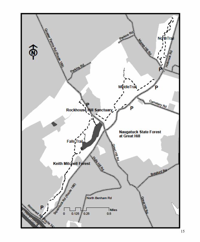
Keith Mitchell Forest, Naugatuck State Forest at Great Hill and Rockhouse Hill Sanctuary Owned by, the State
of Connecticut, and the Town of Seymour.
Trail Length and Difficulty: Falls Trail: 2 miles, moderate to difficult Middle Trail: 1 mile, easy North Trail: 1.35 miles, moderate
Directions: Falls Trail: Parking lot on Rte 34 just west of intersection of Rte 188. GPS Location (N41 21.87866 W-73 8.431442) Oxford High School Trail: Parking lot on Route 188 between the traffic circle and OHS. GPS Location (N41 22.959448 W-73 7.839244) Middle Trail: Two off-street parking areas on Holbrook Road, GPS Location (N41 22.957068 W-73 7.279713) and GPS Location (N41 23.164577 W-73 6.961956) North of the traffic circle.
Highlights: Falls Trail This trail is worth the extra effort. As you hike up from the parking lot, you will follow a brook. The water is dammed behind a magnificently crafted stone wall. Look for the deep water hole created as the water spills over the wall. This is a relaxing place to explore and a great place to bring adventurous children. Middle Trail Human history and nature abound on this trail. Look for the house foundations and stone walls. As you walk, you can find many large boulders resting on the ground. These are remnants of the last ice age. As glaciers over a mile thick plowed over this land, they scooped up everything and anything in their paths. When the ice finally melted around 10,000 years ago, these large boulders were dropped. North Trail Only a few hundred feet from the trail head are some interesting examples of our towns agricultural heritage, rows of planted sugar maples, a stone foundation and a domestic variety of a cheery tree. All of the trees are about the same age which indicates that the area was field and then abandon to become forest.

17
18
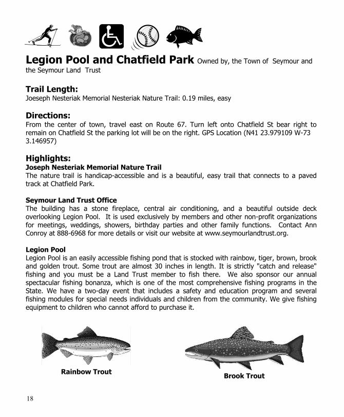
Legion Pool and Chatfield Park Owned by, the Town of Seymour and
the Seymour Land Trust
Trail Length: Joeseph Nesteriak Memorial Nesteriak Nature Trail: 0.19 miles, easy
Directions: From the center of town, travel east on Route 67. Turn left onto Chatfield St bear right to remain on Chatfield St the parking lot will be on the right. GPS Location (N41 23.979109 W-73 3.146957)
Highlights: Joseph Nesteriak Memorial Nature Trail The nature trail is handicap-accessible and is a beautiful, easy trail that connects to a paved track at Chatfield Park. Seymour Land Trust Office The building has a stone fireplace, central air conditioning, and a beautiful outside deck overlooking Legion Pool. It is used exclusively by members and other non-profit organizations for meetings, weddings, showers, birthday parties and other family functions. Contact Ann Conroy at 888-6968 for more details or visit our website at www.seymourlandtrust.org. Legion Pool Legion Pool is an easily accessible fishing pond that is stocked with rainbow, tiger, brown, brook and golden trout. Some trout are almost 30 inches in length. It is strictly "catch and release" fishing and you must be a Land Trust member to fish there. We also sponsor our annual spectacular fishing bonanza, which is one of the most comprehensive fishing programs in the State. We have a two-day event that includes a safety and education program and several fishing modules for special needs individuals and children from the community. We give fishing equipment to children who cannot afford to purchase it.
Rainbow Trout Brook Trout

19

20
Little Laurel Lime Park Owned by , the Town of Seymour Trail Length: Southern Loop Trail: 1.82 miles, moderate to difficult Northern Loop Trail: 1.29 miles, moderate Boundary Loop Trail: 1.98 miles, moderate to difficult
Directions: From the Holbrook Road/ Route 188/ Route334 traffic circle, travel east on Route 334. Turn left onto Laurel Lane. Continue onto Tibbets Road. Park at the dead end. GPS Location (N41 21.540835 W-73 7.629782)
Highlights: 125 Marble Caves. This marble was originally a large coral reef that surrounded a volcanic island in an ancient ocean. During the formation of Pangea, the ocean was subducted under Proto-North America. The coral reef was compressed, heated, and metamorphosized into the marble rocks you now see. Notice how the rain water seems to have melted and washed away the marble due to our slightly acidic rain. Now take a look at the dark rock that was deposited on top of the marble. This rock, called hornblende schist, was originally laid down during a series of volcanic eruptions that coated the coral reef with multiple layers of volcanic ash.
103 and 149 Overlook of Housatonic and Primary Succession. This is a good example of primary succession. During the last ice age, the glaciers scraped away everything in its path, leaving only the bedrock behind. The soil you see here has formed within the last 10,000 years. Lichens are the first to colonize the bare rock. As dust and other airborne particles settled into the nooks and crannies of the lichen, primordial soil begins to form which leads to the colonization of the mosses. Once there is a base layer thick enough to support roots, grasses adapted to dry sites will colonize, then hardy shrubs such as lowbush blueberry which will become a nursery for trees such as pines and oaks. Can you find the bare rock, lichens, mosses, grasses, and shrubs?
76 Red Pines Trees. Look carefully, can you find the Red Pine trees? Red Pine trees are somewhat unusual in Connecticut. They are outnumbered by the White Pine trees. The difference between a red pine and the more common white pine is the number of needles each has per cluster. Red pines have two needles per cluster while white pines have five.
Red Pine Needles and Cone
White Pine Needles and Cone
21

22
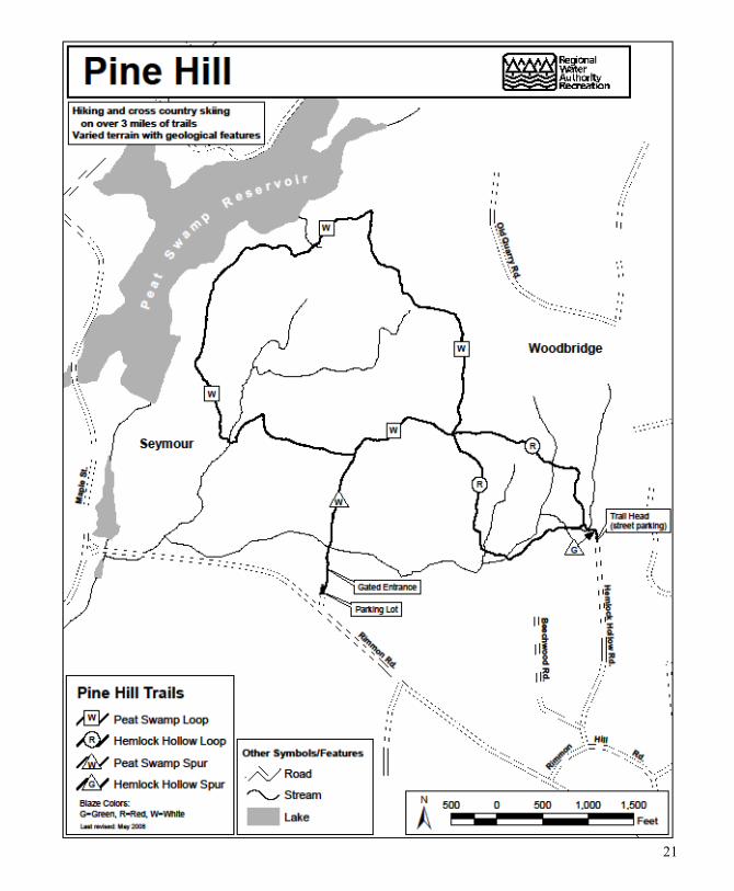
Pine Hill Owned by, the Regional Water Authority
Special Regulations Trails are accessible by PERMIT only. To obtain a permit, users need to contact our office at 203-401-2654 or visit www.rwater.com. No pets, motorized vehicles or horses allowed.
Directions: From center of town, follow Route 313 east. After you pass the reservoir on your left and the road makes a 90 degree turn to the left, look for the parking area on the left. GPS Location(N41 21.847608 W-73 3.158932 )
Highlights: Peat Swamp Spur Trail (white triangle) 0.3 miles. This spur trail connects you to the Peat Swamp Loop from the parking lot off Rimmon Road (Route 313). You will pass an old Christmas tree plantation on your right as you enter. The plantation contains white spruce, blue spruce and black spruce. It is a good spot for observing birds, as the blueberry bushes at the far end provide food for many species. There is a brook which runs under the bridge on your way to the main trail loop.
Peat Swamp Loop (white rectangle) 2.0 miles. Access the main loop by taking the Peat Swamp Spur Trail from the parking area on Rimmon Road (Route 313), or choose the longer route by parking at the end of Hemlock Hollow Road and taking the Hemlock Hollow Loop. Either way, you will have the opportunity to explore previous land use and a variety of forest types along the trail. In the early 1900’s most of the land was cleared for agriculture. The trails you will be walking on were probably old farm roads. There are a number of stone walls that hint at previous farm land use. Our guided trail booklet can assist you in identifying specific tree species and pointing out areas that show previous land use. Other features you will see along this trail include streams and vernal pools; you will be able to catch a glimpse of Peat Swamp Reservoir from the northwest leg of the trail, especially in the winter and early spring. Notice the rocky outcrops and be on the lookout for large boulders deposited by receding glaciers.
Hemlock Hollow Loop (red circle) 1.0 miles. Access this trail by parking at the end of Hemlock Hollow Road and taking the short Hemlock Hollow Spur trail right to the loop. You will cross several small streams and walk through varied hardwood tree stands, including sugar maple, sassafras, tulip tree, and oak. You will see more rocky outcrops, erratic boulders and many stone walls along the way.
Hemlock Hollow Spur (green triangle) 0.1 miles. This very short spur trail connects you from the trailhead off Hemlock Hollow Road to the Hemlock Hollow Loop trail.

23
24
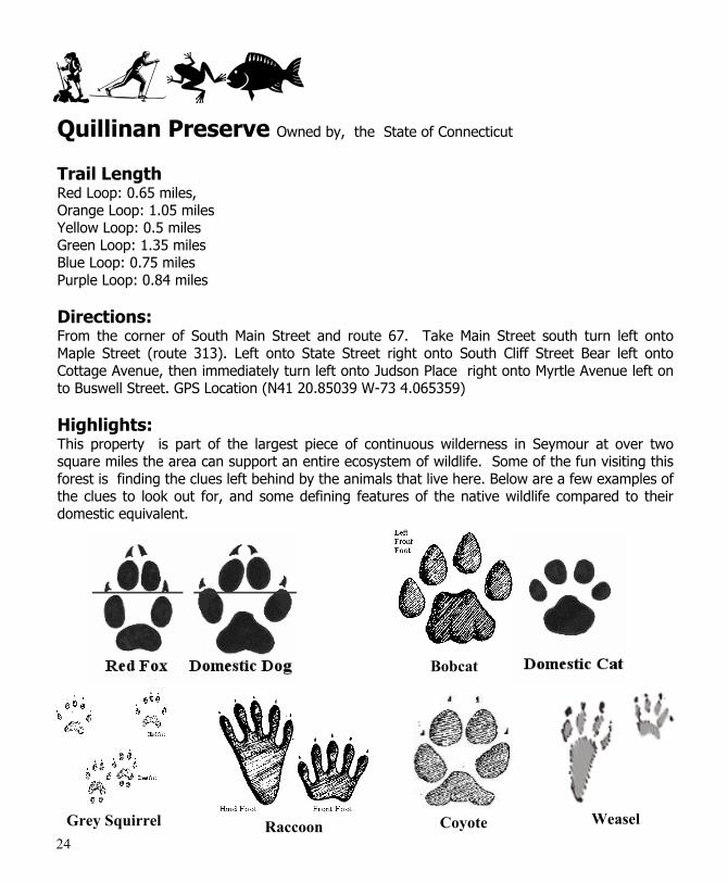
Quillinan Preserve Owned by, the State of Connecticut
Trail Length Red Loop: 0.65 miles, Orange Loop: 1.05 miles Yellow Loop: 0.5 miles Green Loop: 1.35 miles Blue Loop: 0.75 miles Purple Loop: 0.84 miles
Directions: From the corner of South Main Street and route 67. Take Main Street south turn left onto Maple Street (route 313). Left onto State Street right onto South Cliff Street Bear left onto Cottage Avenue, then immediately turn left onto Judson Place right onto Myrtle Avenue left on to Buswell Street. GPS Location (N41 20.85039 W-73 4.065359)
Highlights: This property is part of the largest piece of continuous wilderness in Seymour at over two square miles the area can support an entire ecosystem of wildlife. Some of the fun visiting this forest is finding the clues left behind by the animals that live here. Below are a few examples of the clues to look out for, and some defining features of the native wildlife compared to their domestic equivalent.
Grey Squirrel Raccoon Coyote Weasel
Bobcat
25
26
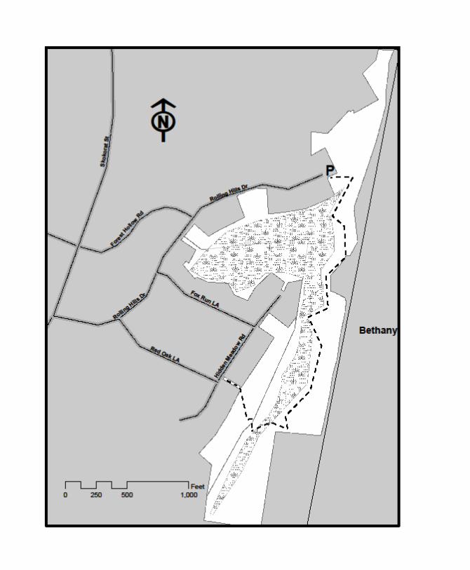
Rolling Hills Owned by, the Town of Seymour
Trail Length: Long Trail: 1.42 miles one way, easy to moderate
Directions: From the center of town, take Route 67 East. Turn left onto Skokorat Road, then right onto Rolling Hills Drive. You can park at the end of Rolling Hills Drive. GPS Location (N41 25.090662 W-73 2.60471)
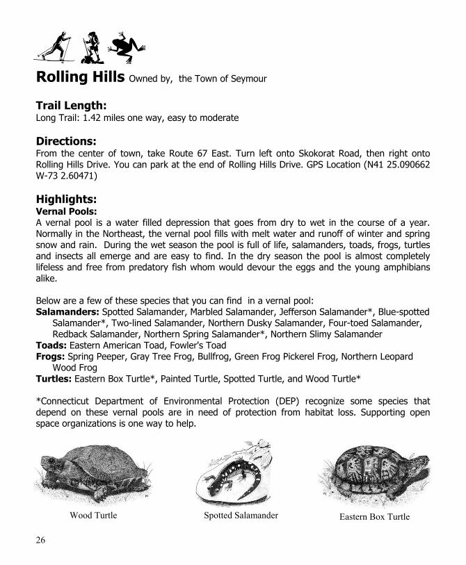
Highlights: Vernal Pools: A vernal pool is a water filled depression that goes from dry to wet in the course of a year. Normally in the Northeast, the vernal pool fills with melt water and runoff of winter and spring snow and rain. During the wet season the pool is full of life, salamanders, toads, frogs, turtles and insects all emerge and are easy to find. In the dry season the pool is almost completely lifeless and free from predatory fish whom would devour the eggs and the young amphibians alike. Below are a few of these species that you can find in a vernal pool: Salamanders: Spotted Salamander, Marbled Salamander, Jefferson Salamander*, Blue-spotted
Salamander*, Two-lined Salamander, Northern Dusky Salamander, Four-toed Salamander, Redback Salamander, Northern Spring Salamander*, Northern Slimy Salamander
Toads: Eastern American Toad, Fowler's Toad Frogs: Spring Peeper, Gray Tree Frog, Bullfrog, Green Frog Pickerel Frog, Northern Leopard
Wood Frog Turtles: Eastern Box Turtle*, Painted Turtle, Spotted Turtle, and Wood Turtle* *Connecticut Department of Environmental Protection (DEP) recognize some species that depend on these vernal pools are in need of protection from habitat loss. Supporting open space organizations is one way to help.
Spotted Salamander Wood Turtle Eastern Box Turtle

27
28
Sochrin’s Pond Park Owned by, the Town of Seymour
Trail Length and Difficulty: Sochrin Trail: 0.34 miles, easy
Directions: From the corner of Maple Street and South Main Street, travel south on South Main Street take left onto Moss Ave park entrance will be on the right. GPS Location (N41 22.629982 W-73 4.551423)
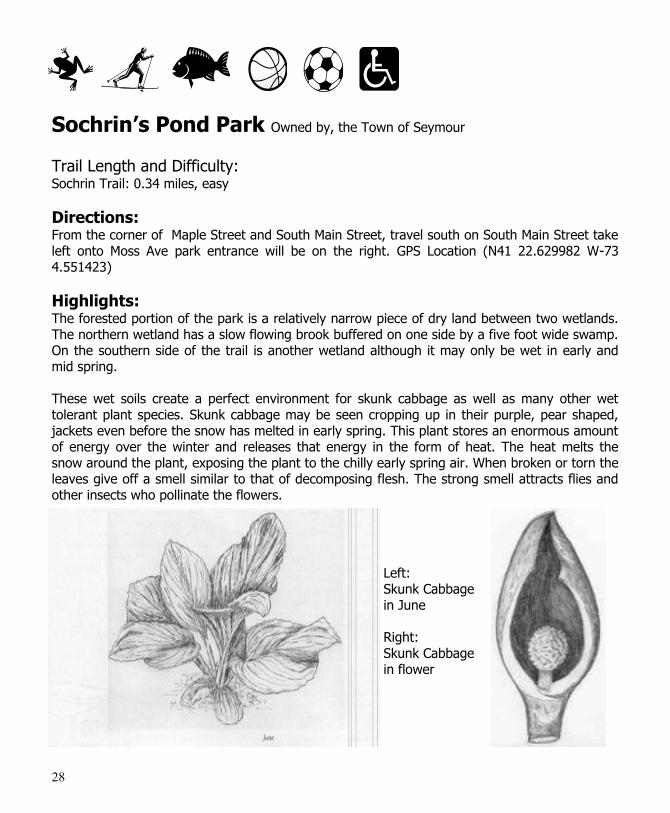
Highlights: The forested portion of the park is a relatively narrow piece of dry land between two wetlands. The northern wetland has a slow flowing brook buffered on one side by a five foot wide swamp. On the southern side of the trail is another wetland although it may only be wet in early and mid spring. These wet soils create a perfect environment for skunk cabbage as well as many other wet tolerant plant species. Skunk cabbage may be seen cropping up in their purple, pear shaped, jackets even before the snow has melted in early spring. This plant stores an enormous amount of energy over the winter and releases that energy in the form of heat. The heat melts the snow around the plant, exposing the plant to the chilly early spring air. When broken or torn the leaves give off a smell similar to that of decomposing flesh. The strong smell attracts flies and other insects who pollinate the flowers.
Left: Skunk Cabbage in June Right: Skunk Cabbage in flower
29
Seymour Land Conservation Trust, Inc. P.O. Box 366 Seymour, CT 06483
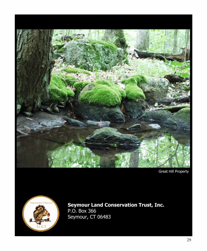
Great Hill Property