Embed Size (px)
Citation preview

Placing Palm Pilot Handheld Technology in
the Hands of Introductory-Level
Geoscience Students During Field Experiences
Laura Guertin, Earth Science
Penn State University Delaware County

AbstractMany geoscience students do not receive the opportunity to use technological tools during field experiences until they enroll in upper-division courses in their departments or attend field camp. Introductory-level geoscience courses are typically “show and tell”with demonstrations of pieces of equipment in the field. However, handheld technology, such as Palm Pilot computers, can be successfully integrated with introductory-level field experiences as a data collection tool and handheld reference guide.Palm Pilots offer each student the opportunity to become actively involved in the field experience. Forms can be created and tailored to a specific outdoor exercise and placed on the Palms for students to collect data. Instructors can create eBooks with instructional materials and reference guides for the students to correspond with the project objective. Instructional videos can be created and placed on the Palms for students to demonstrate field techniques and procedures. With the prices dropping and discounts for bulk purchases available, Palm Pilots are now accessible to departments.

Abstract (cont.)For two years the Penn State Delaware County campus has integrated handheld technology in the field experiences corresponding to introductory-level geoscience courses. For example, the introductory oceanography students use the handhelds to collect data on changes in beach profile elevations at the shore. The physical geology students use the handhelds for a tombstone weathering investigation and rock identification project. All of these projects have eBooks and instructional videos that describe the project and act as reference material, such as the rock identification eBook and video on how to begin measuring a beach profile.Students respond very positively to using the handheld technology. In addition to giving students a valuable introduction to see how technology can be used in the field, the experience gives non-science majors a chance to see an application of an everyday technological tool in a nontraditional setting. End-of-semester course evaluations are filled with student suggestions of additional field experiences and more Palm Pilot use.

PSU Delaware County campus~1,500 students, commuter campusPrimarily freshmen and sophomoresFirst 2 years of science programming

Geology at Penn State DelCo
Intro-level, gen-ed, non-science studentsno TA’s, no majors, one instructor
Overarching course goalsCourse Goal: experience with scientific method, working with data setsCourse Goal: using technology
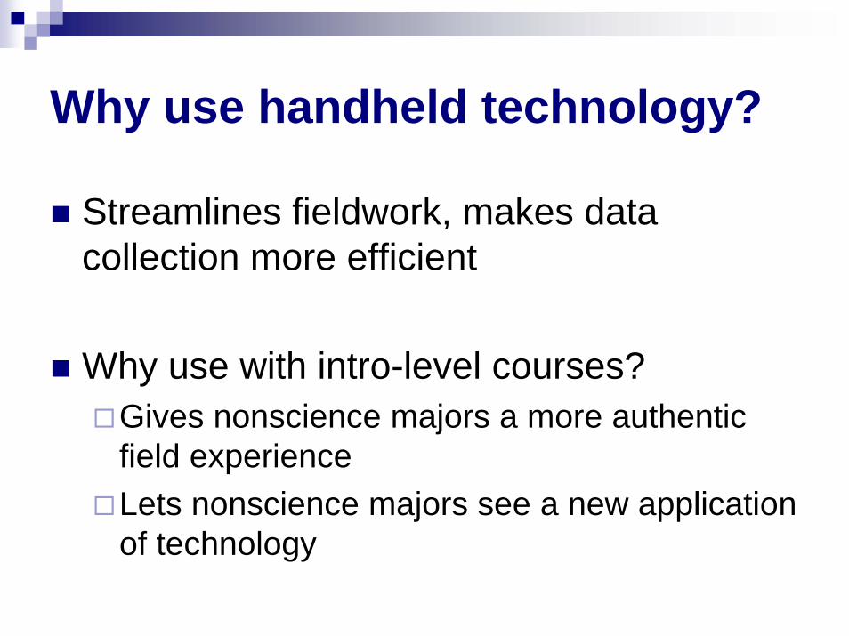
Why use handheld technology?
Streamlines fieldwork, makes data collection more efficient
Why use with intro-level courses?Gives nonscience majors a more authentic field experienceLets nonscience majors see a new application of technology

Tombstone Weathering Project
OLD METHODForm hypothesesCollect data with pen-and-paper methodEnter in MS Excel worksheetInstructor merges filesData sorted for graphing and interpretation

Tombstone Weathering Project
NEW METHODForm hypothesesCollect data on Palm Pilot (eBook for reference)On hotsync, all data compiled online, exported to MS ExcelData sorted for graphing and interpretation
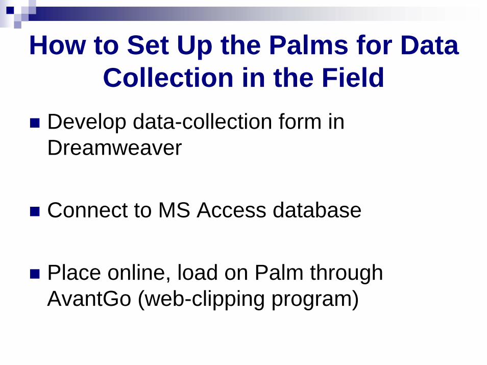
How to Set Up the Palms for Data Collection in the Field
Develop data-collection form in Dreamweaver
Connect to MS Access database
Place online, load on Palm through AvantGo (web-clipping program)

Data collection form on Palm
Pilot


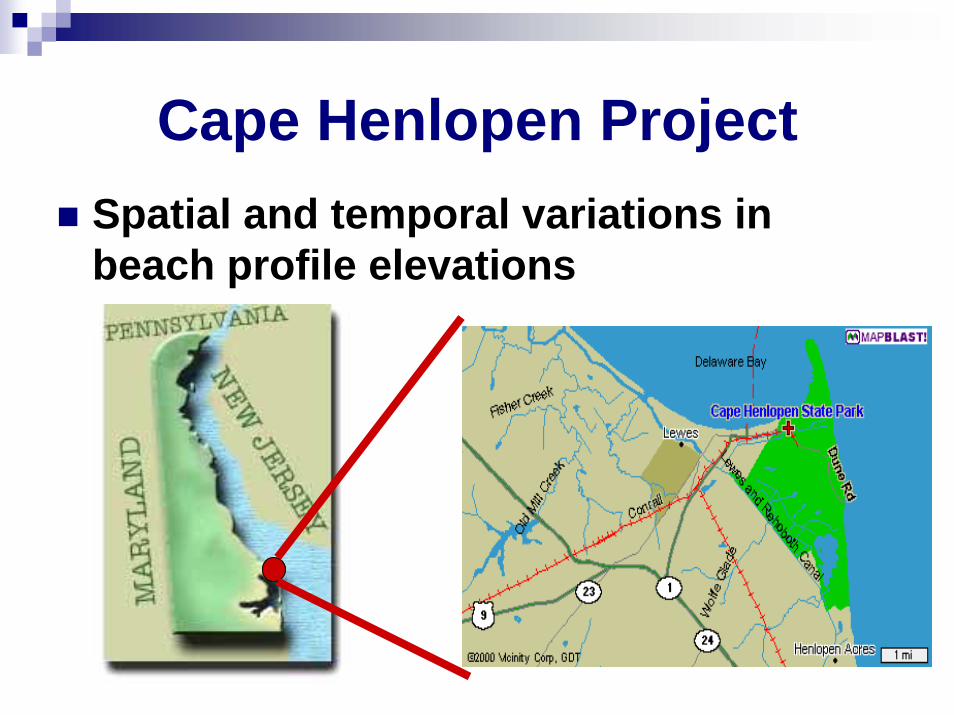
Cape Henlopen ProjectSpatial and temporal variations in beach profile elevations

Old and New Field Methods
OLD: Pen-and-paper, manually enter in Excel during lab period
NEW: practice field technique indoors using handheld technology

Using Palms in the FieldBeach Profiling
LatitudeLongitudeLocationMeasurement NumberIntervalElevation ChangeNotes (if any)

Profile Data on Web Page, in Excel

Students Work With DataProfile A
-120
-100
-80
-60
-40
-20
00 20 40 60 80 100 120 140
Distance (feet)
Elev
atio
n C
hang
e (in
ches
)
FebruaryApril
Figure x. Beach profile comparison at location A, Cape Henlopen State Park.

Benefits of Using Palm Pilots
Minimizes data errors“I can’t read my writing,” entry in ExcelCan have Palm entry errors
Fewer materials to “juggle” in the fieldOne Palm Pilot (with eBooks, data entry forms)Versus paper form, rock ID book, assignment instruction sheet

Benefits of Using Palm Pilots
Data compiled and available immediatelyNo waiting for late dataAll students can access at all time
“I lost my data! I can’t find my Excel sheet!”
Less work for the faculty memberNo merging of multiple filesNo excessive photocopyingStudents can’t “forget” what they need in the field

Benefits of Using Palm Pilots
Students brag about the novelty of using Palms
Can create instructional videos for students when instructor is not accessible

Palms work in all weather!

Drawbacks of Using Palms
Keeping the batteries charged
How students treat the Palms – train and be firm on Day 1!
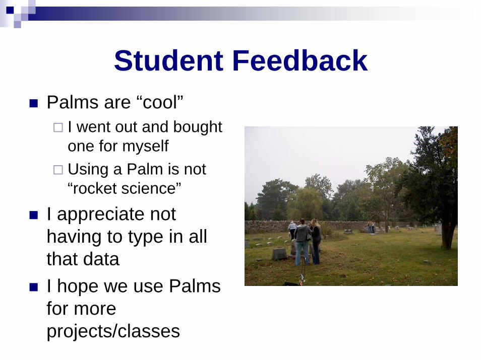
Student FeedbackPalms are “cool”
I went out and bought one for myselfUsing a Palm is not “rocket science”
I appreciate not having to type in all that dataI hope we use Palms for more projects/classes

Summary --field projects with Palm Pilots
Emerging technological tools (handheld computers) can be integrated with introductory-level geoscience field exercises
Improve efficiencyImprove accuracyImprove student attitude