Embed Size (px)
Citation preview

Index of Texas Archaeology: Open Access GrayLiterature from the Lone Star State
Volume 1981 Article 25
1981
Guerrero, Coahuila, Mexico: A Guide to the Townand MissionsJack D. EatonCenter for Archaeological Research
Follow this and additional works at: http://scholarworks.sfasu.edu/ita
Part of the American Material Culture Commons, Archaeological Anthropology Commons,Cultural Resource Management and Policy Analysis Commons, Historic Preservation andConservation Commons, History Commons, Human Geography Commons, Other AnthropologyCommons, Other Arts and Humanities Commons, Other History of Art, Architecture, andArchaeology Commons, Other Social and Behavioral Sciences Commons, and the Technical andProfessional Writing CommonsTell us how this article helped you.
This Article is brought to you for free and open access by SFA ScholarWorks. It has been accepted for inclusion in Index of Texas Archaeology: OpenAccess Gray Literature from the Lone Star State by an authorized editor of SFA ScholarWorks. For more information, please [email protected].
Recommended CitationEaton, Jack D. (1981) "Guerrero, Coahuila, Mexico: A Guide to the Town and Missions," Index of Texas Archaeology: Open Access GrayLiterature from the Lone Star State: Vol. 1981 , Article 25. https://doi.org/10.21112/ita.1981.1.25ISSN: 2475-9333Available at: http://scholarworks.sfasu.edu/ita/vol1981/iss1/25

Guerrero, Coahuila, Mexico: A Guide to the Town and Missions
Creative Commons License
This work is licensed under a Creative Commons Attribution-Noncommercial 4.0 License
This article is available in Index of Texas Archaeology: Open Access Gray Literature from the Lone Star State:http://scholarworks.sfasu.edu/ita/vol1981/iss1/25

GUERRERO, COAHUILA, MEXICO
A Guide to the Town. and Missions Gula De La Ciudad y De Las Misiones
JACK D. EATON
Spanish Translation by Wanda Kaufmann
Center for Archaeological Research The University of Texas at San Antonio
Archaeology and History of the San Juan Bautista Mission Area, Coahuila and Texas Report No. 4
1981

Center for Archaeological Research
The University of Texas at San Antonio
78285
Thomas R. Hester, Director
Mc..haeology a.nd H,0...to1ty ofi .the Sa.n Jua.n Ba.utlo.:ta MJA.6,[o n Me.a., Coa.hu,,Ua. a.nd T exa..6
This series of publications presents information gathered from archaeological investigations and historical research at the Spanish mission complex in the area of Guerrero, Coahuila, Mexico. Additional volumes are forthcoming.
No. l (1979)
No. 2 (1980)
No. 3 (1979)
No. 4 (1981)
Crossroad of Empire: The Church and State on the Rio Grande Frontier of Coahuila and Texas, 1700-1821. By Felix D. Almaraz, Jr. $5.00 + .28 tax for Texas residents.
Inventory of the Rio Grande Missions: 1772; San Juan Bautista and San Bernardo. Translated and edited by Felix D. Almaraz, Jr. $5.00 + .28 tax for Texas residents.
Ethnohistoric Notes on Indian Groups Associated with Three Spanish Missions at Guerrero, Coahuila. By T. N. Campbell. $4.00 + .22 tax for Texas residents.
Guerrero, Coahuila, Mexico. A Guide to (Guia De La Ciudad y De Las Misiones). Spanish translation by Wanda Kaufmann. Texas residents.
the Town and Missions By Jack D. Eaton. $5.00 + .28 tax for


GUERRERO, COAHUILA, MEXICO
A Guide to the Town and Missions Gufa De La Cuidad y De Las Misiones
Jack D. Eaton
Spanish Translation by Wanda Kaufmann
Center for Archaeological Research The University of Texas at San Antonio
Archaeology and History of the San Juan Bautista Mission Area, Coahuila and Texas, Report No. 4
1981


TABLE OF CONTENTS
Li st of Figures
Preface
Guerrero, Coahuila, Mexico: A Guide to the Town and Missions ........ .
Guerrero, Coahuila, Mexico: Gu1a de la Ciudad y de las Mi siones. . . .
Figures (Figuras)
Suggested Reading List.
;
Page
ii
iii
1
11
23
41

1.
2.
3.
4.
5.
6.
7.
8.
9.
LIST OF FIGURES
Map Showing Location of Villa de Guerrero and the Gateway Area . . . . . . . . (Mapa que Muestra la Localizacion de la Villa de Guerrero y el Area de el Paso.)
Artifact Examples Collected from Area Survey and Mission Excavations .............. . {_Ejemplos de Artefactos Encontradas Superficialmente yen las Excavaciones de las Misiones.)
Map of Presidio de San Juan Bautista del Rio Grande ... (Mapa del Presidio de San Juan Bautista del Rio Grande.)
Street Map of Villa de Guerrero ....... . (Mapa de las Calles de la Villa de Guerrero.)
Presidio Period Structures in Guerrero . (Estructuras del Periodo del Presidio.}
Plan of Mission San Juan Bautista .... {_Plan de la Misi6n de San Juan Bautista.)
Mission San Juan Bautista ... (Misi6n de San Juan Bautista.}
Views of Mission San Bernardo ..... (Vista de la Misi6n de San Bernardo.)
Plan of Mission San Bernardo .... (Plan de la Mision de San Bernardo.)
i;
Page
23
25
27
29
31
33
35
37
39
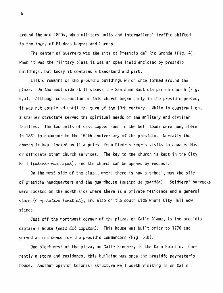
PREFACE
This guide to the town and missions at Guerrero, Coahuila, is based largely upon the research efforts of the Gateway Project, an archaeological and ethnohistoric study of the area conducted by the Center for Archaeological Research, The University of Texas at San Antonio during 1975 to 1977.
Because the project was dealing with historic mission buildings which housed native American inhabitants of the region, the project had both historic and prehistoric aspects. The Indians gathered into the missions where inheritors of the native cultural tradition began at least 11,000 years ago. Therefore, an archaeological survey of prehistoric sites in the region of the missions, on both sides of the Rio Grande, was included in the study.
The excavations carried out at the missions located the buried remains of historic buildings which had been lost and forgotten for nearly a century. In addition, the sifting of the soils removed from the building remains provided both Spanish and Indian artifacts which were related to mission activities.
Ethnohistoric research focused on old Spanish documents which provided valuable additional information about the missionizing program at Guerrero, and also aided to illuminate the archaeological findings. The results of the Gateway Project are beginning to appear in a series of publications issued by the Center for Archaeological Research.
For several months during the Gateway Project, staff members lived in the town of Guerrero. The friendly relationship established with the towns• inhabitants was memorable and the aid provided by the Presidentes Municipal of the time, Sr. Victoriano Garcia P. and Sr. Ricardo Perez Trevino, is very much appreciated. Dr. Farias de las Santos and Sra. Jesusena Flores Rodriguez provided housing for the project staff in Guerrero, and Sr. Julio Santos Coy of Piedras Negras aided us in several difficult matters. To them we are grateful. There are many others to whom we express our appreciation for help, especially those citizens of Guerrero who were employed by the project to work at the excavations.
The author of this guide, Jack D. Eaton, directed the field work at the missions and is therefore intimately familiar with the information he presents. Other project personnel included: Thomas R. Hester (Chief Archaeologist); Felix Almaraz, Thomas N. Campbell, and Thomas C. Greaves (Ethnohistorians); Anne A. Fox (Ceramic Analyst); and J, Parker Nunley and Fred Valdez, Jr. (Archaeologists).
The project was performed under a permit issued by the Direccion de Monumentos Historicos del Instituto Nacional de Antropolog1a e Historia. We are grateful to arquitectos Guillermo Bonfil Batalla, Sergio Zaldivar, Oscar Martinez, and Rene Villareal for their aid and collaboration. The project was funded by grants from the United States National Endowment for the Humanities, the Kathryn Stoner O'Connor Foundation, and the Sid Richardson Foundation. The University of Texas at San Antonio under President Peter T. Flawn provided administrative and logistical support. We are very grateful to all who have made the project possible.
iii
R. E. W. Adams Project Director

GUERRERO, COAHUILA, MEXICO:
A GUIDE TO THE TOWN AND MISSIONS
.A BRIEF BACKGROUND
The modern town of Guerrero was originally the Spanish Colonial Presidio
of San Juan Bautista del Rio Grande, around which there were three Indian
missions. Settlement began with the founding of mission San Juan Bautista in
1700, followed by the establishment of missions San Francisco Solano and San
Bernardo, and the military presidia, which was charged with the responsibility
for guarding the missions. The presidia and nearby missions, located only a
few miles from three important 11 pasos 11 or fords across the Rio Grande, formed
the principal access, or gateway, to the vast and unsettled area to the north.
The settlement which eventually became San Antonio, Texas, began with the
founding of mission San Antonio de Valero in 1718 by Franciscans and Indian
neophytes coming from the Rio Grande missions. Therefore, important in its own
right as an outpost of the Spanish empire, and connected by historical ancestry
with one of the largest cities in Texas, the town of Guerrero is well worth
visiting.
In Guerrero one is confronted with a modern community which is still largely
laid out on the lines of the colonial presidia and in which many of the colonial
houses are still in use. At San Bernardo mission just northeast of town stands
the old church built in the 1760s. It is an interesting and impressive example
of Spanish Colonial architecture and represents the only standing remains of the
famous missions.

2
LOCATION AND HOW TO GET THERE
Guerrero is located about 35 miles downstream from Piedras Negras, Coahuila,
and is accessible by road from that town (Fig. 1). Coming from Mexico, the
easiest route is by way of Monclova north on Mexico's national Highway 57, to
the junction with Highway 2, which leads to Guerrero 30 miles distant. From the
United States, the town is accessible through Eagle Pass, Texas, across the
border to Piedras Negras and through that city on the Monterrey highway (Hwy 57)
to the junction with Highway 2 south of Piedras Negras. One can easily leave
San Antonio early in the morning, drive the 150 miles to Eagle Pass, lunch in
Piedras Negras, and drive on to Guerrero for the two or three hours of visiting
needed to see the town and mission. Then, dependent on the visitor's stamina,
one can either spend the night in Piedras Negras or return to San Antonio or
Monclova. There are no tourist facilities in Guerrero at present (1978), although
simple meals and cold drinks are available. The visitor should have sufficient
gasoline for about 60 miles round trip before leaving Piedras Negras.
THE GATEWAY PROJECT
The Gateway Project was an archaeological and historical study of the
region on both sides of the middle Rio Grande and especially of the colonial
missions near the town of Guerrero. Sponsored by The University of Texas at
San Antonio and by the National Institute of Anthropology and History of Mexico,
the project operated from 1975 until 1978. The Agency for Colonial Monuments
in Mexico and the Ministry of Public Works stabilized the San Bernardo Mission
Church. An architectural survey of the town of Guerrero was carried out earlier
by the Texas Architectural Foundation and the School of Architecture of the
University of Texas at Austin. Excavations at the mission sites were conducted

by the Center for Archaeological Research, The University of Texas at San
Antonio. Gateway Project personnel excavating the missions and analyzing
artifacts lived in the town of Guerrero during the work seasons over a three
year period. The people of the town and their officials were always very
helpful and hospitable, and we therefore dedicate this small guide to them.
THE NATIVE POPULATIONS OF THE AREA
3
American Indian peoples occupied the middle Rio Grande area for more than
11,000 years before the Spanish conquest. Archaeologists working in Texas and
Coahuila have found hundreds of campsites representing the hunting and gathering
way of life of these peoples. The earliest evidence comes from the PALEO-INDIAN
period, between 8000-9000 B.C., and consists of fluted projectile points, used
in the hunting of mammoth, large bison, and other animals of the late Ice Age
or Pleistocene. After the end of the Ice Age, around 7000-8000 B.C., PALEO
INDIAN cultures persist until about 6000 B.C. From that time, up to about A.O.
1000, the region yields evidence of cultures of the ARCHAIC period. Artifacts
include chipped stone projectile points (used on light spears, thrown with the
a;tla;tl or spear-thrower), scrapers, knfves, choppers, and ground stone slabs
used for plant food processing. Sites are characterized by concentrations of
these artifacts, along with large amounts of waste flakes (from tool manufacture),
cooking hearths and scattered burned rock, and food remains (animal bones, mussel
shells, snail shells}. As a part of the Gateway Project, an archaeological survey
team recorded more than 160 sites in the Guerrero area, on both sides of the
Rio Grande. Most of these sites date to the ARCHAIC era. About A.O. 1000,
archaeologists note a change in local cultures. These changes, during the LATE
PREHISTORIC period, reflect new technologies such as the introduction of the

4
bow and arrow and the manufacture of plain, reddish ceramics. Sites of this
period are known on the Texas side of the river, but are very rare in the
Guerrero area. In adjacent Texas, the LATE PREHISTORIC is also marked by the
presence of large numbers of bison.
It must be pointed out that the environment used by these ancient hunting
and gathering peoples was probably quite different than that we see in the
region today. The terrain was probably a grassland savanna, with less mesquite
(the mesquite "invasion" appears to have occurred within the last 300 years) and
with more abundant water sources. Antelope, bison, bear, and gray wolf were
among the animals present at that time, but absent in the region today.
When the Spanish arrived in the area, they found many small groups of
hunters and gatherers. There was no formal tribal organization, but rather a
pattern of mobile and dispersed groups, some of whom shared a common language,
but with other languages used by some groups. Earlier anthropological studies
have used the name "Coahuiltecan" for these peoples. However, it is now clear
that they were diverse both culturally and linguistically, and that this term
is no longer appropriate. It is unfortunate that the Spanish left so few rec
ords of these peoples, because with the arrival of Europeans, these native
groups broke up--some taken into the missions (as was the case in the Guerrero
area), and others destroyed by the introduction of various diseases. In the
Guerrero missions, we find the surviving cultural remains of these native
peoples--their chipped stone tools and pottery, and the artifacts which they
adopted from the Spanish during the mission period (Fig. 2). By the early 1800s
the native peoples were no longer recognizable. Many of the small groups had
become extinct, but others had become part of the Spanish culture.

With the demise of the native populations, much of northern Coahuila and
southern Texas was uninhabited. Thus, intruding Indian groups such as the
Apache and Comanche moved into the area, occupying it until the middle of the
19th century.
THE ARCHAEOLOGY AND HISTORY
Presidio del Rio Grande and the Modern Town of Guerrero
The early 18th century Spanish settlement which eventually became the
modern town of Vicente Guerrero began with the establishment of the military
presidia called San Juan Bautista del Rio Grande del Norte. The presidia and
nearly Indian missions, situated near important crossings of the Rio Grande,
once formed the Gateway to Spanish Texas.
In 1701 a Flying Company (cavalry) consisting of 30 soldiers under the
command of Captain Diego Ramon was assigned to protect the missions San Juan
Bautista and San Francisco Solano which were founded the previous year by
Franciscan missionaries. In 1702 Mission San Bernardo was also established
nearby.
Then, in 1703, a formal presidia was laid out around a plaza (plaza de
aJurJCl.6) consisting of 10 flat-roofed, stone and adobe structures. By the
1760s the presidia was well established. Also by that time numerous houses
belonging to military and civilian families were built around the presidia,
forming a small frontier settlement (Fig. 3).
Although originally designed to protect the Indian missions, the presidia
and the growing Spanish community around it continued to function as a bastion
on the frontier long after the missions were secularized in 1797 and eventually
abandoned. Presidio del Rio Grande ceased to exist as a military establishment
5
6
ardund the mid-1800s, when military units and international traffic shifted
to the towns of Piedras Negras and Laredo.
The center of Guerrero was the site of Presidio del Rio Grande (Fig. 4).
When it was the military plaza it was an open field enclosed by presidia
buildings, but today it contains a bandstand and park.
Little remains of the presidia buildings which once formed around the
plaza. On the east side still stands the San Juan Bautista parish church (Fig.
5,a). Although construction of this church began early in the presidia period,
it was not completed until the turn of the 19th century. While in construction,
a smaller structure served the spiritual needs of the military and civilian
families. The two bells of cast copper seen in the bell tower were hung there
in 1851 to commemorate the 150th anniversary of the presidia. Normally the
church is kept locked until a priest from Piedras Negras visits to conduct Mass
or officiate other church services. The key to the church is kept in the City
Hall (paia.c.io munic.1pa1.), and the church can be opened by request.
On the west side of the plaza, where there is now a school, was the site
of presidia headquarters and the guardhouse (eueJz.po d~ guaJtdia.). Soldiers' barracks
were located on the north side where there is a private residence and a general
store (Coopefl.Clt,{_va F~), and also on the south side where City Hall now
stands.
Just off the northwest corner of the plaza, on Calle Alama, is the presidia
captain's house {_eMa du eap.lta.n.). This house was built prior to 1776 and
served as residence for the presidia commanders (Fig. 5,b).
One block west of the plaza, on Calle Sanchez, is the Casa Botello. Cur
rently a store and residence, this building was once the presidia paymaster's
house. Another Spanish Colonial structure well worth visiting is on Calle

Prieto, one block south of the plaza. In addition, there are many other
buildings throughout Guerrero, some occupied and others in ruin, which date
to the 18th and 19th centuries.
The main street running through Guerrero is Calle Raul Lopez Sanchez, once
called Calle Real (Royal Street). From the plaza this street runs west past
the site of Mission San Juan Bautista, a distance of about l km. The site is
on a hilltop on private land and there are now no visible ruins. Beyond the
mission the old Camino Real (Royal Highway) turned south to Monclova and Mexico
City.
The town cemetery (panteon), located on Calle Abasolo at the eastern side
of town, has burial crypts dating to the Spanish Colonial period.
About l km north of the cemetery is Mission San Bernardo. Its location is
noted by the large unfinished church. Beyond the mission the Camino Real once
crossed the Rio Grande at Pasos Pacuache and Las Islas and led to San Antonio
and the missions of east Texas.
7
Northwest of Guerrero is a long, narrow spring-fed lake called Lo-0 Bana.deJto-0.
There are also two other natural springs (_ojo-0 de agua) called La-0 BJULjM and
La-0 P~ which feed an easterly flowing channel called aQequ.ia. c.,Lenega on the
north side of town. The water of the aQequ.ia. once flowed over two small water
falls (Qaida de agua), the second of which was dynamited early in this century.
Beside the damaged dam is a stone quarry which supplied travertine blocks used
in the construction of Mission San Bernardo. Just below the dam the visitor
will see the aQequ.ia. cut deeply into solid rock. Another old stone quarry,
which probably furnished building material for Mission San Juan Bautista, is
located near the Las Brujas spring.
An aQequ.ia. system, built in colonial times, can still be seen providing
channeled spring water throughout the settlement.

8
San Juan Bautista Mission
San Juan Bautista was the first mission to be established at the Gateway
area. Founded on New Year's Day in 1700 by Captain Diego Ramon and Fathers
Antonio Olivares and Francisco Hidalgo, it was first located near where the
presidia was situated. However, its exact location or any recognizable remains
are currently unknown.
In the 1740s the mission was moved west of the presidia where it occupied
a hilltop a suitable distance from the Spanish settlement (Fig. 4). Here it
stood until it was abandoned sometime after the 1810 Revolution. In time,
the buildings were demolished and most of the materials making up the mission
complex were carried away to build houses in the town and nearby ranches. Today
only a scrub- and cactus-covered hill marks the site of this once famous mission.
In 1976, with permission of the land owner, the site was cleared as needed
and selective excavations were conducted. The results of these excavations are
shown in the ground plan of the mission complex (Fig. 6).
By selective trenching, the most important remaining architectural features
of the complex were uncovered and recorded. In the best-preserved locations
only foundations and flooring, and occasional sections of lower walls, remain.
These were found buried under as much as 3 or 4 feet of debris and built-up
soils (Fig. 7,a). After recording was complete, all excavations were backfilled
to protect the remains.
The mission church was cruciform in plan with the entrance facing west.
The walls were built of cut block and rubble fill set in lime mortar, and were
plastered and whitewashed inside and outside. The floors were surfaced with
ceramic tiles. On the north side of the entrance was the bell tower, and in
the tower base was the baptistry. There was a main altar and two side altars.
The sacristy consisted of two rooms on the south side of the sanctuary.

South of the church was the monastery quadrangle. Within the walled en
closure were the living quarters and offices of the resident friars, as well
as storerooms and workshops. The buildings were built of adobe bricks on
stone foundations, and some floors were paved with ceramic tiles.
A large structure just to the south of the quadrangle was the granary
where harvested grains (corn and beans) were stored. No walls remain, but
excavations uncovered an elevated flagstone flooring.
Beyond the granary were long buildings which housed workshops, such as
blacksmith and carpenter shops, and possibly weaving rooms.
Forming the southern area of the mission, and extending west, was a long
structure which contained many small family apartments for the mission Indians.
Only stone foundations remain. At the western end was a circular bastion form
ing part of the mission defense (Fig. 7,b).
San Bernardo Mission
San Bernardo Mission, founded early in 1702 by Captain Diego Ramon and
Father Alonzo Gonzalez, was located a short distance to the northeast of Presidio
del Rio Grande (Guerrero) (Fig. 4). The large unfinished church of cruciform
plan, built by Father Diego Jimenez during the 1760s, still stands to mark the
site of this mission. This was the second church built at this mission, but all
other buildings have disappeared since final abandonment of the complex. The
standing church was stabilized in 1975 by the Ministry of Public Works under the
direction of the Department of Colonial Monuments (INAH) (Fig. 8,a).
During 1975 and 1976 archaeological investigations were conducted to the
north and northeast of the standing church. The buried remains of mission
buildings were located by selective excavations. The results of this work have
provided a ground plan of the principal buildings which comprised the mission
(Fig. 9}.
9

10
Just north of the standing church were two rows of long buildings which
had contained Indian family apartments and workshops. Only the stone founda
tions, buried under several inches of soil, were found (Fig. 8,b}.
To the northeast of the standing church more buried foundations of mission
buildings were uncovered and recorded. The large area between the two groups
of structures, where there is now a picnic facility, was the mission quadrangle.
No evidence of an enclosure was found, and perhaps one was not built.
The eastern group of structures comprised the original San Bernardo church
and other structures which were the missionaries quarters and offices, store
rooms and workshops.
The original church was a simple linear structure which remained in service
probably until the mission was abandoned. It is not certain if the large
standing church was ever consecrated and used for services.
After the excavations and recordings were completed, most of the remains
were reburied to preserve them.
San Francisco Solano Mission
Little can be said about this mission which was founded only two months
after Mission San Juan. The site of the mission is believed to have been located
northwest of Guerrero {_Fig. 4), but there are no structural remains visible to
verify this, and excavations here were not undertaken.
Founded by Captain Ramon and Father Antonio Olivares, this mission remained
less than three years at the Gateway area. Then, after a series of moves, it
finally settled on the banks of the San Antonio River in Texas, where it was
renamed Mission San Antonio de Valero, and was to eventually become a battle
shrine known as the Alamo.

11
GUERRERO, COAHUILA, MEXICO:
GUIA DE LA CIUDAD Y DE LAS MISIONES
HISTORIA BREVE
La ciudad que ahora se conoce coma Guerrero fue originalmente el presidia
espanol de San Juan Bautista del Rfo Grande, alrededor del cual se hallaran tres
misiones.
La colonizaci6n empez6 primero con la fundaci6n de la misi6n de San Juan
Bautista en 1700 y continua con el establecimiento de las misiones de San
Francisco Solano y de San Bernardo y del presidia militar cuya responsabilidad
era la proteccion de las misiones.
El Presidio y las tres misiones, situadas a pocos kilometres de tres im
portantes pasos del Rfo Bravo eran el punto de acceso hacia el vasto y deshabitado
territorio del norte.
El poblado que eventualmente lleg6 a ser San Antonio, Texas, empez6 su
existencia en el ano 1718 con la fundaci6n de la misi6n de San Antonio de Valero
par las franciscanos y 10s indfos provenientes de las misiones del Rio Grande.
Par lo tanto, la ciudad de Guerrero, que era importante par si sola coma puesto
avanzado del imperio espanol, tambien se relaciona historicamente a San Antonio,
una de las mayores ciudades del estado de Texas, razon para lo que vale la pena
visitarl a.
En Guerrero, el visitante se encuentra con una ciudad moderna que esta
aun organizada segun el plan del antiguo presidia colonial y en la cual muchas
de las casas coloniales estan habitadas. En la misi6n de San Bernardo, al
noreste de la ciudad, esta la antigua iglesia construida en el ano 1760. Este
es un interesante e importante ejemplo de arquitectura colonial y el unico
vestigio en pie de las misiones famosas.

12
LOCALIZACION
Guerrero esta situado a 35 millas rfo abajo de Piedras Negras, Coahuila y
es acesible desde esta ciudad (Fig. 1). Viniendo desde Mexico, la ruta mas
facil es par Monclova, hacia el norte par la carretera numero 57, hasta el cruce
con la carretera 2 la cual llega a Guerrero que esta a 30 millas de distancia.
Desde las Estados Unidos se llega a Guerrero por Eagle Pass, Texas, atravesando
la frontera y la ciudad de Piedras Negras en direcci6n de Monterrey (carretera 57)
hasta llegar al cruce con la carretera numero 2, al sur de Piedras Negras. Se
puede salir de San Antonio por la madrugada, recorrer las 150 millas a Eagle
Pass, almorzar en Piedras Negras, y seguir rumba a Guerrero para pasar dos o
tres horas visitando la ciudad y la mision. Despues, segun el vigor del visitante,
se puede pasar la noche en Piedras Negras o seguir para San Antonio o Monclova.
Actualmente (1978) no hay acomodaciones para las turistas en Guerrero, aunque
comidas y refrescos son obtenibles. El visitante debera tener bastante gasolina
para las 60 millas de ida y vuelta al salir de Piedras Negras.
EL PROYECTO 11 GATEWAY 11
El Proyecto 11 Gateway 11 fue un estudio arqueol6gico e hist6rico de la region
en ambos lados del Rfo Bravo media y especialmente de las misiones coloniales
en las cercanias de la ciudad de Guerrero. Patrocinado par la Universidad de
Texas en San Antonio y par el Instituto Nacional de Antropologfa e Historia de
Mexico, el proyecto fue llevado a cabo entre 1975 y 1978. La Agencia de Monu
mentos Coloniales de Mexico y el Ministerio de Obras Publicas reconstruyeron la
iglesia de la mision de San Bernardo. Una inspecci6n arquitectonica de la ciudad
de Guerrero se hizo previamente par Texas Architectural Foundation y la Escuela
de Arquitectura de la Universidad de Texas en Austin. Las exploraciones de las
misiones fueron llevadas a cabo par el Centro de Investigacion Arqueol6gica de

13
la Universidad de Texas en San Antonio. El personal del Proyecto Gateway que
ha participado en las excavaciones de las misiones yen analizar las artefactos,
permaneci6 trabajando tres anos consecutivos en Guerrero y siempre fue muy bien
acogido par las habitantes y oficiales de la ciudad. Par eso dedicamos a ellos
esta gu1a.
POBLACIONES INDIGENAS DE LA REGION
Los pueblos indios ocuparon la region del Rfo Bravo media par mas de 11,000
anos antes de la conquista espanola. Los arqueologos que trabajan en Texas y
Coahuila han hallado centenares de campamentos que representan un mode de vida
basado sabre la caza y la recoleccion. La evidencia mas antigua viene del
per1odo PALEO-INDIO, entre 8,000 y 9,000 anos A.C., y consiste de puntas de
proyectiles acanaladas que fueron usadas en la caza de mamuts, enormes bisontes,
y otros animales de la Epoca Glacial Tardfa, o sea del Pleistocene. Al terminarse
la Epoca Glacial a los 7,000-8,000 anos A.C. las culturas paleo-indias siguen
existiendo mas o menos hasta 6000 A.C. Desde esta fecha hasta alrededor de
1000 D.C. la region muestra evidencias de culturas pertenecientes al periodo
ARCAICO. Los artefactos incluyen puntas de proyectiles (usados coma puntas de
lanzas ligeras que se arrojaron por media del atlatl, un instrumento para tirar
lanzas), raspadores y cuchillos de piedra as1 coma metates utilizados en la prepa
racion de alimentos. Los sitios se caracterizan par concentraciones de estos
artefactos y tambien de grandes acumulaciones de lascas residuales provenientes
de la produccion de utensilios de piedra, huellas de hogueras, piedras calcinadas
y restos de comidas (huesos de animales, conchas de mejillon y de caracoles).
Como parte integral del Proyecto Gateway un equipo de reconocimiento ar
queologico registro mas de 160 sitios en la zona de Guerrero en ambos lados
del R1o Bravo. La mayorf a de estos sitios datan del per1odo Arcaico. Cerca

14
de 1,000 anos D.C. los arqueologos notan algunos cambios en las cultural locales.
Estos cambins, que aparecen durante el PERIODO PREHISTORICO TARDIO, reflejan
nuevas tecnolog1as como la introduccion del area y flecha y la manufactura de
una ceramica rojiza sin adornos. Los sitios de este per1odo se hallan princi
palmente en la orilla texana del r1o Y, son bastante raros en la region de Guerrero.
En el estado vecino de Texas, el Prehistorico Tardio es tambien caracterizado
par la presencia de un gran numero de bisontes.
Se debe senalar que el ambiente en que viv1an estos antiguos pueblos de
cazadores y recolectores era quizas bastante diferente del que vemos hoy dfa en
la region. Probalemente el terreno estaba cubierto de una sabana de hierba y
tenfa menos mesquites (la 11 invasi6n 11 del mesquite parece haber occurrido durante
las ultimos 300 anos) y tambien mas fuentes de agua. El antflope, el oso, y el
lobo gris habitaban la region en aquella epoca pero han desaparecido de la region
hoy en dfa.
Cuando las espanoles llegaron a la region, hallaron pequenos grupos de caza
dores y pizcadores las cuales no ten1an una organizacion tribal formal. Formaban
una red de grupos mobiles y disperses, algunos de las cuales compart1an una idioma
comun mientras otros usaban dialectos distintos. Los primeros estudios arqueolo
gicos usaron el nombre de 11 coahuiltecos 11 para designar a estos pueblos. Sin
embargo, esta claro ahora que ellos eran distintos unos de las otros, tanto
cultural como linguisticamente y por lo tanto el termino usado previamente no es
apropiado. Es una lastima que las espanoles hayan dejado pocos dates sobre esta
gente porque, con la llegada de las espanoles, se dispersaron. Unos fueron
llevados a las misiones (come fue el caso en la region de Guerrero) y otros
murieron por las enfermedades que los espanoles introdujeron. En las misiones
de Guerrero hallamos las huellas de las culturas de estos pueblos--sus utensilios

15
de piedra tallado Y SU ceramica tambien coma las artefactos qUe ellos adoptaron
de las espanoles durante el periodo misionero (Fig. 2). A principios del siglo
XIX las pueblos indfgenas ya eran irreconocibles. Muchos de las pequenos grupos
se habfan extinguido, pero otros se habfan integrado a la civilizaci6n espanola.
Con la desaparici6n de las poblaciones indfgenas, gran parte de Coahuila y
de Texas se qued6 inhabitada. Par lo tanto grupos de otras regiones coma las
apaches y las comanches empezaron a instalarse en la region, ocupandola hasta
mediados del siglo XIX.
ARQUEOLOGIA E HISTORIA
Presidio del Rf a Grande y la Ciudad Moderna de Guerrero
El poblado espanol a principio del siglo XVIII que eventualmente lleg6 a
ser la ciudad moderna de Vicente Guerrero, empez6 su existencia con el estable
cimiento del presidia militar llamado San Juan Bautista del Rio Grande del Norte.
El presidia y las misiones indias, situados cerca de unos importantes pasos del
Rfo Bravo, eran el punto de acceso a Texas.
En 1701 una Compan1a Volante (caballerfa) constitufda de 30 soldados, bajo
las ordenes del capitan Diego Ramon, fue asignada a la protecci6n de las misiones
de San Juan Bautista y de San Francisco Solano que habfan sido fundadas durante
el ano anterior par misioneros franciscanos. En 1702 se fund6 la misi6n de San
Bernardo en la cercen1a.
En 1703 un presidia formal fue construido alrededor de la plaza de armas.
Consist1a de diez estructuras de piedra y adobe con tejado llano. Tambien por
esta fecha fueron construidas alrededor del presidia numerosas casas pertenecientes
a las familias de los militares y de las civiles quienes formaron un pequeno
poblado fronterizo (Fig. 3).

16
Aunque fuera originalmente fundado para la proteccion de las misiones,
el presidia y la comunidad que creci6 a sus alrededores siguieron funcionando
como bastion fronterizo aun despues de la secularizacion de las misiones en
1797 y de su eventual abandono. El presidia del Rfo Grande perdi6 su papel
militar a mediados del siglo XIX, cuando las unidades militares y el comercio
internacional se desplazaron hacia las ciudades de Piedras Negras y Laredo.
El centro de Guerrero fue el sitio del Presidio del Rio Grande (Fig. 4).
La Plaza de armas estaba rodeada por los edificios del presidia. Hoy dfa contiene
un kiosko y un parque.
Pocos vestigios quedan de los edificias del presidia.
en pie la iglesia parraquial de San Juan Bautista (Fig. 5a).
Al este, aun permanece
Aunque la construcci6n
de esta iglesia se inci6 tempranamente en la histaria del presidia, nu fue acabada
sino hasta principios del sigle XIX. Mientras se construia la iglesia, una
estructura mas pequena servfa de santuaria para las familias militares y civiles.
Las dos campanas de cobre que se ven en el campanario fueron colgadas all1 en
1851 para comemorar el 15QVO aniversario del presidia. De costumbre, la iglesia
se abre solo cuando el sacerdote de Piedras Negras viene a decir misa o a
desempenar otros servicios. Sin embargo, la llave de la iglesia se halla en
el Palacio Municipal y se puede visitar el templo a petici6n.
En el lado occidental de la plaza, dbnde actualmente hay una escuela, se
hallaban el cuartel general y el cuerpo de guardia. Los cuarteles de los solda
dos eran situados en el lado norte, donde ahora hay una residencia privada y una
Cooperativa Familiar y tambien en el lado sur, donde queda hoy el Palacio Munici
pal. A poca distancia de la esquina noroeste de la plaza, en la calle Aldama,
se halla la casa del capit§n del presidia. Esta casa fue construida antes de
1776 y sirvi6 de residencia a los comandantes del presidia (Fig. 5b).

A una cuadra al oeste de la plaza, en la calle Sanchez, se halla la casa
Botello que es ahora una tienda y residencia privada, pero que fue una vez la
casa del rayador del presidia. Otra estructura colonial que bien vale una
visita esta en la calle Prieto, a una cuadra al sur de la plaza. Ademas, hay
muchos otros edificios en toda la ciudad de Guerrero, algunos habitados, otros
en ruinas, que datan de los siglos XVIII y XIX.
17
La calle mas grande que atraviesa Guerrero es la calle Raul Lopez Sanchez,
llamada en otros tiempos Calle Real. De la plaza, esta calle corre hacia el
oeste pasando por el sitio de la misi6n San Juan Bautista, que queda a un kil6-
metro. El lugar esta en la cumbre de un colina en terreno privado y no presenta
ningun vestigio visible. Mas alla de la misi6n, el Camino Real se volv1a hacia
el sur en direcci6n de Monclova y de Mexico, -D.F.
El cementerio de la ciudad, situado en la Calle Abasolo, en el lado este
de la ciudad, contiene criptas del perfodo colonial. Aproximadamente a un kil6-
metro al norte del panteon esta la misi6n de San Bernardo. Su posici6n esta
marcada por una iglesia grande que nunca fue terminada. Mas alla de esta misi6n,
el Camino Real cruzaba en ese tiempo el Rf o Bravo en los pasos Pacuache y Las
Islas y se dirig1a hacia San Antonio y las misiones al oriente de Texas.
Al noroeste de Guerrero hay un lago alimentado por fuentes llamado Los Bana
deros. Hay tambien dos ojos de agua llamados Las Brujas y Las Parritas que
alimentaban la acequia Cienega al norte de la ciudad. El agua de la acequia
pasaba por dos cafdas de agua, la segunda de las cuales fue dinamitada al
principio de este siglo. A un lado de la presa danada se halla la cantera que
proveyo los bloques de travertina usados en la construccion de la misfon San
Bernardo. A poca distancia de la ca1da de agua, el visitante podra ver la acequia
tallada profundamente en la roca. Otra antigua cantera, la cual proveyo probablemente

18
el material para la construcci6n de la misi6n San Juan Bautista, esta situada
cerca del ojo de agua de Las Brujas.
Un sistema de acequias alimentado por las fuentes y construido en tiempos
coloniales aun lleva el agua al poblado.
La Mision de San Juan Bautista
San Juan Bautista fue la primera misi6n establecida en el area de Gateway.
Fundada el Ano Nuevo de 1700 por el capitan Diego Ramon y por los padres Antonio
Olivares y Francisco Hidalgo, al principio fue situada cerca del presidio. Sin
embargo, la posicion exacta es dosconocida y nada queda de ella.
Por los anos 1740, la mision fue traslada al oeste del presidia donde
ocup6 la cumbre de una colina a una distancia conveniente al poblado espanol
(Fig. 4). All1 se qued6 hasta que fue abandonada, poco tiempo despues de la
Guerra de Independicia de 1810. Poco a poco sus edificios fueron demolidos y
la mayoria de las materiales de construcci6n sirvieron para edificar casas en
la ciudad yen los ranchos de l~ vecindad. Hoy dia solo una colina cubierta
de nopales y de arbustos marca el sitio de la misi6n famosa.
En 1976, con el permiso del propietario, el sitio fue limpiado donde era
necesario y excavaciones selectivas fueron llevadas a cabo. Los resultados de
estas exploraciones estan mostrados en el plan del complejo de la misi6n (Fig. 6).
Gracias a la excavaci6n selectiva de zanjas, huellas arquitect6nicas mas
importantes fueron llevadas a la luz y registradas. En las lugares major con
servados permanecen solamente fundaciones y pisos y algunas raras secciones de
muro. Estos vesttgios se hallaban enterrados bajo 3 o 4 pies de escombros y
tierra (Fig. 7a). Registrados los hallazgos, el sitio fue cubierto de nuevo
para proteger los descubrimientos.

19
La iglesia de la mision era cruciforme y se enfrentaba al oeste. Los
muros eran construidos de bloques de piedra tallado y de mamposteria consolidada
con argamasa de cal y eran enyesados y encalados tanto por dentro como por
fuera. Los pisos eran cubiertos de baldosas de ceramica. Al lado norte de
la entrada se hallaba el campanario, en la base del cual hab1a un bautisterio,
y un altar mayor con dos altares menores a cada lado. La sacrist1a consist1a
de dos cuartos situados al sur del santuario.
Al sur de la iglesia estaba el cuadrangulo del monasterio. En el interior
del recinto se hallaban las habitaciones y las oficinas de los monjes residentes
y tambien almacenes y talleres. Los edificios eran construidos de ladrillos de
adobe sobre fundaciones de piedra y algunos de los pisos eran de mosaico.
A poca distancia al sur del cuadrangulo quedaba al granero donde era guardada
la cosecha (ma1z y frijol). Ningun muro queda de este edificio, pero se encontro
un piso elevado de losas de piedra.
M~s alla del granero habia unos largos edificios que albergaban talleres
como la herrer1a, la carpinter1a, y tal vez tambien la hilander1a.
Una estructura alargada que contenfa pequenos apartamentos para las familias
indias formaba la parte sur de la mision y se extendf a hacia el oeste. Solamente
cimientos de piedra quedan de ellos. En la extremidad occidental hab1a un bastion
~ircular que formaba parte de las defensas de la misi6n (Fig. 7b).
La misi6n de San Bernardo
La mision de San Bernardo, fundada a principios del ano 1702 por el capitan
Diego Ramon y el padre Alonso Gonzalez, estaba situada a poca distancia al noreste
del Presidio del R1o Grande (Fig. 4). Una iglesia grande y cruciforme fue construida
por el padre Diego Jimenez durante los anos de la decada de 1760. La iglesia nunca

20
fue terminada pero aun esta en pie, marcando el sitio de esta mision. Esta era
la segunda iglesia constru1da en la mision. Todos los otros edificios han desa
parecido despues del abandono del complejo. La iglesia que queda fue renovada
en 1975 por el Ministerio de Obras Publicas bajo la direccion del Departamento
de Edificios Coloniales (INAH) (Fig. Ba).
Durante los anos 1975-1976 se hicieron investigaciones arqueologicas al
norte y al noreste de la iglesia. Los vestigios enterrados de las edificios de
la mision fueron localizados gracias a las excavaciones selectivas. Los resultados
de este trabajo han demostrado los planos de los edificios principales que componfan
la misi6n (Fig. 9).
A poca distancia al norte de la iglesia, habian dos filas de edificios largos
las cuales albergaban a las familias indias y sus talieres. Solamente fueron
halladas los cimientos de piedra bajo varias pulgadas de tierra (Fig. 8b).
Al noreste de la iglesia, mas cimientos fueron encontradas y registradas.
En el area grande entre las dos grupos de edificios, donde hoy en dfa es lugar de
recreaci6n, se hallaba el cuadrangulo de la misi6n. No fue hallado ninguna evi
dencia de recinto y es posible que no haya habido ninguno.
El grupo oriental de estructuras comprendfa la iglesia original de San Bernardo
y otras estructuras que fueron las habitaciones de los misioneros, oficinas, alma
cenes y talleres.
La iglesia original tenfa una estructura sencilla lineal y probablemente fue
usada hasta que la misi6n fue abandonada. No se sabe si la iglesia que a6n esta
de pie fue jamas consagrada y usada para los ritos.
Completadas las exploraciones y las registros, gran parte de los vestigios
de nuevo fueron cubiertos de tierra para ser conservados.

La Mision de San Francisco Solano
Paco se sabe de esta mision que fue fundada solo dos meses despues de la
mision San Juan. Se cree que el'sitio de esta mision fuera al noroeste de
Guerrero (Fig. 4), pero no quedan de ella ningunos rastros arquitectonitos
para verificarlo y no se han emprendido exploraciones arqueologicas.
21
Fundada por el capitan Diego Ramon y el padre Antonio Olivares, esta mision
se quedo en la region de Gateway solo par tres anos. Despues de una serie de
traslados acab6 par fijarse en las orillas del rio San Antonio en Texas, donde
fue renombrada Misi6n de San Antonio de Valero y posteriormente conocida coma
el Alamo.
22
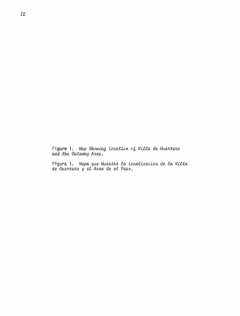
Figure 1. Ma.p ShowJ..ng Loc.ation 06 VU!a. de Gu.e.M.e.Jw a.nd :the Ga.:twa.y All.ea •
Figura l. Ma.pa. qu.e, Mu.v.i.tn.a. la. Loc.al.)_za.c.ion de, la. VU!a. de, Gu.e.M.efl.o y el All.ea. de, el PCl6o.

23
LOCATION MAP
SAN ANTONIO
TEXAS
LAREDO
COAHUILA
MONTERREY

24
Figure 2. Aflti6ac.;t Examp.teo CoUe.c.;te.d 6Jiom Me.a Swwe.y and Mi.o~~on ExQava.tlo~. a, metal pot handle; b, scissors; c, kitchen knife; d-e, metal crucifixes; f-h, metal arrow points; i-k, flint arrow points; 1-p, flint dart points.
Figura 2. Eje.mp.lM de. A!T;f_e. 0ac.;to~ EnQontfl.adM Su.pe.Ji6~ua.tme.n.te. y e.n .lM ExQavauoneo de. .lM Mi.o~neo. a, asa de metal de una jarra; b, tijeras; c, cuchillo de cocina; d-e, crucifijos de metal; f-h, puntas de flecha de metal; i-k, puntas de flecha de silice; 1-p, puntas de lanza de s il ice.

a
g
m
0 I
h
b
I I cm
5 I
0 I I I 5 _ __.__1-:c:-::m~-L_JI
0 I I I
cm
n
5 I
25
d
e
J k
0 p

Figure 3. Map o 6 Ptr..e1.>,lcli..o de. San. Juan. Bau,t.Ll,:ta de.l Rio Gtr..an.de.. Drawn in 1767 by Jose de Urrutia.
Figura 3. Mapa de.l Ptr..e1.>,lcli..o de. San. Juan. Ba.ufu:ta de.l Rio Gtr..an.de.. Trazada en 1767 par Jose de Urrutia.
N O"I

f i t •
~~
" ~ ~ I
; I
11-'
~,:
~
i J
J.t
.J
IJfot j )
' i J ~·
1 J
J
11
l.
i~ I
I i
1~
' i.
ii i
I
~ I jJ •'
J
~'
lj J
-.JJ l J
.,, JJ
I J* : .J
l '. j
I
j
' ~-· .. : ... ! . . . r .
:··:.
' ....... h. ;-.... ....... i. I . ;· . -; ... ·. . . . .• ..
J. .r--:. :_ . · .... ,,... .. .• ...
' •, i j i J
•., : ..
~ .J' .,
i $
~.r
jl
,I .i, j IJ
• f
IJ
.. ;
. . .. •
. . :
. •/ •'
" ... " .·
·( .
'·
-~ 1· · "~: . ' •. '
.· •'
r-::" ,-
f: ' -
I
)
I /
.... ....
..
•'
:l
.. : . •.
i .. ' ..•• • .
"• "
.)
27
.... . : -~-·.
"' "
.. -- '?""'
> ··- -
...
.. -i ~ ·":; :-
. . ~j
' l

Figure 4. S.tJr.ee:t. Map 06 V.lle.a de GueJVr.vz.o. Locations of the presidia and missions with respect to the modern town are shown.
Figura 4. Mapa de ~a.6 Cai1..e1.i de~ V.lle.a de GueJVr.VZ.o. Los sitios del presidia y de las misiones con respecto a la ciudad moderna estan mostrados.
N ex:>

\~:::::::::~:::~':::::::::, \I '\ ,, ,, ,, ,, ,, ,,
1\ - '\ ,_
11 RIOGRANDE
" .;-o"'''~~:~ -0000,,, ,, , , , , , , , ,, , , , , , 'ii,.",,,,,,,,,,,,,,,,,,,,,,,,,,,,,_ - I I
·:· ';. " --o,,,, _ " '• '" " '•-·-.. " " ' , .. ,.,_,
O:• ·:. &. ·: " •• \~ SANFRANCISCOSOLANO ~ :: MISSION SITEll~:~I : I -......._-......._ 10 l 1 !APPROX. LOCA ~4 "LAS BRUJAS" : I
t
\ OJOS OE AGUA IS::~~.~I ) :
~.. ~ .................... ••1•" /; ~~ .......... " \ ,;1 'lf. / II ~~ ........ \,~
'& \,~ .. ••• {~ \~ "~:::::::::,~\.:: ..
;i 11 11 11 11
" 11 LEGEND
1. Main P\aza. Site of Presidio del Rlo Grande (17021 and first location of Minion San Juan Bautista (1700).
2. San Juan Bautista Parish Church (Iglesia}
1' ,1 ,1 1'
\ '":::.;:::::,
"LASPARITAS" .._
~OS ,oe AGUA .. .::- ...
~\__ x:' -~~-"""~ov,"'lc,t:.
o\l~Q"'I
11 II 1• 11 11 11 ii II 11 11
II
3. Presidio Captain's House (Cll.la del Capitani
4. Paymaster's House (Casa Botello!
" 11 11
"lce-au1.q II 11
5. City Hall {Palacio Municipal)
1
~1
88;.- ~ a· ·::, ~~,!;;;;:JI h ~~ =-- ~-~ I ........ ~ ~L.--'i---= ''--~ - - ~ ~r , ·-----.... ..... ~... " ~ • u =D , ·~ ,,~~~GCJE]~EJ~r:lr:ic::i 6F\B8r=-.,, .:• " .: --.,,~/::::00'~ ~~f\l'.J~ LJ;-\\ :: '• " " " " -...._,, • d;l \"' '' II
/- :.· .:· :: :,• " "" "\ :: " " " " " " " "' "
" "'~" " " " " " " " &. -;;. .... ,.... ., ... ,.. .. " :.· " n "' "" :: ~~~y~::~:::~:::·· iL _____ ·····A~-- ,;:' ,;· /I :i LJB~R\ \ I ,, ,. ,, \---·----" " " \ ~ -:- ---... ,,,.,,.,;,,,,J,, ____ .i
Cl-ftoo,r4
~
i 0 200' 400' 600'
--- .. _...._":.":,•--=----------- r--
i1
VILLA DE GUERRERO CDAHUILA, MEXICO
f'V \D

30
Figure 5. PJr.eJ.i.lcU.o PeiUod Stnuc;twz.v., .ln. GueNi.eJw. a, San Juan Bautista parish church; b, presidia captain's house.
Figura 5. El>tnuc;twz.M du PeiUodo du PJr.v.,.lcU.o e..n. GueN1.e..Jr.o. a, la iglesia parroquial de San Juan Bautista; b, la casa del capitan del presidia.

31

Figure 6. Plan ofi Mi.li~lon San Jua.n Bautlo:ta.. Ground plan of structural remains uncovered during 1976 excavations.
Figura 6. Plan de la Mi.lilon de San Jua.n Bautlota.. Planta de las vestigios estructurales llevados a la luz durante las exploraciones de 1976.
w N

:i: ... a:
~\I/! < :l
SAN JUAN BAUTISTA MISSION GUERRERO, COAHUILA, MEXICO PLAN 0 5 10 15 20 25 30
METERS
J. Eaton, T. Hester June 1976
Note: Exact locations of doorways and dividing walls uncertain except as shown.
,--------, I I I Cemetery I I I L _____ J
r-------------, L ___________ _J
Low Linear Mounds
(Probable Indian Housing)
,-----------, L __________ _J
Indian Housina (Divided into Apartments)
D
Monastery
Quadrangle
Granary
+--Work Shops--+
w w

34
Figure 7. Mu.i~lon San Jua.n BatLt.Lo.:ta. a, remains of the main portal; b, view of the bastion foundation.
Figura 7. Ml6lon de San Jua.n BatLt.Lo.:ta. a, restos de entrada principal; b, vista de las cimientos de la torre6n.

35
a
b

36
Figure 8. View6 of; fv!L61.iion San BVtnaJLdo. a, San Bernardo Mission Church constructed during the 1760s; b, excavating remains of Indian apartments north of church.
Figura 8. Vil.i.ta. de ht fv!L6io n de San BVtnMdo. a, Iglesia de la Misi6n de San Bernardo construida en la decada de 1760; b, excavaci6n de los vestigios de los apartamentos Indios al norte de la iglesia.

37
b

38
Figure 9. Plan 06 MUi~ion San Bvr..naJr..do. Ground plan of structural remains north of church uncovered during 1975 and 1976 excavations.
Figura 9. Plan de la. MUiion de San Bvr..naJr..do. Planta de los vestigios estructurales al norte de la iglesia llevados a la luz durante las exploraciones de 1975 y 1976.

Cl c:
·c;; ::I 0
:x: c: cu
"O c:
9.5°
-1 4•
:r ,... a: ~ UJ :r .... ::i a: a: 0 .... z
d < ~
SAN BERNARDO MISSION GUERRERO, COAHUILA, MEXICO PLAN METERS
T 1p 1~ 2p 2,s JP
J. Eaton, T. Hester, P Katz, S. Katz June, 1976
-;1 ~
f I
~r I
I I
I J
,--1 I
I
I
1 Linear
I
I
I 1 Mound I Group I I I I L __ J
".l'.) Ir----------, J.
11 I I I
..c u ... ::I
..c u (ij
·= Cl ·;: 0
r-, I I I I I I I I I I I I I I L _ _J
,-------..., I I L-------_J


SUGGESTED READING LIST
Bannon, John Francis (Editor)
1964 Bolton and the SpavUJ.ih Bohde;r,la_ncl6. University of Oklahoma Press, Norman.
Boteel, G. Aurora
1956 Va..ta.6 H,V.,to!U.c..0.6 .oobhe £.a. Fu..ndauon de la rri,{).,,fon de San Behnahdo y £.a. Vil,la de Gu..eMeho, CoahuJ..ia., Avite.o Real Phe.oicUo du Rio GMnde du No!1.Xe. Piedras Negras.
Morfi, Fray Juan Agustin
1950 Ve.oc..hipuon du TeMdo!U.o du Real Phe.oicUo de San Ju.an Bau..t,v.,m du Rio GMnde du Non.;te, 1J .ou.. j~cUc..uon AVi.o de 1778.
Weddle, Robert S.
41
1968 San Ju.an Bau..t,lom: GateJJJay to SpavUJ.ih Texa.o. University of Texas Press, Austin.
* * * * * * * * ADDENDUM
After completion of the archaeological excavations and documentation at the
mission sites, the architectural remains were reburied in order to preserve them.
However, during September, 1979, an unfortunate event took place at the site of
Mission San Juan Bautista. A man operating a bulldozer entered the mission site
for the purpose of looting, and in the process caused extensive damage to the
buried remains. The man was apprehended and placed in jail, but not before much
destruction was done.
The reader and visitor to the site of Mission San Juan Bautista should be
aware that the badly disturbed condition now seen there results from malicious
looting and not from the archaeological work.
Mr. John Stockley of Quemado, Texas, has kindly provided documentation of
the destruction done at Mission San Juan Bautista. This documentation (including
photographs, sketches, and newspaper clippings) is on file at the Center for
Archaeological Research, The University of Texas at San Antonio.