Embed Size (px)
Citation preview
Grafton Flyford
Deserted Village and Church
Educational PresentationProduced by
Worcestershire Historic Environment
and Archaeology Service
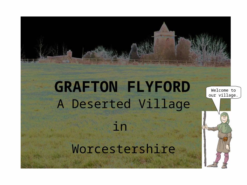
GRAFTON FLYFORD
A Deserted Village
in
Worcestershire
Welcome toour village.
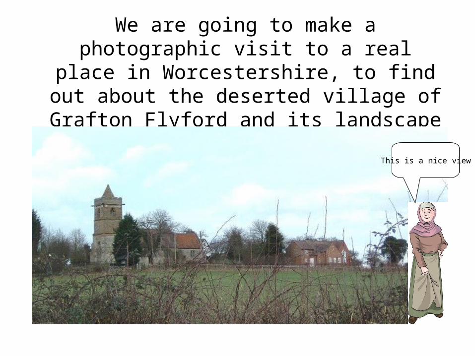
We are going to make a photographic visit to a real place in Worcestershire, to find out about the deserted village of Grafton Flyford and its landscape
and churchThis is a nice view
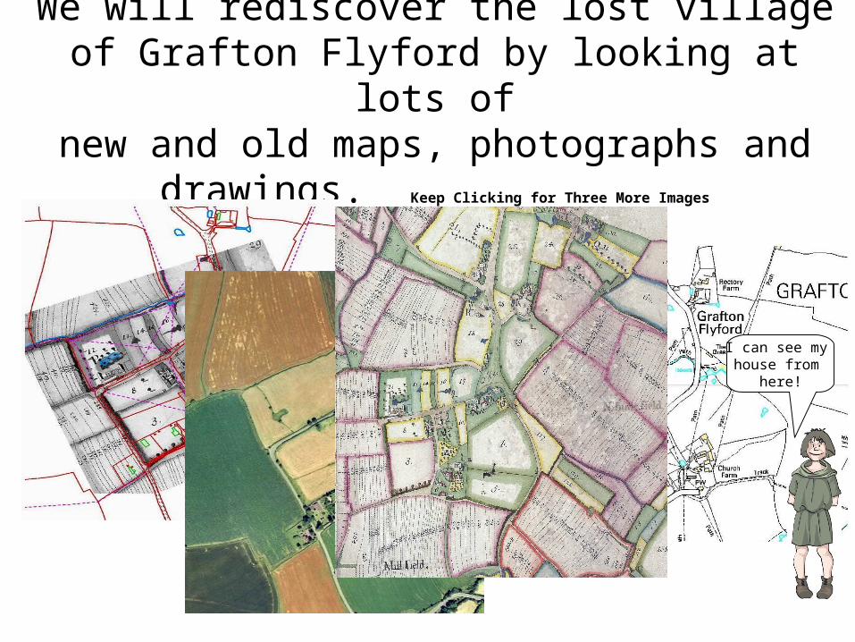
We will rediscover the lost village of Grafton Flyford by looking at lots ofnew and old maps, photographs and
drawings. Keep Clicking for Three More Images
I can see my house from
here!
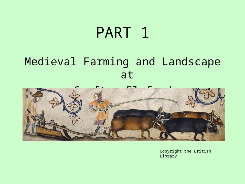
PART 1
Medieval Farming and Landscape atGrafton Flyford
Copyright the British Library
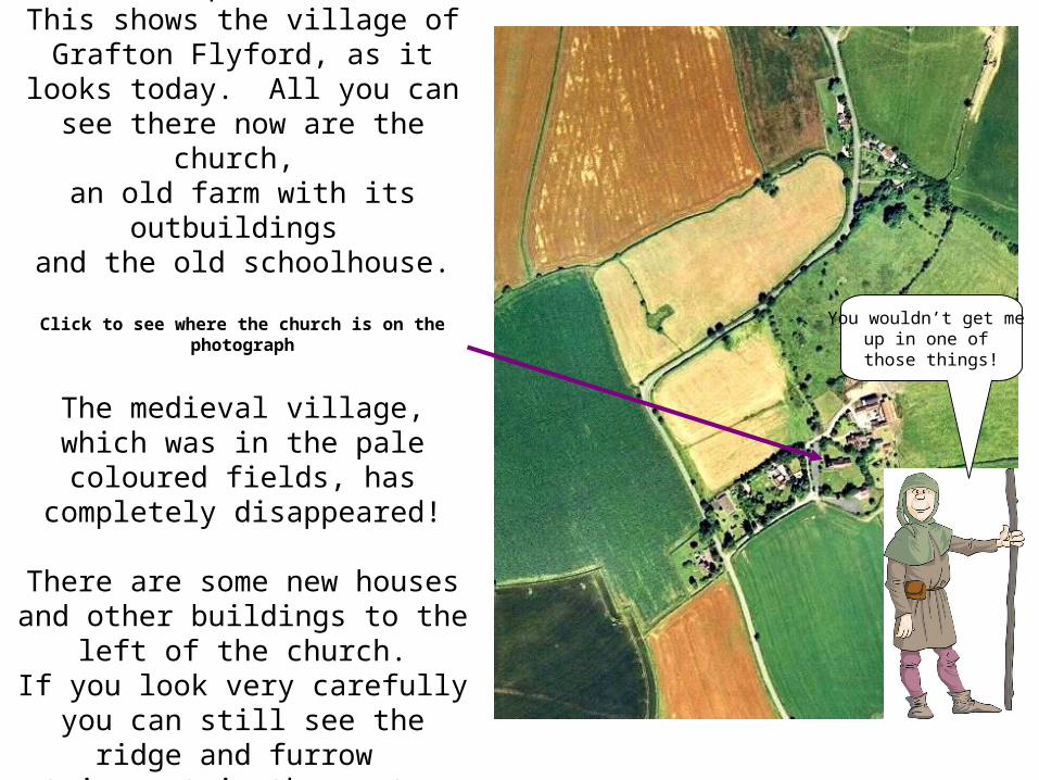
To start, lets look at a photograph taken from an
aeroplane. This shows the village of
Grafton Flyford, as it looks today. All you can see there
now are the church, an old farm with its
outbuildings and the old schoolhouse.
Click to see where the church is on the photograph
The medieval village, which was in the pale coloured fields, has completely disappeared!
There are some new houses and other buildings to the left
of the church.If you look very carefully you
can still see the ridge and furrow
strips out in the pasture and corn fields.
You wouldn’t get me up in one of those things!
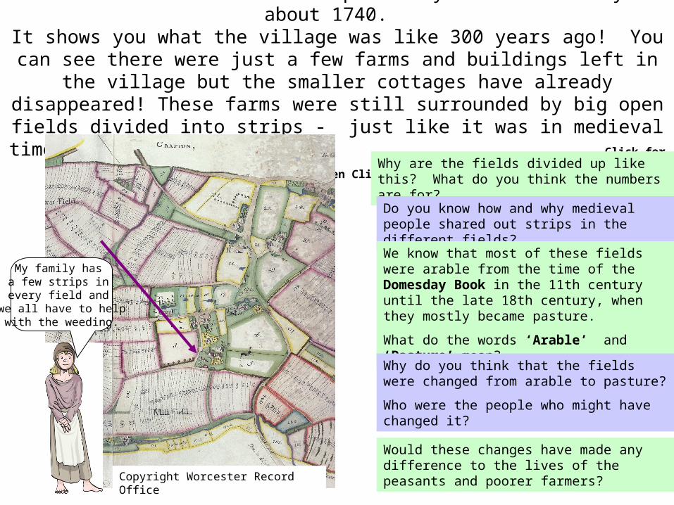
We will now look at an old map made by Mr John Doharty in about 1740.
It shows you what the village was like 300 years ago! You can see there were just a few farms and buildings left in the village but the smaller cottages have already disappeared! These farms were still surrounded by big open fields divided into strips - just like it was in medieval times. Click for Arrow to show
Church ten Click for Questions Why are the fields divided up like this? What do you think the numbers are for?
Do you know how and why medieval people shared out strips in the different fields?We know that most of these fields were arable from the time of the Domesday Book in the 11th century until the late 18th century, when they mostly became pasture.
What do the words ‘Arable’ and ‘Pasture’ mean?Why do you think that the fields were changed from arable to pasture?
Who were the people who might have changed it?
Would these changes have made any difference to the lives of the peasants and poorer farmers?
My family has a few strips in every field and
we all have to helpwith the weeding.
Copyright Worcester Record Office
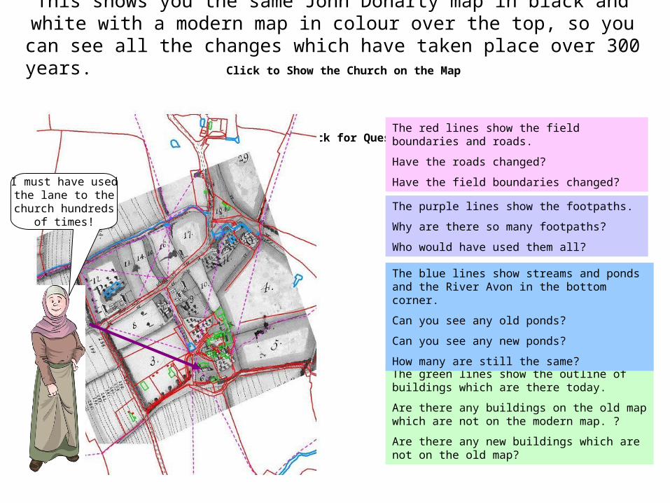
This shows you the same John Doharty map in black and white with a modern map in colour over the top, so you can see all the changes which have taken place over 300 years. Click to Show
the Church on the Map then Click for Questions
The red lines show the field boundaries and roads.
Have the roads changed?
Have the field boundaries changed?
The green lines show the outline of buildings which are there today.
Are there any buildings on the old map which are not on the modern map. ?
Are there any new buildings which are not on the old map?
The blue lines show streams and ponds and the River Avon in the bottom corner.
Can you see any old ponds?
Can you see any new ponds?
How many are still the same?
The purple lines show the footpaths.
Why are there so many footpaths?
Who would have used them all?
I must have usedthe lane to the
church hundredsof times!
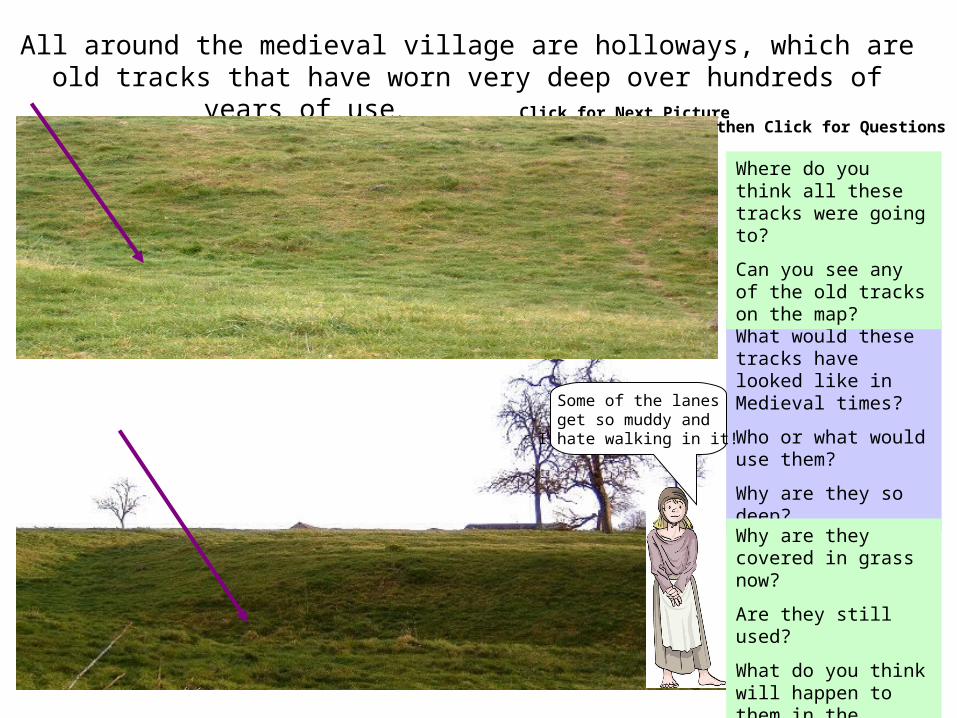
All around the medieval village are holloways, which are old tracks that have worn very deep over hundreds of years of use. Click for
Next Picture then Click for Questions
What would these tracks have looked like in Medieval times?
Who or what would use them?
Why are they so deep?Why are they covered in grass now?
Are they still used?
What do you think will happen to them in the future?
Where do you think all these tracks were going to?
Can you see any of the old tracks on the map?
Some of the lanesget so muddy and I hate walking in it!
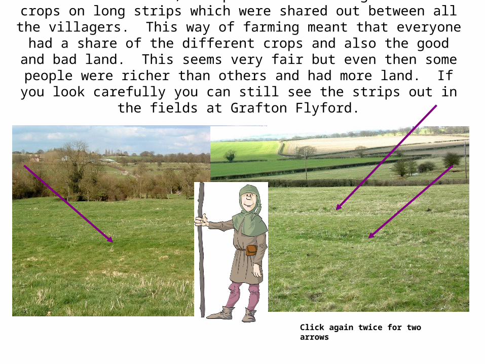
In medieval times, the peasants used to grow their crops on long strips which were shared out between all the villagers. This way
of farming meant that everyone had a share of the different crops and also the good and bad land. This seems very fair but even
then some people were richer than others and had more land. If you look carefully you can still see the strips out in the fields at
Grafton Flyford. Click for Next Image and Arrow
Click again twice for two arrows
We all have strips in different fieldsbut we all work
the land together.
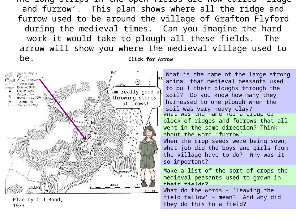
The long strips in the open fields are now called ‘ridge and furrow’. This plan shows where all the ridge and furrow used to be around the village of Grafton Flyford during the medieval times. Can you imagine the hard work it would take to plough all these fields. The arrow will show you where the medieval village used to be.
Click for Arrow
then Click for Questions
What was the name for a group or block of ridges and furrows that all went in the same direction? Think about the word ‘furrow’.
When the crop seeds were being sown, what job did the boys and girls from the village have to do? Why was it so important?
Make a list of the sort of crops the medieval peasants used to grown in their fields?
What do the words - ‘leaving the field fallow’ - mean? And why did they do this to a field?
What is the name of the large strong animal that medieval peasants used to pull their ploughs through the soil? Do you know how many they harnessed to one plough when the soil was very heavy clay?
Plan by C J Bond, 1973
I am really good at throwing stones
at crows!
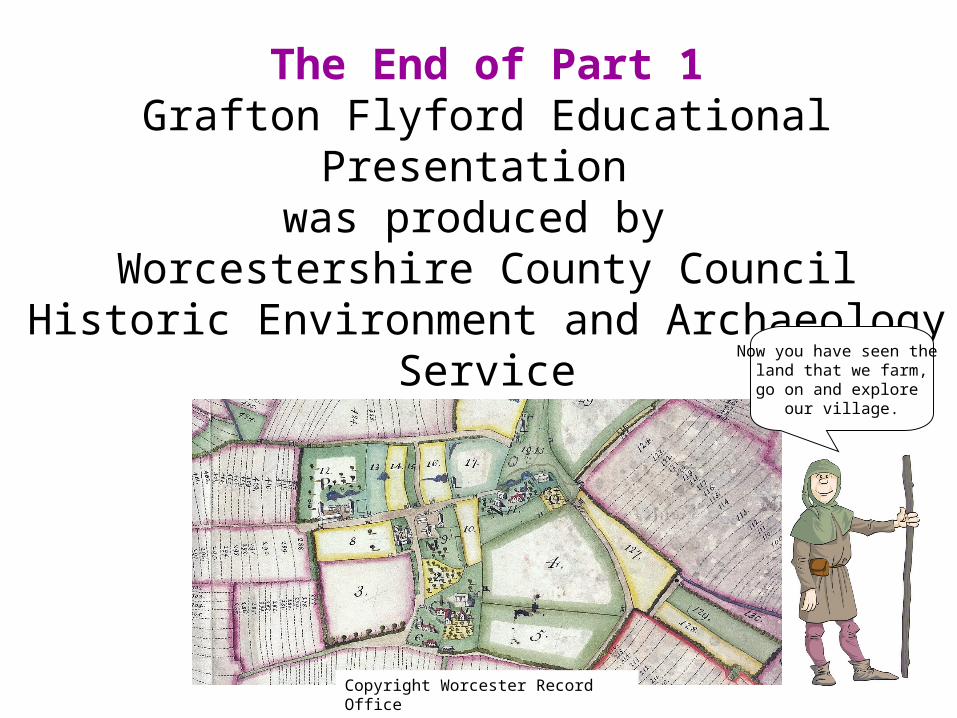
The End of Part 1Grafton Flyford Educational Presentation
was produced by Worcestershire County Council
Historic Environment and Archaeology Service Now you have seen the
land that we farm,go on and explore
our village.
Copyright Worcester Record Office