Embed Size (px)
Citation preview
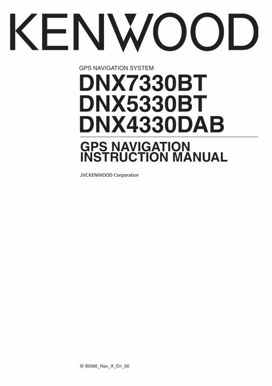
GPS NAVIGATION SYSTEM
DNX7330BTDNX5330BTDNX4330DAB
GPS NAVIGATION INSTRUCTION MANUAL
© IM366_Nav_X_En_00
2 GPS Navigation Instruction Manual
Getting Started 8Using the Navigation System 8Help When You Need It 8Searching Help Topics 8Status Bar Icons 8Satellite Signals 9Viewing GPS Satellite Signals 9Using the On-Screen Buttons 9Using the On-Screen Keyboard 9Adding a Shortcut 9Removing a Shortcut 9
Navigation 15Starting a Route 15Previewing Multiple Routes 15Following a Route 15Using the Navigation Map 15Adding a Point to a Route 16Taking a Detour 16Stopping the Route 16Updating Speed Limits 16Using Suggested Routes 16Using Exit Services 16Finding Exit Services 17Navigating to an Exit 17Using Find Ahead 17Avoiding Road Features 17Adding a Custom Avoidance Area 17Avoiding a Road 17Disabling a Custom Avoidance 17Deleting Custom Avoidances 18Enabling Advanced Detours 18Taking a Detour Around Specified Areas 18Navigating Off Road 18
End-User License Agreements 4
Finding Locations 10Finding a Location by Category 10Searching Within a Category 10Finding a Location Using the Search Bar 10Changing the Search Area 10Finding an Address 11Finding a City 11Finding an Intersection 11Finding a Location Using Coordinates 12Finding a Location by Browsing the Map 12Finding a Location Using Quick Search 12Saving a Home Location 12Going Home 13Editing Your Home Location Information 13Finding Recently Found Places 13Clearing the List of Recently Found Places 13Finding Parking 13Setting a Simulated Location 13Saving a Location 13Saving Your Current Location 13Starting a Route to a Saved Location 14Editing a Saved Location 14Assigning Categories to a Saved Location 14Deleting a Saved Location 14
The Map Pages 19Customizing the Map Layers 19Viewing the Trip Log 19Changing the Map Data Field 19Changing the Map Perspective 19Customizing Map Buttons 19Removing Buttons from the Map 19Viewing a List of Turns 20Viewing the Entire Route on the Map 20Viewing the Next Turn 20Highway Mode 20Viewing Junctions 20Viewing Trip Information 21Resetting Trip Information 21Viewing Current Location Information 21Finding Nearby Services 21Directions to Your Current Location 21
Contents
English 3
Appendix 29Updating the Software 29Updating the Map Data 29Safety Cameras 29Custom POIs (Points of Interest) 30Finding Custom POIs 30
Customizing the Settings 27Customizing the Navigation System 27Changing the Map Settings 27Enabling Maps 27Changing the Navigation Settings 27Adjusting the Display Settings 27Route Preferences 27Updating the Time Settings 28Setting the Languages 28Adding Security 28Device and Privacy Settings 28Restoring Settings 28
Icons Used in This Manual
Important precautions are described to prevent injuries and potentially dangerous situations.
Special instructions, supplementary explanations, limitations, and reference pages are described.
Using the Apps 22About Smartphone Link 22Downloading Smartphone Link 22Connecting to Smartphone Link 22Sending a Location from Your Phone 22Disabling Calls While Connected 22About Garmin Live Services 23Subscribing to Garmin Live Services 23About ecoRoute 23Creating a Vehicle Profile 23Resetting Your Vehicle Profile 23Calibrating Fuel Economy 23Taking the ecoChallenge 24About ecoChallenge Scores 24Hiding Your ecoChallenge Score 24Resetting Your Score 24Viewing Your Fuel Economy 24About the Mileage Report 24Viewing a Mileage Report 24Exporting a Mileage Report 25Setting Routes that Use Less Fuel 25Viewing myGarmin Messages 25Planning a Trip 25Editing a Trip Itinerary 26Navigating to a Saved Trip 26Editing a Saved Trip 26Viewing Previous Routes & Destinations 26Using the World Clock 26Viewing the World Map 26
4 GPS Navigation Instruction Manual
End-User License Agreements
Software License AgreementBY USING THE DNX7330BT / DNX5330BT / DNX4330DAB, YOU AGREE TO BE BOUND BY THE TERMS AND CONDITIONS OF THE FOLLOWING SOFTWARE LICENSE AGREEMENT. PLEASE READ THIS AGREEMENT CAREFULLY.Garmin Ltd. and its subsidiaries (“Garmin”) grant you a limited license to use the software embedded in this device (the “Software”) in binary executable form in the normal operation of the product. Title, ownership rights, and intellectual property rights in and to the Software remain in Garmin and/or its third-party providers.You acknowledge that the Software is the property of Garmin and/or its third-party providers and is protected under the United States of America copyright laws and international copyright treaties. You further acknowledge that the structure, organization, and code of the Software, for which source code is not provided, are valuable trade secrets of Garmin and/or its third-party providers and that the Software in source code form remains a valuable trade secret of Garmin and/or its third-party providers. You agree not to decompile, disassemble, modify, reverse assemble, reverse engineer, or reduce to human readable form the Software or any part thereof or create any derivative works based on the Software. You agree not to export or re-export the Software to any country in violation of the export control laws of the United States of America or the export control laws of any other applicable country.
NAVTEQ® End-user License AgreementThe software embedded in your Garmin product (the “Software”) is owned by Garmin Ltd. or its subsidiaries (“Garmin”). The third-party map data embedded in or accompanying your Garmin product (the “Map Data”) is owned by NAVTEQ North America LLC and/or its affiliates (“NAVTEQ”) and is licensed to Garmin. Garmin also licenses information, text, images, graphics, photographs, audio, video, images and other applications and data from third party data providers (“Third Party Content Data”). The Map Data and Third Party Content Data are collectively the “Data”. Both the Software and Data are protected under copyright laws and international copyright treaties. The Software and Data are licensed, not sold. The Software and Data are provided under the following license and are subject to the following terms and conditions which are agreed to by End User (“you” or “your”), on the one hand, and Garmin and its licensors (including their licensors and
suppliers) and affiliated companies on the other hand.
IMPORTANT: CAREFULLY READ THIS LICENSE BEFORE USING THIS PRODUCT. INSTALLING, COPYING, OR OTHERWISE USING THIS PRODUCT INDICATES YOUR ACKNOWLEDGMENT THAT YOU HAVE READ THIS LICENSE AND AGREE TO ITS TERMS. IF YOU DO NOT AGREE, RETURN THE COMPLETE PRODUCT WITHIN 7 DAYS OF THE DATE YOU ACQUIRED IT (IF PURCHASED NEW) FOR A FULL REFUND TO THE DEALER FROM WHICH YOU PURCHASED THIS PRODUCT.
License Terms And Conditions
Garmin (“we” or “us”) provides you with storage media containing the computer Software (the “Software”) and the embedded or accompanying Data, including any “online” or electronic documentation and printed materials (together called the “Product” for purposes of this License Agreement), and grants you a limited, non-exclusive license to use the Product in accordance with the terms of this Agreement. You agree to use this Data together with the Garmin product for solely personal, or if applicable, for use in your business’ internal operations, and not for service bureau, time-sharing, resale or other similar purposes. Accordingly, but subject to the restrictions set forth in the following paragraphs, you may copy this Data only as necessary for your use to (i) view it, and (ii) save it, provided that you do not remove any copyright notices that appear and do not modify the Software or Data in any way. You agree not to otherwise reproduce, copy, modify, decompile, disassemble, reverse engineer or create derivative works of any portion of the Product, and may not transfer or distribute it in any form, for any purpose, except to the extent permitted by mandatory laws. Garmin also reserves the right to discontinue offering any Data supplied by any third party supplier if such supplier ceases to supply such content or Garmin’s contract with such supplier terminates for any reason.
Restrictions. Except where you have been specifically licensed to do so by Garmin, and without limiting the preceding paragraph, you may not use this Data with any products, systems, or applications installed or otherwise connected to or in communication with vehicles, and which are capable of dispatch, fleet management or similar applications where the Data is used by a central control center in dispatching a fleet of vehicles. In
English 5
addition, you are prohibited from renting or leasing the Data or the Garmin products containing the Data to any other person or third party. Only those rental car companies that are specifically authorized by Garmin in writing to rent Garmin products containing the Data to their rental customers are permitted to rent out such products.
No Warranty. This Product (including the Data) is provided to you “as is,” and you agree to use it at your own risk. Garmin and its licensors (and their licensors and suppliers) make no guarantees, representations or warranties of any kind, express or implied, arising by law or otherwise, including but not limited to, content, quality, accuracy, completeness, effectiveness, reliability, merchantability, fitness for a particular purpose, usefulness, use or results to be obtained from the Product, or that the Data or server will be uninterrupted or error-free.
Disclaimer of Warranty. GARMIN AND ITS LICENSORS (INCLUDING THEIR LICENSORS AND SUPPLIERS) DISCLAIM ANY WARRANTIES, EXPRESS OR IMPLIED, OF QUALITY, PERFORMANCE, MERCHANTABILITY, FITNESS FOR A PARTICULAR PURPOSE OR NONINFRINGEMENT. NO ORAL OR WRITTEN ADVICE OR INFORMATION PROVIDED BY GARMIN OR ITS SUPPLIERS AND LICENSORS SHALL CREATE A WARRANTY, AND YOU ARE NOT ENTITLED TO RELY ON ANY SUCH ADVICE OR INFORMATION. THIS DISCLAIMER OF WARRANTIES IS AN ESSENTIAL CONDITION OF THIS AGREEMENT. Some States, Territories and Countries do not allow certain warranty exclusions, so to that extent the above exclusion may not apply to you.
Disclaimer of Liability. GARMIN AND ITS LICENSORS (INCLUDING THEIR LICENSORS AND SUPPLIERS) SHALL NOT BE LIABLE TO YOU: IN RESPECT OF ANY CLAIM, DEMAND OR ACTION, IRRESPECTIVE OF THE NATURE OF THE CAUSE OF THE CLAIM, DEMAND OR ACTION ALLEGING ANY LOSS, INJURY OR DAMAGES, DIRECT OR INDIRECT, WHICH MAY RESULT FROM THE USE OR POSSESSION OF THE INFORMATION; OR FOR ANY LOSS OF PROFIT, REVENUE, CONTRACTS OR SAVINGS, OR ANY OTHER DIRECT, INDIRECT, INCIDENTAL, SPECIAL OR CONSEQUENTIAL DAMAGES ARISING OUT OF YOUR USE OF OR INABILITY TO USE THIS INFORMATION, ANY DEFECT IN THE DATA OR INFORMATION, OR THE BREACH OF THESE TERMS OR CONDITIONS, WHETHER IN AN ACTION IN CONTRACT OR TORT OR BASED ON A WARRANTY, EVEN IF GARMIN OR ITS LICENSORS
HAVE BEEN ADVISED OF THE POSSIBILITY OF SUCH DAMAGES. GARMIN’S AND ITS LICENSORS’ TOTAL AGGREGATE LIABILITY WITH RESPECT TO ITS OBLIGATIONS UNDER THIS AGREEMENT OR OTHERWISE WITH RESPECT TO THE GARMIN PRODUCT OR THE DATA SHALL NOT EXCEED $1.00. Some States, Territories and Countries do not allow certain liability exclusions or damages limitations, so to that extent the above may not apply to you.
Disclaimer of Endorsement. Reference to any products, services, processes, hypertext links to third parties or other Data by trade name, trademark, manufacturer, supplier or otherwise does not necessarily constitute or imply its endorsement, sponsorship or recommendation by Garmin or its licensors. Product and service information are the sole responsibility of each individual vendor. The NAVTEQ name and logo, the NAVTEQ and NAVTEQ ON BOARD trademarks and logos, and other trademarks and trade names owned by NAVTEQ North America LLC may not be used in any commercial manner without the prior written consent of NAVTEQ.
Export Control. You agree not to export from anywhere any part of the Data provided to you or any direct product thereof except in compliance with, and with all licenses and approvals required under, applicable export laws, rules and regulations.
Indemnity. You agree to indemnify, defend and hold Garmin and its licensors (including their respective licensors, suppliers, assignees, subsidiaries, affiliated companies, and the respective officers, directors, employees, shareholders, agents and representatives of each of them) free and harmless from and against any liability, loss, injury (including injuries resulting in death), demand, action, cost, expense, or claim of any kind or character, including but not limited to attorney’s fees, arising out of or in connection with any use or possession by you of the Product (including the Data).
Canadian Map Data. The Map Data for Canada may include or reflect data of licensors, including Her Majesty and Canada Post. Such data is licensed on an “as is” basis. The licensors, including Her Majesty and Canada Post, make no guarantees, representations or warranties respecting such data, either express or implied, arising by law or otherwise, including but not limited to, effectiveness, completeness, accuracy or fitness for a particular purpose. The licensors, including
6 GPS Navigation Instruction Manual
Her Majesty and Canada Post, shall not be liable in respect of any claim, demand or action, irrespective of the nature of the cause of the claim, demand or action alleging any loss, injury or damages, direct or indirect, which may result from the use or possession of the data or the Map Data. The licensors, including Her Majesty and Canada Post, shall not be liable in any way for loss of revenues or contracts, or any other consequential loss of any kind resulting from any defect in the data or the Map Data. You shall indemnify and save harmless the licensors, including Her Majesty the Queen, the Minister of Natural Resources of Canada and Canada Post, and their officers, employees and agents from and against any claim, demand or action, irrespective of the nature of the cause of the claim, demand or action, alleging loss, costs, expenses, damages or injuries (including injuries resulting in death) arising out of the use or possession of the data or the Map Data. The terms contained in this Section are in addition to all of the rights and obligations of the parties under the Agreement. To the extent that any of the provisions of this Section are inconsistent with, or conflict with, any other provisions of the Agreement, the provisions of this Section shall prevail. United States Map Data. NAVTEQ holds a non-exclusive license from the United States Postal Service® to publish and sell ZIP+4® information. ©United States Postal Service® 2010. Prices are not established, controlled or approved by the United States Postal Service®. The following trademarks and registrations are owned by the USPS: United States Postal Service, USPS, and ZIP+4.
Canadian Map Data. Map Data for Canada includes information taken with permission from Canadian authorities, including © Her Majesty, © Queen's Printer for Ontario, © Canada Post, GeoBase®, © Department of Natural Resources Canada. All rights reserved.
Australian Map Data. Map Data for Australia is based on data NAVTEQ has licensed from PSMA Australia Limited (www.psma.com.au). In addition, the Product incorporates data which is © 2010 Telstra Corporation Limited, GM Holden Limited, Intelematics Australia Pty Ltd, Sentinel Content Pty Limited and Continental Pty Ltd. If your Product uses RDS-TMC Codes contained in the Map Data, the traffic location codes are © 2010 Telstra Corporation Limited and its licensors.
Term. This Agreement is effective until such time
as (i) if applicable, your subscription term is either terminated (by you or by Garmin) or expires, or (ii) Garmin terminates this Agreement for any reason, including, but not limited to, if Garmin finds that you have violated any of the terms of this Agreement. In addition, this Agreement shall terminate immediately upon the termination of an agreement between Garmin and any third party from whom Garmin licenses the Data.
Entire Agreement. These terms and conditions constitute the entire agreement between Garmin (and its licensors, including their licensors and suppliers) and you pertaining to the subject matter hereof, and supersedes in their entirety any and all written or oral agreements previously existing between us with respect to such subject matter.
Governing Law.
(a) For European Union NAVTEQ Data
The above terms and conditions shall be governed by the laws of the Netherlands, without giving effect to (i) its conflict of laws provisions, or (ii) the United Nations Convention for Contracts for the International Sale of Goods, which is explicitly excluded. You agree to submit to the jurisdiction of the Netherlands for any and all disputes, claims and actions arising from or in connection with the NAVTEQ Data provided to you hereunder.
(b) For North American NAVTEQ Data and other non-European Union NAVTEQ Data
The above terms and conditions shall be governed by the laws of Illinois, without giving effect to (i) its conflict of laws provisions, or (ii) the United Nations Convention for Contracts for the International Sale of Goods, which is explicitly excluded. You agree to submit to the jurisdiction of Illinois for any and all disputes, claims and actions arising from or in connection with the NAVTEQ Data provided to you hereunder.
(c) For disputes, claims and actions not related to the NAVTEQ Data
The above terms and conditions shall be governed by the laws of Kansas, without giving effect to (i) its conflict of laws provisions, or (ii) the United Nations Convention for Contracts for the International Sale of Goods, which is explicitly excluded. You agree to submit to the jurisdiction of Kansas for any
End-User License Agreements
English 7
and all disputes, claims and actions arising from or in connection with the Data provided to you hereunder.
Government End Users. If End User is an agency, department, or other entity of the United States Government, or funded in whole or in part by the U.S. Government, then use, duplication, reproduction, release, modification, disclosure or transfer of the Product and accompanying documentation is subject to restrictions as set forth in DFARS 252.227-7014(a)(1) (JUN 1995) (DOD commercial computer software definition), DFARS 27.7202-1 (DOD policy on commercial computer software), FAR 52.227-19 (JUN 1987) (commercial computer software clause for civilian agencies), DFARS 252.227-7015 (NOV 1995) (DOD technical data – commercial items clause); FAR 52.227-14 Alternates I, II, and III (JUN 1987) (civilian agency technical data and noncommercial computer software clause); and/or FAR 12.211 and FAR 12.212 (commercial item acquisitions), as applicable. In case of conflict between any of the FAR and DFARS provisions listed herein and this License, the construction that provides greater limitations on the Government’s rights shall control. The contractor/manufacturer is Garmin International, Inc., 1200 East 151st Street, Olathe, KS 66062, USA and NAVTEQ North America LLC, 425 West Randolph Street, Chicago, Illinois 60606 USA.
Garmin® is a trademark of Garmin Ltd. or its subsidiaries, registered in the USA and other countries. These trademarks may not be used without the express permission of Garmin.
NAVTEQ is a trademark in the U.S. and other countries. All other company names and trademarks mentioned or referenced in this documentation are the properties of their respective owners. All rights reserved.
8 GPS Navigation Instruction Manual
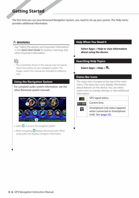
WARNINGSee "Safety Precautions and Important Information" in the Quick Start Guide for product warnings and other important information.
ڥ The screenshots shown in this manual may not exactly
match the screens on your navigation system. The images used in this manual are intended for reference only.
Using the Navigation System
For complete audio system information, see the other Kenwood system manuals.
➊
➋• Select ➊ to access the navigation system.
• When navigating, ➋ displays Kenwood audio. When using audio, this displays navigation information.
Help When You Need It
Select Apps > Help to view information about using the device.
Searching Help Topics
Select Apps > Help > .
Status Bar IconsThe status bar is located at the top of the main menu. The status bar icons display information about features on the device. You can select some icons to change settings or view additional information.
GPS signal status.
Current time.
Smartphone Link status (appears when connected to Smartphone Link). See (page 22).
The first time you use your Kenwood Navigation System, you need to set up your system. The Help menu provides additional information.
Getting Started
English 9
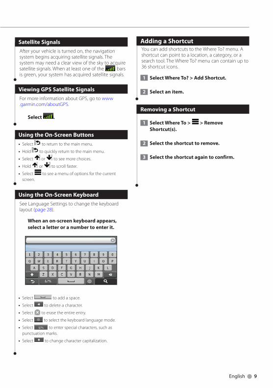
Satellite SignalsAfter your vehicle is turned on, the navigation system begins acquiring satellite signals. The system may need a clear view of the sky to acquire satellite signals. When at least one of the bars is green, your system has acquired satellite signals.
Viewing GPS Satellite SignalsFor more information about GPS, go to www.garmin.com/aboutGPS.
Select .
Using the On-Screen Buttons• Select to return to the main menu.
• Hold to quickly return to the main menu.
• Select or to see more choices.
• Hold or to scroll faster.
• Select to see a menu of options for the current screen.
Using the On-Screen KeyboardSee Language Settings to change the keyboard layout (page 28).
When an on-screen keyboard appears, select a letter or a number to enter it.
• Select to add a space.
• Select to delete a character.
• Select to erase the entire entry.
• Select to select the keyboard language mode.
• Select to enter special characters, such as punctuation marks.
• Select to change character capitalization.
Adding a ShortcutYou can add shortcuts to the Where To? menu. A shortcut can point to a location, a category, or a search tool. The Where To? menu can contain up to 36 shortcut icons.
1 Select Where To? > Add Shortcut.
2 Select an item.
Removing a Shortcut
1 Select Where To > > Remove Shortcut(s).
2 Select the shortcut to remove.
3 Select the shortcut again to confirm.
10 GPS Navigation Instruction Manual
Finding a Location by Category
1 Select Where To?.
2 Select a category, or select Categories.
3 If necessary, select a subcategory.
4 Select a location.
Searching Within a Category
To narrow your search results, you can search within some categories.
1 Select Where To?.
2 Select a category, or select Categories.
3 If necessary, select a subcategory.
4 If necessary, enter all or part of the name in the search bar (page 10).
Finding a Location Using the Search Bar
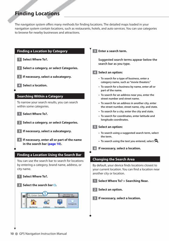
You can use the search bar to search for locations by entering a category, brand name, address, or city name.
1 Select Where To?.
2 Select the search bar ➊.
➊
3 Enter a search term.
Suggestedsearchtermsappearbelowthesearchbarasyoutype.
4 Select an option:
•Tosearchforatypeofbusiness,enteracategoryname,suchas“movietheaters.”
•Tosearchforabusinessbyname,enterallorpartofthename.
•Tosearchforanaddressnearyou,enterthestreetnumberandstreetname.
•Tosearchforanaddressinanothercity,enterthestreetnumber,streetname,city,andstate.
•Tosearchforacity,enterthecityandstate.
•Tosearchforcoordinates,enterlatitudeandlongitudecoordinates.
5 Select an option:
•Tosearchusingasuggestedsearchterm,selecttheterm.
•Tosearchusingthetextyouentered,select .
6 If necessary, select a location.
Changing the Search Area
By default, your device finds locations closest to your current location. You can find a location near another city or location.
1 Select Where To? > Searching Near.
2 Select an option.
3 If necessary, select a location.
Finding Locations
The navigation system offers many methods for finding locations. The detailed maps loaded in your navigation system contain locations, such as restaurants, hotels, and auto services. You can use categories to browse for nearby businesses and attractions.
English 11
Finding an Address
ڥ The order of the steps may change depending on the
map data loaded on your device.
1 Select Where To? > Address.
2 Enter the address number, and select Done.
3 Enter the street name, and select Next.
4 If necessary, select Searching In to change the city, state, or province.
5 If necessary, select the city, the state, or the province.
6 If necessary, select the address.
Finding a City
Before you can find a city, you must add a shortcut to the cities search tool (page 9).
1 Select Where To? > Cities.
2 Select Enter Search.
3 Enter a city name, and select .
4 Select a city.
Finding an Intersection
Before you can find an intersection, you must add a shortcut to the intersection search tool (page 9).
1 Select Where To? > Intersections.
2 Select a state or province.
Ifnecessary,selectState or Countrytochangethecountry,state,orprovince.
3 Enter the first street name, and select Next.
4 If necessary, select the street.
5 Enter the second street name, and select Next.
6 If necessary, select the street.
7 If necessary, select the intersection.
12 GPS Navigation Instruction Manual
Finding a Location Using Coordinates
Before you can find a location using coordinates, you must add a shortcut to the coordinates search tool (page 9).
You can find a location using latitude and longitude coordinates. This can be helpful when geocaching.
1 Select Where To? > Coordinates.
2 If necessary, select > Format, select the correct coordinate format for the type of map you are using, and select Save.
3 Select the latitude coordinate.
4 Enter the new coordinate, and select Done.
5 Select the longitude coordinate.
6 Enter the new coordinate, and select Done.
7 Select View on Map.
Finding a Location by Browsing the Map
Before you can find places included in the map data, such as restaurants, hospitals, and fuel stations, you must enable the map layer for places along the road (page 19).
1 Select View Map.
2 Drag and zoom the map to display the area to search.
3 If necessary, select , and select a category icon to view only a specific category of places.
Locationmarkers( orabluedot)appearonthemap.
4 Select an option:
•Selectalocationmarker.
•Selectapoint,suchasastreet,intersection,oraddresslocation.
5 If necessary, select the location description to view additional information.
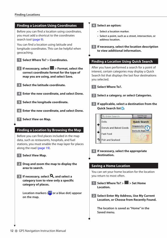
Finding a Location Using Quick Search
After you have performed a search for a point of interest, certain categories may display a Quick Search list that displays the last four destinations you selected.
1 Select Where To?.
2 Select a category, or select Categories.
3 If applicable, select a destination from the Quick Search list ➊.
➊
4 If necessary, select the appropriate destination.
Saving a Home Location
You can set your home location for the location you return to most often.
1 Select Where To? > > Set Home Location.
2 Select Enter My Address, Use My Current Location, or Choose from Recently Found.
Thelocationissavedas“Home”intheSavedmenu.
Finding Locations
English 13
Going Home
Select Where To? > Go Home.
Editing Your Home Location Information
1 Select Where To? > Saved > Home.
2 Select > > Edit.
3 Enter your changes.
4 Select Done.
Finding Recently Found Places
Your device stores the last 50 locations you have found.
1 Select Where To? > Recent.
2 Select a location.
Clearing the List of Recently Found Places
Select Where To? > Recent > > Clear > Yes.
Finding Parking
1 Select Where To? > Categories > Parking.
2 Select a parking location.
Setting a Simulated Location
If you are not receiving satellite signals, you can use the GPS to set a simulated location.
1 Select Settings > Navigation.
2 Select GPS Simulator.
3 From the main menu, select View Map.
4 Select an area on the map.
Theaddressofthelocationappearsatthebottomofthescreen.
5 Select the location description.
6 Select Set Location.
Saving a Location
1 Search for a location (page 10).
2 From the search results, select a location.
3 Select .
4 Select > Save.
5 If necessary, enter a name, and select OK.
Saving Your Current Location
1 From the map, select the vehicle icon.
2 Select Save.
3 Enter a name, and select Done.
4 Select OK.
14 GPS Navigation Instruction Manual
Finding Locations
Starting a Route to a Saved Location
1 Select Where To? > Saved.
2 If necessary, select a category, or select All Saved Places.
3 Select a location.
4 Select Go!.
Editing a Saved Location
1 Select Where To? > Saved.
2 If necessary, select a category.
3 Select a location.
4 Select .
5 Select > Edit.
6 Select an option:
• Select Name.
• Select Phone Number.
• ToassigncategoriestotheFavorite,selectCategories.
• TochangethesymbolusedtomarktheFavoriteonamap,selectChange Map Symbol.
7 Edit the information.
8 Select Done.
Assigning Categories to a Saved Location
You can add custom categories to organize your saved locations.
ڥ Categories appear in the saved locations menu after you
have saved more than 12 locations.
1 Select Where To? > Saved.
2 Select a location.
3 Select .
4 Select > Edit > Categories.
5 Enter one or more category names, separated by commas.
6 If necessary, select a suggested category.
7 Select Done.
Deleting a Saved Location
ڥ Deleted locations cannot be recovered.
1 Select Where To? > Saved.
2 Select > Delete Saved Places.
3 Select the box next to the saved locations to delete, and select Delete.
English 15
Starting a Route
1 Search for a location (page 10).
2 Select a location.
3 Select Go!.
4 If necessary, select a route.
Previewing Multiple Routes
1 Search for a location (page 10).
2 From the search results, select a location.
3 Select Routes.
4 Use the on-screen buttons to select a route.
5 Select Go!.
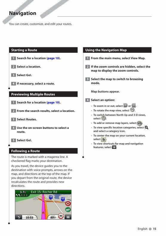
Following a Route
The route is marked with a magenta line. A checkered flag marks your destination.
As you travel, the device guides you to the destination with voice prompts, arrows on the map, and directions at the top of the map. If you depart from the original route, the device recalculates the route and provides new directions.
Using the Navigation Map
1 From the main menu, select View Map.
2 If the zoom controls are hidden, select the map to display the zoom controls.
3 Select the map to switch to browsing mode.
Mapbuttonsappear.
4 Select an option:
• Tozoominorout,select or .
• Torotatethemapview,select .
• ToswitchbetweenNorthUpand3-Dviews,select .
• Toaddorremovemaplayers,select .
• Toviewspecificlocationcategories,select andselectacategoryicon.
• Tocenterthemaponyourcurrentlocation,select .
• Toviewshortcutsformapandnavigationfeatures,select .
Navigation
You can create, customize, and edit your routes.
16 GPS Navigation Instruction Manual
Navigation
Adding a Point to a Route
1 While navigating a route, select to return to the main menu.
2 Select Where To?.
3 Search for the location (page 10)
4 Select Go!.
5 Select Add to Active Route.
Taking a Detour
While navigating a route, you can use detours to avoid obstacles ahead of you, such as construction zones.
ڥ If the route you are currently navigating is the only
reasonable option, your device might not calculate a detour.
From the map, select > Detour.
Stopping the Route
From the map, select .
Updating Speed Limits
NOTICEThe speed limit icon feature is for information only and does not replace the driver’s responsibility to abide by all posted speed limit signs and to use safe driving judgment at all times. Garmin and JVC KENWOOD will not be responsible for any traffic fines or citations that you may receive for failing to follow all applicable traffic laws and signsAn icon displaying the current speed limit may appear as you travel on major roadways.
1 From the map, select > Set Speed Limit.
2 Select and to set the speed limit.
Using Suggested Routes
Before you can use this feature, you must save at least one location and enable the travel history feature (page 13).
Using the myTrends™ feature, your device predicts your destination based on your travel history, the day of the week, and the time of day. After you have driven to a saved location several times, the location may appear in the navigation bar on the map, along with the estimated time of travel, and traffic information.
Select the navigation bar to view a suggested route to the location.
Using Exit Services
ڥ You must be on a major highway or road to use Exit
Services.
While navigating a route, you can find gas, food, lodging, and restrooms near upcoming exits.
Services are listed under tabs by category.
Gas
Food
Lodging
Restrooms
English 17
Finding Exit Services
1 From the map, select > Exit Services.
2 Use the arrows to select an upcoming exit.
3 Select an exit service tab.
4 Select a point of interest.
Navigating to an Exit
1 From the map, select > Exit Services > .
2 Select Go!.
Using Find Ahead
When upcoming exits do not have needed services, you can search farther ahead on your route.
1 While navigating a route, from the map select > Exit Services.
2 Select an exit service tab that does not have an upcoming service match.
3 Select Find Ahead.
4 Select > to see more exits.
5 Select a service.
6 Select Go!
Avoiding Road Features
1 Select Settings > Navigation > Avoidances.
2 Select the road features to avoid on your routes, and select Save.
Adding a Custom Avoidance Area
Custom avoidances allow you to avoid specific areas and sections of road. You can enable and disable custom avoidances as needed.
1 Select Settings > Navigation > Custom Avoidances.
2 If necessary, select Add Avoidance.
3 Select Add Avoid Area.
4 Select the upper-left corner of the area to avoid, and select Next.
5 Select the lower-right corner of the area to avoid, and select Next.
Theselectedareaisshadedonthemap.
6 Select Done.
Avoiding a Road
1 Select Settings > Navigation > Custom Avoidances.
2 Select Add Avoid Road.
3 Select the starting point of the section of road to avoid, and select Next.
4 Select the ending point of the road section, and select Next.
5 Select Done.
Disabling a Custom Avoidance
You can disable a custom avoidance without deleting it.
1 Select Settings > Navigation > Custom Avoidances.
2 Select an avoidance.
3 Select > Disable.
18 GPS Navigation Instruction Manual
Navigation
Deleting Custom Avoidances
1 Select Settings > Navigation > Custom Avoidances.
2 Select an option:
• Todeleteallcustomavoidances,select .
• Todeleteonecustomavoidance,selecttheavoidance,andselect >Delete.
Enabling Advanced Detours
Select Settings > Navigation > Advanced Detours.
Taking a Detour Around Specified Areas
You can take a detour for a specified distance along your route or detour around specific roads. This is useful if you encounter construction zones, closed roads, or poor road conditions.
1 Select a destination, and select Go! (page 10).
2 From the map, select > Detour
3 Select Next .5km on Route, Next 2km on Route, Next 5km on Route, or Detour by Road(s) on Route.
4 If necessary, select a road to detour around.
Navigating Off Road
If you are not following roadways as you navigate, you can use Off Road mode.
1 Select Settings > Navigation.
2 Select Calculation Mode > Off Road > Save.
Theroutewillbecalculatedasastraightlinetothelocation.
English 19
The Map Pages
You can customize which data appear on the map and view upcoming turns and current location information.
Customizing the Map Layers
You can customize which data appear on the map, such as icons for points of interest and road conditions.
1 From the map, select .
2 Select Map Layers.
3 Select which layers you want to include on the map, and select Save.
Viewing the Trip Log
Your device keeps a trip log, which is a record of the path you have traveled.
1 Select Settings > Map & Vehicle > Map Layers.
2 Select the Trip Log check box.
Changing the Map Data Field
1 From the map, select the data field in the lower left-hand corner.
2 Select a type of data to display.
3 Select Save.
Changing the Map Perspective
1 Select Settings > Map & Vehicle > Driving Map View.
2 Select an option:
• SelectTrack Up todisplaythemapintwodimensions(2-D),withyourdirectionoftravelatthetop.
• SelectNorth Up todisplaythemapin2-DwithNorthatthetop.
• Select3-D todisplaythemapinthreedimensions.
Customizing Map Buttons
You can include up to three icons on the right side of the main map.
1 Select Settings > Map & Vehicle > Map Buttons.
2 Select an icon, and select OK.
3 Select .
4 Select a different icon.
Removing Buttons from the Map
You can remove all buttons from the right side of the map.
1 Select Settings > Map & Vehicle > Map Buttons.
2 Select an icon, and touch OK.
3 Select Save.
20 GPS Navigation Instruction Manual
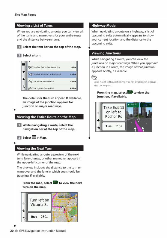
Viewing a List of Turns
When you are navigating a route, you can view all of the turns and maneuvers for your entire route and the distance between turns.
1 Select the text bar on the top of the map.
2 Select a turn.
Thedetailsfortheturnappear.Ifavailable,animageofthejunctionappearsforjunctiononmajorroadways.
Viewing the Entire Route on the Map
1 While navigating a route, select the navigation bar at the top of the map.
2 Select > Map.
Viewing the Next Turn
While navigating a route, a preview of the next turn, lane change, or other maneuver appears in the upper-left corner of the map.
The preview includes the distance to the turn or maneuver and the lane in which you should be traveling, if available.
From the map, select to view the next turn on the map.
Highway Mode
When navigating a route on a highway, a list of upcoming exits automatically appears to show your current location and the distance to the upcoming exits.
Viewing Junctions
While navigating a route, you can view the junctions on major roadways. When you approach a junction in a route, the image of that junction appears briefly, if available.
ڥ Lane Assist with junction view is not available in all map
areas or regions..
From the map, select to view the junction, if available.
The Map Pages

English 21
Viewing Trip Information
The trip information page displays your present speed and provides statistics about your trip.
From the map, select > Trip Computer.
Resetting Trip Information
1 From the map, select > Trip Computer.
2 Select > Reset All.
3 Select an option:
• Whennotnavigatingaroute,selectSelect Alltoreseteverydatafield,exceptthespeedometer,onthepage.
• SelectReset Trip Datatoresettheinformationonthetripcomputer.
• SelectReset Max. Speed toresetthemaximumspeed.
• SelectReset Trip B toresettheodometer.
Viewing Current Location Information
You can use the Where Am I? page to view information about your current location. This feature is helpful if you need to tell emergency personnel your location.
From the map, select > Where Am I?.
Finding Nearby Services
You can use the Where Am I? page to find nearby services, such as hospitals or police stations.
1 From the map, select > Where Am I?.
2 Select a category.
Directions to Your Current Location
If you need to tell another person how to get to your current location, your device can give you a list of directions.
Select Apps > Where Am I? > > Directions to Me.
22 GPS Navigation Instruction Manual
The Apps on your navigation system provide access to weather, trip planning, fuel reports, and more. Smartphone Link Is not be available in all areas, countries, or regions.
About Smartphone Link
Smartphone Link is a phone application that allows your navigation system to download live data using your phone data connection. Your system transfers data from Smartphone Link using Bluetooth wireless technology.
Connecting to Smartphone Link provides access to Garmin Live Services. Garmin Live Services provides free and subscription-based plans to view live data on your device, such as traffic data, weather, and fuel prices.
Saved locations and recently found locations are synchronized with your phone each time your navigation system connects to Smartphone Link.
Downloading Smartphone Link
Smartphone Link supports phones running Android™ operating system version 2.1 or newer.
Download Smartphone Link from the application market on your supported phone. See your phone owner's manual for information on downloading and installing applications.
Connecting to Smartphone Link
Before you can connect to Smartphone Link, you must download and install the Smartphone Link application on your phone.
1 Start Smartphone Link on your phone.
2 See your other Kenwood system manuals and your phone owner's manual for connection information.
appears in the status bar on your device when Smartphone Link is connected.
Sending a Location from Your Phone
Smartphone Link is registered as a navigation application on your phone.
1 From your phone, select the button to start navigating to a location (see the owner's manual for your phone).
2 Select Smartphone Link from the application menu.
Thenexttimeyouconnectyourdevicetoyourphone,thelocationistransferredtotherecentlyfounditemsonyourdevice.
Disabling Calls While Connected
While the device is connected to the phone and receiving Garmin Live Services, you can disable hands-free calling.
1 Select Apps > Smartphone Link.
2 Select your phone.
3 Clear the Hands-Free Calling check box.
Using the Apps
English 23
About Garmin Live Services
ڥ Smartphone Link supports phones running Android
operating system version 2.1 or newer.
Before you can use Garmin Live Services, your device must be connected to a supported phone running Smartphone Link (page 22).
Connecting to Smartphone Link provides access to Garmin Live Services. Garmin Live Services provide free and subscription-based plans to view live data on your device, such as traffic data, weather and fuel prices.
Features that require access to Garmin Live Services display the Smartphone Link symbol and appear only when the device is connected to Smartphone Link.
Subscribing to Garmin Live Services
You must subscribe to Garmin Live Services using the Smartphone Link app on your phone.
1 Start the Smartphone Link app on your phone (page 22).
2 Select Garmin Live Services.
Alistofservicesandsubscriptionpricesappears.
3 Select a service.
4 Select the price.
5 Select Subscribe.
6 Follow the on-screen instructions.
About ecoRoute
The ecoRoute™ feature calculates your vehicle fuel economy, carbon footprint, and the fuel price of navigating to a destination, and offers tools for improving fuel efficiency.
The data provided by the ecoRoute feature is only an estimate. The data is not actually read from your vehicle. To receive more-accurate fuel reports for your specific vehicle and driving habits, calibrate the fuel economy.
Creating a Vehicle Profile
The vehicle profile provides a basis for ecoRoute to calculate your vehicle fuel economy.
1 Select Apps > ecoRoute™.
2 Enter the required information, and select Next.
3 Select Done.
Resetting Your Vehicle Profile
1 Select Apps > ecoRoute™ > Vehicle Profile.
2 Select Reset.
Calibrating Fuel Economy
Use this feature when you refuel to maintain an accurate fuel economy.
1 Select Apps > ecoRoute™ > At the Pump.
2 Enter the current fuel price.
3 Enter how much fuel your vehicle has used since the last fill up.
4 Enter the distance you have traveled since the last fill up.
5 Select Next.
24 GPS Navigation Instruction Manual
Taking the ecoChallenge
The ecoChallenge helps you maximize your fuel economy by scoring your driving habits. The higher your ecoChallenge scores, the more fuel you save. The ecoChallenge collects data and calculates a score whenever you are moving.
The ecoChallenge icon displays your current score on the map.
Select Apps > ecoRoute™ > ecoChallenge.
ڥ To view detailed ecoChallenge scores, select the icon.
The leaf color on the driving challenge icon changes depending on your performance in the challenge.
About ecoChallenge Scores• Overall—a combination of the speed, acceleration, and
braking score.
• Speed—gain points for driving at your vehicle optimal speed for conserving fuel (45–60 mph for most vehicles).
• Acceleration—gain points for smooth acceleration; lose points for rapid acceleration.
• Braking—gain points for smooth braking; lose points for hard braking.
Hiding Your ecoChallenge Score
1 Select Settings > Map & Vehicle > Map Buttons.
2 Select .
3 Select OK.
Resetting Your Score
You can restart your current ecoChallenge.
1 Select Apps > ecoRoute > ecoChallenge.
2 Select > Reset.
3 Select Yes.
Viewing Your Fuel Economy
1 Select Apps > ecoRoute™ > Fuel Economy.
The graph along the bottom shows your average fuel economy for a period of driving time.
2 Select a section of the graph to zoom in.
3 Select Reset to clear the fuel economy data.
About the Mileage Report
A mileage report tracks the distance, the time, the average fuel economy, and the fuel cost of navigating to a destination.
A mileage report is created for every route that you drive. If you stop a route on the device, a mileage report is created for the distance you traveled.
Mileage reports are created automatically when you stop or complete routes.
Viewing a Mileage Report
You can view the 20 most-recent mileage reports.
1 Select Apps > ecoRoute™ > Mileage Report.
2 Select a report.
Toresetallreportdata,selectReset.
Using the Apps
English 25
Exporting a Mileage Report
1 Connect a USB mass storage device to your Kenwood unit.
2 Select Apps > ecoRoute™ > Mileage Report.
3 Select Export to export and save the reports to the USB mass storage device.
Setting Routes that Use Less Fuel
1 Select Settings > Navigation > Calculation Mode.
2 Select Less Fuel.
Viewing myGarmin Messages
Before you can use this feature, your device must be connected to a supported phone running Smartphone Link (page 22). This feature is not available in all areas.
You can view messages from myGarmin, such as notifications for software and map updates.
1 Select Apps > myGarmin.
Ifyouhaveunreadmessages,thenumberofunreadmessagesappearsonthemyGarminicon.
2 Select a message subject.
Thefullmessageappears.
Planning a Trip
You can use the trip planner to create and save a trip with multiple destinations.
1 Select Apps > Trip Planner.
2 Select New Trip.
3 Select Select Start Location.
4 Search for a location (page 10).
5 Select Select.
6 To add additional locations, select .
7 Select Next.
8 Enter a name, and select Done.
26 GPS Navigation Instruction Manual
Using the Apps
Editing a Trip Itinerary
1 Select Apps > Trip Planner.
2 Select a saved trip.
3 Select an option:
• Tochangethearrivalordeparturetime,selectalocationinthetrip.
• Torecordhowlongyouwillstayatalocation,selectalocationinthetrip,andselectDuration.
• Toviewthetriponthemap,selectMap.
Navigating to a Saved Trip
1 Select Apps > Trip Planner.
2 Select a saved trip.
3 Select Go!.
4 If prompted, select a route.
Editing a Saved Trip
1 Select Apps > Trip Planner.
2 Select a saved trip.
3 Select .
4 Select an option:
• SelectRename Trip.
• SelectEdit Destinationstoaddanddeletelocations,ortochangetheorderoflocations.
• SelectDelete Trip.
• SelectOptimize Ordertoarrangethestopsonyourtripinthemost-efficientorder.
Viewing Previous Routes & Destinations
Before you can use this feature, you must enable the travel history feature (page 28).
You can view your previous routes and places you have stopped on the map.
Select Apps > Where I’ve Been.
Using the World Clock
1 Select Apps > World Clock.
2 If necessary, select a city, enter a city name, and select Done.
Viewing the World Map
Select Apps > World Clock > .
Nighttimehoursappearintheshadedareaofthemap.
English 27
Customizing the Settings
You can customize the settings of your GPS navigation system.
Customizing the Navigation System
1 Select Settings.
2 Select a setting category.
3 Select the setting to change it.
Changing the Map Settings
Select Settings > Map & Vehicle.
• Vehicle—select Change to change the icon used to display your position on the map. Select the icon you want to use, and select Save.
• Driving Map View—select a map perspective.
• Map Detail—adjust the amount of detail shown on the map. More detail may cause the map to redraw slower.
• Map theme—changes the color of the map data.
• Map Buttons: Sets which icons are included on the map. Up to three icons can be included on the map.
• Map Layers: Sets the data that appears on the map.
• Dashboards: Sets the map dashboard layout.
• myMaps: Sets which installed maps the device uses.
Enabling Maps
1 Select Settings > Map & Vehicle > myMaps.
2 Select a map.
Changing the Navigation Settings
Select Settings > Navigation.
• Calculation Mode—sets route preference.
• Avoidances—sets road features to avoid on a route.
• Custom Avoidances—allows you to avoid specific roads or areas.
• Advanced Detours—sets the length of a detour.
• Safe Mode—disables all functions that require significant operator attention and could become a distraction while driving.
• GPS Simulator—stops the device from receiving a GPS signal, and saves battery power.
Adjusting the Display Settings
Select Settings > Display.
• Color Mode—select Day for a light background, Night for a dark background, or Auto to automatically switch between the two.
Route Preferences
Select Settings > Navigation > Calculation Mode.
The route calculation is based on road speeds and vehicle acceleration data for a given route.• Faster Time—calculates routes that are faster to drive
but can be longer in distance.
• Shorter Distance—calculates routes that are shorter in distance but can take more time to drive.
• Less Fuel—calculates routes that could use less fuel than other routes.
• Off Road—calculates a direct line from your location to your destination.
28 GPS Navigation Instruction Manual
Customizing the Settings
Updating the Time Settings
Select Settings > Units & Time.
• Current Time—select Automatic to update the time automatically. When Automatic is not selected, you can adjust the time in 15-minute increments.
• Time Format—select a 12-hour, 24-hour, or UTC time format.
• Units—sets the unit of measure used for distances.
Setting the Languages
Select Settings > Language & Keyboard.
• Voice Language—select a voice for the voice prompts.
• Keyboard Language—sets the language for your keyboard.
• Keyboard Layout—sets the keyboard layout.
Adding Security
Select Settings > Navigation > Safe Mode.
• Safe Mode—turn safe mode on or off. When your vehicle is moving, safe mode disables all functions that require significant operator attention and could become a distraction while driving.
Device and Privacy Settings
Select Settings > Device.
• About — displays the software version number, the unit ID number, and information on several other software features.
ڥ You need this information when you update the system
software or purchase additional map data (page 29).
• Travel History — allows the device to record information for the myTrends (page 16), Where I’ve Been (page 26) and Trip Log features.
• Clear Travel History—clears all travel history for the myTrends (page 16), Where I’ve Been (page 26) and Trip Log features.
Restoring Settings
You can restore a category of settings or all settings to the factory default values.
1 Select Settings.
2 If necessary, select a settings category.
3 Select > Restore.
English 29
Appendix
This appendix provides additional information about your navigation system, such as how to update the software and map data.
Updating the Software
To update the navigation system software, you must have a USB mass storage device and an Internet connection.
1 Go to www.garmin.com/Kenwood.
2 Find your model and select Software Updates > Download.
3 Read and accept the terms of the Software License Agreement.
4 Follow the instructions on the Web site to complete the installation of the software update.
Updating the Map Data
You can purchase updated map data from Garmin or ask your Kenwood dealer or Kenwood service center for details.
1 Go to www.garmin.com/Kenwood.
2 Select Order Map Updates for your Kenwood unit.
3 Follow the Web site instructions to update your map.
Safety Cameras
WARNINGGarmin and JVC KENWOOD are not responsible for the accuracy of, or the consequences of using, a safety camera database.
Safety camera information is available in some locations. Go to http://my.garmin.com for availability. For these locations, the navigation system includes the locations of hundreds of safety cameras. Your navigation system alerts you when you are approaching a safety camera and can warn you if you are driving too fast. The data is updated at least weekly, so you always have access to the most up-to-date information.
You can purchase a new region or extend an existing subscription at any time. Each region that you purchase has an expiration date.
30 GPS Navigation Instruction Manual
Appendix
Custom POIs (Points of Interest)
You can manually load custom points of interest (POI) databases, available from various companies on the Internet. Some custom POI databases contain alert information for points such as safety cameras and school zones. The navigation system can notify you when you approach one of these points. You are responsible for ensuring that your use of safety camera information is lawful in your area.
WARNINGGarmin and JVC KENWOOD are not responsible for the consequences of using custom POI databases, or for the accuracy of custom POI databases.
After downloading your POI database, use the Garmin POI Loader to install the POIs onto a USB mass storage device. Use the USB mass storage device to load the POIs. The POI Loader is available at www.garmin.com/products/poiloader. Refer to the POI Loader Help file for more information; click Help to open the Help file.
ڥ Each time you load custom POIs to the navigation
system, any other custom POIs already saved in the system will be overwritten.
Finding Custom POIs
1 Select Where To? > Categories > Custom POIs.
2 Select a category.

English 31
For the latest free software updates (excluding map data) throughout the life of your Garmin products, visit the Garmin Web site at www.garmin.com/Kenwood.
© 2012 Garmin Ltd. or its subsidiaries
Garmin International, Inc. 1200 East 151st Street, Olathe, Kansas 66062, USA
Garmin (Europe) Ltd. Liberty House, Hounsdown Business Park, Southampton, Hampshire, SO40 9LR, UK
Garmin Corporation No. 68, Zhangshu 2nd Road, Xizhi Dist., New Taipei City, 221, Taiwan (R.O.C.)
www.garmin.com
Part Number 190-01570-02_0A
Garmin® and the Garmin logo are trademarks of Garmin Ltd. or its subsidiaries, registered in the USA and other countries. ecoRoute™, myTrends™, and trafficTrends™ are trademarks of Garmin Ltd. or its subsidiaries. These trademarks may not be used without the express permission of Garmin. NAVTEQ® is a trademark of NAVTEQ Inc. or its affiliates and is registered in one or more countries, including the U.S. The Bluetooth® word mark and logos are owned by the Bluetooth SIG, Inc. and any use of such marks by Garmin is under license. Android is a trademark of Google Inc. All other company names and trademarks mentioned or referenced in this documentation are the properties of their respective owners. All rights reserved.