Embed Size (px)
Citation preview
GPS & MAGNETOMETERS
• We recognize the requirement for GPS navigation in the field
• To be competitive we have initiated a software development program to utilize inexpensive hand-held GPS systems
• This talk will discuss our new developments and show results
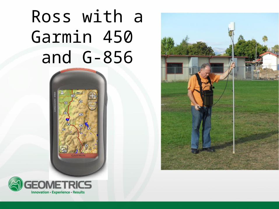
Ross with a Garmin 450 and G-856
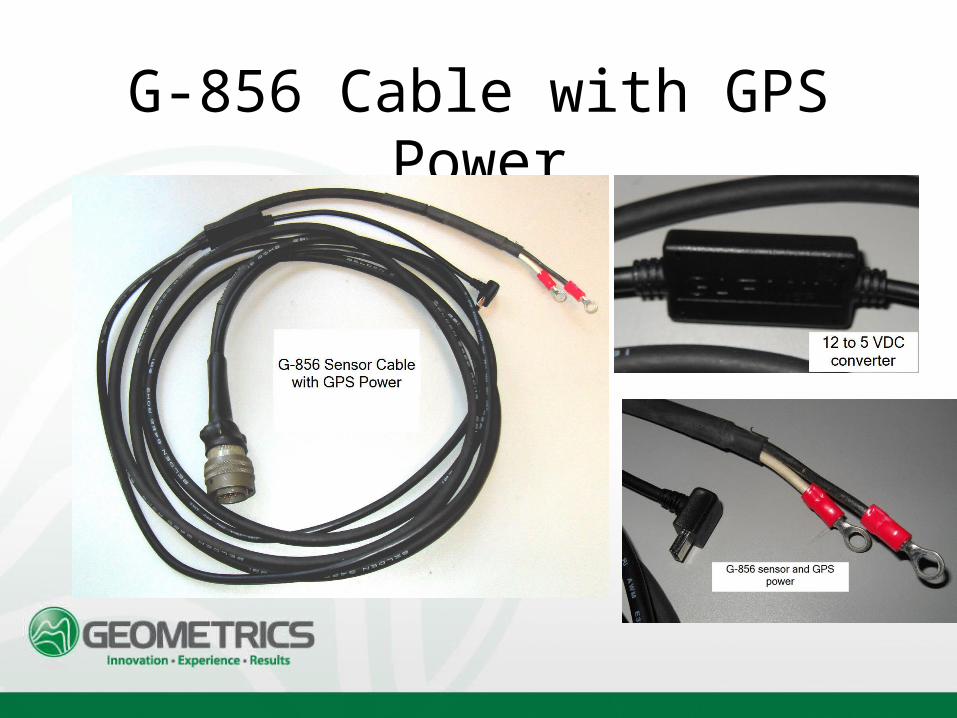
G-856 Cable with GPS Power
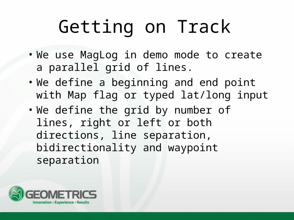
Getting on Track
• We use MagLog in demo mode to create a parallel grid of lines.
• We define a beginning and end point with Map flag or typed lat/long input
• We define the grid by number of lines, right or left or both directions, line separation, bidirectionality and waypoint separation
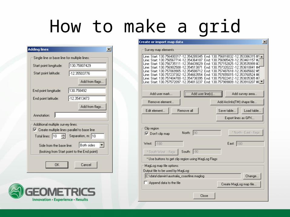
How to make a grid
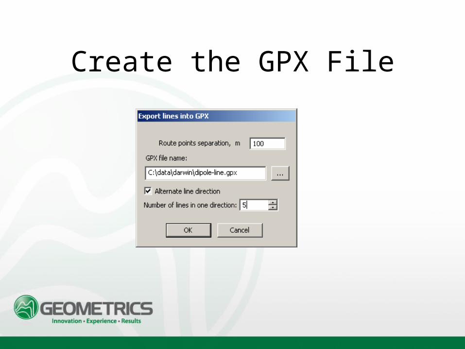
Create the GPX File
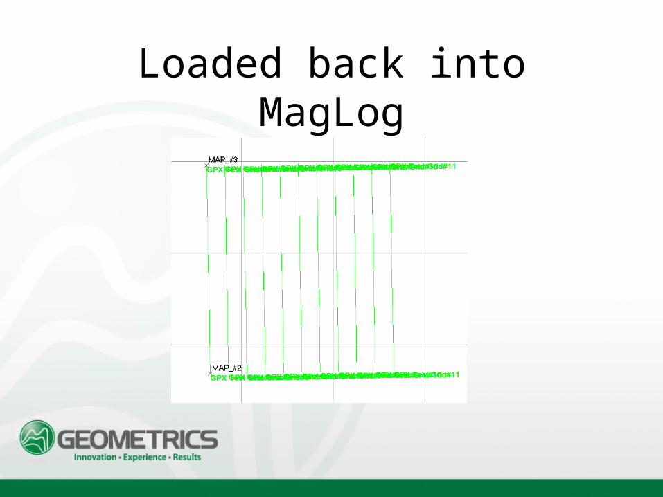
Loaded back into MagLog
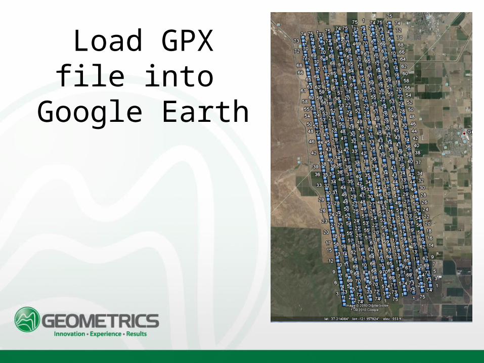
Load GPX file into
Google Earth
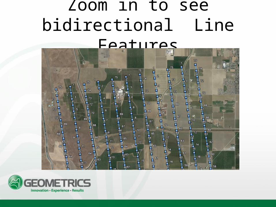
Zoom in to see bidirectional Line
Features
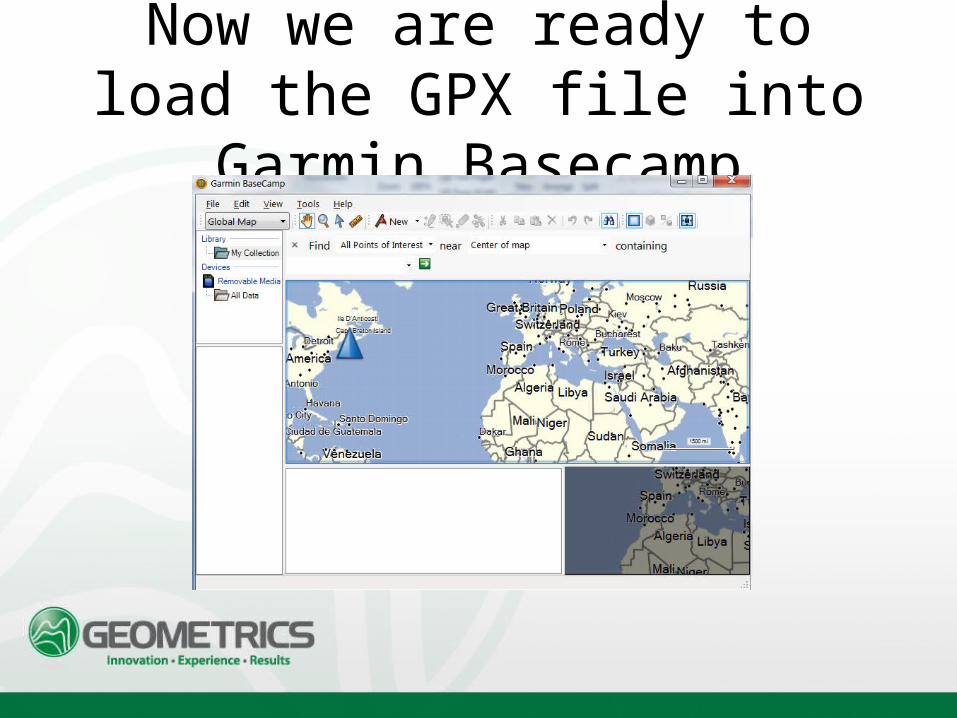
Now we are ready to load the GPX file into Garmin
Basecamp
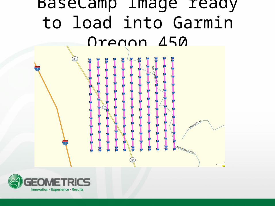
BaseCamp Image ready to load into Garmin Oregon
450
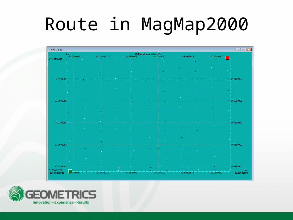
Route in MagMap2000
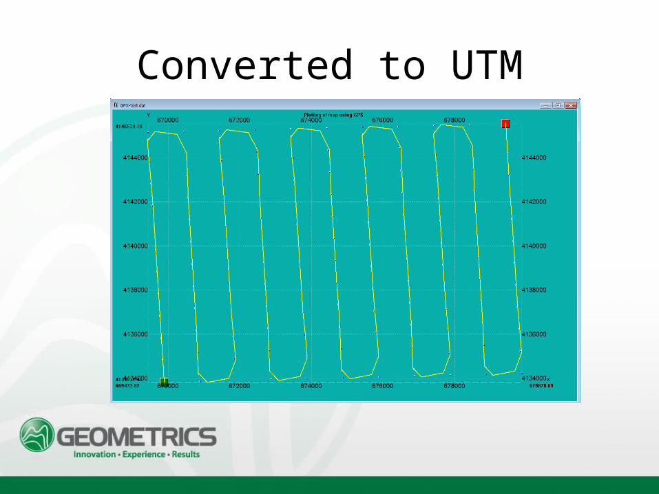
Converted to UTM
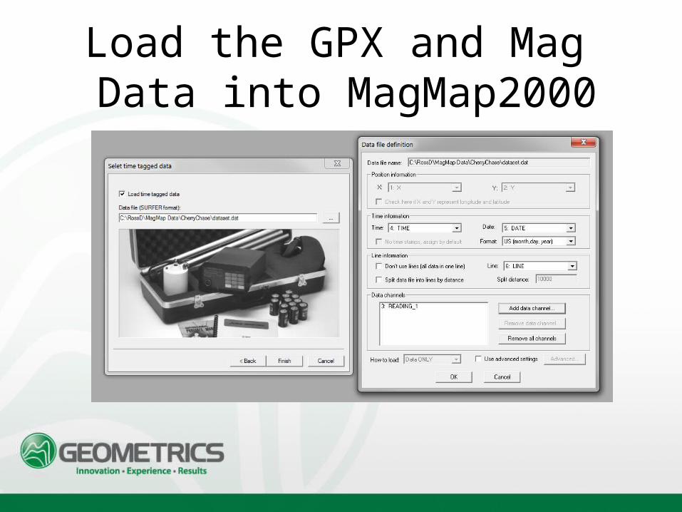
Load the GPX and Mag Data into MagMap2000
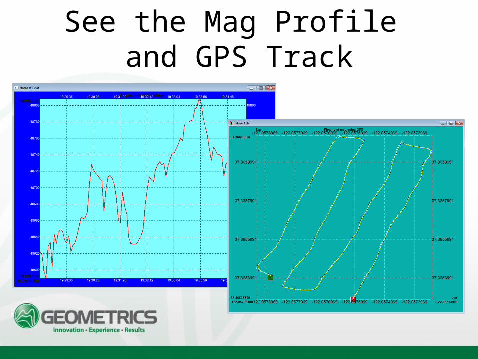
See the Mag Profile and GPS Track
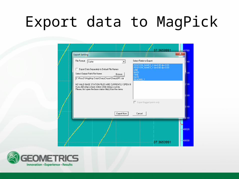
Export data to MagPick
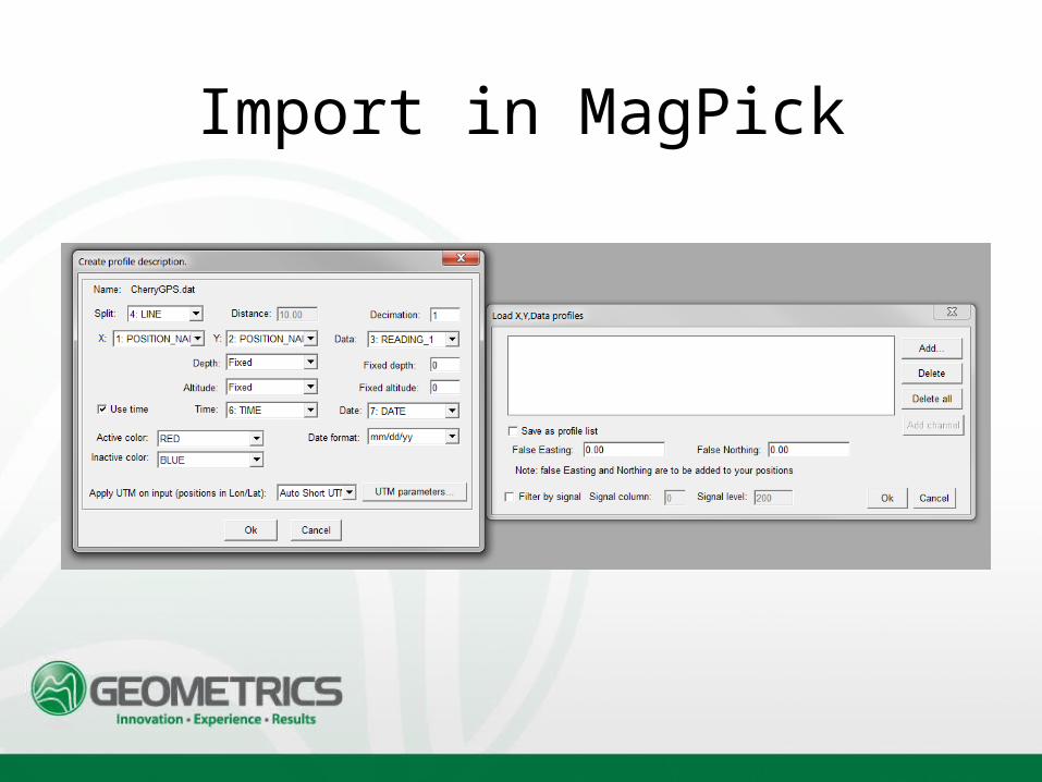
Import in MagPick
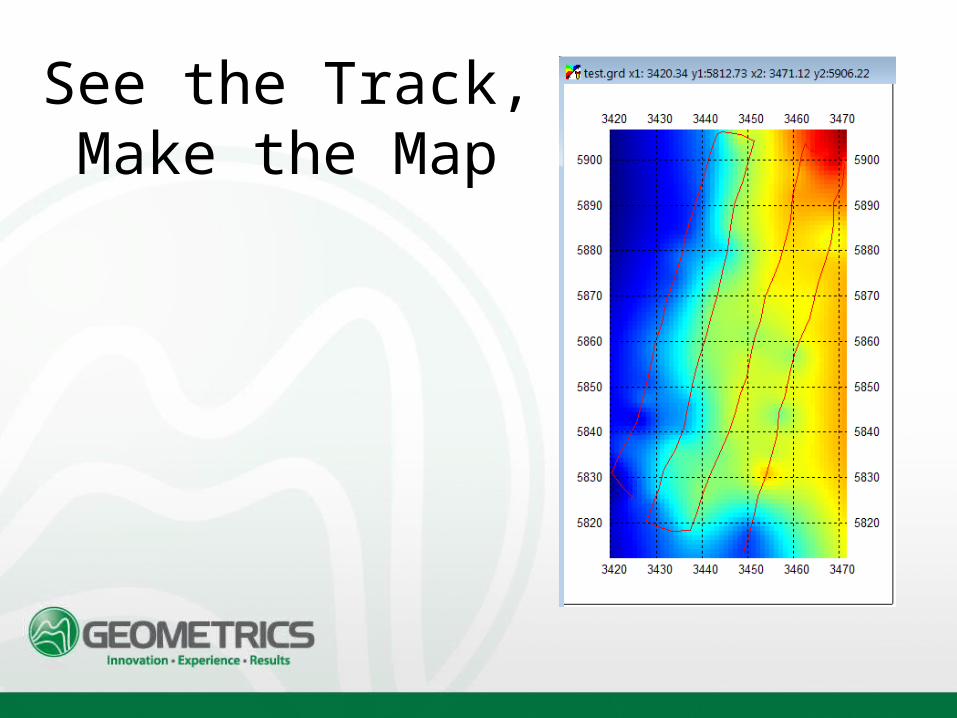
See the Track, Make the Map
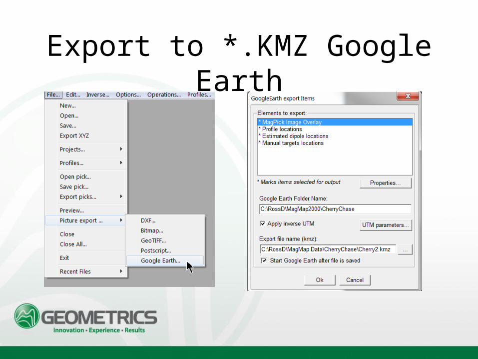
Export to *.KMZ Google Earth
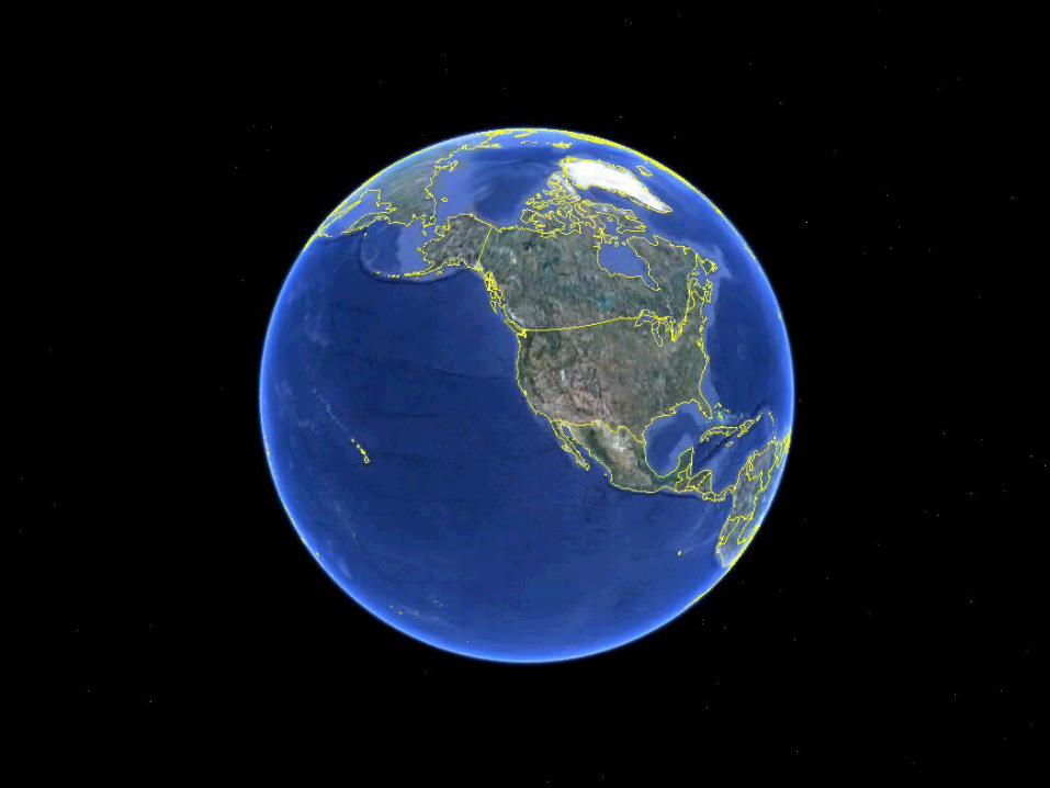
Load Positions and Data into Google Earth
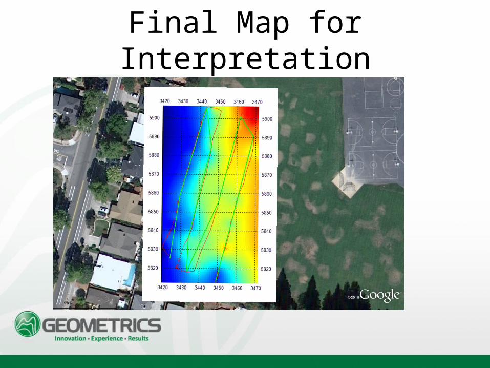
Final Map for Interpretation