Embed Size (px)
Citation preview
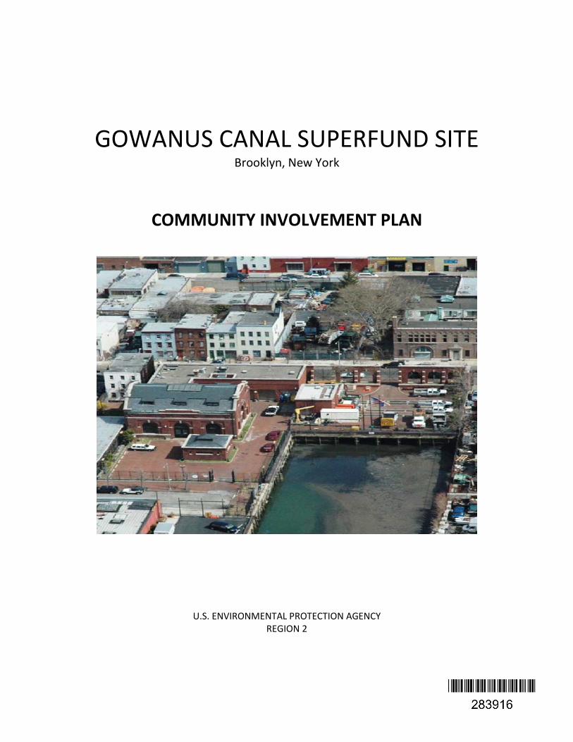
GOWANUS CANAL SUPERFUND SITE Brooklyn, New York
COMMUNITY INVOLVEMENT PLAN
U.S. ENVIRONMENTAL PROTECTION AGENCY
REGION 2
Table of Contents Section 1: Overview of the Community Involvement Plan 4
Gowanus Canal Superfund site map 5
Section 2: Site Description
Location 6
Early History 6
Site History From 1867 to 2010 7
Site Contamination 9
Section 3: Community Profile
Population 10
Neighborhoods
Red Hook 10
Carroll Gardens 10
Park Slope 10
Cobble Hill 11
Gowanus 11
Environmental Justice 11
Section 4: Community Issues and Concerns
Environmental 13
Human Health 13
Land Use and Development 14
Archeological Preservation 15
Population Growth 15
Technical Information 15
Employment 15
Environmental Justice 15
Section 5: Community Involvement Action Plan
Fact Sheets, handouts and flyers 17
Community Meetings 18
Web Site 18
Information Repository and Administrative Record 18
Mailing List 18
E-mail Group 18
Proposed Plan 19
Responsiveness Summary for the Proposed Plan Comment Period 19
Comment Periods 19
Public Notices 19
Press Releases/Media contacts 19
Technical Documents 19
Technical Assistance Grant (TAG) 20
3
Table of Contents (continued)
Community Advisory Group (CAG) 21
Social Media 21
Appendix A EPA Regional Contacts 22
Appendix B Federal Contacts 23
Appendix C State Elected Officals 24
Appendix D New York City Officals 25
Appendix E Information Repositories and EPA Web Information 26
Appendix F Media Contacts 27
4
Section 1: Overview of the Community Involvement Plan
EPA developed this Community Involvement Plan to facilitate two-way communication between the community surrounding the Gowanus Canal Superfund Site and the Environmental Protection Agency (EPA), as well as to encourage community involvement in site activities. EPA will utilize the community involvement activities outlined in this plan to ensure that residents are continuously informed and provided opportunities to be involved. This Community Involvement Plan addresses the Gowanus Canal’s relationship to the community and EPA, provides a background of the community, presents EPA’s community involvement program, and provides a listing of resources available. EPA drew upon several information sources to develop this plan, including communicating with community members and site files. EPA’s Regional Office will oversee the implementation of the community involvement activities outlined in this Plan.

5
Gowanus Canal Superfund Site Map
6
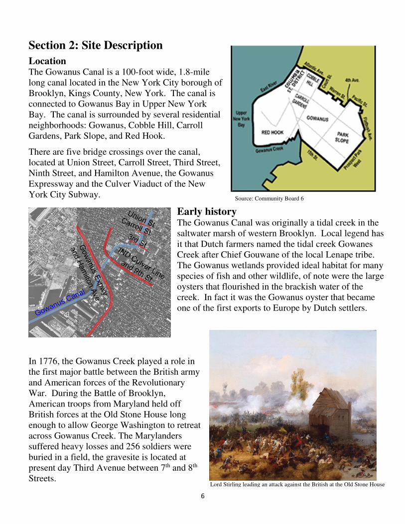
Section 2: Site Description
Location The Gowanus Canal is a 100-foot wide, 1.8-mile long canal located in the New York City borough of Brooklyn, Kings County, New York. The canal is connected to Gowanus Bay in Upper New York Bay. The canal is surrounded by several residential neighborhoods: Gowanus, Cobble Hill, Carroll Gardens, Park Slope, and Red Hook.
There are five bridge crossings over the canal, located at Union Street, Carroll Street, Third Street, Ninth Street, and Hamilton Avenue, the Gowanus Expressway and the Culver Viaduct of the New York City Subway.
Early history The Gowanus Canal was originally a tidal creek in the saltwater marsh of western Brooklyn. Local legend has it that Dutch farmers named the tidal creek Gowanes Creek after Chief Gouwane of the local Lenape tribe. The Gowanus wetlands provided ideal habitat for many species of fish and other wildlife, of note were the large oysters that flourished in the brackish water of the creek. In fact it was the Gowanus oyster that became one of the first exports to Europe by Dutch settlers.
In 1776, the Gowanus Creek played a role in the first major battle between the British army and American forces of the Revolutionary War. During the Battle of Brooklyn, American troops from Maryland held off British forces at the Old Stone House long enough to allow George Washington to retreat across Gowanus Creek. The Marylanders suffered heavy losses and 256 soldiers were buried in a field, the gravesite is located at present day Third Avenue between 7th and 8th Streets.
Lord Stirling leading an attack against the British at the Old Stone House
Source: Community Board 6

7
Site History from 1867 to 2010
By the mid 1800’s the City of Brooklyn had become the third largest city in America. Starting in 1867, the Gowanus Canal was bulk-headed and dredged in order to create a passageway that would allow access for industrial needs. The canal was completed in 1869, it soon became one of the nation’s busiest waterways, supporting manufactured gas plants (MGPs), paint and ink factories, coal yards, cement makers, soap makers, tanneries, machine shops, chemical plants, and oil refineries.
Untreated industrial wastes, raw sewage, and surface water emptied into the canal and continued for decades
resulting in the canal becoming one of New York’s most polluted waterways. Although much of the industrial activity along the canal has stopped, high contaminant levels remain in the sediments. Despite this pollution, some city inhabitants still use the 100-foot-wide, 1.8 mile long canal for recreation, such as canoeing and diving, while others catch fish at the Canal for recreation and consumption.
Gowauns Canal built in 1869 over the original tidal estuary
1766 map of Brooklyn showing original footprint of the Gowanus
8
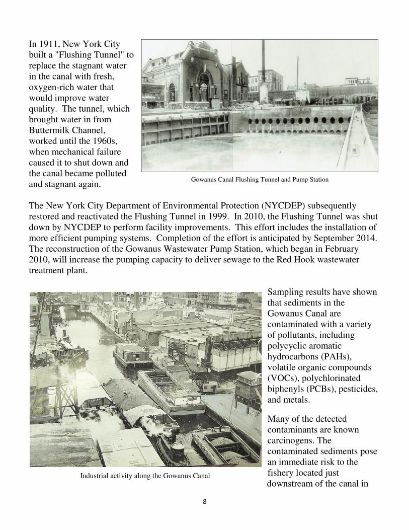
Gowanus Canal Flushing Tunnel and Pump Station
Heavy industrial usage of the Gowanus Canal
In 1911, New York City built a "Flushing Tunnel" to replace the stagnant water in the canal with fresh, oxygen-rich water that would improve water quality. The tunnel, which brought water in from Buttermilk Channel, worked until the 1960s, when mechanical failure caused it to shut down and the canal became polluted and stagnant again. The New York City Department of Environmental Protection (NYCDEP) subsequently restored and reactivated the Flushing Tunnel in 1999. In 2010, the Flushing Tunnel was shut down by NYCDEP to perform facility improvements. This effort includes the installation of more efficient pumping systems. Completion of the effort is anticipated by September 2014. The reconstruction of the Gowanus Wastewater Pump Station, which began in February 2010, will increase the pumping capacity to deliver sewage to the Red Hook wastewater treatment plant.
Sampling results have shown that sediments in the Gowanus Canal are contaminated with a variety of pollutants, including polycyclic aromatic hydrocarbons (PAHs), volatile organic compounds (VOCs), polychlorinated biphenyls (PCBs), pesticides, and metals.
Many of the detected contaminants are known carcinogens. The contaminated sediments pose an immediate risk to the fishery located just downstream of the canal in
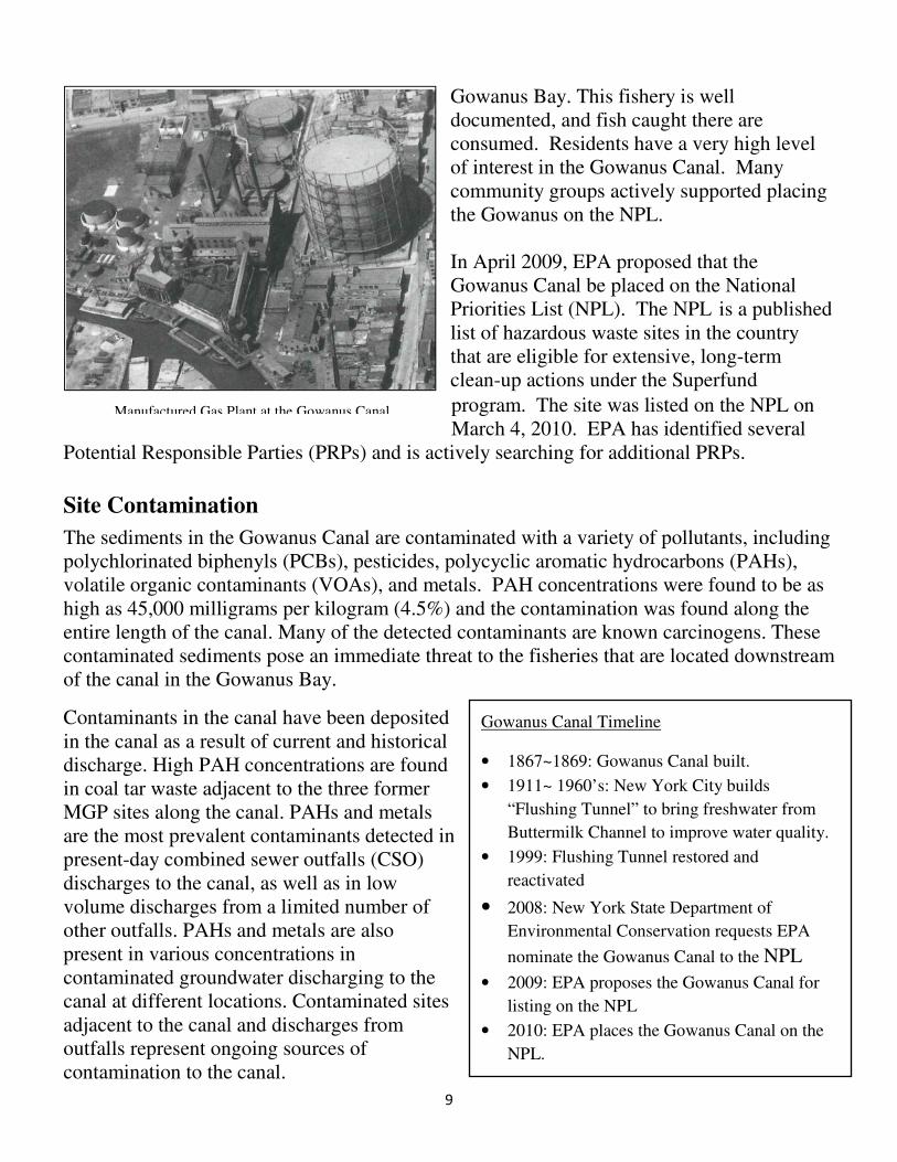
Industrial activity along the Gowanus Canal
9
Gowanus Bay. This fishery is well documented, and fish caught there are consumed. Residents have a very high level of interest in the Gowanus Canal. Many community groups actively supported placing the Gowanus on the NPL. In April 2009, EPA proposed that the Gowanus Canal be placed on the National Priorities List (NPL). The NPL is a published list of hazardous waste sites in the country that are eligible for extensive, long-term clean-up actions under the Superfund
program. The site was listed on the NPL on March 4, 2010. EPA has identified several
Potential Responsible Parties (PRPs) and is actively searching for additional PRPs.
Site Contamination
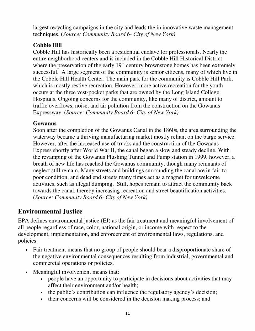
The sediments in the Gowanus Canal are contaminated with a variety of pollutants, including polychlorinated biphenyls (PCBs), pesticides, polycyclic aromatic hydrocarbons (PAHs), volatile organic contaminants (VOAs), and metals. PAH concentrations were found to be as high as 45,000 milligrams per kilogram (4.5%) and the contamination was found along the entire length of the canal. Many of the detected contaminants are known carcinogens. These contaminated sediments pose an immediate threat to the fisheries that are located downstream of the canal in the Gowanus Bay.
Contaminants in the canal have been deposited in the canal as a result of current and historical discharge. High PAH concentrations are found in coal tar waste adjacent to the three former MGP sites along the canal. PAHs and metals are the most prevalent contaminants detected in present-day combined sewer outfalls (CSO) discharges to the canal, as well as in low volume discharges from a limited number of other outfalls. PAHs and metals are also present in various concentrations in contaminated groundwater discharging to the canal at different locations. Contaminated sites adjacent to the canal and discharges from outfalls represent ongoing sources of contamination to the canal.
Manufactured Gas Plant at the Gowanus Canal
Gowanus Canal Timeline
• 1867~1869: Gowanus Canal built.
• 1911~ 1960’s: New York City builds
“Flushing Tunnel” to bring freshwater from
Buttermilk Channel to improve water quality.
• 1999: Flushing Tunnel restored and
reactivated
• 2008: New York State Department of
Environmental Conservation requests EPA
nominate the Gowanus Canal to the NPL
• 2009: EPA proposes the Gowanus Canal for
listing on the NPL
• 2010: EPA places the Gowanus Canal on the
NPL.

10
Section 3: Community Profile
The Gowanus Canal Superfund site is located in Brooklyn Community District 6 (CD6), which encompasses the neighborhoods of Carroll Gardens, Cobble Hill, Columbia Street District, Gowanus, Park Slope and Red Hook.
Population Based on 2010 Census data, the New York City Department of City Planning report shows that the total population of CD6 is 104,709 residents, 47,188 households and 50,268 housing units. The percentage of the population 18 years and over was 80.4%.
Of the 47,188 households in CD6, 49% were family households, 25% had children under the age of 18 living with them and 16% were households with one or more persons 65 years and over. The average number family size was 2.93 and the average household size was 2.19.
Neighborhoods Red Hook
Red Hook is a mixed neighborhood, combining residential areas of both low and high density with light to heavy areas of industry and manufacturing zones. The community is a peninsula that is surrounded by the Gowanus Bay, Erie Basin, and Buttermilk Channel. Red Hook is traditionally known as a waterfront community and still retains much of its working class characteristics. A majority of the population lives in the Red Hook Houses (east and west clusters) that were completed in 1938 as a Federal Works Project. (Source: Community Board 6- City of New York)
Carroll Gardens
Carroll Gardens is primarily a residential community with a large Italian community, a historical remnant of the wave of Italians who immigrated in the first part of the 20th century. Carroll Gardens is bordered by the Gowanus Canal, regional transportation throughways such as the Gowanus Expressway, and Cobble Hill. Carroll Park is the main public space, recreational, and sport area for the community, which caters to both the young and adult population. Organized softball fields bocce leagues, along with community events and childcare programs can be found in the park. Recently, the community finished construction on a grassy ball field at DiMattina Park. (Source:
Community Board 6- City of New York)
Park Slope
Park Slope is the largest neighborhood of the five Community District 6 communities. Some of the nation’s best examples of brownstone homes from the late 19th century, along with Brooklyn’s largest historic district, are in Park Slope. In recent years, the neighborhood has seen a substantial increase in the number of high end retail shops, along with gourmet restaurants, along 5th and 7th avenue, in the heart of the community. Much like Carroll Gardens, the community of Park Slope has become an activist for environmental and civic causes. The community is also host to one of the
11
largest recycling campaigns in the city and leads the in innovative waste management techniques. (Source: Community Board 6- City of New York)
Cobble Hill
Cobble Hill has historically been a residential enclave for professionals. Nearly the entire neighborhood centers and is included in the Cobble Hill Historical District where the preservation of the early 19th century brownstone homes has been extremely successful. A large segment of the community is senior citizens, many of which live in the Cobble Hill Health Center. The main park for the community is Cobble Hill Park, which is mostly restive recreation. However, more active recreation for the youth occurs at the three vest-pocket parks that are owned by the Long Island College Hospitals. Ongoing concerns for the community, like many of district, amount to traffic overflows, noise, and air pollution from the construction on the Gowanus Expressway. (Source: Community Board 6- City of New York)
Gowanus
Soon after the completion of the Gowanus Canal in the 1860s, the area surrounding the waterway became a thriving manufacturing market mostly reliant on the barge service. However, after the increased use of trucks and the construction of the Gownaus Express shortly after World War II, the canal began a slow and steady decline. With the revamping of the Gowanus Flushing Tunnel and Pump station in 1999, however, a breath of new life has reached the Gowanus community, though many remnants of neglect still remain. Many streets and buildings surrounding the canal are in fair-to-poor condition, and dead end streets many times act as a magnet for unwelcome activities, such as illegal dumping. Still, hopes remain to attract the community back towards the canal, thereby increasing recreation and street beautification activities. (Source: Community Board 6- City of New York)
Environmental Justice
EPA defines environmental justice (EJ) as the fair treatment and meaningful involvement of all people regardless of race, color, national origin, or income with respect to the development, implementation, and enforcement of environmental laws, regulations, and policies.
• Fair treatment means that no group of people should bear a disproportionate share of the negative environmental consequences resulting from industrial, governmental and commercial operations or policies.
• Meaningful involvement means that: • people have an opportunity to participate in decisions about activities that may
affect their environment and/or health; • the public’s contribution can influence the regulatory agency’s decision; • their concerns will be considered in the decision making process; and
12
• the decision makers seek out and facilitate the involvement of those potentially affected
By using readily available environmental and demographic information EPA conducts EJ screening to highlight areas within a community where disproportionate environmental and health impacts may fall on a low-income and/or racial minority group. EPA’s tool for conducting this initial community characterization is called EJSCREEN. In the case of the Gowanus Canal Superfund site, EPA Region 2 examined the environmental character of the communities within 1500 meters of the site. EPA looked at the environmental impacts currently faced by communities with EJ concerns within the study area. Several environmental indicators were assessed including exposure to air pollutants, lead paint, and exposure to site related contaminants through the consumption of contaminated fish. Subsistence fishing takes place along the Columbia Street pier, in Red Hook. The consumption of fish impacted by contamination from the Gowanus Canal superfund site does add an additional environmental burden to communities with EJ concerns. Cleaning up the Gowanus Canal will greatly reduce the impact of contamination on these fish thereby lowering the environmental burden borne by subsistence fishing.

13
Section 4: Community Issues and Concerns
Residents in the communities (Gowanus, Red Hook, Carroll Gardens, Cobble Hill and Park Slope) have a wide range of knowledge about issues pertaining to the Gowanus Canal. Community concerns fell into primarily these categories: 1) Environmental, 2) Human Health, 3) Land Use and Development, 4) Archeological Preservation, 5) Population Growth 6) Technical Information, 7) Employment Opportunities and 8) Environmental Justice.
1) Environmental
The Gowanus Canal has been a highly contaminated water body in this community for several decades. Residents voiced a variety of environmental concerns regarding the canal and clean up.
• CSOs should be addressed as part of a comprehensive cleanup of the canal.
• Water quality should be included as a part of the remediation efforts.
• Any remedy implemented at the canal should ensure that recontamination does not occur as a result of CSO and upland sources.
• EPA should consider the impact of sea level rise as part of any remedy.
• A long-term goal in remediating the canal should be to make it fishable and swimmable.
• EPA should consider creating soft edges along the length of the canal thereby, creating wetlands.
• The canal should be cleaned up completely for the betterment of the environment.
• Toxins form the sediment in the canal could become worse as a result of disturbing them through remediation.
• Cleanup of the canal should not result in an inequitable distribution of the environmental burden to neighborhoods along the canal
• EPA should consider the impact of hurricanes on the implementation of the remedy.
• Residents in Red Hook expressed concerns that the sediment in the lower portion of the canal may have increased in toxicity post-Hurricane Sandy.
• Concerns were raised that placing a confined disposal facility in a flood zone could increase the risk of environmental disaster for Red Hook.
2) Human Health
The Gowanus Canal is located in a well-populated residential, mixed use and industrial section of Brooklyn. Residents bike, walk and jog across the bridges that traverse the canal at Union Street, Carroll Street, 3rd Street and 9th Street. Individuals also canoe; kayak and scuba dive in the Canal. Many individuals voiced concerns about the possible health effects from contamination in the canal.
• Residents would like EPA to conduct a health study to determine the long-term health effects of living near the canal.
14
• Concerns were expressed regarding the health impact of exposure to canal contaminants through recreational use of the canal (e.g. canoeing, kayaking diving, etc.).
• Residents indicated that they were concerned about the potential health impact of exposure to site related contaminants due to flooding.
• Concerns were expressed regarding the health impact of exposure to canal contaminants through fishing and consumption of fish.
• Residents are concerned about the potential of a higher risk of exposure to site related contaminants by living in close proximity to the canal.
• Community representatives are concerned about cancer incidence in the neighborhood and the possible link with the canal.
• Concerns were expressed about non-cancer risks that the canal could pose (e.g. hepatitis and scoliosis).
• Community residents are concerned about the impact of the clean up on air quality (odors), noise levels, and general health impacts on residents.
• Residents would like EPA to implement real time air monitoring at dewatering sites and to make this information available to the public.
• Concerns were expressed about the health and environmental impacts of siting a confined disposal facility adjacent to the Red Hook ball fields.
3) Land Use and Development
Many various properties abut the canal; the majority are industrial, commercial and manufacturing. However, several lots along the canal have been re-classified as residential and further development along the canal and adjoining areas is expected.
• There was concern that the length of time it would take to remediate the canal would have a negative impact on development along the canal.
• Residents were concerned about the impact of the upland development on any remedy EPA implements at the Canal.
• Concerns were expressed that lenders might become reluctant to provide funding for purchases or renovations of properties near the canal due to remediation efforts.
• Placing the Gowanus Canal on the superfund list would have a negative impact on property values.
• Concerns were expressed that cleanup of the canal should take place before development should move forward.
• Concerns were expressed that cleaning the canal would result in increased residential development along the canal.
• There are fears that cleaning the canal would result in displacing industrial/commercial businesses from Gowanus and relocating them in Red Hook.
• Concerns were expressed about how development along the canal could impact the implementation of the cleanup plan.
15
• Concerns were expressed that constructing a CDF or dewatering facility at the Gowanus Bay Terminal site could have a negative impact on the community’s ability to implement flood mitigation.
4) Archeological Preservation
The New York State Historic Preservation Office found the Gowanus Canal Historic District eligible for the National Register of Historic Places in 2006.
• Concerns were expressed about the impact of remediation of the canal on existing archeological artifacts in the canal, including the original bulkheads and any potentially submerged cultural resources.
• Dredging the canal may uncover important artifacts, (possibly the lost Marylanders burial site); EPA needs to preserve these cultural resources.
5) Population Growth
The neighborhoods of Gowanus, Cobble Hill, Park Slope, Red Hook and Carroll Gardens are seeing an increase in population. Several multi-unit residential properties have been built in these communities. Many individuals expressed concerns about the increased population density and its impact on the Gowanus Canal.
• Concerns were expressed with regard to the population increase and its impact on the canal cleanup with respect to increased sewer discharge volume.
• With an increase of residential properties along the canal, EPA needs to consider the impact of the implementation of the remedy on the individuals living in close proximity to the site.
6) Technical Information
EPA is responsible for communicating complex technical information to a wide audience. Individuals expressed their position on how they would like the information to be shared.
• Complex technical principles should be (as much as possible) expressed in simple terms
• Photographs, graphic representations and visual aids should be used in technical presentations.
• EPA should consider conducting technical workshops to explain complex site related principles in an informal setting.
7) Employment
• EPA should work toward providing employment opportunities for residents during the construction of and operation of the remedy
8) Environmental Justice
• EPA’s outreach efforts should also target Communities with EJ concerns in public
16
housing
• Outreach material should be provided in other languages (Spanish, Mandarin, Russian)
• EPA should ensure equal opportunity and access to site related information
17
Section 5: Community Involvement Action Plan
This section describes the specific activities and resources that EPA will use to help the community be actively involved in the cleanup process. Whenever EPA begins work on a site, it identifies a point of contact for community questions, issues or concerns. The two primary points of contact for the Gowanus Canal are:
Christos Tsiamis
Remedial Project Manager
U.S. EPA, Region 2
290 Broadway
New York, NY 10007-1866
212-637-4257
Natalie Loney
Community Involvement Coordinator
US EPA Region 2
290 Broadway
New York, NY 10007-1866
212 637-3639 or 800 346-5009
In addition to providing an EPA representative to answer questions, EPA uses other tools and techniques to support the community’s involvement in EPA’s work.
1. Fact Sheets, handouts and flyers
Fact sheets are one of EPA’s principal methods of providing site-related information to the community. They are short (2-4 pages) documents, written in non-technical language that can be e-mailed directly to the site’s mailing list, posted on the Gowanus webpage, mailed directly to residents or provided at meetings. They often summarize larger, technical documents. They include EPA contact information and refer people to the site related webpage or site repository for more technical information. EPA will create fact sheets as events dictate or in response to community requests for specific kinds of information.
Flyers are 1-page notices that are generally used to announce meetings. EPA e-mails and/or mails flyers to the Gowanus e-mail list, posts them to the webpage, and also places them as display ads in local papers
18
2. Community Meetings
EPA holds public meetings at various milestones and at the request of the community. The public information meetings are organized to convey Site information via presentations�and discussions, and to answer questions from community members. Each meeting will be structured to fit its purpose by using different formats (e.g. town hall meetings, open houses, informal roundtables, PowerPoint presentations, etc.).
3. Web Site
EPA has created a website specifically for this Site. The website includes electronic copies of EPA’s investigation documents and will be one location for viewing the proposed cleanup plans as they are developed. EPA will update the webpage on a regular basis. The website for the Gowanus Canal is located at:
http://www.epa.gov/region2/superfund/npl/gowanus/
4. Information Repository and Administrative Record
EPA maintains a local public site file, which is called the “Information Repository.” The Information Repository contains hardcopies of major site documents, fact sheets and other relevant items. Electronic copies on compact disk are also available at the repository. EPA has established two information repositories for the Gowanus Canal Superfund site. They are located at:
Carroll Gardens Library 396 Clinton Street
Brooklyn, NY 11231
Red Hook Library 7 Wolcott St. at Dwight St.
Brooklyn, NY 11231
When EPA is ready to formally propose a cleanup action, it collects every document that was used to develop and analyze the proposed action. This collection of technical documents is called the Administrative Record, and it is placed in both information repositories.
5. Mailing List
EPA maintains a mailing list for distribution of fact sheets and meeting notices. To be added or deleted from the mailing list, contact Natalie Loney, Community Involvement Coordinator, [email protected] or call 212-637-3639.
6. E-mail Group
EPA maintains an e-mail list for electronic distribution of fact sheets, meeting notes, and periodic site updates. To be added or deleted from the mailing list, contact Natalie Loney (see above).

19
7. Proposed Plan
When EPA is ready to formally propose a cleanup plan, it creates a special document called a Proposed Plan. The Proposed Plan summarizes the contamination that has been found, compares the various ways that the contamination can be cleaned up, and identifies one preferred alternative that EPA thinks balances all considerations. This is the most important time for community input.
EPA distributes the Proposed Plan to its mailing list, holds a minimum 30-day public comment period and conducts a public meeting where the Proposed Plan is discussed and public comments are taken.
8. Responsiveness Summary for the Proposed Plan Comment Period
When EPA makes a final decision about which cleanup methods it will use, it creates a document that explains how it has addressed the public comments that were received during the comment period. This document is called a Responsiveness Summary, and it is a part of EPA’s decision document called the Record of Decision.
9. Comment Periods
EPA holds public comment period for certain documents. Sometimes the comment periods are less formal and not required, but nonetheless EPA wants to get the community’s thoughts. These comments periods may be announced in several ways, including a notice in a fact sheet, an announcement at a public meeting or through the email list.
10. Public Notices For those who are not on the site’s mailing list, EPA will announce community meetings and formal comment periods in a display advertisement in the main section of The Brooklyn Paper, Courier Life and the Red Hook Star Revue.
11. Press Releases/Media contacts
EPA will provide press releases and develop media contacts with the following newspapers: The Brooklyn Eagle, New York Times, Daily News, New York Post, Courier Post and the Red Hook Star Revue.
12. Technical Documents
Most of the community residents had environmental and health concerns. They wanted a clear picture of the contamination at the site and how EPA planned to address those areas through some cleanup effort. The answers to those many of those questions will be in the technical documents that EPA will produce as part of its investigation and cleanup process. The major documents will include a summary suitable for a general audience. EPA will also mail out a summary of some documents as a fact sheet. Below is a listing and short
20
description of those documents that will be developed over the course of the Superfund cleanup process.
• Remedial Investigation Report (RI): The overall purpose of the RI is to identify the nature and extent of contaminants, migration pathways of the contaminants, and potential threats to human and ecological receptors in the study area. The remedial investigation is usually done with the feasibility study. Together they are often referred to as the “RI/FS.”
• Cultural Resources and Historic Building Survey: A report that includes archival research, an historic building survey, and an intensive pedestrian cultural resources survey of the Superfund Site. The purpose of this report is to provide an inventory and assessment of cultural resources that might be affected by the Superfund cleanup.
• Biological Evaluation: This report contains an ecological habitat survey of the Site and a benthic invertebrate survey of the Gowanus Canal.
• Human Health Risk Assessment (HHRA): This document provides a qualitative and quantitative evaluation of the current and potential risks posed to human health by the presence of Site contaminants. Risk assessments evaluate both the carcinogenic risks and non-carcinogenic risks to human health from Site contaminants.
• Feasibility Study (FS): A report that identifies cleanup objectives and alternatives to meet those objectives, and evaluates each alternative using the first seven of EPA’s nine criteria which are: protection of human health and environment; compliance with applicable or relevant and appropriate requirements (ARARs); long-term effectiveness and permanence; reduction �of toxicity, mobility or volume through treatment; short-term effectiveness; implementability; cost; state acceptance; and community acceptance. The evaluation of State and community acceptance criteria is completed after the receipt of public comments during the 30-day comment period for the Proposed Plan.
• Record of Decision: A public document that explains which cleanup methods, actions, tools and/or techniques will be used at the Site, including the residual contamination levels (if any) and any restrictions on future land use (where waste is left in place).
• Remedial Design: The development of engineering drawings and specifications for a site cleanup. This phase follows the remedial investigation/feasibility study. A fact sheet may be distributed when the design work is at 70% complete.
15. Technical Assistance Grant (TAG)
A TAG is a federal grant awarded to an incorporated nonprofit organization of community members affected by the site. It is used to fund an environmental professional to provide an

21
independent technical review of cleanup documents. An initial grant up to $50,000 is available to help the community understand technical information about their site.
16. Community Advisory Group (CAG)
A CAG is a self-forming, self-governing stakeholder group that meets periodically, but regularly, to learn about EPA’s cleanup process, discusses their issues and concerns, and provides feedback to EPA. EPA is able to provide support to the CAG by attending the meetings, and providing technical support. (For more information on CAG’s go to: www.epa.gov/superfund/community/cag/index.htm)
A CAG has been formed at the Gowanus Canal superfund site. The Gowanus CAG has established a webpage for Gowanus related information at:
www.gowanuscag.org
In addition, CAG meeting minutes can be accessed at: www.epa.gov/region2/superfund/npl/gowanus/cag.html
17. Social Media
In addition to more traditional methods of disseminating information EPA is also using social media to share site related information with the public. As such EPA created a Gowanus Canal Group Facebook page:
www.facebook.com/groups/195975002802/
The group page serves as a way for EPA to share information with the public and for the public to raise and discuss issues related to the Gowanus Canal. In addition, the agency utilizes Twitter to announce public meetings and major milestones regarding the Gowanus Canal.
22
Appendix A
EPA Regional Contacts
Christos Tsiamis Remedial Project Manager U.S. EPA, Region 2 Tel: 212-637-4257 [email protected]
Natalie Loney Community Involvement Coordinator US EPA Region 2 290 Broadway New York, NY 10007-1866 Tel: 212 637-3639 or 800 346-5009 [email protected]
George H. Zachos Superfund Regional Public Liaison US EPA Region 2 2890 Woodbridge Ave Edison, NJ 08837 888-283-7626 or 732-321-6621 732-906-6182 [email protected]

23
Appendix B
Federal Contacts
Senator Chuck Schumer New York City Office 780 Third Avenue Suite 2301 New York, NY 10017 212-486-4430 Senator Kristen Gillibrand New York City Office 780 Third Avenue,Suite 2601 New York, New York 10017 212-688-6262 Congresswoman Nydia M. Velazquez 266 Broadway, Suite 201 Brooklyn, NY 11211 718-599-3658
24
Appendix C
State Elected Officials
New York State Senator Velmanette Montgomery 30 Third Avenue Brooklyn, NY 11217 United States 718-643-6140 New York State Assemblyman Felix Ortiz 404 55th Street Brooklyn, NY 11220 718-492-6334 New York State Assemblywoman Joan Millman 341 Smith Street Brooklyn, NY 718-246-4889 [email protected]
25
Appendix D
New York City Officials
New York City Mayor Bill deBlasio City Hall New York, NY 10007 212-NEW-YORK http://www1.nyc.gov/office-of-the-mayor/contact-the-mayor.page Brooklyn Borough President Eric Adams Brooklyn Borough Hall 209 Joralemon Street Brooklyn, New York 11201 718-802-3700 [email protected]
Council Member - Brad Lander District Office 456 5th Ave Brooklyn, NY 11215 718-499-1090 [email protected]
Council Member – Stephen Levin District Office 410 Atlantic Avenue Brooklyn, NY 11217 718-875-5200 [email protected] Council Member – Carlos Menchaca District Office 5601 5th Ave S-2 Brooklyn, NY 11220 718-439-9012 [email protected]

26
27
Appendix E
Information Repositories and EPA Web Site
Carroll Gardens Library 396 Clinton Street Brooklyn, NY 11231 Red Hook Library 7 Wolcott St. at Dwight St. Brooklyn, NY 11231
EPA- Region 2 Superfund Records Center 290 Broadway, 18th Floor New York, NY 10007
EPA Gowanus web site: www.epa.gov/region2/superfund/npl/gowanus
28
Appendix F
Media Contacts
The Brooklyn Paper One Metrotech Center, Suite 1001 Brooklyn, NY 11201 (718) 260-2500 Courier Life One Metrotech Center, Suite 1001 Brooklyn, NY 11201 (718) 260-2500 Red Hook Star-Revue 101 Union Street Brroklyn, NY 11231 (718) 624-5568