Embed Size (px)
Citation preview
Da
te:
5/5
/202
0 -
Las
t sa
ved
by:
kze
che
r -
P
ath
: Z
:\P
roje
cts\
j122
290
0\M
AP
DO
C\F
igu
res\
Fig
ure3
_S
BC
Terr
ain
.mxd
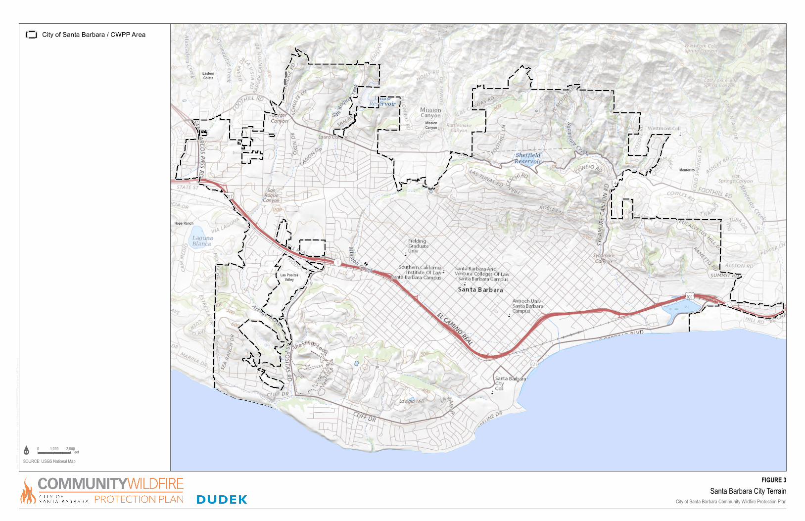
Las PositasValley
Montecito
EasternGoleta
MissionCanyon
Hope Ranch
Santa Barbara City Terrain
City of Santa Barbara Community Wildfire Protection Plan
SOURCE: USGS National Map
0 2,0001,000Feet
FIGURE 3
City of Santa Barbara / CWPP Area