Embed Size (px)
Citation preview
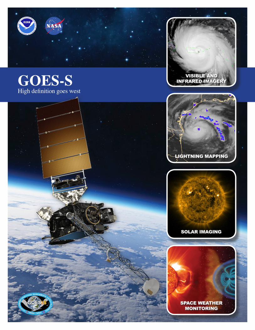
GOES-SHigh definition goes west
VISIBLE AND INFRARED IMAGERY
LIGHTNING MAPPING
SOLAR IMAGING
SPACE WEATHER MONITORING
Visual representation of a GOES-R Series satellite above Earth with a hurricane image to represent visual and infrared imagery capabilities, lightning image to show lightning mapping capabilities, a solar flare for solar imaging capabilities, and a visualization of the magnetosphere to represent space weather monitoring.
MissionNOAA’s most sophisticated Geostationary Operational Environmental Satellites (GOES), known as the GOES-R Series, provide advanced imagery and atmospheric measurements of Earth’s Western Hemisphere, real-time mapping of lightning activity, and improved monitoring of solar activity and space weather. The first satellite in the series, GOES-R, was launched in 2016 and renamed GOES-16 upon reaching geostationary orbit. GOES-16 now serves as NOAA’s operational GOES East satellite. GOES-S launched on March 1, 2018, and joined GOES-16 in orbit as GOES-17. GOES-17 will become the GOES West operational satellite in late 2018. Together, GOES-16 and GOES-17 will watch over the Western Hemisphere from the west coast of Africa all the way to New Zealand.
Monitoring Weather on Earth and in SpaceThe GOES-R Series imager scans the Earth five times faster with four times the resolution and three times the number of channels than previous GOES for more accurate and reliable forecasts and severe weather warnings. The imager provides images of weather patterns, hurricanes and severe storms as frequently as every 30 seconds.
GOES-R Series satellites carry the first operational lightning mapper flown in geostationary orbit which measures both in-cloud and cloud-to-ground lightning. Developing severe storms often exhibit a significant increase in total lightning activity, and data from the GOES-R Series lightning mapper, in combination with radar, other satellite data, and surface observations, has great potential to increase lead time for severe thunderstorm and tornado warnings.
The GOES-R Series also hosts a suite of instruments that improve detection of approaching space weather hazards such as disruption of power utilities and communication and navigation systems and radiation damage to orbiting satellites. The instruments provide advanced imaging of the sun and detection of solar eruptions as well as more accurate monitoring of energetic particles and magnetic field variations associated with space weather.
BenefitsAs GOES West, GOES-17 will be positioned to watch over the western United States, Alaska, Hawaii, Mexico, Central America, parts of South America, and the Pacific Ocean. The satellite will be ideally located to monitor weather systems and hazards that most affect these areas of the Western Hemisphere. GOES-17 will also greatly improve geostationary coverage of Alaska and surrounding high-latitude areas.
√ More and better data over the northeasternPacific Ocean, where most of the weather systemsaffecting the continental United States originate
√ Better fire detection and intensity estimation
√ Improved detection of low cloud/fog
√ Improved tropical cyclone track and intensityforecasts
√ Advanced monitoring of atmospheric riverevents that can cause flooding and mudslides
√ Better monitoring of smoke and dust
√ Improved air quality warnings and alerts
√ Improved transportation safety and aviationroute planning
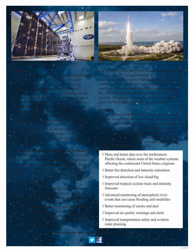
GOES-S satellite in a clean room. Credit: Lockheed Martin GOES-S launch on March 1, 2018. Credit: ULA
WWW.NESDIS.NOAA.GOV | WWW. GOES-R.GOV | TWITTER: NOAASATELLITES | FACEBOOK: GOES-R
05/2018