Embed Size (px)
Citation preview
Second Summer School
Advanced Global Navigation Satellite Systems
tropospheric products for monitoring severe weather events and climate
GNSS4SWEC
GFZ, Potsdam, Germany
Aug 29-31, 2016
Contents
Schedule ......................................................................................................................................................... 2
Speakers and teaching staff ............................................................................................................................ 4
Lectures at a glance ........................................................................................................................................ 8
Abstracts ......................................................................................................................................................... 9
Programme GNSS4SWEC Summer School, Germany, 2016 – page 1
Schedule
DAY
1 -
Mon
day,
Aug
29
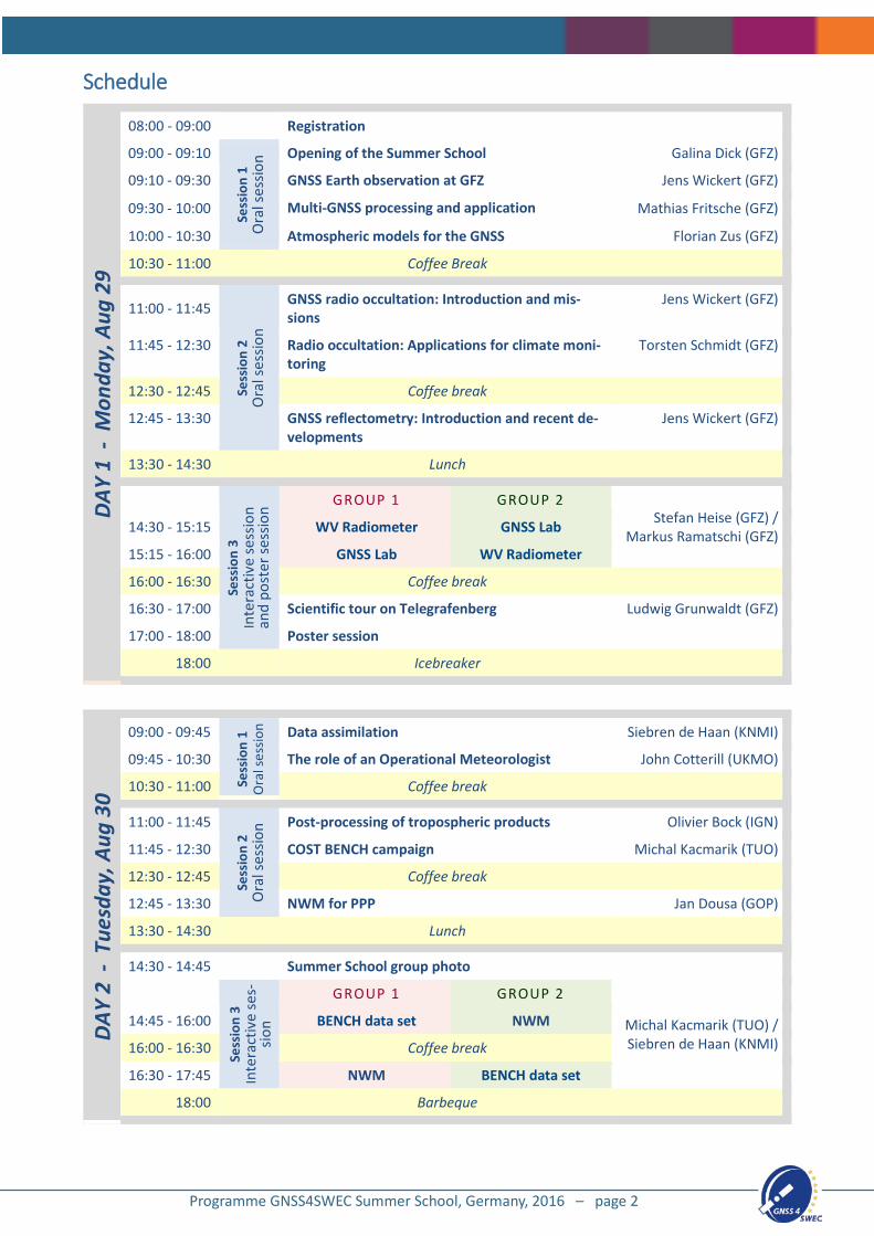
08:00 - 09:00 Registration
09:00 - 09:10
Sess
ion
1 O
ral s
essio
n Opening of the Summer School Galina Dick (GFZ)
09:10 - 09:30 GNSS Earth observation at GFZ Jens Wickert (GFZ)
09:30 - 10:00 Multi-GNSS processing and application Mathias Fritsche (GFZ)
10:00 - 10:30 Atmospheric models for the GNSS Florian Zus (GFZ)
10:30 - 11:00 Coffee Break
11:00 - 11:45
Sess
ion
2 O
ral s
essio
n
GNSS radio occultation: Introduction and mis-sions
Jens Wickert (GFZ)
11:45 - 12:30 Radio occultation: Applications for climate moni-toring
Torsten Schmidt (GFZ)
12:30 - 12:45 Coffee break
12:45 - 13:30 GNSS reflectometry: Introduction and recent de-velopments
Jens Wickert (GFZ)
13:30 - 14:30 Lunch
Sess
ion
3 In
tera
ctiv
e se
ssio
n an
d po
ster
sess
ion
GROUP 1 GROUP 2 Stefan Heise (GFZ) /
Markus Ramatschi (GFZ)
14:30 - 15:15 WV Radiometer GNSS Lab
15:15 - 16:00 GNSS Lab WV Radiometer
16:00 - 16:30 Coffee break
16:30 - 17:00 Scientific tour on Telegrafenberg Ludwig Grunwaldt (GFZ)
17:00 - 18:00 Poster session
18:00 Icebreaker
DAY
2 -
Tue
sday
, Aug
30
09:00 - 09:45
Sess
ion
1 O
ral s
essio
n Data assimilation Siebren de Haan (KNMI)
09:45 - 10:30 The role of an Operational Meteorologist John Cotterill (UKMO)
10:30 - 11:00 Coffee break
11:00 - 11:45
Sess
ion
2 O
ral s
essio
n Post-processing of tropospheric products Olivier Bock (IGN)
11:45 - 12:30 COST BENCH campaign Michal Kacmarik (TUO)
12:30 - 12:45 Coffee break
12:45 - 13:30 NWM for PPP Jan Dousa (GOP)
13:30 - 14:30 Lunch
14:30 - 14:45 Summer School group photo
Sess
ion
3 In
tera
ctiv
e se
s-sio
n
GROUP 1 GROUP 2
Michal Kacmarik (TUO) / Siebren de Haan (KNMI)
14:45 - 16:00 BENCH data set NWM
16:00 - 16:30 Coffee break
16:30 - 17:45 NWM BENCH data set
18:00 Barbeque
Programme GNSS4SWEC Summer School, Germany, 2016 – page 2
DA
Y 3
- W
edne
sday
, Aug
31
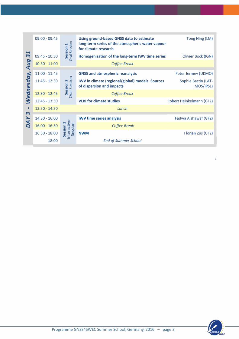
09:00 - 09:45
Sess
ion
1 O
ral S
essio
n
Using ground-based GNSS data to estimate long-term series of the atmospheric water vapour for climate research
Tong Ning (LM)
09:45 - 10:30 Homogenization of the long-term IWV time series Olivier Bock (IGN)
10:30 - 11:00 Coffee Break
11:00 - 11:45
Sess
ion
2 O
ral S
essio
n GNSS and atmospheric reanalysis Peter Jermey (UKMO)
11:45 - 12:30 IWV in climate (regional/global) models: Sources of dispersion and impacts
Sophie Bastin (LAT-MOS/IPSL)
12:30 - 12:45 Coffee Break
12:45 - 13:30 VLBI for climate studies Robert Heinkelmann (GFZ)
13:30 - 14:30 Lunch
14:30 - 16:00
Sess
ion
3 In
tera
ctiv
e Se
ssio
n
IWV time series analysis Fadwa Alshawaf (GFZ)
16:00 - 16:30 Coffee Break
16:30 - 18:00 NWM Florian Zus (GFZ)
18:00 End of Summer School
/
Programme GNSS4SWEC Summer School, Germany, 2016 – page 3
Speakers and teaching staff (in alphabetical order)
Fadwa Alshawaf
Fadwa Alshawaf started her postdoc research at the GFZ in November 2015. She received the Ph.D. degree in remote sensing from Karlsruhe Institute of Technology (KIT), Karlsruhe, Germany, in 2013. Her research interests include atmospheric water vapor mapping using interferometric synthetic aperture radar and GNSS. She also used statistical data fusion with numerical weather models to improving the quality of the map. She is also working on time series analysis of atmospheric variables such as water vapor and temperature to evaluate the evolution of climate in central Europe.
Sophie Bastin
Sophie Bastin is a scientist at Laboratoire Atmospheres Milieux Observations Spatiales (LATMOS), part of IPSL, in France. She obtained her PhD in 2004 at LMD/IPSL and after a post-doctoral position at NCAR, Boulder, USA, she obtained a position at LATMOS where she works since 2006 in a team whom scientific research is devoted to the study of processes involved in the water cycle at different scales. She participated in several field campaigns during which GPS networks and other instruments were deployed and she analyzed the obtained data using mesoscale models. Her current
work focusses on Mediterranean climate and specifically on the evolution of the water cycle over this area using regional models and long-term datasets.
Olivier Bock
Olivier Bock is a senior scientist at LAREG/IGN (Laboratory de Recherche en Geodesie/Institut National de l’Information Géographique et Forestière) and University Paris Diderot, in Paris, France. He obtained his PhD degree in Physics and Remote Sensing in 1996 and his Habilitation in 2012. His main research activities are the development of GNSS meteorology and climatology and the study of the water cycle at different scales. He has participated in many national and international projects and field campaigns on atmospheric research. Olivier Bock is chair of Working Group 3 of the
GNSS4SWEC COST project.
John Cotterill
John Cotterill is an Operational Meteorologist working at the Met Office in the UK. John began his career with the Met Office in May 2002 when he joined as an Airfield Weather Observer at the Royal Air Force (RAF) station Brize Norton. John completed nearly 10 years in this role during which time he has worked at many different locations throughout the UK. In April 2012 John applied to become a Forecaster and was accepted on to the Met Office Initial Forecasting Course (IFC), where he trained at the Met Office College in Exeter. John now works as an Operational Meteorologist
and specialises in Aviation Meteorology, while at the same time never forgetting his weather observing background, which lends itself very well to his everyday role working directly with his colleagues in the aviation industry.
Programme GNSS4SWEC Summer School, Germany, 2016 – page 4
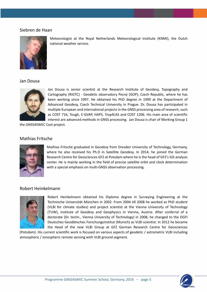
Siebren de Haan
Meteorologist at the Royal Netherlands Meteorological Institute (KNMI), the Dutch national weather service.
Jan Dousa
Jan Dousa is senior scientist at the Research Institute of Geodesy, Topography and Cartography (RIGTC) - Geodetic observatory Pecný (GOP), Czech Republic, where he has been working since 1997. He obtained his PhD degree in 1999 at the Department of Advanced Geodesy, Czech Technical University in Prague. Dr. Dousa has participated in multiple European and international projects in the GNSS processing area of research, such as COST 716, Tough, E-GVAP, HAPS, Trop4LAS and COST 1206. His main area of scientific interest are advanced methods in GNSS processing. Jan Dousa is chair of Working Group 1
the GNSS4SWEC Cost project.
Mathias Fritsche
Mathias Fritsche graduated in Geodesy from Dresden University of Technology, Germany, where he also received his Ph.D in Satellite Geodesy. In 2014, he joined the German Research Centre for Geosciences GFZ at Potsdam where he is the head of GFZ's IGS analysis center. He is mainly working in the field of precise satellite orbit and clock determination with a special emphasis on multi-GNSS observation processing.
Robert Heinkelmann
Robert Heinkelmann obtained his Diploma degree in Surveying Engineering at the Technische Universität München in 2002. From 2004 till 2008 he worked as PhD student (VLBI for climate studies) and project scientist at the Vienna University of Technology (TUW), Institute of Geodesy and Geophysics in Vienna, Austria. After conferral of a doctorate (Dr. techn., Vienna University of Technology) in 2008, he changed to the DGFI Deutsches Geodätisches Forschungsinstitut (Munich) as VLBI scientist. In 2012 he became the Head of the new VLBI Group at GFZ German Research Centre for Geosciences
(Potsdam). His current scientific work is focused on various aspects of geodetic / astrometric VLBI including atmospheric / ionospheric remote sensing with VLBI ground segment.
Programme GNSS4SWEC Summer School, Germany, 2016 – page 5
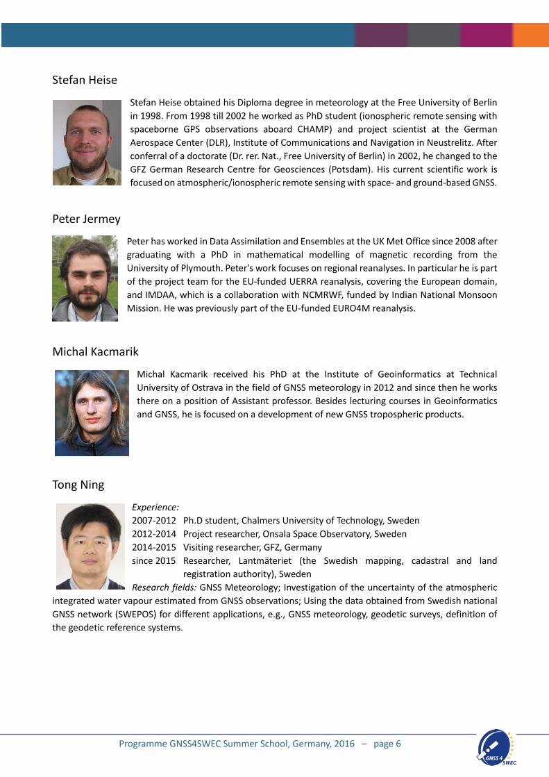
Stefan Heise
Stefan Heise obtained his Diploma degree in meteorology at the Free University of Berlin in 1998. From 1998 till 2002 he worked as PhD student (ionospheric remote sensing with spaceborne GPS observations aboard CHAMP) and project scientist at the German Aerospace Center (DLR), Institute of Communications and Navigation in Neustrelitz. After conferral of a doctorate (Dr. rer. Nat., Free University of Berlin) in 2002, he changed to the GFZ German Research Centre for Geosciences (Potsdam). His current scientific work is focused on atmospheric/ionospheric remote sensing with space- and ground-based GNSS.
Peter Jermey
Peter has worked in Data Assimilation and Ensembles at the UK Met Office since 2008 after graduating with a PhD in mathematical modelling of magnetic recording from the University of Plymouth. Peter's work focuses on regional reanalyses. In particular he is part of the project team for the EU-funded UERRA reanalysis, covering the European domain, and IMDAA, which is a collaboration with NCMRWF, funded by Indian National Monsoon Mission. He was previously part of the EU-funded EURO4M reanalysis.
Michal Kacmarik
Michal Kacmarik received his PhD at the Institute of Geoinformatics at Technical University of Ostrava in the field of GNSS meteorology in 2012 and since then he works there on a position of Assistant professor. Besides lecturing courses in Geoinformatics and GNSS, he is focused on a development of new GNSS tropospheric products.
Tong Ning
Experience: 2007-2012 Ph.D student, Chalmers University of Technology, Sweden 2012-2014 Project researcher, Onsala Space Observatory, Sweden 2014-2015 Visiting researcher, GFZ, Germany since 2015 Researcher, Lantmäteriet (the Swedish mapping, cadastral and land registration authority), Sweden Research fields: GNSS Meteorology; Investigation of the uncertainty of the atmospheric
integrated water vapour estimated from GNSS observations; Using the data obtained from Swedish national GNSS network (SWEPOS) for different applications, e.g., GNSS meteorology, geodetic surveys, definition of the geodetic reference systems.
Programme GNSS4SWEC Summer School, Germany, 2016 – page 6
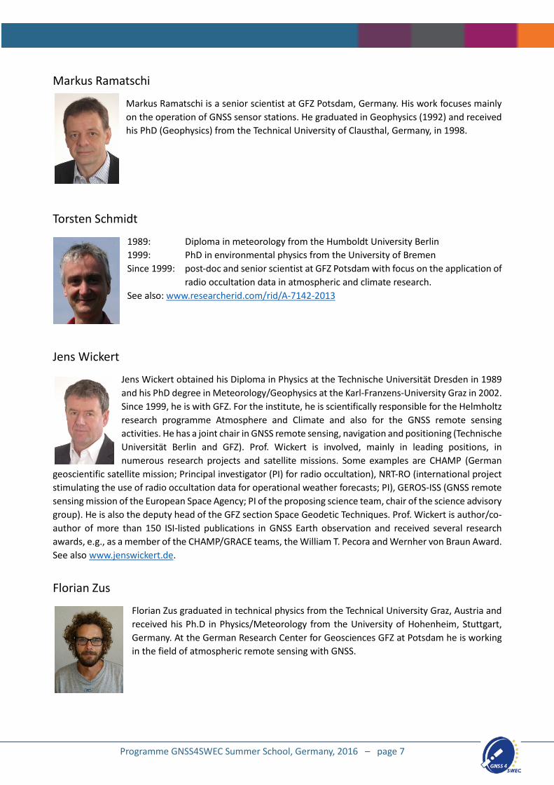
Markus Ramatschi
Markus Ramatschi is a senior scientist at GFZ Potsdam, Germany. His work focuses mainly on the operation of GNSS sensor stations. He graduated in Geophysics (1992) and received his PhD (Geophysics) from the Technical University of Clausthal, Germany, in 1998.
Torsten Schmidt
1989: Diploma in meteorology from the Humboldt University Berlin 1999: PhD in environmental physics from the University of Bremen Since 1999: post-doc and senior scientist at GFZ Potsdam with focus on the application of
radio occultation data in atmospheric and climate research. See also: www.researcherid.com/rid/A-7142-2013
Jens Wickert
Jens Wickert obtained his Diploma in Physics at the Technische Universität Dresden in 1989 and his PhD degree in Meteorology/Geophysics at the Karl-Franzens-University Graz in 2002. Since 1999, he is with GFZ. For the institute, he is scientifically responsible for the Helmholtz research programme Atmosphere and Climate and also for the GNSS remote sensing activities. He has a joint chair in GNSS remote sensing, navigation and positioning (Technische Universität Berlin and GFZ). Prof. Wickert is involved, mainly in leading positions, in numerous research projects and satellite missions. Some examples are CHAMP (German
geoscientific satellite mission; Principal investigator (PI) for radio occultation), NRT-RO (international project stimulating the use of radio occultation data for operational weather forecasts; PI), GEROS-ISS (GNSS remote sensing mission of the European Space Agency; PI of the proposing science team, chair of the science advisory group). He is also the deputy head of the GFZ section Space Geodetic Techniques. Prof. Wickert is author/co-author of more than 150 ISI-listed publications in GNSS Earth observation and received several research awards, e.g., as a member of the CHAMP/GRACE teams, the William T. Pecora and Wernher von Braun Award. See also www.jenswickert.de.
Florian Zus
Florian Zus graduated in technical physics from the Technical University Graz, Austria and received his Ph.D in Physics/Meteorology from the University of Hohenheim, Stuttgart, Germany. At the German Research Center for Geosciences GFZ at Potsdam he is working in the field of atmospheric remote sensing with GNSS.
Programme GNSS4SWEC Summer School, Germany, 2016 – page 7
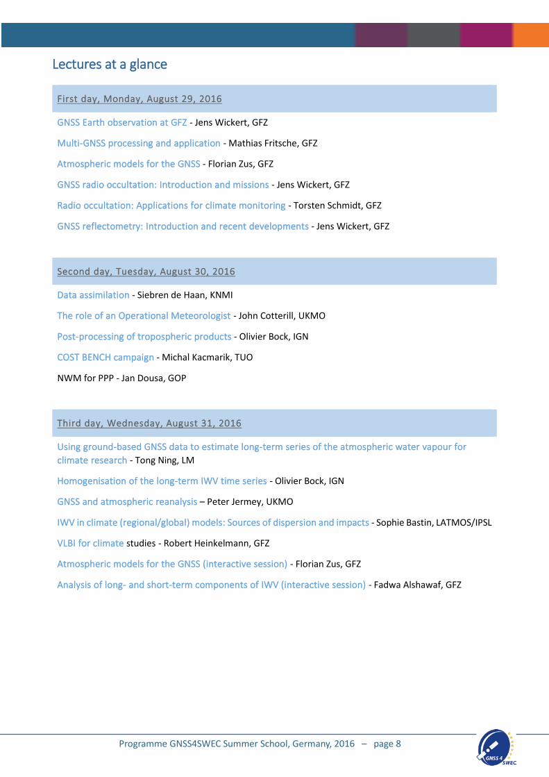
Lectures at a glance
First day, Monday, August 29, 2016
GNSS Earth observation at GFZ - Jens Wickert, GFZ
Multi-GNSS processing and application - Mathias Fritsche, GFZ
Atmospheric models for the GNSS - Florian Zus, GFZ
GNSS radio occultation: Introduction and missions - Jens Wickert, GFZ
Radio occultation: Applications for climate monitoring - Torsten Schmidt, GFZ
GNSS reflectometry: Introduction and recent developments - Jens Wickert, GFZ
Second day, Tuesday, August 30, 2016
Data assimilation - Siebren de Haan, KNMI
The role of an Operational Meteorologist - John Cotterill, UKMO
Post-processing of tropospheric products - Olivier Bock, IGN
COST BENCH campaign - Michal Kacmarik, TUO
NWM for PPP - Jan Dousa, GOP
Third day, Wednesday, August 31, 2016
Using ground-based GNSS data to estimate long-term series of the atmospheric water vapour for climate research - Tong Ning, LM
Homogenisation of the long-term IWV time series - Olivier Bock, IGN
GNSS and atmospheric reanalysis – Peter Jermey, UKMO
IWV in climate (regional/global) models: Sources of dispersion and impacts - Sophie Bastin, LATMOS/IPSL
VLBI for climate studies - Robert Heinkelmann, GFZ
Atmospheric models for the GNSS (interactive session) - Florian Zus, GFZ
Analysis of long- and short-term components of IWV (interactive session) - Fadwa Alshawaf, GFZ
Programme GNSS4SWEC Summer School, Germany, 2016 – page 8
Abstracts (in chronological order)
GNSS Earth observation at GFZ
Jens Wickert
German Research Centre for Geosciences GFZ, Potsdam, Germany
During the last decade, GNSS-based techniques for Earth observation (EO) became a powerful tool for the geosciences. One of the most prominent examples are ground- and space-based atmosphere/ionosphere sounding techniques, which are currently applied operationally to improve global and regional weather forecasts. Another important GNSS Earth observation technique, the GNSS reflectometry, is not yet operationally applied. The optimal exploitation of its potential for remote sensing of water, ice/snow and land surfaces is recently a major challenge of international geophysical research. GFZ, the German Research Centre for Geosciences, is a pioneering institution for the development and application of GNSS Earth observation techniques. GNSS EO is introduced as an emerging field and selected examples of recent research activities at GFZ are given to underline its huge and versatile potential for numerous applications in modern geosciences.
Multi-GNSS processing and application
Mathias Fritsche
German Research Centre for Geosciences GFZ, Potsdam, Germany
Processing GPS signals for the purpose of studying geophysical phenomena is widely used in Earth sciences. Since GPS had been declared operationally in 1994, user-specific applications have benefited from a continuous increase in accuracy and precision of products derived from the navigation signals, e.g. satellite orbits and clocks, Earth rotation parameter, ground station positions, and atmospheric parameters. The emergence of additional satellite navigation systems such as GLONASS, BeiDou, Galileo, QZSS and IRNSS promises to facilitate even more accurate products which should also allow for new GNSS applications for the user community. However, users will profit from the addition of other GNSS only if the processing of associated signals provides the same accuracy level as compared to GPS and consistency is guaranteed among all GNSS. The presentation will give an overview on the current status of the different GNSS. Particular emphasis is put on aspects of simultaneously processing observations from different GNSS. Results obtained in the MGEX framework will provide some insights into the multi-GNSS performance currently achievable.
Atmospheric models for the GNSS
Florian Zus
German Research Centre for Geosciences GFZ, Potsdam, Germany
When GNSS radio signals propagate through the atmosphere they are affected in a characteristic way. The atmospheric propagation effects must be taken into account in the analysis of the GNSS data. In this presentation an overview will be given of the models for tropospheric and ionospheric refraction.
In the interactive session, participants will generate maps and time series of NWM-derived tropospheric parameters, i.e., zenith delays, mapping function coefficients and gradient components. The tropospheric parameters from two different NWMs will be compared to gain some insight into their uncertainty.
Programme GNSS4SWEC Summer School, Germany, 2016 – page 9
GNSS radio occultation: Introduction and missions
Jens Wickert
German Research Centre for Geosciences GFZ, Potsdam, Germany
Space-based GNSS radio occultation (RO) allows for the determination of globally distributed vertical profiles of temperature, water vapor and electron density. Since its initial application in 1995 within the pioneering GPS/MET mission, it was further developed to be an acknowledged atmospheric sounding technique. Prominent application examples are the operational use of GNSS RO data in several missions, improved global weather forecasting of the world’s leading forecast centers, and the observation of climatological variations of the Earth’s atmosphere. History and basics of the GNSS RO technique with the most important missions are introduced and selected examples of geophysical application are given.
Radio occultation: Applications for climate monitoring
Torsten Schmidt
German Research Centre for Geosciences GFZ, Potsdam, Germany
A short introduction to the climate system is given with the focus of atmospheric temperature changes during the last century. Since the "satellite era" different temperature data sets are compared and the special characteristics of the radio occultation technique is highlighted. The potential of the radio occultation data for climate monitoring is discussed.
GNSS reflectometry: Introduction and recent developments
Jens Wickert
German Research Centre for Geosciences GFZ, Potsdam, Germany
The exploitation of Earth-reflected GNSS signals from water, ice/snow, and land surfaces for remote sensing is a recent focus of international geoscientific and GNSS research. Standard geodetic receivers of global and regional ground networks can be used to derive information on soil moisture, vegetation and snow properties in the vicinity of the receiver. Dedicated receivers aboard flight platforms and satellites can be applied to monitor, e.g., sea surface heights or wind speed of water surfaces. Several satellite missions presently in preparation applying GNSS reflectometry on a global scale, such as CYGNSS, GEROS-ISS, TechdemoSAT-1 or CUBECAT, will provide novel remote sensing data of the Earth’s surface. The GNSS reflectometry technique is introduced and current developments in this promising research field are reviewed.
Data assimilation
Siebren de Haan
KNMI, The Netherlands
In this talk we discuss methods to estimate an atmospheric state based on observations and a priori knowledge. The main focus will be on the so-called 3D-VAR, three dimensional variational technique and its extension in time: 4D-VAR. These techniques are widely used in (short range) weather prediction models and exploits observations through an observation operator which connects the (artificial) model space with the (less artificial) observation space. The VAR technique combines some background estimate with the observations to improve the estimate of the initial state.
The VAR-technique requires a priori information on the model background error covariances and observation error covariances. There are several methods to estimate these quantities and we will discuss a few of them:
Programme GNSS4SWEC Summer School, Germany, 2016 – page 10
Hollingworth–Lonnberg method, Desroziers and triple collocation.
References:
ECMWF course on Data Assimilation: http://www.ecmwf.int/sites/default/files/Data%20assimilation%20concepts%20and%20methods.pdf
Desroziers, G., Berre, L., Chapnik, B., Poli, P. 2005. Diagnosis of observation, background and analysis-error statistics in observation space Q. J. R. Meteorol. Soc. 131, 3385–3396<tel:3385%E2%80%933396>
Stoffelen, A.: Toward the true near-surface wind speed: Error modelling and calibration using triple collocation, J. Geophys. Res.- Oceans, 103, 7755–7766, 1998<tel:7755%E2%80%937766,%201998>
The role of an Operational Meteorologist
John Cotterill
Met Office, United Kingdom
John's presentation will cover the many and varied aspects of Operational Aviation forecasting. Acknowledging how it has evolved rapidly in the last few years, as technology has allowed increased integration with, and the ability to work alongside his customers. John will outline his current role, giving some examples of the types of forecast he has to produce, and the decision making processes that he goes through on a typical day in the life of an Operational Aviation Meteorologist.
Post-processing of tropospheric products
Olivier Bock
IGN, France
Post-processing of tropospheric products consists in several step required to quality check the estimated parameters as well as to transform the estimated parameters into more convenient geophysical variables. This lecture will focus on the screening of ZTD (zenith tropospheric delay) data, the aim of which is to detect and remove outliers and erroneous ZTD estimates, and conversion of ZTD to IWV (integrated water vapour). The methodologies developed and used in by the COST GNSS4SWEC community will be explained and illustrated.
COST BENCH campaign
Michal Kacmarik
Technical University of Ostrava, Czech Republic
The presentation is dedicated to the introduction of the Benchmark activity within the Working Group 1 of the GNSS4SWEC project. Firstly a description of collected extensive data set covering central Europe and a period of 56 days will be given. Secondly prepared GNSS and NWM-derived reference tropospheric products will be presented as well as current results of selected activities based on the Benchmark data set including validation of slant delays or real-time ZTD products.
In the interactive session, participants will get an opportunity to work with GNSS and NWM-derived tropospheric products from the Benchmark data set together with original meteorological data. A set of outputs covering selected interesting meteorological events will be prepared for the session. Using maps of Zenith Wet Delays, horizontal tropospheric gradient or visualizations of slant delays we will try to interpret the events and get a knowledge what products current GNSS meteorology can offer.
Programme GNSS4SWEC Summer School, Germany, 2016 – page 11
Using ground-based GNSS data to estimate long-term series of the atmospheric water vapour for climate research
Tong Ning
Lantmäteriet (Swedish Mapping, Cadastre and Land Registration Authority), Gävle, Sweden
Atmospheric water vapour is important for the Earth’s energy balance due to its ability of absorbing and trapping long wave radiation emitted from the Earth’s surface. In addition, it is highly related to precipitation and it is the dominate greenhouse gas. Therefore, measurements of the atmospheric water vapour content are of very interest for meteorology and climatology. Based on the path delay, which radio signals undergo when propagating through the neutral atmosphere, the Global Positioning System (GPS) measurements can be used to derive the atmospheric integrated water vapour (IWV). With a relatively high temporal resolution, continuously improved spatial density, and less expensive receivers, ground-based GPS measurement has been identified as a useful technique to monitor long-term variations in the IWV.
The presentation will first give a general introduction on techniques, i.e. Radiosondes, WVR, VLBI, and GNSS, which are capable to estimate atmospheric water vapour. Thereafter, more details will be given about how to use ground-based GNSS data to provide long-term series of water vapour and its linear trends, as well as how to estimate the uncertainty of the linear trend after taking the temporal correlation of the variability about the estimated model into account. In addition, the inconsistences in the GNSS-derived water vapour time series due to two types of changes, i.e., data-processing related and site-related changes, and their impact on the resulting trends will also be discussed in the presentation.
Homogenisation of the long-term IWV time series
Olivier Bock
IGN, France
Homogenisation is the operation of making observed time series of a geophysical parameter homogeneous in time and space. This lecture will give an overview of the main homogeneity problems encountered with long GNSS ZTD and IWV time series and introduce some of the homogenisation techniques developed and used by the COST GNSS4SWEC community.
GNSS and atmospheric reanalysis
Peter Jermey
UK Met Office, United Kingdom
Numerical weather prediction uses (NWP) analyses as initial conditions for forecasting. These analyses are estimates of the atmospheric model state, given the previous forecast and the observations. The derivation of these analyses is called data assimilation.
Data assimilation may be used to produce a long series of analyses for historical atmospheric states. This process is called reanalysis and is useful for a wide range of applications from forecast model diagnostics to climate monitoring.
GNSS signals are affected in a predictable way by the atmosphere and therefore GNSS data contains information about the state of the atmosphere. For operational NWP the Met Office assimilates this data in two different ways: zenith total delay to ground stations and radio occultation between satellites.
The Met Office is currently producing regional reanalysis over a European domain for the EU-funded UERRA (Uncertainties in Regional Reanalyses) research project which inform the EU's Copernicus Climate Services.
Programme GNSS4SWEC Summer School, Germany, 2016 – page 12
This talk will introduce atmospheric reanalysis and demonstrate how GNSS data is being exploited to improve the quality of this satellite-era reanalysis.
IWV in climate (regional/global) models: Sources of dispersion and impacts
Sophie Bastin
Laboratoire Atmospheres Milieux Observations Spatiales (LATMOS/IPSL), Guyancourt, France
Water vapor is a key parameter in both energy and water cycles. The evolution of this parameter in the context of climate change is crucial because it governs the intensity of rainfall, the triggering of precipitation (particularly in the tropics) and the intensity of feedbacks due to its high greenhouse effect. Long-term homogenized datasets of IWV are thus very useful to evaluate how regional and global models represent water vapor at different time scales in present climate to better assess the uncertainties on future projections of precipitation and temperature. During this presentation, I will present the evaluation of this parameter over several areas in different simulations for mean, variability and trends and discuss the sources of discrepancies that are obtained. I will also show the impacts such discrepancies can have in the estimation of future precipitation or temperature.
VLBI for climate studies
Robert Heinkelmann
German Research Centre for Geosciences GFZ, Potsdam, Germany
In the 45 minutes, I will give a short introduction to the radio interferometry technique “VLBI” associated with the geodetic VLBI of the International VLBI Service for Geodesy and Astrometry (IVS). I will leave out the parts that are irrelevant for atmospheric applications. I will discuss the current and potential role of geodetic VLBI for climate and atmospheric research considering the legacy as well as the upcoming new generation ground segment: VGOS. The lecture presents features that are relevant for calibration or comparison with GNSS and I will show a variety of comparisons between GNSS and VLBI maybe involving other space geodetics as well. Most of the contents are relevant for GNSS climatology without considering VLBI or other techniques as well. Optionally, if there is enough time and if it was not sufficiently covered by other lectures, I plan to add a short discussion about climate time series modeling and analytical methods to assess and represent climate trends.
Analysis of long- and short-term components of IWV
Fadwa Alshawaf
German Research Centre for Geosciences GFZ, Potsdam, Germany
IWV can be determined at GNSS, meteorological station, and from atmospheric models. In this session, we will compare the three data sets and look at temporal and spatial properties of the signals. We will check the homogeneity of the data.
Next, we will split the stochastic and deterministic components and estimate related parameters. We will compare the behavior at different sites with different local surroundings.
Programme GNSS4SWEC Summer School, Germany, 2016 – page 13