Embed Size (px)
Citation preview
Global Positioning Systems Directorate
20 September 2011
GPS Program Update to CGSIC 2011
Col Bernard Gruber Director
GPS Directorate 2011 09 11 GPS Program Update to CGSIC – FINAL4 (3)

2 2011 09 21 GPS Program Update to CGSIC – FINAL4 (3)
Global Positioning Systems Directorate
Mission: Deliver sustained, reliable GPS capabilities to America’s warfighters, our allies and civil users
Col Bernie Gruber
Deliver and Sustain Global Navigation and Timing Service

3 2011 09 21 GPS Program Update to CGSIC – FINAL4 (3)
GPS Constellation • Very robust constellation
• 30 space vehicles currently in operation • 10 GPS IIA, 12 GPS IIR, 7 GPS IIR-M, 1 GPS IIF
• 4 additional satellites in residual status • 1 IIF satellite in test/checkout
• Extensive International and Civil Cooperation • Agreements with 53 international customers • 1+ billion civil/commercial users • Countless applications…and growing
• Global GPS civil service performance commitment met continuously since Dec 1993

4 2011 09 21 GPS Program Update to CGSIC – FINAL4 (3)
GPS Signal in Space Performance

5 2011 09 21 GPS Program Update to CGSIC – FINAL4 (3)
GPS IIF Status
• Launched GPS IIF-2 on 15 Jul 11 • SVN 63, PRN 1 • Check out phase complete • Second operational L5 • Increases the enhanced GPS clock
performance coverage
• Excellent on-orbit performance • SIS URE of .30 meters (1 yr performance Jul 11)
• 10 more IIFs in the pipeline • SVs 3-6 are in production
• IIF-3 Initial Launch Capability in Feb 12

6 2011 09 21 GPS Program Update to CGSIC – FINAL4 (3)
GPS III Status
• Newest block of GPS satellites • First satellite to broadcast common L1C signal • Multiple civil and military signals; L1 C/A,
L1 P(Y), L1M, L1C, L2C, L2 P(Y), L2M, L5 • Three Rubidium clocks
• Completed Critical Design Review • Completed Independent Program
Assessment (Milestone C) • Prototype and engineering unit build/test underway
• Completed 54 of 59 Manufacturing Readiness Reviews • Completed 32 of 59 Test Readiness Reviews
• GPS Nonflight Satellite Testbed (GNST) started 1 month early • Manufacturing Readiness Review initiated • Completed System Design Review and initiated Capability
Insertion Program for SV-9+

7 2011 09 21 GPS Program Update to CGSIC – FINAL4 (3)
Dual Launch of GPS III Satellites
• Dual launch of GPS III satellites could reduce launch costs of GPS III
• SMC is exploring the technical feasibility and cost implications of dual manifest launch, • Two studies, a space vehicle (SV) study and a launch
vehicle (LV) study, are expected to be complete by Jan 12
• Initial results indicate dual launch on Atlas V possible with minor updates to GPS III and a new dual-payload adapter
Notional Dual Launch
Configuration on Atlas V 551
SV2
SV1
8 2011 09 21 GPS Program Update to CGSIC – FINAL4 (3)
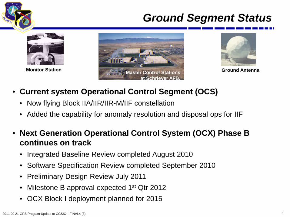
Ground Segment Status
• Current system Operational Control Segment (OCS) • Now flying Block IIA/IIR/IIR-M/IIF constellation • Added the capability for anomaly resolution and disposal ops for IIF
• Next Generation Operational Control System (OCX) Phase B continues on track • Integrated Baseline Review completed August 2010 • Software Specification Review completed September 2010 • Preliminary Design Review July 2011 • Milestone B approval expected 1st Qtr 2012 • OCX Block I deployment planned for 2015
Monitor Station Ground Antenna Master Control Stations at Schriever AFB,
Colorado

9 2011 09 21 GPS Program Update to CGSIC – FINAL4 (3)
• Fourth civil signal “L1C” • Designed for GNSS interoperability • Specification developed in cooperation
with industry • Launches with GPS III in 2014 • Available on 24 SVs ~ 2026* • Improved tracking performance
GPS Modernization – New Civil Signals
• Second civil signal “L2C” • Designed to meet commercial needs • Available since 2005 without data message • Phased roll-out of CNAV message • Full capability: 24 satellites and full CNAV ~2016*
• Third civil signal “L5” • Designed to meet transportation safety-of-life requirements • Uses Aeronautical Radio Navigation Service band • 24 satellites and full CNAV ~2020*
Urban Canyons
Improved performance in
challenged environments
* FOC dates are based on our best estimate of launch schedule
10 2011 09 21 GPS Program Update to CGSIC – FINAL4 (3)
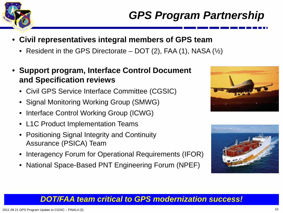
GPS Program Partnership
• Civil representatives integral members of GPS team • Resident in the GPS Directorate – DOT (2), FAA (1), NASA (½)
• Support program, Interface Control Document and Specification reviews • Civil GPS Service Interface Committee (CGSIC) • Signal Monitoring Working Group (SMWG) • Interface Control Working Group (ICWG) • L1C Product Implementation Teams • Positioning Signal Integrity and Continuity
Assurance (PSICA) Team • Interagency Forum for Operational Requirements (IFOR) • National Space-Based PNT Engineering Forum (NPEF)
DOT/FAA team critical to GPS modernization success!

11 2011 09 21 GPS Program Update to CGSIC – FINAL4 (3)
GPS Metrics for Alternatives Assessment
• Performance Metrics generated for multiple constellations • Leveraging existing constellation management tool (GIANT) for our ongoing analysis efforts
• Assessment in terms of GPS User in various scenarios at the Architecture level • 1. Elevation Masking; 2. Jamming; 3. Precision Approach
• Focusing on core metrics associated with: Availability: How often is signal available to the user? Accuracy: What 3-D position accuracy will the user achieve? Robustness: What is the range to denied areas?
GPS Performance Metrics
Scenarios Availability Accuracy Robustness
Elevation Mask (5˚ & 30˚)
NA
Jammer Power (10W, 50W & 100W)
NA
NA
Precision Approach NA NA
Approach provides a more universal way of assessing alternatives

12 2011 09 21 GPS Program Update to CGSIC – FINAL4 (3)
Acquisition Opportunities
• Released GPS Enterprise Modernization Research and Prototype Demonstration “Broad Agency Announcement” – 22 Aug 11 • Soliciting proposals for research and prototypes of GPS capabilities • Released thru Space and Naval Warfare Systems Center, Pacific • Specific areas of interest include:
• Information Assurance • Advanced Integrity • Software Defined Radios • GPS Alternative Architectures
• GPS Systems Engineering & Integration support
• Industry Day held Aug 11 • Refining acquisition strategy • Targeting Industry comments on Draft Request for Proposal (RFP) 1QFY12 • Estimated RFP release in 2QFY12
Resiliency / Affordability
13 2011 09 21 GPS Program Update to CGSIC – FINAL4 (3)
LightSquared (LSQ) Status
• LSQ proposed open wireless broadband network adjacent to GPS L1 • Offering terrestrial 4G service – 34,000+ ATCs across the U.S.A.
• FCC granted conditional waiver to LSQ – 26 Jan 11 • Required LSQ study GPS overload and interference prevention NLT 15 Jun 11
• Supports National Broadband Plan – find 500 MHz for wireless broadband
• Numerous organizations conducted testing - all indicated interference • National Space-Based PNT Engineering Forum Test Report - 1 Jun 11 • Radio Technical Commission for Aeronautics Report - 26 May 11 • Numerous separate filings with FCC by Industry
• LSQ/GPS Industry Council Tech Working Group Report submitted - 30 Jun 11
• LSQ proposing “10 Low” implementation as alternative
• NTIA requesting additional testing be conducted by 30 Nov 11 • Directorate working with DoD and Civil agencies to develop execution plan

14 2011 09 21 GPS Program Update to CGSIC – FINAL4 (3)
Summary
• GPS has continuously met its commitments to all users
• GPS had multiple operational and acquisition successes in the past year
• Modernization of all GPS Segments is on track
• Striving to continually improve navigation and timing services while maintaining backward compatibility with legacy equipment
Maintaining And Improving GPS Services For All Users Is Job #1
15 2011 09 21 GPS Program Update to CGSIC – FINAL4 (3)
Backup
16 2011 09 21 GPS Program Update to CGSIC – FINAL4 (3)
New Certification Paradigm
• 2009 - Receiver problems experienced during segment upgrades • Problems traced to non-ICD compliant User Equipment
• Incorrect implementation/interpretation of interface specifications • Developing DoD “Performance Certification” strategy
• Will determine efficient “Mother of all Test Vector (MTV)” approach to verify Signal-in-Space ICDs
• Final certifying authority will reside either within the directorate or be an independent 3rd party (Underwriter Laboratories construct) organization
• Clarifying business case for both options • Implementing actions
• Seeking stakeholder feedback prior to final ‘certification design’ • Will result in new DoD-Instruction (possibly encompassing both security and
performance certification)
ICD Compliance is Critical for GNSS Success

17 2011 09 21 GPS Program Update to CGSIC – FINAL4 (3)
Military User Segment Status
• Delivered 447,333 GPS handhelds receivers • Accelerated fielding to US + allies (6 months ahead of schedule) • Program transitioning to sustainment
• Fielded over 94,000 embedded GPS military receiver for US and allied nations
• Military GPS User Equipment (MGUE) Program • 3 Prototypes complete; government testing underway • Ongoing ACAT 1D receiver program • Completed MGUE Industry Day

18 2011 09 21 GPS Program Update to CGSIC – FINAL4 (3)
Performance Standard Update
• Planning a draft update of the Open Access Service Performance (OAS PS) Standard by the end of CY11 • Name changed from "Standard Positioning Service Performance Standard"
(SPS PS) • Addition of L2C signal to current L1 C/A signal • Same performance values • Draft update will be circulated for review & comment within U.S. Government • SPS PS update approval before Initial Operational Capability (IOC)
declaration for L2C • Planning subsequent draft updates for L5 signal & for L1C signal
• Prior to each subsequent IOC declaration • Developing an updated set of performance metrics
• Include different user applications and terrain environments