Embed Size (px)
Citation preview
Global Map Update -as a base of utilization of Global Earth Observation
Data-
Global Map Liaison Report
Osamu Ochiai JAXA/EORC
WGISS #18, SG#17Beijing Sept. 6-10 2004
iscgm.org
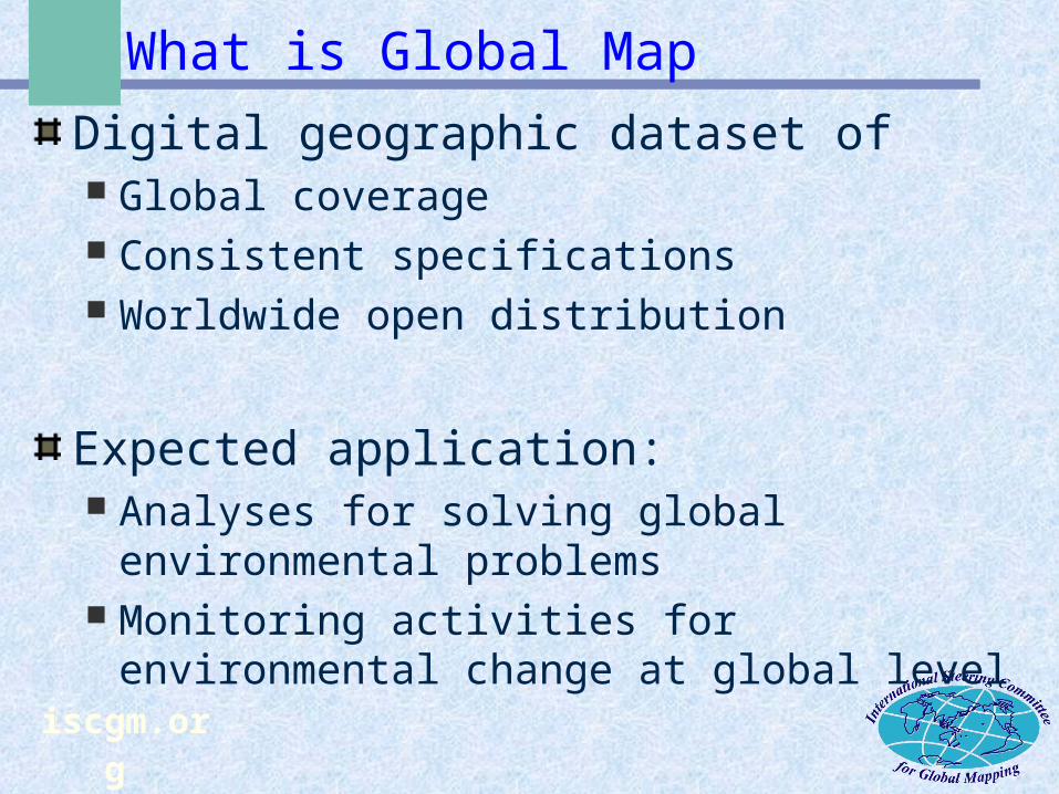
What is Global Map
Digital geographic dataset of Global coverage Consistent specifications Worldwide open distribution
Expected application: Analyses for solving global environmental
problems Monitoring activities for environmental
change at global level
iscgm.org
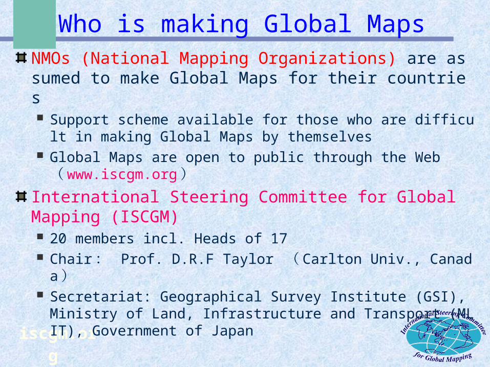
Who is making Global MapsNMOs (National Mapping Organizations) are assumed to make Global Maps for their countries Support scheme available for those who are difficult in ma
king Global Maps by themselves Global Maps are open to public through the Web ( www.i
scgm.org )
International Steering Committee for Global Mapping (ISCGM) 20 members incl. Heads of 17 Chair : Prof. D.R.F Taylor ( Carlton Univ., Canada ) Secretariat: Geographical Survey Institute (GSI), Ministry o
f Land, Infrastructure and Transport (MLIT), Government of Japan
iscgm.org
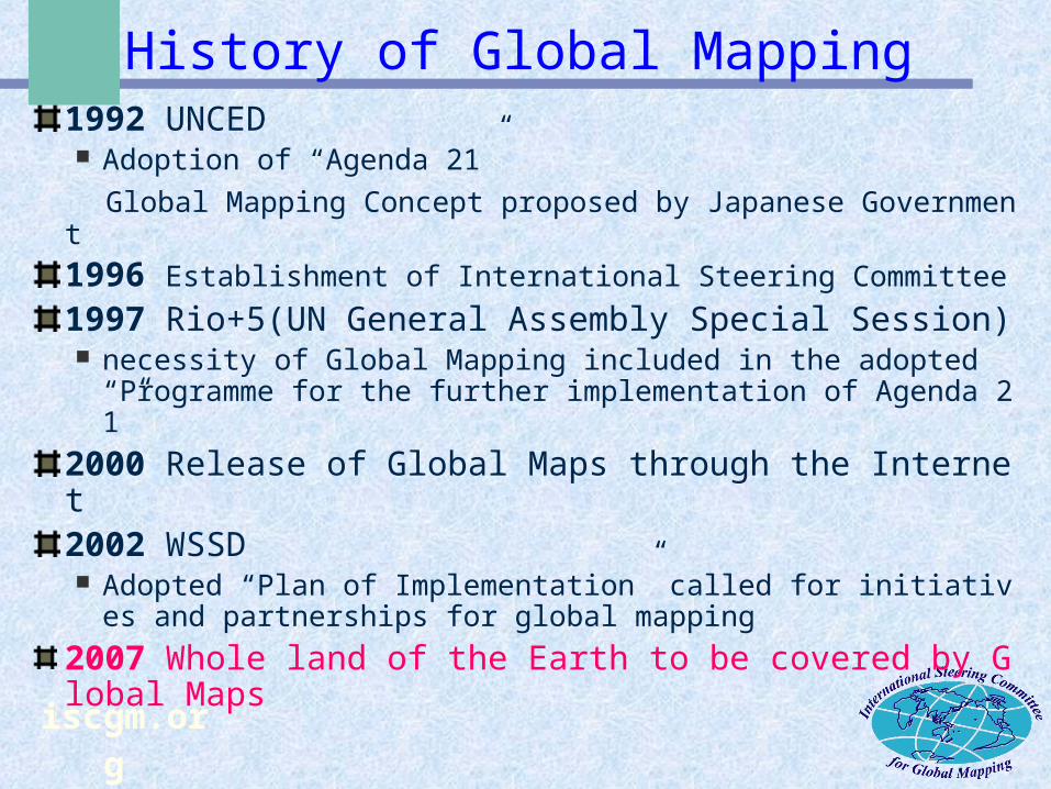
History of Global Mapping1992 UNCED Adoption of “Agenda 21”
Global Mapping Concept proposed by Japanese Government1996 Establishment of International Steering Committee1997 Rio+5(UN General Assembly Special Session) necessity of Global Mapping included in the adopted “Progr
amme for the further implementation of Agenda 21”2000 Release of Global Maps through the Internet2002 WSSD Adopted “Plan of Implementation” called for initiatives and
partnerships for global mapping 2007 Whole land of the Earth to be covered by Global Maps
iscgm.org
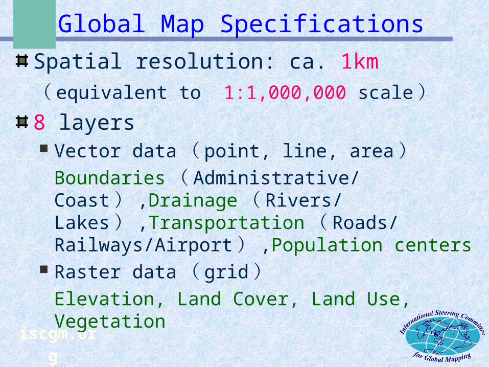
Global Map Specifications
Spatial resolution: ca. 1km( equivalent to 1:1,000,000 scale)8 layers Vector data( point, line, area)
Boundaries( Administrative/Coast) ,Drainage( Rivers/Lakes) ,Transportation( Roads/Railways/Airport) ,Population centers
Raster data( grid)Elevation, Land Cover, Land Use,
Vegetation
iscgm.org
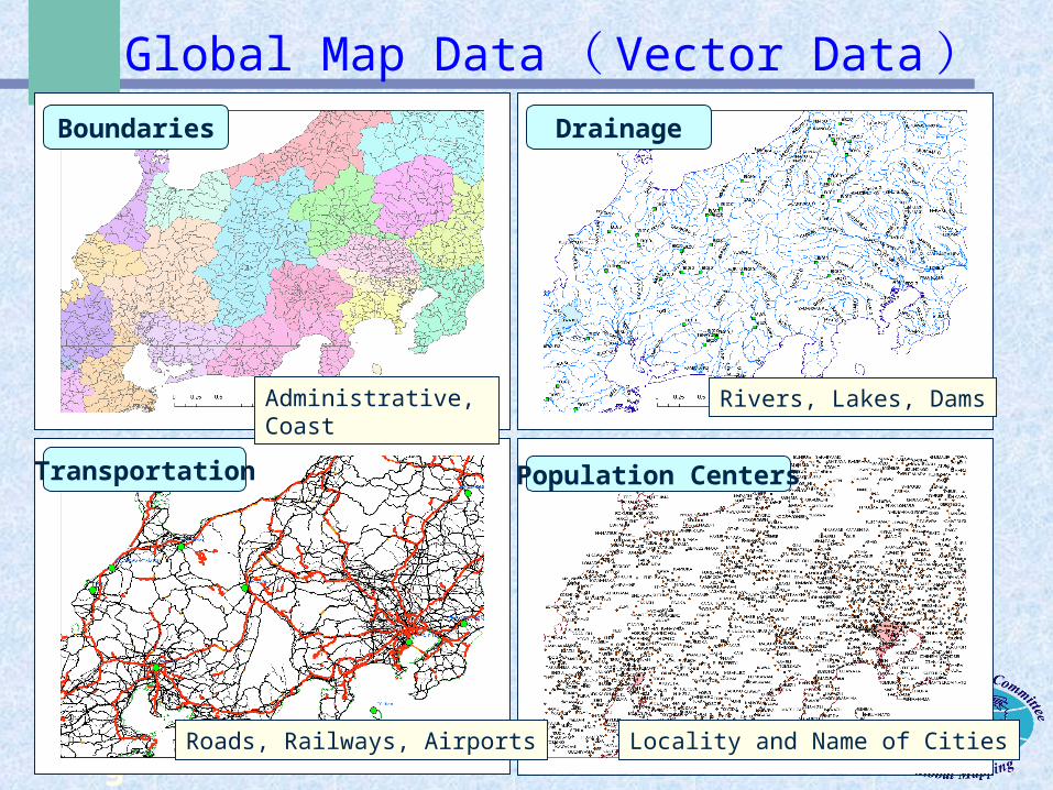
Global Map Data( Vector Data)
Administrative, Coast
Boundaries
Population CentersTransportation
Drainage
Locality and Name of CitiesRoads, Railways, Airports
Rivers, Lakes, Dams
iscgm.org
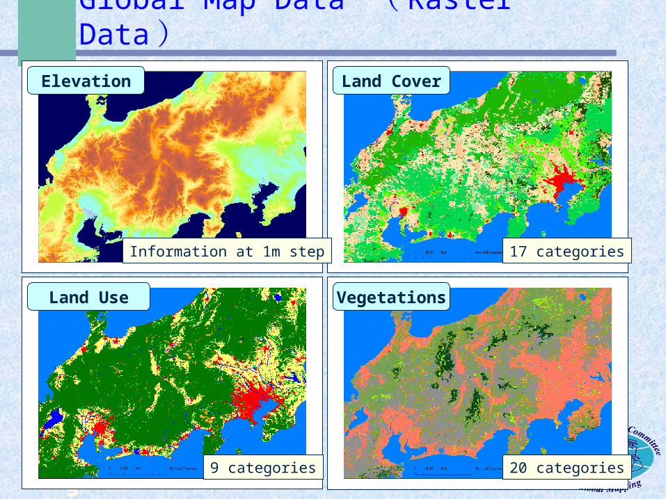
Global Map Data ( Raster Data)
Information at 1m step
Elevation
VegetationsLand Use
Land Cover
20 categories9 categories
17 categories
iscgm.org
How to get Global Maps
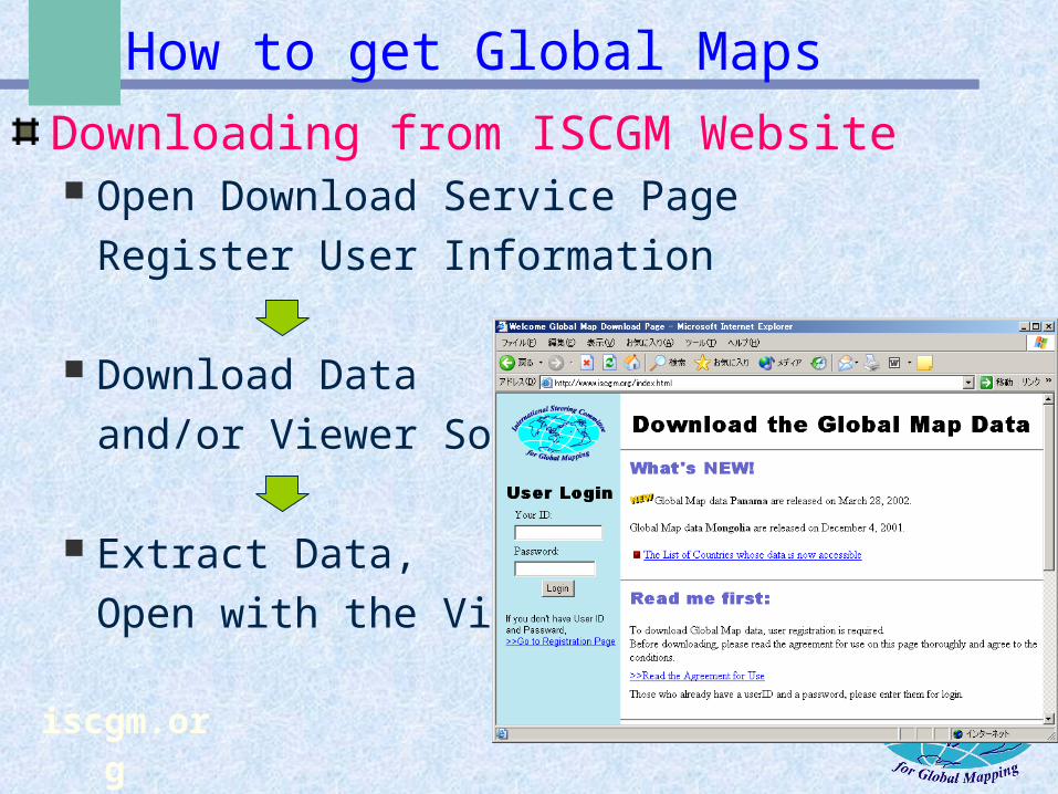
Downloading from ISCGM Website Open Download Service Page
Register User Information
Download Dataand/or Viewer Soft
Extract Data,Open with the Viewer
iscgm.org
ISCGM status update by GSI/Japan
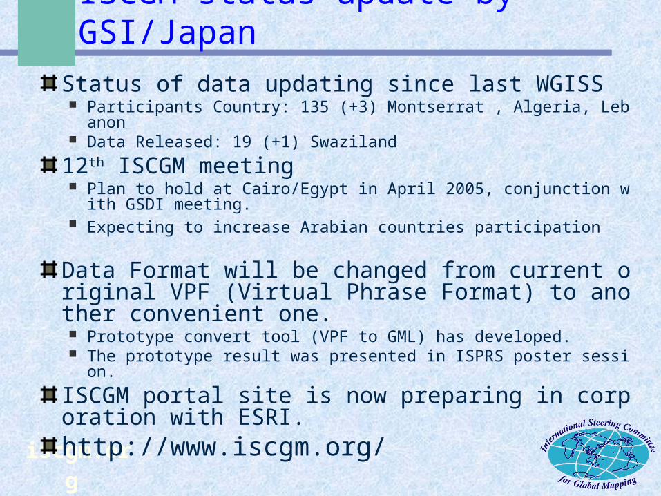
Status of data updating since last WGISS Participants Country: 135 (+3) Montserrat , Algeria, Lebanon Data Released: 19 (+1) Swaziland
12th ISCGM meeting Plan to hold at Cairo/Egypt in April 2005, conjunction with GSDI m
eeting. Expecting to increase Arabian countries participation
Data Format will be changed from current original VPF (Virtual Phrase Format) to another convenient one. Prototype convert tool (VPF to GML) has developed. The prototype result was presented in ISPRS poster session.
ISCGM portal site is now preparing in corporation with ESRI. http://www.iscgm.org/
iscgm.org
CEOS/WGISS collaboration?
Current ISCGM data has already registered into JAXA-Keio Univ. WMS, WFS server under the Digital Asia framework.Keep updating when more data available.Need to consider how to apply the specific use case.It could be CEOS/WGISS and ISCGM collaboration!!