Embed Size (px)
Citation preview
Global land cover mapping with satellite remote sensing – progress at Tsinghua
Peng Gong
Center for Earth System Science, Tsinghua University
Mexico City, Nov 10, 2015
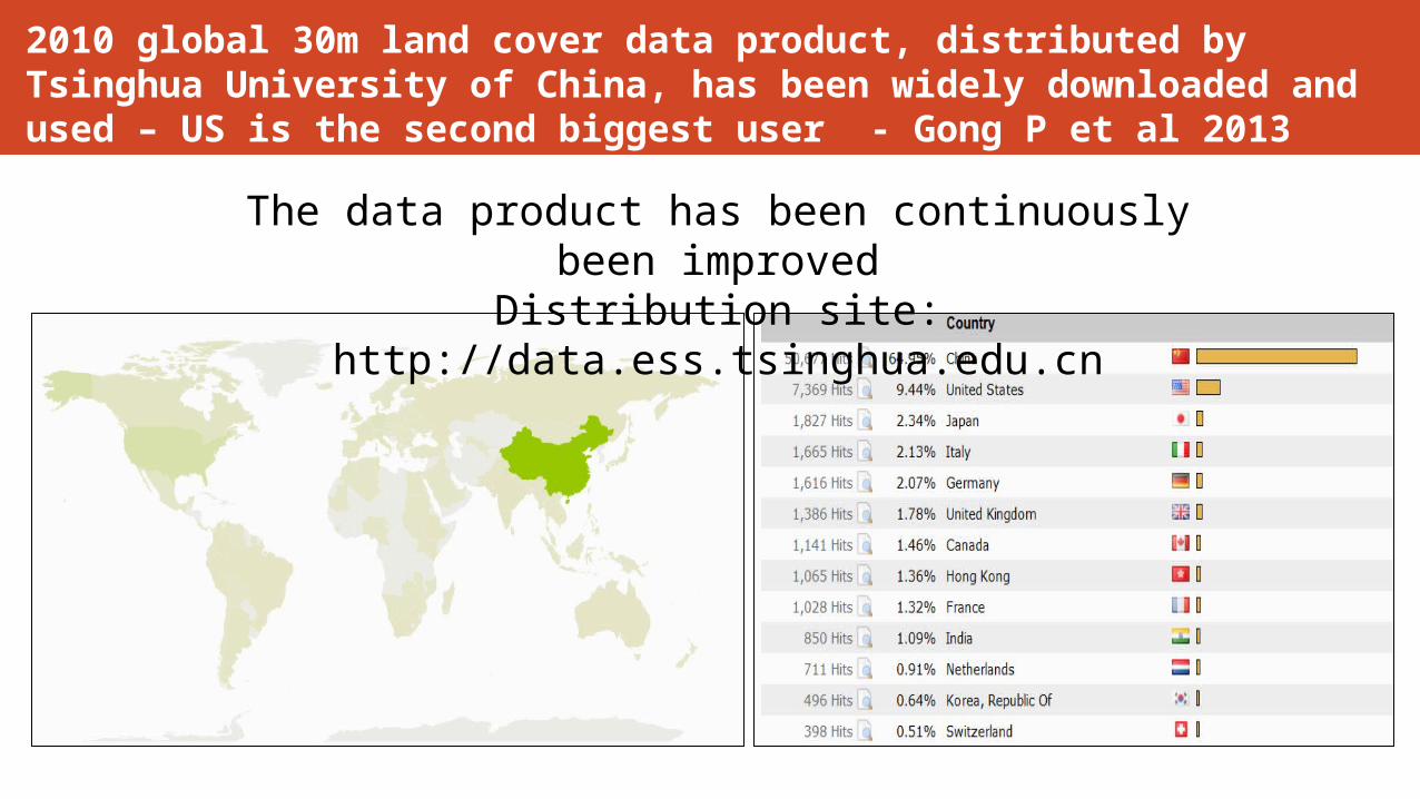
2010 global 30m land cover data product, distributed by Tsinghua University of China, has been widely downloaded and used – US is the second biggest user - Gong P et al 2013
The data product has been continuously been improved
Distribution site: http://data.ess.tsinghua.edu.cn
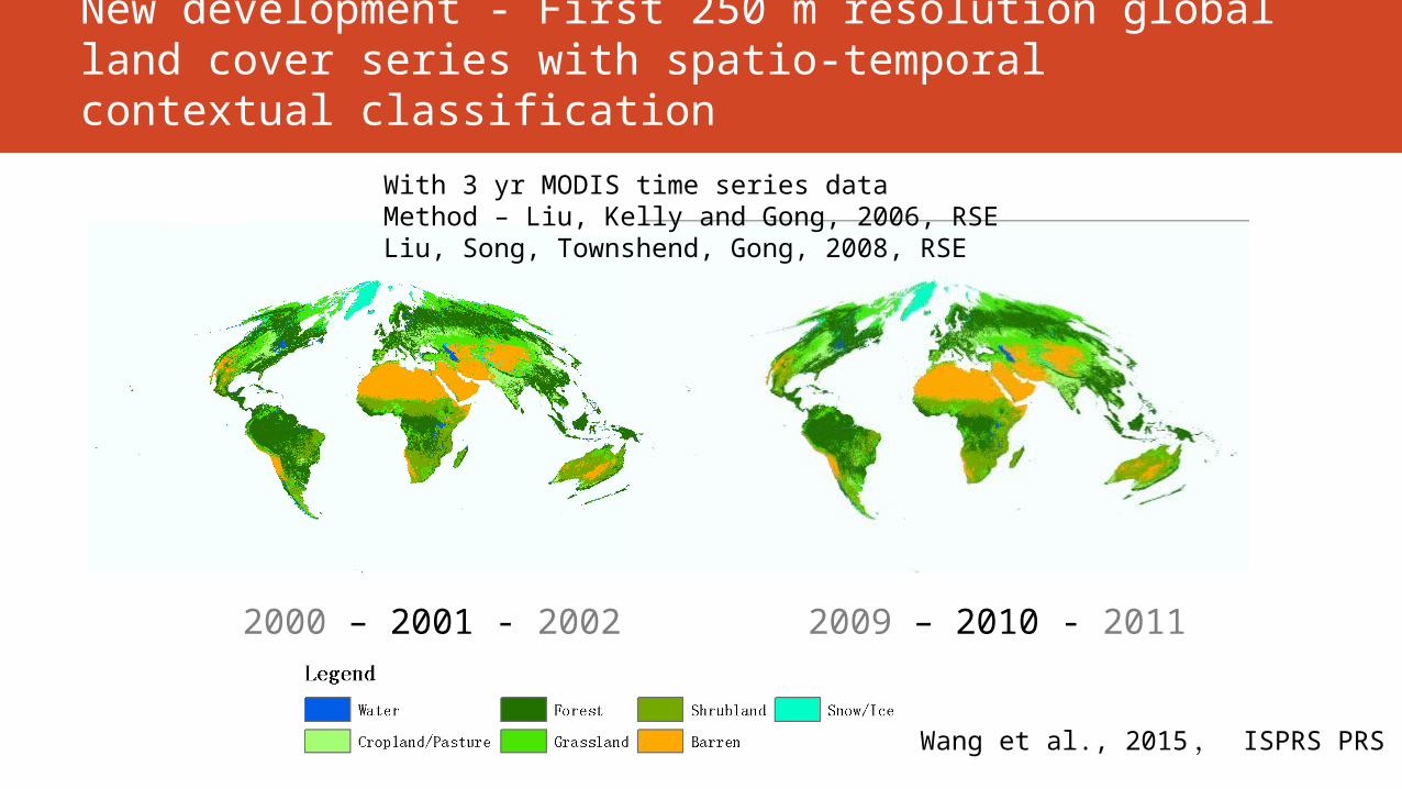
New development - First 250 m resolution global land cover series with spatio-temporal contextual classification
2000 – 2001 - 2002
With 3 yr MODIS time series dataMethod – Liu, Kelly and Gong, 2006, RSELiu, Song, Townshend, Gong, 2008, RSE
2009 – 2010 - 2011
Wang et al., 2015 , ISPRS PRS

New development - Global 1 km potential wetland map
Zhu and Gong, 2014. Science China Earth Sci
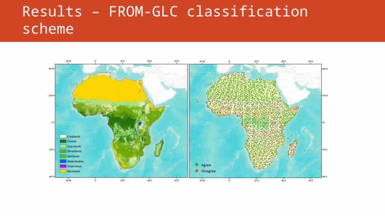
New development – 2014 Africa Land CoverResults – FROM-GLC classification scheme
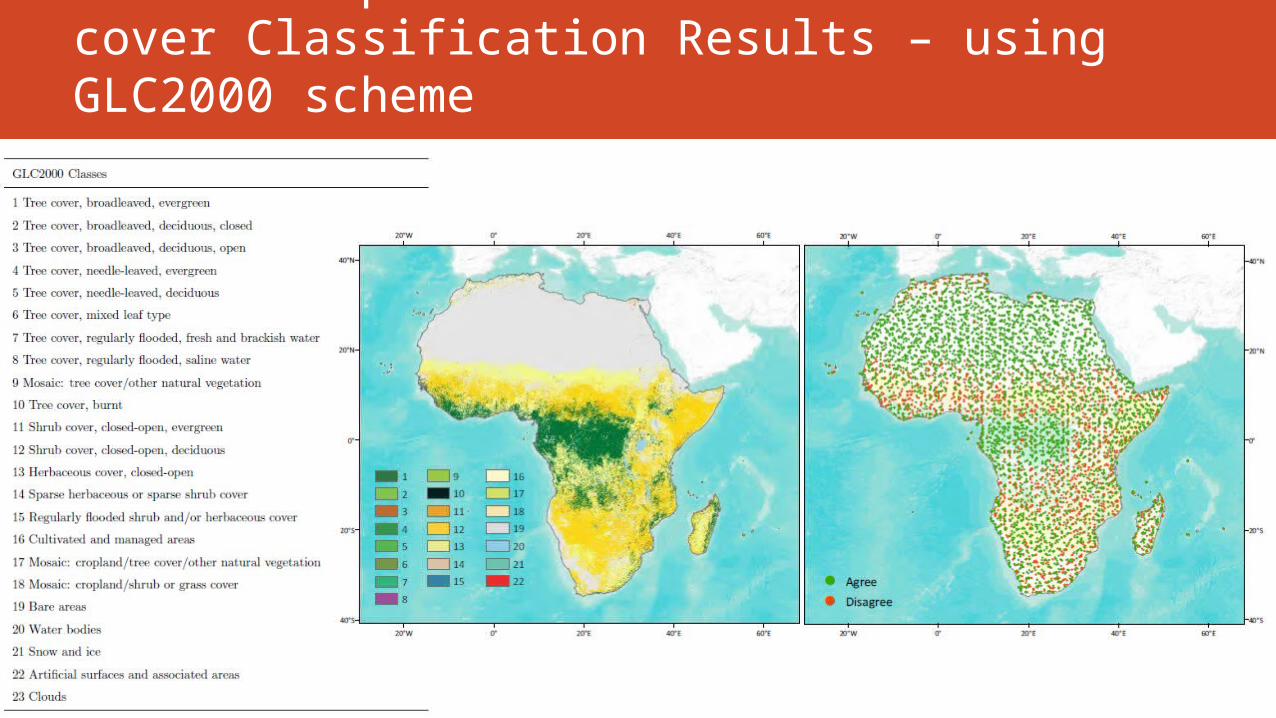
New development – 2014 Africa land cover Classification Results – using GLC2000 scheme
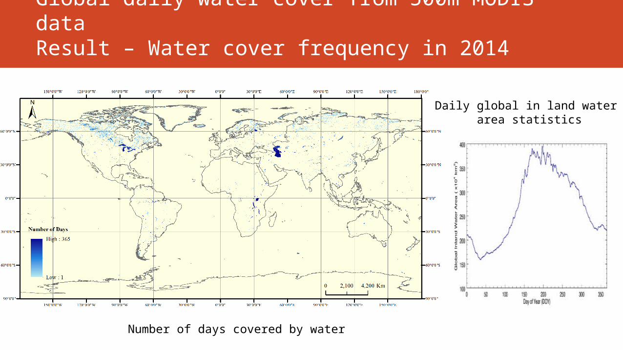
Global daily water cover from 500m MODIS dataResult – Water cover frequency in 2014
Number of days covered by water
Daily global in land water area statistics
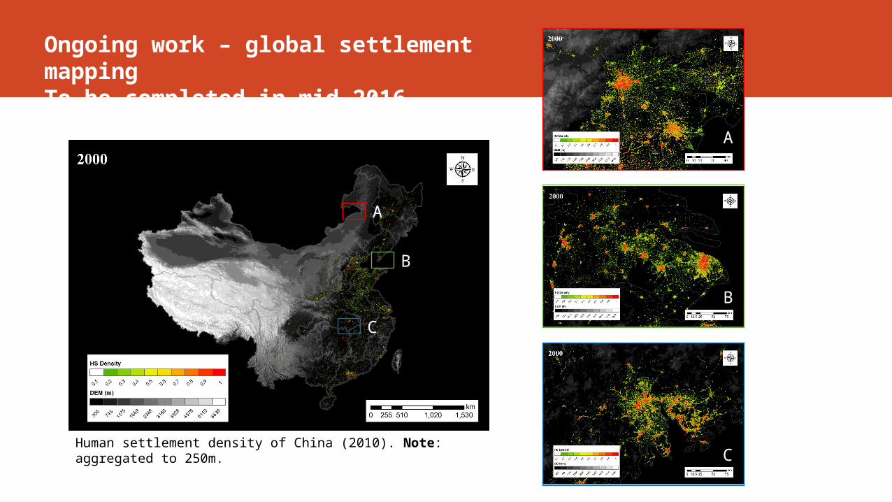
Ongoing work – global settlement mappingTo be completed in mid 2016
Human settlement density of China (2010). Note: aggregated to 250m.
A
B
C
A
B
C