Embed Size (px)
Citation preview
Gla
sg
ow
HF
Outd
oor
Clu
b 1
917
-2017
– S
harin
g 1
00 y
ea
rs o
f he
ritag
e
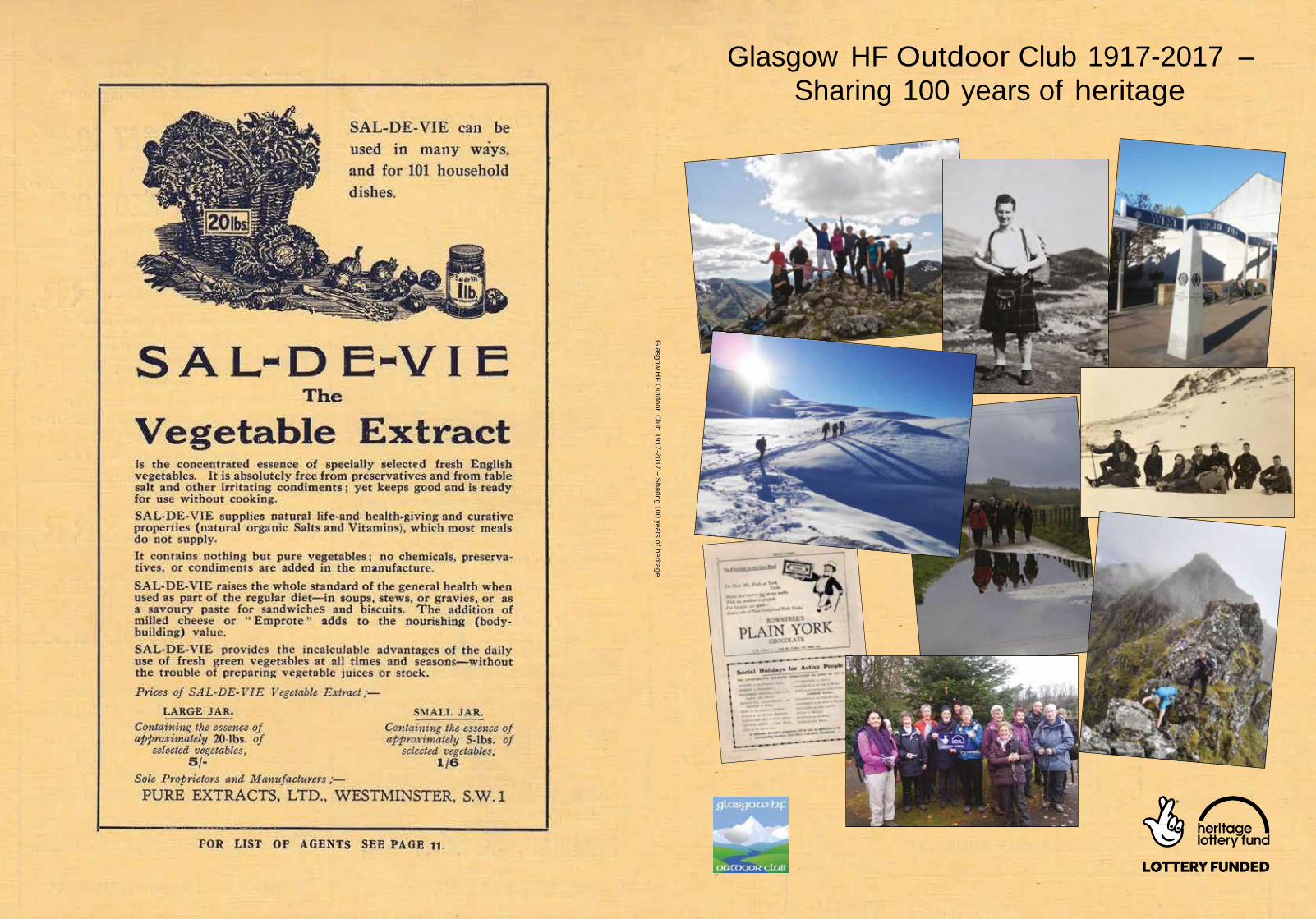
Glasgow HF Outdoor Club 1917-2017 –
Sharing 100 years of heritage
Glasgow HF Outdoor Club 1917-2017 – Sharing 100 years of heritage
Glasgow HF Outdoor Club –
Sharing 100 years
of heritage
2
Glasgow HF Outdoor Club 1917-2017 – Sharing 100 years of heritage
Copyright © Glasgow HF Outdoor Club, 2017.
All rights reserved.
The moral right of the author has been asserted.
First published in Scotland in 2017.
No part of this publication may be reproduced, stored in a retrieval system, or transmitted, in any
form or by any means, without the prior permission in writing of the publisher, nor be otherwise
circulated in any form of binding or cover other than in which it is published and without a similar
condition including this condition being imposed on the subsequent purchaser.
Typeset in Avenir.
4
Glasgow HF Outdoor Club 1917-2017 – Sharing 100 years of heritage
Acknowledgements
When I started this book little did I realise the rich heritage that had been saved by members over the previous 99
years. Material previously stored in attics, garages, cupboards and boxes saw the light of day for the first time in
many years. The following are to be recognised as playing their part in making the archives available to you today.
Heritage Lottery Fund – without which this book would not be in your hands.
The following organisations provided us with letters of support, without which we would not have received the
grant from the Heritage Lottery Fund.
The Mitchell Library Glasgow Archive Unit – who currently hold our archives Ref TD 1937
Mountaineering Council of Scotland (MCoS) – now Mountaineering Scotland
The National Trust for Scotland
Scottish Natural Heritage
The Munro Society
SCRAN – Scottish Communities Resource Archive Network, providing digital educational material for schools
colleges libraries and universities.
My 3 proof readers.
Fiona Gauld for book design.
Picture credits
It is not possible to credit every photograph in the book over a 90 year period. I have tried where possible to
make sure credit is attributed, but if I have missed you out then please contact me via the website at www.
meetup.com/glasgow-hf-outdoor-club
In particular Sheila Watt, Toronto, Canada mainly chapters 1,2,3,4; Mildred Ross, Gerena Sumen, Pamela Wilson,
Jean Gibson, Joan Rennie, Sheryl Adams, Valerie Inglis, Aggie Kaluzna, Allan Ramsay, Paul McGregor, Nick
Dickens, Claire Wilson, John O’Brien, Laura Nava, Kathleen McGovern, Fran Mancuso, John Moore, Jim McLarnon
(editor) and some from online picture libraries.
And to every individual member of Glasgow HF Outdoor Club that has lead a walk, served on the committee,
been a car driver or took part as a paid up member in our walking programme over the past 100 years.
Thank you to every one of you.
6
Introduction
Foreword by Heather Morning,
Mountaineering Scotland
Glasgow HF Outdoor Club was founded in 1917 during the pre-
war years with a view to providing the opportunity for folk to
enjoy the countryside, explore new places and meet friendly,
like-minded people. The ethos of the club has changed little;,
what has changed however is how members communicate and
travel to their adventures. Letters and phone calls have been
replaced by the internet for planning and preparation;, travel to
the hills has moved from tramcars and buses to private cars. What
hasn’t changed though is the magic adventures experienced on
the clubs numerous days out and the camaraderie and craic that
ensue with like-minded folk on the hill.
Glasgow HF has not been an inward looking Club either. During
the Club’s early years The Club was instrumental in designing,
carrying and building the indicator on the summit of Ben Lomond,
which, as well as providing a most interesting reference point, is
also a useful pinpoint when navigating in poor visibility.
Another notable achievement by a Club member was for the planning, designing and
ultimately opening of the most popular long distance footpath in Scotland – the West Highland
Way. Little could we have known that the West Highland Way, opened in 1980 would become
such a well-travelled, well-loved route enjoyed by thousands from all over the world. The
opening of this route has also played a pivotal role in bringing much needed income into
remote communities such as Kinlochleven.
In our modern, urbanised world, Glasgow HF Outdoor Club continues to provide the
inspiration and opportunity for people to head out of the city and experience the joy and
beauty of the fabulous Scottish countryside and mountains. I wish the Club every success for
another 100 years!
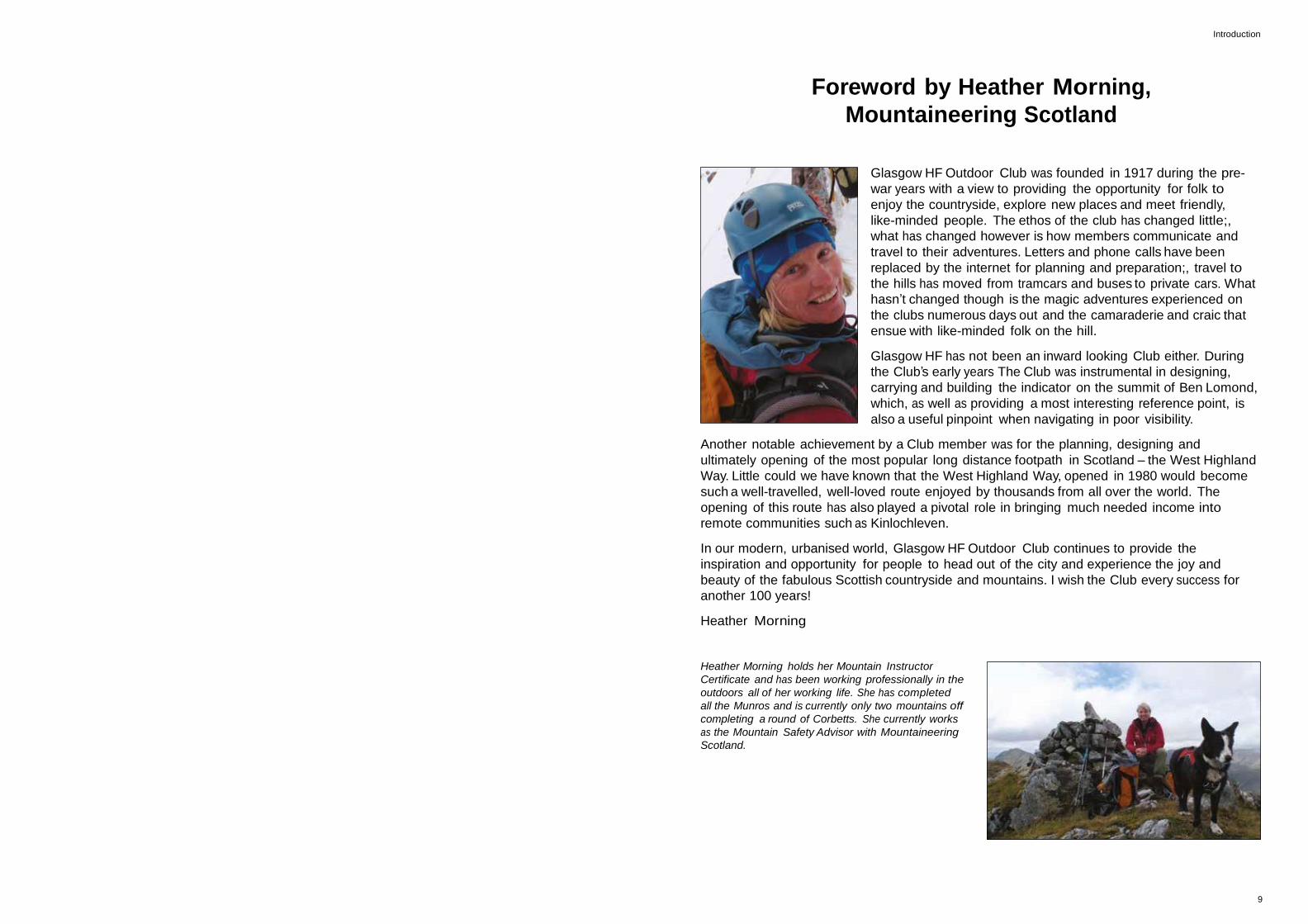
Heather Morning
Heather Morning holds her Mountain Instructor
Certificate and has been working professionally in the
outdoors all of her working life. She has completed
all the Munros and is currently only two mountains off
completing a round of Corbetts. She currently works
as the Mountain Safety Advisor with Mountaineering
Scotland.
9
Glasgow HF Outdoor Club 1917-2017 – Sharing 100 years of heritage 1917
This year 1917
Born 1917
John F Kennedy, President of USA; Ella Fitzgerald, Jazz singer; Dean Martin, American
singer/entertainer; Frankie Howard, British comedy actor; Maharishi Yogi, developed
Transandental Meditation technique; Arthur C Clarke, British born science fiction writer,
co wrote film ‘A Space Odyssey‘; Indira Gandhi, Prime Minister of India 1966-84.
Died 1917
August Rodin, French sculptor and painter; William ‘Buffalo Bill’; Cody American
showman and circus owner.
Home 1917
Royal Family adopt name Windsor from Saxe-Couburg-Gotha.
King George V visits Glasgow.
Cottingley fairies hoax photographs published in Yorkshire.
World Events
USA enter WW1
World War 1, 1st Battle of Passchendale.
Mata Hari, Dutch born dancer executed as a spy.
Russian Revolution, Bolsheviks take control of Russian Government and storm Russian
Royal Familys’ Winter Palace residence.
Arts, cinema, literature
Edgar Rice Burroughs publishes ‘Son of Tarzan’.
Moving picture ‘The Immigrant’ starring Charlie Chaplin first shown in US cinemas.
Wilfred Owen publishes ‘Dulce et Decorum est’.
10 11
Glasgow HF Outdoor Club 1917-2017 – Sharing 100 years of heritage Introduction
Introduction
Our object
‘To provide for the healthy enjoyment of leisure, to encourage the love of the open air,
and to promote social and international friendship‘.
Glasgow HF Outdoor Club is 100 years old in 2017. It has a strong membership of
approximately 300 and has a programme of walks every Saturday, Sunday, some midweek
walks, weekends away and social events too.
How we arrived at our Centenary is an interesting mix of social, economic, sporting and
popular culture. From the conflict of the First World War to the freedom of weekend leisure
time, growth in ownership of the motor car, advances in the technology of wet weather
clothing, the pursuit of ‘Munro bagging’, the world wide web and many more interwoven
strands make the Club one of Glasgow’s oldest active walking clubs today.
12 13
Glasgow HF Outdoor Club 1917-2017 – Sharing 100 years of heritage Chapter 1
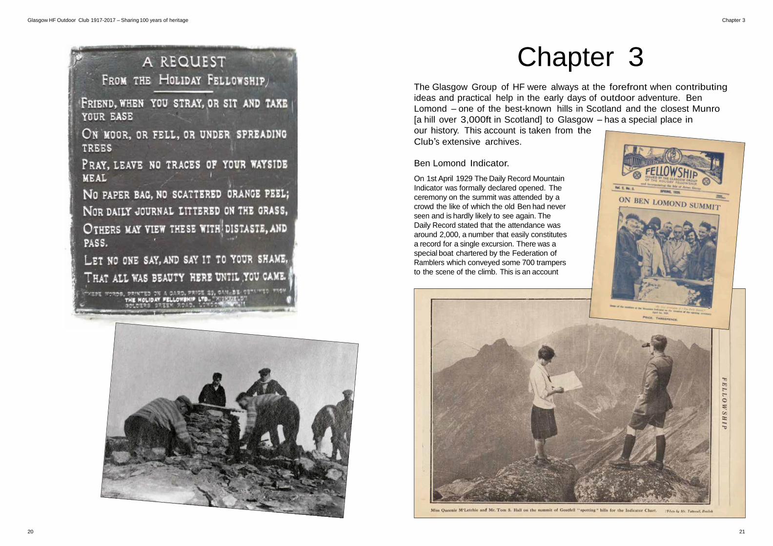
Chapter 1 The following are taken from the Clubs archives, the information is taken
directly from various Club publications and the majority of the words are
from members serving on the committee in the Clubs early years.
They were mostly strangers to each other, but
they had one thing in common, the experience
of an HF holiday, this welded them into the
power which later infused life into the Glasgow
group. The Group was thus brought to life in
the winter of 1917.
The charm of that group at that time was its
informality. Rambles were held regularly. When
walks were not, the time was spent over ham
and eggs and a ‘blether’ round the fire of a
wayside tea room.
Other less happy folks were not forgotten,
these were the war years and the boys at the
military hospital at Bellahouston in Glasgow
were not forgotten and had cause to know
the Glasgow group. It was war time of course
and consequently the ladies were largely to
the fore in the early stages under the guidance
of Mr Wallace’s presidency and the Honorary
Secretary was Miss Florence Guthrie.
Walking in the 20s was flourishing, the tramcar
was the magic carpet for the masses to the
“Borderlands of Glasgow” – the title of the
book of ‘tramps’ radiating from tram terminals.
added to the still intermittent rambles which
although active remained steady and familiar
until 1925 when things began to move. That
familiar little object, the weekly programme
made its debut in 1925. Rambles were held
monthly, four being held jointly with our close
friends the Health Culture Society, HF and
the YMCA Ramblers respectively. The most
important feature of the year was an influx
of members with energy, initiative and a real
desire for strenuous tramping.
It was the 1930s that the Glasgow Group
came through its adolescence to the vigour
of strong youth. The previous happy go
lucky and itinerant activity gave way to order
and regular action while the stress and co-
operation of effort created an enthusiasm
of friendship among the members both
individually and collectively. The membership
reached 133. The Saturday Rambles were
held weekly. A site was sought upon which
was to raise the Group Camp, later known as
Drumkinnon Camp near Balloch on shores of
Loch Lomond, and the New Year Day Tramp
was to Earl’s Seat on The Campsie Fells.
1930 is an important date in the Club’s early
years, as it was the first time that The Holiday
Fellowship had its AGM in Glasgow, the Club
introduced a Sunday section together with a
rock climbing section, members were given
the chance to give talks on their favourite
subjects, and were encouraged to attend
map reading rambles. Whatever the occasion
the camera came too, and in 1932 the first
camp site on the shores of Loch Lomond.
Growth and change were inevitable. The early
Group may seem to have been dilettante to
the strenuous trampers and climbers of the
day. It may have lacked the urge for great
experiment and development, but it laid the
foundations of friendship, comradeship and
sympathy for others, upon which the present
Group is built.
HF Holidays – The first 100 years
HF Holidays was formed in 1913 and are one
of the UK’s longest running holiday companies.
They currently own 18 (in 2015) Country Houses
in the UK and also run walking holiday abroad.
It has gone through a number of changes and
challenges in a proud 104 year history but
it still has the same sentiments at the core –
carefully selected locations, good leaders, and
convivial social gatherings.
* Thomas Arthur Leonard is an important figure in the
British outdoor movement, he helped establish numerous
organisations, including HF Holidays. Having established
the Co-operative Holidays Association he then founded
The Holiday Fellowship and was the General Secretary until
1934. The Youth Hostels Association was another of his
projects which he had a helping hand in establishing in the
1930s and was also one of the founders of the Friends of the
Lake District. The 30s were a flourishing time for the outdoor
movement and he had the honour of being the chairman of
the first national meeting of the Ramblers Association in 1935. ** Rev Henry Wallace was Minister at Glasgow Parkhead
Congregational Church from 1906 until 1937.
In the beginning
The Holiday Fellowship made the Glasgow
group. In 1916 the third year of Holiday
Fellowships existence, under the guidance
of its founder, Thomas Arthur Leonard*, The
Holiday Fellowship Ltd met at a holiday centre
in Portpatrick in the south west of Scotland
and provided the walking activities which HF
was best able to offer, and it was not surprising
that Glaswegians grasped the opportunity
with both hands and feet. During the following
winter some 12 of the Portpatrick centre
guests met at the home of Rev Henry Wallace**
in Shettleston in the east end of Glasgow.
A muster of sixty odd ramblers on Saturdays
and on Tuesday afternoons and evenings was
by no means uncommon and according to
the syllabus “song books should always be
carried”. Winter rambles always finished in a
social evening, possibly at one of the tea rooms
under the friendly ownership which the Group
regularly patronised, or it might even have been
a night at the pictures or the gods (theatre).
1921 saw Tom Hall take the helm. The tempo
quickened, and the following year two lectures
were delivered to other organisations. At St
Andrews Halls the re union in 1923 housed
around 123 friends. The Cobbler, the popular
name for Ben Arthur near Arrochar was
photographic exhibition was mounted.
Pleasure was by no means the group’s only
preoccupation. Redundancy was rife and
£23 was raised for the Miners Distress Fund,
Further funds were raised for Spaniards facing
starvation in the civil war. In the late 1930s
through the ensuing war years it continued
to function as before, while adapting itself to
current austerities. Hostilities over however we
find the Group branching out again this time
with its own choir and pantomime productions.
The Coronation in 1953 was marked with a
garden party and two years later came the
opening on Drumkinnon’s successor camp at
Aber at Gartocharn, not far from the original
14 15
Glasgow HF Outdoor Club 1917-2017 – Sharing 100 years of heritage Chapter 2
Chapter 2 The Club was very forward thinking in much of its early life. Before the arrival
of S.Y.H.A Hostels it purchased land near Balloch in order to build its own
camp, complete with accommodation, a cook house, a common room and a
swimming pool!!
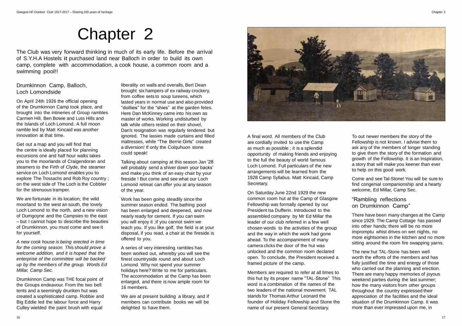
Drumkinnon Camp, Balloch,
Loch Lomondside
On April 24th 1926 the official opening
of the Drumkinnon Camp took place, and
brought into the intineries of Group rambles
Carmen Hill, Ben Bowie and Luss Hills and
the Islands of Loch Lomond. A full moon
ramble led by Matt Kincaid was another
innovation at that time.
Get out a map and you will find that
the centre is ideally placed for planning
excursions one and half hour walks takes
you to the moorlands of Craigendoran and
steamers to the Firth of Clyde, the steamer
service on Loch Lomond enables you to
explore The Trossachs and Rob Roy country ;
on the west side of The Loch is the Cobbler
for the strenuous tramper.
We are fortunate in its location; the wild
moorland to the west an south, the lovely
Loch Lomond to the north, and a new vision
of Dumgoyne and the Campsies to the east
– but I cannot hope to describe the beauties
of Drumkinnon, you must come and see it
for yourself.
A new cook house is being erected in time
for the coming season. This should prove a
welcome addition, and it is hoped that the
enterprise of the committee will be backed
up by the members of the group. Words Ed
Millar, Camp Sec.
Drumkinnon Camp was THE focal point of
the Groups endeavour. From the two bell
tents and a seemingly drunken hut was
created a sophisticated camp. Robbie and
Big Eddie led the labour force and Harry
Culley wielded the paint brush with equal
liberality on walls and overalls, Bert Dean
brought six hampers of ex railway crockery,
from coffee sets to soup tureens, which
lasted years in normal use and also provided
“dollies” for the “shies” at the garden fetes.
Here Dan McKinney came into his own as
master of works. Working undisturbed by
talk while others rested on their shovel,
Dan’s resignation was regularly tendered but
ignored. The lassies made curtains and filled
mattresses, while “The Berrie Girls“ created
a diversion! If only the Colquhuon stone
could speak!
Talking about camping at this season Jan ’28
will probably send a shiver down your backs’
and make you think of an easy chair by your
fireside ! But come and see what our Loch
Lomond retreat can offer you at any season
of the year.
Work has been going steadily since the
summer season ended. The bathing pool
has been enlarged and deepened, and now
nearly ready for cement. If you can swim
you will enjoy it ;if you cannot swim we
teach you. If you like golf, the field is at your
disposal, if you read, a chair at the fireside is
offered to you.
A series of very interesting rambles has
been worked out, whereby you will see the
finest countryside round and about Loch
Lomond. Why not spend your summer
holidays here? Write to me for particulars.
The accommodation at the Camp has been
enlarged, and there is now ample room for
16 members.
We are at present building a library, and if
members can contribute books we will be
delighted to have them.
A final word. All members of the Club
are cordially invited to use the Camp
as much as possible ; it is a splendid
opportunity of making friends and enjoying
to the full the beauty of world famous
Loch Lomond. Full particulars of the new
arrangements will be learned from the
1928 Camp Syllabus. Matt Kincaid, Camp
Secretary.
On Saturday June 22nd 1929 the new
common room hut at the Camp of Glasgow
Fellowship was formally opened by our
President Isa Dufferin. Introduced to the
assembled company by Mr Ed Millar the
leader of our club referred in a few well
chosen words to the activities of the group
and the way in which the work had gone
ahead. To the accompaniment of many
camera clicks the door of the hut was
unlocked and the common room declared
open. To conclude, the President received a
framed picture of the camp.
Members are required to refer at all times to
this hut by its proper name “TAL-Stone” This
word is a combination of the names of the
two leaders of the national movement. TAL
stands for Thomas Arthur Leonard the
founder of Holiday Fellowship and Stone the
name of our present General Secretary.
To out newer members the story of the
Fellowship is not known. I advise them to
ask any of the members of longer standing
to give them the story of the formation and
growth of the Fellowship. It is an Inspiration,
a story that will make you keener than ever
to help on this good work.
Come and see Tal-Stone! You will be sure to
find congenial companionship and a hearty
welcome, Ed Millar, Camp Sec.
“Rambling reflections
on Drumkinnon Camp”
There have been many changes at the Camp
since 1929. The Camp Cottage has passed
into other hands; there will be no more
impromptu whist drives on wet nights, no
more eightsomes in the kitchen and no more
sitting around the room fire swapping yarns.
The new hut TAL-Stone has been well
worth the efforts of the members and has
fully justified the time and energy of those
who carried out the planning and erection.
There are many happy memories of joyous
weekend parties during the last summer;
how the many visitors from other groups
throughout the country expressed their
appreciation of the facilities and the ideal
situation of the Drumkinnon Camp. It was
more than ever impressed upon me, in
16 17
Glasgow HF Outdoor Club 1917-2017 – Sharing 100 years of heritage Chapter 2
conversation with members from other
groups, that out our movement is active
and alive, that it is on the right lines, and is
certain to have a definitive influence on the
problem of making best use of leisure.
A review of the years work at Camp would
not be complete without a word about
our friends from the Dundee Group. They
visited us in spring and summer and quickly
established themselves as firm favourites;
at present they have a scheme in hand for
starting a weekend camp of their own, the
site of which was visited by a party from
Glasgow on a memorable Sunday last
August.
Soon after these lines appear I will be on way
to California where local social customs and
habits will probably be different from those
prevailing here. It will be a big wrench to say
good bye, but it will be softened
by the countless memories of Drumkinnon
Camp during 1929. Ed. Millar, Camp Sec.
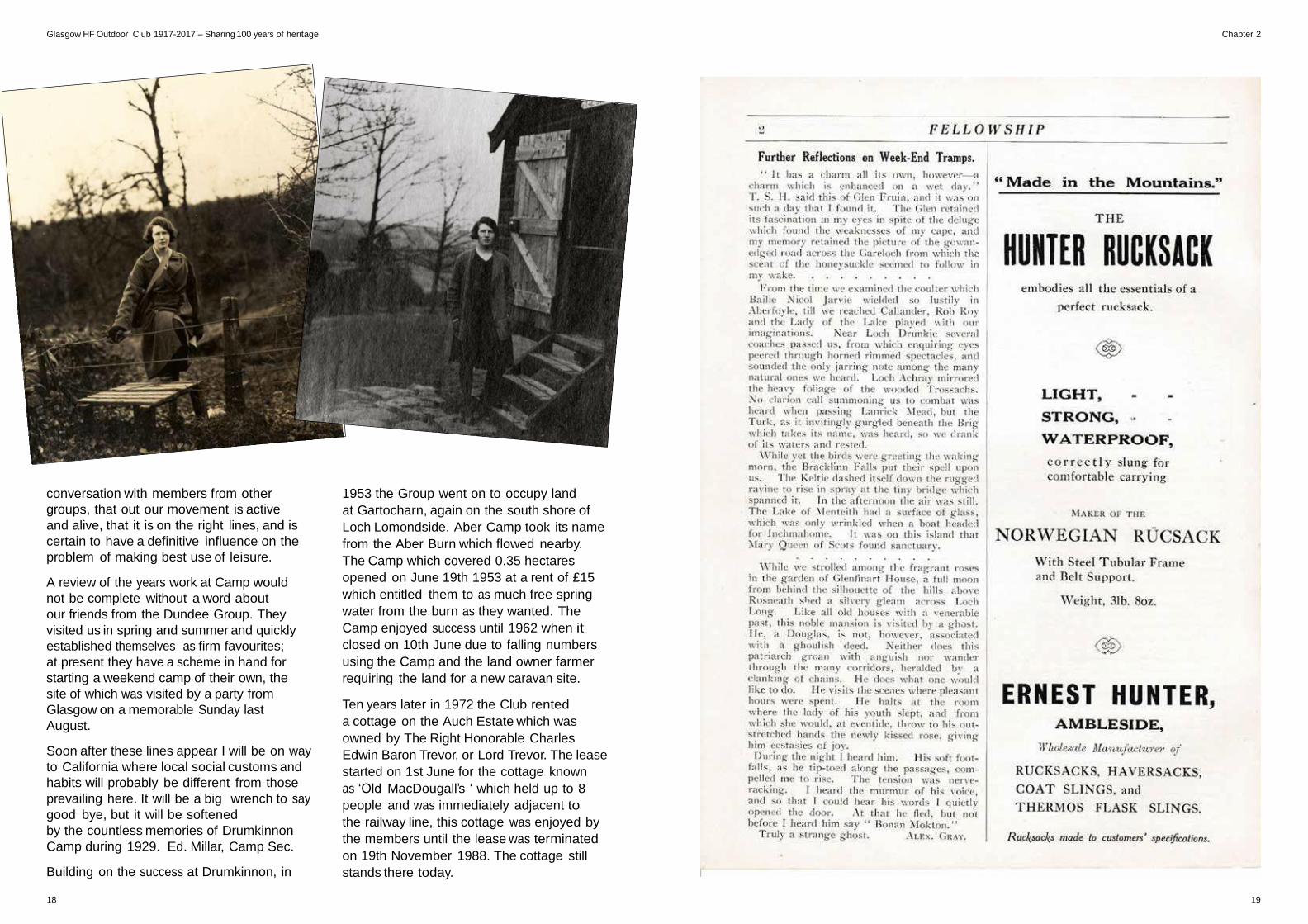
Building on the success at Drumkinnon, in
1953 the Group went on to occupy land
at Gartocharn, again on the south shore of
Loch Lomondside. Aber Camp took its name
from the Aber Burn which flowed nearby.
The Camp which covered 0.35 hectares
opened on June 19th 1953 at a rent of £15
which entitled them to as much free spring
water from the burn as they wanted. The
Camp enjoyed success until 1962 when it
closed on 10th June due to falling numbers
using the Camp and the land owner farmer
requiring the land for a new caravan site.
Ten years later in 1972 the Club rented
a cottage on the Auch Estate which was
owned by The Right Honorable Charles
Edwin Baron Trevor, or Lord Trevor. The lease
started on 1st June for the cottage known
as ‘Old MacDougall’s ‘ which held up to 8
people and was immediately adjacent to
the railway line, this cottage was enjoyed by
the members until the lease was terminated
on 19th November 1988. The cottage still
stands there today.
18 19
Glasgow HF Outdoor Club 1917-2017 – Sharing 100 years of heritage Chapter 3
Chapter 3
The Glasgow Group of HF were always at the forefront when contributing
ideas and practical help in the early days of outdoor adventure. Ben
Lomond – one of the best-known hills in Scotland and the closest Munro
[a hill over 3,000ft in Scotland] to Glasgow – has a special place in
our history. This account is taken from the
Club’s extensive archives.
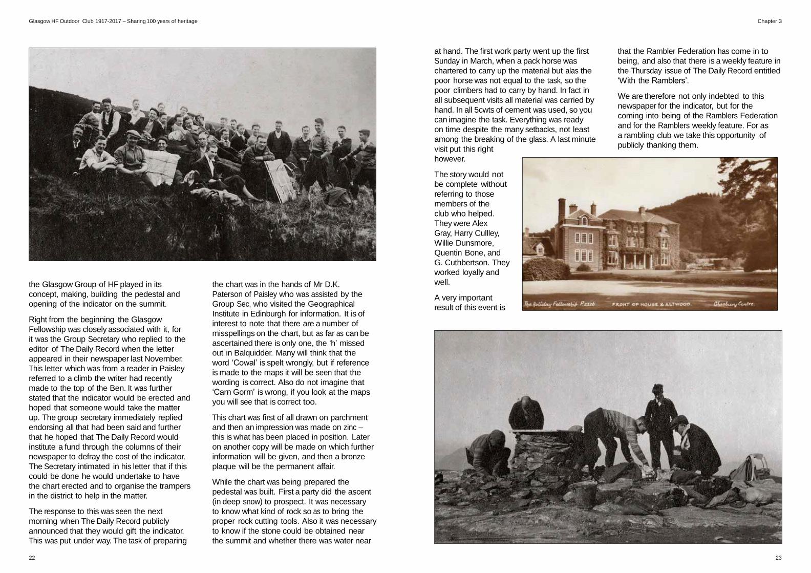
Ben Lomond Indicator.
On 1st April 1929 The Daily Record Mountain
Indicator was formally declared opened. The
ceremony on the summit was attended by a
crowd the like of which the old Ben had never
seen and is hardly likely to see again. The
Daily Record stated that the attendance was
around 2,000, a number that easily constitutes
a record for a single excursion. There was a
special boat chartered by the Federation of
Ramblers which conveyed some 700 trampers
to the scene of the climb. This is an account
20 21
Glasgow HF Outdoor Club 1917-2017 – Sharing 100 years of heritage Chapter 3
the Glasgow Group of HF played in its
concept, making, building the pedestal and
opening of the indicator on the summit.
Right from the beginning the Glasgow
Fellowship was closely associated with it, for
it was the Group Secretary who replied to the
editor of The Daily Record when the letter
appeared in their newspaper last November.
This letter which was from a reader in Paisley
referred to a climb the writer had recently
made to the top of the Ben. It was further
stated that the indicator would be erected and
hoped that someone would take the matter
up. The group secretary immediately replied
endorsing all that had been said and further
that he hoped that The Daily Record would
institute a fund through the columns of their
newspaper to defray the cost of the indicator.
The Secretary intimated in his letter that if this
could be done he would undertake to have
the chart erected and to organise the trampers
in the district to help in the matter.
The response to this was seen the next
morning when The Daily Record publicly
announced that they would gift the indicator.
This was put under way. The task of preparing
the chart was in the hands of Mr D.K.
Paterson of Paisley who was assisted by the
Group Sec, who visited the Geographical
Institute in Edinburgh for information. It is of
interest to note that there are a number of
misspellings on the chart, but as far as can be
ascertained there is only one, the ‘h’ missed
out in Balquidder. Many will think that the
word ‘Cowal’ is spelt wrongly, but if reference
is made to the maps it will be seen that the
wording is correct. Also do not imagine that
‘Carn Gorm’ is wrong, if you look at the maps
you will see that is correct too.
This chart was first of all drawn on parchment
and then an impression was made on zinc –
this is what has been placed in position. Later
on another copy will be made on which further
information will be given, and then a bronze
plaque will be the permanent affair.
While the chart was being prepared the
pedestal was built. First a party did the ascent
(in deep snow) to prospect. It was necessary
to know what kind of rock so as to bring the
proper rock cutting tools. Also it was necessary
to know if the stone could be obtained near
the summit and whether there was water near
at hand. The first work party went up the first
Sunday in March, when a pack horse was
chartered to carry up the material but alas the
poor horse was not equal to the task, so the
poor climbers had to carry by hand. In fact in
all subsequent visits all material was carried by
hand. In all 5cwts of cement was used, so you
can imagine the task. Everything was ready
on time despite the many setbacks, not least
among the breaking of the glass. A last minute
visit put this right
however.
The story would not
be complete without
referring to those
members of the
club who helped.
They were Alex
Gray, Harry Cullley,
Willie Dunsmore,
Quentin Bone, and
G. Cuthbertson. They
worked loyally and
well.
A very important
result of this event is
that the Rambler Federation has come in to
being, and also that there is a weekly feature in
the Thursday issue of The Daily Record entitled
‘With the Ramblers’.
We are therefore not only indebted to this
newspaper for the indicator, but for the
coming into being of the Ramblers Federation
and for the Ramblers weekly feature. For as
a rambling club we take this opportunity of
publicly thanking them.
22 23
Glasgow HF Outdoor Club 1917-2017 – Sharing 100 years of heritage Chapter 4
Chapter 4
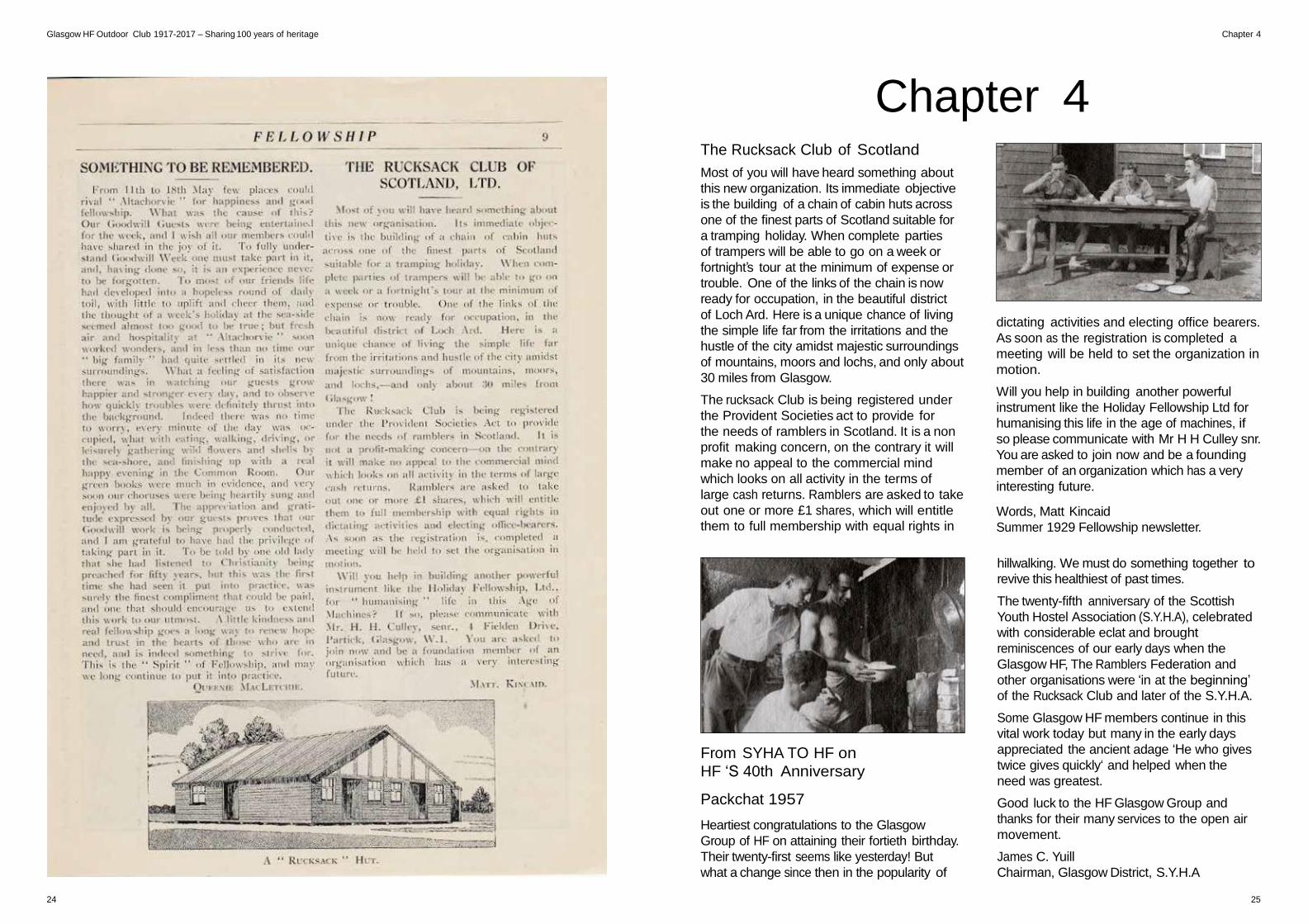
The Rucksack Club of Scotland
Most of you will have heard something about
this new organization. Its immediate objective
is the building of a chain of cabin huts across
one of the finest parts of Scotland suitable for
a tramping holiday. When complete parties
of trampers will be able to go on a week or
fortnight’s tour at the minimum of expense or
trouble. One of the links of the chain is now
ready for occupation, in the beautiful district
of Loch Ard. Here is a unique chance of living
the simple life far from the irritations and the
hustle of the city amidst majestic surroundings
of mountains, moors and lochs, and only about
30 miles from Glasgow.
The rucksack Club is being registered under
the Provident Societies act to provide for
the needs of ramblers in Scotland. It is a non
profit making concern, on the contrary it will
make no appeal to the commercial mind
which looks on all activity in the terms of
large cash returns. Ramblers are asked to take
out one or more £1 shares, which will entitle
them to full membership with equal rights in
From SYHA TO HF on
HF ‘S 40th Anniversary
Packchat 1957
Heartiest congratulations to the Glasgow
Group of HF on attaining their fortieth birthday.
Their twenty-first seems like yesterday! But
what a change since then in the popularity of
dictating activities and electing office bearers.
As soon as the registration is completed a
meeting will be held to set the organization in
motion.
Will you help in building another powerful
instrument like the Holiday Fellowship Ltd for
humanising this life in the age of machines, if
so please communicate with Mr H H Culley snr.
You are asked to join now and be a founding
member of an organization which has a very
interesting future.
Words, Matt Kincaid
Summer 1929 Fellowship newsletter.
hillwalking. We must do something together to
revive this healthiest of past times.
The twenty-fifth anniversary of the Scottish
Youth Hostel Association (S.Y.H.A), celebrated
with considerable eclat and brought
reminiscences of our early days when the
Glasgow HF, The Ramblers Federation and
other organisations were ‘in at the beginning’
of the Rucksack Club and later of the S.Y.H.A.
Some Glasgow HF members continue in this
vital work today but many in the early days
appreciated the ancient adage ‘He who gives
twice gives quickly‘ and helped when the
need was greatest.
Good luck to the HF Glasgow Group and
thanks for their many services to the open air
movement.
James C. Yuill
Chairman, Glasgow District, S.Y.H.A
24 25
Glasgow HF Outdoor Club 1917-2017 – Sharing 100 years of heritage Chapter 4
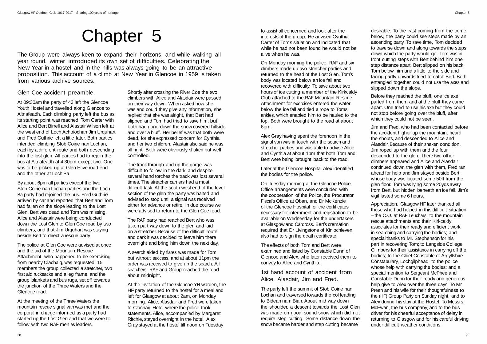
HF and The Scottish Rambling
Federation (SRF) ‘Lang may
your lum reek’
Packchat 1957
I hardly think that any members of the fifty
seven Rambling Club forming The Scottish
Ramblers Federation in 1931 would differ with
me when I state that it was members of the
The Glasgow Group of the Holiday Fellowship
who not only laid the foundation of the
organization in 1929 but did most of the spade
work which ensures its success. One only has
to look at the names Tom S Hall, President;
Alex. Gray and Matt Kincaid, to mention only
a few and the many lady members of the
group also active on the various committee’s
operating from Glasgow.
It must have given great satisfaction the HF
Group to see the immediate growth into a
National body to be known as The Scottish
Ramblers’ Federation. The Glasgow Group
of the HF was numbered among new clubs
then, but what it lacked in history it more
than made up for in enthusiasm for the
present. Furthermore it joined the very few
clubs that included hillwalking and extended
outings among their activities and no doubt
inspired the beginnings of several small
mountaineering groups that have developed
into well know clubs since.
It should be recalled that The Rucksack Club
of Scotland came from the inspired leadership
of HF members and HF Ltd became
shareholders to assist this Scottish effort.
This early experiment in ‘hostelling ‘ became
the forerunner of The Scottish Youth Hostel
Association(S.Y.H.A) in 1930 and it is not
surprising that a few HF Members were at the
meeting with Dr Fothergil when it was decided
to hand over the assets of the Rucksack Club
to the new body. The Committee of the
Rucksack Club including HF members found
another job on the Committee of the new
S.Y.H.A.
The first decade of the Federation 1929-39
was the most successful with out of doors
organisations and much of this success is
noted in the eleven Ramblers Annuals, again
with names of the HF members well to the
fore. Wattie Nelson not only contributed to the
text but supplied many illustrations throughout
the various issues.
The Glasgow Group assisted in preserving the
Ramblers’ rooms during the war and no doubt
do their little bit in maintaining then now.
Rambling is not so popular now a days and it
is good to know that the HF Glasgow Group is
one of the few active clubs still operating.
Congratulations on your group Jubilee,
we, the remaining members of the Scottish
Ramblers Federation have much to thanks you
for, ‘Lang may your lum reek’
Words (edited) Bill Ferris S.R.F
Packchat 1957
26 27
Glasgow HF Outdoor Club 1917-2017 – Sharing 100 years of heritage Chapter 5
Chapter 5 The Group were always keen to expand their horizons, and while walking all year round, winter introduced its own set of difficulties. Celebrating the New Year in a hostel and in the hills was always going to be an attractive proposition. This account of a climb at New Year in Glencoe in 1959 is taken from various archive sources.
to assist all concerned and look after the
interests of the group. He advised Cynthia
Carter of Tom’s situation and indicated that
while he had not been found he would not be
alive when he was.
On Monday morning the police, RAF and six
climbers made up two stretcher parties and
returned to the head of the Lost Glen. Tom’s
body was located below an ice fall and
recovered with difficulty. To save about two
desirable. To the east coming from the corrie below, the party could see steps made by an ascending party. To save time, Tom decided
to traverse down and along towards the steps, down which the party would go. Tom was in front cutting steps with Bert behind him one step distance apart. Bert slipped on his back, Tom below him and a little to the side and facing partly upwards tried to catch Bert. Both entangled together could not use the axes and slipped down the slope.
Glen Coe accident preamble.
At 09:30am the party of 43 left the Glencoe
Youth Hostel and travelled along Glencoe to
Altnafeadh. Each climbing party left the bus as
its starting point was reached. Tom Carter with
Alice and Bert Birrell and Alastair Wilson left at
the west end of Loch Achtriochan Jim Urquhart
and Fred Guthrie left a little later. Both parties
intended climbing Stob Coirie nan Lochan,
each by a different route and both descending
into the lost glen. All parties had to rejoin the
bus at Altnafeadh at 4.30pm except two. One
was to be picked up at Glen Etive road end
and the other at Loch Ba.
By about 6pm all parties except the two
Stob Coirie nan Lochan parties and the Loch
Ba party had rejoined the bus. Fred Guthrie
arrived by car and reported that Bert and Tom
had fallen on the slope leading to the Lost
Glen: Bert was dead and Tom was missing.
Alice and Alastair were being conducted
down the Lost Glen to Glen Coe road by two
climbers, and that Jim Urquhart was staying
beside Bert to direct a rescue party.
The police at Glen Coe were advised at once
and the aid of the Mountain Rescue
Attachment, who happened to be exercising
from nearby Clachaig, was requested. 15
members the group collected a stretcher, two
first aid rucksacks and a leg frame, and the
group blankets and bus rugs, set off towards
the junction of the Three Waters and the
Glencoe road.
At the meeting of the Three Waters the
mountain rescue signal van was met and the
corporal in charge informed us a party had
started up the Lost Glen and that we were to
follow with two RAF men as leaders.
Shortly after crossing the River Coe the two climbers with Alice and Alasdair were passed
on their way down. When asked how she was and could they give any information, she replied that she was alright, that Bert had
slipped and Tom had tried to save him, but both had gone down the snow covered hillside
and over a bluff. Her belief was that both were dead, for she expressed concern for Cynthia and her two children. Alastair also said he was
all right. Both were obviously shaken but well controlled.
The track through and up the gorge was
difficult to follow in the dark, and despite several hand torches the track was lost several
times. The stretcher carriers had a most difficult task. At the south west end of the level section of the glen the party was halted and
advised to stop until a signal was received either for advance or retire. In due course we were advised to return to the Glen Coe road.
The RAF party had reached Bert who was taken part way down to the glen and laid on a stretcher. Because of the difficult route
and dark it was decided to leave him there overnight and bring him down the next day.
A search aided by flares was made for Tom
but without success, and at about 11pm the order was received to give up the search. All
searchers, RAF and Group reached the road about midnight.
At the invitation of the Glencoe YH warden, the
HF party returned to the hostel for a meal and left for Glasgow at about 2am, on Monday morning. Alice, Alasdair and Fred were taken
to Clachaig Hotel where the police took statements. Alice, accompanied by Margaret
Ritchie, stayed overnight in the hotel. Alex Gray stayed at the hostel till noon on Tuesday
hours of ice cutting a member of the Kirkcaldy Club attached to the RAF Mountain Rescue
Attachment for exercises entered the water
below the ice fall and tied a rope to Toms
ankles, which enabled him to be hauled to the
top. Both were brought to the road at about
6pm.
Alex Gray having spent the forenoon in the
signal van was in touch with the search and
stretcher parties and was able to advise Alice
and Cynthia at about 1pm that both Tom and
Bert were being brought back to the road.
Later at the Glencoe Hospital Alex identified
the bodies for the police.
On Tuesday morning at the Glencoe Police
Office arrangements were concluded with
the cooperation of the Police, the Procurator
Fiscal’s Office at Oban, and Dr McKenzie
of the Glencoe Hospital for the certificates
necessary for internment and registration to be
available on Wednesday, for the undertakers
at Glasgow and Cardross. Bert’s cremation
required that Dr Livingstone of Kinlochleven
also had to sign the death certificate.
The effects of both Tom and Bert were
examined and listed by Constable Dunn of
Glencoe and Alex, who later received them to
convey to Alice and Cynthia.
1st hand account of accident from
Alice, Alasdair, Jim and Fred.
The party left the summit of Stob Coirie nan
Lochan and traversed towards the col leading
to Bidean nam Bian. About mid way down
the shoulder, a descent towards the Lost Glen
was made on good sound snow which did not
require step cutting. Some distance down the
snow became harder and step cutting became
Before they reached the bluff, one ice axe parted from them and at the bluff they came apart. One tried to use his axe but they could not stop before going over the bluff, after which they could not be seen.
Jim and Fred, who had been contacted before the accident higher up the mountain, heard the shouts, and descended to Alice and Alasdair. Because of their shaken condition, Jim roped up with them and the four descended to the glen. There two other climbers appeared and Alice and Alasdair continued down the glen with them, Fred ran ahead for help and Jim stayed beside Bert, whose body was located some 50ft from the glen floor. Tom was lying some 20yds away from Bert, but hidden beneath an ice fall. Jim’s vigil lasted some 6 hours.
Appreciation. Glasgow HF later thanked all those who had helped in this difficult situation – the C.O. at RAF Leuchars, to the mountain
rescue attachments and their Kirkcaldy associates for their ready and efficient work in searching and carrying the bodies; and special thanks to Mr. Stephenson for his
part in recovering Tom; to Langside College
Climbers for their assistance in carrying off the bodies; to the Chief Constable of Argyllshire Constabulary, Lochgilphead, to the police
whose help with carrying the bodies: and a special mention to Sergeant McPhee and
Constable Dunn for their ready and generous help give to Alex over the three days. To Mr. Preen and his wife for their thoughtfulness to
the (HF) Group Party on Sunday night, and to Alex during his stay at the Hostel. To Messrs.
McEwan, the bus company, and to the bus driver for his cheerful acceptance of delay in returning to Glasgow and for his careful driving
under difficult weather conditions.
28 29
Glasgow HF Outdoor Club 1917-2017 – Sharing 100 years of heritage
30 31
Glasgow HF Outdoor Club 1917-2017 – Sharing 100 years of heritage Chapter 6
Chapter 6 The West Highland Way opened in 1980 and is one of Scotland’s most
popular outdoor attractions with over 85,000 people walking along its
various parts each year and 30,000 doing the entire route. The route,
normally done south from Milngavie just north west of Glasgow to Fort
William in the north, at current total of 96 miles or 154 kms, is an established
and popular long distance route with walkers from all over the world.
But how did we arrive at the current WHW as we recognise it today? The
answer is that it has its roots firmly established in within the committee of
Glasgow HF Outdoor Club in 1969.
more than’ approximately’ …’just over’ 100
miles and as certain stretches are over rough
country it is intended for the for experienced
hillwalkers who can use maps and compass
and who were prepared to carry full packs.
It is hoped that different types of Long
Distance Hillwalkers will use the route e.g.
the people who would like to camp en route
and those that prefer putting up at hotels
and cottages for bed and breakfasts and
those that prefer hostelling will observe that
a chain of hostels are ‘in close proximity’/
near the route.
Excerpts taken from typed
report by Alex Gray
In his report on the ‘Long Distance
Pedestrian Way’, Tom Hunter of The
Glasgow Group of The Holiday Fellowship
states that – the original idea was the ‘brain
child’ of Alex Gray an Honorary President
of The Glasgow Group of the Holiday
Fellowship, seeking the advice from other
walking clubs in Glasgow he sent out a
request for help and the response was
generous and so The Long Distance Route
Committee held their first meeting on March
4th 1969. The remit was the ‘creation of
public paths and long distance routes for
walkers linking the towns and villages of
Renfrewshire, Lanarkshire Dunbartonshire
and Stirlingshire with the countryside
within and outwith these counties’ … ‘the
extent of the remit was enormous and our
subcommittee of willing workers was very
small so therefore on Alex Gray’s suggestion
I wrote to several other clubs in Glasgow
and asked for assistance the response was
very good and after a meeting with HF Club
members we rejected our wide remit and
agreed to concentrate our energies on first
of all our idea of a Long Distance Walking
Route from the heart of Glasgow to Fort
William’.
Part of this initial focus was because of
Glasgow City Parks Departments existing
plans for a new walking route ‘The Kelvin
Way’ which started in Glasgow and
finished at Dalsholm Park which opened in
September 1970, although it did not link
directly with Milngavie at this time due to
roads development.
(Ed. note) The Kelvin Way subsequently did go directly
to Milngavie and finished at the precinct where the West
Highland Way now starts.
The groups first task was to survey the area
to be covered by the new (as yet unnamed)
route, other walking clubs from the local
areas along the way would prove to be of
invaluable assistance. In an early discussion
the group suggested that if the LDR were
to continue to Mallaig the path could be
named ‘The Way to the Isles’, as yet Fort
William remains the routes final destination.
It was decided the best way to tackle this
was to send out groups of walkers divided
into field parties from the report group and
allocated sections of the proposed path
to survey, this manual process of actually
walking the way, measuring time and
distance, establishing the actual route as
obviously none existed before, linking
up existing short rights of way paths. The
various survey teams completed their
efforts in summer and autumn of 1969 and
concluded that the maps best used for
exploration of this new route were the OS 1”
to the mile maps namely sheets 46,47,53,54,
and 60.
‘Who did this report envisage would use
the this new route , Tom Hunter wrote ‘The
length of the complete route is ‘slightly
‘Consideration concerning walkers and
routes‘. It was felt that these long distance
routes should be neither for the casual
walker in soft shoes or high heels nor the
Hillman who prided himself on his ability to
cross any terrain in any weather they should
be for the person capable of energetic
walking and wanted mild adventure in
lonely places and who could use a compass
and carry his requirements in his rucksack
possibly including a tent.
It was also felt that these routes should avoid
traffic roads, pass beside or close to places
where overnight accommodation could
be had such as hotels, houses, hostels and
camp sites and also shops and telephone
kiosks.
This self reliance and outdoor spirit of
adventure and endeavour would be an
explanation for the attitude towards
signposting of the Way, and ‘should be kept
to a minimum and should only be used at
villages and main roads where the path is
not obvious...’. ‘It is presumed that in time
the long distance routes will have published
directions available to the public...’ how right
they were!
To strengthen their case for support of the
LDR WHW, *The Glasgow Herald on Friday
September 21 1970 reported that at the
opening of the Kelvin Way in Glasgow on
Sept 20 1970 five men, all members of
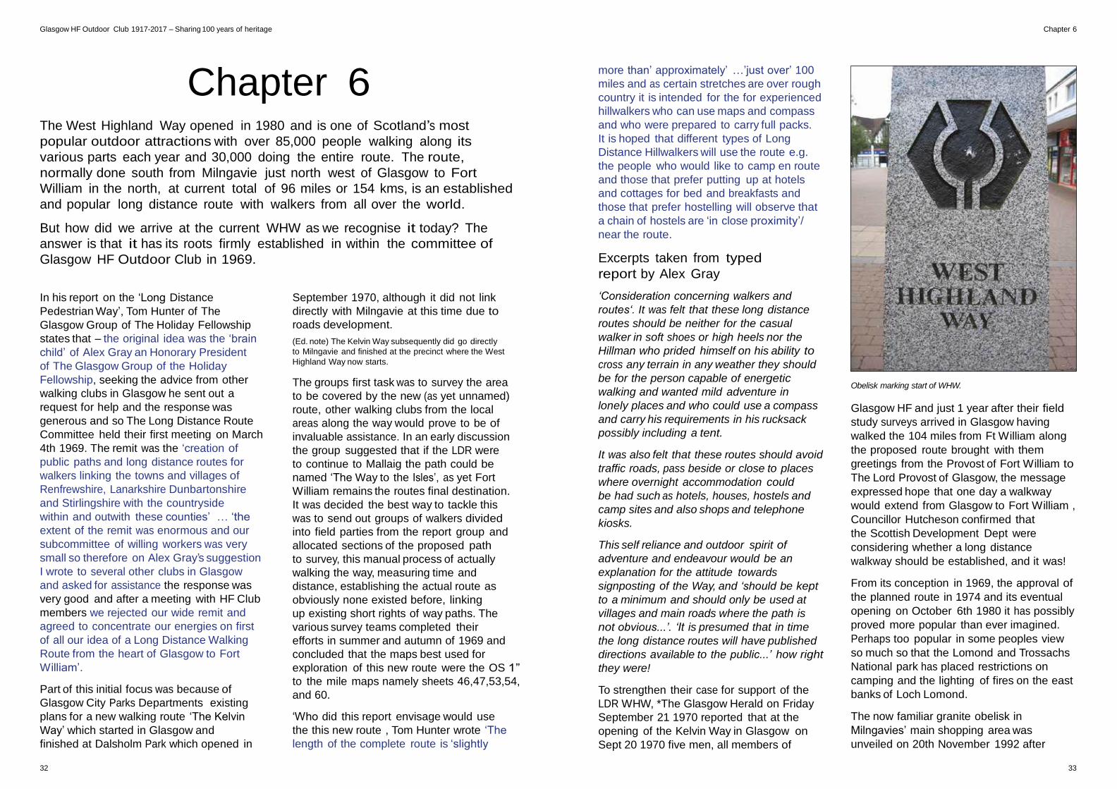
Obelisk marking start of WHW.
Glasgow HF and just 1 year after their field
study surveys arrived in Glasgow having
walked the 104 miles from Ft William along
the proposed route brought with them
greetings from the Provost of Fort William to
The Lord Provost of Glasgow, the message
expressed hope that one day a walkway
would extend from Glasgow to Fort William ,
Councillor Hutcheson confirmed that
the Scottish Development Dept were
considering whether a long distance
walkway should be established, and it was!
From its conception in 1969, the approval of
the planned route in 1974 and its eventual
opening on October 6th 1980 it has possibly
proved more popular than ever imagined.
Perhaps too popular in some peoples view
so much so that the Lomond and Trossachs
National park has placed restrictions on
camping and the lighting of fires on the east
banks of Loch Lomond.
The now familiar granite obelisk in
Milngavies’ main shopping area was
unveiled on 20th November 1992 after
32 33
Glasgow HF Outdoor Club 1917-2017 – Sharing 100 years of heritage Chapter 6
it was donated by East Dun Dist Council,
added to that in 2001 Marks and Spencers
added 2 decorative benches and an arch
through which walkers past on the start (or
end ) of their journey.
Despite the West Highland West being
developed with only the walker in mind little
did Tom Hunter and his group realise the
popularity that mountain biking would play
in the enjoyment of this LDR, many bikers
have made the traverse either in whole or in
parts some even in one day ! As impressive
as this may be what was probably also not
envisaged was the growth/ popularity of Trail
Running and Ultra Marathon running, there
are 3 organised and well established races
that take place along the way, The 53 miles
(85k) of the Milngavie to Tyndrum section
starts at 1am in Milngavie, The Devil O’ the
Highlands starts off where the Mingavie to
Tyndrum finishes (not on the same day),
this race takes in the route from Tyndrum
to Fort William all 43 miles(69k) of it and that
includes the 1,800 ft of ascent of the Devils
Staircase from Glencoe and thankfully its
downhill run into Kinlochleven and
onto Fort William. However these 2 pale
into insignificant when the WHW race
proper is taken into account which is the
entire 96 mile (153k), started in 1991 the
record for completing the journey in one
continuous run was 17hrs and 48 mins,
however in 2010 the record stood at, and
still does, 14hrs 20m, that’s an average of 7
miles per hour for 14 hrs!
NOTES The highlighted section in blue are taken from original hand
written letters by Tom Hunter. Lines in Italic are taken directly from a typed report on the
progress of the group *All related documents are available to read at the Archive
Unit of the Mitchell Library Glasgow.
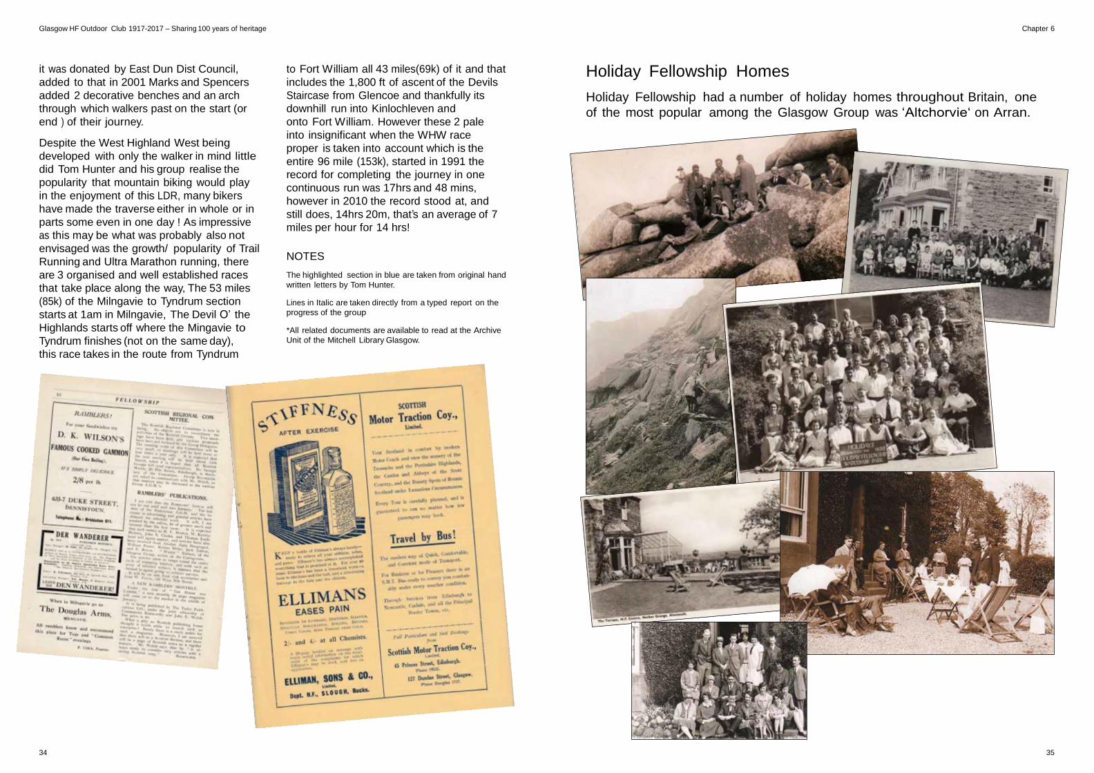
Holiday Fellowship Homes
Holiday Fellowship had a number of holiday homes throughout Britain, one
of the most popular among the Glasgow Group was ‘Altchorvie‘ on Arran.
34 35
Glasgow HF Outdoor Club 1917-2017 – Sharing 100 years of heritage Chapter 7
Chapter 7 Cathy McMillan’s last Munro. The first woman in Glasgow HF Club to climb all
of Scotland’s 284 Munros.
August 29th 1982 was a landmark in Cathy
McMillan’s life because it was the day she was
going to climb the 3,500ft Ben Dorain, the last
of the 284 Munros which she had spent the
last seven years of her life climbing.
She was very excited and even had her hair
done at the hairdressers the day before.
She had also bought a new pair of royal
blue cordouroy breeches for this important
occasion. She said she felt like a bride.
Thirty three people including Glasgow HF
Outdoor Club members and other friends
accompanied her to help her celebrate and
excitement was running high as we set off from
Bridge of Orchy for the Corrie an Dothaidh
route to take us to the summit of Ben Dorain.
Unfortunately the weather wasn’t very good
and after the first 1,000 ft visibility was very
poor but at last a large cairn loamed out of the
mist, ahh the summit was in sight and cheers
went up!
Everybody lined up behind the cairn and a
piper piped Cathy onto the top and another
cheers went up. Cathy s husband and son
joined her on top of the cairn and a bottle of
champagne was opened and fizzed from the
bottle. There were drinks all round and nibbles
from a Tupperware ‘party Susan’. Everybody
was cheering and dancing wildly around the
cairn, it was all very exciting.
Then an HF member Peter Kemp called for
attention to inform us we were not at the
summit. The mist had led us astray! The true
summit was about 200 metres further along.
Hurriedly we gathered everything up and
made our way to the actual summit cairn
where once again Cathy was piped onto the
cairn. More champagne flowed as we carried
on with the celebrations still in high spirits, Ben
Dorain had not seen a last Munro like it!
Then it was back it was back down to the cars
at Bridge of Orchy and another drink before
setting off for the celebrations at ‘The Drovers
Inn’. Cathy gave a speech and ended up by
urging us all to do The Munros, a suggestion
that was taken up by many of the HF
members.
The celebrations ended by us dancing ‘The
dashing white sergeant ‘ to the skirl of the
pipes, a fitting end to an unforgettable ‘Last
Munro’.
Words by Jean Gibson.
Some of Cathy’s other achievements
• Ran 2 marathons
• Was speed/champion time trail cyclist
• Climbed Ben Lomond over 100 times
• Passed her advances driving test.
Cathy McMillan’s last Munro
by Wendy Gibson
When Cathy climbed her first Munro
To climb another she had to go
But when she thought she wanted to stop
To her surprise she found she could not For
by the Munro bug she had been smitten and
to climb them all was her ambition
so this at once she took to task
and seven years later she climbed her last
now at last her aim complete
She now may rest her weary feet
36 37
Glasgow HF Outdoor Club 1917-2017 – Sharing 100 years of heritage Chapter 8
Trekking poles
Chapter 8
recommended by professional guides and
leaders on the continent and they recommend
using two poles.
I personally use only one and have a friend who
laughed at me out on the hills in perfectly good
conditions walking with “that stick” as he called
it. He recently damaged an ankle and is now
the owner of two poles! I had a wee laugh at
him.
I mention some of the benefits that the
manufactures suggest namely:
• Transference of weight especially downhill;
• Relieving pressure on lower back and knees;
• It is estimated that a pole will take an estimated 250 tons on an 8 hour hike
As a worker
in a restricted
profession he did
not fight in the
Second World War
but was an air raid
warden instead. My
mum’s duty was to
bake bread in the
event of disaster.
During his time in the Glasgow H.F., Forrest
was in charge of Sunday Buses. He told me
that he was responsible for a trip one Sunday,
immediately after the Clydebank blitz, and
the roads were full of bomb craters. As they
couldn’t contact anyone to cancel the trip,
they went ahead with the bus anyway, and had
to just drive round the craters. When the bus
arrived at their destination everyone piled out
& fell asleep in the countryside as they hadn’t
slept for several nights.
This photo, in the history part of the website,
with the 5 sisters in the background, was taken
in springtime 1967. I was expecting Alistair
at the time and was delighted to be able to
get to the Ratagan Youth Hostel. I had heard
from Bill what a great place it was and I wasn’t
disappointed.
With the arrival of Alistair, our climbing
days were curtailed for a while, however we
continued to take part in the family walks with
all the other parents with young children. The
family rambles were very popular and always
was good fun. One that we led was in Bridge
Of Weir, where we lived, and the children were
able to roll their Easter eggs in the local Glen
Park before going on the walk.
In 1972, H.F.
member John
Oliver organized a
gliding evening at Many advances and innovations have been adopted by the club throughout its 100
years! Walking with trekking poles was back
in the early 1990’s seen as a fad that only the
continentals needed but “we” didn’t because
we were Scottish and HF!
It has become noticeable that trekking poles
have become much more popular. Some
walkers have two! It is interesting to note the
benefits there are from using trekking poles.
For people who have knee trouble the poles
are a tremendous aid. However they are not
only for folk with knee trouble, they are highly
Three Generations of The Glasgow H.F.
Hamilton Forrest
Smith, Pamela
Wilson & Alistair
Forrest Wilson
My father, Hamilton
Forrest Smith
(he was known
as Forrest), was
born in Glasgow
in 1910. Son of
James Hamilton
– 31 tons per hour;
• Will enable a more upright posture;
• Breathing is helped.
There are more benefits so it makes one think
that perhaps they are worth a try! They cost
around £24 which you may feel to be a bit
expensive when one could use an old wooden
walking stick or tree branch. The trekking
pole, however, is adjustable to any length you
require. You can’t do that with an old walking
stick!
Margaret Grieg. Packchat 1992
Smith, a typesetter on the Glasgow Herald, he
had two brothers, Jimmy & Robert and they
grew up in Shawlands. He did well at school
and joined Yarrows shipyard where he became
a naval draughtsman. In the mid 1930s, while
staying near Wakefield in Yorkshire, he met
my mother, Mabel (also Smith!) on a bicycle
trip. They were married in 1939 and settled in
Bearsden, Glasgow.
He was president of the H.F. in 1942, the year I
was born.
He was an active member for many decades,
leading walks & climbs, and I am delighted to
still have his wooden ice axe, complete with
leather cover, with his initials engraved on it.
My husband (Bill) and I joined the H.F. in 1963
and we were lucky enough to have 4 years of
climbing before Alistair was born. We weren’t
‘munro-baggers’ but thoroughly enjoyed all
the days and weekends away. In those days
there were far more buses organized as fewer
people had cars.
Many of you may
remember John
McCulloch (from
Saltcoats) brightening
up the Sunday bus
trips by organizing a regular quiz, courtesy of
The Sunday Post. Round this time Margaret
Ferguson would organize annual Burn’s
suppers in Glasgow, Ayr & Edinburgh in
various hotels & members would perform
songs & poetry. Another popular H.F. activity
were the barbecues. One I remember was at
Sallochy Bay, Loch Lomond side. This tradition
continues to this day with the barbecues at
Mugdock Park, where Alistair is usually the
chef.
Strathaven. I had
two boys at the
time and my friend
very kindly looked
after them for me
so that Bill & I could
go. The weather
was dreadful before and after the event but on
the evening it was beautiful, with sun and blue
skies. It was a wonderful experience silently
gliding through the blue skies.
The next time we went youth hostelling was
Easter 1978 at Inverary Youth Hostel. By this
time I had 3 sons and as they were all over 5
years old we were able to go. We had a lovely
German lady, Trudi Galeski in our club and she
organized an Easter egg hunt for the children.
Alistair was the eldest, won most of the eggs
& was most disappointed that they had to be
shared out.
The club rented a
railway cottage on
the West Highland
Way near Auch,
between Tyndrum
& Bridge Of Orchy.
It had cold running
water, an indoor
38 39
Glasgow HF Outdoor Club 1917-2017 – Sharing 100 years of heritage Chapter 8
toilet but no electricity. In 1977 our family had
a wonderful fortnight’s summer holiday there
for the bargain price of £28. The railway ran
along the bottom of the garden, and as the
The Glasgow HF has always been such a
friendly club. My family has benefited greatly
from being members. Alistair continues as an
active member, leading summer and winter
Packchat 2012
Jack Cowie (John Scott Cowie 1922 – 2011)
trains passed by, the driver would sound his
horn and our 3 boys would dash out & wave at
the passengers. Just like the railway children.
The weather was fantastic and on the Friday
the club came down for the Glasgow fair & it
started raining.
walks and enjoying the company. My family’s
three generations have thoroughly enjoyed
taking part and hope that the club continues
for many more years to come.
Sadly Jack passed away on Friday 16th
December at the Victoria Infirmary. He was
always very interested in the Club, knew its
values and continued to renew his
membership right up to the end of his 89
years of his life. Although he will be mostly
remembered as Club Treasurer for his
incredible 43 years in his post, he was also a
this selflessly and unassumingly and had a
fine, dry sense of humour – he was typically
unflappable and meticulous in his various roles
never making a fuss, just got on with the job
year on year.
Jack’s funeral service was at Williamwood
Parish Church and his burial was at Mearns
Cemetery on Thursday 29th December. It was
Chriss Anderson, The Club’s longest serving member. popular Club leader before and during this
time also. He gave a tremendous amount well attended by the many Club members who
knew him. He was a real gentleman in the old Chriss was born in Govan and went to Elder
Park primary school and Govan High. She
started her working life in Thomas the fish
merchant in the Glasgow Fish market but soon
joined the administrative staff of the Productive
Grocery Company of the Scottish Cooperative
society in Shieldhall where she stayed until she
join the staff of Glentaner Knitwear of which
Glen hat skirts was a part. There she remained
until she retired in 1952. She was a regular
church attender, first of all at St Kenneth’s
Church Govan where she was christened, then
Cardonald Church and finally Queens Park
West Church. It was in 1925 that she joined
the Glasgow group of the Holiday Fellowship
which had been founded the winter of 1917.
Her love of Arran made her a regular visitor to
that Island and in 1935 she became Godwill
secretary for the Holiday Fellowship arranging
holidays at Altchorvie. Chriss held the post of
Goodwill sec for 35 years.
In total she arranged and obtained the finance
for more than 1500 holidays in Lamlash for
deserving people and their children – some
of whom had never had a holiday in their life.
For this sterling work Chriss was commended
by the Lord Provost and Council of the City of
Glasgow. In the 1950s and 1960s, Chriss was
a member of the general committee of HF Ltd
and held that position for 17 years. She was
also a person who loved company and was an
excellent hostess (her cream sponge was
alight as a feather and many a committee
member looked forward to her tea and cakes.
As honorary President of Glasgow HF Outdoor
Club, she followed the clubs progress right
up to the end of her vigorous life. No one
was left in any doubt abut her genuine desire
to maintain the ethos, objectives and high
standards of the club as it adapted to the
different needs of its members over the years.
Her zest for life, her dedication to the task on
hand, her compassion and her obvious pride
in the achievements of others, were qualities
that made her and inspiration to us all.
Compiled by her Nephew and friends with in HF.
over the course of his membership, all
the one thousand and one deeds, which
were crucial to the necessary function and
good housekeeping of the Club. He did
Winter 2009 Packchat
Centenary Fund Jack Kerr
In 1917 almost every able bodied man was
fighting on the Western Front or lay buried in
Flanders. Women were working on munitions
and the land, and Britain, was war weary.
This was hardly a good time to launch a
club devoted to outdoor activities. However,
The Reverend Henry Wallace of Shettleston
had faith. I am sure that even he would be
surprised that the club he founded would last
92 years and would soon be celebrating its
centenary. We live in a world of change but the
club has followed the time honoured percept
of ‘adapt and survive ‘. Even the clubs name
has changed from ‘Holiday Fellowship ‘ to
‘HF’.
The meaning of the word fellowship used
t mean friendship but now it has an almost
exclusively religious connotation. However,
one thing that has not changed in the club
is this notion of friendship. Willingness to
take office to and friendship are qualities
which keep the club going from strength-to-
strength. Few members realise that well over
sense and never took himself too seriously –
he had seen more than enough of life to do
so! Our sympathies to his daughter Mhaire and
the family. 100 leaders for climbs and walks have to be
found each year.
I have suggested to the club committee that
we open a ‘2017 Account’. This account
will be used to defray the cost of Centenary
Celebrations. Although I will not be here in
2017, I would like to feel that after a long
connection with the club, I will be remembered
by some of the current club members during
these centenary celebrations. I have therefore
given a sum of money to open this account
and feel sure that there will be some older
members who would like to be similarly
remembered. Accordingly the committee
have agreed that everyone that contributes
shall be mentioned in some sort of centenary
celebration publication. It is my expressed
wish that only names and contributors be
mentioned and not the amount given.
Therefore please do join me and give some
money to this fund, if like me, you are
unlikely to be present at the Clubs Centenary
Celebrations.
40 41
Glasgow HF Outdoor Club 1917-2017 – Sharing 100 years of heritage Chapter 9
Chapter 9 The walking and climbing of high Alpine summits today is a big tourist
industry, just google your intended 4,000, peak and up pops numerous online
climbing and trekking companies competing to take you ever higher. In 1993
and 1994 a group of HF members got together and decided to go that little
bit higher, without the aid of a website or online forum.
Glasgow HF group before their ascent of Mont Blanc 1993 – photo credit Joan Rennie.
Margaret’s exploits earned her a page
of praise in the Glasgow Evening Times
newspaper on Thursday 21st July 1994. This
article is available to read in our archives.
Margaret B’s story.
After the necessary 3 days acclimatisation
we set off in brilliant sunshine for the 4,807m
summit. Cable car and cog railway brought
us to 2,300m, where the hard work started,
by the late afternoon having traversed the
dreaded couloir without mishap; we reached
the Refuge de Goutier at 3,800m now feeling
the effects of altitude.
Next a good meal an early night in a tightly
packed dorm and a 2 am rise to chaos, a sea
of ropes crampons and torches as everyone
prepared for the ascent at 3 am! We set off
following a long line of lights weaving their
way up the mountain, the pace slow, but
steady. Discomfort and breathing difficulties
were forgotten as we viewed a spectacular
sunrise. Steeper and narrower... finally we
rounded the summit... and we gazed over
to Switzerland in the north and Italy in the
east. Superb views perfect weather. It was not
always easy but without doubt well worth the
effort. Margaret Brown.
John’s story – Return to the Alps.
Over 30 years ago I had my first opportunity
The highlight of the tour was the climbing of
the Gross Glackner at 11,500 ft. This was a
high level hut to hut type holiday and being
a little younger I never doubted that I would
complete the tour. This year I returned to the
Alps – the objective – to climb Mont Blanc.
Having read the various accounts of the ascent
of this ‘hill’ I realised I might have problems with
altitude so I improved my fitness by regularly
swimming, cycling and hillwalking although it’s a
known fact that altitude over 8,000 ft can affect
the fittest of climbers. Travel to the Alps has
improved somewhat over the past 30 years. My
first trip began on the ‘Starlight Express’ from
Glasgow/London for 13 hours, train, boat and
train again not reaching our destination till mid-
afternoon a day and a half later. This year it was
overnight coach to Heathrow/Geneva and mini
bus to Chamonix – a difference of 24 hours!
It was also much more congenial to be based
in a B&B hotel with a few nights in huts rather
than moving daily as previously (from hut to
hut). The intense preparation for the ascent of
Mont Blanc merits this and the many facilities
of Chamonix gave some relaxation to the
holiday.
Congratulations to our magnificent seven on
climbing Mont Blanc Europe’s highest summit.
An outstanding achievement! Well done team.
On top of the world Europe: Mont
Blanc conquered by HF.
Margaret G’s story.
The origins: A simple coffee stop in Aviemore
in September 1992; a card in a sports shop
which read “why not do the Tour du Mont
Blanc with Hilary Sharp?”. The idea: Why not
Climb Mont Blanc with Hilary Sharp? Thus
began the plan and by Easter this year (1993)
our group of 7 stalwarts was established: Joan
Rennie, Mary McIlroy, Margaret Brown, John
Barrowman, Tom Addie, Stephen Thomson
and myself – all club members.
Arrangements were made to climb Mont Blanc
on 7/8th July with Alpine guide John
de Montjoye (an Englishman!). We were
strongly urged
to include 3 days
acclimatisation –
excellent advice as we
later appreciated. Our
objective was achieved
and we reached the
summit between 6.30am
and 7.30am on Thursday 8th July. The Alpine
rule is a ratio of 1:2 so roped to our guides
we arrived at the top at different times, far
too cold to wait for each other. Magnificent
weather, magnificent sunrise, recommended.
Margaret Greig.
Alpine Guides: John de Montjoye (Chamonix),
Andy Ritchie (Scottish), Paul (Scottish) –
Glencoe Mountain Rescue, Willie (Scottish).
to take a walking holiday in the Austrian Alps.
The same group photographed in
2016 – photo credit Jim McLarnon.
Original article by Tom Addie.
42 43
Glasgow HF Outdoor Club 1917-2017 – Sharing 100 years of heritage Chapter 10
Chapter 10
After the success of summiting Mont Blanc in France, in the following year the
same group of HF members decided to try for the Matterhorn in Switzerland.
The group were mainly walkers with a couple having some rock climbing
experience out with the usual Munro scrambles. The following article is taken
from Pack-Chat the Club’s own newsletter from September 1994.
taken up by Willie Todd, the rest of us
would try and get Swiss guides – hoping the
weather would hold – Mary McIlroy decided
against attempting the climb – this seemed
quite a sensible decision!
However we had to “prove” ourselves to
the guides, by climbing another hill with a
“funny bit on it”, and a very hard slog, but
we passed – and all set for the “Horn” the
following day. Up to the Hornli Hut stage
1, overnight, met guides, and set off – yes
at 4 am in the pitch darkness. Up and up
Addie and Stephen Thomson making really
excellent times, the two Margaret’s making a
respectable “within the book “ time.
Each of us has our own opinion of The
Matterhorn; but true to say it is not
technically difficult (with the aids provided)
never- the-less it is a long, long slog up AND
equally long down again.
For hillwalkers it is a great challenge –
requiring a head for heights; considerable
stamina; strong arms; expect no stops
President’s party conquers Matterhorn.
In July this year, John Barrowman’s dream of
climbing the Matterhorn came true.
Congratulations to the whole party on
another marvellous achievement and well
done to all the club members who eschewed
the pleasures of the sun, sand and just
dossing about – to conquer the Mountains
of Europe and the U.S.A.
Margaret Greig shares her experiences,
her thoughts and her impression of two
memorable weeks in July 1994.
“It’s a young man’s hill”
M. Greig – a personal account.
Knowing no limits to our ambitions, we set
off once again to the Alps – invigorated by
our success last year on Mont Blanc, which
only whetted our appetites for more!
Someone said that Mont Blanc “was all
snow” and The Matterhorn “was all rock –
and plenty of it “. Doubts and reservations
see-sawed like the swing of a pendulum
– “go for it “…”don’t be daft”… better to
have tried”… etc..
Our acclimatisation would be the traverse of
the Haute Route, walking over glaciers and
peaks from Verbier to Zermatt. Our
accommodation was in marvellous mountain
huts (marvellous because of the marvellous
food they provided in such remote habitats)
and prices to match the heights.
Our guide would be Willie Todd, whom
we had met last year as one of the guides
on Mont Blanc. Roped up once again
– a voluntary chain gang – we followed
doggedly in Willie’s footsteps, across
glaciers, over cols and peaks – all at a
steady nonstop pace in order to traverse
the glaciers before the snow melted into a
dangerous soup, before crevices softened
and widened…so it was go…go…go!
Used now to the usual hustle, bustle and
hassle at 4 am, as Swiss, French, Germans,
Italians and Scots, clumped around in
their hut slipper /clogs, all trying to locate
their gear among the maze and mangle of
crampons, karabiners, ice-axes, harnesses,
ruck-sacks, boots, helmets, head torches and
all retrieved in surprisingly good humoured
panic.
Staggering along behind Willie in the semi
darkness at 5 am wondering if you are fully
dressed, and, was this such a good idea
anyway – the dawn slowly breaks behind
these beautiful serrated, jagged, aggressive
peaks, as more and more gradually appear –
yes you are having a wonderful experience.
After five lovely breath-taking hard working
days we dropped down into Zermatt across
meadows massed with colourful wild
scented flowers – quite beautiful!
Next – The Matterhorn – rearing, apparently
perpendicular above Zermatt, both
intimidating and challenging – a towering
mass of rock. Donald Bennett described the
climb as “a young man’s hill”. For myself,
being neither a man nor young – I had
“ma doots” (my doubts) – but then, it was
a challenge – John Barrowman was being
and up, constant rock, good rock, loose
rock, slippery rock, scree, smooth rock …
we had the lot – really difficult bits had
ropes (hawsers), pegs and chains to assist
… with our Swiss guide good progress was
made. The summit was a snowy narrow
knife like ridge with only room for one or
two at once – a cross at the far end – a
Madonna 20ft from the summit ridge – Tom
other than putting on/off warm weather
clothing – otherwise – nae bother. NO; it is
not the preserve of young men! A holiday
to remember indeed! Then there was the
Babhoff Hotel in Zermatt…but that’s another
story.
Participants: Stephen Thomson, Tom Addie,
John Barrowman, Mary McIlroy, Margaret
Brown and Margaret Greig.
44 45
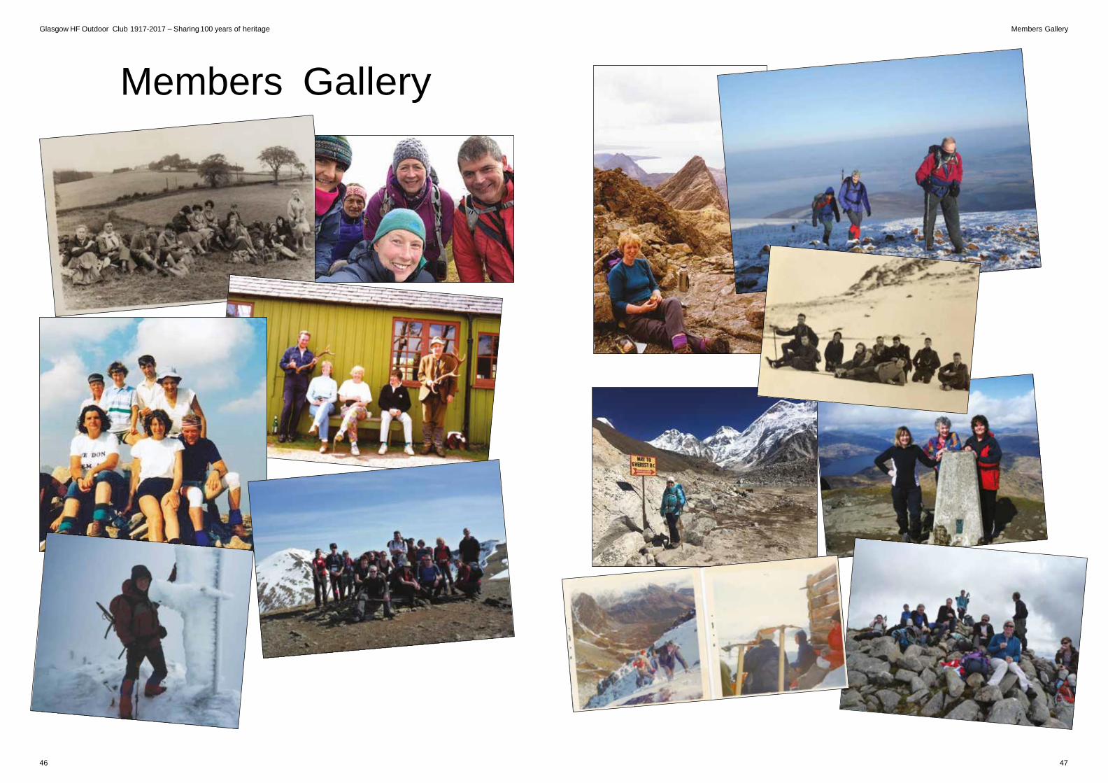
Glasgow HF Outdoor Club 1917-2017 – Sharing 100 years of heritage Members Gallery
Members Gallery
46 47
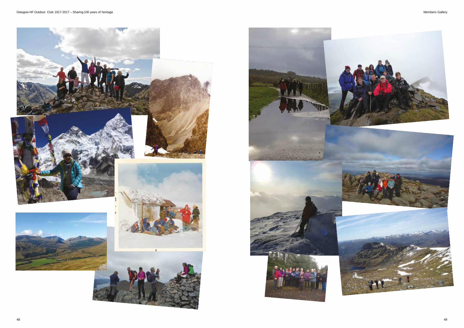
Glasgow HF Outdoor Club 1917-2017 – Sharing 100 years of heritage Members Gallery
48 49
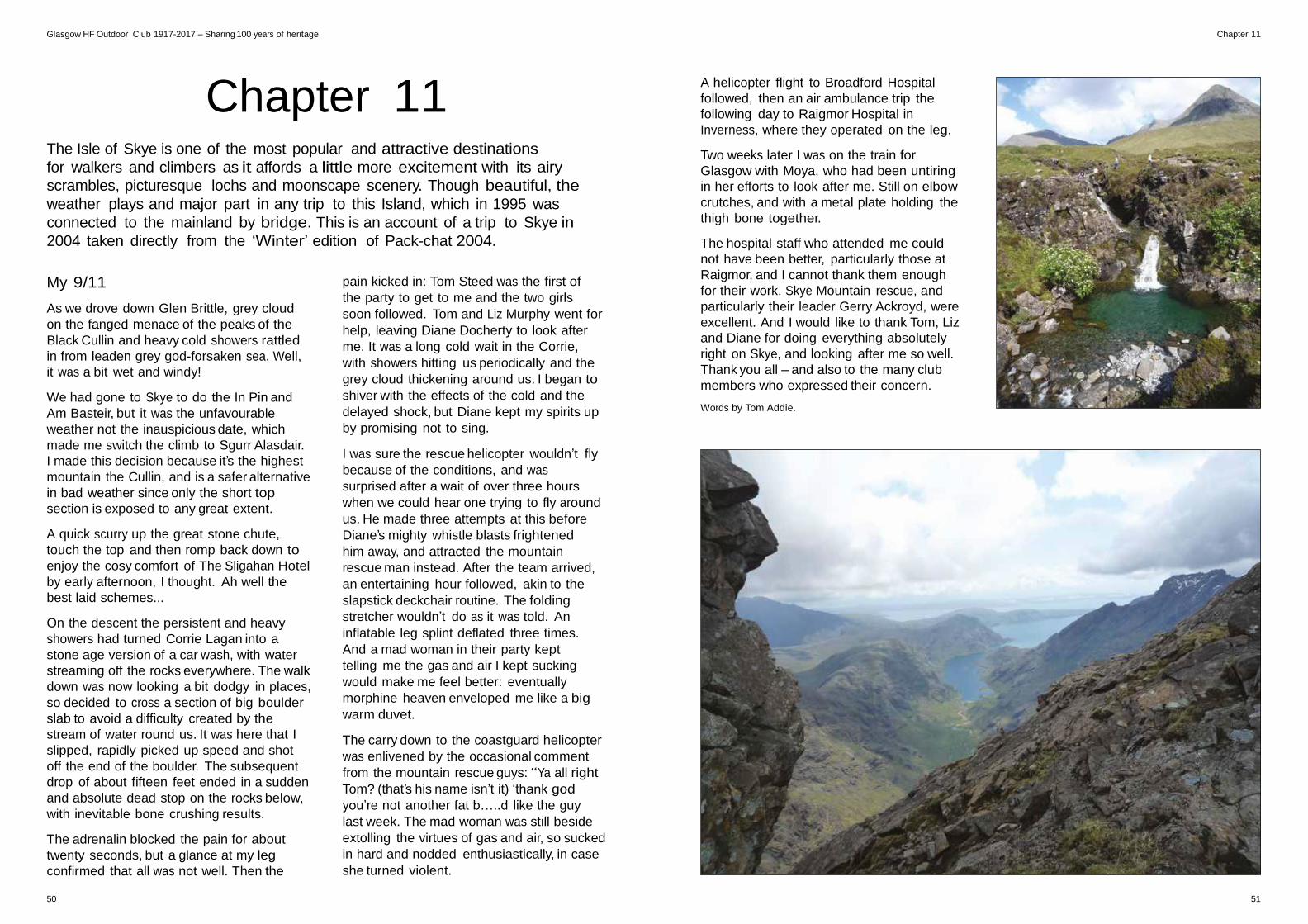
Glasgow HF Outdoor Club 1917-2017 – Sharing 100 years of heritage Chapter 11
Chapter 11
The Isle of Skye is one of the most popular and attractive destinations
for walkers and climbers as it affords a little more excitement with its airy
scrambles, picturesque lochs and moonscape scenery. Though beautiful, the
weather plays and major part in any trip to this Island, which in 1995 was
connected to the mainland by bridge. This is an account of a trip to Skye in
2004 taken directly from the ‘Winter’ edition of Pack-chat 2004.
A helicopter flight to Broadford Hospital
followed, then an air ambulance trip the
following day to Raigmor Hospital in
Inverness, where they operated on the leg.
Two weeks later I was on the train for
Glasgow with Moya, who had been untiring
in her efforts to look after me. Still on elbow
crutches, and with a metal plate holding the
thigh bone together.
The hospital staff who attended me could
not have been better, particularly those at
My 9/11
As we drove down Glen Brittle, grey cloud
on the fanged menace of the peaks of the
Black Cullin and heavy cold showers rattled
in from leaden grey god-forsaken sea. Well,
it was a bit wet and windy!
We had gone to Skye to do the In Pin and
Am Basteir, but it was the unfavourable
weather not the inauspicious date, which
made me switch the climb to Sgurr Alasdair.
I made this decision because it’s the highest
mountain the Cullin, and is a safer alternative
in bad weather since only the short top
section is exposed to any great extent.
A quick scurry up the great stone chute,
touch the top and then romp back down to
enjoy the cosy comfort of The Sligahan Hotel
by early afternoon, I thought. Ah well the
best laid schemes...
On the descent the persistent and heavy
showers had turned Corrie Lagan into a
stone age version of a car wash, with water
streaming off the rocks everywhere. The walk
down was now looking a bit dodgy in places,
so decided to cross a section of big boulder
slab to avoid a difficulty created by the
stream of water round us. It was here that I
slipped, rapidly picked up speed and shot
off the end of the boulder. The subsequent
drop of about fifteen feet ended in a sudden
and absolute dead stop on the rocks below,
with inevitable bone crushing results.
The adrenalin blocked the pain for about
twenty seconds, but a glance at my leg
confirmed that all was not well. Then the
pain kicked in: Tom Steed was the first of
the party to get to me and the two girls
soon followed. Tom and Liz Murphy went for
help, leaving Diane Docherty to look after
me. It was a long cold wait in the Corrie,
with showers hitting us periodically and the
grey cloud thickening around us. I began to
shiver with the effects of the cold and the
delayed shock, but Diane kept my spirits up
by promising not to sing.
I was sure the rescue helicopter wouldn’t fly
because of the conditions, and was
surprised after a wait of over three hours
when we could hear one trying to fly around
us. He made three attempts at this before
Diane’s mighty whistle blasts frightened
him away, and attracted the mountain
rescue man instead. After the team arrived,
an entertaining hour followed, akin to the
slapstick deckchair routine. The folding
stretcher wouldn’t do as it was told. An
inflatable leg splint deflated three times.
And a mad woman in their party kept
telling me the gas and air I kept sucking
would make me feel better: eventually
morphine heaven enveloped me like a big
warm duvet.
The carry down to the coastguard helicopter
was enlivened by the occasional comment
from the mountain rescue guys: “Ya all right
Tom? (that’s his name isn’t it) ‘thank god
you’re not another fat b…..d like the guy
last week. The mad woman was still beside
extolling the virtues of gas and air, so sucked
in hard and nodded enthusiastically, in case
she turned violent.
Raigmor, and I cannot thank them enough
for their work. Skye Mountain rescue, and
particularly their leader Gerry Ackroyd, were
excellent. And I would like to thank Tom, Liz
and Diane for doing everything absolutely
right on Skye, and looking after me so well.
Thank you all – and also to the many club
members who expressed their concern.
Words by Tom Addie.
50 51
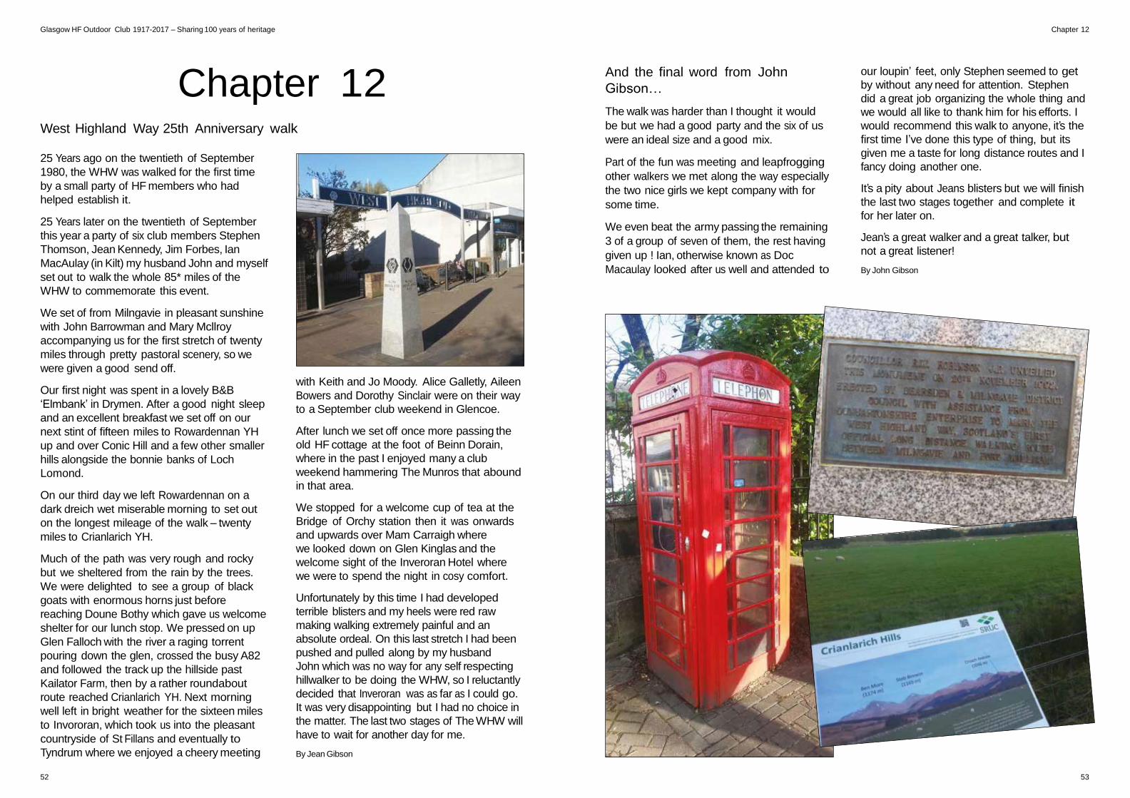
Glasgow HF Outdoor Club 1917-2017 – Sharing 100 years of heritage Chapter 12
Chapter 12
West Highland Way 25th Anniversary walk
25 Years ago on the twentieth of September
1980, the WHW was walked for the first time
by a small party of HF members who had
helped establish it.
25 Years later on the twentieth of September
this year a party of six club members Stephen
Thomson, Jean Kennedy, Jim Forbes, Ian
MacAulay (in Kilt) my husband John and myself
set out to walk the whole 85* miles of the
WHW to commemorate this event.
We set of from Milngavie in pleasant sunshine
with John Barrowman and Mary Mcllroy
accompanying us for the first stretch of twenty
miles through pretty pastoral scenery, so we
were given a good send off.
And the final word from John
Gibson…
The walk was harder than I thought it would
be but we had a good party and the six of us
were an ideal size and a good mix.
Part of the fun was meeting and leapfrogging
other walkers we met along the way especially
the two nice girls we kept company with for
some time.
We even beat the army passing the remaining
3 of a group of seven of them, the rest having
given up ! Ian, otherwise known as Doc
Macaulay looked after us well and attended to
our loupin’ feet, only Stephen seemed to get
by without any need for attention. Stephen
did a great job organizing the whole thing and
we would all like to thank him for his efforts. I
would recommend this walk to anyone, it’s the
first time I’ve done this type of thing, but its
given me a taste for long distance routes and I
fancy doing another one.
It’s a pity about Jeans blisters but we will finish
the last two stages together and complete it
for her later on.
Jean’s a great walker and a great talker, but
not a great listener!
By John Gibson
Our first night was spent in a lovely B&B
‘Elmbank’ in Drymen. After a good night sleep
and an excellent breakfast we set off on our
next stint of fifteen miles to Rowardennan YH
up and over Conic Hill and a few other smaller
hills alongside the bonnie banks of Loch
Lomond.
On our third day we left Rowardennan on a
dark dreich wet miserable morning to set out
on the longest mileage of the walk – twenty
miles to Crianlarich YH.
Much of the path was very rough and rocky
but we sheltered from the rain by the trees.
We were delighted to see a group of black
goats with enormous horns just before
reaching Doune Bothy which gave us welcome
shelter for our lunch stop. We pressed on up
Glen Falloch with the river a raging torrent
pouring down the glen, crossed the busy A82
and followed the track up the hillside past
Kailator Farm, then by a rather roundabout
route reached Crianlarich YH. Next morning
well left in bright weather for the sixteen miles
to Invororan, which took us into the pleasant
countryside of St Fillans and eventually to
Tyndrum where we enjoyed a cheery meeting
with Keith and Jo Moody. Alice Galletly, Aileen
Bowers and Dorothy Sinclair were on their way
to a September club weekend in Glencoe.
After lunch we set off once more passing the
old HF cottage at the foot of Beinn Dorain,
where in the past I enjoyed many a club
weekend hammering The Munros that abound
in that area.
We stopped for a welcome cup of tea at the
Bridge of Orchy station then it was onwards
and upwards over Mam Carraigh where
we looked down on Glen Kinglas and the
welcome sight of the Inveroran Hotel where
we were to spend the night in cosy comfort.
Unfortunately by this time I had developed
terrible blisters and my heels were red raw
making walking extremely painful and an
absolute ordeal. On this last stretch I had been
pushed and pulled along by my husband
John which was no way for any self respecting
hillwalker to be doing the WHW, so I reluctantly
decided that Inveroran was as far as I could go.
It was very disappointing but I had no choice in
the matter. The last two stages of The WHW will
have to wait for another day for me.
By Jean Gibson
52 53
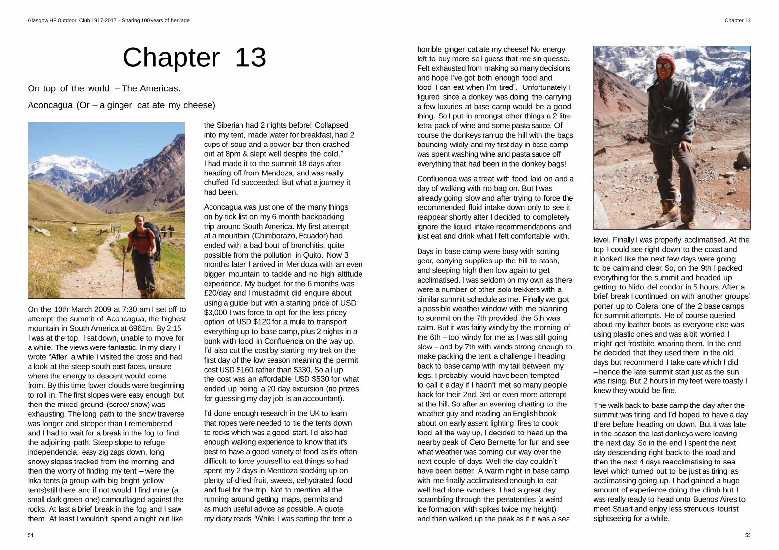
Glasgow HF Outdoor Club 1917-2017 – Sharing 100 years of heritage Chapter 13
Chapter 13
On top of the world – The Americas.
Aconcagua (Or – a ginger cat ate my cheese)
the Siberian had 2 nights before! Collapsed
into my tent, made water for breakfast, had 2
cups of soup and a power bar then crashed
out at 8pm & slept well despite the cold.”
I had made it to the summit 18 days after
heading off from Mendoza, and was really
chuffed I’d succeeded. But what a journey it
had been.
Aconcagua was just one of the many things
on by tick list on my 6 month backpacking
trip around South America. My first attempt
at a mountain (Chimborazo, Ecuador) had
ended with a bad bout of bronchitis, quite
possible from the pollution in Quito. Now 3
months later I arrived in Mendoza with an even
bigger mountain to tackle and no high altitude
experience. My budget for the 6 months was
£20/day and I must admit did enquire about
using a guide but with a starting price of USD
horrible ginger cat ate my cheese! No energy
left to buy more so I guess that me sin quesso.
Felt exhausted from making so many decisions
and hope I’ve got both enough food and
food I can eat when I’m tired”. Unfortunately I
figured since a donkey was doing the carrying
a few luxuries at base camp would be a good
thing. So I put in amongst other things a 2 litre
tetra pack of wine and some pasta sauce. Of
course the donkeys ran up the hill with the bags
bouncing wildly and my first day in base camp
was spent washing wine and pasta sauce off
everything that had been in the donkey bags!
Confluencia was a treat with food laid on and a
day of walking with no bag on. But I was
already going slow and after trying to force the
recommended fluid intake down only to see it
reappear shortly after I decided to completely
ignore the liquid intake recommendations and
just eat and drink what I felt comfortable with.
Days in base camp were busy with sorting
gear, carrying supplies up the hill to stash,
and sleeping high then low again to get
acclimatised. I was seldom on my own as there
were a number of other solo trekkers with a
similar summit schedule as me. Finally we got
level. Finally I was properly acclimatised. At the
top I could see right down to the coast and
it looked like the next few days were going
to be calm and clear. So, on the 9th I packed
everything for the summit and headed up
getting to Nido del condor in 5 hours. After a
brief break I continued on with another groups’
On the 10th March 2009 at 7:30 am I set off to
attempt the summit of Aconcagua, the highest
mountain in South America at 6961m. By 2:15
I was at the top. I sat down, unable to move for
a while. The views were fantastic. In my diary I
wrote “After a while I visited the cross and had
a look at the steep south east faces, unsure
where the energy to descent would come
from. By this time lower clouds were beginning
to roll in. The first slopes were easy enough but
then the mixed ground (scree/ snow) was
exhausting. The long path to the snow traverse
was longer and steeper than I remembered
and I had to wait for a break in the fog to find
the adjoining path. Steep slope to refuge
independencia, easy zig zags down, long
snowy slopes tracked from the morning and
then the worry of finding my tent – were the
Inka tents (a group with big bright yellow
tents)still there and if not would I find mine (a
small dark green one) camouflaged against the
rocks. At last a brief break in the fog and I saw
them. At least I wouldn’t spend a night out like
$3,000 I was force to opt for the less pricey
option of USD $120 for a mule to transport
everything up to base camp, plus 2 nights in a
bunk with food in Confluencia on the way up.
I’d also cut the cost by starting my trek on the
first day of the low season meaning the permit
cost USD $160 rather than $330. So all up
the cost was an affordable USD $530 for what
ended up being a 20 day excursion (no prizes
for guessing my day job is an accountant).
I’d done enough research in the UK to learn
that ropes were needed to tie the tents down
to rocks which was a good start. I’d also had
enough walking experience to know that it’s
best to have a good variety of food as it’s often
difficult to force yourself to eat things so had
spent my 2 days in Mendoza stocking up on
plenty of dried fruit, sweets, dehydrated food
and fuel for the trip. Not to mention all the
running around getting maps, permits and
as much useful advice as possible. A quote
my diary reads “While I was sorting the tent a
a possible weather window with me planning
to summit on the 7th provided the 5th was
calm. But it was fairly windy by the morning of
the 6th – too windy for me as I was still going
slow – and by 7th with winds strong enough to
make packing the tent a challenge I heading
back to base camp with my tail between my
legs. I probably would have been tempted
to call it a day if I hadn’t met so many people
back for their 2nd, 3rd or even more attempt
at the hill. So after an evening chatting to the
weather guy and reading an English book
about on early assent lighting fires to cook
food all the way up, I decided to head up the
nearby peak of Cero Bernette for fun and see
what weather was coming our way over the
next couple of days. Well the day couldn’t
have been better. A warm night in base camp
with me finally acclimatised enough to eat
well had done wonders. I had a great day
scrambling through the penatenties (a weird
ice formation with spikes twice my height)
and then walked up the peak as if it was a sea
porter up to Colera, one of the 2 base camps for summit attempts. He of course queried
about my leather boots as everyone else was
using plastic ones and was a bit worried I
might get frostbite wearing them. In the end
he decided that they used them in the old
days but recommend I take care which I did
– hence the late summit start just as the sun
was rising. But 2 hours in my feet were toasty I
knew they would be fine.
The walk back to base camp the day after the
summit was tiring and I’d hoped to have a day
there before heading on down. But it was late
in the season the last donkeys were leaving
the next day. So in the end I spent the next
day descending right back to the road and
then the next 4 days reacclimatising to sea
level which turned out to be just as tiring as
acclimatising going up. I had gained a huge
amount of experience doing the climb but I
was really ready to head onto Buenos Aires to
meet Stuart and enjoy less strenuous tourist
sightseeing for a while.
54 55
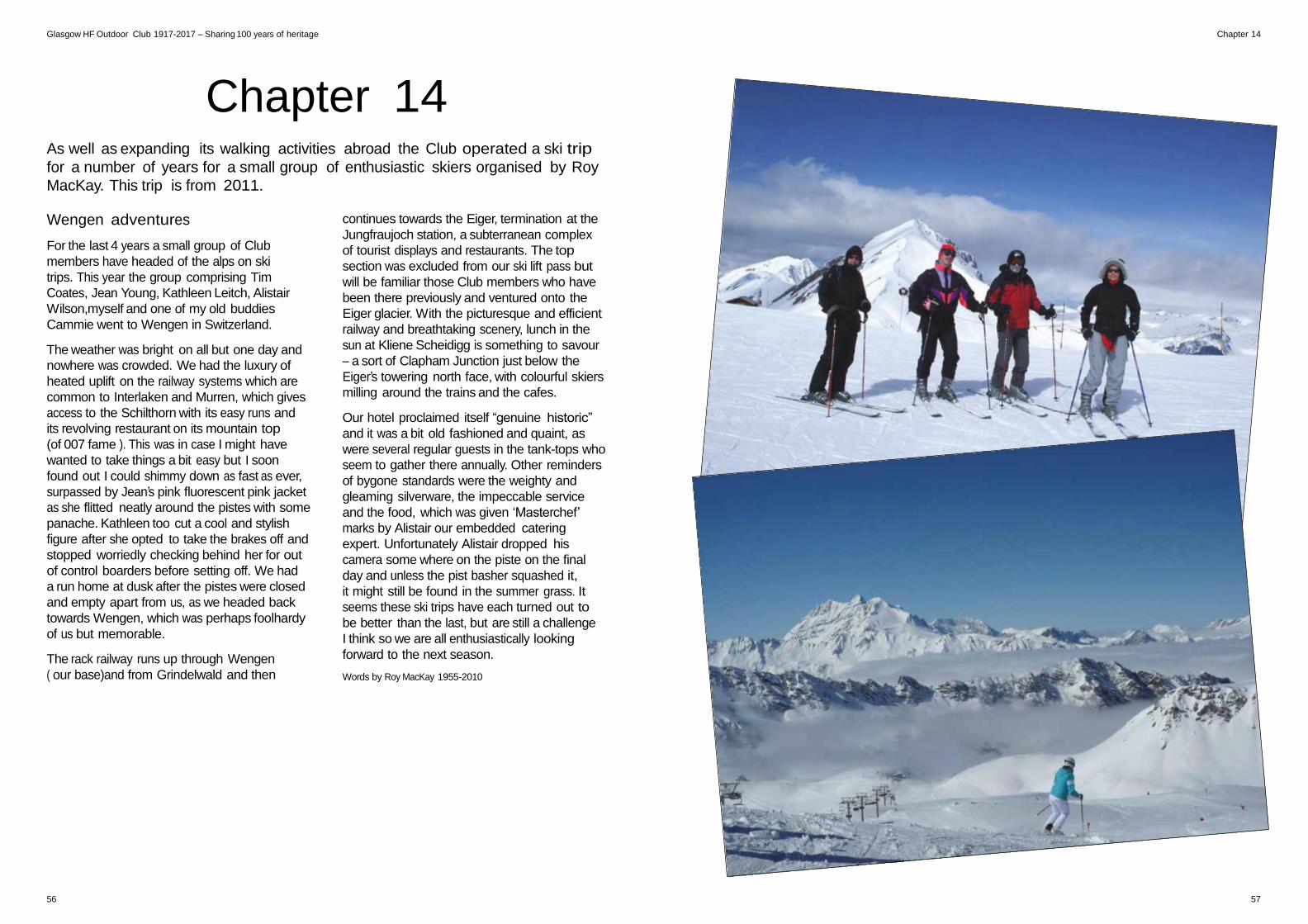
Glasgow HF Outdoor Club 1917-2017 – Sharing 100 years of heritage Chapter 14
Chapter 14
As well as expanding its walking activities abroad the Club operated a ski trip
for a number of years for a small group of enthusiastic skiers organised by Roy
MacKay. This trip is from 2011.
Wengen adventures
For the last 4 years a small group of Club
members have headed of the alps on ski
trips. This year the group comprising Tim
Coates, Jean Young, Kathleen Leitch, Alistair
Wilson,myself and one of my old buddies
Cammie went to Wengen in Switzerland.
The weather was bright on all but one day and
nowhere was crowded. We had the luxury of
heated uplift on the railway systems which are
common to Interlaken and Murren, which gives
access to the Schilthorn with its easy runs and
its revolving restaurant on its mountain top
(of 007 fame ). This was in case I might have
wanted to take things a bit easy but I soon
found out I could shimmy down as fast as ever,
surpassed by Jean’s pink fluorescent pink jacket
as she flitted neatly around the pistes with some
panache. Kathleen too cut a cool and stylish
figure after she opted to take the brakes off and
stopped worriedly checking behind her for out
of control boarders before setting off. We had
a run home at dusk after the pistes were closed
and empty apart from us, as we headed back
towards Wengen, which was perhaps foolhardy
of us but memorable.
The rack railway runs up through Wengen
( our base)and from Grindelwald and then
continues towards the Eiger, termination at the
Jungfraujoch station, a subterranean complex
of tourist displays and restaurants. The top
section was excluded from our ski lift pass but
will be familiar those Club members who have
been there previously and ventured onto the
Eiger glacier. With the picturesque and efficient
railway and breathtaking scenery, lunch in the
sun at Kliene Scheidigg is something to savour
– a sort of Clapham Junction just below the
Eiger’s towering north face, with colourful skiers
milling around the trains and the cafes.
Our hotel proclaimed itself “genuine historic”
and it was a bit old fashioned and quaint, as
were several regular guests in the tank-tops who
seem to gather there annually. Other reminders
of bygone standards were the weighty and
gleaming silverware, the impeccable service
and the food, which was given ‘Masterchef’
marks by Alistair our embedded catering
expert. Unfortunately Alistair dropped his
camera some where on the piste on the final
day and unless the pist basher squashed it,
it might still be found in the summer grass. It
seems these ski trips have each turned out to
be better than the last, but are still a challenge
I think so we are all enthusiastically looking
forward to the next season.
Words by Roy MacKay 1955-2010
56 57
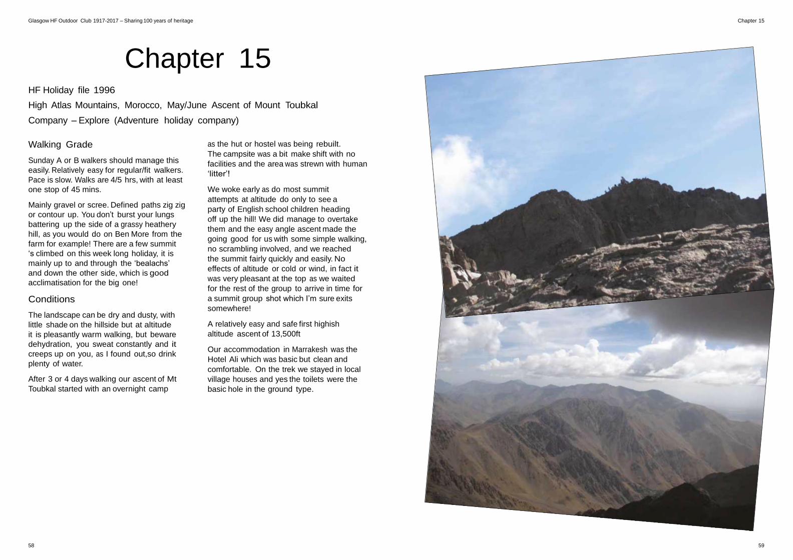
Glasgow HF Outdoor Club 1917-2017 – Sharing 100 years of heritage Chapter 15
Chapter 15
HF Holiday file 1996
High Atlas Mountains, Morocco, May/June Ascent of Mount Toubkal
Company – Explore (Adventure holiday company)
Walking Grade
Sunday A or B walkers should manage this
easily. Relatively easy for regular/fit walkers.
Pace is slow. Walks are 4/5 hrs, with at least
one stop of 45 mins.
Mainly gravel or scree. Defined paths zig zig
or contour up. You don’t burst your lungs
battering up the side of a grassy heathery
hill, as you would do on Ben More from the
farm for example! There are a few summit
‘s climbed on this week long holiday, it is
mainly up to and through the ‘bealachs’
and down the other side, which is good
acclimatisation for the big one!
Conditions
The landscape can be dry and dusty, with
little shade on the hillside but at altitude
it is pleasantly warm walking, but beware
dehydration, you sweat constantly and it
creeps up on you, as I found out,so drink
plenty of water.
After 3 or 4 days walking our ascent of Mt
Toubkal started with an overnight camp
as the hut or hostel was being rebuilt.
The campsite was a bit make shift with no
facilities and the area was strewn with human
‘litter’!
We woke early as do most summit
attempts at altitude do only to see a
party of English school children heading
off up the hill! We did manage to overtake
them and the easy angle ascent made the
going good for us with some simple walking,
no scrambling involved, and we reached
the summit fairly quickly and easily. No
effects of altitude or cold or wind, in fact it
was very pleasant at the top as we waited
for the rest of the group to arrive in time for
a summit group shot which I’m sure exits
somewhere!
A relatively easy and safe first highish
altitude ascent of 13,500ft
Our accommodation in Marrakesh was the
Hotel Ali which was basic but clean and
comfortable. On the trek we stayed in local
village houses and yes the toilets were the
basic hole in the ground type.
58 59
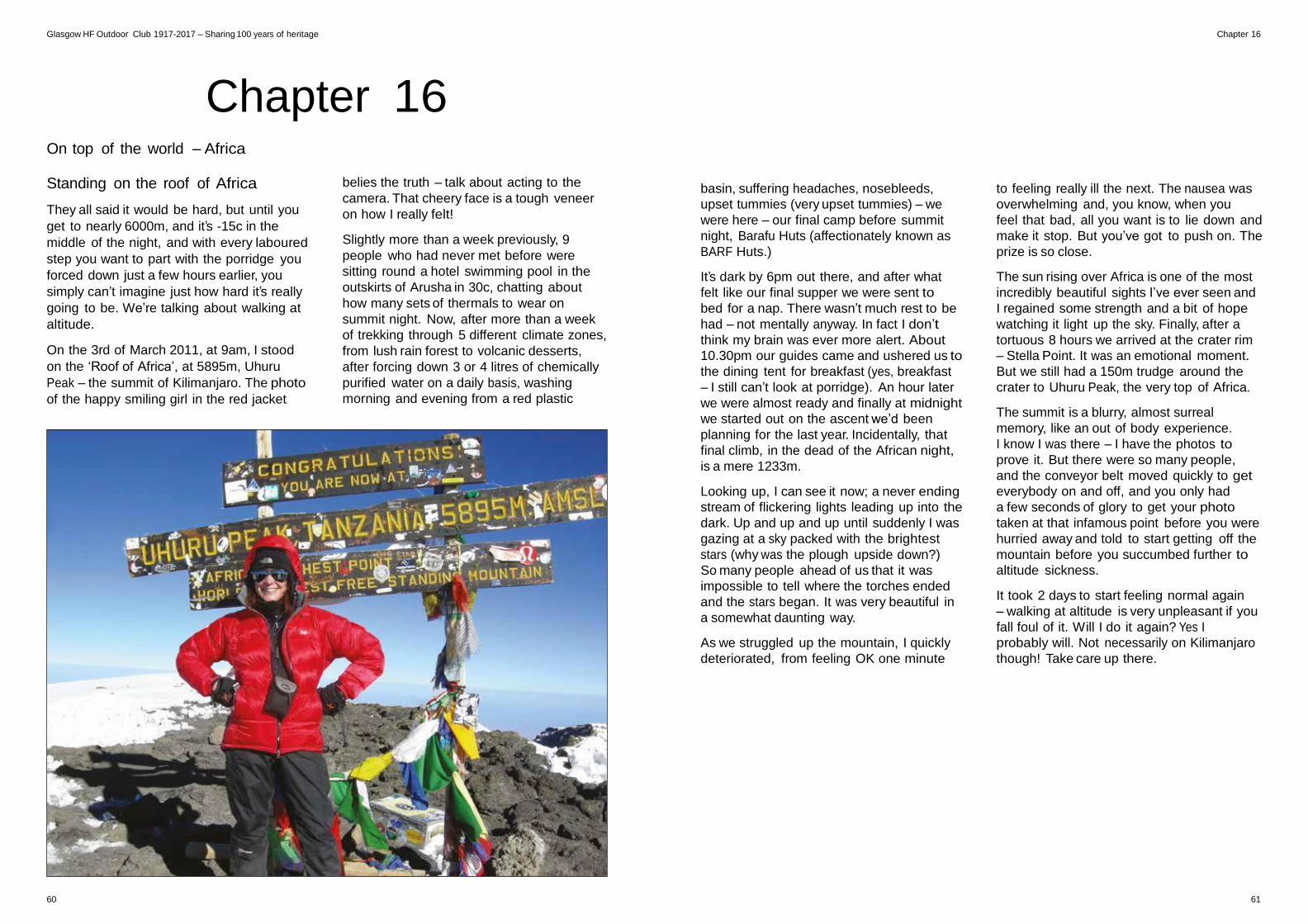
Glasgow HF Outdoor Club 1917-2017 – Sharing 100 years of heritage Chapter 16
Chapter 16
On top of the world – Africa
Standing on the roof of Africa
They all said it would be hard, but until you
get to nearly 6000m, and it’s -15c in the
middle of the night, and with every laboured
step you want to part with the porridge you
forced down just a few hours earlier, you
simply can’t imagine just how hard it’s really
going to be. We’re talking about walking at
altitude.
On the 3rd of March 2011, at 9am, I stood
on the ‘Roof of Africa’, at 5895m, Uhuru
Peak – the summit of Kilimanjaro. The photo
of the happy smiling girl in the red jacket
belies the truth – talk about acting to the
camera. That cheery face is a tough veneer
on how I really felt!
Slightly more than a week previously, 9
people who had never met before were
sitting round a hotel swimming pool in the
outskirts of Arusha in 30c, chatting about
how many sets of thermals to wear on
summit night. Now, after more than a week
of trekking through 5 different climate zones,
from lush rain forest to volcanic desserts,
after forcing down 3 or 4 litres of chemically
purified water on a daily basis, washing
morning and evening from a red plastic
basin, suffering headaches, nosebleeds,
upset tummies (very upset tummies) – we
were here – our final camp before summit
night, Barafu Huts (affectionately known as
BARF Huts.)
It’s dark by 6pm out there, and after what
felt like our final supper we were sent to
bed for a nap. There wasn’t much rest to be
had – not mentally anyway. In fact I don’t
think my brain was ever more alert. About
10.30pm our guides came and ushered us to
the dining tent for breakfast (yes, breakfast
– I still can’t look at porridge). An hour later
we were almost ready and finally at midnight
we started out on the ascent we’d been
planning for the last year. Incidentally, that
final climb, in the dead of the African night,
is a mere 1233m.
Looking up, I can see it now; a never ending
stream of flickering lights leading up into the
dark. Up and up and up until suddenly I was
gazing at a sky packed with the brightest
stars (why was the plough upside down?)
So many people ahead of us that it was
impossible to tell where the torches ended
and the stars began. It was very beautiful in
a somewhat daunting way.
As we struggled up the mountain, I quickly
deteriorated, from feeling OK one minute
to feeling really ill the next. The nausea was
overwhelming and, you know, when you
feel that bad, all you want is to lie down and
make it stop. But you’ve got to push on. The
prize is so close.
The sun rising over Africa is one of the most
incredibly beautiful sights I’ve ever seen and
I regained some strength and a bit of hope
watching it light up the sky. Finally, after a
tortuous 8 hours we arrived at the crater rim
– Stella Point. It was an emotional moment.
But we still had a 150m trudge around the
crater to Uhuru Peak, the very top of Africa.
The summit is a blurry, almost surreal
memory, like an out of body experience.
I know I was there – I have the photos to
prove it. But there were so many people,
and the conveyor belt moved quickly to get
everybody on and off, and you only had
a few seconds of glory to get your photo
taken at that infamous point before you were
hurried away and told to start getting off the
mountain before you succumbed further to
altitude sickness.
It took 2 days to start feeling normal again
– walking at altitude is very unpleasant if you
fall foul of it. Will I do it again? Yes I
probably will. Not necessarily on Kilimanjaro
though! Take care up there.
60 61
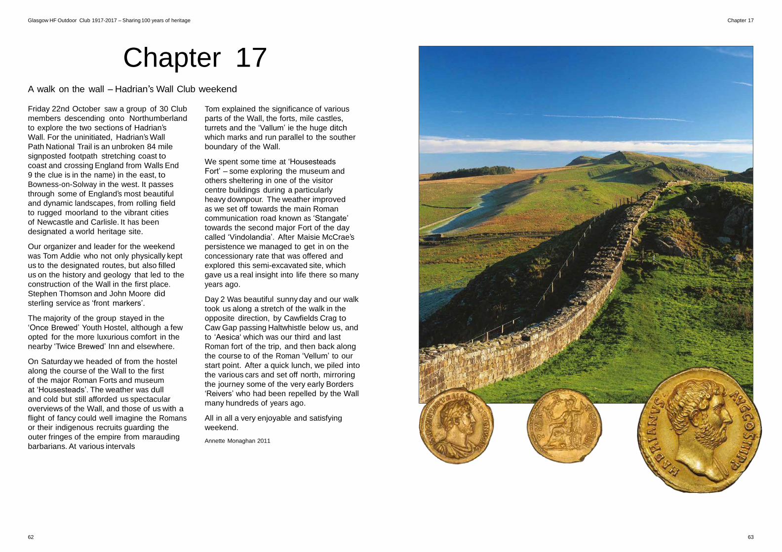
Glasgow HF Outdoor Club 1917-2017 – Sharing 100 years of heritage Chapter 17
Chapter 17
A walk on the wall – Hadrian’s Wall Club weekend Friday 22nd October saw a group of 30 Club
members descending onto Northumberland
to explore the two sections of Hadrian’s
Wall. For the uninitiated, Hadrian’s Wall
Path National Trail is an unbroken 84 mile
signposted footpath stretching coast to
coast and crossing England from Walls End
9 the clue is in the name) in the east, to
Bowness-on-Solway in the west. It passes
through some of England’s most beautiful
and dynamic landscapes, from rolling field
to rugged moorland to the vibrant cities
of Newcastle and Carlisle. It has been
designated a world heritage site.
Our organizer and leader for the weekend
was Tom Addie who not only physically kept
us to the designated routes, but also filled
us on the history and geology that led to the
construction of the Wall in the first place.
Stephen Thomson and John Moore did
sterling service as ‘front markers’.
The majority of the group stayed in the
‘Once Brewed’ Youth Hostel, although a few
opted for the more luxurious comfort in the
nearby ‘Twice Brewed’ Inn and elsewhere.
On Saturday we headed of from the hostel
along the course of the Wall to the first
of the major Roman Forts and museum
at ‘Housesteads’. The weather was dull
and cold but still afforded us spectacular
overviews of the Wall, and those of us with a
flight of fancy could well imagine the Romans
or their indigenous recruits guarding the
outer fringes of the empire from marauding
barbarians. At various intervals
Tom explained the significance of various
parts of the Wall, the forts, mile castles,
turrets and the ‘Vallum’ ie the huge ditch
which marks and run parallel to the souther
boundary of the Wall.
We spent some time at ‘Housesteads
Fort’ – some exploring the museum and
others sheltering in one of the visitor
centre buildings during a particularly
heavy downpour. The weather improved
as we set off towards the main Roman
communication road known as ‘Stangate’
towards the second major Fort of the day
called ‘Vindolandia’. After Maisie McCrae’s
persistence we managed to get in on the
concessionary rate that was offered and
explored this semi-excavated site, which
gave us a real insight into life there so many
years ago.
Day 2 Was beautiful sunny day and our walk
took us along a stretch of the walk in the
opposite direction, by Cawfields Crag to
Caw Gap passing Haltwhistle below us, and
to ‘Aesica‘ which was our third and last
Roman fort of the trip, and then back along
the course to of the Roman ‘Vellum’ to our
start point. After a quick lunch, we piled into
the various cars and set off north, mirroring
the journey some of the very early Borders
‘Reivers’ who had been repelled by the Wall
many hundreds of years ago.
All in all a very enjoyable and satisfying
weekend.
Annette Monaghan 2011
62 63
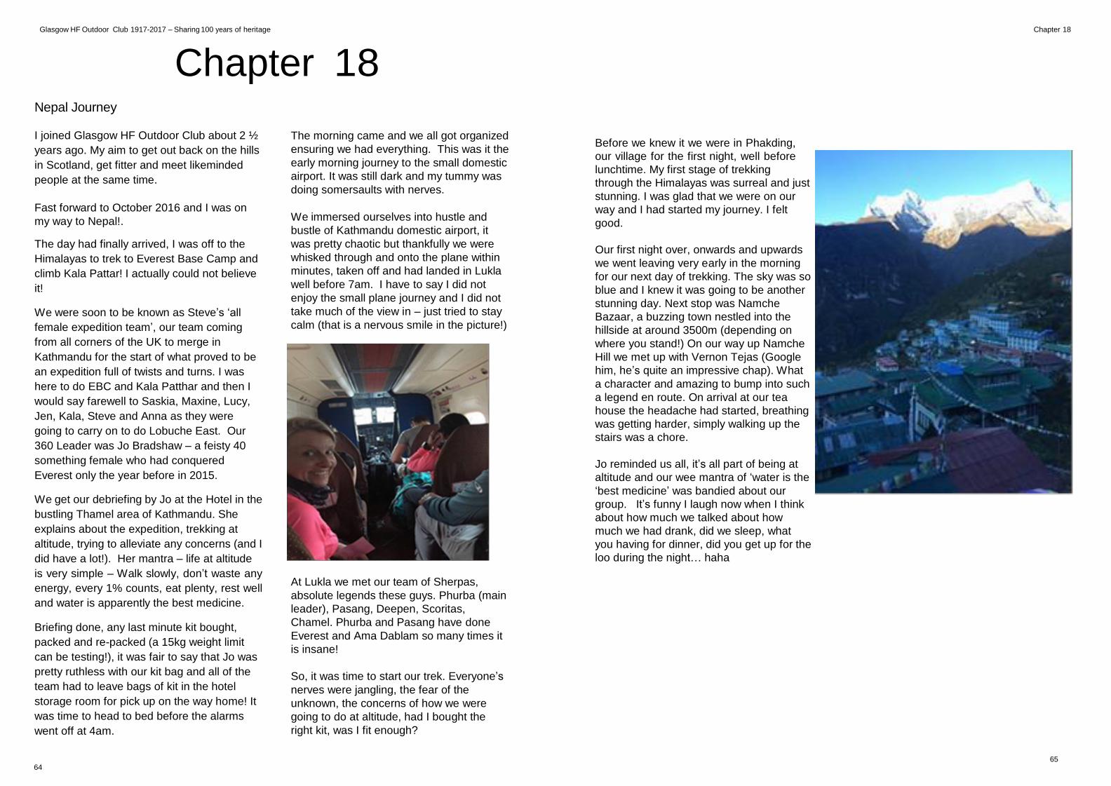
Glasgow HF Outdoor Club 1917-2017 – Sharing 100 years of heritage Chapter 18
Chapter 18
Nepal Journey I joined Glasgow HF Outdoor Club about 2 ½
years ago. My aim to get out back on the hills
in Scotland, get fitter and meet likeminded
people at the same time.
Fast forward to October 2016 and I was on
my way to Nepal!.
The day had finally arrived, I was off to the
Himalayas to trek to Everest Base Camp and
climb Kala Pattar! I actually could not believe
it!
We were soon to be known as Steve’s ‘all
female expedition team’, our team coming
from all corners of the UK to merge in
Kathmandu for the start of what proved to be
an expedition full of twists and turns. I was
here to do EBC and Kala Patthar and then I
would say farewell to Saskia, Maxine, Lucy,
Jen, Kala, Steve and Anna as they were
going to carry on to do Lobuche East. Our
360 Leader was Jo Bradshaw – a feisty 40
something female who had conquered
Everest only the year before in 2015.
We get our debriefing by Jo at the Hotel in the
bustling Thamel area of Kathmandu. She
explains about the expedition, trekking at
altitude, trying to alleviate any concerns (and I
did have a lot!). Her mantra – life at altitude
is very simple – Walk slowly, don’t waste any
energy, every 1% counts, eat plenty, rest well
and water is apparently the best medicine.
Briefing done, any last minute kit bought,
packed and re-packed (a 15kg weight limit
can be testing!), it was fair to say that Jo was
pretty ruthless with our kit bag and all of the
team had to leave bags of kit in the hotel
storage room for pick up on the way home! It
was time to head to bed before the alarms
went off at 4am.
The morning came and we all got organized
ensuring we had everything. This was it the
early morning journey to the small domestic
airport. It was still dark and my tummy was
doing somersaults with nerves.
We immersed ourselves into hustle and
bustle of Kathmandu domestic airport, it
was pretty chaotic but thankfully we were
whisked through and onto the plane within
minutes, taken off and had landed in Lukla
well before 7am. I have to say I did not
enjoy the small plane journey and I did not
take much of the view in – just tried to stay
calm (that is a nervous smile in the picture!)
At Lukla we met our team of Sherpas,
absolute legends these guys. Phurba (main
leader), Pasang, Deepen, Scoritas,
Chamel. Phurba and Pasang have done
Everest and Ama Dablam so many times it
is insane!
So, it was time to start our trek. Everyone’s
nerves were jangling, the fear of the
unknown, the concerns of how we were
going to do at altitude, had I bought the
right kit, was I fit enough?
Before we knew it we were in Phakding,
our village for the first night, well before
lunchtime. My first stage of trekking
through the Himalayas was surreal and just
stunning. I was glad that we were on our
way and I had started my journey. I felt
good.
Our first night over, onwards and upwards
we went leaving very early in the morning
for our next day of trekking. The sky was so
blue and I knew it was going to be another
stunning day. Next stop was Namche
Bazaar, a buzzing town nestled into the
hillside at around 3500m (depending on
where you stand!) On our way up Namche
Hill we met up with Vernon Tejas (Google
him, he’s quite an impressive chap). What
a character and amazing to bump into such
a legend en route. On arrival at our tea
house the headache had started, breathing
was getting harder, simply walking up the
stairs was a chore.
Jo reminded us all, it’s all part of being at
altitude and our wee mantra of ‘water is the
‘best medicine’ was bandied about our
group. It’s funny I laugh now when I think
about how much we talked about how
much we had drank, did we sleep, what
you having for dinner, did you get up for the
loo during the night… haha
65
64
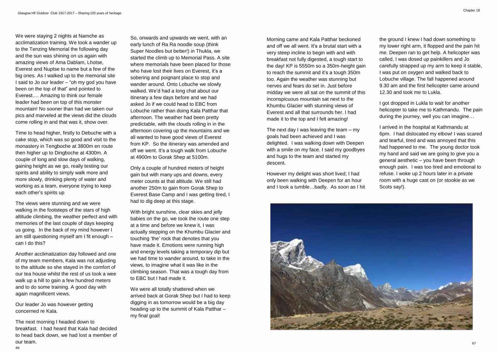
Glasgow HF Outdoor Club 1917-2017 – Sharing 100 years of heritage
Chapter 18
We were staying 2 nights at Namche as
acclimatization training. We took a wander up
to the Tenzing Memorial the following day
and the sun was shining on us again with
amazing views of Ama Dablam, Lhotse,
Everest and Nuptse to name but a few of the
big ones. As I walked up to the memorial site
I said to Jo our leader – “oh my god you have
been on the top of that” and pointed to
Everest…. Amazing to think our female
leader had been on top of this monster
mountain! No sooner than had we taken our
pics and marveled at the views did the clouds
come rolling in and that was it, show over.
Time to head higher, firstly to Debuche with a
cake stop, which was so good and visit to the
monastery in Tengboche at 3800m en route
then higher up to Dingboche at 4300m. A
couple of long and slow days of walking,
gaining height as we go, really testing our
spirits and ability to simply walk more and
more slowly, drinking plenty of water and
working as a team, everyone trying to keep
each other’s spirits up
The views were stunning and we were
walking in the footsteps of the stars of high
altitude climbing, the weather perfect and with
memories of the last couple of days keeping
us going. In the back of my mind however I
am still questioning myself am I fit enough –
can I do this?
Another acclimatization day followed and one
of my team members, Kala was not adjusting
to the altitude so she stayed in the comfort of
our tea house whilst the rest of us took a wee
walk up a hill to gain a few hundred meters
and to do some training. A good day with
again magnificent views.
Our leader Jo was however getting
concerned re Kala.
The next morning I headed down to
breakfast. I had heard that Kala had decided
to head back down, we had lost a member of
our team. 66
So, onwards and upwards we went, with an
early lunch of Ra Ra noodle soup (think
Super Noodles but better!) in Thukla, we
started the climb up to Memorial Pass. A site
where memorials have been placed for those
who have lost their lives on Everest, it’s a
sobering and poignant place to stop and
wander around. Onto Lobuche we slowly
walked. We’d had a long chat about our
itinerary a few days before and we had
asked Jo if we could head to EBC from
Lobuche rather than doing Kala Patthar that
afternoon. The weather had been pretty
predictable, with the clouds rolling in in the
afternoon covering up the mountains and we
all wanted to have good views of Everest
from KP. So the itinerary was amended and
off we went. It’s a tough walk from Lobuche
at 4900m to Gorak Shep at 5100m.
Only a couple of hundred meters of height
gain but with many ups and downs, every
meter counts at that altitude. We still had
another 250m to gain from Gorak Shep to
Everest Base Camp and I was getting tired, I
had to dig deep at this stage.
With bright sunshine, clear skies and jelly
babies on the go, we took the route one step
at a time and before we knew it, I was
actually stepping on the Khumbu Glacier and
touching ‘the’ rock that denotes that you
have made it. Emotions were running high
and energy levels taking a temporary dip but
we had time to wander around, to take in the
views, to imagine what it was like in the
climbing season. That was a tough day from
to EBC but I had made it.
We were all totally shattered when we
arrived back at Gorak Shep but I had to keep
digging in as tomorrow would be a big day
heading up to the summit of Kala Patthar –
my final goal!
Morning came and Kala Patthar beckoned
and off we all went. It’s a brutal start with a
very steep incline to begin with and with
breakfast not fully digested, a tough start to
the day! KP is 5550m so a 350m-height gain
to reach the summit and it’s a tough 350m
too. Again the weather was stunning but
nerves and fears do set in. Just before
midday we were all sat on the summit of this
inconspicuous mountain sat next to the
Khumbu Glacier with stunning views of
Everest and all that surrounds her. I had
made it to the top and I felt amazing!
The next day I was leaving the team – my
goals had been achieved and I was
delighted. I was walking down with Deepen
with a smile on my face. I said my goodbyes
and hugs to the team and started my
descent.
However my delight was short lived; I had
only been walking with Deepen for an hour
and I took a tumble…badly. As soon as I hit
the ground I knew I had down something to
my lower right arm, it flopped and the pain hit
me. Deepen ran to get help. A helicopter was
called, I was dosed up painkillers and Jo
carefully strapped up my arm to keep it stable,
I was put on oxygen and walked back to
Lobuche village. The fall happened around
9.30 am and the first helicopter came around
12.30 and took me to Lukla. I got dropped in Lukla to wait for another
helicopter to take me to Kathmandu. The pain
during the journey, well you can imagine…
I arrived in the hospital at Kathmandu at
6pm. I had dislocated my elbow! I was scared
and tearful, tired and was annoyed that this
had happened to me. The young doctor took
my hand and said we are going to give you a
general aesthetic – you have been through
enough pain. I was too tired and emotional to
refuse. I woke up 2 hours later in a private
room with a huge cast on (or stookie as we
Scots say!).
67
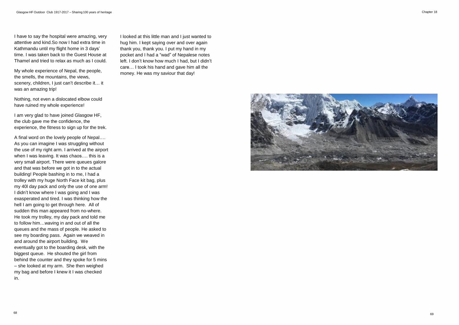
Chapter 18 Glasgow HF Outdoor Club 1917-2017 – Sharing 100 years of heritage
I have to say the hospital were amazing, very
attentive and kind.So now I had extra time in
Kathmandu until my flight home in 3 days’
time. I was taken back to the Guest House at
Thamel and tried to relax as much as I could.
My whole experience of Nepal, the people,
the smells, the mountains, the views,
scenery, children, I just can’t describe it… it
was an amazing trip!
Nothing, not even a dislocated elbow could
have ruined my whole experience!
I am very glad to have joined Glasgow HF,
the club gave me the confidence, the
experience, the fitness to sign up for the trek.
A final word on the lovely people of Nepal….
As you can imagine I was struggling without
the use of my right arm. I arrived at the airport
when I was leaving. It was chaos…. this is a
very small airport. There were queues galore
and that was before we got in to the actual
building! People bashing in to me, I had a
trolley with my huge North Face kit bag, plus
my 40l day pack and only the use of one arm!
I didn’t know where I was going and I was
exasperated and tired. I was thinking how the
hell I am going to get through here. All of
sudden this man appeared from no-where.
He took my trolley, my day pack and told me
to follow him…waving in and out of all the
queues and the mass of people. He asked to
see my boarding pass. Again we weaved in
and around the airport building. We
eventually got to the boarding desk, with the
biggest queue. He shouted the girl from
behind the counter and they spoke for 5 mins
– she looked at my arm. She then weighed
my bag and before I knew it I was checked
in.
I looked at this little man and I just wanted to
hug him. I kept saying over and over again
thank you, thank you. I put my hand in my
pocket and I had a “wad” of Nepalese notes
left. I don’t know how much I had, but I didn’t
care… I took his hand and gave him all the
money. He was my saviour that day!
68 69
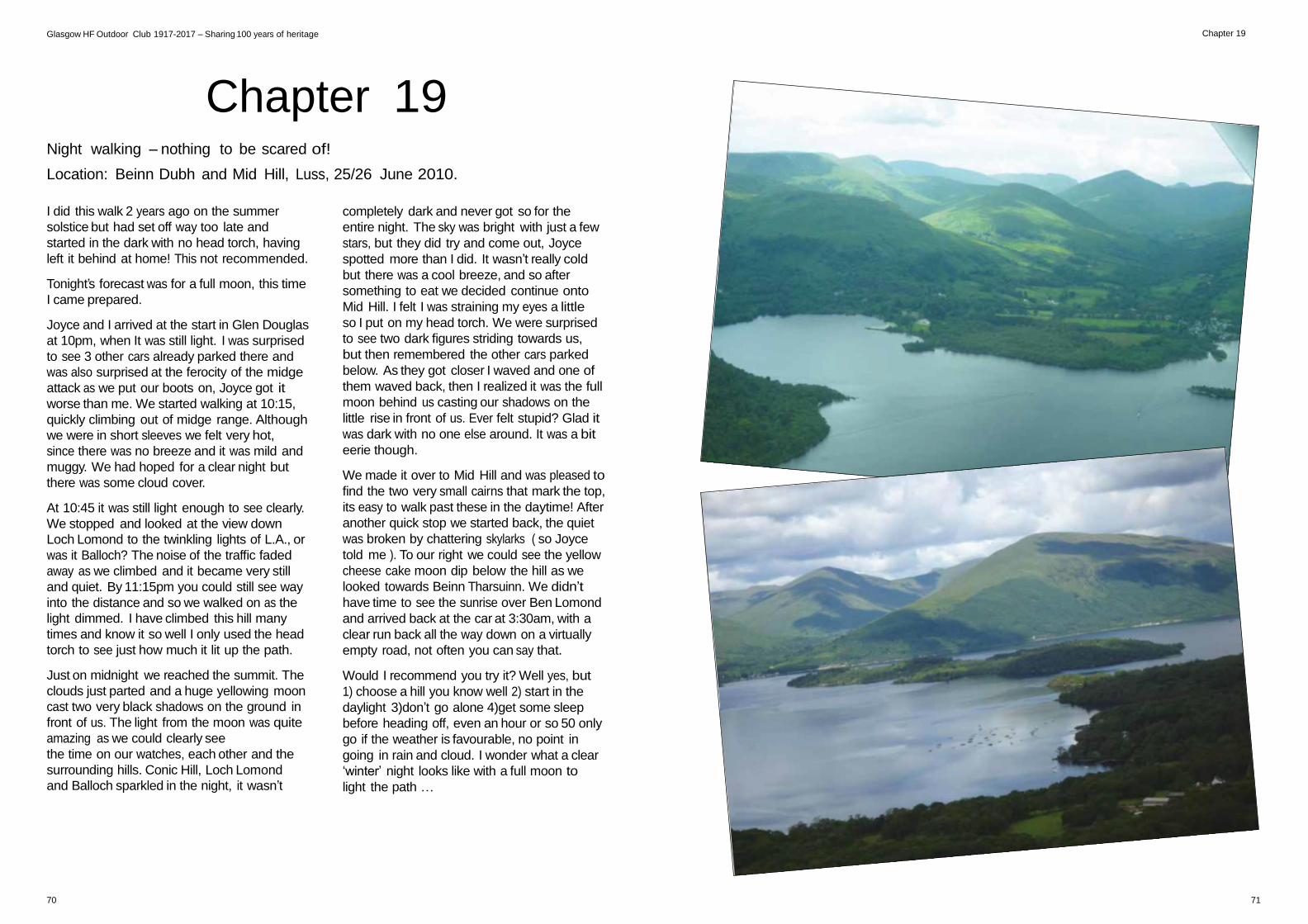
Chapter 19 Glasgow HF Outdoor Club 1917-2017 – Sharing 100 years of heritage
Chapter 19
Night walking – nothing to be scared of!
Location: Beinn Dubh and Mid Hill, Luss, 25/26 June 2010.
I did this walk 2 years ago on the summer
solstice but had set off way too late and
started in the dark with no head torch, having
left it behind at home! This not recommended.
Tonight’s forecast was for a full moon, this time
I came prepared.
Joyce and I arrived at the start in Glen Douglas
at 10pm, when It was still light. I was surprised
to see 3 other cars already parked there and
was also surprised at the ferocity of the midge
attack as we put our boots on, Joyce got it
worse than me. We started walking at 10:15,
quickly climbing out of midge range. Although
we were in short sleeves we felt very hot,
since there was no breeze and it was mild and
muggy. We had hoped for a clear night but
there was some cloud cover.
At 10:45 it was still light enough to see clearly.
We stopped and looked at the view down
Loch Lomond to the twinkling lights of L.A., or
was it Balloch? The noise of the traffic faded
away as we climbed and it became very still
and quiet. By 11:15pm you could still see way
into the distance and so we walked on as the
light dimmed. I have climbed this hill many
times and know it so well I only used the head
torch to see just how much it lit up the path.
Just on midnight we reached the summit. The
clouds just parted and a huge yellowing moon
cast two very black shadows on the ground in
front of us. The light from the moon was quite
amazing as we could clearly see
the time on our watches, each other and the
surrounding hills. Conic Hill, Loch Lomond
and Balloch sparkled in the night, it wasn’t
completely dark and never got so for the
entire night. The sky was bright with just a few
stars, but they did try and come out, Joyce
spotted more than I did. It wasn’t really cold
but there was a cool breeze, and so after
something to eat we decided continue onto
Mid Hill. I felt I was straining my eyes a little
so I put on my head torch. We were surprised
to see two dark figures striding towards us,
but then remembered the other cars parked
below. As they got closer I waved and one of
them waved back, then I realized it was the full
moon behind us casting our shadows on the
little rise in front of us. Ever felt stupid? Glad it
was dark with no one else around. It was a bit
eerie though.
We made it over to Mid Hill and was pleased to
find the two very small cairns that mark the top,
its easy to walk past these in the daytime! After
another quick stop we started back, the quiet
was broken by chattering skylarks ( so Joyce
told me ). To our right we could see the yellow
cheese cake moon dip below the hill as we
looked towards Beinn Tharsuinn. We didn’t
have time to see the sunrise over Ben Lomond
and arrived back at the car at 3:30am, with a
clear run back all the way down on a virtually
empty road, not often you can say that.
Would I recommend you try it? Well yes, but
1) choose a hill you know well 2) start in the
daylight 3)don’t go alone 4)get some sleep
before heading off, even an hour or so 50 only
go if the weather is favourable, no point in
going in rain and cloud. I wonder what a clear
‘winter’ night looks like with a full moon to
light the path …
70 71
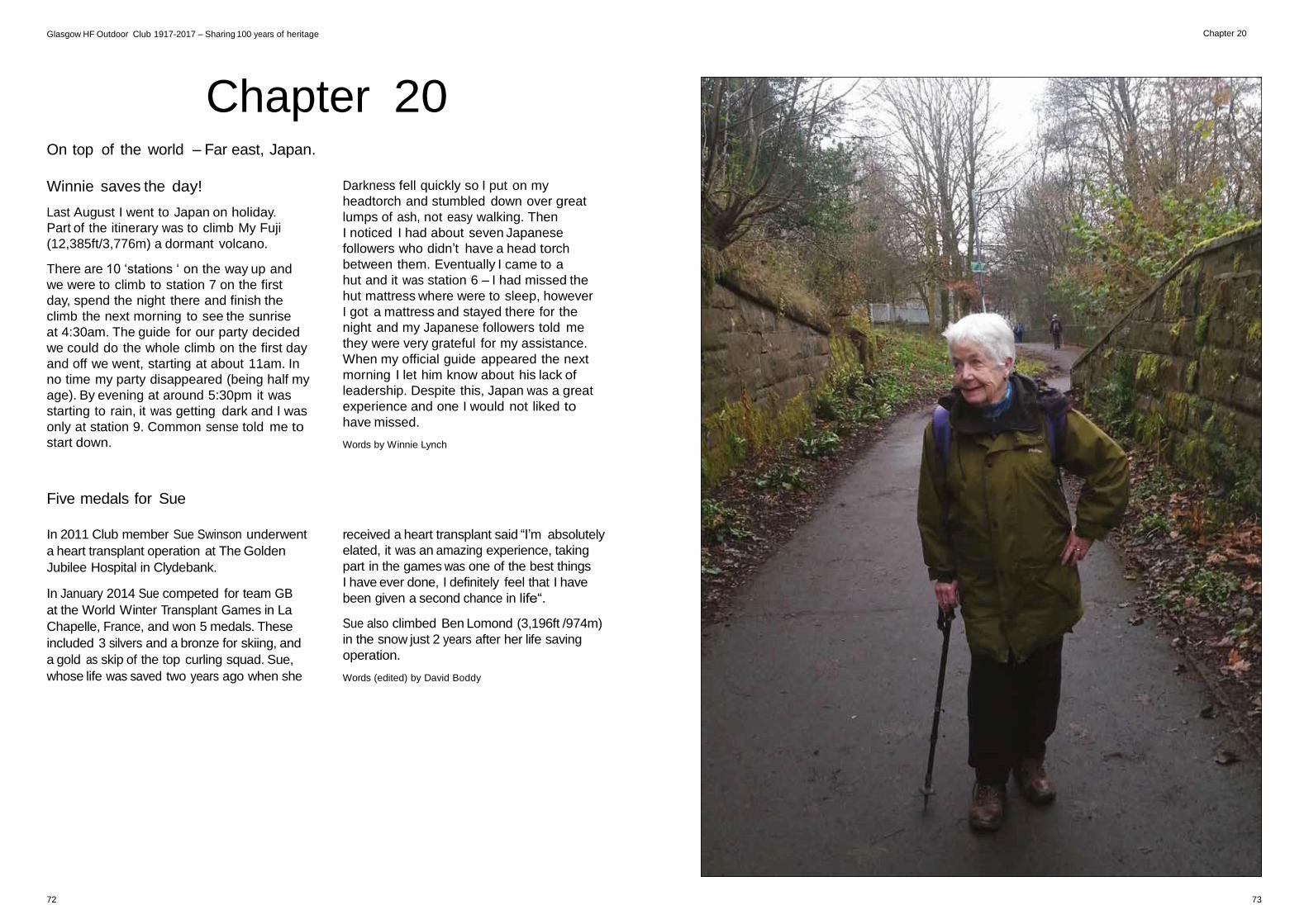
Chapter 20 Glasgow HF Outdoor Club 1917-2017 – Sharing 100 years of heritage
Chapter 20
On top of the world – Far east, Japan.
Winnie saves the day!
Last August I went to Japan on holiday.
Part of the itinerary was to climb My Fuji
(12,385ft/3,776m) a dormant volcano.
There are 10 ‘stations ‘ on the way up and
we were to climb to station 7 on the first
day, spend the night there and finish the
climb the next morning to see the sunrise
at 4:30am. The guide for our party decided
we could do the whole climb on the first day
and off we went, starting at about 11am. In
no time my party disappeared (being half my
age). By evening at around 5:30pm it was
starting to rain, it was getting dark and I was
only at station 9. Common sense told me to
start down.
Darkness fell quickly so I put on my
headtorch and stumbled down over great
lumps of ash, not easy walking. Then
I noticed I had about seven Japanese
followers who didn’t have a head torch
between them. Eventually I came to a
hut and it was station 6 – I had missed the
hut mattress where were to sleep, however
I got a mattress and stayed there for the
night and my Japanese followers told me
they were very grateful for my assistance.
When my official guide appeared the next
morning I let him know about his lack of
leadership. Despite this, Japan was a great
experience and one I would not liked to
have missed.
Words by Winnie Lynch
Five medals for Sue
In 2011 Club member Sue Swinson underwent
a heart transplant operation at The Golden
Jubilee Hospital in Clydebank.
In January 2014 Sue competed for team GB
at the World Winter Transplant Games in La
Chapelle, France, and won 5 medals. These
included 3 silvers and a bronze for skiing, and
a gold as skip of the top curling squad. Sue,
whose life was saved two years ago when she
received a heart transplant said “I’m absolutely
elated, it was an amazing experience, taking
part in the games was one of the best things
I have ever done, I definitely feel that I have
been given a second chance in life“.
Sue also climbed Ben Lomond (3,196ft /974m)
in the snow just 2 years after her life saving
operation.
Words (edited) by David Boddy
72 73
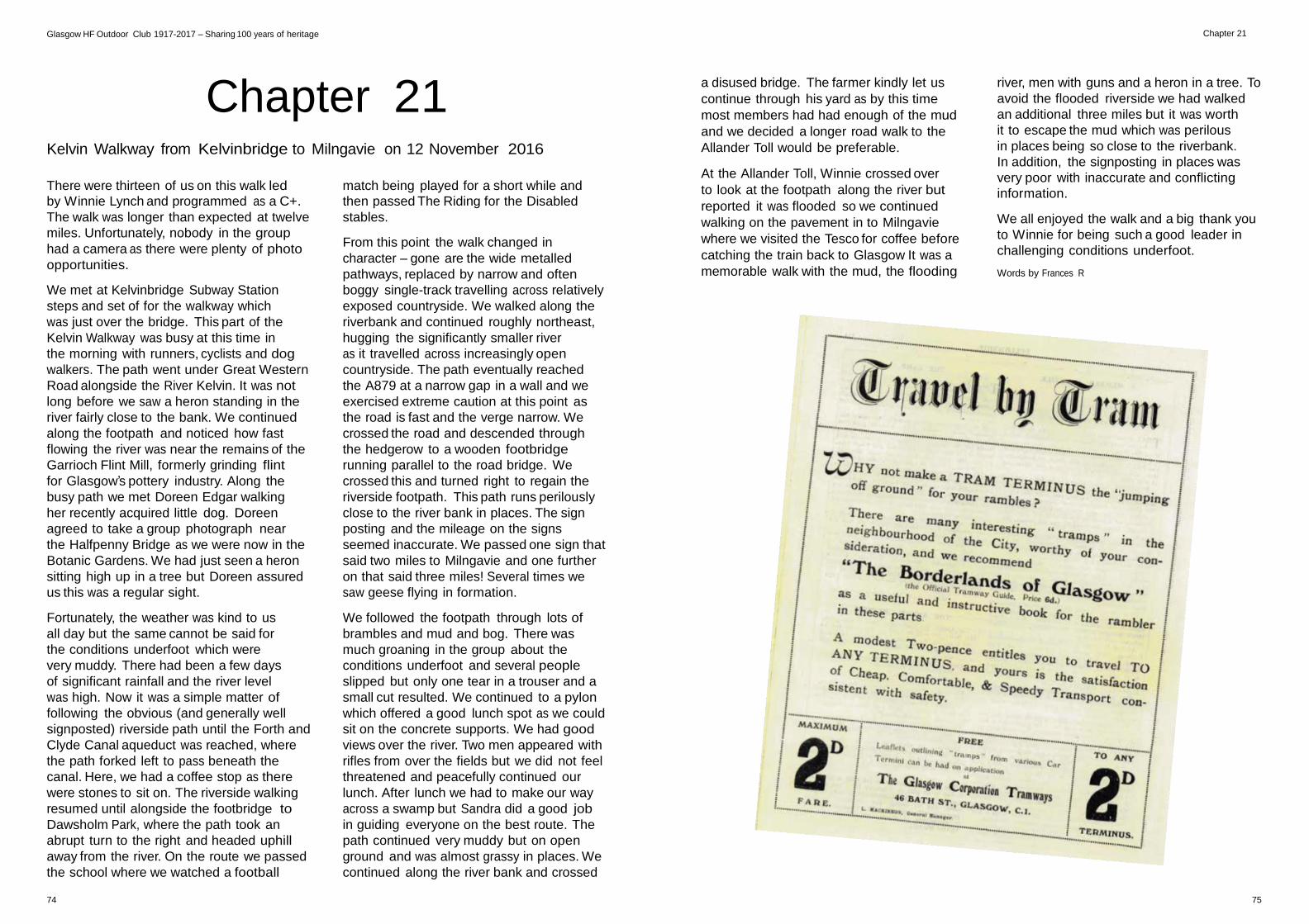
Chapter 21 Glasgow HF Outdoor Club 1917-2017 – Sharing 100 years of heritage
Chapter 21
Kelvin Walkway from Kelvinbridge to Milngavie on 12 November 2016
a disused bridge. The farmer kindly let us
continue through his yard as by this time
most members had had enough of the mud
and we decided a longer road walk to the
Allander Toll would be preferable.
At the Allander Toll, Winnie crossed over
river, men with guns and a heron in a tree. To
avoid the flooded riverside we had walked
an additional three miles but it was worth
it to escape the mud which was perilous
in places being so close to the riverbank.
In addition, the signposting in places was
very poor with inaccurate and conflicting There were thirteen of us on this walk led
by Winnie Lynch and programmed as a C+.
The walk was longer than expected at twelve
miles. Unfortunately, nobody in the group
had a camera as there were plenty of photo
opportunities.
We met at Kelvinbridge Subway Station
steps and set of for the walkway which
was just over the bridge. This part of the
Kelvin Walkway was busy at this time in
the morning with runners, cyclists and dog
walkers. The path went under Great Western
Road alongside the River Kelvin. It was not
long before we saw a heron standing in the
river fairly close to the bank. We continued
along the footpath and noticed how fast
flowing the river was near the remains of the
Garrioch Flint Mill, formerly grinding flint
for Glasgow’s pottery industry. Along the
busy path we met Doreen Edgar walking
her recently acquired little dog. Doreen
agreed to take a group photograph near
the Halfpenny Bridge as we were now in the
Botanic Gardens. We had just seen a heron
sitting high up in a tree but Doreen assured
us this was a regular sight.
Fortunately, the weather was kind to us
all day but the same cannot be said for
the conditions underfoot which were
very muddy. There had been a few days
of significant rainfall and the river level
was high. Now it was a simple matter of
following the obvious (and generally well
signposted) riverside path until the Forth and
Clyde Canal aqueduct was reached, where
the path forked left to pass beneath the
canal. Here, we had a coffee stop as there
were stones to sit on. The riverside walking
resumed until alongside the footbridge to
Dawsholm Park, where the path took an
abrupt turn to the right and headed uphill
away from the river. On the route we passed
the school where we watched a football
match being played for a short while and
then passed The Riding for the Disabled
stables.
From this point the walk changed in
character – gone are the wide metalled
pathways, replaced by narrow and often
boggy single-track travelling across relatively
exposed countryside. We walked along the
riverbank and continued roughly northeast,
hugging the significantly smaller river
as it travelled across increasingly open
countryside. The path eventually reached
the A879 at a narrow gap in a wall and we
exercised extreme caution at this point as
the road is fast and the verge narrow. We
crossed the road and descended through
the hedgerow to a wooden footbridge
running parallel to the road bridge. We
crossed this and turned right to regain the
riverside footpath. This path runs perilously
close to the river bank in places. The sign
posting and the mileage on the signs
seemed inaccurate. We passed one sign that
said two miles to Milngavie and one further
on that said three miles! Several times we
saw geese flying in formation.
We followed the footpath through lots of
brambles and mud and bog. There was
much groaning in the group about the
conditions underfoot and several people
slipped but only one tear in a trouser and a
small cut resulted. We continued to a pylon
which offered a good lunch spot as we could
sit on the concrete supports. We had good
views over the river. Two men appeared with
rifles from over the fields but we did not feel
threatened and peacefully continued our
lunch. After lunch we had to make our way
across a swamp but Sandra did a good job
in guiding everyone on the best route. The
path continued very muddy but on open
ground and was almost grassy in places. We
continued along the river bank and crossed
to look at the footpath along the river but
reported it was flooded so we continued
walking on the pavement in to Milngavie
where we visited the Tesco for coffee before
catching the train back to Glasgow It was a
memorable walk with the mud, the flooding
information.
We all enjoyed the walk and a big thank you
to Winnie for being such a good leader in
challenging conditions underfoot.
Words by Frances R
74 75

Chapter 22 Glasgow HF Outdoor Club 1917-2017 – Sharing 100 years of heritage
Chapter 22
I’m Laura, a relatively new HF member, but
one who enjoys the club’s activities very
much! I try to go out every weekend, and
prefer strenuous, grade A walks. Hillwalking
always puts a smile on my face and helps to
‘re-charge my batteries’ for a new week.
Every walk is like a wee surprise: we check
the forecast and try to predict the weather,
and when we get to know people we try to
predict their walking pace. When we hike
in the same area a couple of times, we start
to imagine the scenery but we can never
know what the hills/mountains/Munros have
prepared for us, especially in Scotland where
everything can change in ten minutes. I
really like that – I never get bored!
Because of my accent it’s easy to notice that
I’m not a native. I was born and have lived
the majority of my life in Lithuania. It’s a
small green country near the Baltic Sea.
Lithuanians are proud of white sand dunes
and shoreline which extends for 60 miles;
the countryside is rich in lakes, rivers and
woods. I used to cycle and walk in Lithuania
a lot – unfortunately (or fortunately?!) It’s a
flat country. Although I have been travelling
quite a lot all around the world, it’s therefore
not a surprise that I have always been
attracted to countries with wide mountain
ranges. I have been walking in the Alps,
Tatras and Caucasus, climbing in Italy,
Malta, Mallorca and Gozo, and cycling in
Asia from Tajikistan to Kyrgyzstan along the
Pamir Highway – the highest pass was 4,655
m (15,270ft) high, which took some effort
to climb! Even in the cities I try to find the
highest point and look around as far as I can.
I moved to Scotland at the beginning of
2015 and the first walk I did was to The
Cobbler or Ben Arthur. I decided that it’s the
boggiest place I have ever been and that
a new pair of waterproof boots is needed!
But nature and the views charmed me and
I started walking more and more often.
I got interested in the Munros challenge
and found HF, which fulfilled my needs. All
walks are well organised, leaders are very
experienced and the company is always
friendly and cheerful. I’m really glad to be
a member of the club and very excited
about the 100-year anniversary! I hope that
thousands of walks will be written in the
club’s history during another century!
76 77
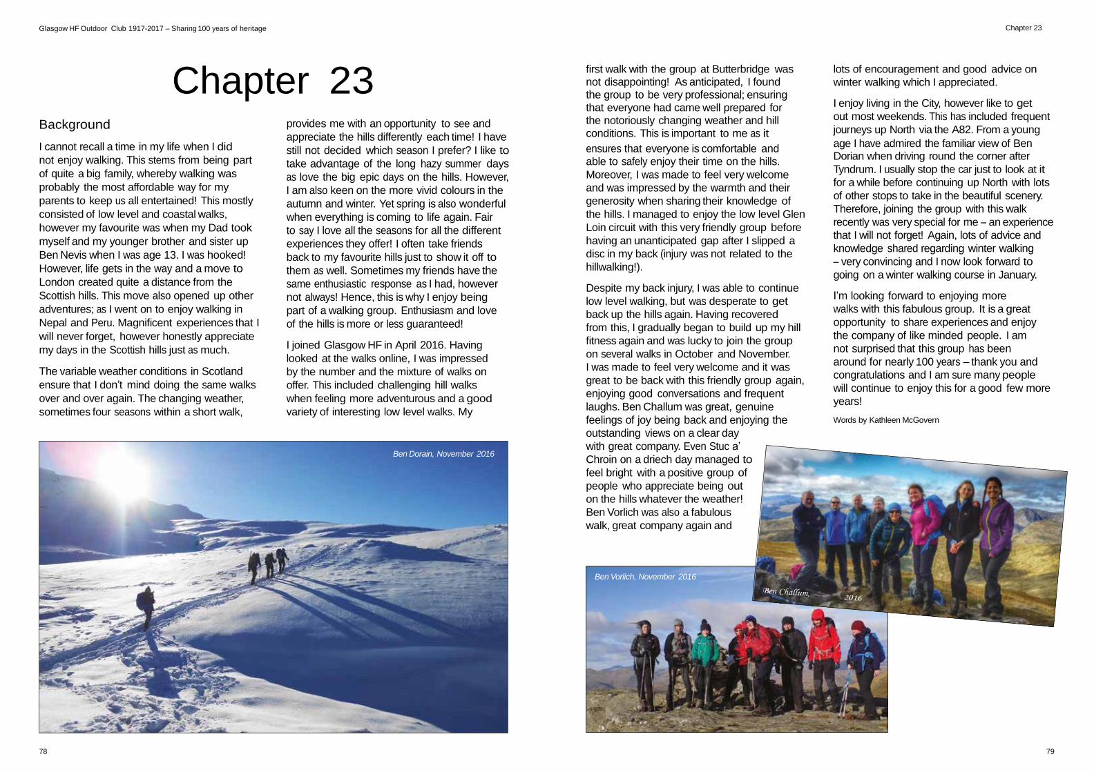
Chapter 23 Glasgow HF Outdoor Club 1917-2017 – Sharing 100 years of heritage
Background
Chapter 23
provides me with an opportunity to see and
appreciate the hills differently each time! I have
first walk with the group at Butterbridge was not disappointing! As anticipated, I found the group to be very professional; ensuring that everyone had came well prepared for the notoriously changing weather and hill conditions. This is important to me as it
lots of encouragement and good advice on
winter walking which I appreciated.
I enjoy living in the City, however like to get
out most weekends. This has included frequent
journeys up North via the A82. From a young
I cannot recall a time in my life when I did
not enjoy walking. This stems from being part
of quite a big family, whereby walking was
probably the most affordable way for my
parents to keep us all entertained! This mostly
consisted of low level and coastal walks,
however my favourite was when my Dad took
myself and my younger brother and sister up
Ben Nevis when I was age 13. I was hooked!
However, life gets in the way and a move to
London created quite a distance from the
Scottish hills. This move also opened up other
adventures; as I went on to enjoy walking in
Nepal and Peru. Magnificent experiences that I
will never forget, however honestly appreciate
my days in the Scottish hills just as much.
The variable weather conditions in Scotland
ensure that I don’t mind doing the same walks
over and over again. The changing weather,
sometimes four seasons within a short walk,
still not decided which season I prefer? I like to
take advantage of the long hazy summer days
as love the big epic days on the hills. However,
I am also keen on the more vivid colours in the
autumn and winter. Yet spring is also wonderful
when everything is coming to life again. Fair
to say I love all the seasons for all the different
experiences they offer! I often take friends
back to my favourite hills just to show it off to
them as well. Sometimes my friends have the
same enthusiastic response as I had, however
not always! Hence, this is why I enjoy being
part of a walking group. Enthusiasm and love
of the hills is more or less guaranteed!
I joined Glasgow HF in April 2016. Having
looked at the walks online, I was impressed
by the number and the mixture of walks on
offer. This included challenging hill walks
when feeling more adventurous and a good
variety of interesting low level walks. My
Ben Dorain, November 2016
ensures that everyone is comfortable and able to safely enjoy their time on the hills.
Moreover, I was made to feel very welcome
and was impressed by the warmth and their
generosity when sharing their knowledge of
the hills. I managed to enjoy the low level Glen
Loin circuit with this very friendly group before
having an unanticipated gap after I slipped a
disc in my back (injury was not related to the
hillwalking!).
Despite my back injury, I was able to continue
low level walking, but was desperate to get
back up the hills again. Having recovered
from this, I gradually began to build up my hill
fitness again and was lucky to join the group
on several walks in October and November.
I was made to feel very welcome and it was
great to be back with this friendly group again,
enjoying good conversations and frequent
laughs. Ben Challum was great, genuine
feelings of joy being back and enjoying the
outstanding views on a clear day
with great company. Even Stuc a’
Chroin on a driech day managed to
feel bright with a positive group of
people who appreciate being out
on the hills whatever the weather!
Ben Vorlich was also a fabulous
walk, great company again and
age I have admired the familiar view of Ben Dorian when driving round the corner after
Tyndrum. I usually stop the car just to look at it
for a while before continuing up North with lots
of other stops to take in the beautiful scenery.
Therefore, joining the group with this walk
recently was very special for me – an experience
that I will not forget! Again, lots of advice and
knowledge shared regarding winter walking
– very convincing and I now look forward to
going on a winter walking course in January.
I’m looking forward to enjoying more
walks with this fabulous group. It is a great
opportunity to share experiences and enjoy
the company of like minded people. I am
not surprised that this group has been
around for nearly 100 years – thank you and
congratulations and I am sure many people
will continue to enjoy this for a good few more
years!
Words by Kathleen McGovern
Ben Vorlich, November 2016
78 79
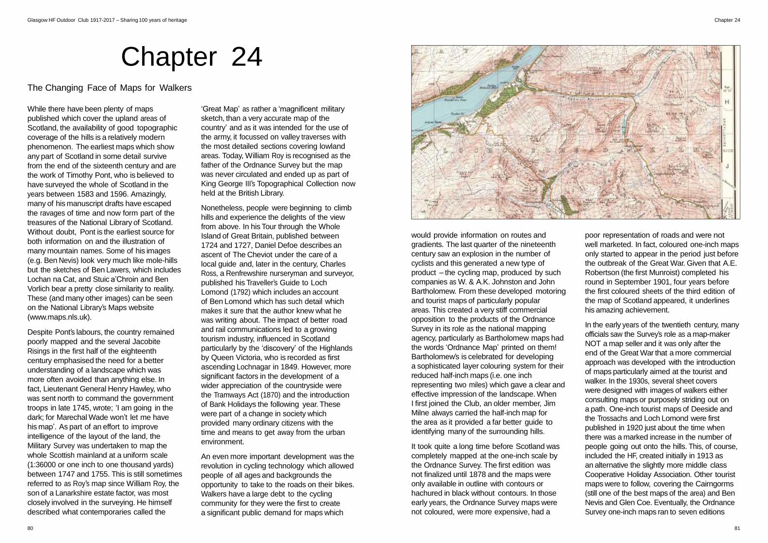
Glasgow HF Outdoor Club 1917-2017 – Sharing 100 years of heritage Chapter 24
Chapter 24
The Changing Face of Maps for Walkers
While there have been plenty of maps
published which cover the upland areas of
Scotland, the availability of good topographic
coverage of the hills is a relatively modern
phenomenon. The earliest maps which show
any part of Scotland in some detail survive
from the end of the sixteenth century and are
the work of Timothy Pont, who is believed to
have surveyed the whole of Scotland in the
years between 1583 and 1596. Amazingly,
many of his manuscript drafts have escaped
the ravages of time and now form part of the
treasures of the National Library of Scotland.
Without doubt, Pont is the earliest source for
both information on and the illustration of
many mountain names. Some of his images
(e.g. Ben Nevis) look very much like mole-hills
but the sketches of Ben Lawers, which includes
Lochan na Cat, and Stuic a’Chroin and Ben
Vorlich bear a pretty close similarity to reality.
These (and many other images) can be seen
on the National Library’s Maps website
(www.maps.nls.uk).
Despite Pont’s labours, the country remained
poorly mapped and the several Jacobite
Risings in the first half of the eighteenth
century emphasised the need for a better
understanding of a landscape which was
more often avoided than anything else. In
fact, Lieutenant General Henry Hawley, who
was sent north to command the government
troops in late 1745, wrote; ‘I am going in the
dark; for Marechal Wade won’t let me have
his map’. As part of an effort to improve
intelligence of the layout of the land, the
Military Survey was undertaken to map the
whole Scottish mainland at a uniform scale
(1:36000 or one inch to one thousand yards)
between 1747 and 1755. This is still sometimes
referred to as Roy’s map since William Roy, the
son of a Lanarkshire estate factor, was most
closely involved in the surveying. He himself
described what contemporaries called the
‘Great Map’ as rather a ‘magnificent military
sketch, than a very accurate map of the
country’ and as it was intended for the use of
the army, it focussed on valley traverses with
the most detailed sections covering lowland
areas. Today, William Roy is recognised as the
father of the Ordnance Survey but the map
was never circulated and ended up as part of
King George III’s Topographical Collection now
held at the British Library.
Nonetheless, people were beginning to climb
hills and experience the delights of the view
from above. In his Tour through the Whole
Island of Great Britain, published between
1724 and 1727, Daniel Defoe describes an
ascent of The Cheviot under the care of a
local guide and, later in the century, Charles
Ross, a Renfrewshire nurseryman and surveyor,
published his Traveller’s Guide to Loch
Lomond (1792) which includes an account
of Ben Lomond which has such detail which
makes it sure that the author knew what he
was writing about. The impact of better road
and rail communications led to a growing
tourism industry, influenced in Scotland
particularly by the ‘discovery’ of the Highlands
by Queen Victoria, who is recorded as first
ascending Lochnagar in 1849. However, more
significant factors in the development of a
wider appreciation of the countryside were
the Tramways Act (1870) and the introduction
of Bank Holidays the following year. These
were part of a change in society which
provided many ordinary citizens with the
time and means to get away from the urban
environment.
An even more important development was the
revolution in cycling technology which allowed
people of all ages and backgrounds the
opportunity to take to the roads on their bikes.
Walkers have a large debt to the cycling
community for they were the first to create
a significant public demand for maps which
would provide information on routes and
gradients. The last quarter of the nineteenth
century saw an explosion in the number of
cyclists and this generated a new type of
product – the cycling map, produced by such
companies as W. & A.K. Johnston and John
Bartholomew. From these developed motoring
and tourist maps of particularly popular
areas. This created a very stiff commercial
opposition to the products of the Ordnance
Survey in its role as the national mapping
agency, particularly as Bartholomew maps had
the words ‘Ordnance Map’ printed on them!
Bartholomew’s is celebrated for developing
a sophisticated layer colouring system for their
reduced half-inch maps (i.e. one inch
representing two miles) which gave a clear and
effective impression of the landscape. When
I first joined the Club, an older member, Jim
Milne always carried the half-inch map for
the area as it provided a far better guide to
identifying many of the surrounding hills.
It took quite a long time before Scotland was
completely mapped at the one-inch scale by
the Ordnance Survey. The first edition was
not finalized until 1878 and the maps were
only available in outline with contours or
hachured in black without contours. In those
early years, the Ordnance Survey maps were
not coloured, were more expensive, had a
poor representation of roads and were not
well marketed. In fact, coloured one-inch maps
only started to appear in the period just before
the outbreak of the Great War. Given that A.E.
Robertson (the first Munroist) completed his
round in September 1901, four years before
the first coloured sheets of the third edition of
the map of Scotland appeared, it underlines
his amazing achievement.
In the early years of the twentieth century, many
officials saw the Survey’s role as a map-maker
NOT a map seller and it was only after the
end of the Great War that a more commercial
approach was developed with the introduction
of maps particularly aimed at the tourist and
walker. In the 1930s, several sheet covers
were designed with images of walkers either
consulting maps or purposely striding out on
a path. One-inch tourist maps of Deeside and
the Trossachs and Loch Lomond were first
published in 1920 just about the time when
there was a marked increase in the number of
people going out onto the hills. This, of course,
included the HF, created initially in 1913 as
an alternative the slightly more middle class
Cooperative Holiday Association. Other tourist
maps were to follow, covering the Cairngorms
(still one of the best maps of the area) and Ben
Nevis and Glen Coe. Eventually, the Ordnance
Survey one-inch maps ran to seven editions
80 81
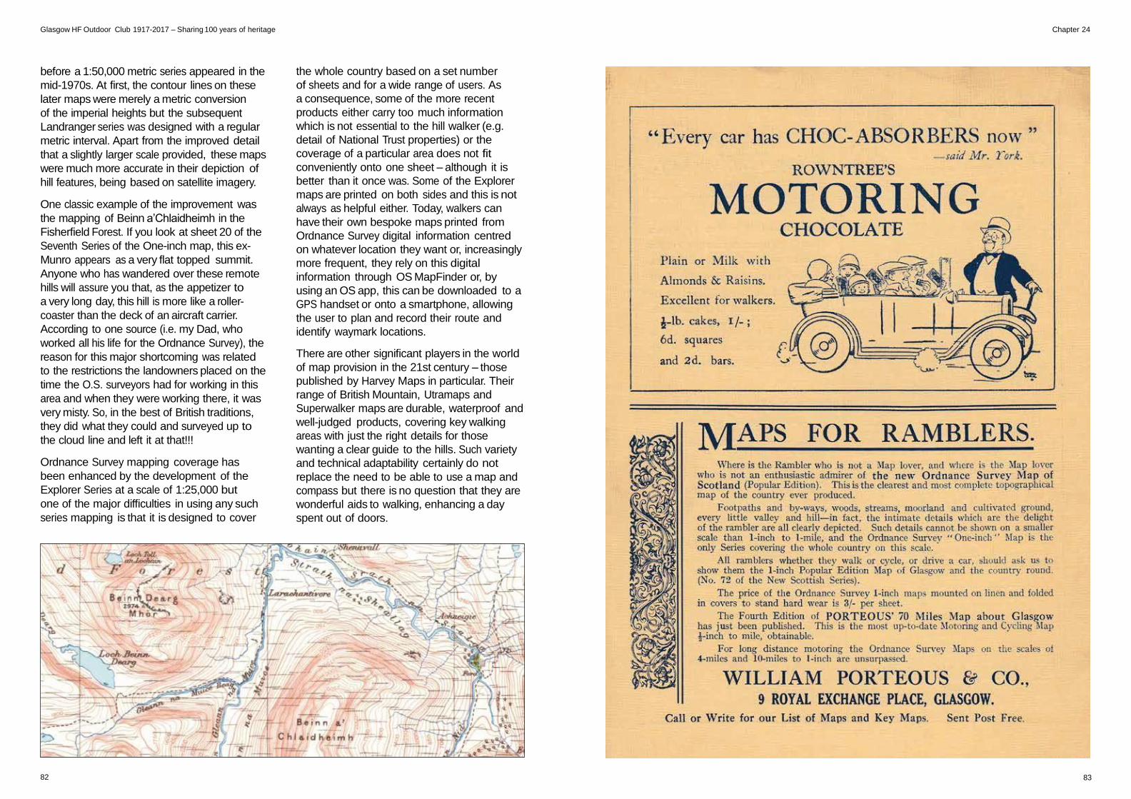
Glasgow HF Outdoor Club 1917-2017 – Sharing 100 years of heritage Chapter 24
before a 1:50,000 metric series appeared in the
mid-1970s. At first, the contour lines on these
later maps were merely a metric conversion
of the imperial heights but the subsequent
Landranger series was designed with a regular
metric interval. Apart from the improved detail
that a slightly larger scale provided, these maps
were much more accurate in their depiction of
hill features, being based on satellite imagery.
One classic example of the improvement was
the mapping of Beinn a’Chlaidheimh in the
Fisherfield Forest. If you look at sheet 20 of the
Seventh Series of the One-inch map, this ex-
Munro appears as a very flat topped summit.
Anyone who has wandered over these remote
hills will assure you that, as the appetizer to
a very long day, this hill is more like a roller-
coaster than the deck of an aircraft carrier.
According to one source (i.e. my Dad, who
worked all his life for the Ordnance Survey), the
reason for this major shortcoming was related
to the restrictions the landowners placed on the
time the O.S. surveyors had for working in this
area and when they were working there, it was
very misty. So, in the best of British traditions,
they did what they could and surveyed up to
the cloud line and left it at that!!!
Ordnance Survey mapping coverage has
been enhanced by the development of the
Explorer Series at a scale of 1:25,000 but
one of the major difficulties in using any such
series mapping is that it is designed to cover
82
the whole country based on a set number
of sheets and for a wide range of users. As
a consequence, some of the more recent
products either carry too much information
which is not essential to the hill walker (e.g.
detail of National Trust properties) or the
coverage of a particular area does not fit
conveniently onto one sheet – although it is
better than it once was. Some of the Explorer
maps are printed on both sides and this is not
always as helpful either. Today, walkers can
have their own bespoke maps printed from
Ordnance Survey digital information centred
on whatever location they want or, increasingly
more frequent, they rely on this digital
information through OS MapFinder or, by
using an OS app, this can be downloaded to a
GPS handset or onto a smartphone, allowing
the user to plan and record their route and
identify waymark locations.
There are other significant players in the world
of map provision in the 21st century – those
published by Harvey Maps in particular. Their
range of British Mountain, Utramaps and
Superwalker maps are durable, waterproof and
well-judged products, covering key walking
areas with just the right details for those
wanting a clear guide to the hills. Such variety
and technical adaptability certainly do not
replace the need to be able to use a map and
compass but there is no question that they are
wonderful aids to walking, enhancing a day
spent out of doors.
83


![[HF] FREEWEIGHT PRODUCTS - HOIST Fitness · [hf] flat bench hf-5163 [hf] 7-position folding f.i.d. bench hf-5167 new! warranty new! warranty [hf] 7-position f.i.d. olympic bench hf-5170](https://img.pdfslide.us/doc/110x75/5b5909d87f8b9ad0048c899a/hf-freeweight-products-hoist-fitness-hf-flat-bench-hf-5163-hf-7-position.jpg)