Embed Size (px)
Citation preview
Glaciers (chapter 11 in Summerfield)
• Permanent (on human timescales) body of ice, consisting largely of recrystallized snow, that shows evidence of downslope or outward movement due to pull of gravity.
• ~10% of surface of continents covered by ice today, but ~30% covered as little as ~18,000 years ago (landforms, sediments, isostasy, climate records)
• Glaciers responsible for huge amounts of erosion in high-elevation terrain (although processes tough to observe, poorly understood)
Glaciers (chapter 11 in Summerfield)
• Form depends on competition between accumulation and melting of ice
• Snow accumulates and compacts to form ice, but ice doesn’t sit still… it deforms plastically
(handout)
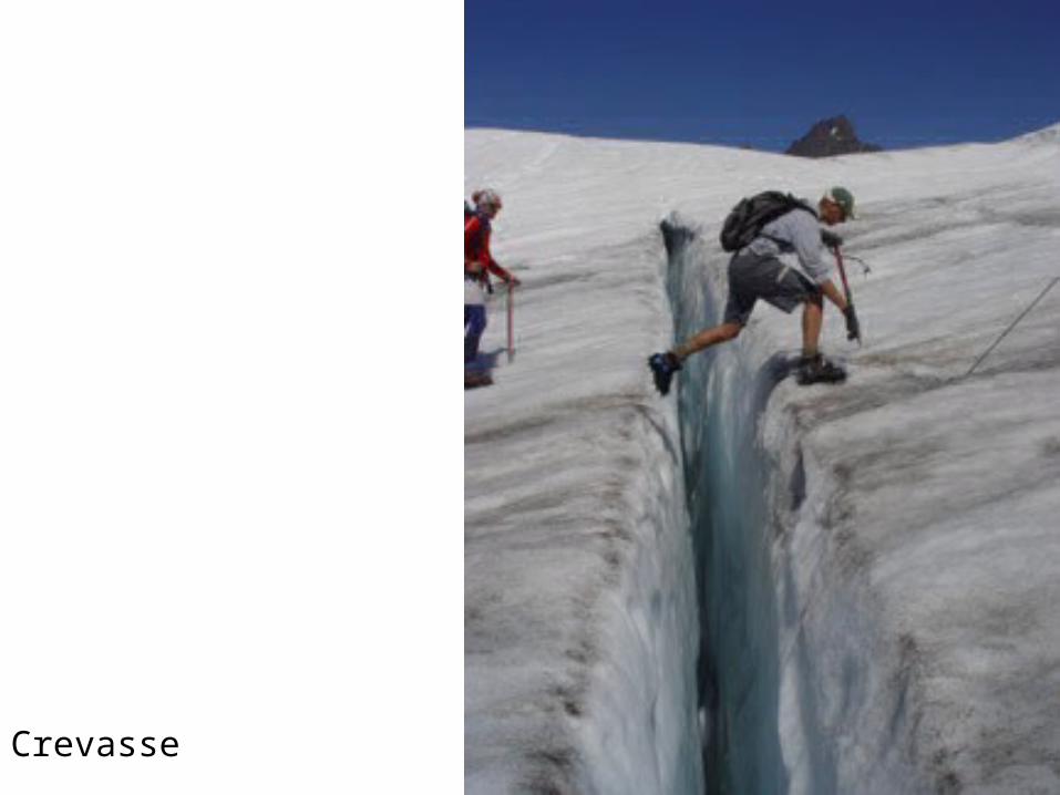
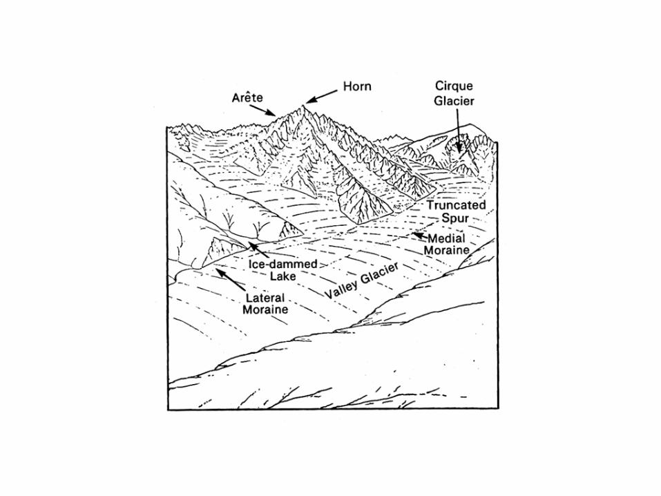
Crevasse
Types of glaciers
(1) Temperate vs. Polar
(2) Alpine or mountain glaciers• Valley glaciers• Cirque glaciers• Fjord glaciers
Ice caps or ice sheets or continental glaciers• Today, only Greenland and Antarctica• Their combined mass is 95% of ice on Earth• Melt would cause 200 ft sea level rise• Can have ice shelves (floating ice at coast)
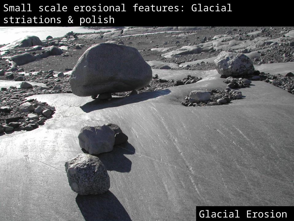
Small scale erosional features: Glacial striations & polish
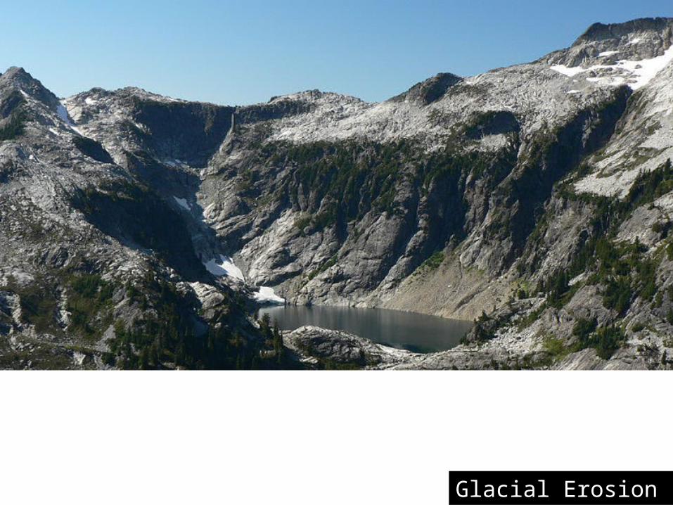
Glacial Erosion
CirqueGlacial Erosion
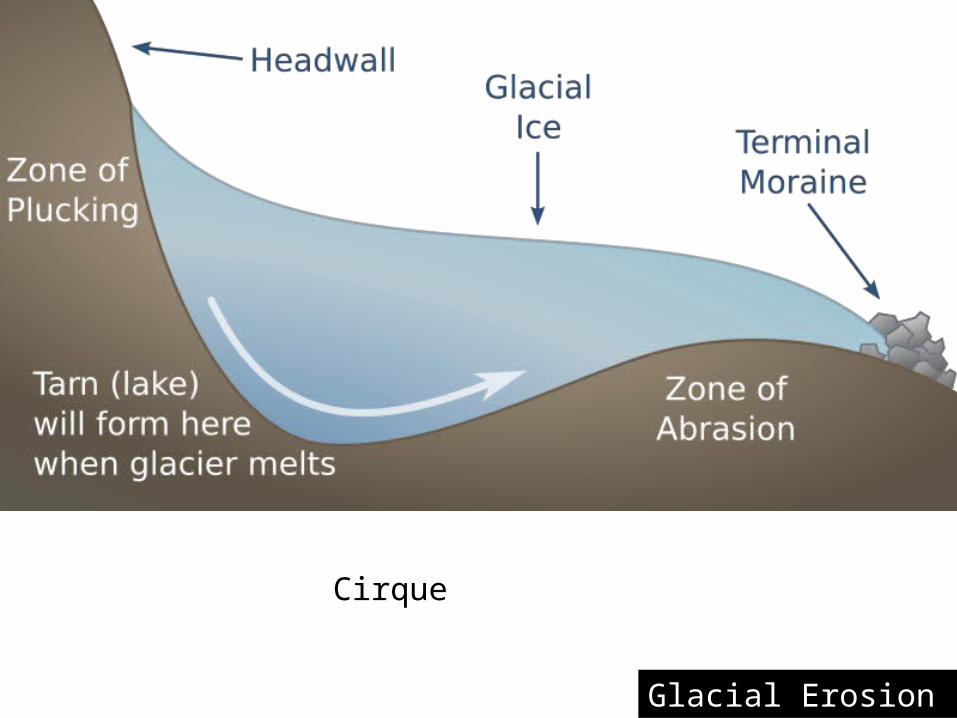
Cirque
Cirque
Glacial Erosion
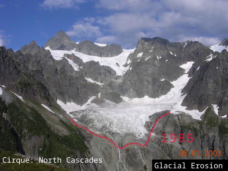
Cirque: North CascadesGlacial Erosion
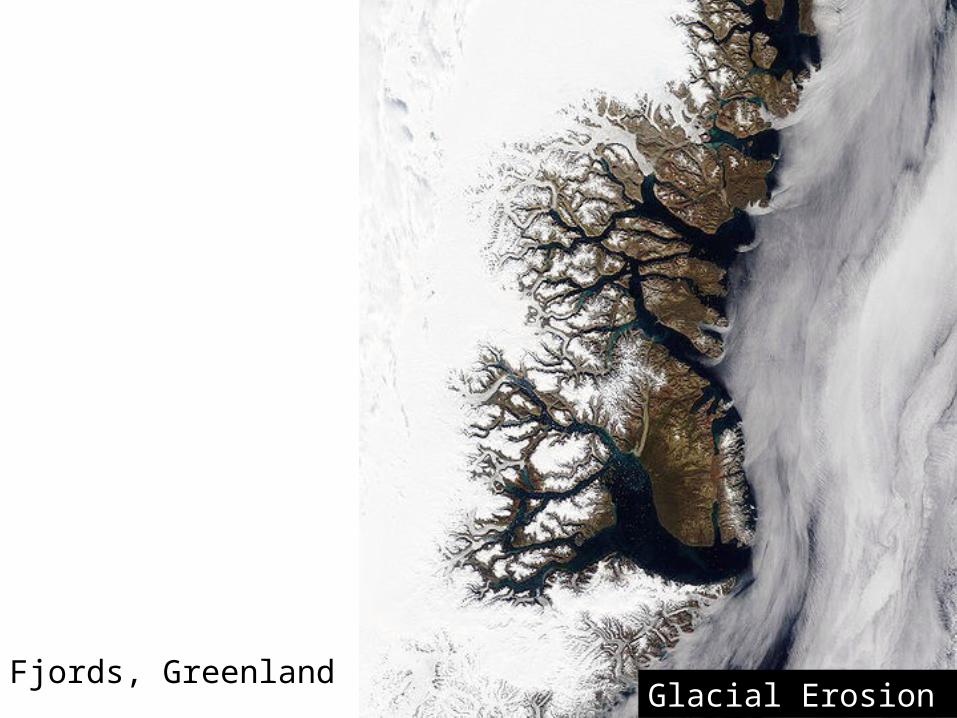
Fjords, Greenlandorth CascadesGlacial Erosion
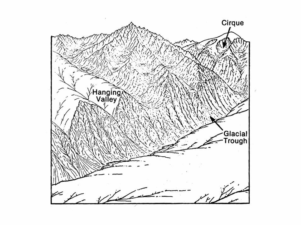
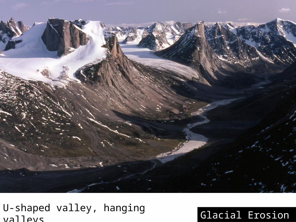
U-shaped valley, hanging valleysGlacial Erosion
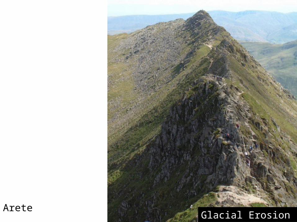
Arete North CascadesGlacial Erosion
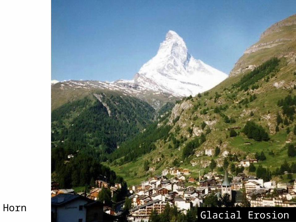
HornNorth CascadesGlacial Erosion
Glacial Deposits
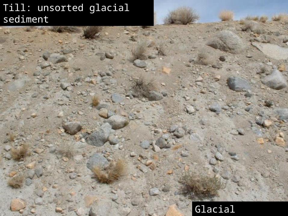
Till: unsorted glacial sediment

Glacial Deposits
Yeager Rock, a 400 ton erratic on the Waterville Plateau, Washington
Glacial Deposits
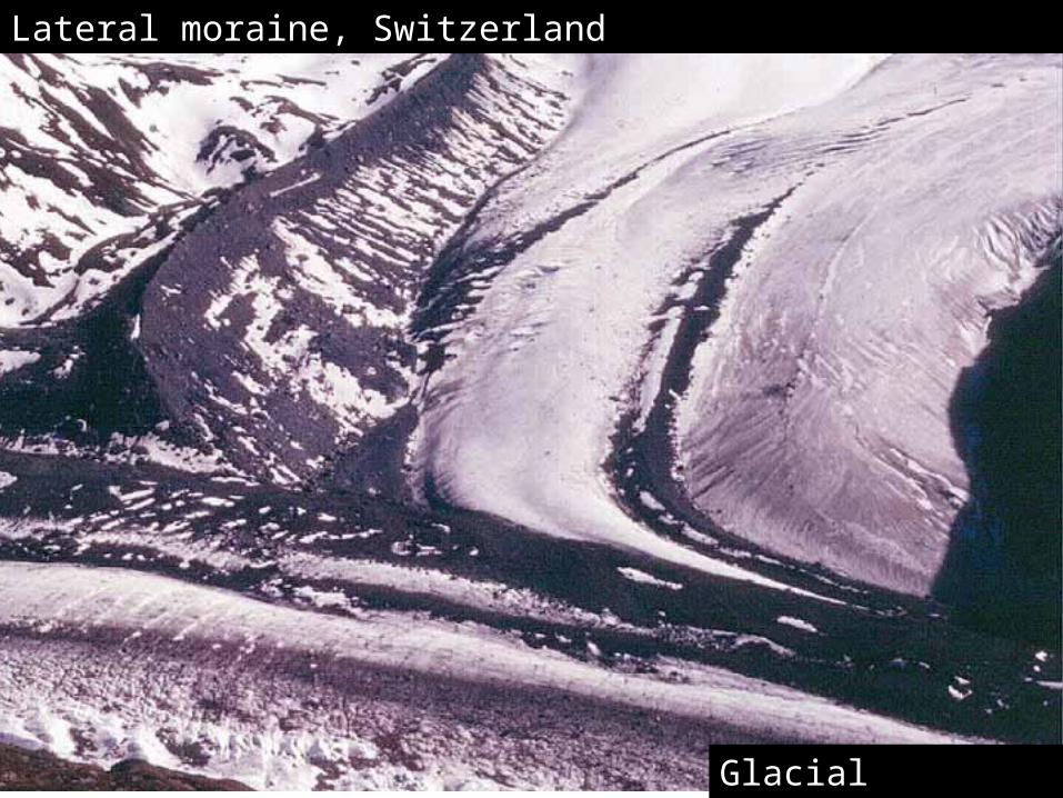
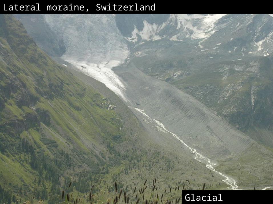
Lateral moraine, Switzerland
Glacial Deposits
Lateral moraine, Switzerland
Glacial Deposits
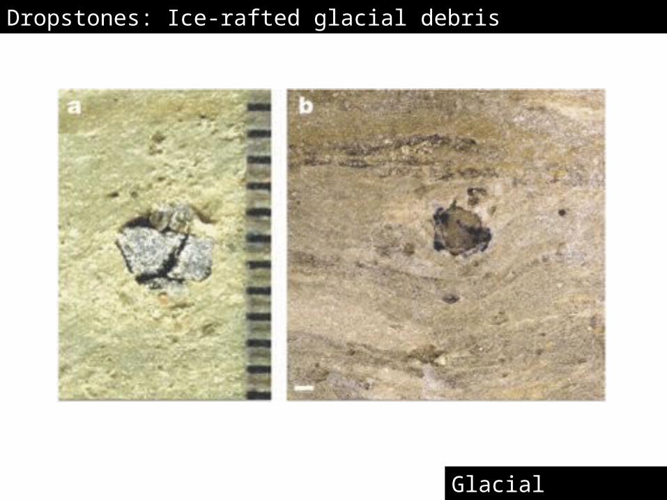
Dropstones: Ice-rafted glacial debris
Glacial Deposits
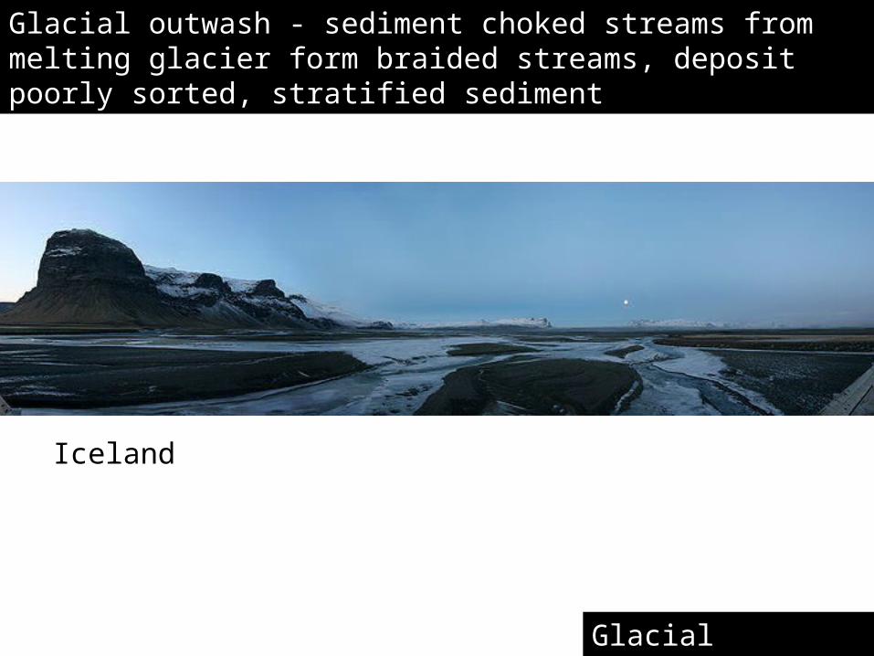
Glacial outwash - sediment choked streams from melting glacier form braided streams, deposit poorly sorted, stratified sediment
Iceland
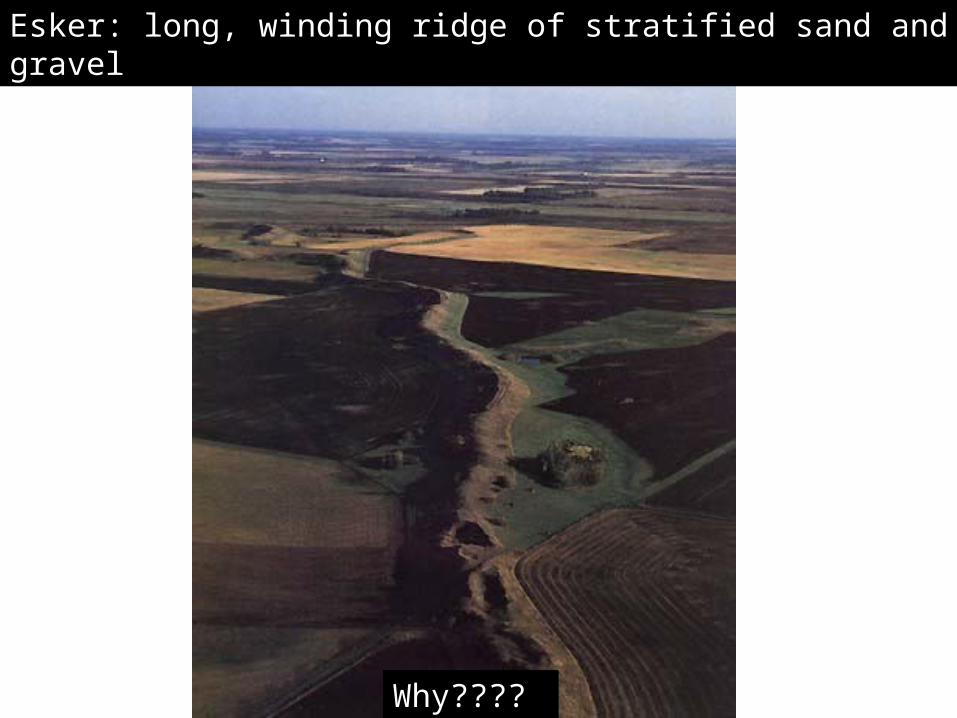
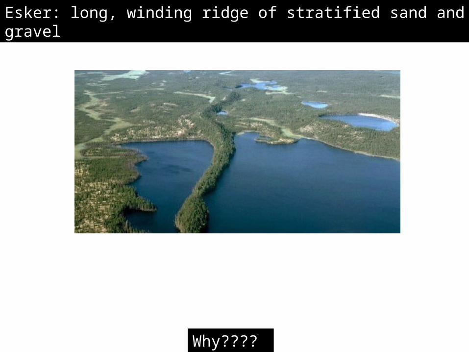
Esker: long, winding ridge of stratified sand and gravel
Why????
Esker: long, winding ridge of stratified sand and gravel
Why????
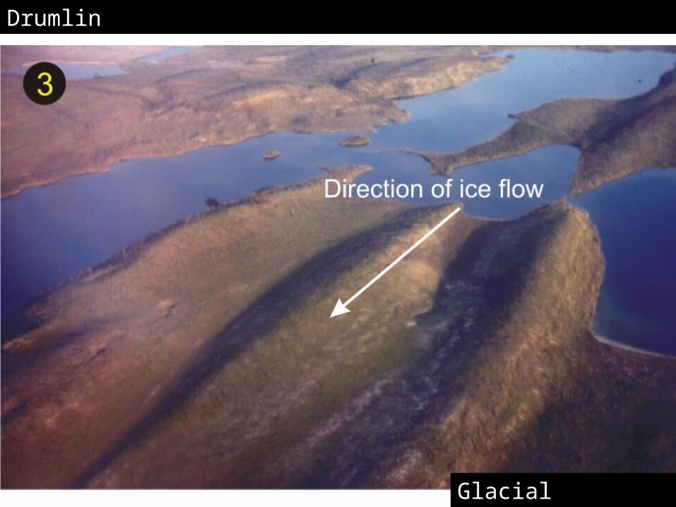
Drumlin
Glacial landforms
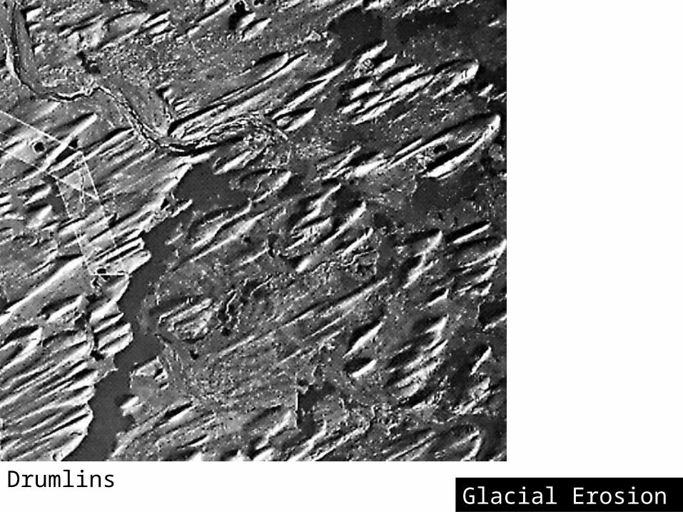
DrumlinsGlacial Erosion
Glacial landforms
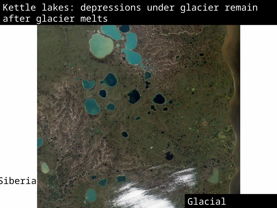
Kettle lakes: depressions under glacier remain after glacier melts
Siberia
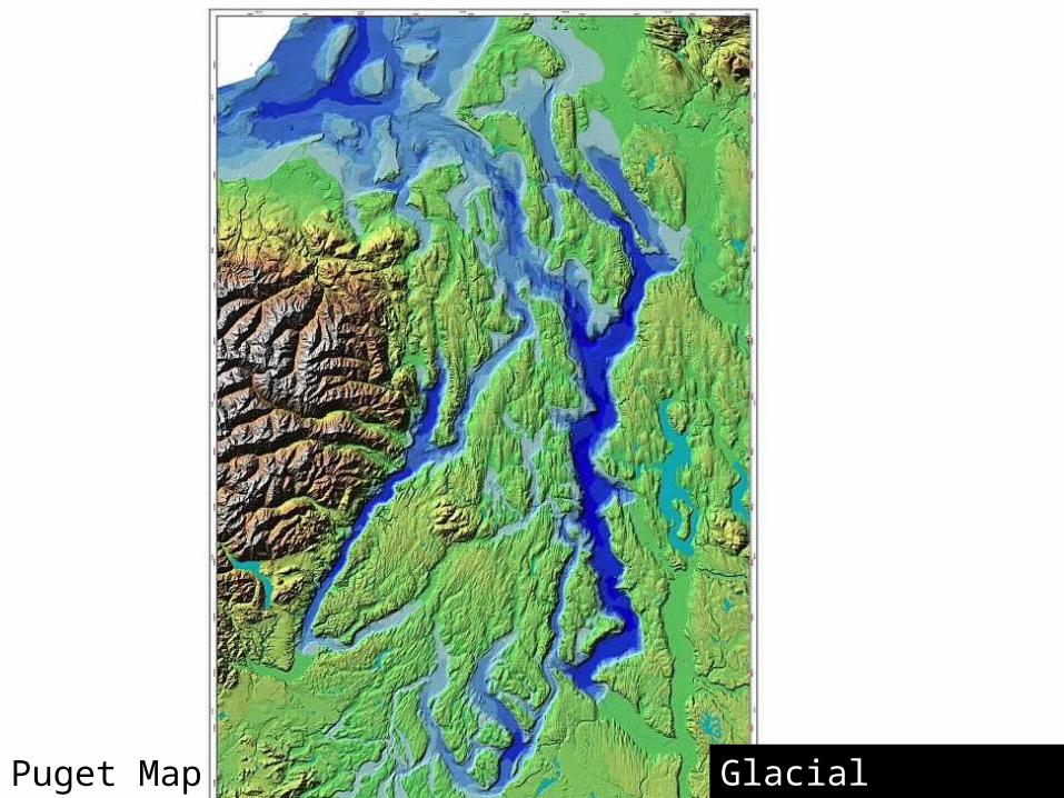
Puget Map Glacial Landscape
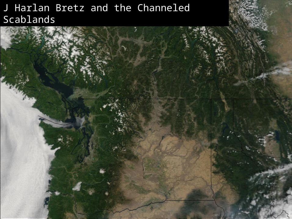
J Harlan Bretz and the Channeled Scablands
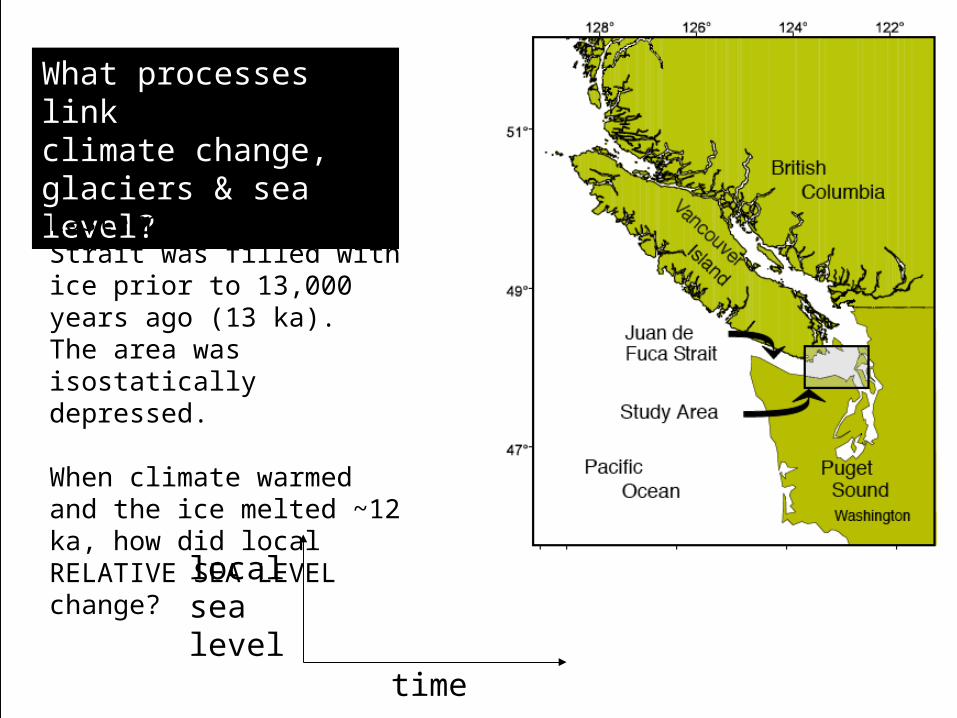
What processes link climate change, glaciers & sea level?
Eastern Juan de Fuca Strait was filled with ice prior to 13,000 years ago (13 ka). The area was isostatically depressed.
When climate warmed and the ice melted ~12 ka, how did local RELATIVE SEA LEVEL change?
time
local sea level
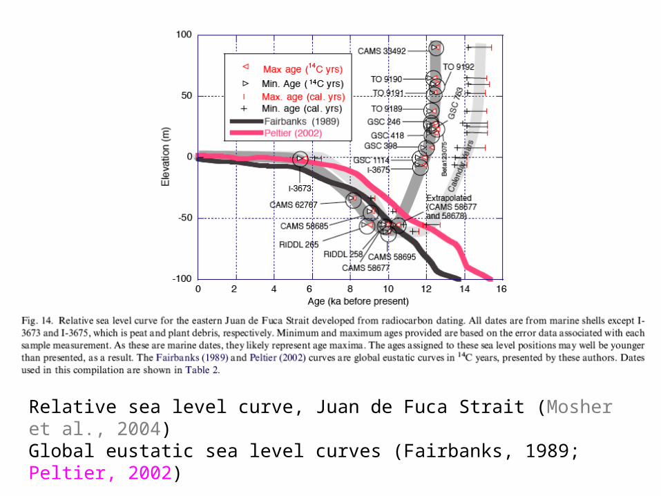
Relative sea level curve, Juan de Fuca Strait (Mosher et al., 2004) Global eustatic sea level curves (Fairbanks, 1989; Peltier, 2002)
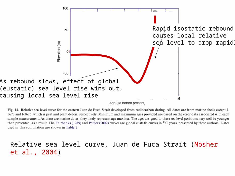
Relative sea level curve, Juan de Fuca Strait (Mosher et al., 2004)
Rapid isostatic rebound causes local relativesea level to drop rapidly
As rebound slows, effect of global (eustatic) sea level rise wins out, causing local sea level rise