Embed Size (px)
Citation preview
GLACIERS
AND
GLACIATION
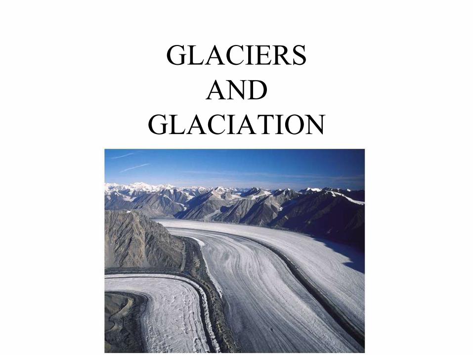
Glaciers and Earth’s Systems
• A glacier is a large, long-lasting
mass of ice, formed on land, that
moves under its own weight
• Glaciers, along with oceans, lakes,
and rivers, are part of the Earth’s
hydrosphere
• Along with sea ice, glaciers are a
portion of the hydrosphere known as
the cryosphere
• About 75% of the world’s supply of
fresh water is locked up as glacial ice
GLACIER
• A body of ice
• Formed on land
• Recrystallization of snow
• Evidence of movement
• Alpine glaciation
• Continental glaciation

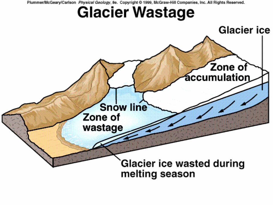
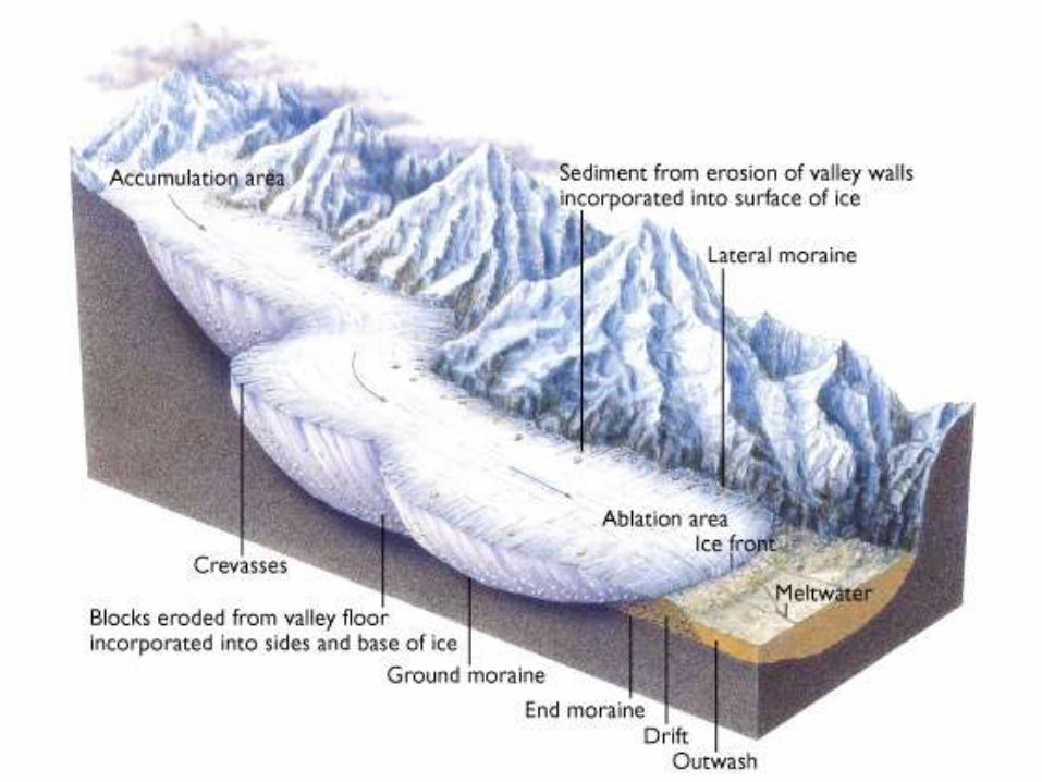
Anatomy of a Glacier • Snow is added in the zone of accumulation of glaciers and melting
occurs in the zone of ablation
• The equilibrium line separates accumulation and ablation zones,
and will advance or retreat depending on whether accumulation or
ablation dominates

Mass balance in glaciers
• Accumulation from snow to ice
• Ablation by sublimation, melting, calving
= retreating = steady state = advancing
Types of Glaciers
• Valley or Alpine glaciers
• Ice sheet or Continental glaciers
– Ice cap
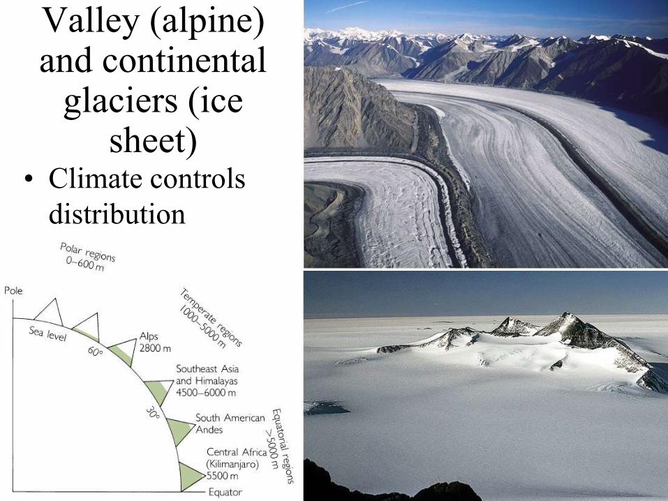
Valley (alpine) and continental
glaciers (ice sheet)
• Climate controls
distribution

Formation of Glaciers
• Glaciers develop as
snow is compacted
and recrystallized,
first into firn and
then glacial ice
• A glacier can only
form where more
snow accumulates
during the winter
than melts away
during the spring
and summer
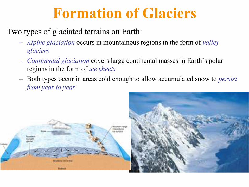
Formation of Glaciers Two types of glaciated terrains on Earth:
– Alpine glaciation occurs in mountainous regions in the form of valley
glaciers
– Continental glaciation covers large continental masses in Earth’s polar
regions in the form of ice sheets
– Both types occur in areas cold enough to allow accumulated snow to persist
from year to year
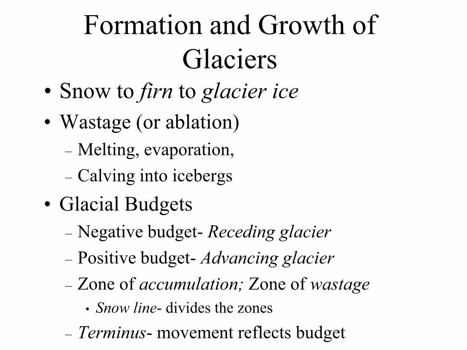
Formation and Growth of
Glaciers • Snow to firn to glacier ice
• Wastage (or ablation)
– Melting, evaporation,
– Calving into icebergs
• Glacial Budgets
– Negative budget- Receding glacier
– Positive budget- Advancing glacier
– Zone of accumulation; Zone of wastage
• Snow line- divides the zones
– Terminus- movement reflects budget
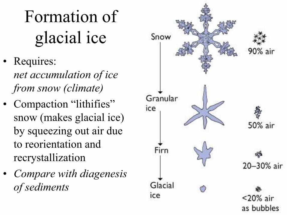
Formation of
glacial ice
• Requires:
net accumulation of ice
from snow (climate)
• Compaction ―lithifies‖
snow (makes glacial ice)
by squeezing out air due
to reorientation and
recrystallization
• Compare with diagenesis
of sediments
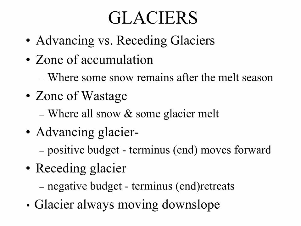
GLACIERS
• Advancing vs. Receding Glaciers
• Zone of accumulation
– Where some snow remains after the melt season
• Zone of Wastage
– Where all snow & some glacier melt
• Advancing glacier-
– positive budget - terminus (end) moves forward
• Receding glacier
– negative budget - terminus (end)retreats
• Glacier always moving downslope
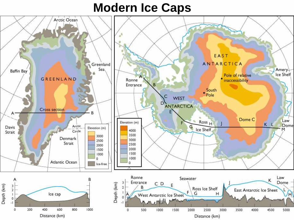
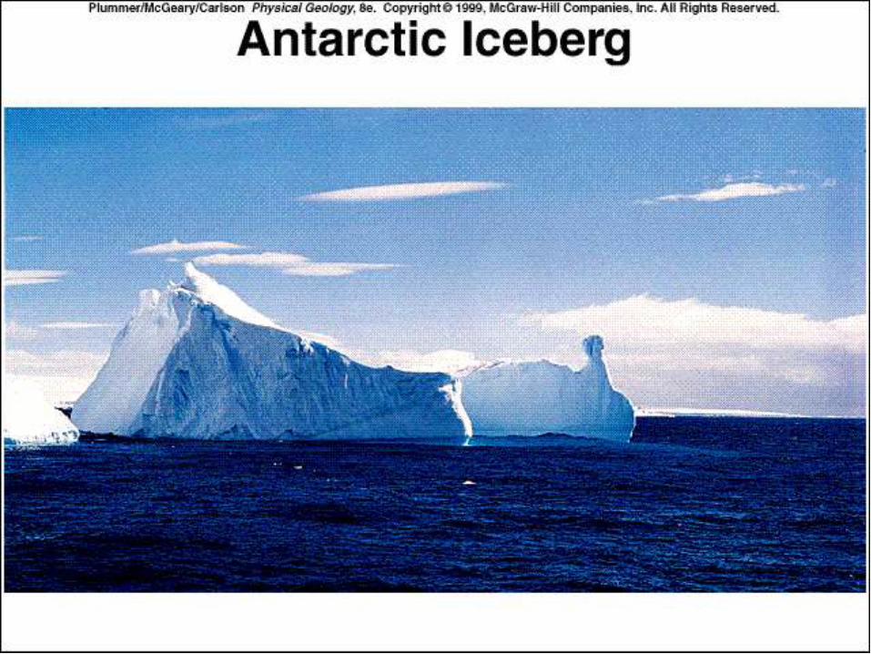
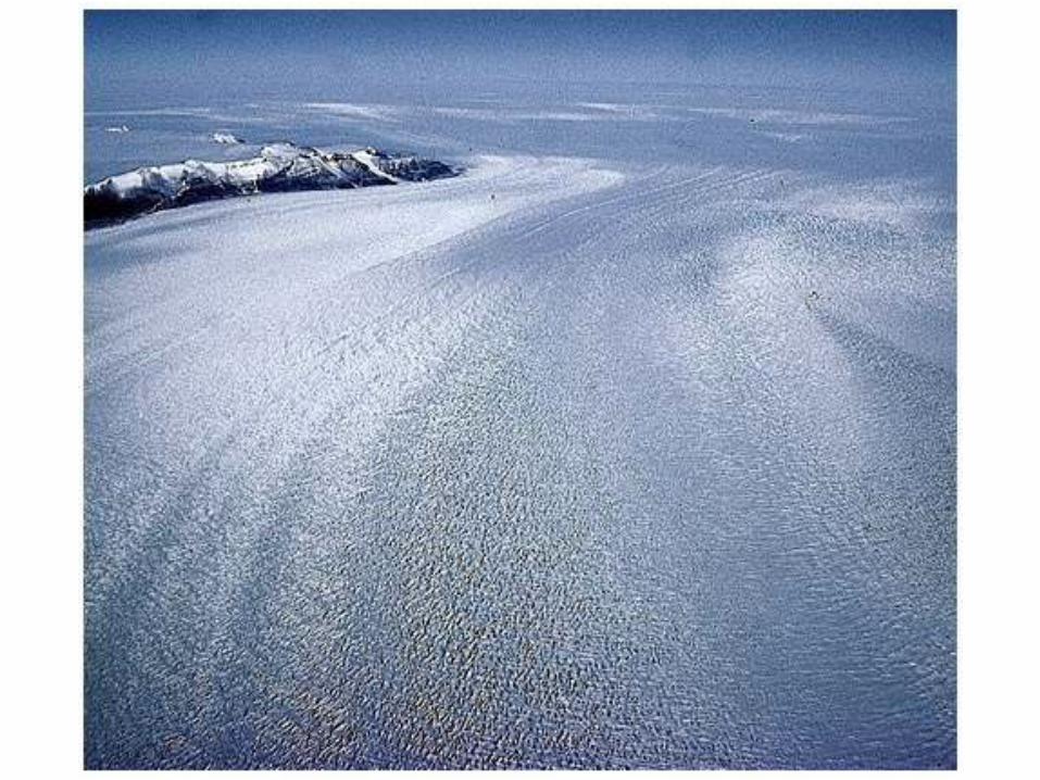
Modern Ice Caps

Antarctica
• Blue ice (sky
color)—so clean
because it came
from depth
• Abundant
meteorites,
including Martian
Alan Hills
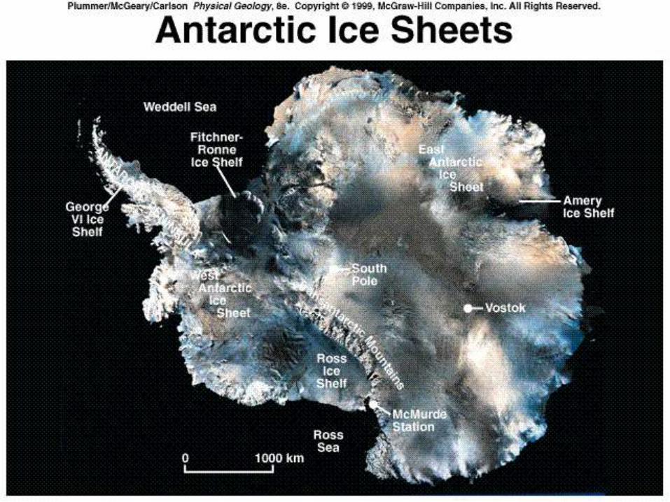
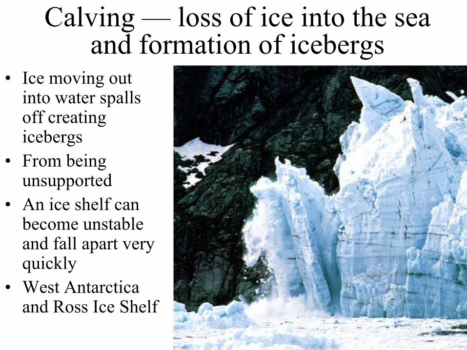
Calving — loss of ice into the sea and formation of icebergs
• Ice moving out into water spalls off creating icebergs
• From being unsupported
• An ice shelf can become unstable and fall apart very quickly
• West Antarctica and Ross Ice Shelf
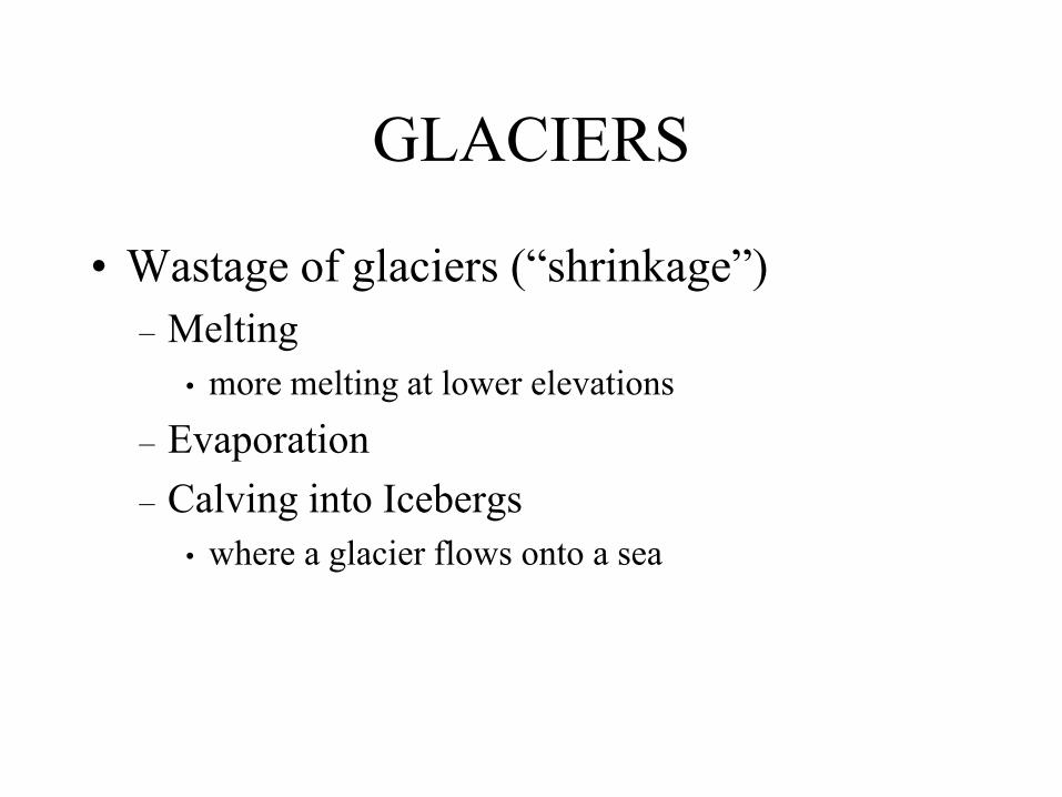
GLACIERS
• Wastage of glaciers (―shrinkage‖)
– Melting
• more melting at lower elevations
– Evaporation
– Calving into Icebergs
• where a glacier flows onto a sea
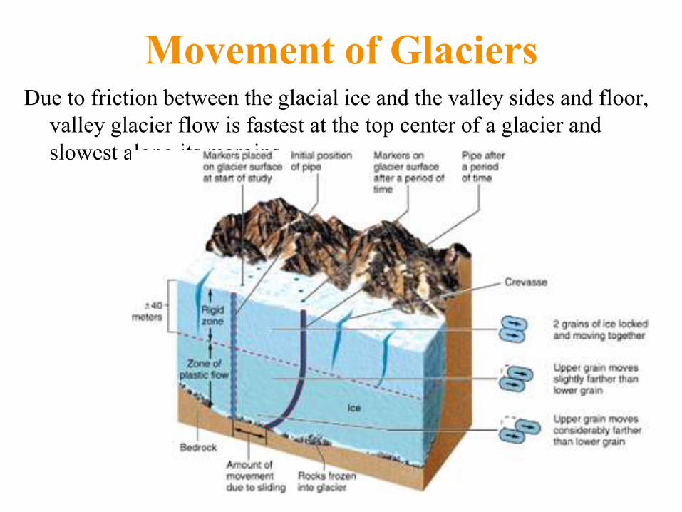
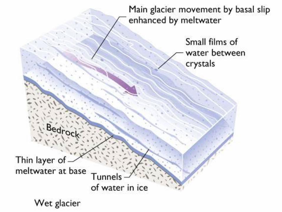
Movement of Glaciers Due to friction between the glacial ice and the valley sides and floor,
valley glacier flow is fastest at the top center of a glacier and
slowest along its margins
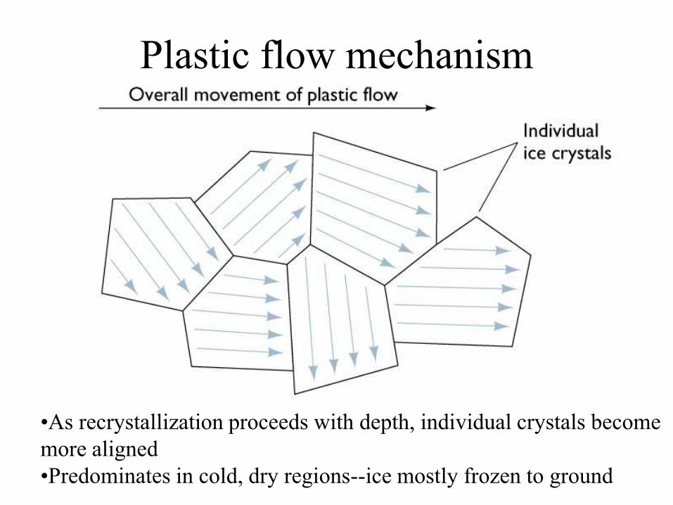
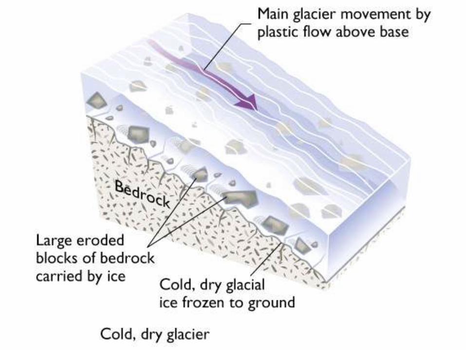
Plastic flow mechanism
•As recrystallization proceeds with depth, individual crystals become
more aligned
•Predominates in cold, dry regions--ice mostly frozen to ground
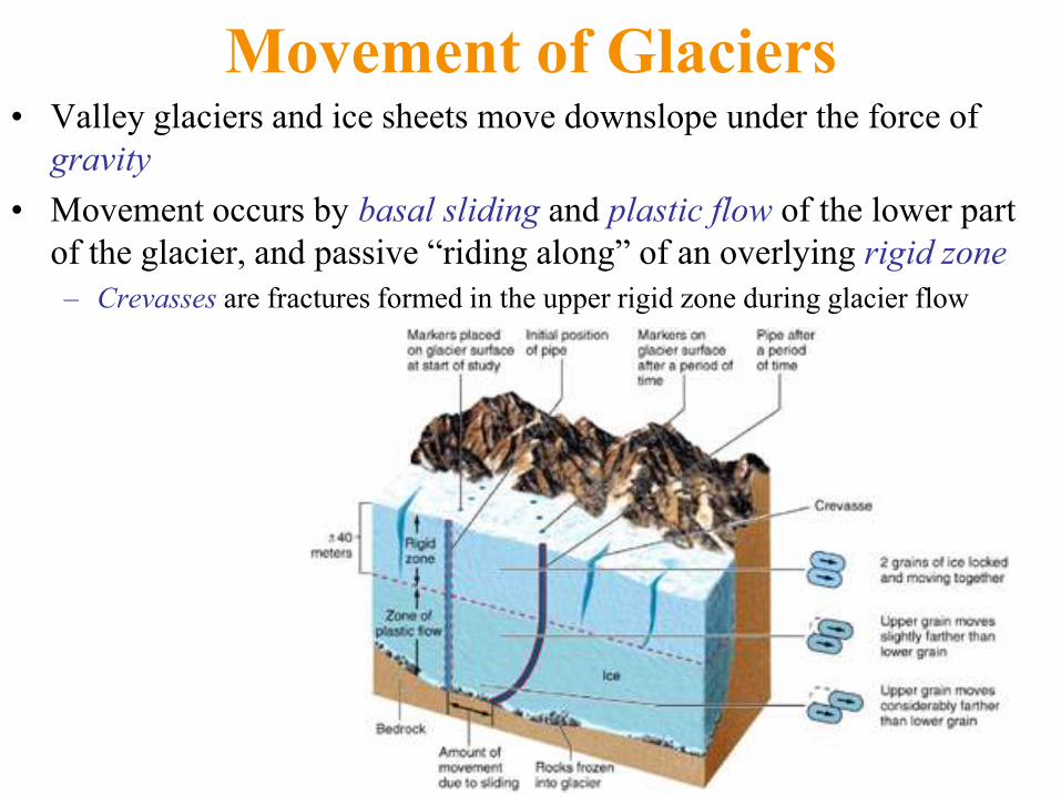
Movement of Glaciers • Valley glaciers and ice sheets move downslope under the force of
gravity
• Movement occurs by basal sliding and plastic flow of the lower part
of the glacier, and passive ―riding along‖ of an overlying rigid zone
– Crevasses are fractures formed in the upper rigid zone during glacier flow
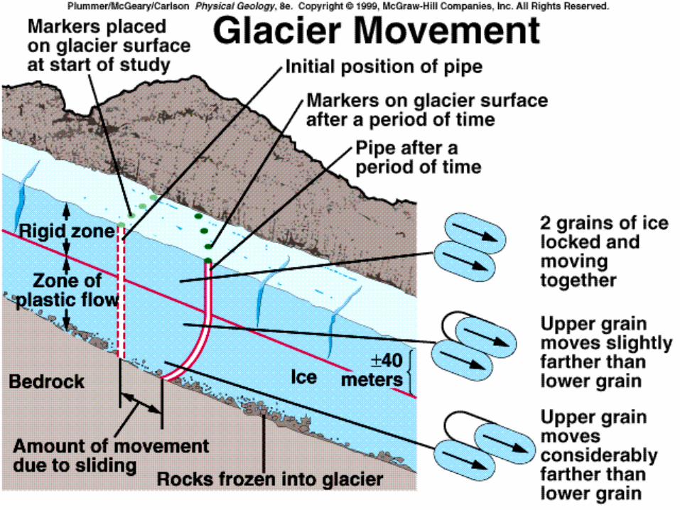

1. Movement
by plastic
flow
2. Movement by basal slip
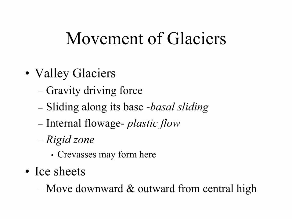
Movement of Glaciers
• Valley Glaciers
– Gravity driving force
– Sliding along its base -basal sliding
– Internal flowage- plastic flow
– Rigid zone
• Crevasses may form here
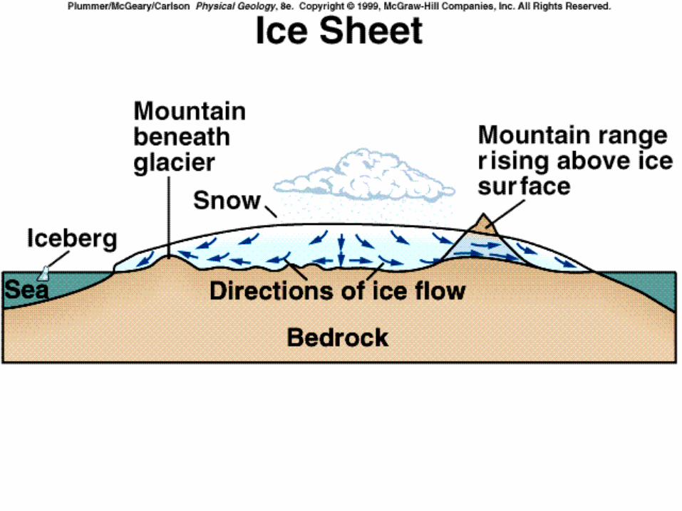
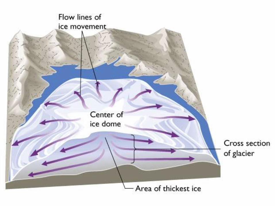
• Ice sheets
– Move downward & outward from central high

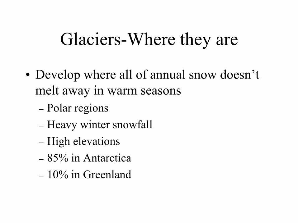
Glaciers-Where they are
• Develop where all of annual snow doesn’t
melt away in warm seasons
– Polar regions
– Heavy winter snowfall
– High elevations
– 85% in Antarctica
– 10% in Greenland
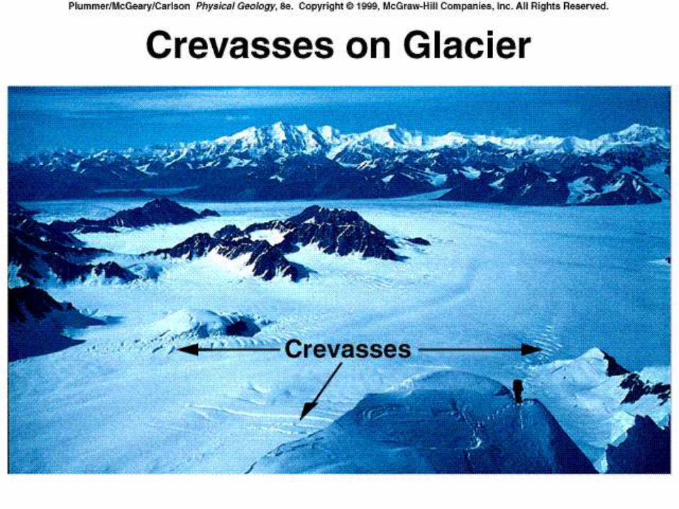
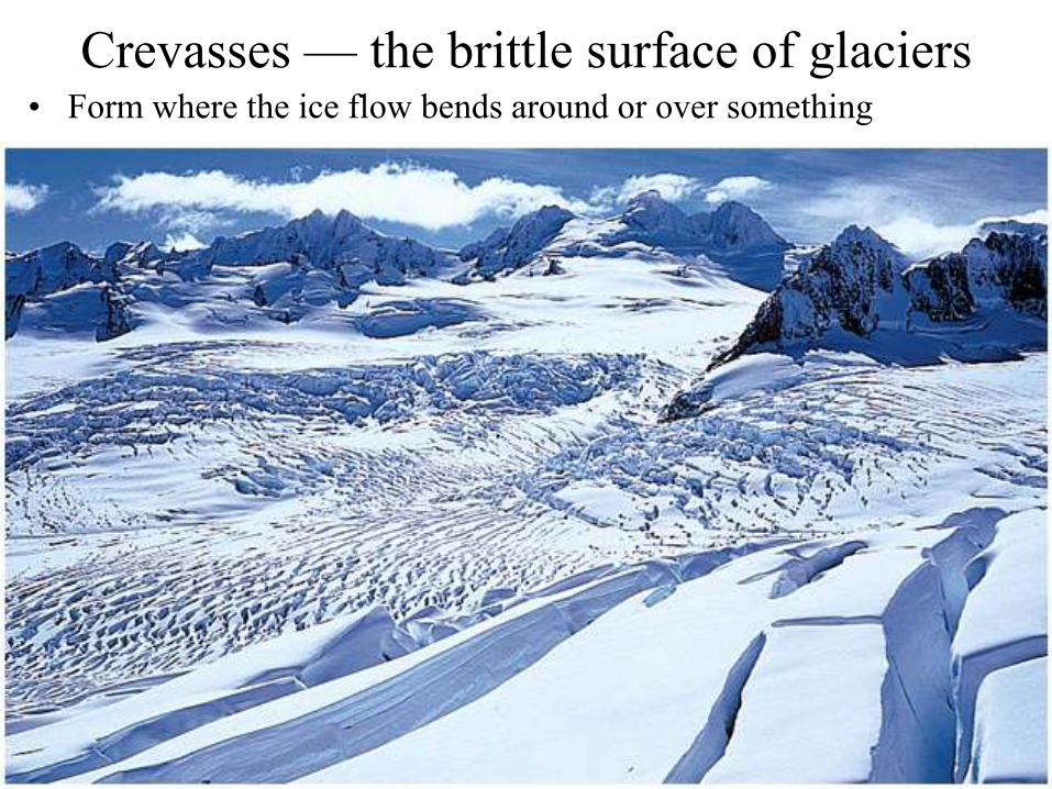
Crevasses — the brittle surface of glaciers • Form where the ice flow bends around or over something
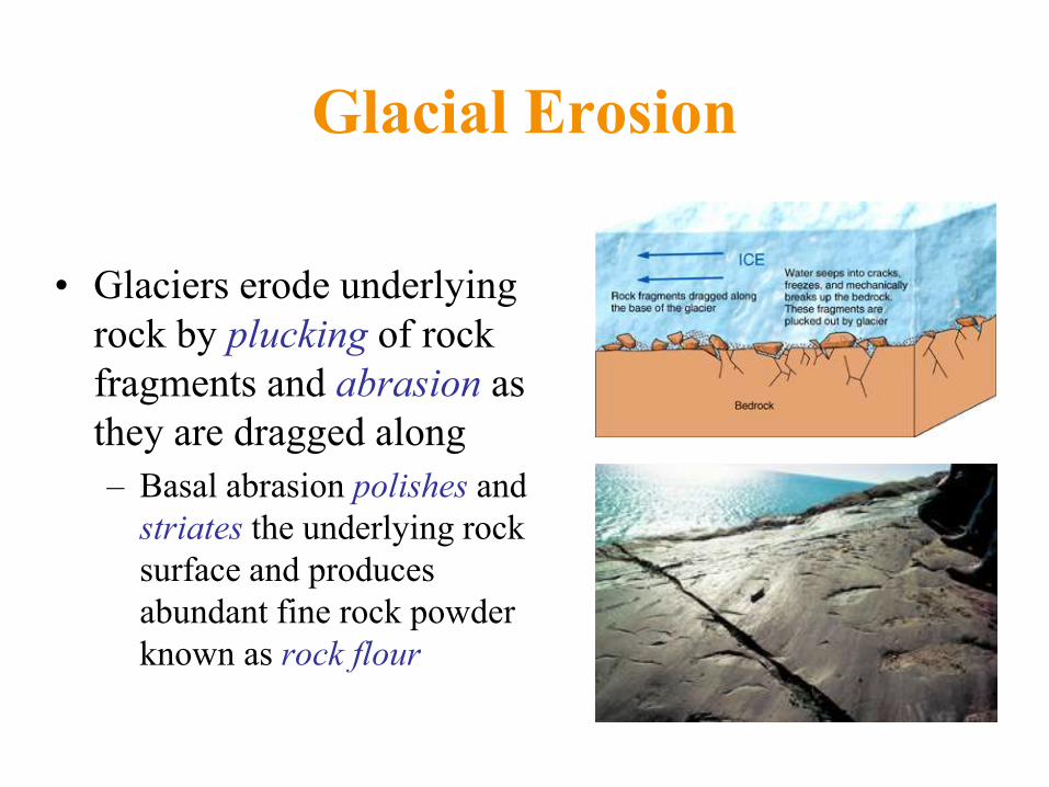
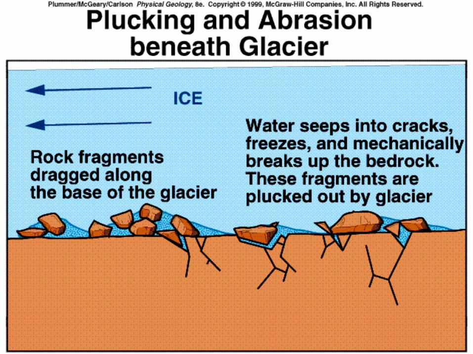
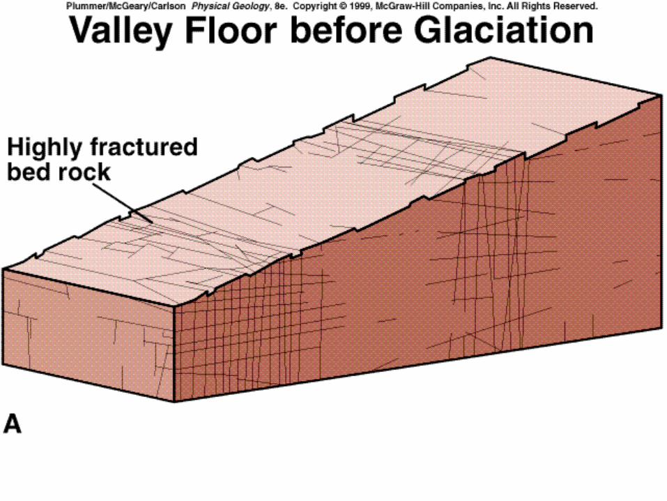
Glacial Erosion
• Glaciers erode underlying
rock by plucking of rock
fragments and abrasion as
they are dragged along
– Basal abrasion polishes and
striates the underlying rock
surface and produces
abundant fine rock powder
known as rock flour
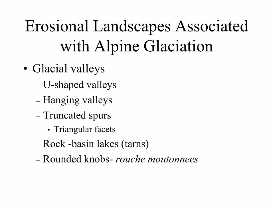
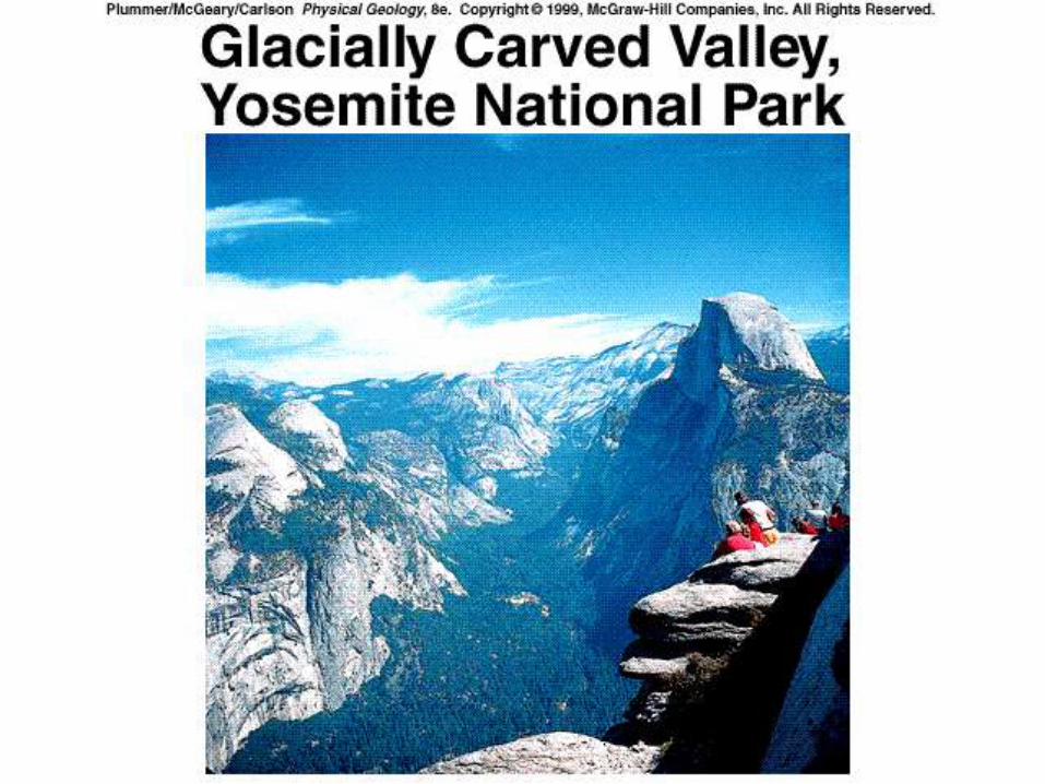
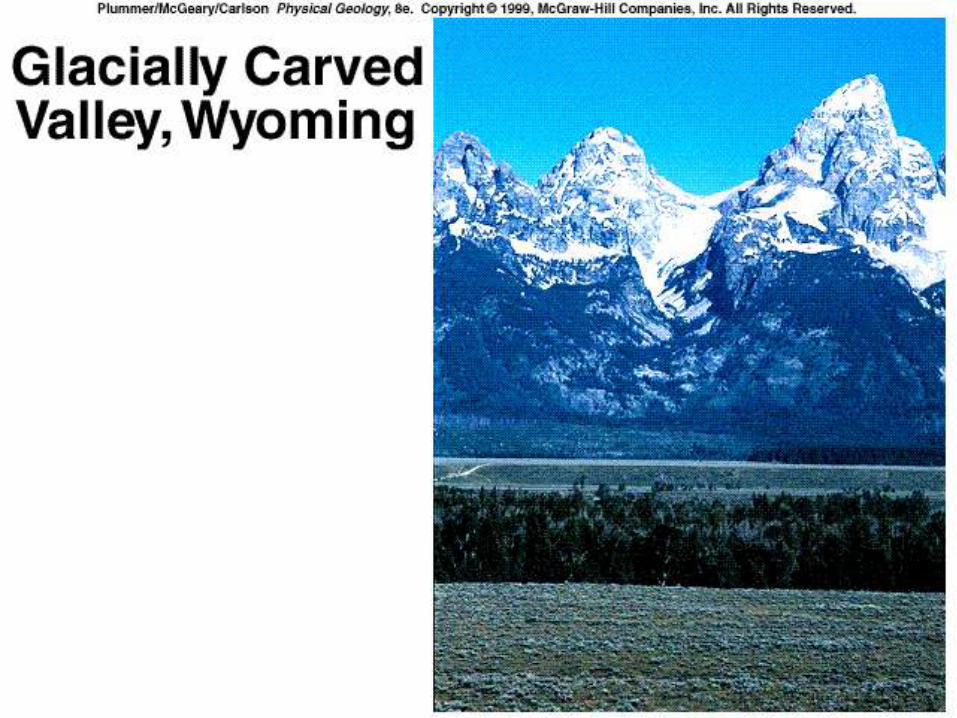
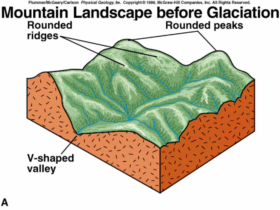
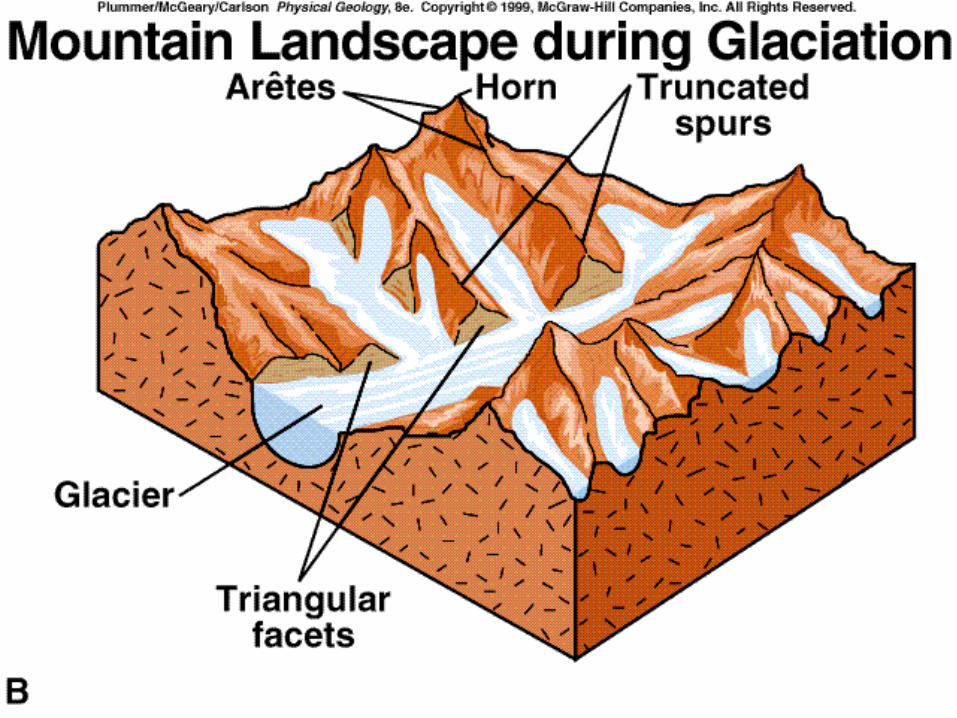
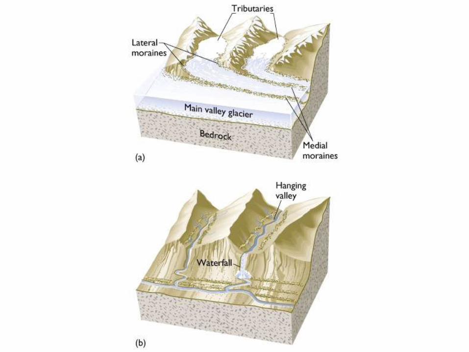
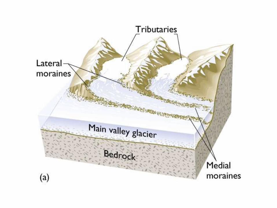
Erosional Landscapes Associated
with Alpine Glaciation
• Glacial valleys
– U-shaped valleys
– Hanging valleys
– Truncated spurs
• Triangular facets
– Rock -basin lakes (tarns)
– Rounded knobs- rouche moutonnees
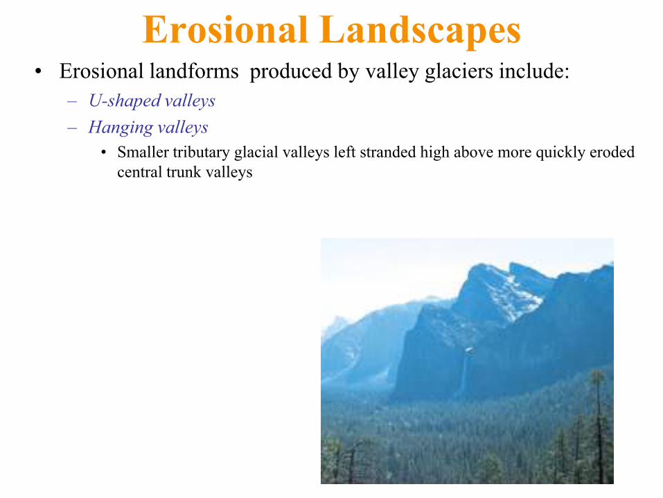
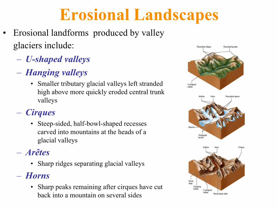
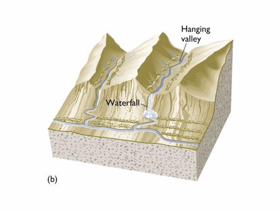
Erosional Landscapes • Erosional landforms produced by valley glaciers include:
– U-shaped valleys
– Hanging valleys
• Smaller tributary glacial valleys left stranded high above more quickly eroded
central trunk valleys
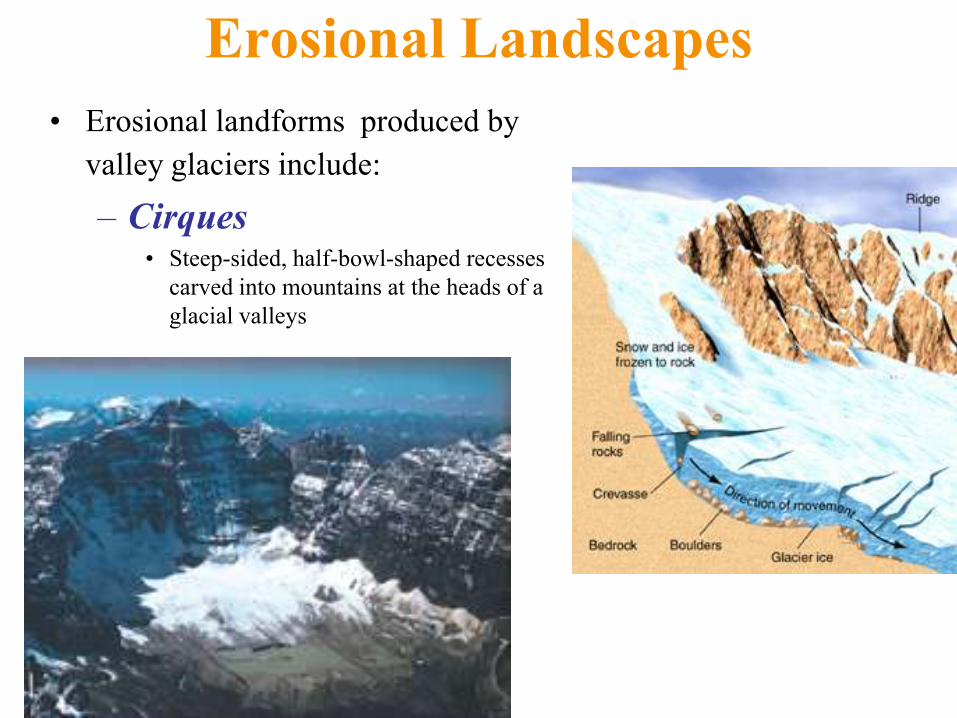
Erosional Landscapes
• Erosional landforms produced by
valley glaciers include:
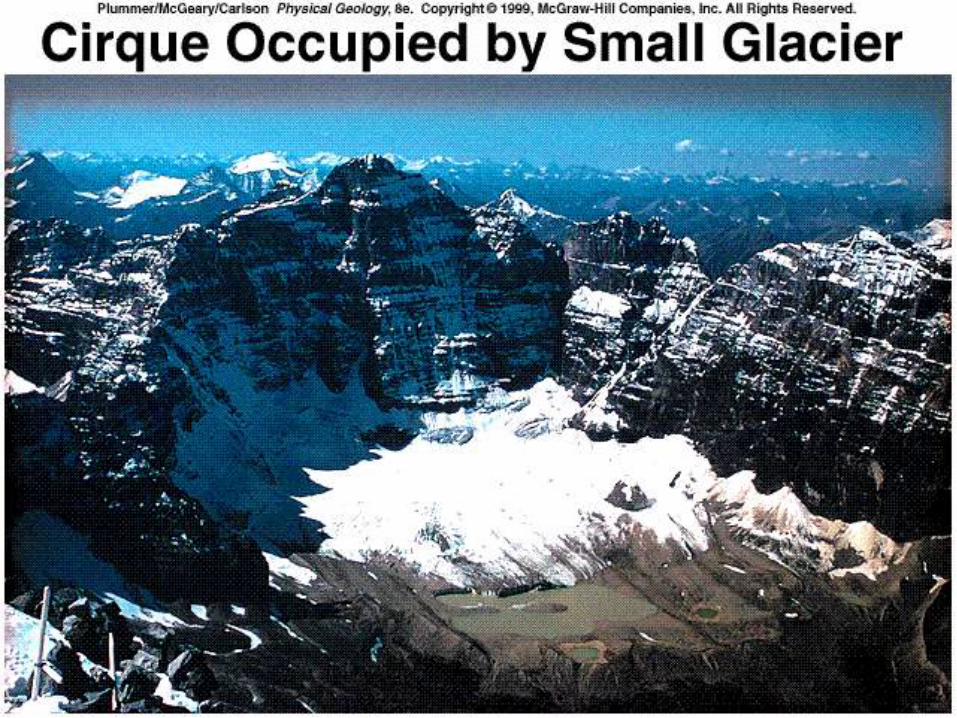
– Cirques • Steep-sided, half-bowl-shaped recesses
carved into mountains at the heads of a
glacial valleys
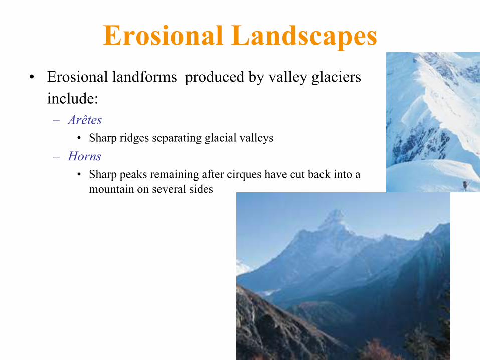
Erosional Landscapes
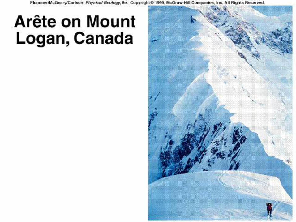
• Erosional landforms produced by valley glaciers
include: – Arêtes
• Sharp ridges separating glacial valleys
– Horns
• Sharp peaks remaining after cirques have cut back into a
mountain on several sides
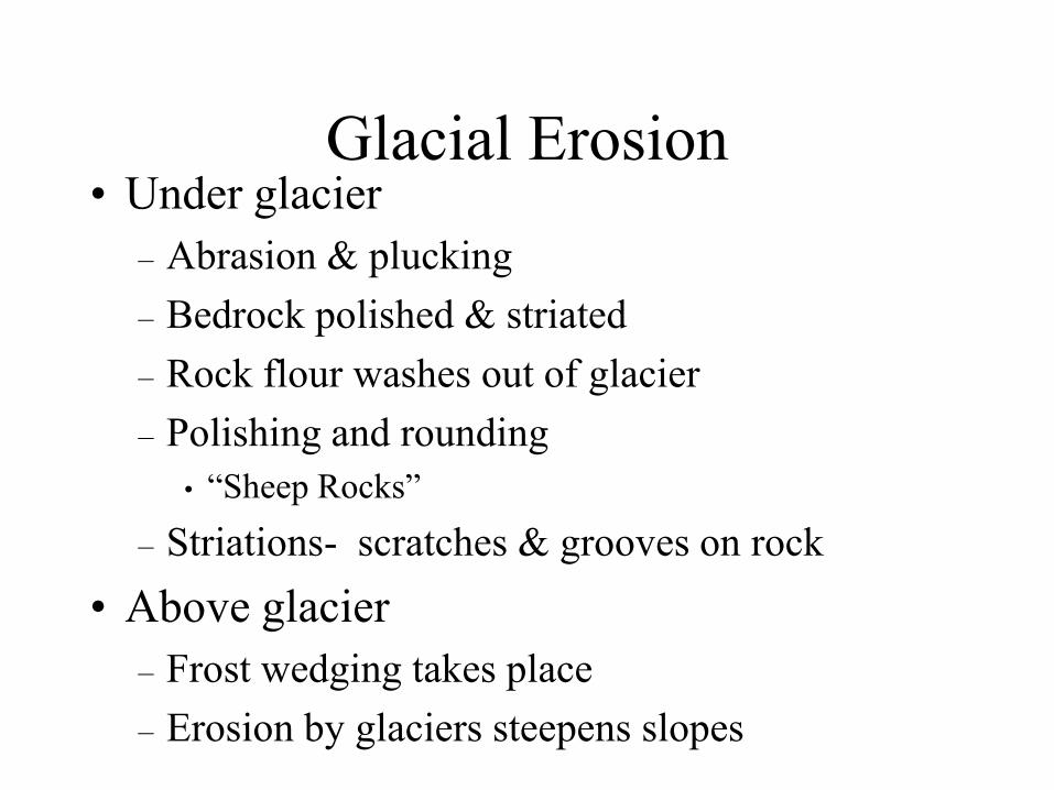
Glacial Erosion • Under glacier
– Abrasion & plucking
– Bedrock polished & striated
– Rock flour washes out of glacier
– Polishing and rounding
• ―Sheep Rocks‖
– Striations- scratches & grooves on rock
• Above glacier
– Frost wedging takes place
– Erosion by glaciers steepens slopes
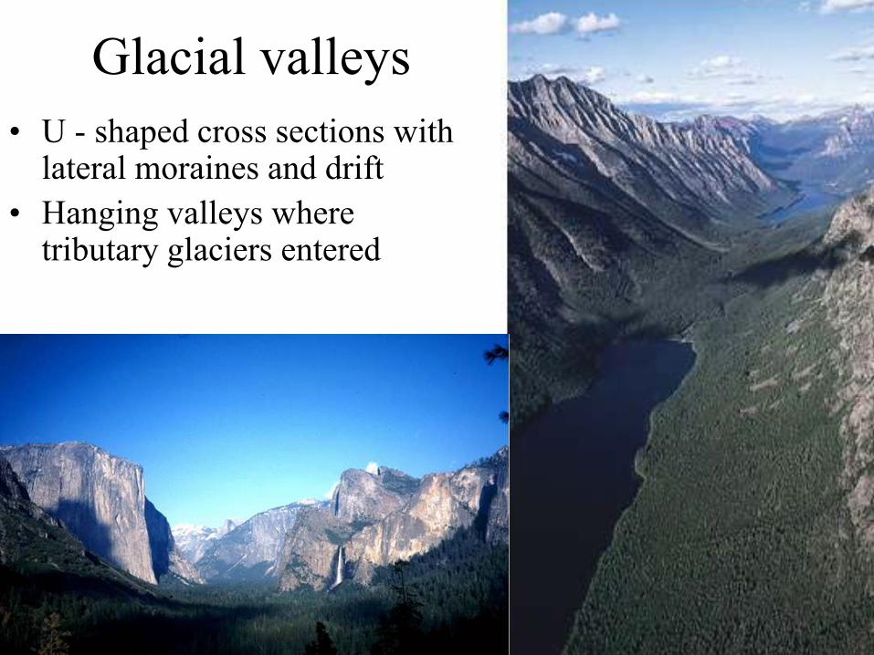
Glacial valleys
• U - shaped cross sections with lateral moraines and drift
• Hanging valleys where tributary glaciers entered
Erosional Landscapes • Erosional landforms produced by valley
glaciers include:
– U-shaped valleys
– Hanging valleys
• Smaller tributary glacial valleys left stranded
high above more quickly eroded central trunk
valleys
– Cirques
• Steep-sided, half-bowl-shaped recesses
carved into mountains at the heads of a
glacial valleys
– Arêtes
• Sharp ridges separating glacial valleys
– Horns
• Sharp peaks remaining after cirques have cut
back into a mountain on several sides
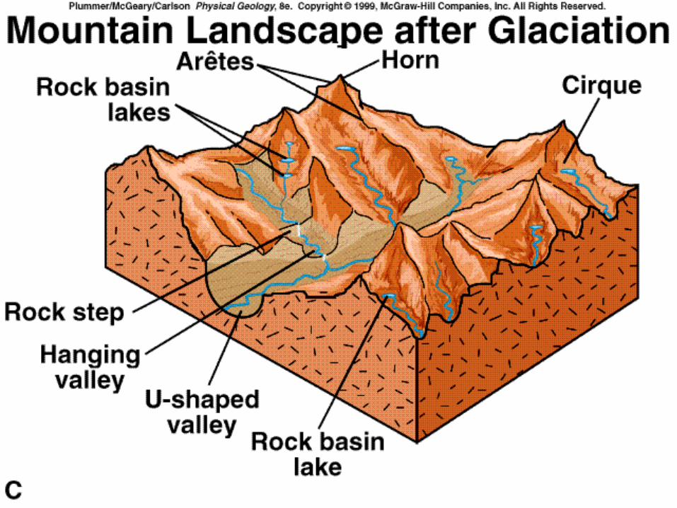
Erosional Landscapes Associated
with Alpine Glaciation
• Cirque- at head of valley glacier
– Rock steps
• Rock basin lakes
– Pater Noster Lakes – string of beads
• Horn
• Arete- sharp ridge
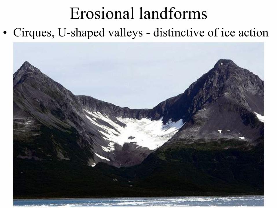
Erosional landforms • Cirques, U-shaped valleys - distinctive of ice action
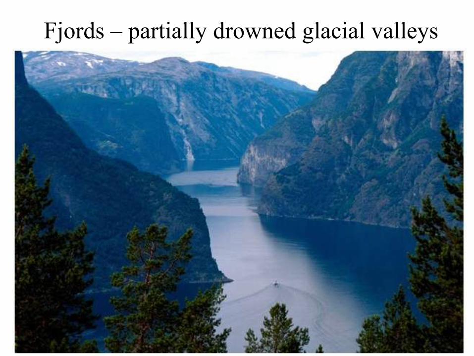
Fjords – partially drowned glacial valleys
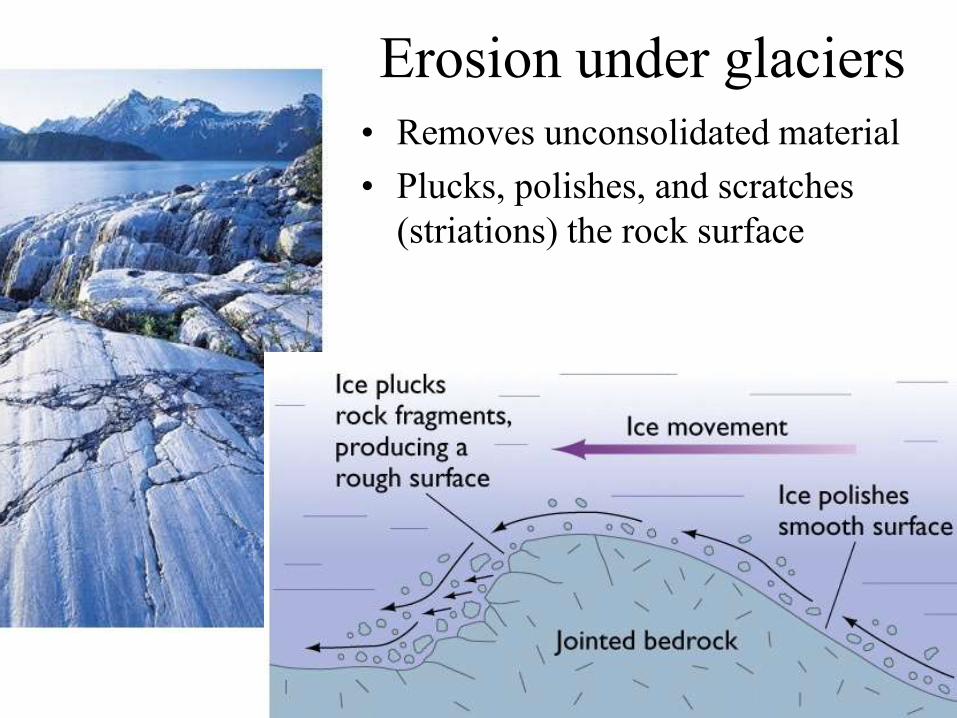
Erosion under glaciers
• Removes unconsolidated material
• Plucks, polishes, and scratches
(striations) the rock surface
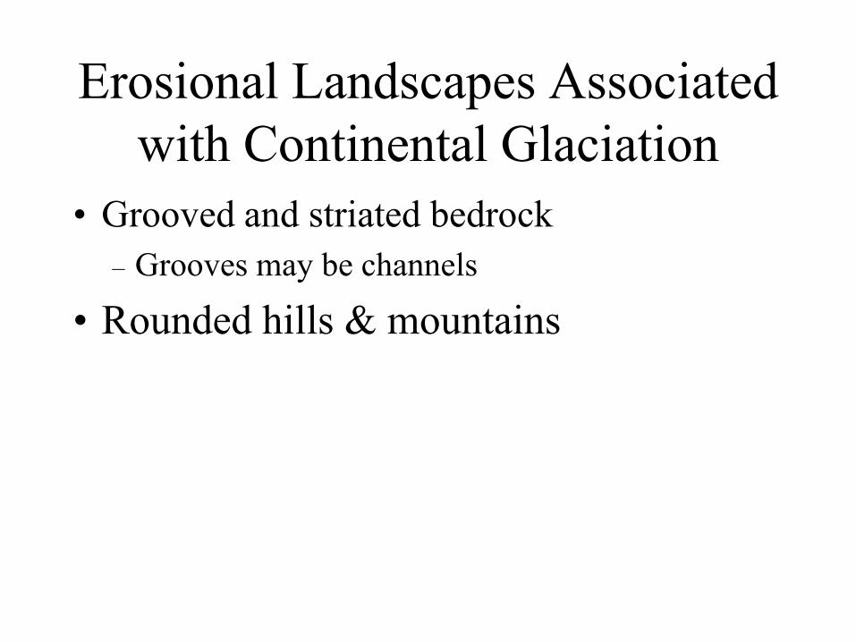
Erosional Landscapes Associated
with Continental Glaciation
• Grooved and striated bedrock
– Grooves may be channels
• Rounded hills & mountains

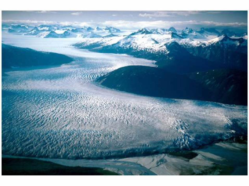
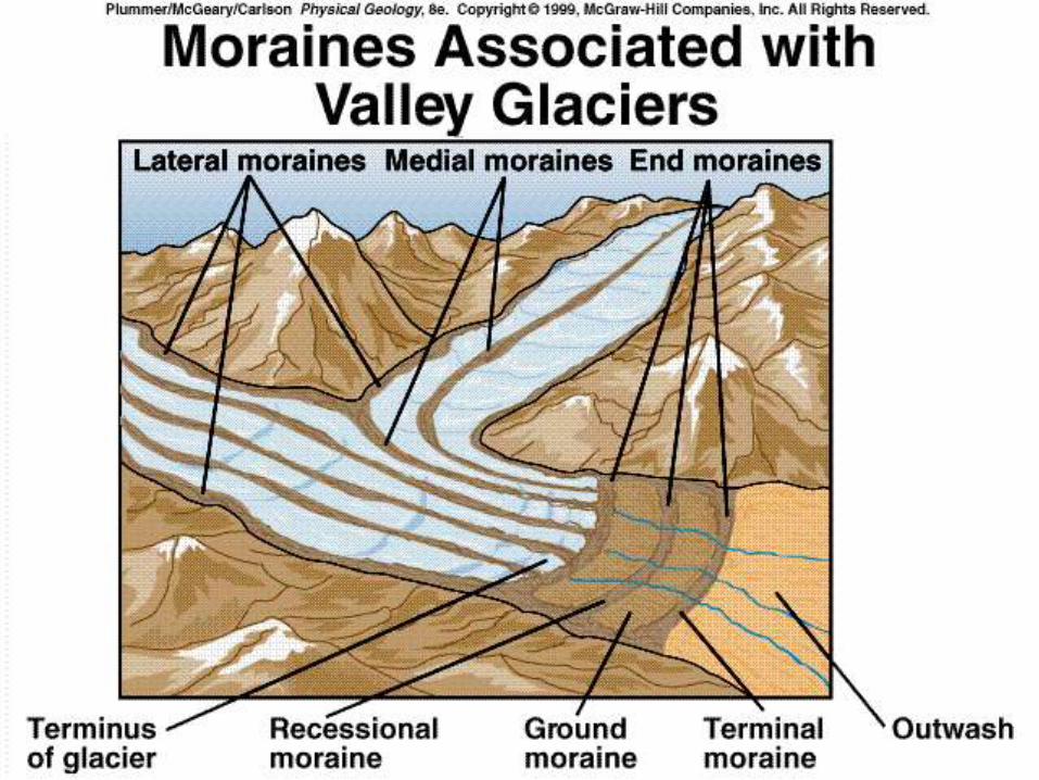
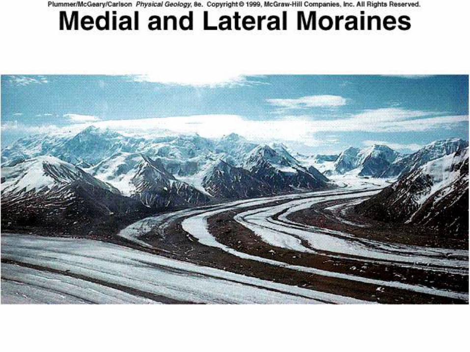
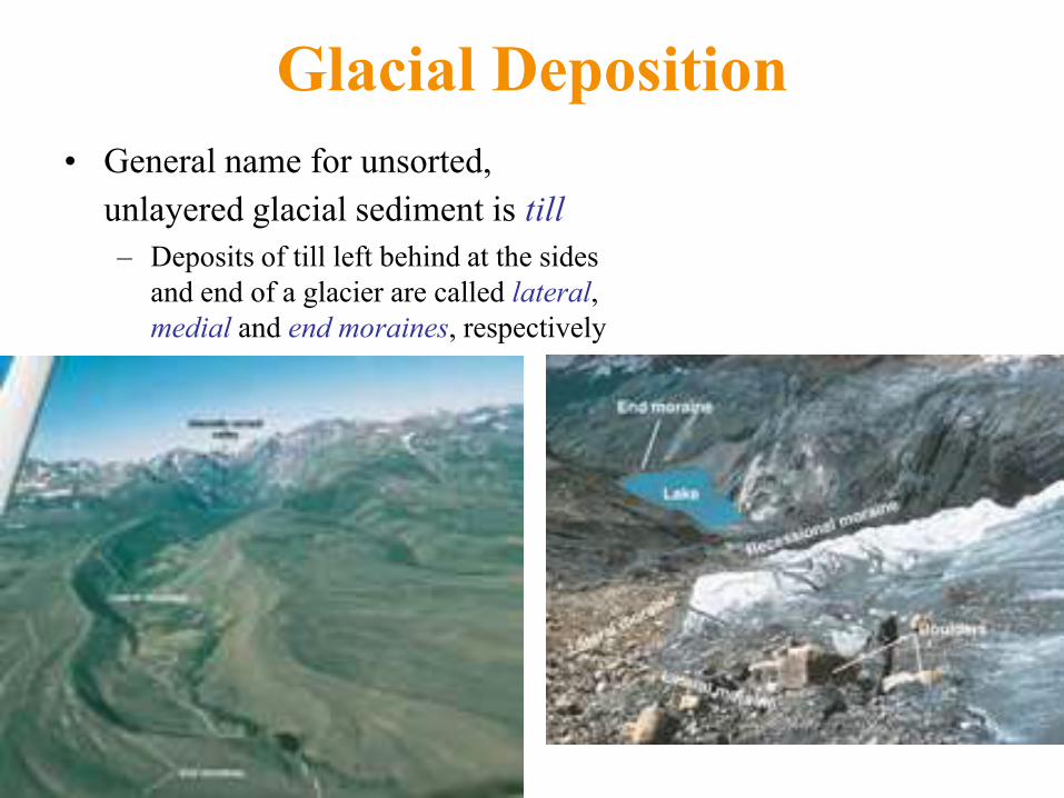
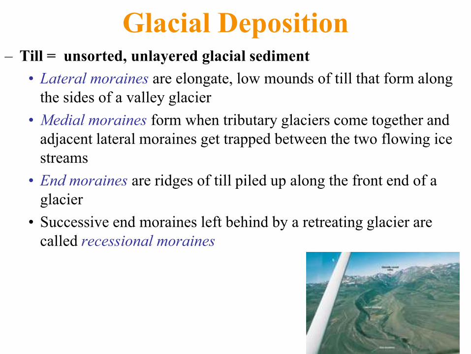
Glacial Deposition
• General name for unsorted, unlayered glacial sediment is till – Deposits of till left behind at the sides and end of a glacier are called lateral,
medial and end moraines, respectively
• Lateral moraines are elongate, low mounds of till that form along the sides of a
valley glacier
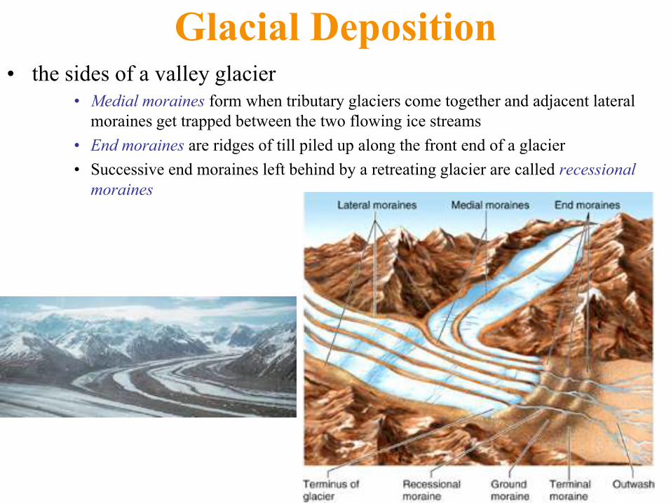
Glacial Deposition • the sides of a valley glacier
• Medial moraines form when tributary glaciers come together and adjacent lateral
moraines get trapped between the two flowing ice streams
• End moraines are ridges of till piled up along the front end of a glacier
• Successive end moraines left behind by a retreating glacier are called recessional
moraines
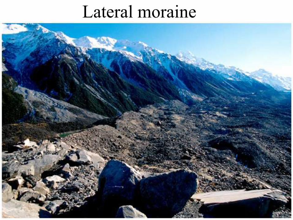
Lateral moraine
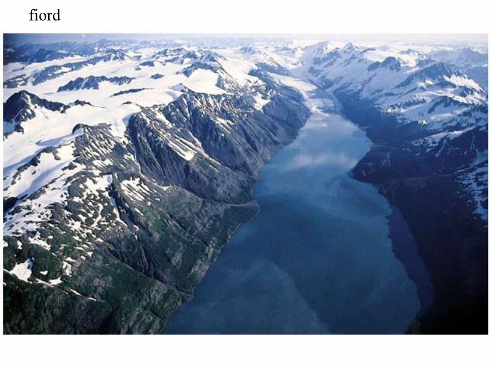
fiord
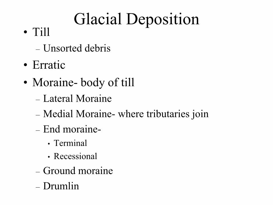
Glacial Deposition • Till
– Unsorted debris
• Erratic
• Moraine- body of till
– Lateral Moraine
– Medial Moraine- where tributaries join
– End moraine-
• Terminal
• Recessional
– Ground moraine
– Drumlin
Glacial Deposition
• General name for unsorted,
unlayered glacial sediment is till – Deposits of till left behind at the sides
and end of a glacier are called lateral,
medial and end moraines, respectively
Glacial Deposition – Till = unsorted, unlayered glacial sediment
• Lateral moraines are elongate, low mounds of till that form along
the sides of a valley glacier
• Medial moraines form when tributary glaciers come together and
adjacent lateral moraines get trapped between the two flowing ice
streams
• End moraines are ridges of till piled up along the front end of a
glacier
• Successive end moraines left behind by a retreating glacier are
called recessional moraines
Glacial Deposition
• Outwash
– Stream-deposited sediment
• sorted
– Braided streams typical
– Esker
– Kettle
• Glacial lakes
– Varves
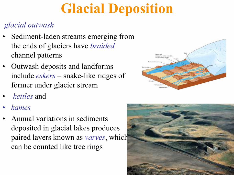
Glacial Deposition glacial outwash
• Sediment-laden streams emerging from
the ends of glaciers have braided
channel patterns
• Outwash deposits and landforms
include eskers – snake-like ridges of
former under glacier stream
• kettles and
• kames
• Annual variations in sediments
deposited in glacial lakes produces
paired layers known as varves, which
can be counted like tree rings
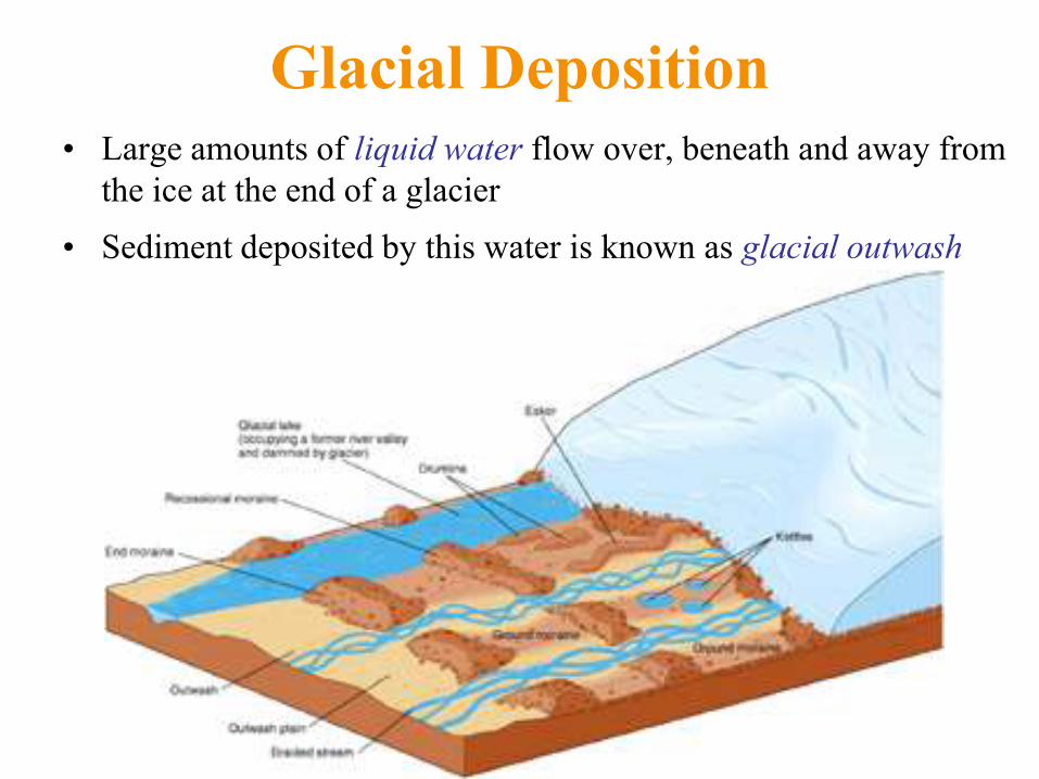
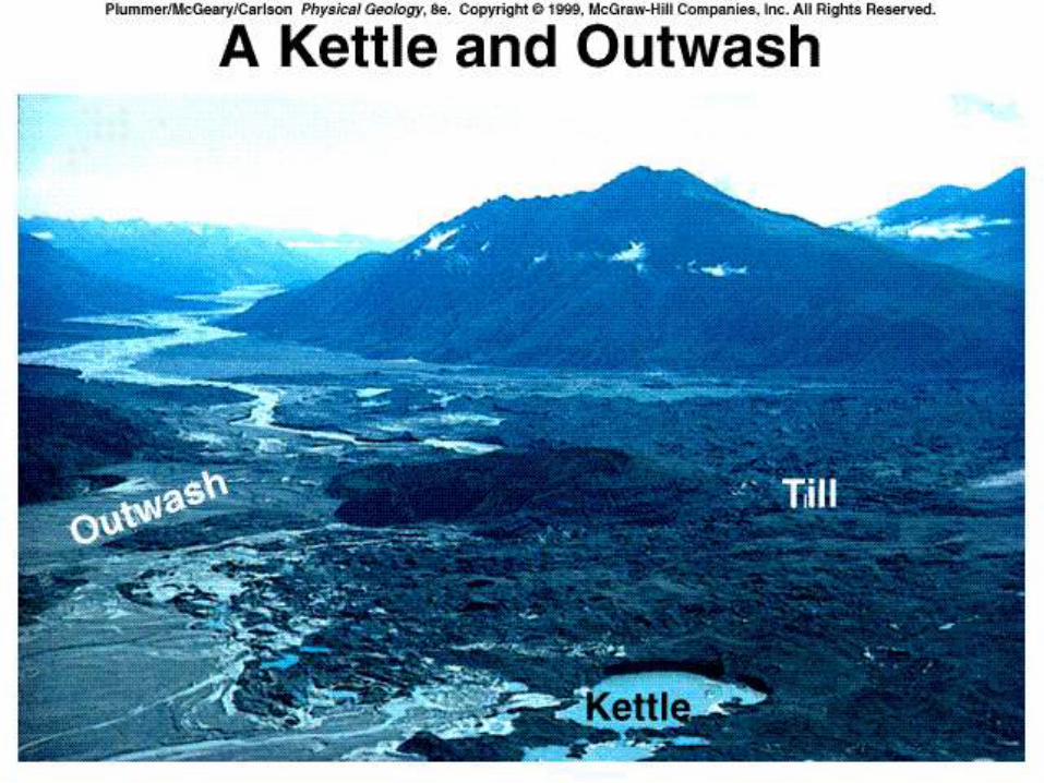
Glacial Deposition • Large amounts of liquid water flow over, beneath and away from
the ice at the end of a glacier
• Sediment deposited by this water is known as glacial outwash
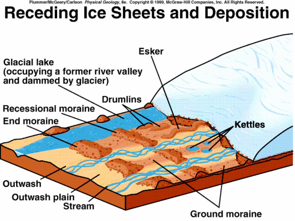
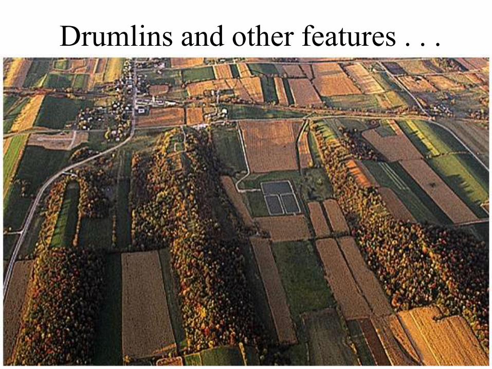
Drumlins and other features . . .
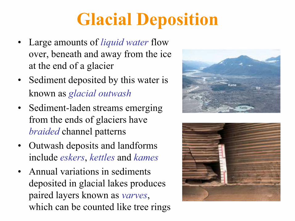
Glacial Deposition • Large amounts of liquid water flow
over, beneath and away from the ice
at the end of a glacier
• Sediment deposited by this water is
known as glacial outwash
• Sediment-laden streams emerging
from the ends of glaciers have
braided channel patterns
• Outwash deposits and landforms
include eskers, kettles and kames
• Annual variations in sediments
deposited in glacial lakes produces
paired layers known as varves,
which can be counted like tree rings
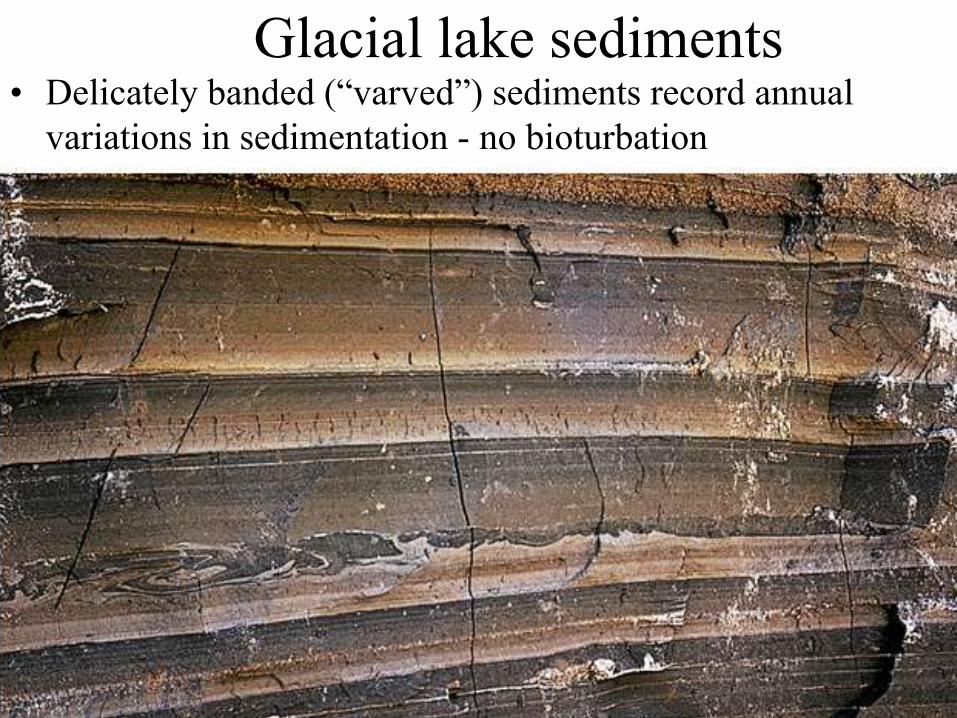
Glacial lake sediments • Delicately banded (―varved‖) sediments record annual
variations in sedimentation - no bioturbation
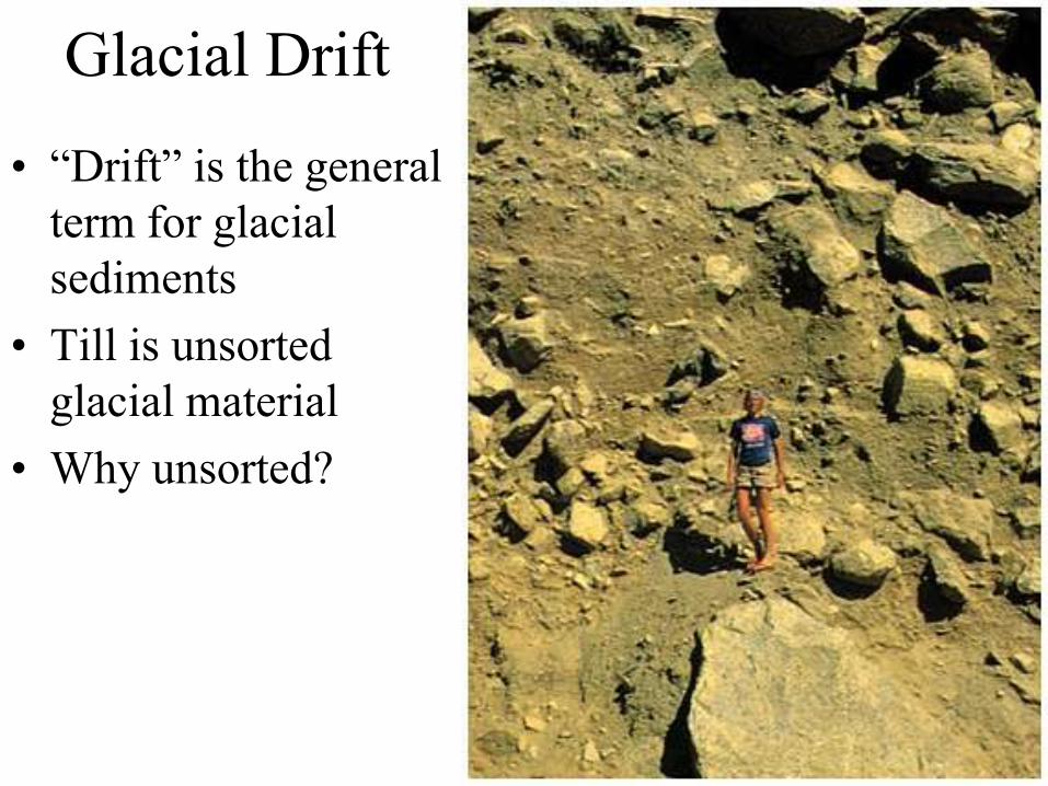
Glacial Drift
• ―Drift‖ is the general
term for glacial
sediments
• Till is unsorted
glacial material
• Why unsorted?

Varieties of glacial sediment (drift)
• Till
– Unstratified, poorly sorted glacial drift deposited directly by melting ice
– Has clay, sand, and boulders; boulders known as erratics
• Outwash
– Stratified, well sorted drift deposited by meltwater streams; may be crossbedded
• Loess
– Wind-sorted material, generally reworked from outwash
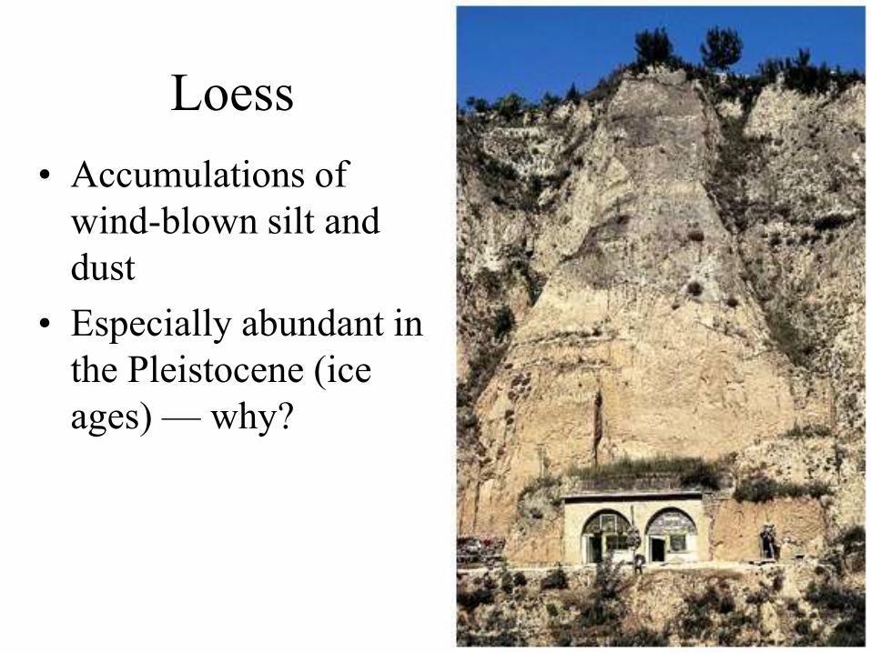
Loess
• Accumulations of
wind-blown silt and
dust
• Especially abundant in
the Pleistocene (ice
ages) — why?
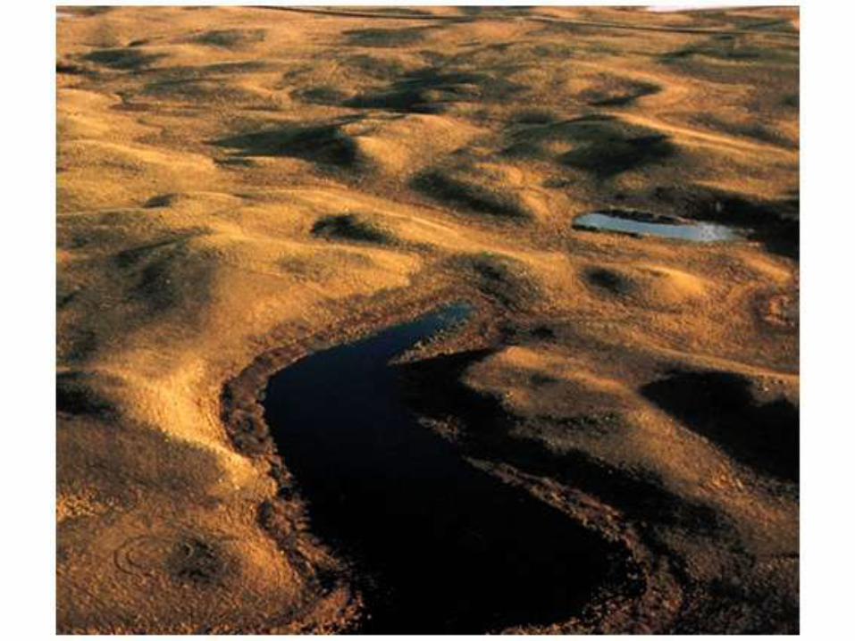
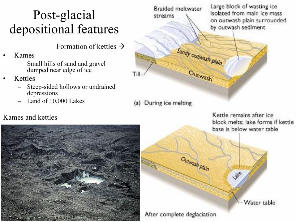
Post-glacial depositional features
Formation of kettles
• Kames – Small hills of sand and gravel
dumped near edge of ice
• Kettles – Steep-sided hollows or undrained
depressions
– Land of 10,000 Lakes
Kames and kettles
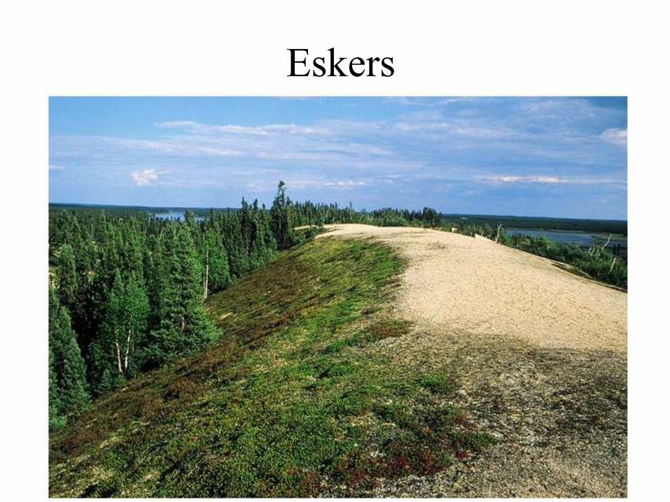
Eskers
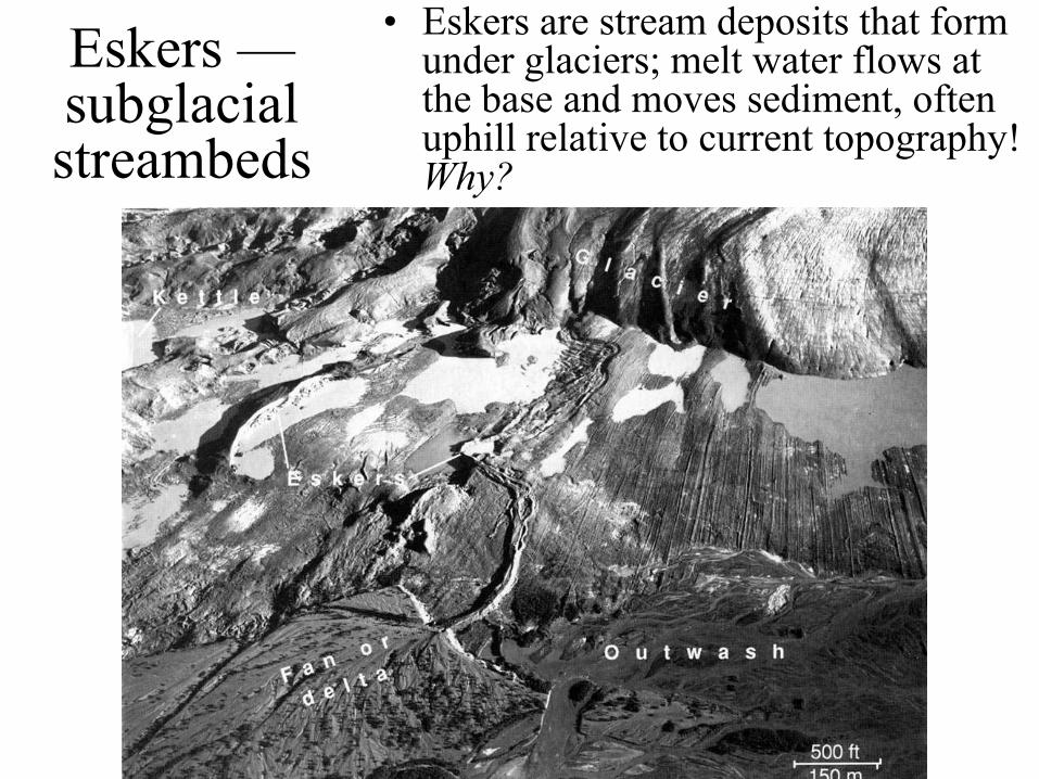
Eskers — subglacial streambeds
• Eskers are stream deposits that form under glaciers; melt water flows at the base and moves sediment, often uphill relative to current topography! Why?
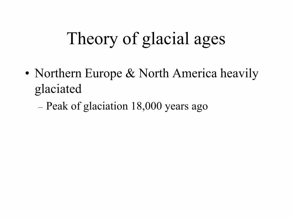
Theory of glacial ages
• Northern Europe & North America heavily
glaciated
– Peak of glaciation 18,000 years ago
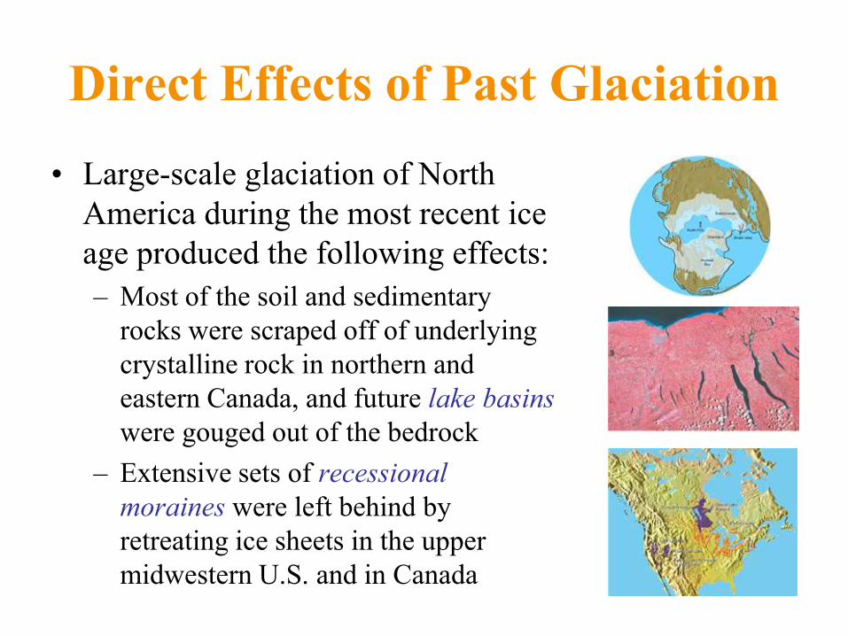
Direct Effects of Past Glaciation
• Large-scale glaciation of North
America during the most recent ice
age produced the following effects:
– Most of the soil and sedimentary
rocks were scraped off of underlying
crystalline rock in northern and
eastern Canada, and future lake basins
were gouged out of the bedrock
– Extensive sets of recessional
moraines were left behind by
retreating ice sheets in the upper
midwestern U.S. and in Canada
Glacial Ages
• In the early 1800s, past extensive glaciation of Europe was
first hypothesized
– Hypothesis was initially considered outrageous, but further
observations by Louis Agassiz (initially a major opponent of the
hypothesis) in the Swiss Alps found much supporting evidence
– Agassiz traveled widely in Europe and North America, finding
more and more supporting evidence, eventually leading to the
theory of glacial ages
• Theory of glacial ages states that at times in the past,
colder climates prevailed during which much more of the
land surface of Earth was glaciated than at present
– Most recent glacial age was at its peak only 18,000 years ago

Effects of Past Glaciation
• Glacial ages
• Direct effects in North America
– Scoured much of Canada
– Cut Great Lakes
– Deposited till & flattened Midwest
– Extensive alpine glaciation in mountains
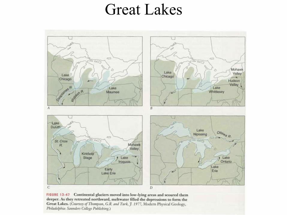
Great Lakes
Effects of Glacial Ages
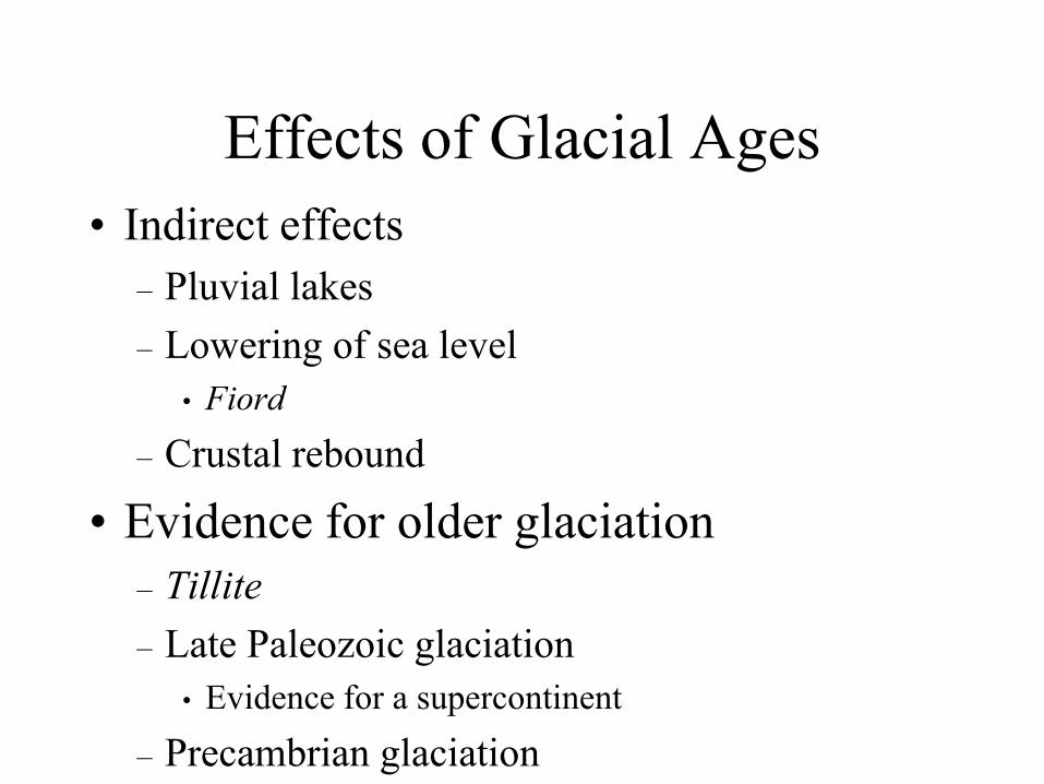
• Indirect effects
– Pluvial lakes
– Lowering of sea level
• Fiord
– Crustal rebound
• Evidence for older glaciation
– Tillite
– Late Paleozoic glaciation
• Evidence for a supercontinent
– Precambrian glaciation
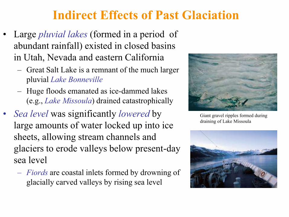
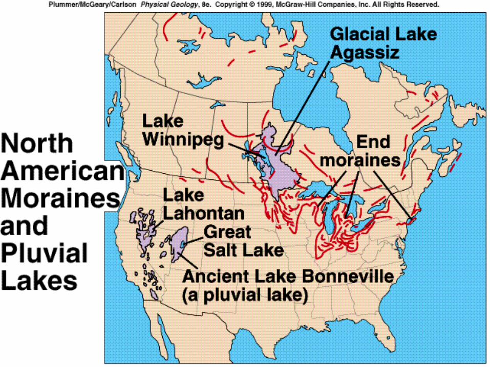
Indirect Effects of Past Glaciation
• Large pluvial lakes (formed in a period of
abundant rainfall) existed in closed basins
in Utah, Nevada and eastern California
– Great Salt Lake is a remnant of the much larger
pluvial Lake Bonneville
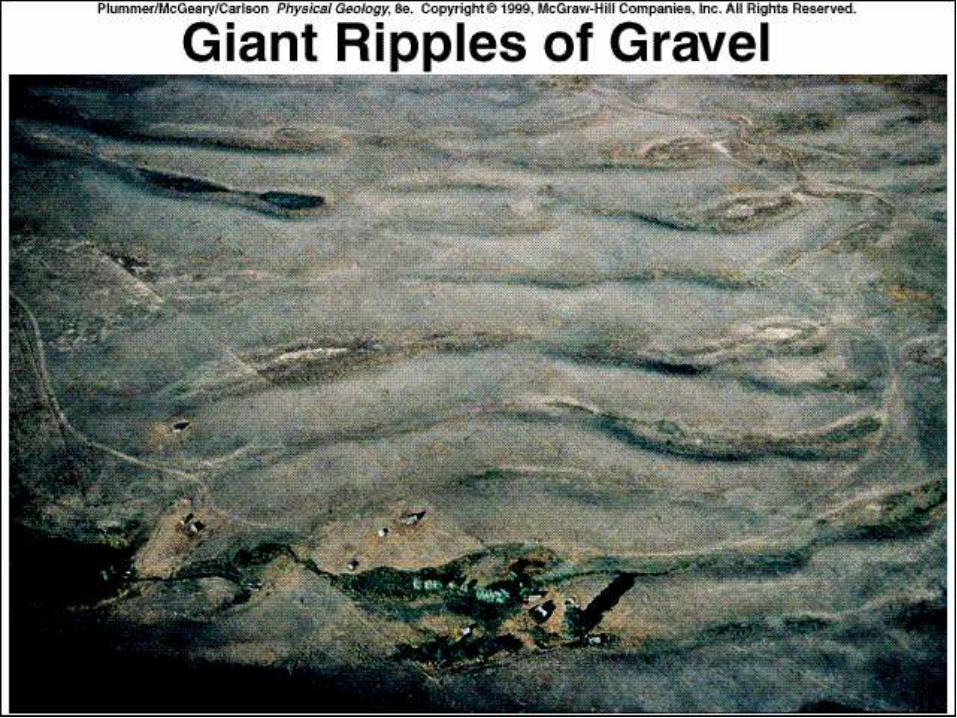
– Huge floods emanated as ice-dammed lakes
(e.g., Lake Missoula) drained catastrophically
• Sea level was significantly lowered by
large amounts of water locked up into ice
sheets, allowing stream channels and
glaciers to erode valleys below present-day
sea level
– Fiords are coastal inlets formed by drowning of
glacially carved valleys by rising sea level
Giant gravel ripples formed during
draining of Lake Missoula
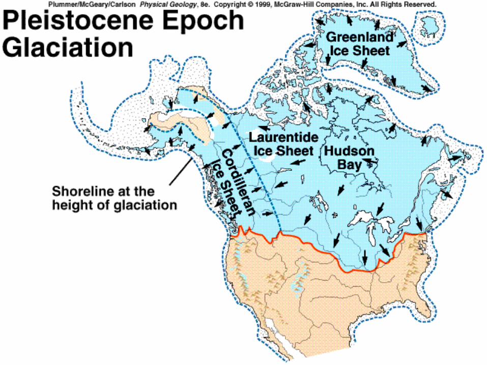
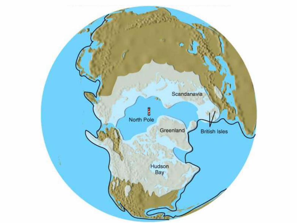
Fig. 12.33
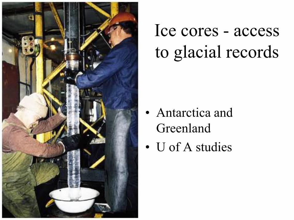
Ice cores - access
to glacial records
• Antarctica and
Greenland
• U of A studies

Glacial stratigraphy - a record of the last
250,000 years
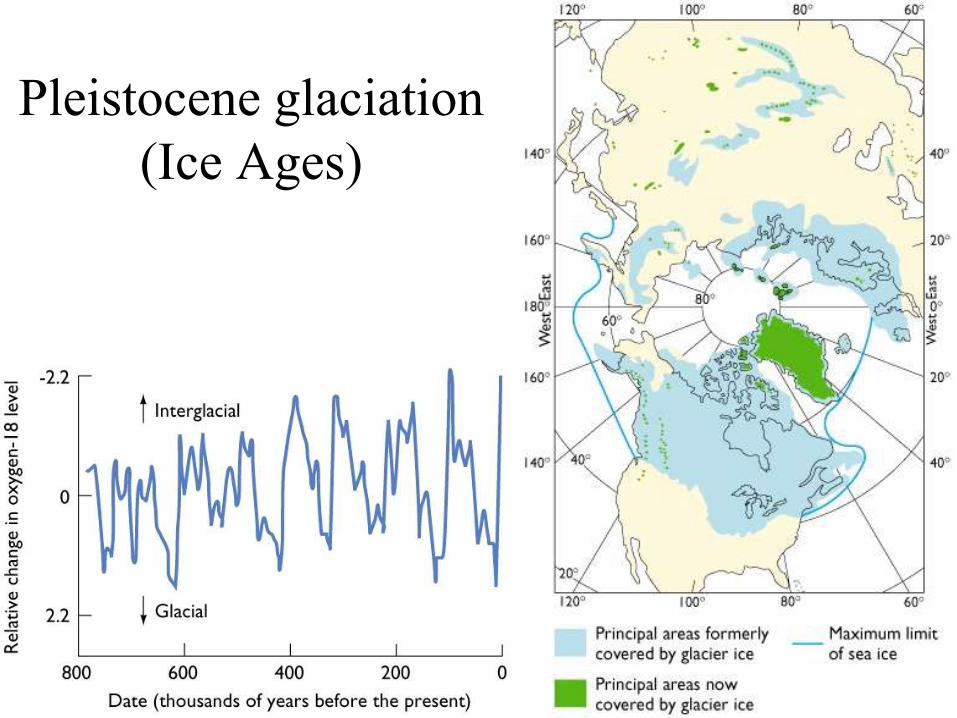
Pleistocene glaciation
(Ice Ages)

Quaternary Period
(Pleistocene and Recent epochs)
• Evidence for glaciation
• Climate change
• Temperature changes with time
• Effects of glaciation
• Future glacial and interglacial stages
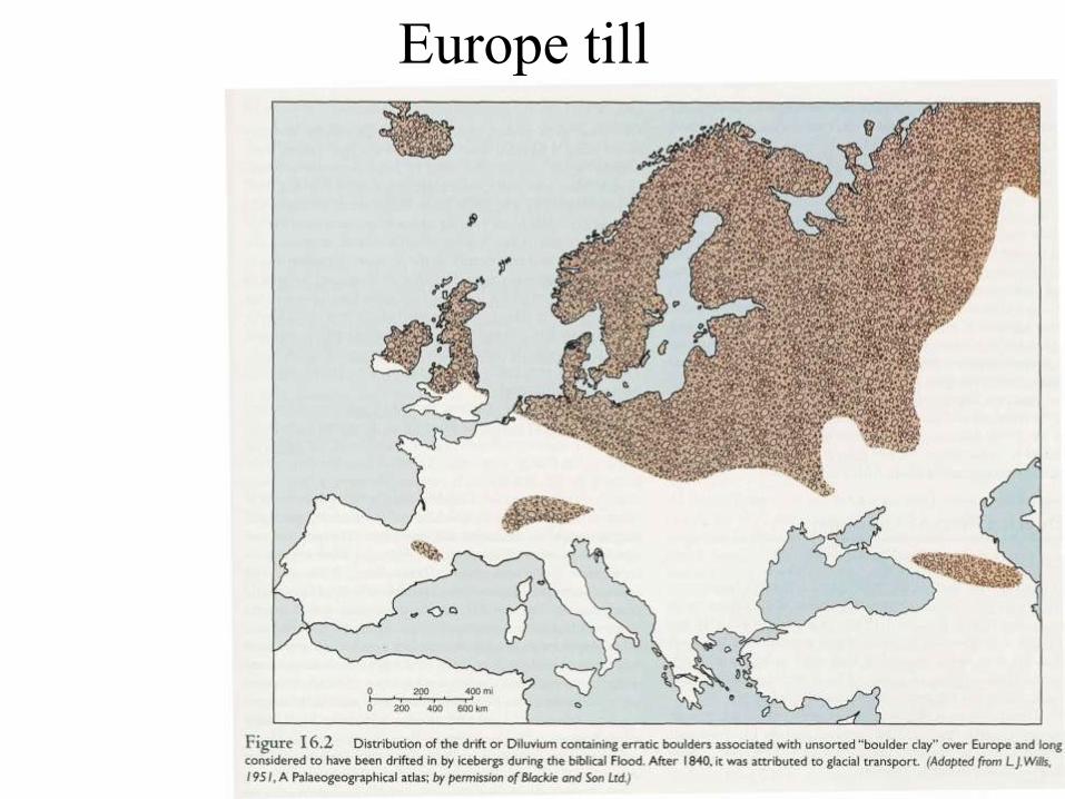
Europe till
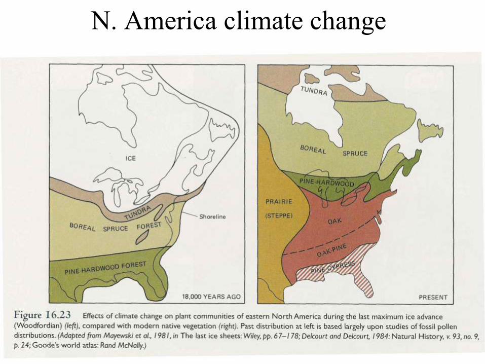
N. America climate change
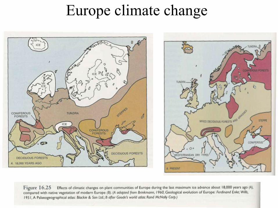
Europe climate change
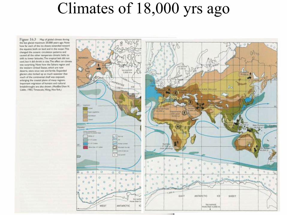
Climates of 18,000 yrs ago
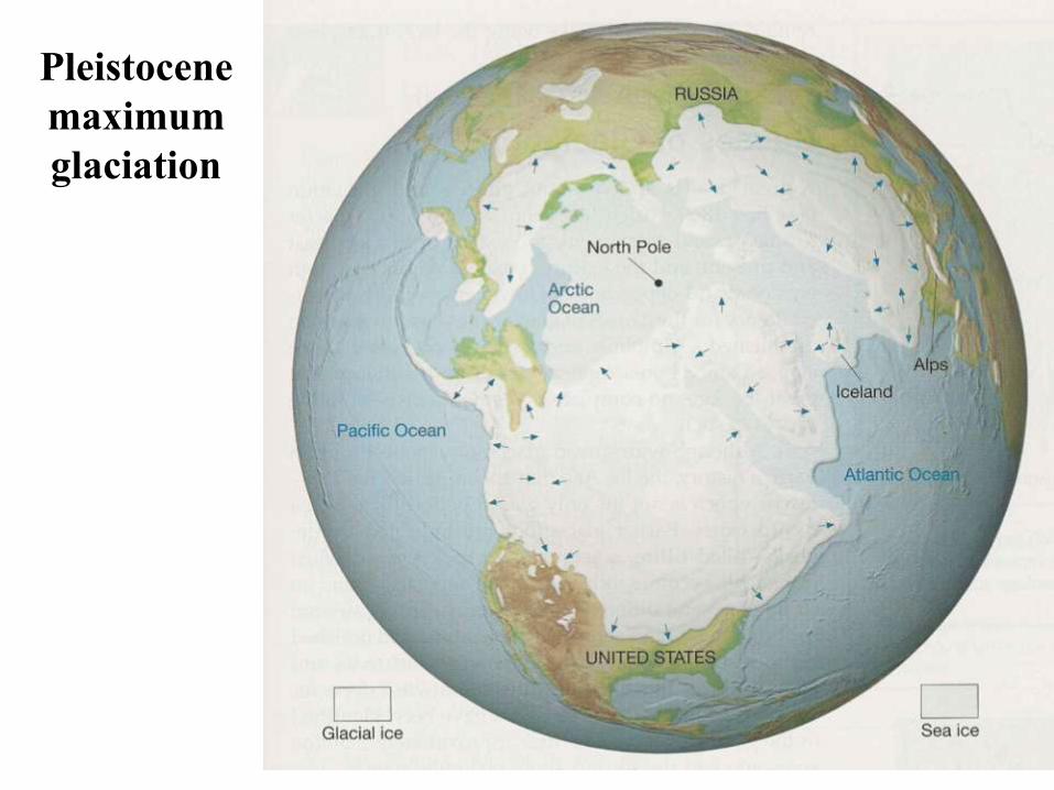
Pleistocene
maximum
glaciation
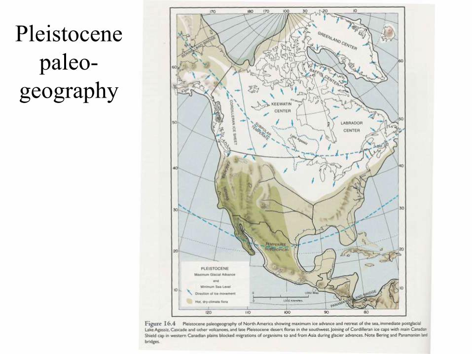
Pleistocene
paleo-
geography
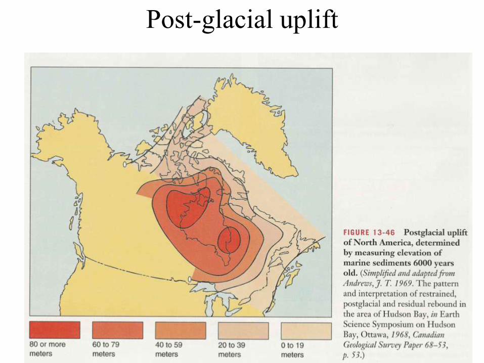
Post-glacial uplift
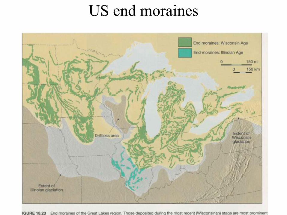
US end moraines
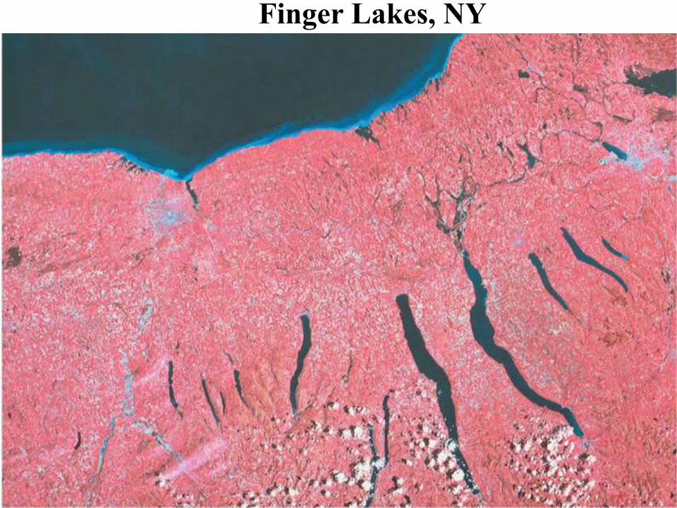
Finger Lakes, NY
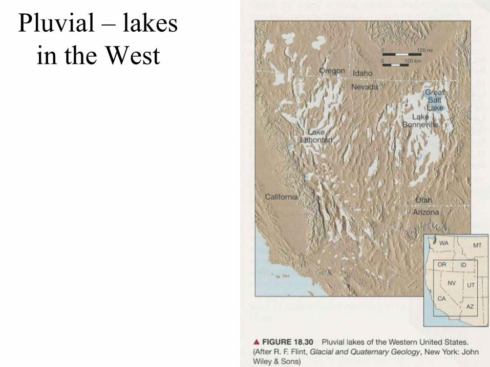
Pluvial – lakes
in the West
Evidence for Older Glaciation
• Rocks called tillites, lithified glacial till, have distinctive
textures that suggest emplacement of sediments by glaciers
– Unsorted rock particles including angular, faceted and striated boulders
• In some areas, old tillites directly overlie polished and striated
crystalline rocks
• Tillites formed during the late Precambrian and late Paleozoic
eras exist in portions of the southern continents
• Late Paleozoic tillites from South Africa, Australia, Antarctica
and South America indicate that these landmasses were once
joined - strong evidence supporting Theory of Plate Tectonics
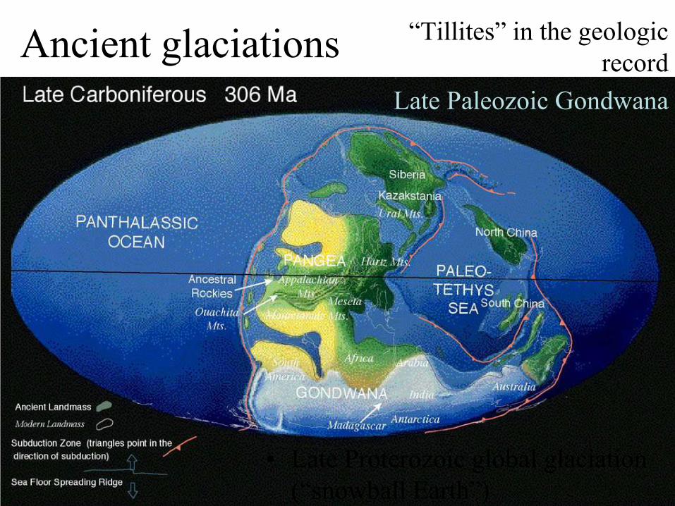
Ancient glaciations ―Tillites‖ in the geologic
record
Late Paleozoic Gondwana
• Late Proterozoic global glaciation
(―snowball Earth‖)
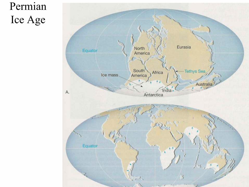
Permian
Ice Age
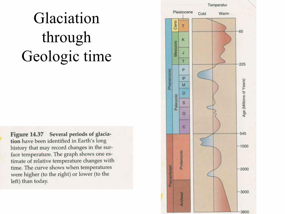
Glaciation
through
Geologic time
Evidence for Older Glaciation
• Rocks called tillites, lithified glacial till, have distinctive textures
that suggest emplacement of sediments by glaciers
– Unsorted rock particles including angular, faceted and striated boulders
• In some areas, old tillites directly overlie polished and striated
crystalline rocks
• Tillites formed during the late Precambrian and late Paleozoic
eras exist in portions of the southern continents
• Late Paleozoic tillites from South Africa, Australia, Antarctica
and South America indicate that these landmasses were once
joined - strong evidence supporting Theory of Plate Tectonics
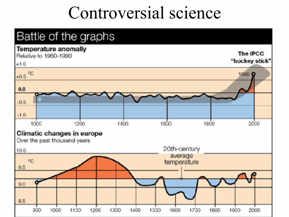
Controversial science
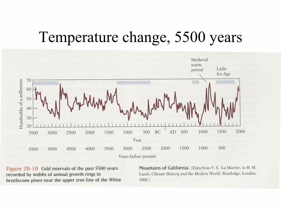
Temperature change, 5500 years

Last 10,000 yrs temperature
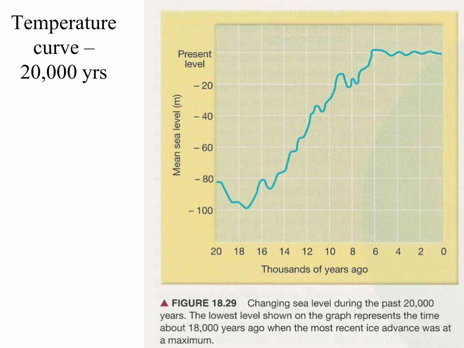
Temperature
curve –
20,000 yrs
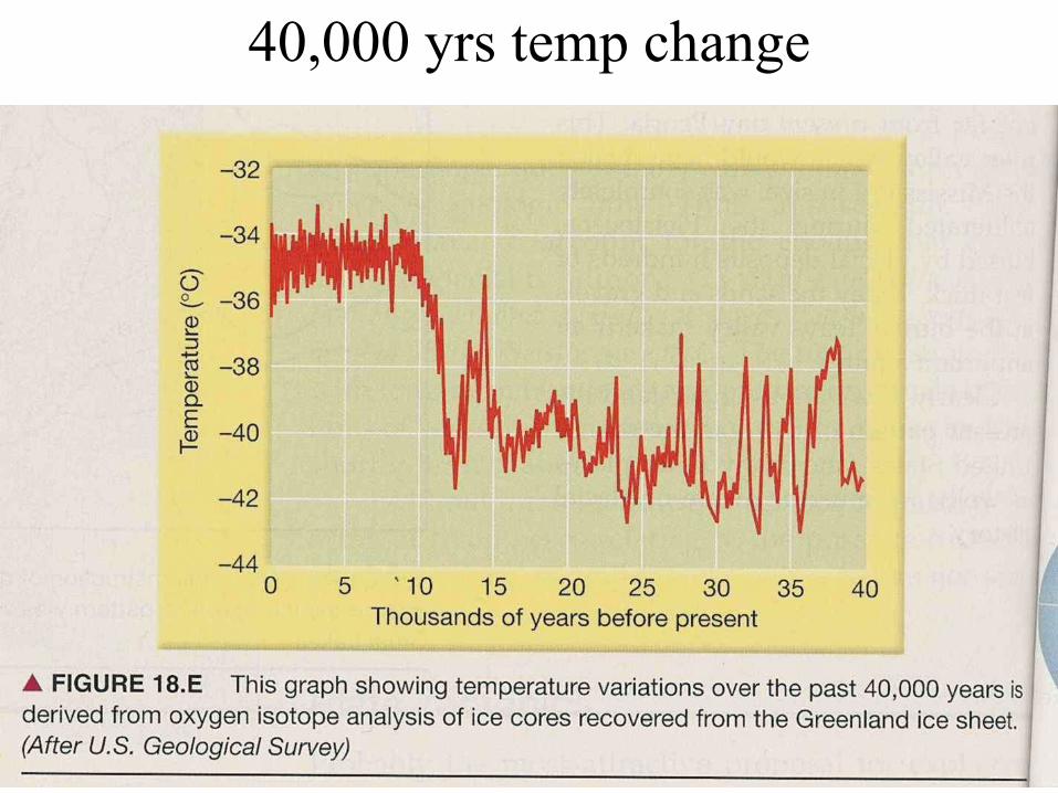
40,000 yrs temp change
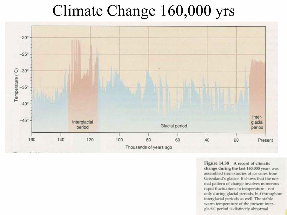
Climate Change 160,000 yrs
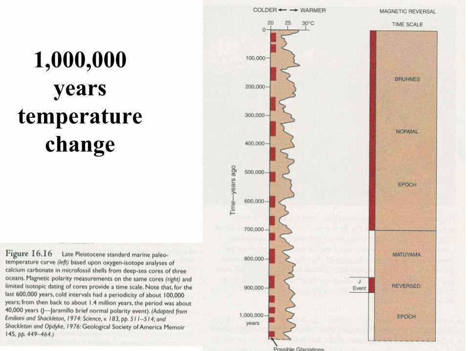
1,000,000
years
temperature
change
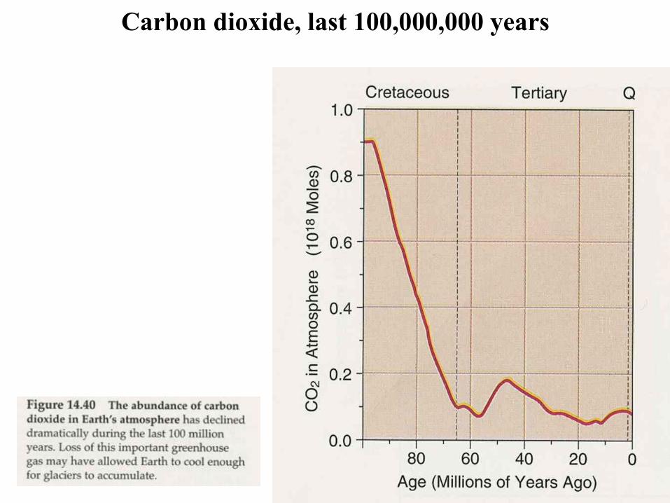
Carbon dioxide, last 100,000,000 years

Glacial and
Interglacial
stages

Milankovitch causes
of glaciation
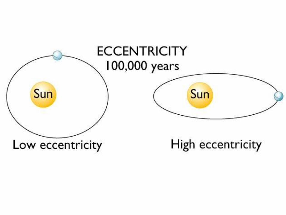
• Polar continents are necessary for ice
accumulation
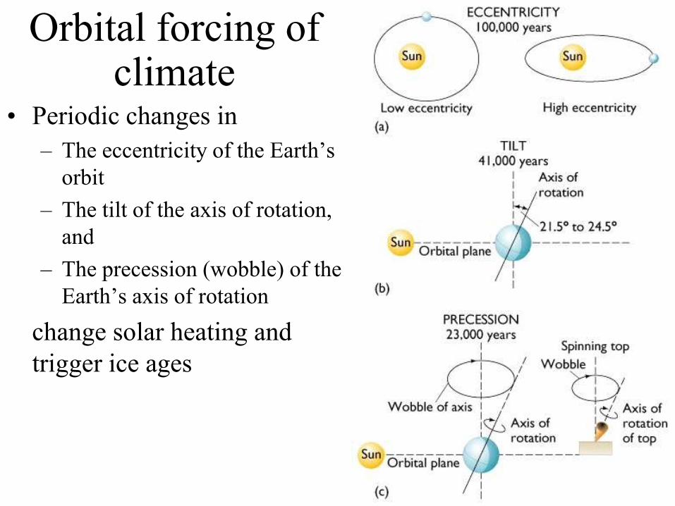
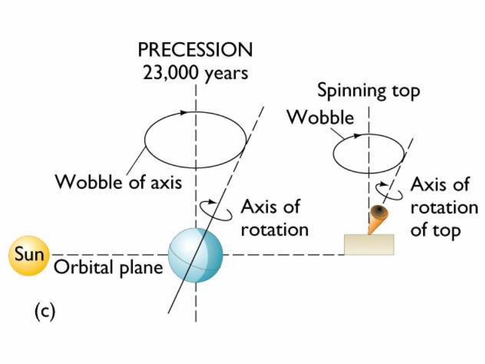
Orbital forcing of climate
• Periodic changes in
– The eccentricity of the Earth’s
orbit
– The tilt of the axis of rotation,
and
– The precession (wobble) of the
Earth’s axis of rotation
change solar heating and
trigger ice ages
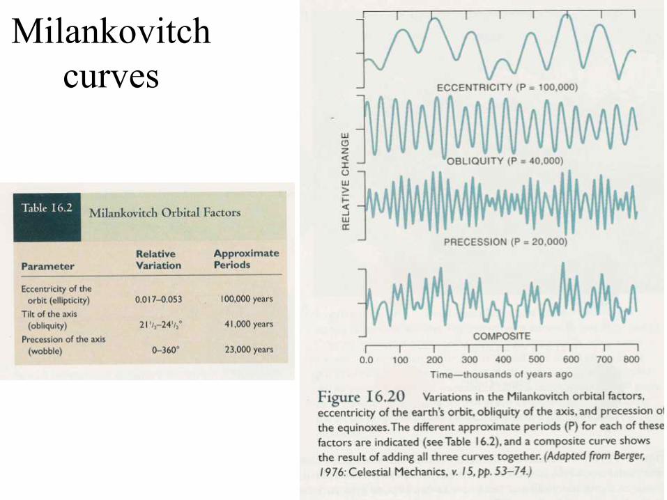
Milankovitch
curves
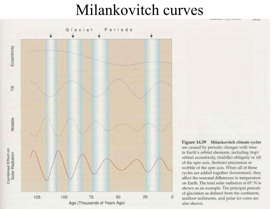
Milankovitch curves
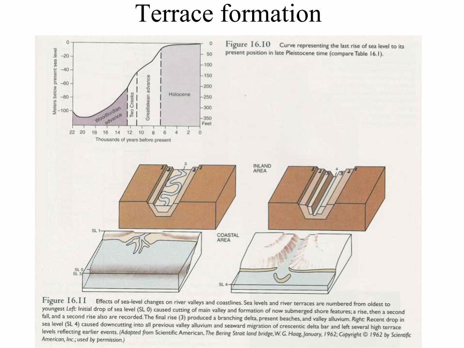
Terrace formation
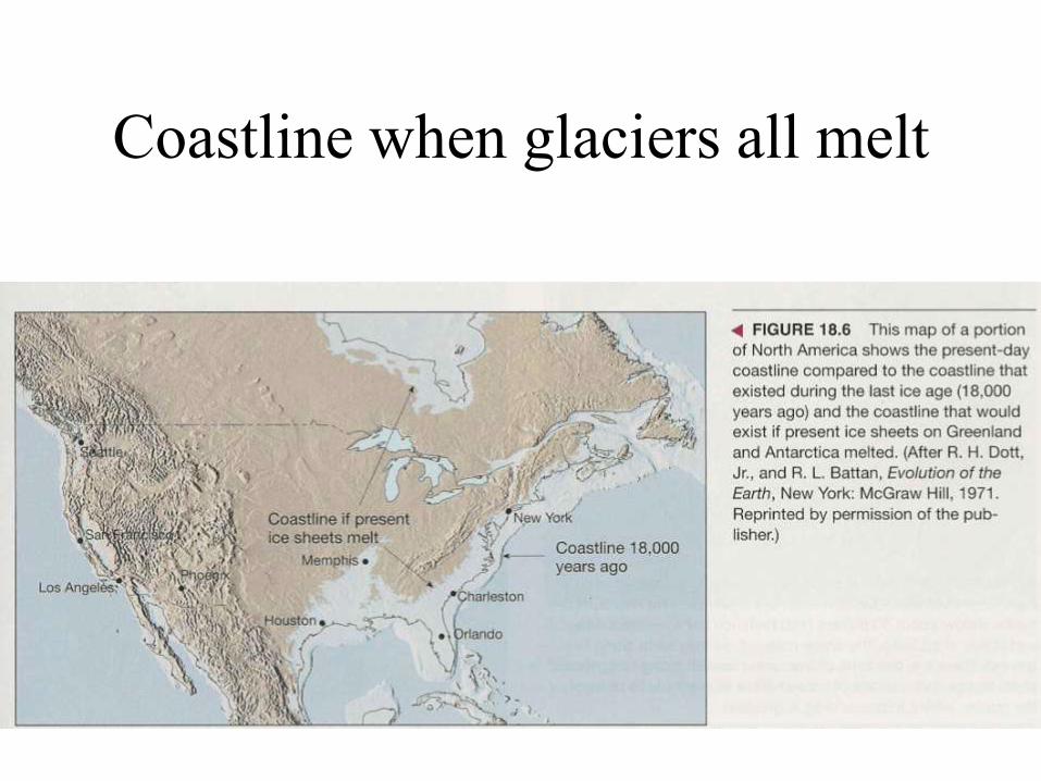
Coastline when glaciers all melt
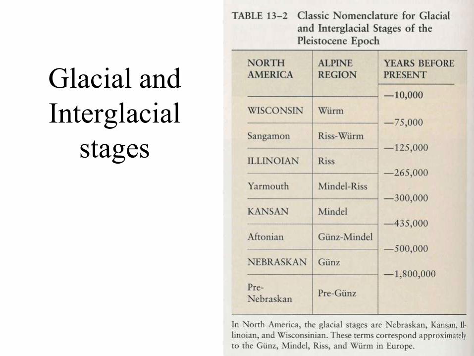
Glacial and
Interglacial
stages