Embed Size (px)
Citation preview
GLACIER STUDIES OF THE McCALL GLACIER, ALASKA
John E. Sater*
T HE McCall Glacier is a long thin body of ice shaped roughly like a crescent. Its overall length is approximately 8 km. and its average
width about 640 m., making an area of 5.12 sq. km. The highest reaches of the ice are on the north-facing walls of the upper valley in cirques at an altitude of over 2,700 m. above sea-level. The altitude of the terminus is 1,250 m. (see Fig. 1).
The main camp with the micrometeorological and climatological sta- tions lies at an altitude of 2,318 m. on a shelf in the highest cirque. Situated 2.41 km. from the terminus on a lateral moraine is the lower camp, which is used during the summer as base for the ice-motion studies and geological reconnaissance.
The drainage basin of the McCall Glacier is a very well defined area, of which the upper two-thirds are filled by the glacier itself. The walls of the basin consist mostly of loose rock talus, with a few bed-rock faces, as for instance along the southwest rim. Their exposures or pitch are such that they do not retain snow throughout the year.
The lower part of the basin does not now contribute to the regimen of the McCall Glacier. Whereas there are vestiges of former glacial activ- ities in two small, probably stagnant cirque glaciers and a more active (based on quantity of dry calving) hanging glacier (see Fig. 4), which flows down the north face of Mt. MacVicar, the only connection these features have at present is through the marginal meltwater channels of the McCall Glacier. The broadening of the lower basin is indicated by the fact that the ridges defining the area are not visible from the glacier itself.
The outline of the rock walls causes the ice in the highest cirque to flow west, 150 m. lower the ice joins a smaller source, another 180 m. lower it meets the ice from the lowest cirque and then turns sharply, to assume finally a northerly flow. The lowest cirque has the largest area, but its gradient is relatively small and its contribution to the total flow appears less than might be expected. However, the individual contribution of each cirque has not yet been determined (see Fig. 2).
From the confluence of the cirques the ice drops 730 m. in eight broad steps to the terminus. The surface slope of the risers of the steps ranges up to 15 degrees and that of the benches or treads is seldom more than 3 degrees (see Fig. 3).
* Junior Scientist, Arctic Institute, 1958.
82
McCALL GLACIER PROJECT 83
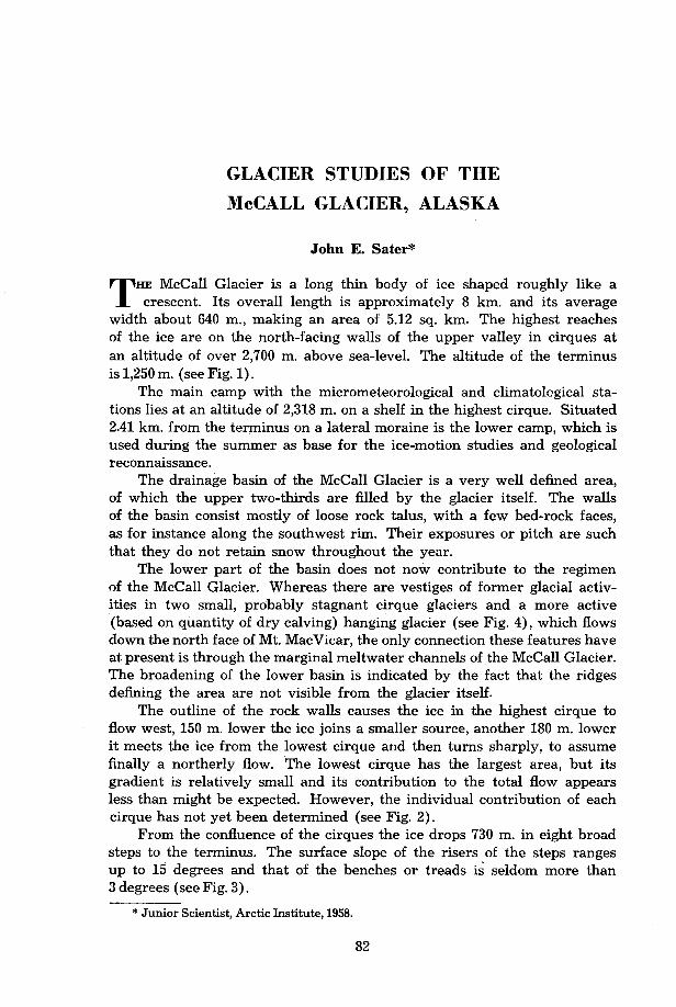
Fig. 4. View of hanging glacier from west ridge. Lower camp is the small dot on left half of lateral moraine.
Three of the highest peaks of the area are located along the east side of the cirques and they, as well as most of the prominent peaks surrounding the glacier, rise 520 m. above the ice surface. This barrier, in combination with the open vista to the west and the prevailing southwest winds, has an important influence on the weather conditions at the high camp. The full exposure of the camp has the consequence that observations of temper- ature and wind are more indicative of regional behaviour of the air than they would be elsewhere on the glacier. The barrier to leeward also causes downdraughts and general turbulence in the cirque, and occasionally re- inforces the drainage wind that flows down the glacier.
Much of the same behaviour of the air was seen at the lower camp, the position of which on the moraine removed it from the main influence of the drainage movement. The strongest winds experienced at this camp were those coming down out of the pocket of the hanging glacier, which lies directly above and behind it; they were presumably a combination of drainage winds and downdraughts from this cirque.
The ice surface, as it appeared in September 1957 when almost two- thirds of the glacier were bare, is composed of elongate hummocks from
84 McCALL GLACIER PROJECT
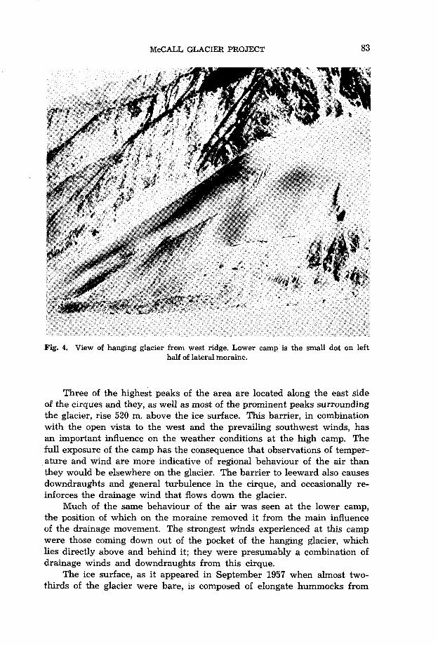
Fig. 5. View up glacier from lower camp. Corniced peak is Mount McCall.
0.3 to 2 m. long, which stand up as the high ground between meltwater channels. Most of the glacier, especially the lower half, is covered with a mantle of dust, rock, and boulders, many of which melt into the ice and give it a pock-marked surface. The size and depth of the cavities depend on the objects causing them, and they range from a few millimetres in diameter to basins the size of a bathtub around large boulders. On the lower fourth of the glacier there are several boulder trains the members of which blanket the ice and become pedestalled. As a result of this rough surface travel on the ice is quite easy, except on warm windy or rainy days when melting is rapid and the surface becomes slippery. An area in which the hummocks are much less pronounced lies opposite the lower camp. It is the location of the lower air strip during the months when the snow has melted off the glacier (see Fig. 5).
During the summer of 1957 the summer melt exposed bare ice as far as the area slightly above the confluence of the cirques, and the firn cover on the floors of the cirques was sufficiently sodden and compacted to show the form of the ice in some locations.
The surface runoff from the cirques appears to flow into two main outlets: a marginal stream following the right side of the glacier (facing down flow) ; and a circular fissure, about 0.6 m. in diameter, probably a former crevasse, which has filled and frozen except for this one well, which is located at the head of the glacier trunk. The depth of this fissure and the immediate destination of the water have not been determined.
McCALL GLACIER PROJECT 85
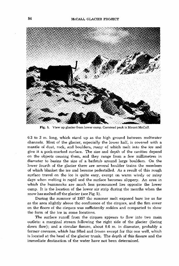
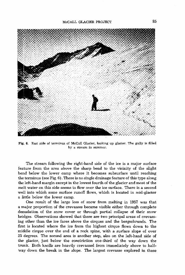
Fig. 6. East side of terminus of McCall Glacier, looking up glacier. The gully is filled by a stream in summer.
The stream following the right-hand side of the ice is a major surface feature from the area above the sharp bend to the vicinity of the slight bend below the lower camp where it becomes subsurface until reaching the terminus (see Fig. 6). There is no single drainage feature of this type along the left-hand margin except in the lowest fourth of the glacier and most of the melt water on this side seems to flow over the ice surface. There is a second well into which some surface runoff flows, which is located in mid-glacier a little below the lower camp.
One result of the large loss of snow from melting in 1957 was that a major proportion of the crevasses became visible either through complete denudation of the snow cover or through partial collapse of their snow bridges. Observations showed that there are two principal areas of crevass- ing other than the ice faces above the cirques and the bergschrunds. The first is located where the ice from the highest cirque flows down to the middle cirque over the end of a rock spine, with a surface slope of over 25 degrees. The second area is another step, also on the left-hand side of the glacier, just below the constriction one-third of the way down the trunk. Both knolls are heavily crevassed from immediately above to half- way down the break in the slope. The largest crevasse explored in these
86 McCALL GLACIER PROJECT
areas was 5 m. across at the widest point, 60 m. long and an estimated 25 m. deep.
Whereas this appraisal gives only an indication of the amount of crevassing in the cirque bowls, it shows that travel over most of the glacier can be accomplished in relative safety, which is of great advantage in checking the motion profiles.
The majority of the large crevasses in the trunk have widths up to 1 m., they have partially filled with water that later froze, so that their depth is reduced to 2 to 3 m. and the bottom is flat. Still smaller ones, about 0.3 m. or less in width and of unknown depth, tended to fill com- pletely with melt water. Their consequent behaviour has not yet been ascertained.
The crevasses open most noticeably during the winter when they do not fill with water. In the upper half of the glacier more than 24 open- ings were observed in May that had not been present in October. Two longitudinal crevasses, about 1 m. wide and 18 m. long, were observed near mid-glacier,, slightly below the lower camp. The central portions were about 5 m. deep and they were partially filled with melt water, but the drainage was usually sufficient to prevent their being filled completely.
Blue bands are quite frequent in the glacier and are apparently com- pletely random in their orientation. Dirt-filled shear planes are also quite common and in several areas along the right-hand side of the glacier show the effects of lateral shearing in the ice mass. Some offsets amount to as much as 0.6 m. No effort has yet been made to study the stratigraphy or petrofabrics in detail.
From the head to the lower camp the cross section of the glacier is concave upward, but from this area to the terminus the profile is convex. Below the final bend the relief from the marginal stream to the top of the ice shoulder is roughly 20 m.
The data collected at the upper station include continuous records of long and short wave energy gain and loss, air temperatures, and wind speed. They are supplemented by regular visual weather observations and stand- ard US. Weather Bureau climatic reports. Snow pits have been dug at regular intervals to a depth of 2.5 m. to study the stratigraphy of the snow and the behaviour of the firn as it begins to turn into ice. Temperatures down to a depth of 100 m. are recorded periodically to follow the changes in temperature gradient in the firn and ice in connection with surface fluctuations of temperature.
Ice motion studies are carried out by triangulation to 80 dowels em- bedded in transverse and longitudinal profiles. The periodic determination of the positions of the dowels in relation to fixed points gives the motion of the ice during that period and so the average daily motion. This was of the order of 20 mm. per day from June to November 1957.