Embed Size (px)
Citation preview
GIS Updates for Next Generation 9-1-1 in Washington State
Dan Miller E911 GIS Manager Washington State 9-1-1 Program Office
Esri International Users Conference 2014
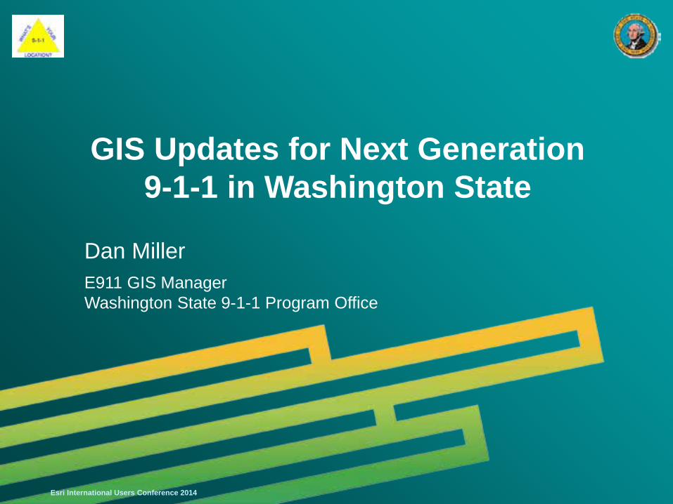
Agenda
• Background on the State of Washington
• Assessing the Status: The “State of Washington”
• What is this “Next Generation” Stuff anyway?
• Challenges Ahead
• RFI in the Making – RFP to Follow
• Solutions?
• Summary
Esri International Users Conference 2014
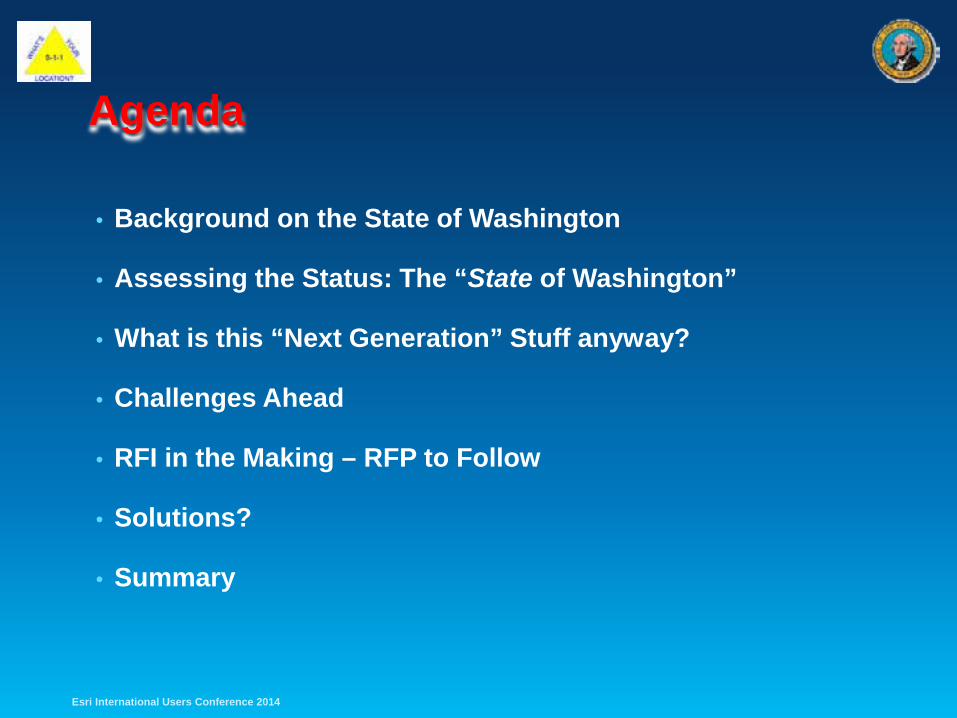
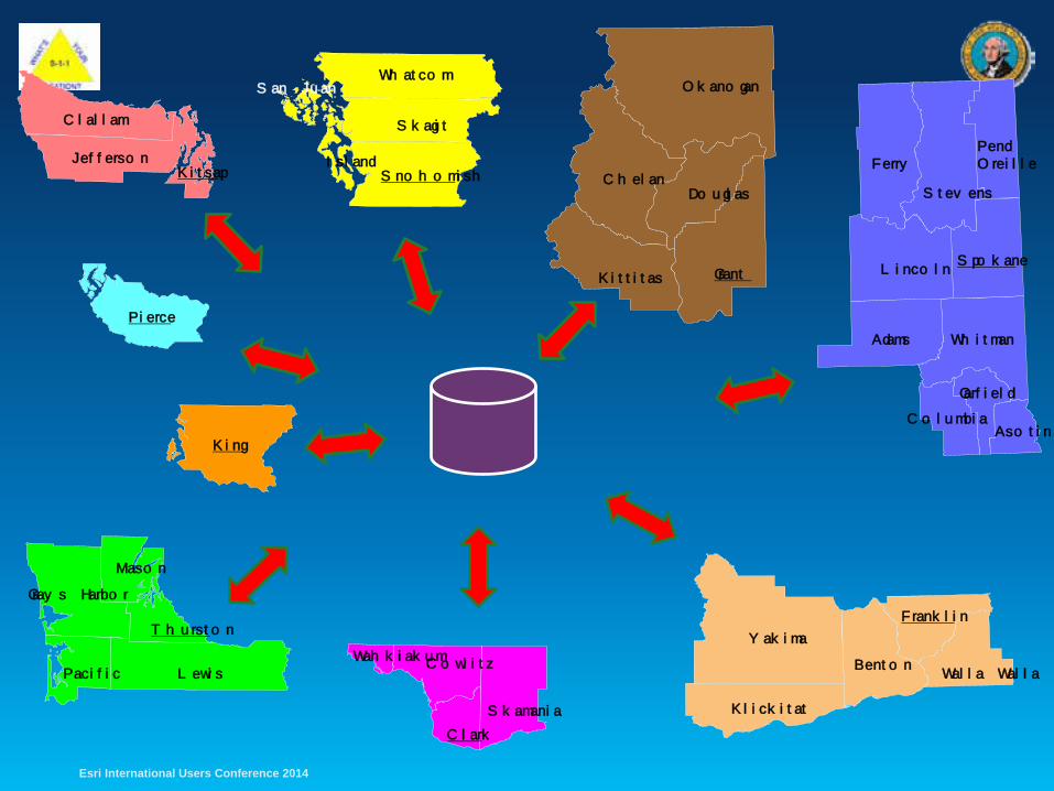
Washington: The State • Area: 71,362 sq mi (18th in size)
• 39 Counties
• Population: 6,971,406 (13th), Pop. Density: 103/sq mi (25th)
• Highest Point: Mt. Rainier (14,411 ft.)
• 69 PSAPs (57 Primary, 12 Secondary)
• 29 Native American Tribes
• 6 Major Military Installations (Army, Air Force, Navy *)
• A “Home Rule” State
• Home of the Super Bowl Champion Seahawks!
Esri International Users Conference 2014
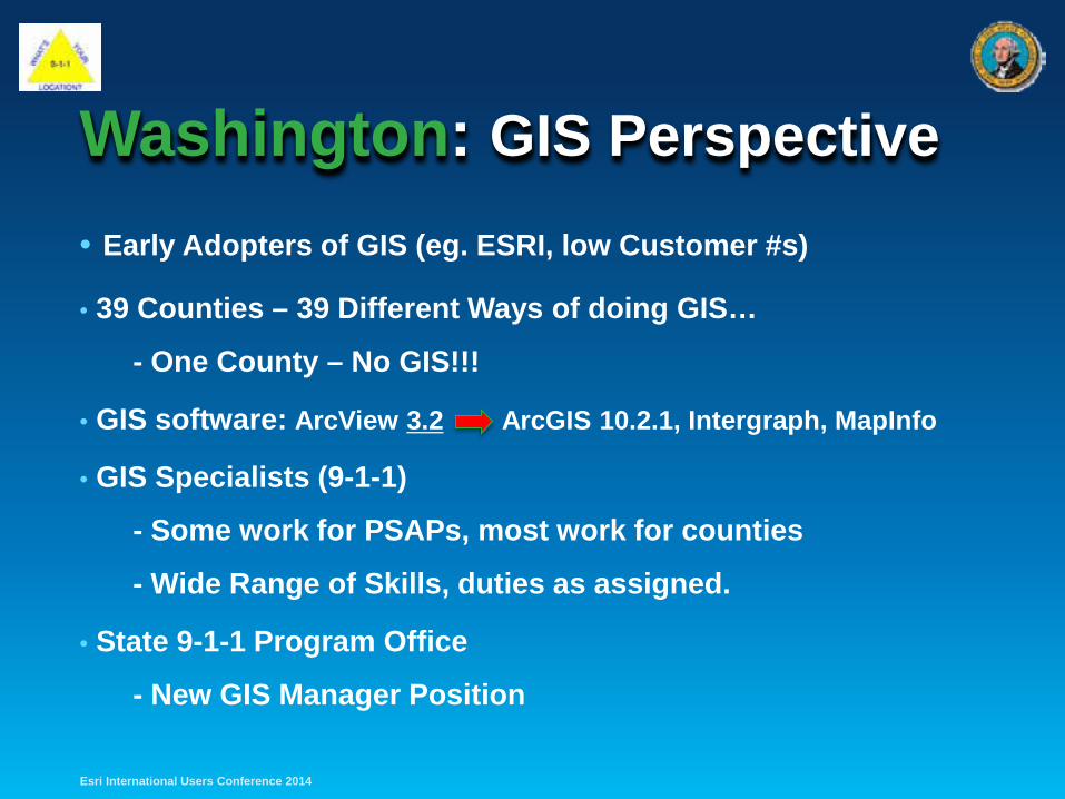
• Early Adopters of GIS (eg. ESRI, low Customer #s)
• 39 Counties – 39 Different Ways of doing GIS…
- One County – No GIS!!!
• GIS software: ArcView 3.2 ArcGIS 10.2.1, Intergraph, MapInfo
• GIS Specialists (9-1-1)
- Some work for PSAPs, most work for counties
- Wide Range of Skills, duties as assigned.
• State 9-1-1 Program Office
- New GIS Manager Position
Washington: GIS Perspective
Esri International Users Conference 2014
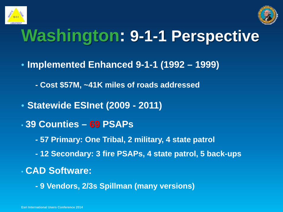
• Implemented Enhanced 9-1-1 (1992 – 1999)
- Cost $57M, ~41K miles of roads addressed
• Statewide ESInet (2009 - 2011)
• 39 Counties – 69 PSAPs - 57 Primary: One Tribal, 2 military, 4 state patrol
- 12 Secondary: 3 fire PSAPs, 4 state patrol, 5 back-ups
• CAD Software: - 9 Vendors, 2/3s Spillman (many versions)
Washington: 9-1-1 Perspective
Esri International Users Conference 2014
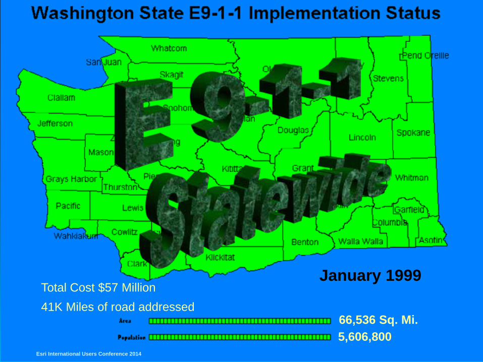
January 1999
66,536 Sq. Mi. 5,606,800
Total Cost $57 Million 41K Miles of road addressed
Esri International Users Conference 2014
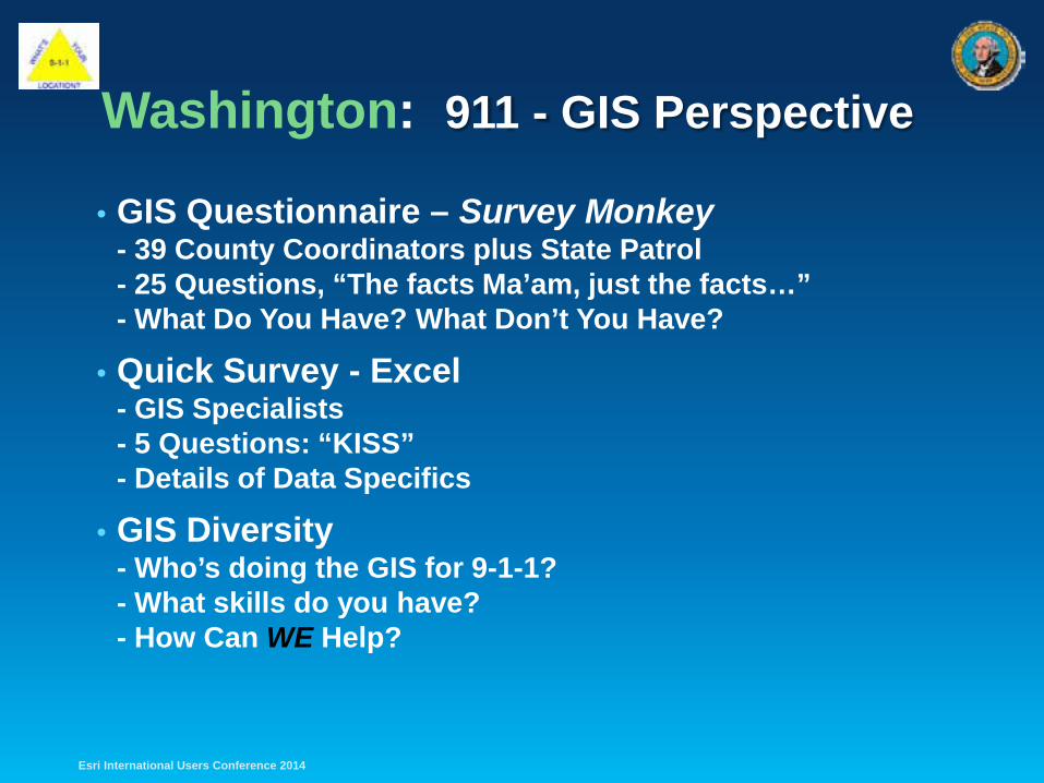
Washington: 911 - GIS Perspective
• GIS Questionnaire – Survey Monkey - 39 County Coordinators plus State Patrol - 25 Questions, “The facts Ma’am, just the facts…” - What Do You Have? What Don’t You Have?
• Quick Survey - Excel - GIS Specialists - 5 Questions: “KISS” - Details of Data Specifics
• GIS Diversity - Who’s doing the GIS for 9-1-1? - What skills do you have? - How Can WE Help?
Esri International Users Conference 2014
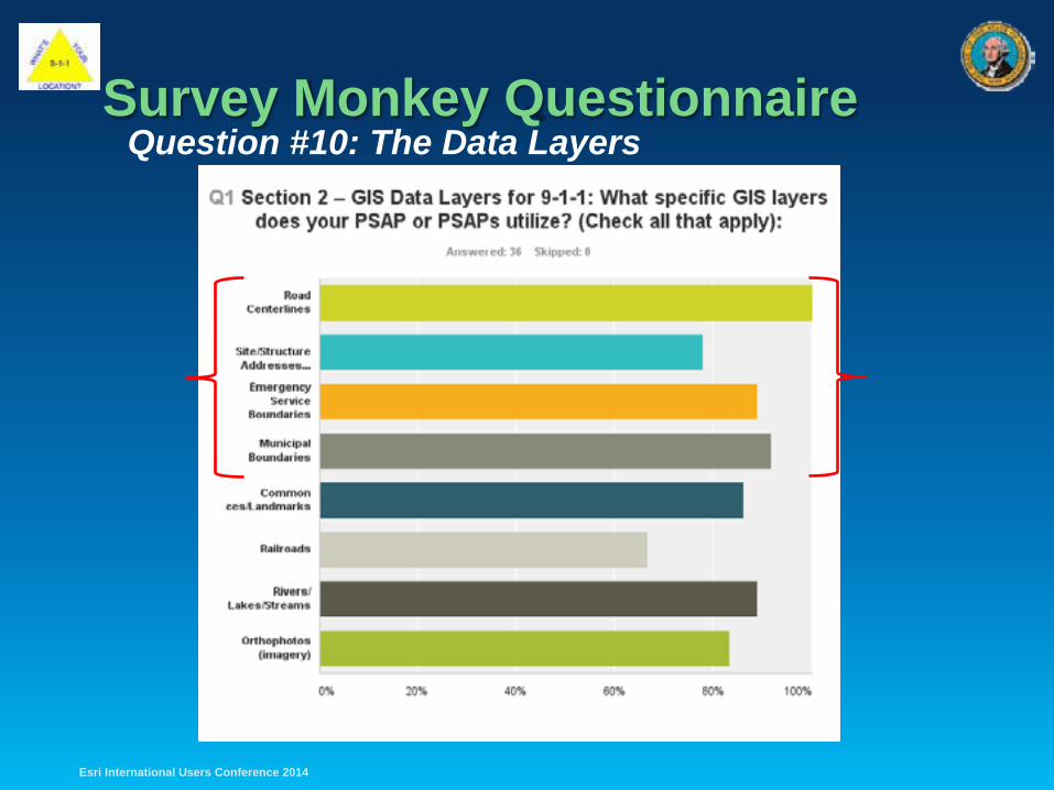
Survey Monkey Questionnaire Question #10: The Data Layers
Esri International Users Conference 2014
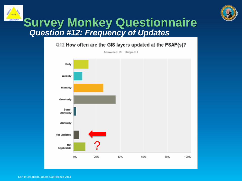
Survey Monkey Questionnaire
Esri International Users Conference 2014
Question #12: Frequency of Updates
?
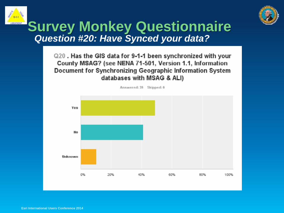
Survey Monkey Questionnaire
Esri International Users Conference 2014
Question #20: Have Synced your data?
?
Follow Up Survey – 5 Questions • Specific Questions about the data:
- Segments in Road Centerline
- Number of ESZ Polygons
- PSAP Polygons
- Municipal Boundary Polygons
- County Boundary Polygons
• Survey sent to the GIS Specialists, quicker turn around.
• Results of Questionnaire & Survey “Crunched”!
Esri International Users Conference 2014
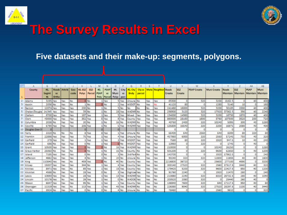
The Survey Results in Excel
Five datasets and their make-up: segments, polygons.
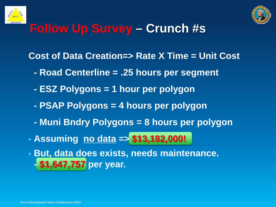
Follow Up Survey – Crunch #s
Cost of Data Creation=> Rate X Time = Unit Cost
- Road Centerline = .25 hours per segment
- ESZ Polygons = 1 hour per polygon
- PSAP Polygons = 4 hours per polygon
- Muni Bndry Polygons = 8 hours per polygon
• Assuming no data => $13,182,000! • But, data does exists, needs maintenance.
- $1,647,757 per year.
Esri International Users Conference 2014

Next Generation 9-1-1: Oh My!
Esri International Users Conference 2014

Next Generation 9-1-1: What the heck is it?
Esri International Users Conference 2014
• ESInet (Emergency Service IP Network)
• ECRF/ESRP geospatial call routing
• LVF/LIS – authoritative location validation
• GIS Data – created to sprt ECRF/LVF & assoc. w/ GIS Mgmt Tools
• Publish Authoritative NG9-1-1 Routing Data for state & local levels
• Support for legacy originating service via gateways
• Ability to control call routing based upon policy routing
• Additional data acquisition after call delivery
• Support for the transfer of calls with call-takers notes and data
• Ability to interconnect with other NG9-1-1 systems
• Support for system monitoring (logging, discrepancy reports, etc.)
i3
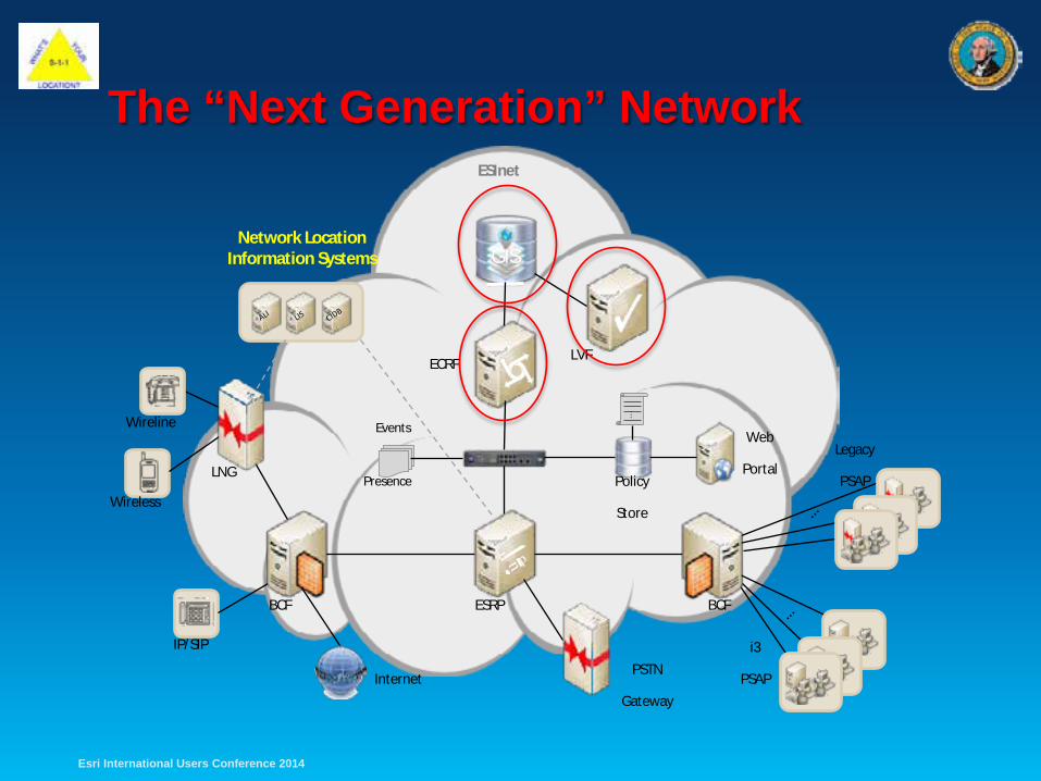
The “Next Generation” Network
GIS
…
Wireline
Wireless
IP/SIP
LNG
BCF BCF ESRP
ECRF LVF
Web
Portal Legacy
PSAP
i3
PSAP
Policy
Store
Events
Presence
ESInet
PSTN
Gateway Internet
Network Location Information Systems
Esri International Users Conference 2014
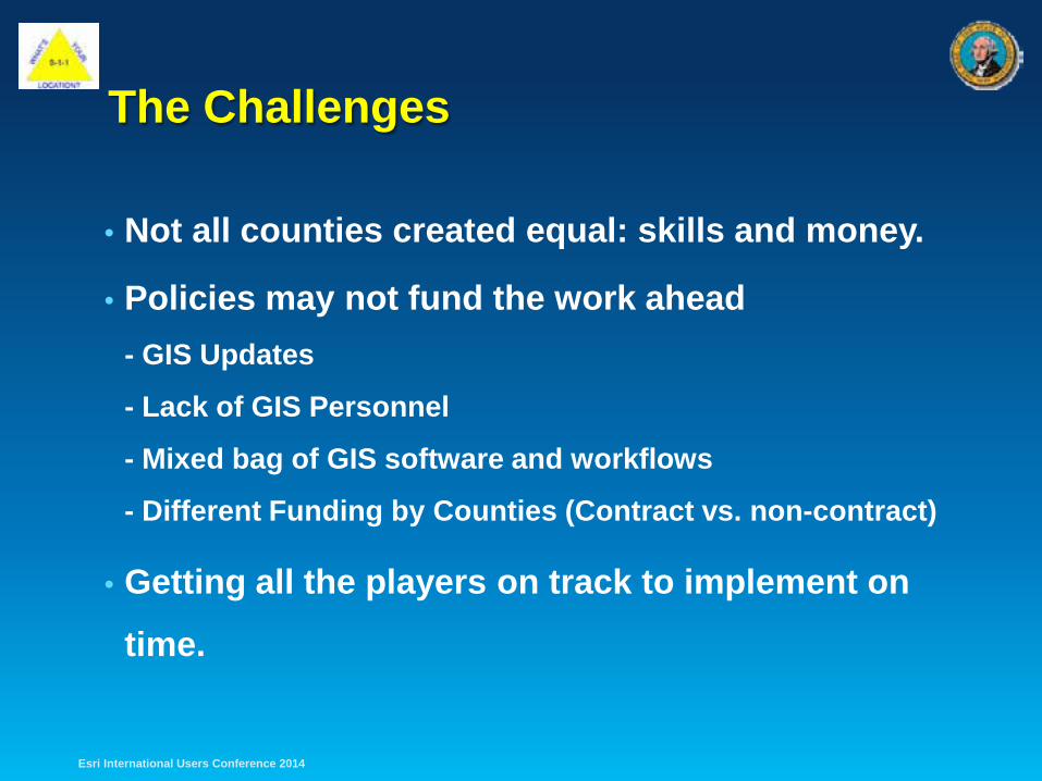
The Challenges
• Not all counties created equal: skills and money.
• Policies may not fund the work ahead - GIS Updates
- Lack of GIS Personnel
- Mixed bag of GIS software and workflows
- Different Funding by Counties (Contract vs. non-contract)
• Getting all the players on track to implement on
time.
Esri International Users Conference 2014
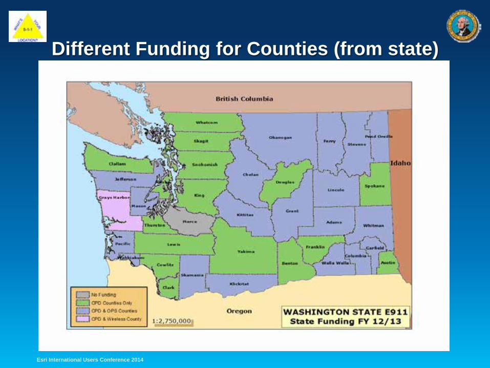
Different Funding for Counties (from state)
Esri International Users Conference 2014
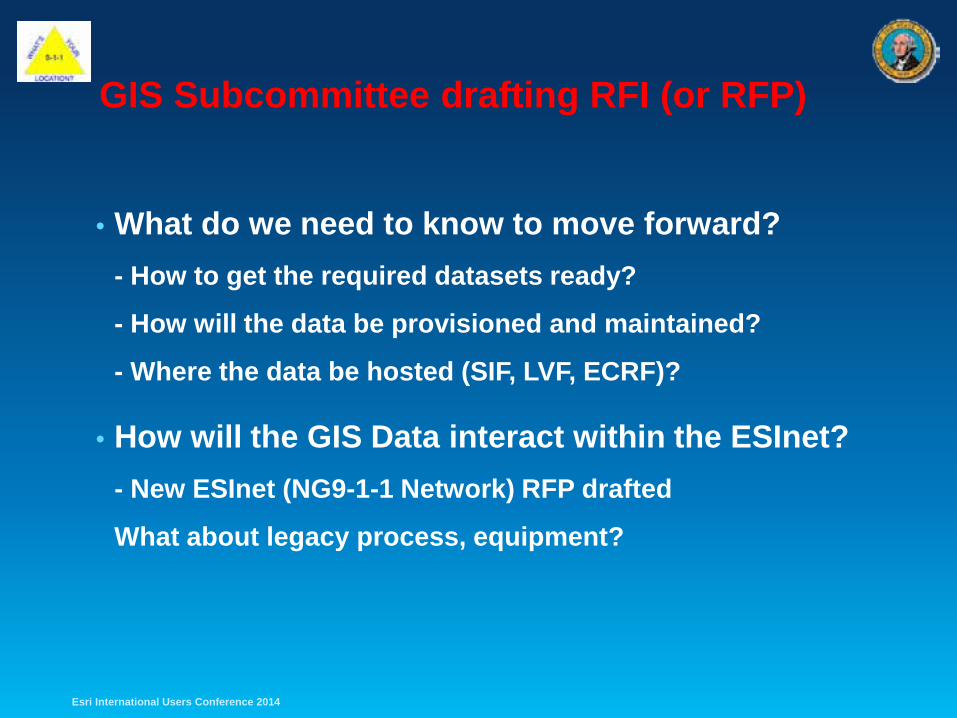
GIS Subcommittee drafting RFI (or RFP)
• What do we need to know to move forward? - How to get the required datasets ready?
- How will the data be provisioned and maintained?
- Where the data be hosted (SIF, LVF, ECRF)?
• How will the GIS Data interact within the ESInet? - New ESInet (NG9-1-1 Network) RFP drafted
What about legacy process, equipment?
Esri International Users Conference 2014
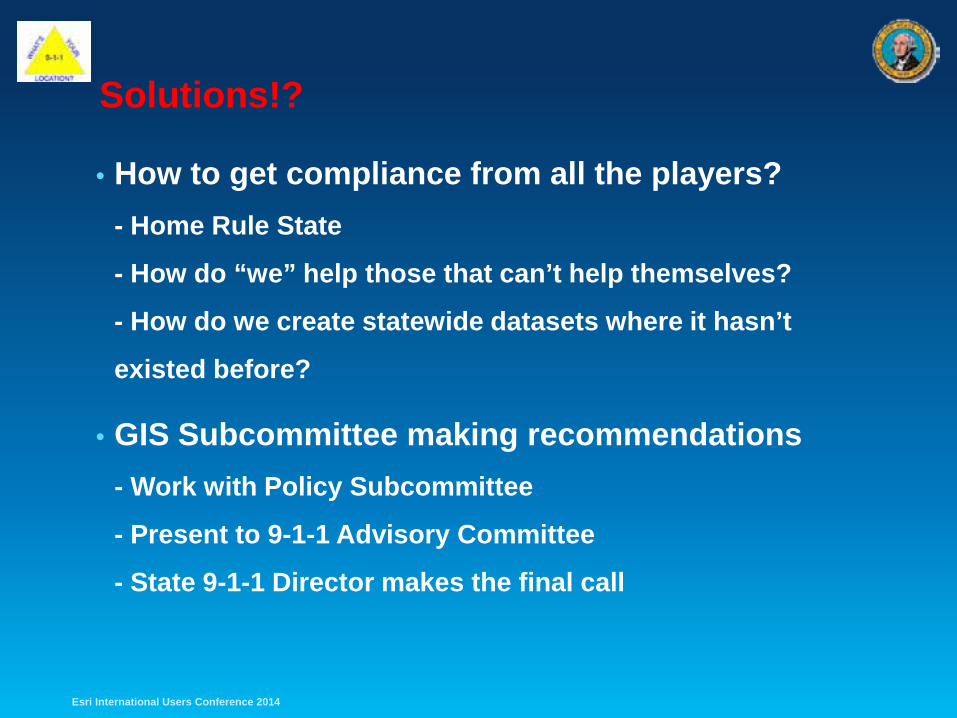
Solutions!?
• How to get compliance from all the players? - Home Rule State
- How do “we” help those that can’t help themselves?
- How do we create statewide datasets where it hasn’t
existed before?
• GIS Subcommittee making recommendations - Work with Policy Subcommittee
- Present to 9-1-1 Advisory Committee
- State 9-1-1 Director makes the final call
Esri International Users Conference 2014
Pierce
King
Franklin
Walla Walla
Benton
Yakima
Klickitat Clark
Skamania
Cowlitz
Wahkiakum
Thurston
Lewis
Pacific
Mason Grays Harbor
Kitsap
Jefferson
Clallam
Kittitas
Grant
Chelan
Okanogan
Douglas Spokane
Lincoln
Adams Asotin
Garfield
Columbia
Whitman
Pend Oreille
Stevens
Ferry
Snohomish
Whatcom
Skagit
San Juan
Island
Esri International Users Conference 2014
Pierce
King
Franklin
Walla Walla Benton
Yakima
Klickitat
Clark Skamania
Cowlitz Wahkiakum
Thurston
Lewis Pacific
Mason
Grays Harbor
Kitsap Jefferson
Clallam
Kittitas Grant
Chelan
Okanogan
Douglas
Spokane Lincoln
Adams
Asotin
Garfield Columbia
Whitman
Pend Oreille
Stevens
Ferry Snohomish
Whatcom
Skagit
San Juan
Island
Esri International Users Conference 2014
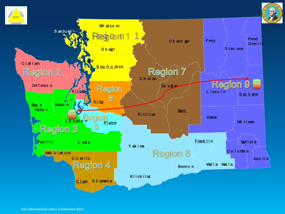
Region 1
Kittitas Grant
Kitsap
Thurston Pierce
King
Clark
Franklin
Spokane
Snohomish
Lincoln
Adams
Asotin
Garfield
Columbia
Walla Walla Benton
Yakima
Klickitat Skamania
Cowlitz Wahkiakum
Lewis Pacific
Mason Grays Harbor
Jefferson
Clallam
Whitman
Pend Oreille
Chelan
Okanogan
Douglas
Stevens
Ferry
Whatcom
Skagit
San Juan
Island
Esri International Users Conference 2014
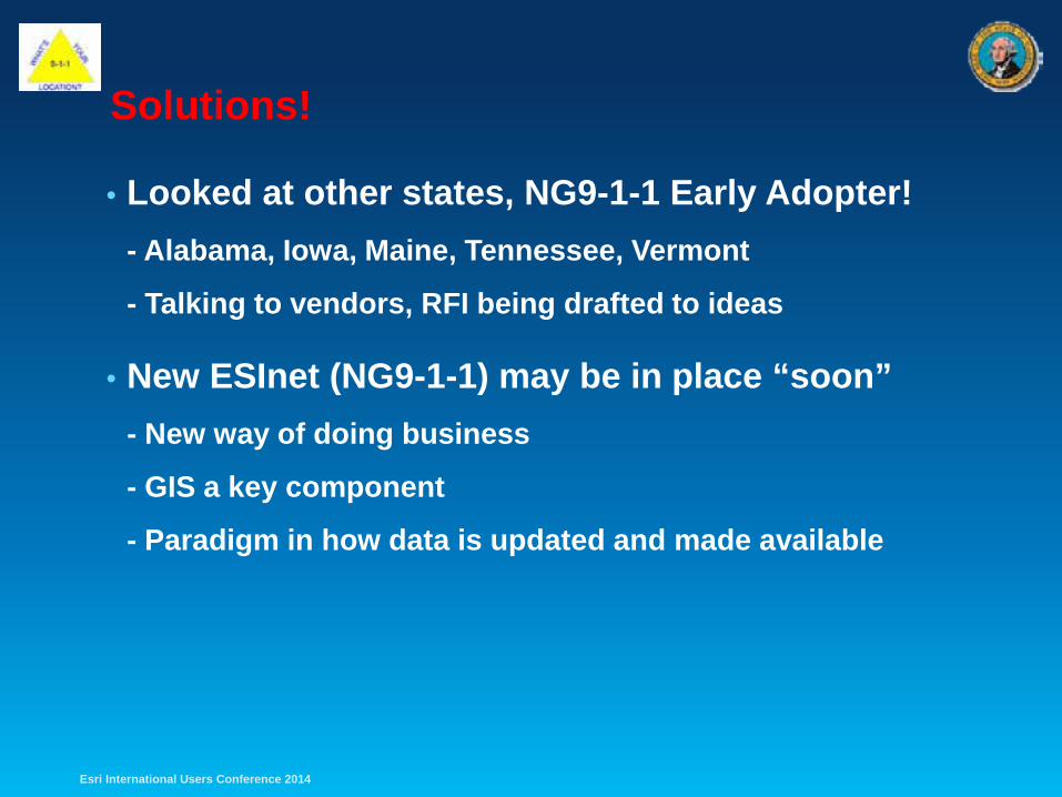
Solutions!
• Looked at other states, NG9-1-1 Early Adopter! - Alabama, Iowa, Maine, Tennessee, Vermont
- Talking to vendors, RFI being drafted to ideas
• New ESInet (NG9-1-1) may be in place “soon” - New way of doing business
- GIS a key component
- Paradigm in how data is updated and made available
Esri International Users Conference 2014
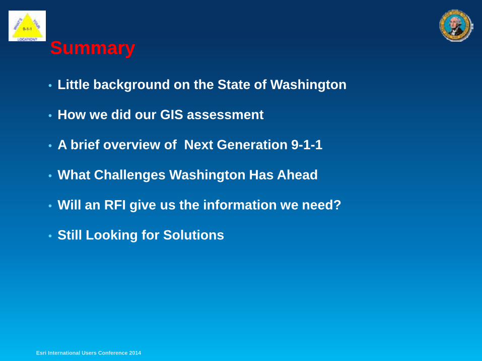
Summary
• Little background on the State of Washington
• How we did our GIS assessment
• A brief overview of Next Generation 9-1-1
• What Challenges Washington Has Ahead
• Will an RFI give us the information we need?
• Still Looking for Solutions
Esri International Users Conference 2014
Question? Ideas!
Dan Miller E911 GIS Manager Washington State Military Department State E911 Program Office [email protected] (253) 512-7464
Esri International Users Conference 2014