Embed Size (px)
Citation preview
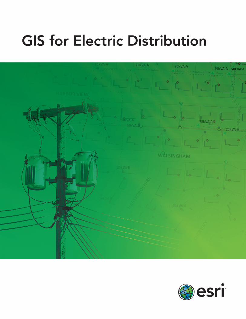
GIS for Electric Distribution

The Geographic Approach™
A geographic information system (GIS) integrates hardware, software, and data for capturing, managing, analyz-
ing, and displaying all forms of geographically referenced information. The geographic approach, through ESRI®
GIS technology, allows us to view, query, and understand data in many ways. We see relationships, patterns, and
trends in the form of GIS-based maps, globes, reports, and charts. GIS helps you answer questions and solve
problems. When viewed in the context of geography, your data is quickly understood and easily shared. GIS tech-
nology can be integrated into any enterprise information system framework.
to Electric Distribution
Learn more. Read case studies, explore options, and connect with an expert at www.esri.com/electric.
Data ManagementUtilities worldwide use GIS to manage and map the location of millions of miles of overhead and underground circuits. Within GIS, your utility’s assets can be linked directly to your customer information system, allowing you to proactively monitor work orders, vegetation management, and outages.
Empowering Utilities with GIS
Planning and AnalysisGIS enables distribution utilities to identify vulnerabilities that cause outages, to weigh asset investments, and to understand customer satisfaction. With a rich set of easy-to-use spatial analysis tools, GIS helps you determine the right location for new facilities and new technology such as smart grid sensors and smart meters.

to Electric Distribution
Learn more. Read case studies, explore options, and connect with an expert at www.esri.com/electric.
Workforce AutomationWorkforce automation systems allow you to more efficiently schedule and dispatch utility service staff. Your productivity will be even greater with a workforce automation system built with GIS technology. GIS shows you where crews are working and gives you the status of their work. In addition, street-level routing allows you to reduce fleet costs and gain additional scheduling time, giving you the ability to handle more service calls.
Situational AwarenessThrough GIS-based graphic outputs and Web-based reporting, you can quickly demonstrate how your organization is meeting compliance requirements, responding to large outages, or seeing where you are spending your money wisely. Meeting regulatory requirements and keeping the public informed becomes less time consuming and easier to accomplish when you use GIS to communicate with regulators and the public.

Printed in USA
About Esri
Since 1969, Esri has been helping
organizations map and model our
world. Esri’s GIS software tools
and methodologies enable these
organizations to effectively analyze
and manage their geographic
information and make better
decisions. They are supported by our
experienced and knowledgeable staff
and extensive network of business
partners and international distributors.
A full-service GIS company, Esri
supports the implementation of GIS
technology on desktops, servers,
online services, and mobile devices.
These GIS solutions are flexible,
customizable, and easy to use.
Our Focus
Esri software is used by hundreds
of thousands of organizations that
apply GIS to solve problems and
make our world a better place to
live. We pay close attention to our
users to ensure they have the best
tools possible to accomplish their
missions. A comprehensive suite of
training options offered worldwide
helps our users fully leverage their
GIS applications.
Esri is a socially conscious business,
actively supporting organizations
involved in education, conservation,
sustainable development, and
humanitarian affairs.
Contact Esri
1-800-GIS-XPRT (1-800-447-9778)
Phone: 909-793-2853
Fax: 909-793-5953
esri.com
Offices worldwide
esri.com/locations
Copyright © 2010 Esri. All rights reserved. Esri, the Esri globe logo, ArcGIS, @esri.com, and esri.com are trademarks, registered trademarks, or service marks of Esri in the United States, the European Community, or certain other jurisdictions. Other companies and products mentioned herein may be trademarks or registered trademarks of their respective trademark owners.
119220INLD5M1/11jb
380 New York Street Redlands, CA 92373-8100 USA