Embed Size (px)
Citation preview
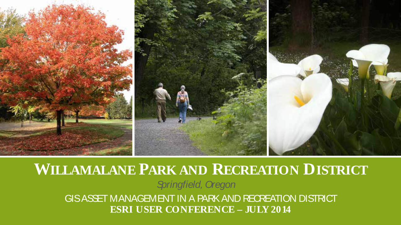
WILLAMALANE PARK AND RECREATION DISTRICT
GIS ASSET MANAGEMENT IN A PARK AND RECREATION DISTRICT ESRI USER CONFERENCE – JULY 2014
Springfield, Oregon
Lucinda Dykes Web GIS The GIS Lab, Willamalane
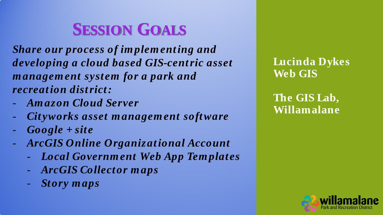
Share our process of implementing and developing a cloud based GIS-centric asset management system for a park and recreation district: - Amazon Cloud Server - Cityworks asset management software - Google + site - ArcGIS Online Organizational Account
- Local Government Web App Templates - ArcGIS Collector maps - Story maps
SESSION GOALS
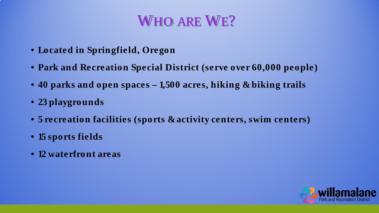
WHO ARE WE?
• Located in Springfield, Oregon
• Park and Recreation Special District (serve over 60,000 people)
• 40 parks and open spaces – 1,500 acres, hiking & biking trails
• 23 playgrounds
• 5 recreation facilities (sports & activity centers, swim centers)
• 15 sports fields
• 12 waterfront areas
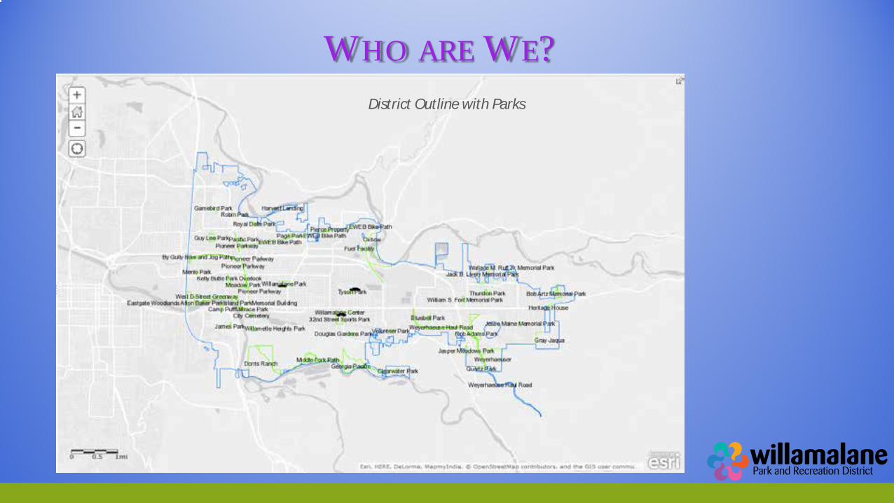
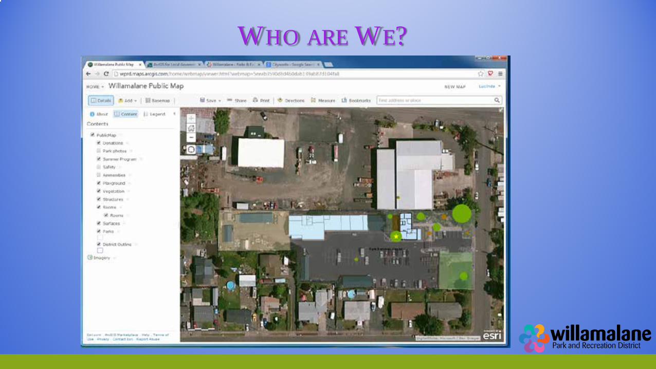
WHO ARE WE?
District Outline with Parks
WHO ARE WE?
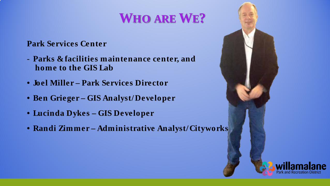
Park Services Center
- Parks & facilities maintenance center, and home to the GIS Lab
• Joel Miller – Park Services Director
• Ben Grieger – GIS Analyst/Developer
• Lucinda Dykes – GIS Developer
• Randi Zimmer – Administrative Analyst/Cityworks
WHO ARE WE?
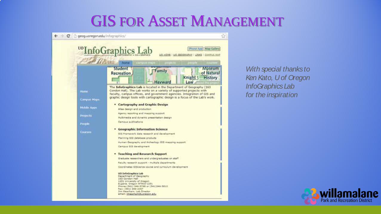
GIS FOR ASSET MANAGEMENT
With special thanks to Ken Kato, U of Oregon InfoGraphics Lab for the inspiration
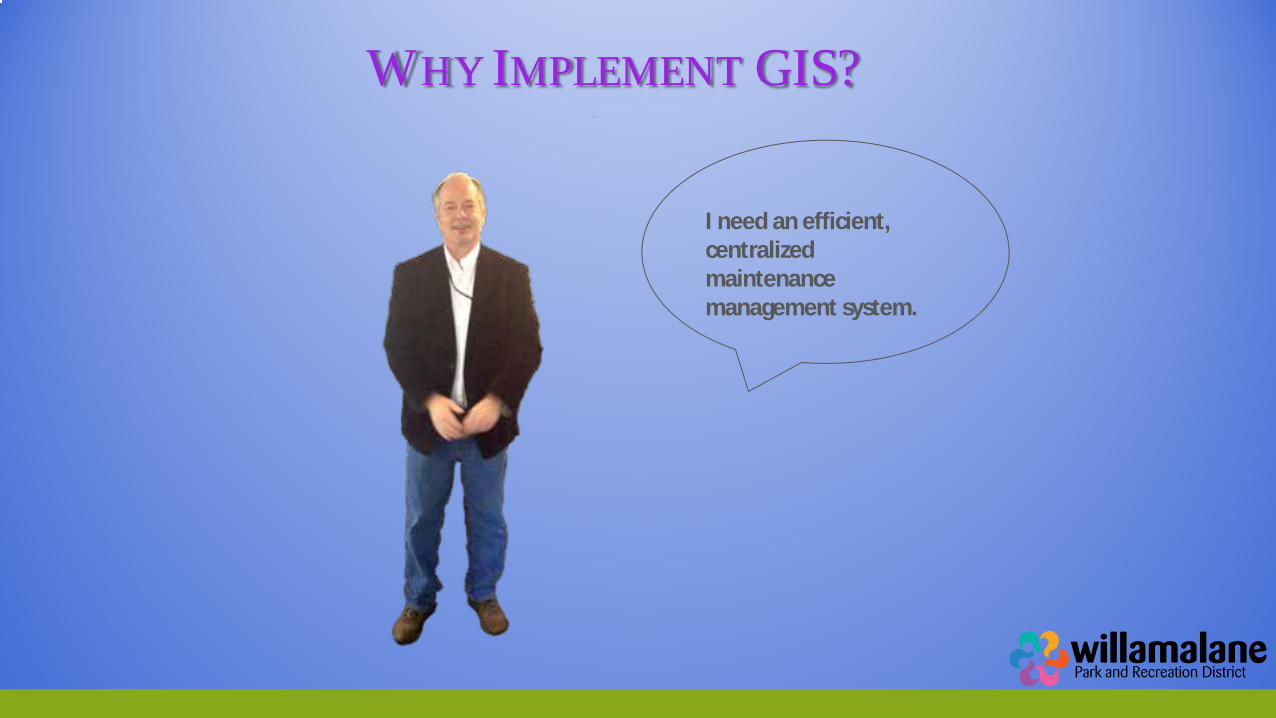
WHY IMPLEMENT GIS?
I need an efficient, centralized maintenance management system.
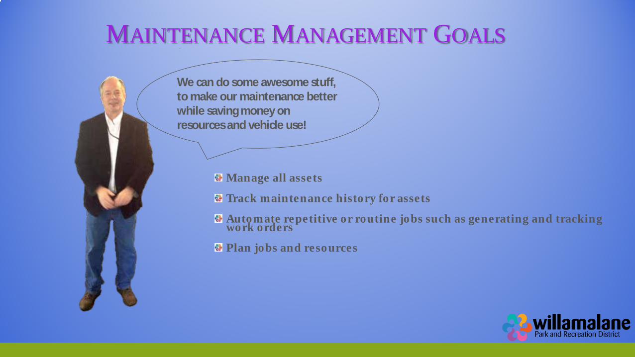
MAINTENANCE MANAGEMENT GOALS
Manage all assets
Track maintenance history for assets
Automate repetitive or routine jobs such as generating and tracking work orders
Plan jobs and resources
We can do some awesome stuff, to make our maintenance better while saving money on resources and vehicle use!
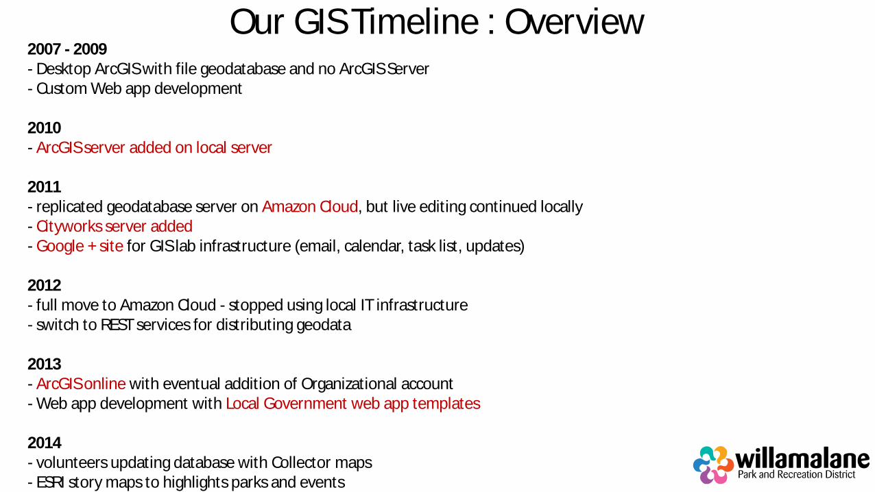
Our GIS Timeline : Overview 2007 - 2009 - Desktop ArcGIS with file geodatabase and no ArcGIS Server - Custom Web app development 2010 - ArcGIS server added on local server 2011 - replicated geodatabase server on Amazon Cloud, but live editing continued locally - Cityworks server added - Google + site for GIS lab infrastructure (email, calendar, task list, updates) 2012 - full move to Amazon Cloud - stopped using local IT infrastructure - switch to REST services for distributing geodata 2013 - ArcGIS online with eventual addition of Organizational account - Web app development with Local Government web app templates 2014 - volunteers updating database with Collector maps - ESRI story maps to highlights parks and events
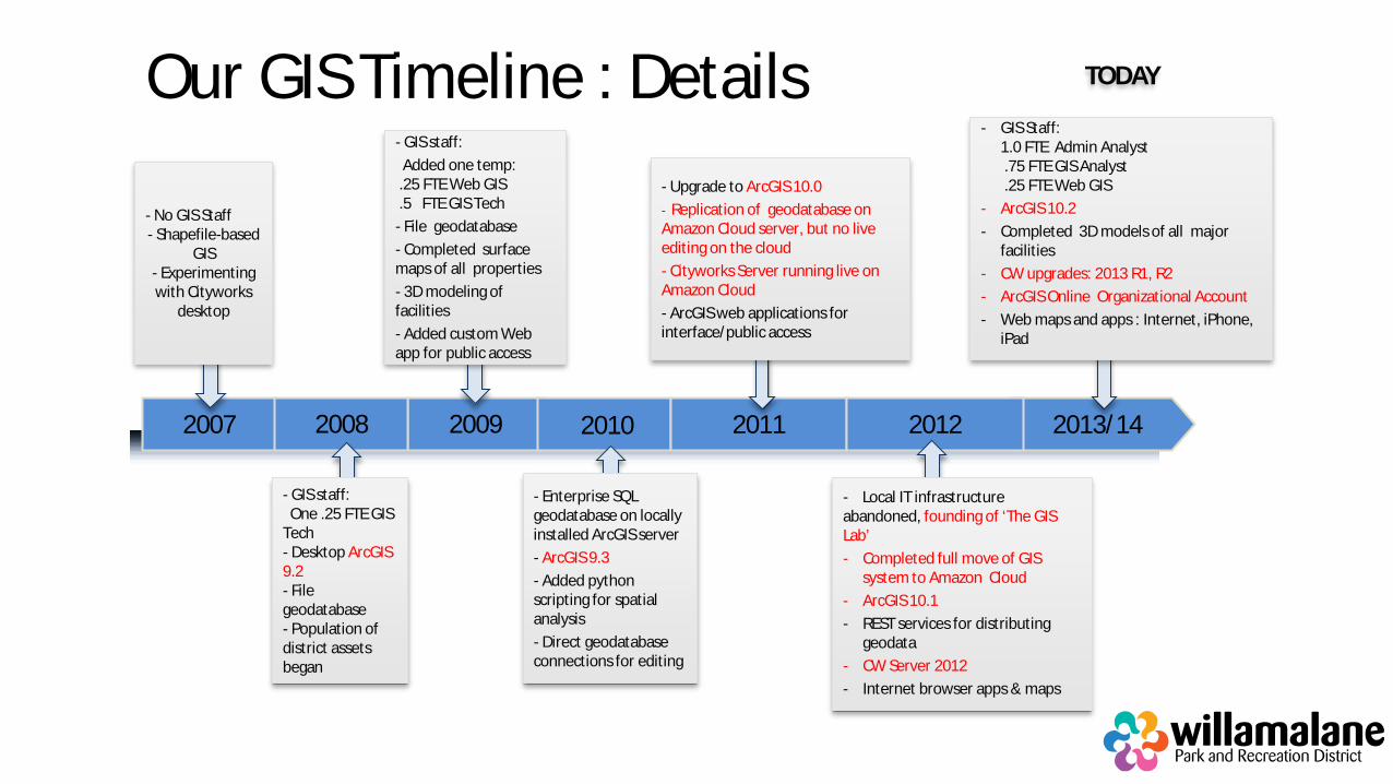
Our GIS Timeline : Details
2013/14 2009 2011 2012 2007 2010
- No GIS Staff - Shapefile-based
GIS - Experimenting with Cityworks
desktop
- Enterprise SQL geodatabase on locally installed ArcGIS server - ArcGIS 9.3 - Added python scripting for spatial analysis - Direct geodatabase connections for editing
- GIS staff: Added one temp: .25 FTE Web GIS .5 FTE GIS Tech - File geodatabase - Completed surface maps of all properties - 3D modeling of facilities - Added custom Web app for public access
- Upgrade to ArcGIS 10.0 - Replication of geodatabase on Amazon Cloud server, but no live editing on the cloud - Cityworks Server running live on Amazon Cloud - ArcGIS web applications for interface/public access
TODAY
- GIS Staff: 1.0 FTE Admin Analyst .75 FTE GIS Analyst .25 FTE Web GIS
- ArcGIS 10.2 - Completed 3D models of all major
facilities - CW upgrades: 2013 R1, R2 - ArcGIS Online Organizational Account - Web maps and apps : Internet, iPhone,
iPad
2008
- GIS staff: One .25 FTE GIS Tech - Desktop ArcGIS 9.2 - File geodatabase - Population of district assets began
- Local IT infrastructure abandoned, founding of ‘The GIS Lab’ - Completed full move of GIS
system to Amazon Cloud - ArcGIS 10.1 - REST services for distributing
geodata - CW Server 2012 - Internet browser apps & maps

I WANT TO BE ON THE CLOUD
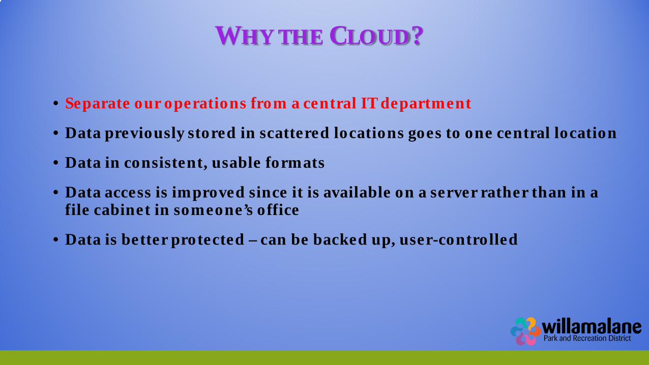
WHY THE CLOUD?
• Separate our operations from a central IT department
• Data previously stored in scattered locations goes to one central location
• Data in consistent, usable formats
• Data access is improved since it is available on a server rather than in a file cabinet in someone’s office
• Data is better protected – can be backed up, user-controlled
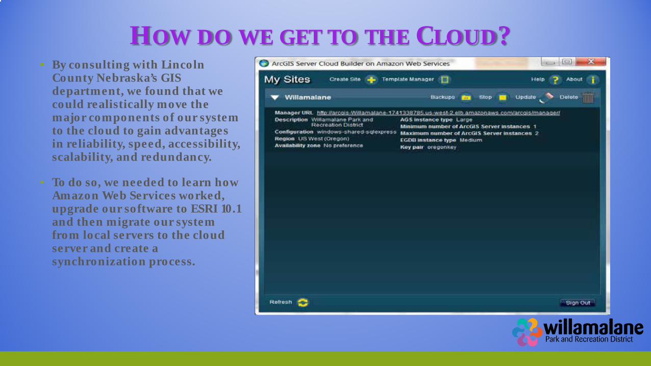
HOW DO WE GET TO THE CLOUD?
▪ By consulting with Lincoln County Nebraska’s GIS department, we found that we could realistically move the major components of our system to the cloud to gain advantages in reliability, speed, accessibility, scalability, and redundancy.
▪ To do so, we needed to learn how Amazon Web Services worked, upgrade our software to ESRI 10.1 and then migrate our system from local servers to the cloud server and create a synchronization process.
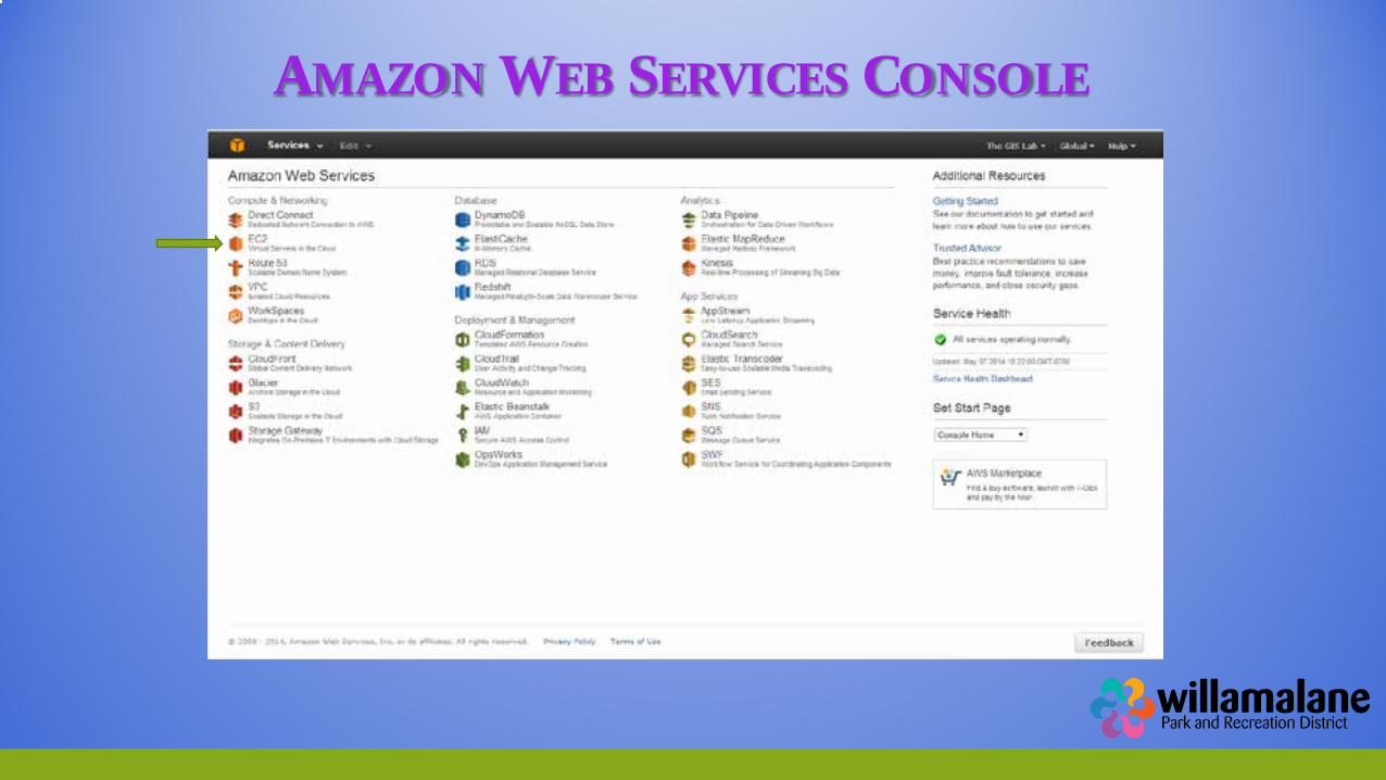
AMAZON WEB SERVICES CONSOLE
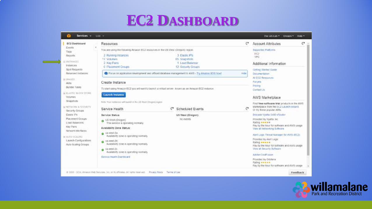
EC2 DASHBOARD
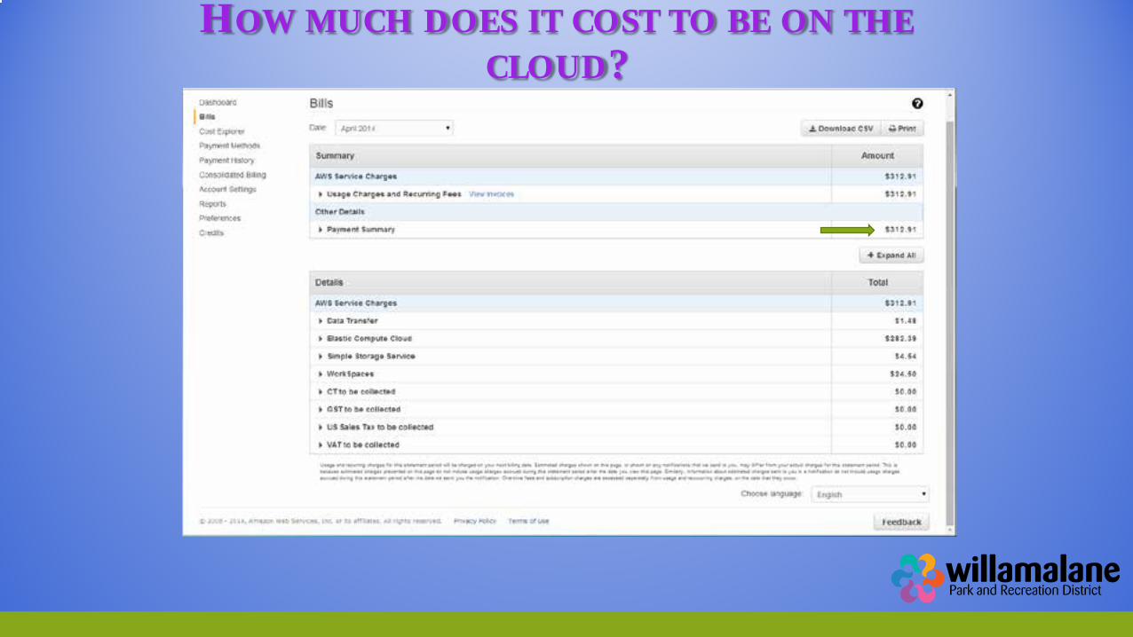
HOW MUCH DOES IT COST TO BE ON THE CLOUD?
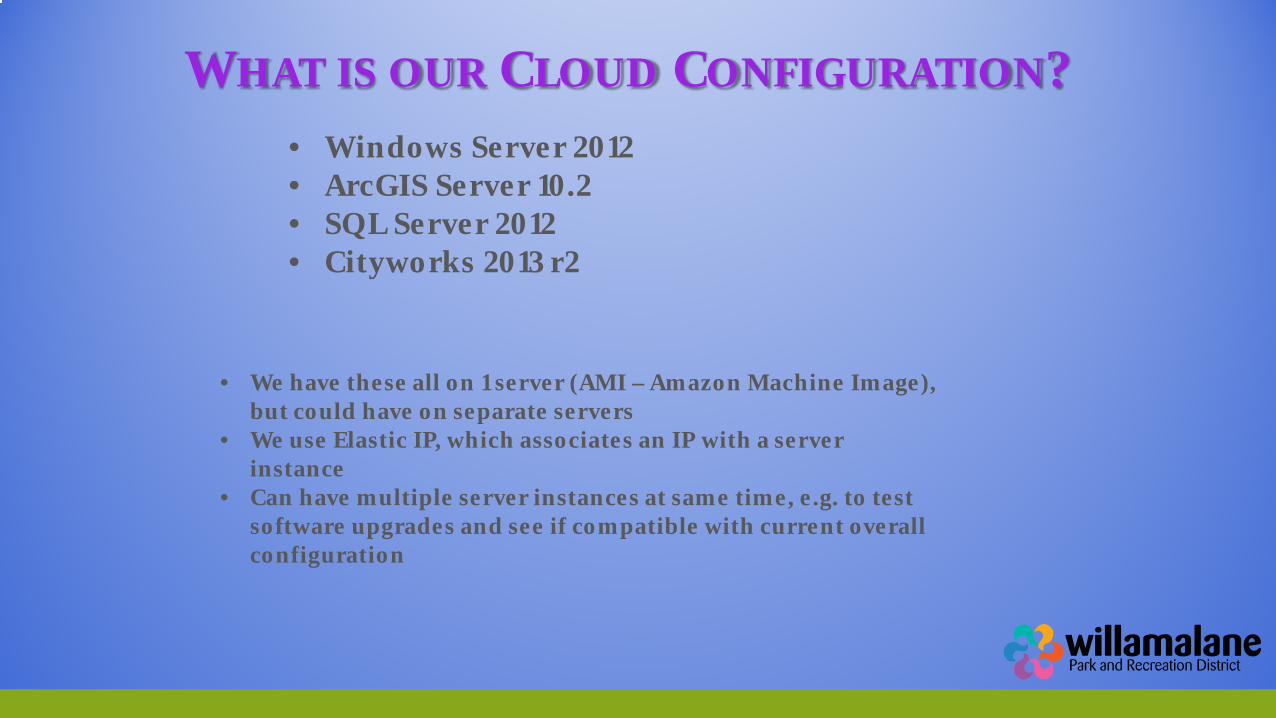
WHAT IS OUR CLOUD CONFIGURATION?
• Windows Server 2012 • ArcGIS Server 10.2 • SQL Server 2012 • Cityworks 2013 r2
• We have these all on 1 server (AMI – Amazon Machine Image),
but could have on separate servers • We use Elastic IP, which associates an IP with a server
instance • Can have multiple server instances at same time, e.g. to test
software upgrades and see if compatible with current overall configuration
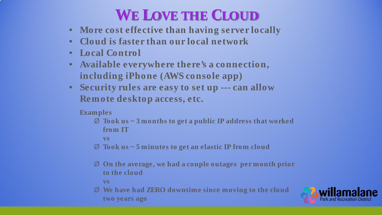
WE LOVE THE CLOUD
• More cost effective than having server locally • Cloud is faster than our local network • Local Control • Available everywhere there’s a connection,
including iPhone (AWS console app) • Security rules are easy to set up --- can allow
Remote desktop access, etc. Examples Ø Took us ~ 3 months to get a public IP address that worked
from IT vs
Ø Took us ~ 5 minutes to get an elastic IP from cloud
Ø On the average, we had a couple outages per month prior to the cloud vs
Ø We have had ZERO downtime since moving to the cloud two years ago
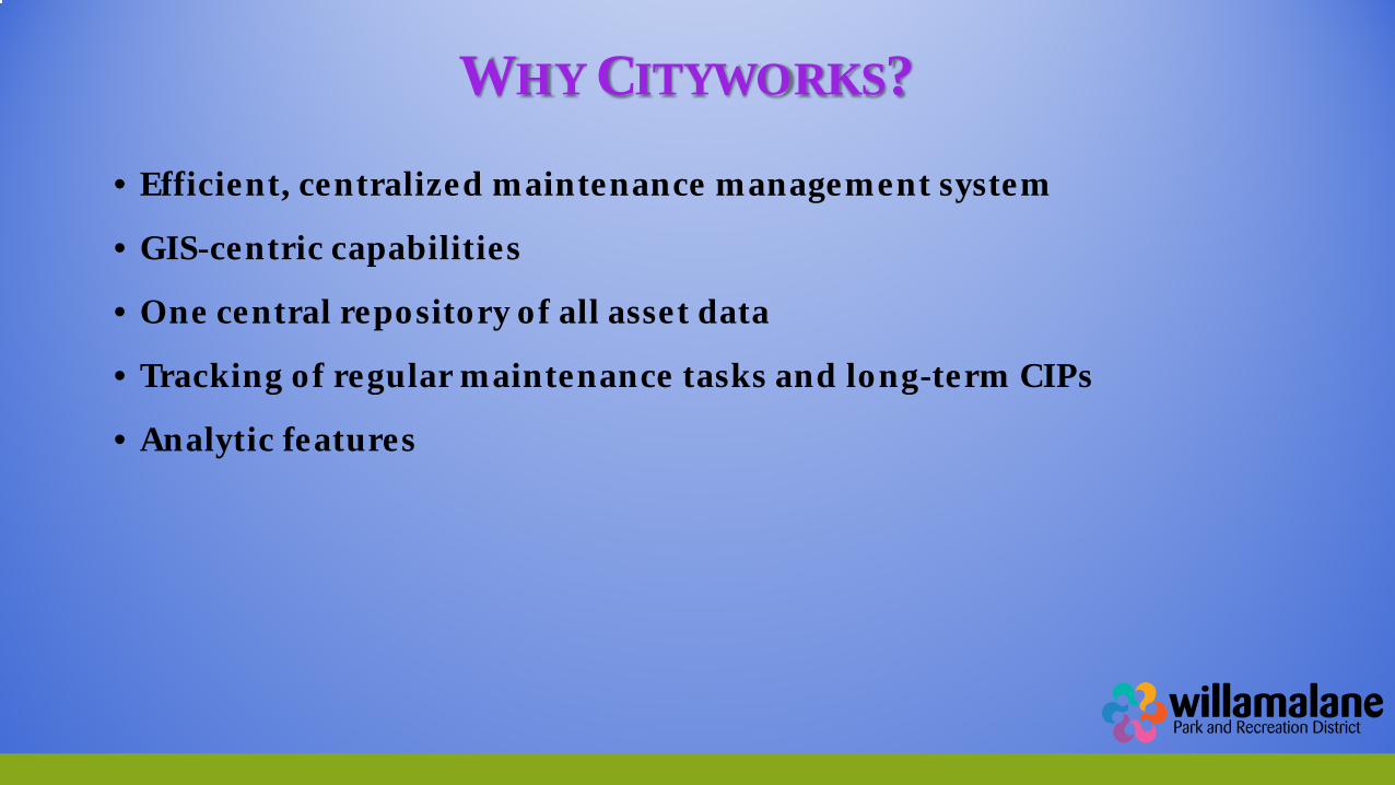
WHY CITYWORKS?
• Efficient, centralized maintenance management system
• GIS-centric capabilities
• One central repository of all asset data
• Tracking of regular maintenance tasks and long-term CIPs
• Analytic features
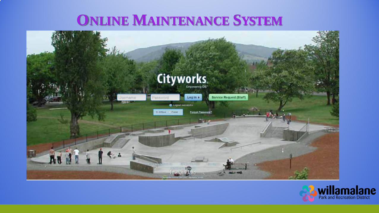
ONLINE MAINTENANCE SYSTEM
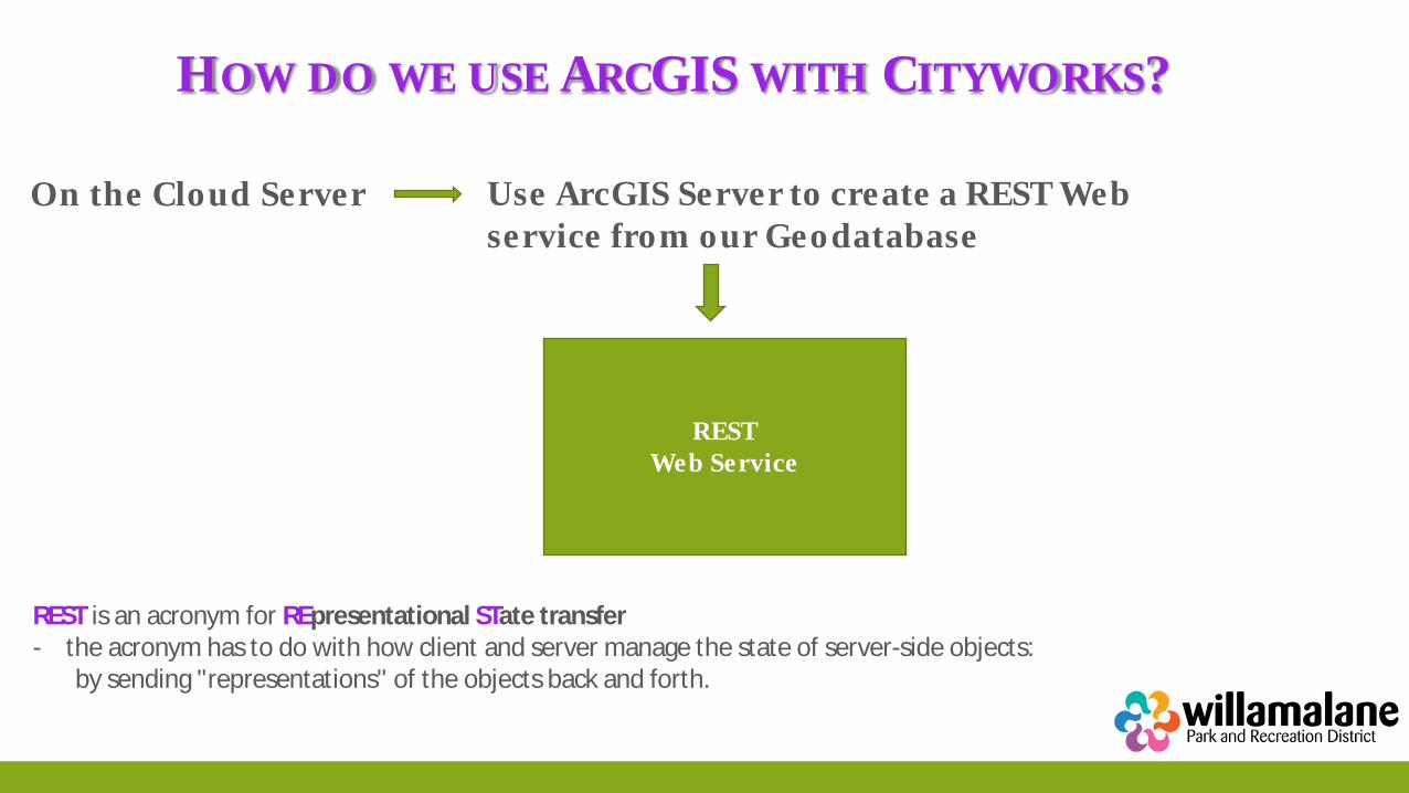
HOW DO WE USE ARCGIS WITH CITYWORKS?
REST Web Service
Use ArcGIS Server to create a REST Web service from our Geodatabase
On the Cloud Server
REST is an acronym for REpresentational STate transfer - the acronym has to do with how client and server manage the state of server-side objects: by sending "representations" of the objects back and forth.
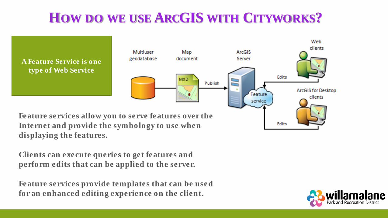
HOW DO WE USE ARCGIS WITH CITYWORKS?
A Feature Service is one type of Web Service
Feature services allow you to serve features over the Internet and provide the symbology to use when displaying the features. Clients can execute queries to get features and perform edits that can be applied to the server. Feature services provide templates that can be used for an enhanced editing experience on the client.
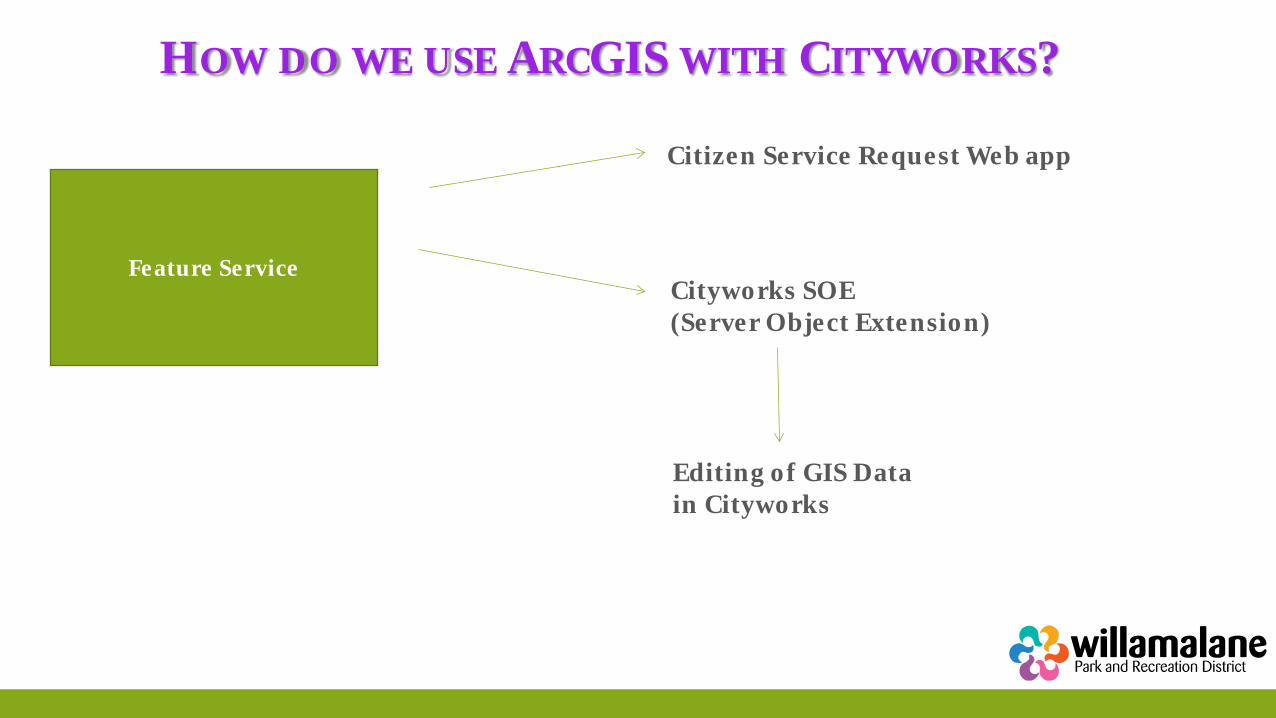
HOW DO WE USE ARCGIS WITH CITYWORKS?
Feature Service
Citizen Service Request Web app
Cityworks SOE (Server Object Extension)
Editing of GIS Data in Cityworks
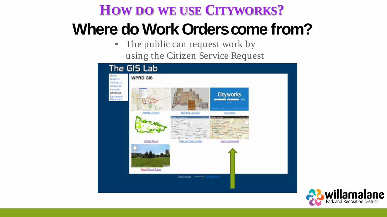
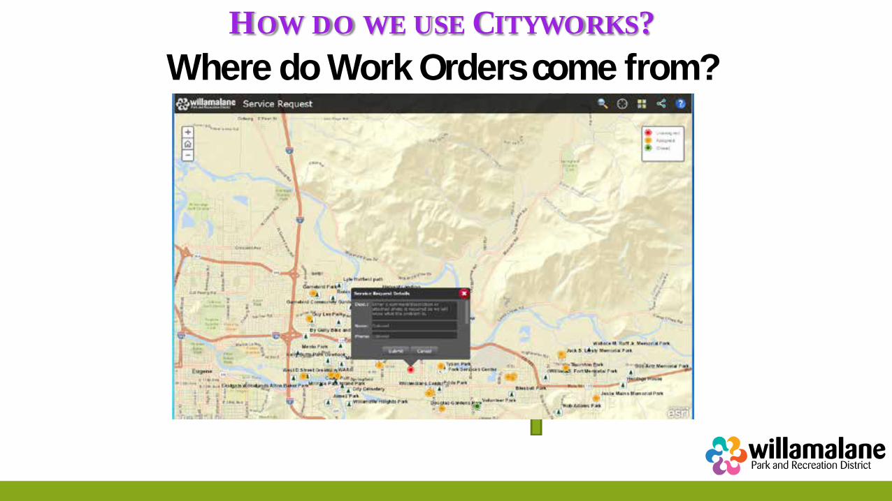
HOW DO WE USE CITYWORKS? Where do Work Orders come from?
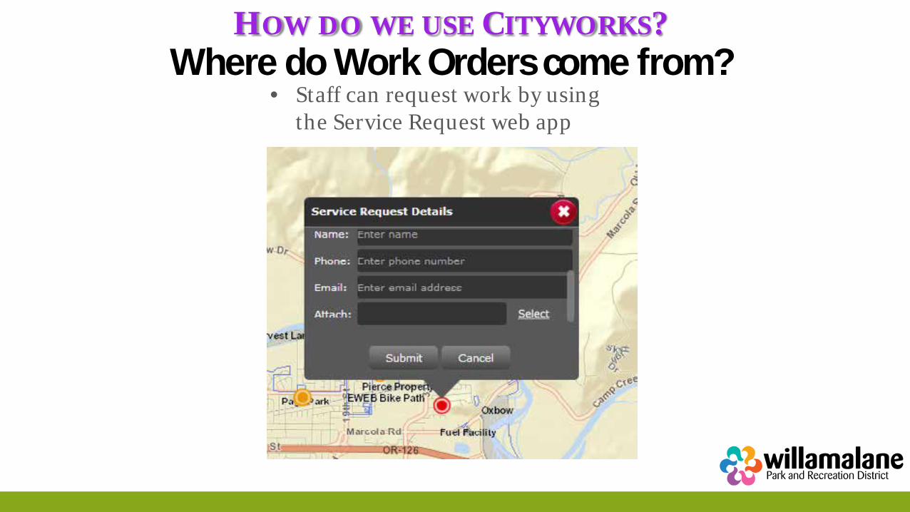
• The public can request work by using the Citizen Service Request
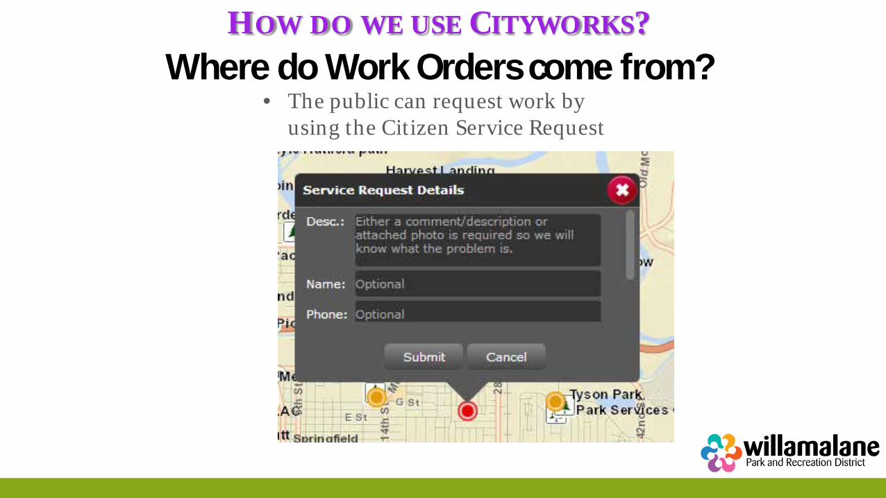
HOW DO WE USE CITYWORKS? Where do Work Orders come from?
• The public can request work by using the Citizen Service Request
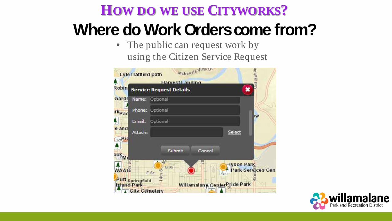
HOW DO WE USE CITYWORKS? Where do Work Orders come from?
• The public can request work by using the Citizen Service Request
HOW DO WE USE CITYWORKS? Where do Work Orders come from?
• The public can request work by using the Citizen Service Request
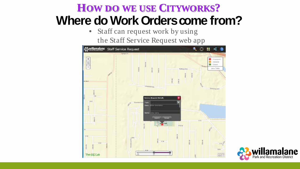
HOW DO WE USE CITYWORKS? Where do Work Orders come from?
• Staff can request work by using the Staff Service Request web app
HOW DO WE USE CITYWORKS? Where do Work Orders come from?
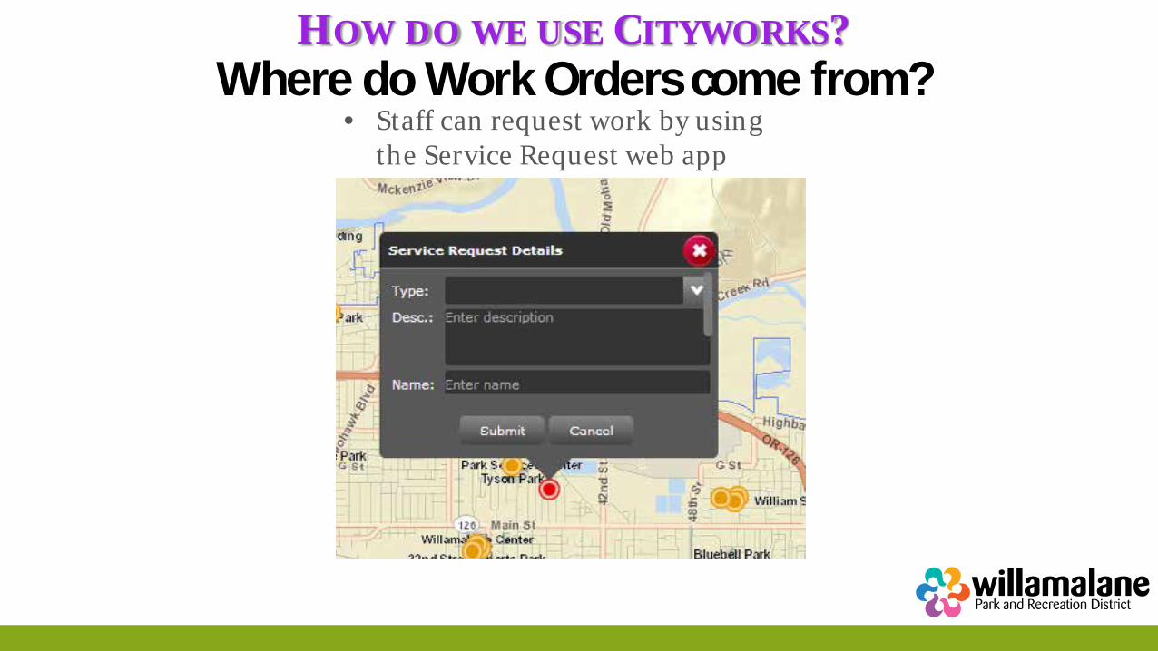
• Staff can request work by using the Service Request web app
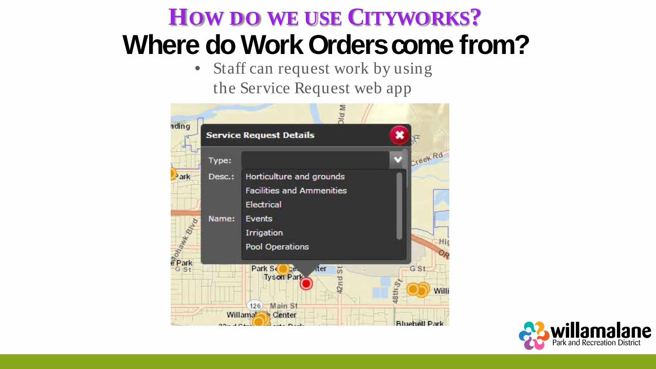
HOW DO WE USE CITYWORKS? Where do Work Orders come from?
• Staff can request work by using the Service Request web app
HOW DO WE USE CITYWORKS? Where do Work Orders come from?
• Staff can request work by using the Service Request web app
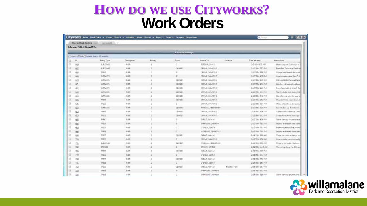
HOW DO WE USE CITYWORKS? Work Orders
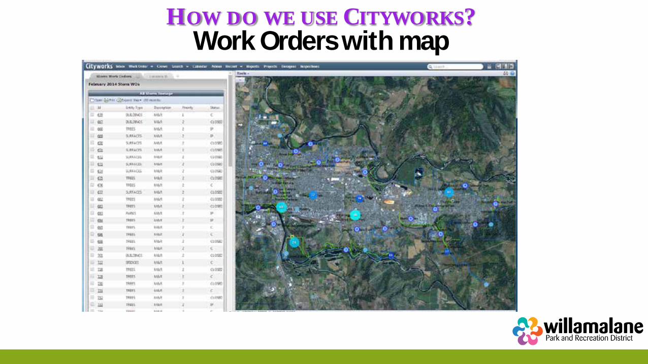
HOW DO WE USE CITYWORKS? Work Orders with map
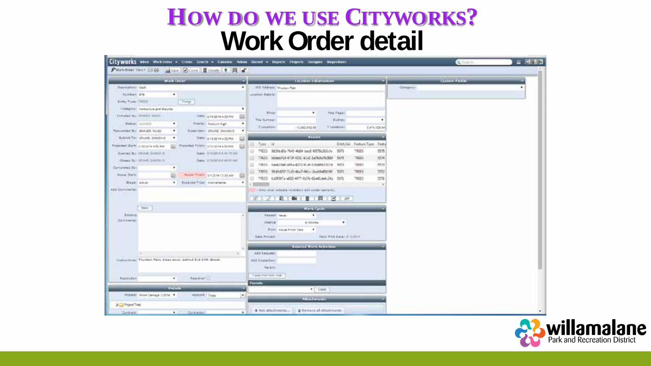
HOW DO WE USE CITYWORKS? Work Order detail
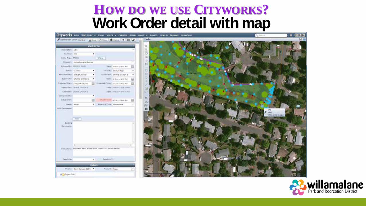
HOW DO WE USE CITYWORKS? Work Order detail with map
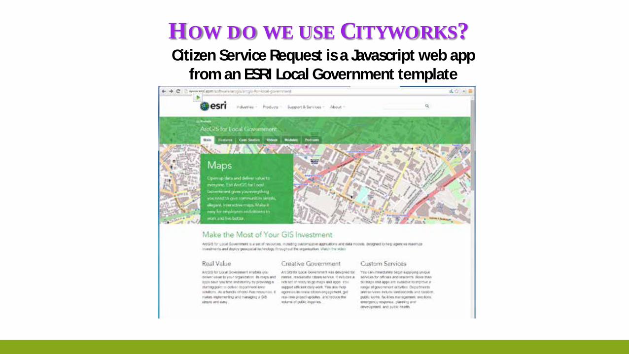
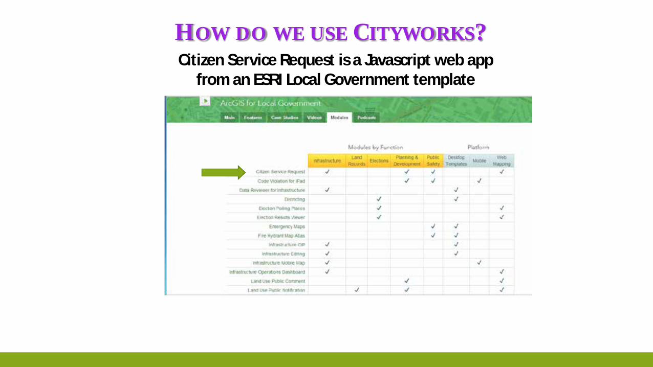
HOW DO WE USE CITYWORKS? Citizen Service Request is a Javascript web app
from an ESRI Local Government template
HOW DO WE USE CITYWORKS? Citizen Service Request is a Javascript web app
from an ESRI Local Government template
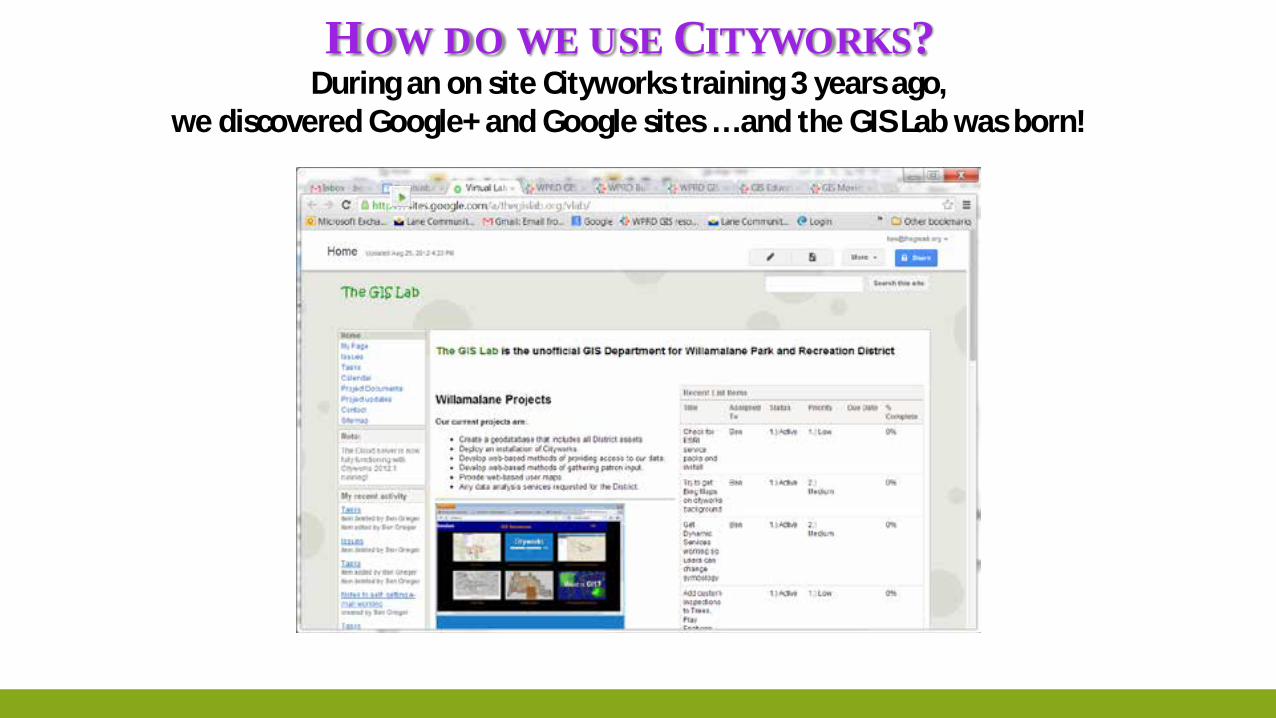
HOW DO WE USE CITYWORKS? During an on site Cityworks training 3 years ago,
we discovered Google+ and Google sites … and the GIS Lab was born!
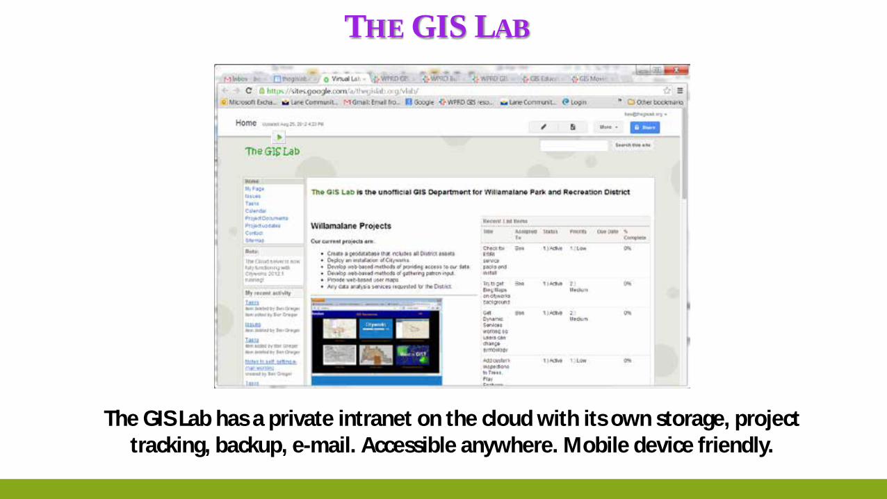
THE GIS LAB
The GIS Lab has a private intranet on the cloud with its own storage, project tracking, backup, e-mail. Accessible anywhere. Mobile device friendly.
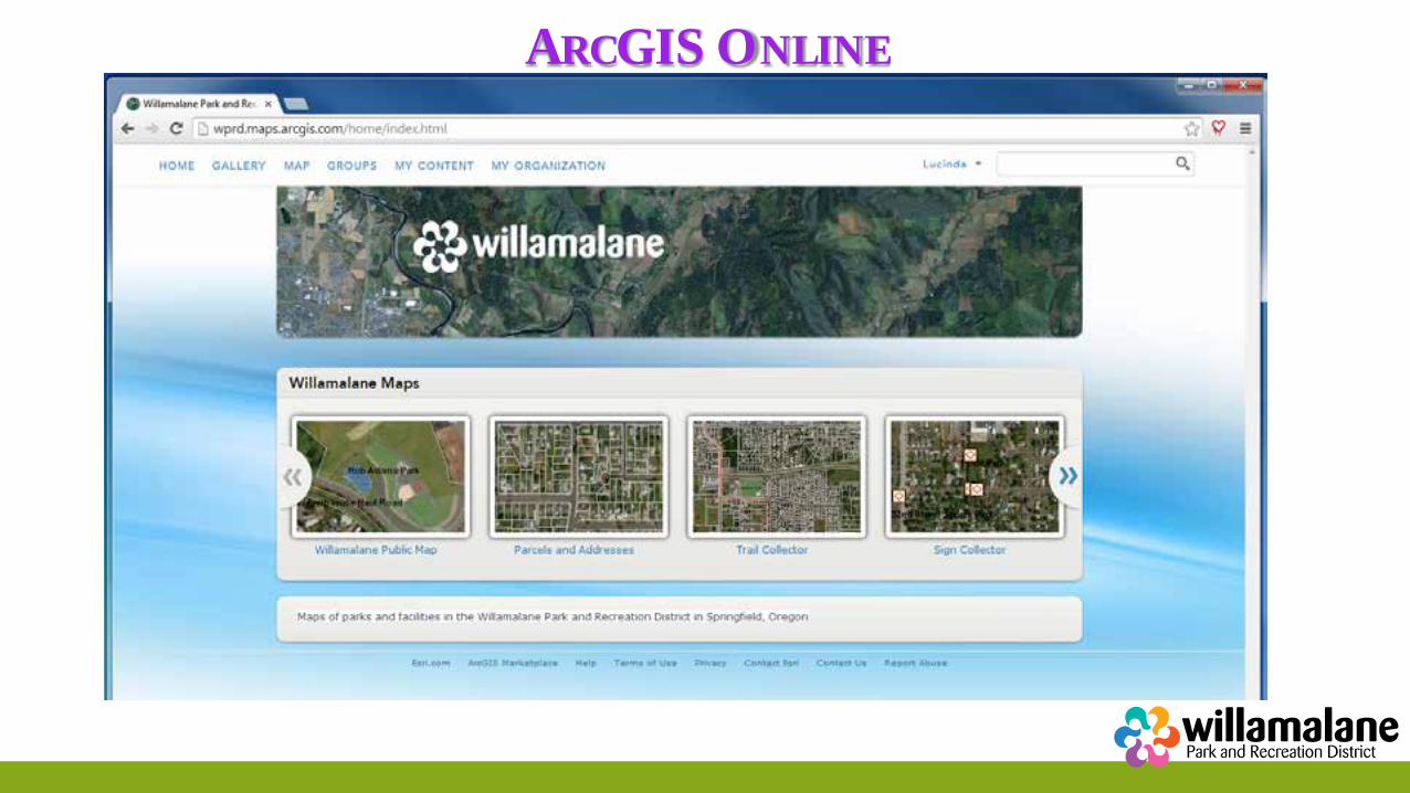
ARCGIS ONLINE ArcGIS Online: Collector (CIP)
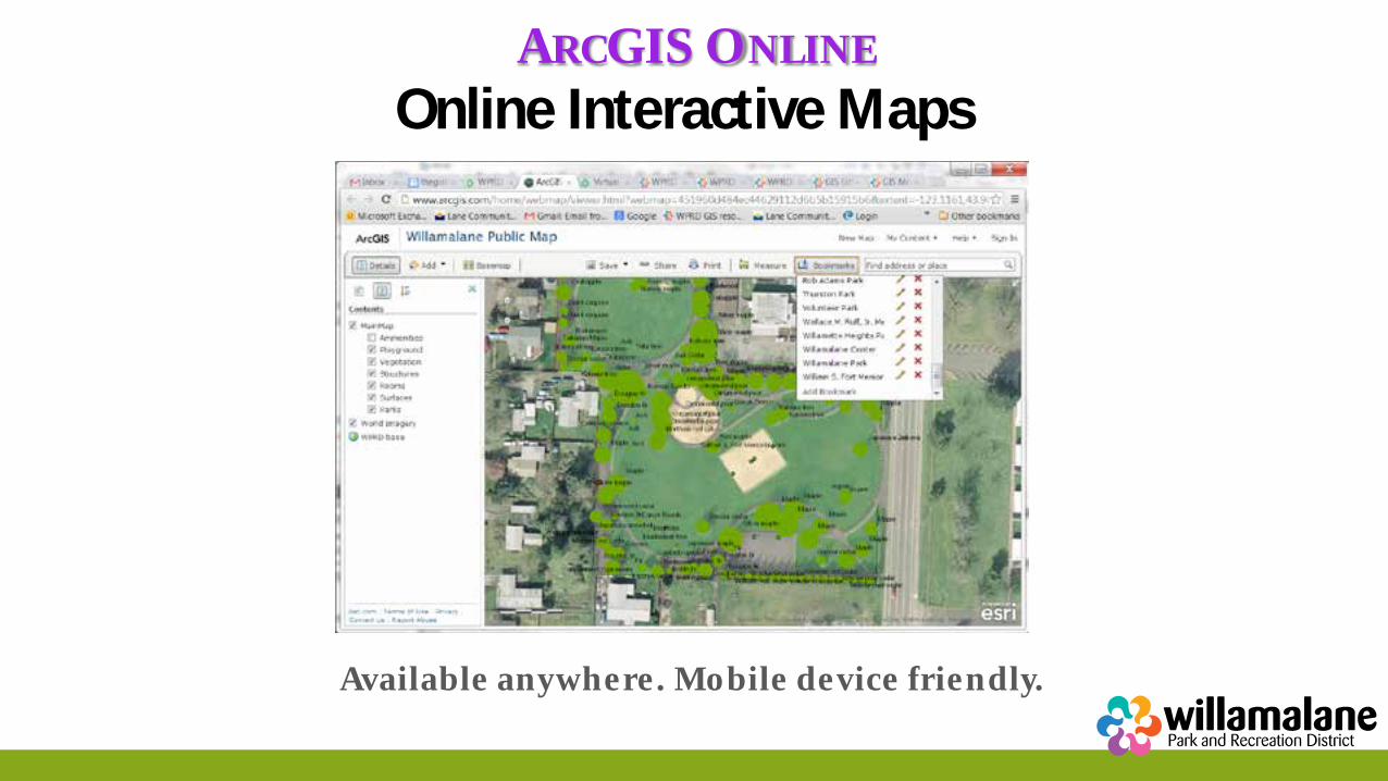
ARCGIS ONLINE Online Interactive Maps
Available anywhere. Mobile device friendly.
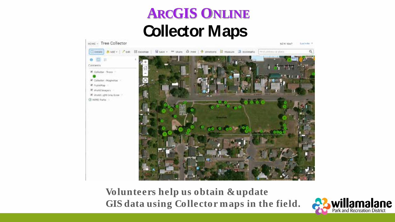
ARCGIS ONLINE Collector Maps
Volunteers help us obtain & update GIS data using Collector maps in the field.
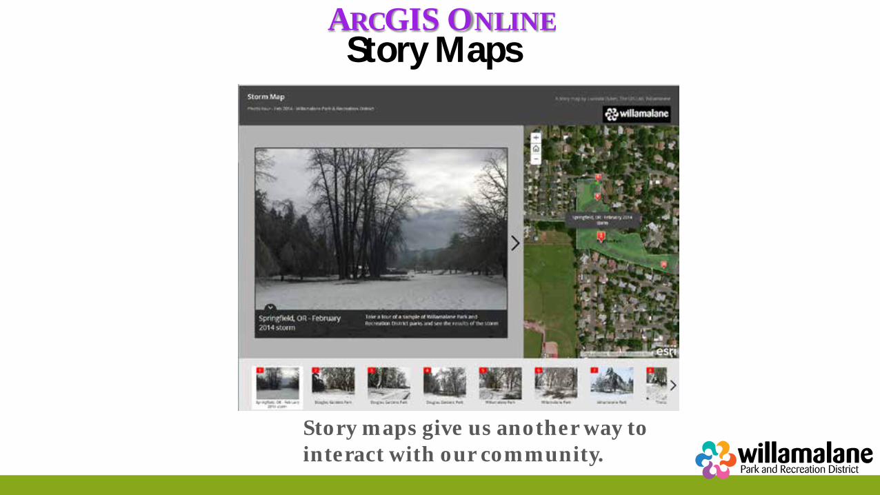
ARCGIS ONLINE Story Maps
Story maps give us another way to interact with our community.
QUESTIONS? Cityworks questions: Randi Zimmer [email protected] Cloud server questions: Ben Grieger [email protected] ArcGIS online questions: Lucinda Dykes [email protected] Or call us at the GIS Lab: (541) 736-4110