Embed Size (px)
Citation preview
GIS and Surveying Technologies Used to Map Plants at the Desert Botanical Garden:
How Does the Collector App Fit In?
Veronica NixonGIS SpecialistDesert Botanical Garden-Phoenix, AZ

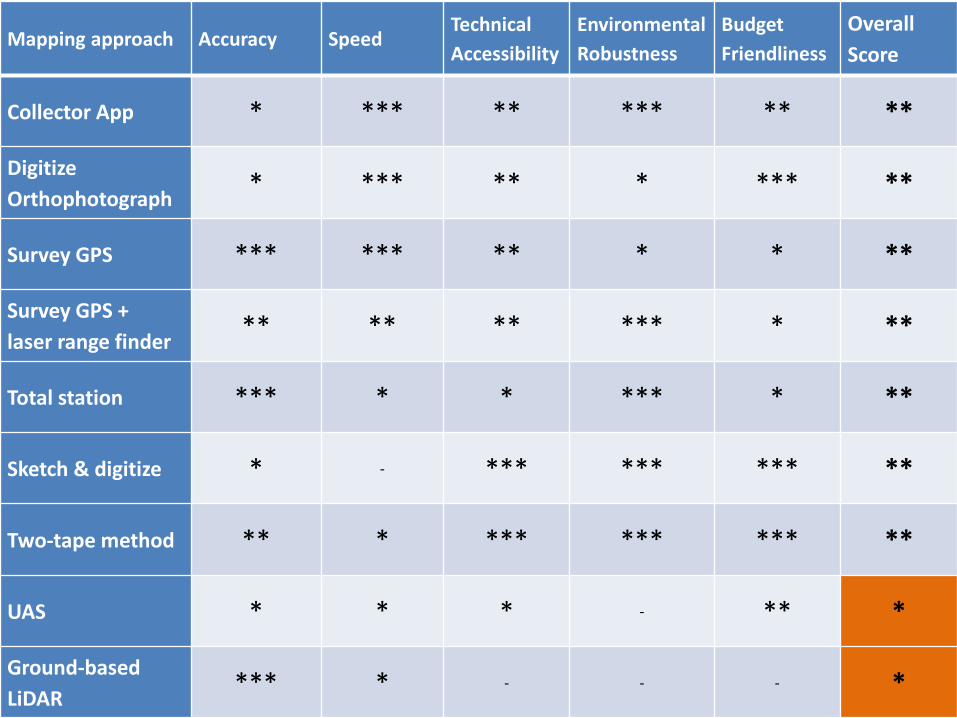
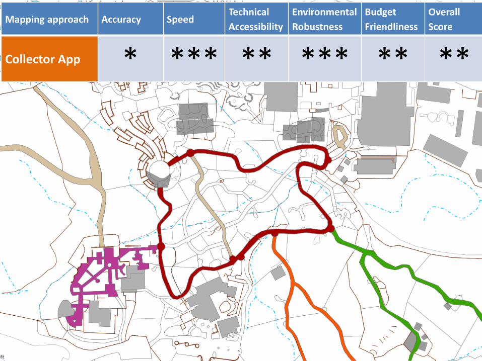
Mapping approach Accuracy SpeedTechnical Accessibility
Environmental Robustness
Budget Friendliness
Overall Score
Collector App * *** ** *** ** **
Digitize Orthophotograph * *** ** * *** **
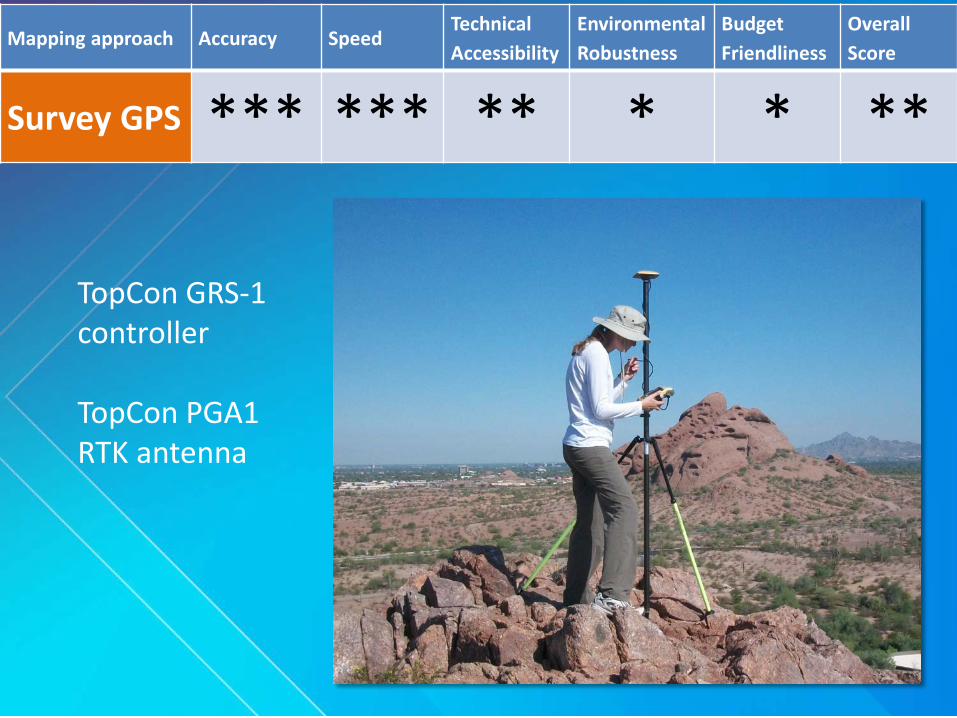
Survey GPS *** *** ** * * **
Survey GPS + laser range finder ** ** ** *** * **
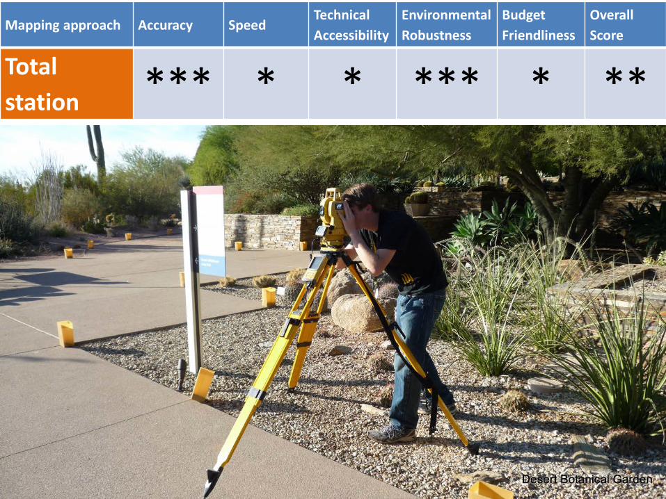
Total station *** * * *** * **
Sketch & digitize * - *** *** *** **
Two-tape method ** * *** *** *** **
UAS * * * - ** *
Ground-based LiDAR *** * - - - *
Mapping approach Accuracy SpeedTechnical Accessibility
Environmental Robustness
Budget Friendliness
Overall Score
Collector App * *** ** *** ** **
Digitize Orthophotograph * *** ** * *** **
Survey GPS *** *** ** * * **
Survey GPS + laser range finder ** ** ** *** * **
Total station *** * * *** * **
Sketch & digitize * - *** *** *** **
Two-tape method ** * *** *** *** **
UAS * * * - ** *
Ground-based LiDAR *** * - - - *
Mapping approach Accuracy SpeedTechnical Accessibility
Environmental Robustness
Budget Friendliness
Overall Score
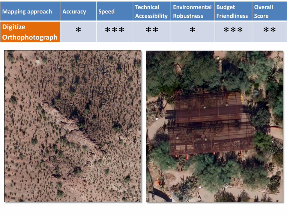
Digitize Orthophotograph * *** ** * *** **
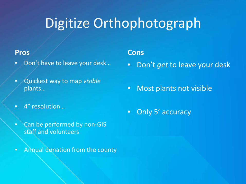
Digitize Orthophotograph
Pros• Don’t have to leave your desk…
• Quickest way to map visible plants…
• 4” resolution…
• Can be performed by non-GIS staff and volunteers
• Annual donation from the county
Cons• Don’t get to leave your desk
• Most plants not visible
• Only 5’ accuracy
Mapping approach Accuracy SpeedTechnical Accessibility
Environmental Robustness
Budget Friendliness
Overall Score
Survey GPS *** *** ** * * **
TopCon GRS-1 controller
TopCon PGA1 RTK antenna
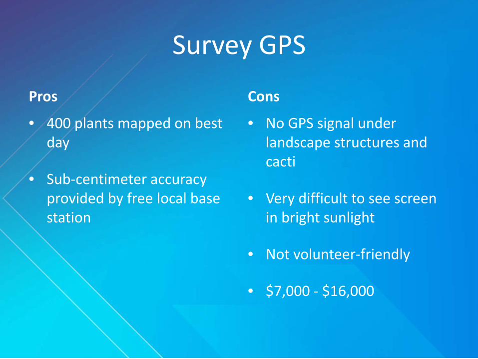
Survey GPS
Pros
• 400 plants mapped on best day
• Sub-centimeter accuracy provided by free local base station
Cons
• No GPS signal under landscape structures and cacti
• Very difficult to see screen in bright sunlight
• Not volunteer-friendly
• $7,000 - $16,000
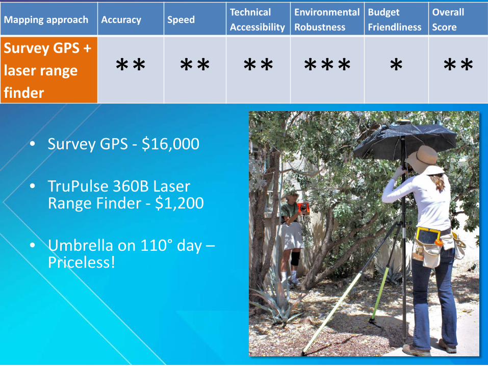
• Survey GPS - $16,000
• TruPulse 360B Laser Range Finder - $1,200
• Umbrella on 110° day –Priceless!
Mapping approach Accuracy SpeedTechnical Accessibility
Environmental Robustness
Budget Friendliness
Overall Score
Survey GPS + laser range finder
** ** ** *** * **

Survey GPS + Laser Range Finder
Pros
• 1-foot accuracy
• Works where there is no GPS signal available
Cons• Very difficult to see screen in
bright sunlight
• Very difficult to teach volunteers
• Requires two people
• $17,000+
Mapping approach Accuracy SpeedTechnical Accessibility
Environmental Robustness
Budget Friendliness
Overall Score
Total station *** * * *** * **
Insert photo of Dylan with total station.
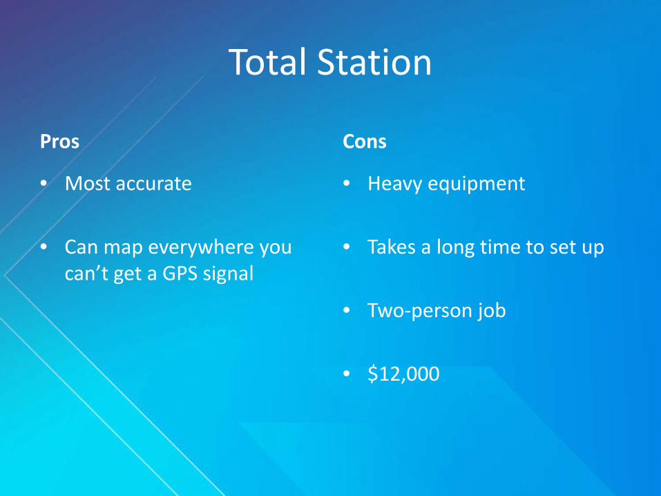
Total Station
Pros
• Most accurate
• Can map everywhere you can’t get a GPS signal
Cons
• Heavy equipment
• Takes a long time to set up
• Two-person job
• $12,000
Mapping approach Accuracy SpeedTechnical Accessibility
Environmental Robustness
Budget Friendliness
Overall Score
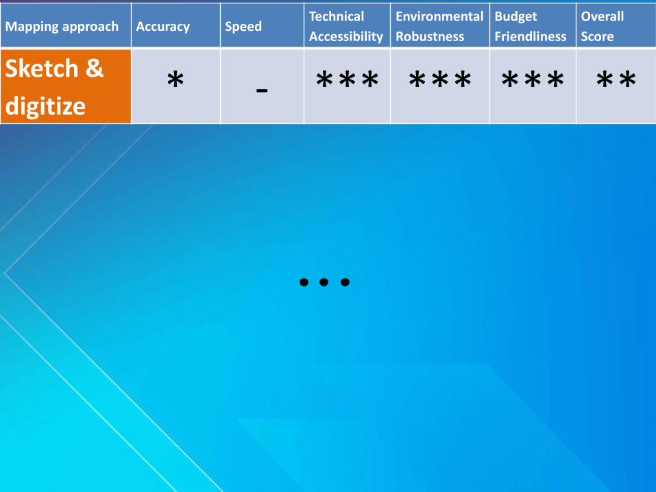
Sketch & digitize * - *** *** *** **
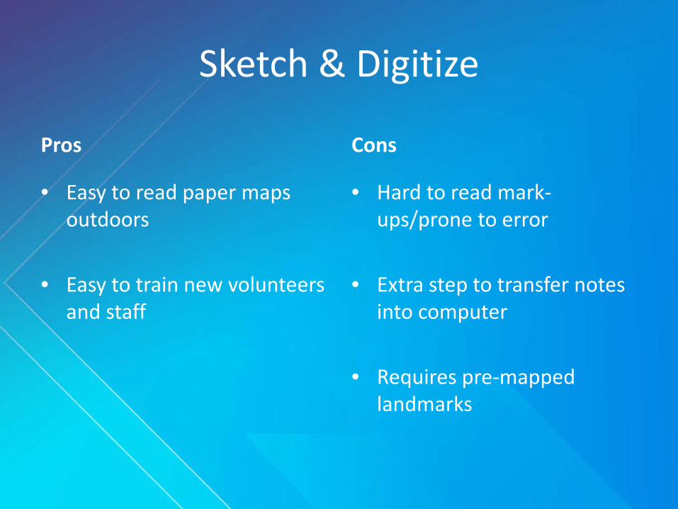
Sketch & Digitize
Pros
• Easy to read paper maps outdoors
• Easy to train new volunteers and staff
Cons
• Hard to read mark-ups/prone to error
• Extra step to transfer notes into computer
• Requires pre-mapped landmarks
Mapping approach Accuracy SpeedTechnical Accessibility
Environmental Robustness
Budget Friendliness
Overall Score
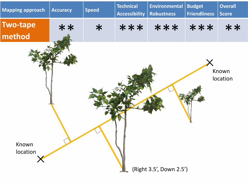
Two-tape method ** * *** *** *** **
Known location
Known location
(Right 3.5’, Down 2.5’)
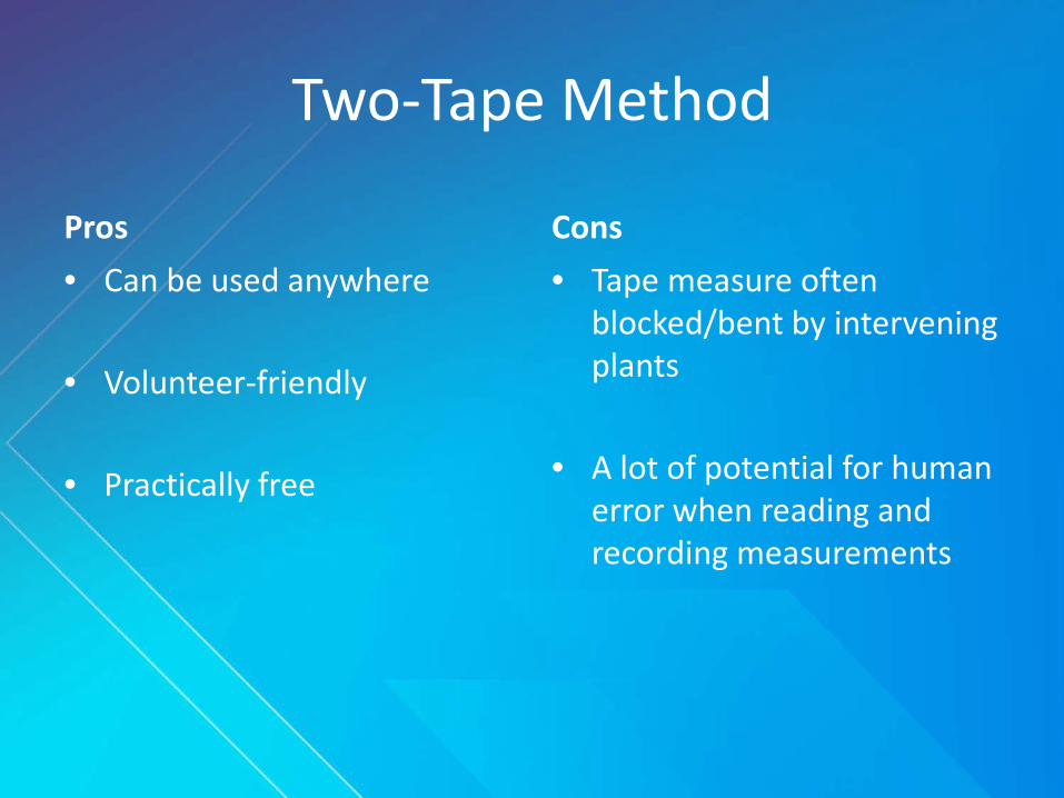
Two-Tape Method
Pros• Can be used anywhere
• Volunteer-friendly
• Practically free
Cons• Tape measure often
blocked/bent by intervening plants
• A lot of potential for human error when reading and recording measurements
Mapping approach Accuracy SpeedTechnical Accessibility
Environmental Robustness
Budget Friendliness
Overall Score
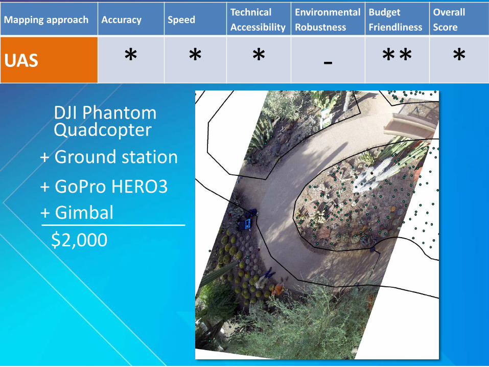
UAS * * * - ** *
+ GoPro HERO3
DJI Phantom Quadcopter
+ Gimbal$2,000
+ Ground station
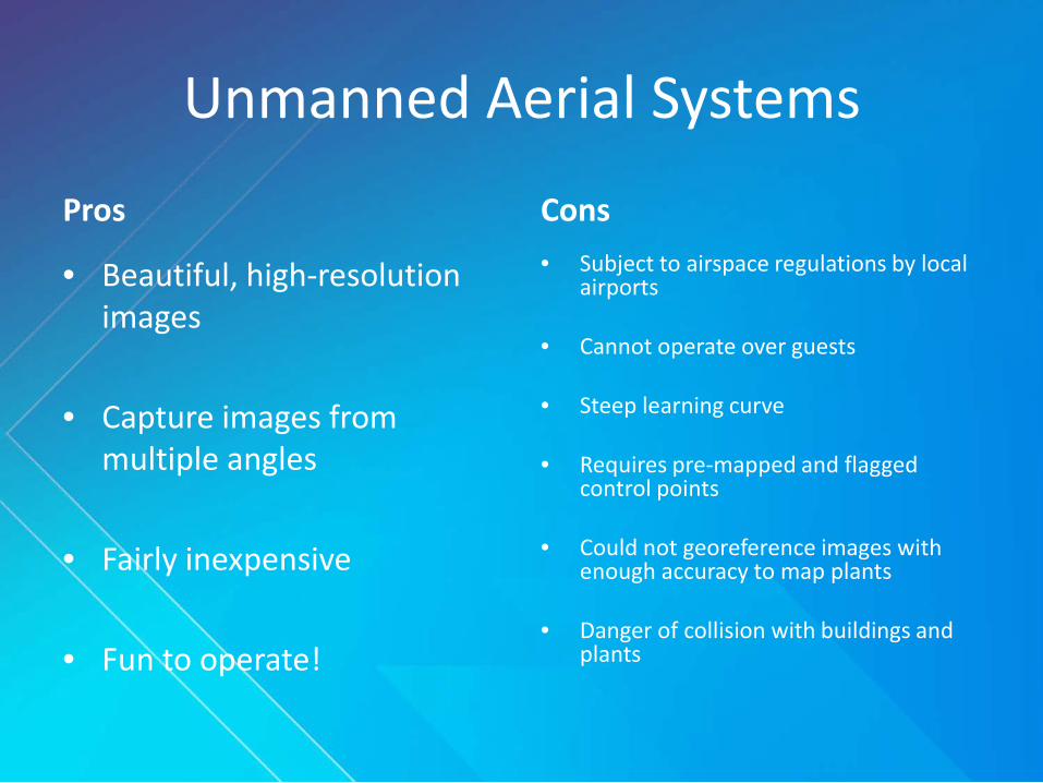
Unmanned Aerial Systems
Pros
• Beautiful, high-resolution images
• Capture images from multiple angles
• Fairly inexpensive
• Fun to operate!
Cons• Subject to airspace regulations by local
airports
• Cannot operate over guests
• Steep learning curve
• Requires pre-mapped and flagged control points
• Could not georeference images with enough accuracy to map plants
• Danger of collision with buildings and plants
Mapping approach Accuracy SpeedTechnical Accessibility
Environmental Robustness
Budget Friendliness
Overall Score
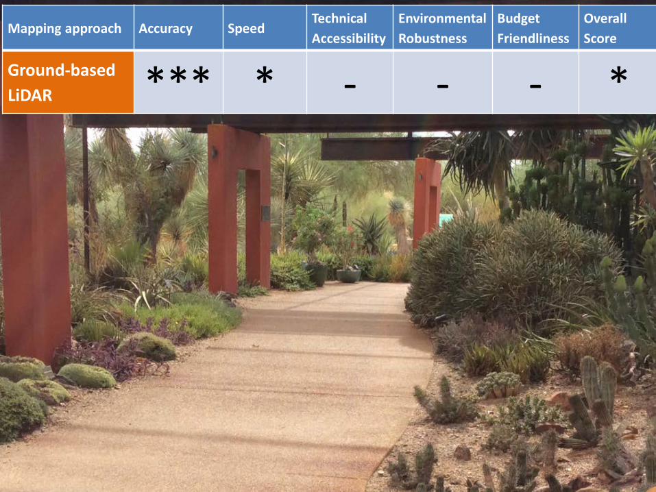
Ground-based LiDAR *** * - - - *

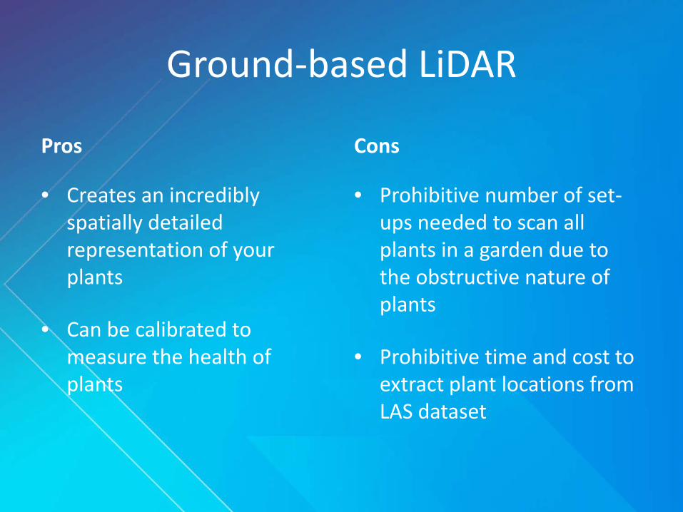
Ground-based LiDAR
Pros
• Creates an incredibly spatially detailed representation of your plants
• Can be calibrated to measure the health of plants
Cons
• Prohibitive number of set-ups needed to scan all plants in a garden due to the obstructive nature of plants
• Prohibitive time and cost to extract plant locations from LAS dataset
Mapping approach Accuracy SpeedTechnical Accessibility
Environmental Robustness
Budget Friendliness
Overall Score
Collector App * *** ** *** ** **
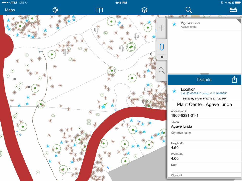
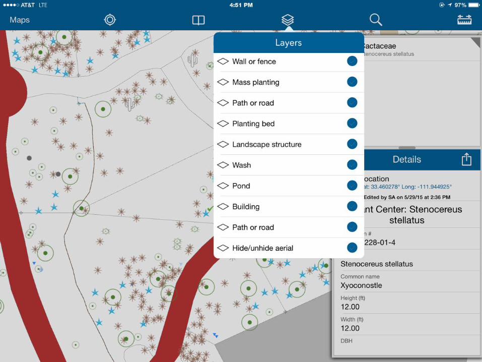
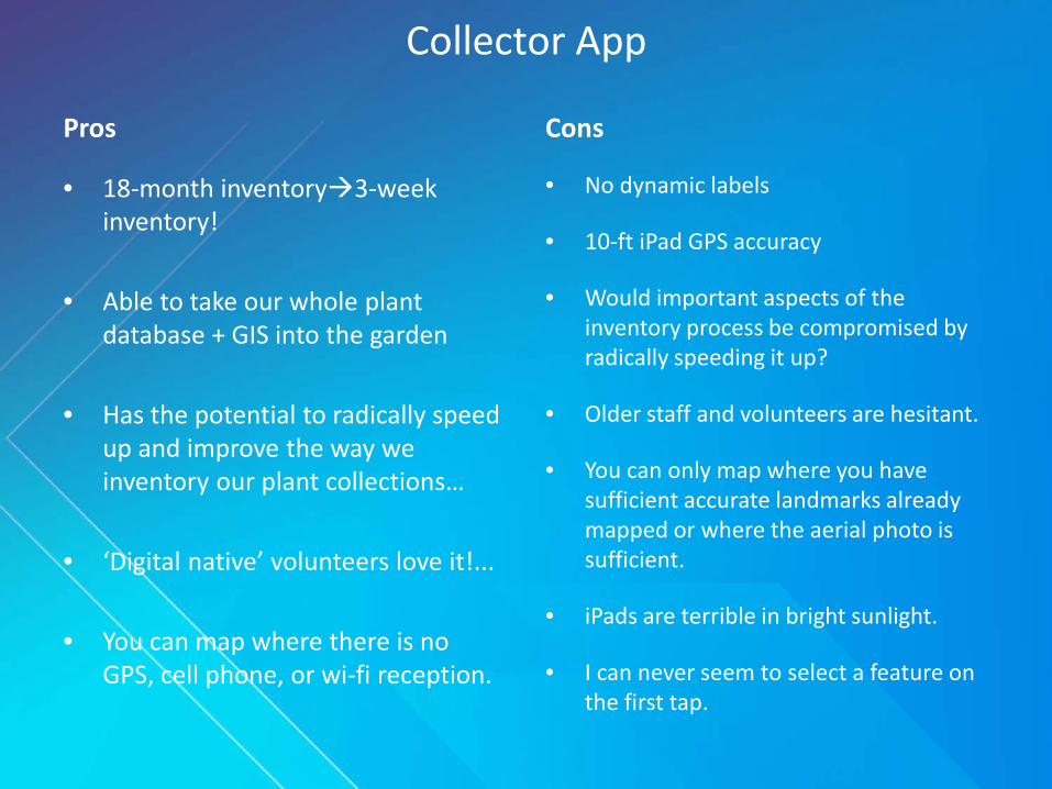
Collector App
Pros
• 18-month inventory3-week inventory!
• Able to take our whole plant database + GIS into the garden
• Has the potential to radically speed up and improve the way we inventory our plant collections…
• ‘Digital native’ volunteers love it!...
• You can map where there is no GPS, cell phone, or wi-fi reception.
Cons
• No dynamic labels
• 10-ft iPad GPS accuracy
• Would important aspects of the inventory process be compromised by radically speeding it up?
• Older staff and volunteers are hesitant.
• You can only map where you have sufficient accurate landmarks already mapped or where the aerial photo is sufficient.
• iPads are terrible in bright sunlight.
• I can never seem to select a feature on the first tap.
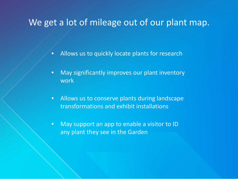
We get a lot of mileage out of our plant map.
• Allows us to quickly locate plants for research
• May significantly improves our plant inventory work
• Allows us to conserve plants during landscape transformations and exhibit installations
• May support an app to enable a visitor to ID any plant they see in the Garden
Thank you
Veronica NixonGIS SpecialistDesert Botanical Garden-Phoenix, AZ