Embed Size (px)
Citation preview
1
1 Federal AviationAdministration
Regional Workshop - AAL
October 19-20, 2011
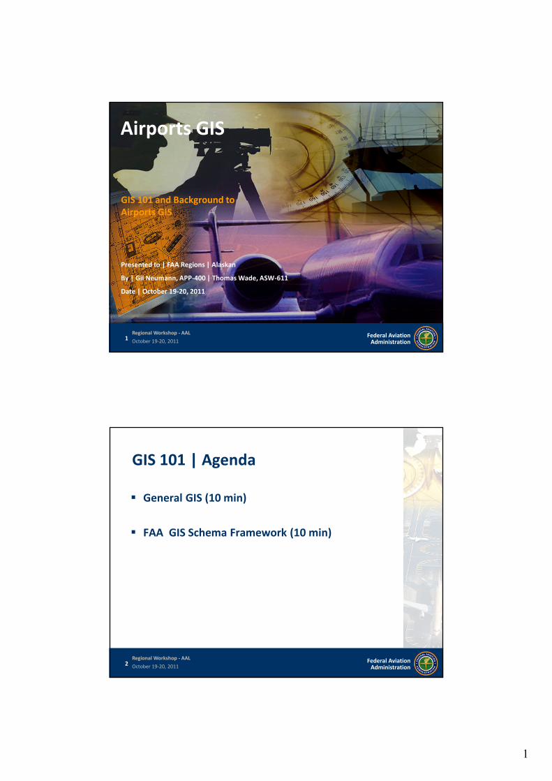
GIS 101 and Background toAirports GIS
Airports GIS
Presented to | FAA Regions | Alaskan
By | Gil Neumann, APP-400 | Thomas Wade, ASW-611
Date | October 19-20, 2011
2 Federal AviationAdministration
Regional Workshop - AAL
October 19-20, 2011
GIS 101 | Agenda
General GIS (10 min)
FAA GIS Schema Framework (10 min)
2
3 Federal AviationAdministration
Regional Workshop - AAL
October 19-20, 2011
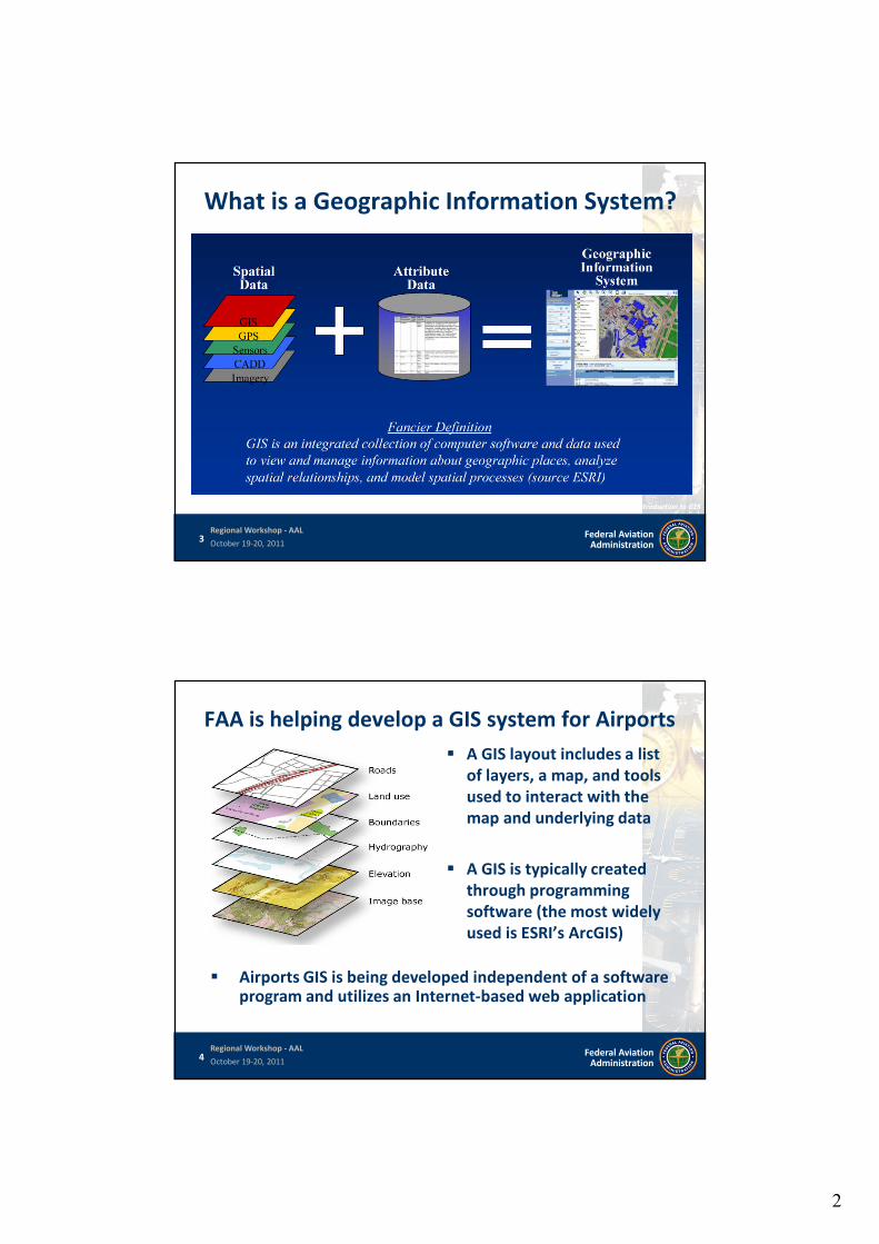
What is a Geographic Information System?
Source: 2010 AAAE-GIS Conference – Introduction to GIS
4 Federal AviationAdministration
Regional Workshop - AAL
October 19-20, 2011
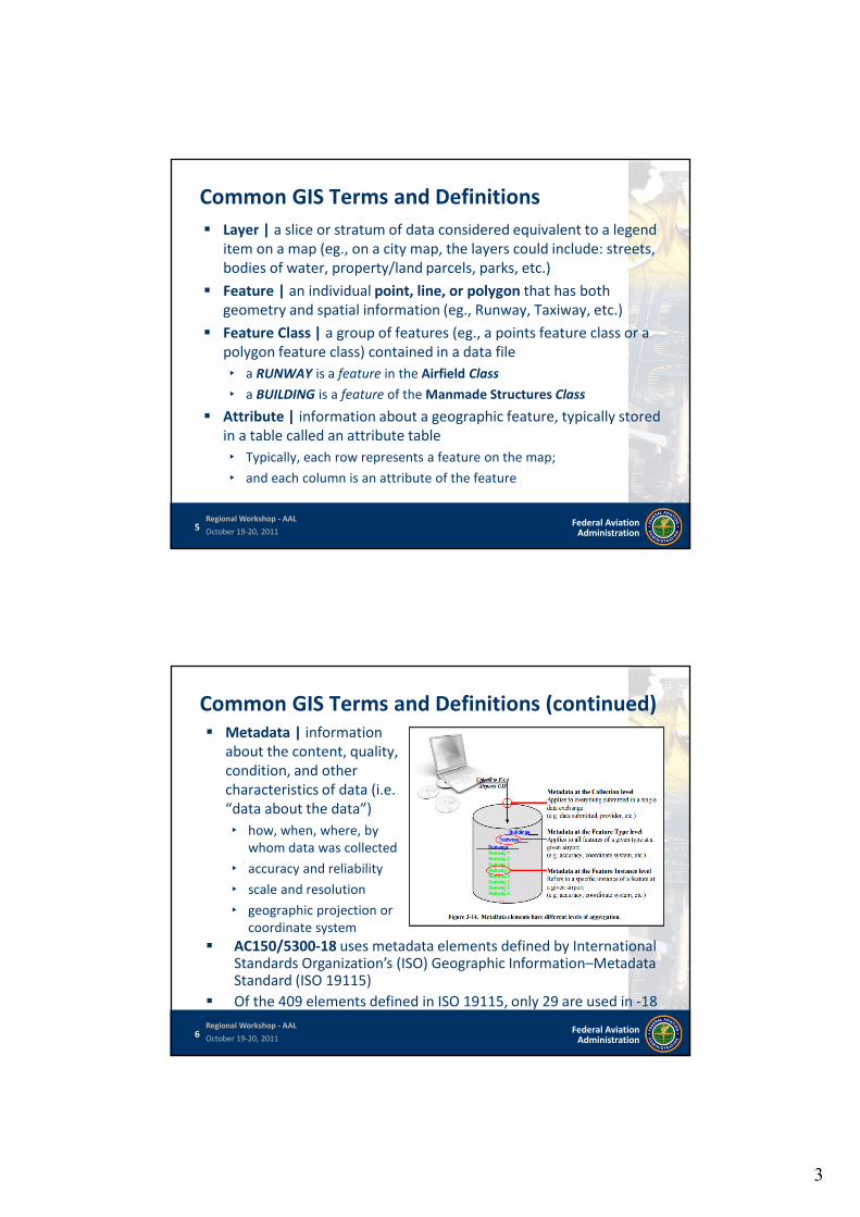
FAA is helping develop a GIS system for Airports
A GIS layout includes a listof layers, a map, and toolsused to interact with themap and underlying data
A GIS is typically createdthrough programmingsoftware (the most widelyused is ESRI’s ArcGIS)
Airports GIS is being developed independent of a softwareprogram and utilizes an Internet-based web application
3
5 Federal AviationAdministration
Regional Workshop - AAL
October 19-20, 2011
Common GIS Terms and Definitions
Layer | a slice or stratum of data considered equivalent to a legenditem on a map (eg., on a city map, the layers could include: streets,bodies of water, property/land parcels, parks, etc.)
Feature | an individual point, line, or polygon that has bothgeometry and spatial information (eg., Runway, Taxiway, etc.)
Feature Class | a group of features (eg., a points feature class or apolygon feature class) contained in a data file
‣ a RUNWAY is a feature in the Airfield Class
‣ a BUILDING is a feature of the Manmade Structures Class
Attribute | information about a geographic feature, typically storedin a table called an attribute table
‣ Typically, each row represents a feature on the map;
‣ and each column is an attribute of the feature
6 Federal AviationAdministration
Regional Workshop - AAL
October 19-20, 2011
Common GIS Terms and Definitions (continued) Metadata | information
about the content, quality,condition, and othercharacteristics of data (i.e.“data about the data”)
‣ how, when, where, bywhom data was collected
‣ accuracy and reliability
‣ scale and resolution
‣ geographic projection orcoordinate system
AC150/5300-18 uses metadata elements defined by InternationalStandards Organization’s (ISO) Geographic Information–MetadataStandard (ISO 19115)
Of the 409 elements defined in ISO 19115, only 29 are used in -18
4
7 Federal AviationAdministration
Regional Workshop - AAL
October 19-20, 2011
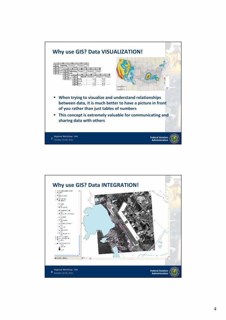
Why use GIS? Data VISUALIZATION!
When trying to visualize and understand relationshipsbetween data, it is much better to have a picture in frontof you rather than just tables of numbers
This concept is extremely valuable for communicating andsharing data with others
8 Federal AviationAdministration
Regional Workshop - AAL
October 19-20, 2011
Why use GIS? Data INTEGRATION!
5
9 Federal AviationAdministration
Regional Workshop - AAL
October 19-20, 2011
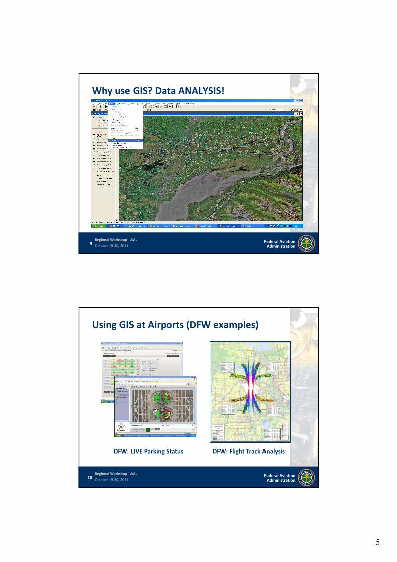
Why use GIS? Data ANALYSIS!
10 Federal AviationAdministration
Regional Workshop - AAL
October 19-20, 2011
Using GIS at Airports (DFW examples)
DFW: LIVE Parking Status DFW: Flight Track Analysis
6
11 Federal AviationAdministration
Regional Workshop - AAL
October 19-20, 2011
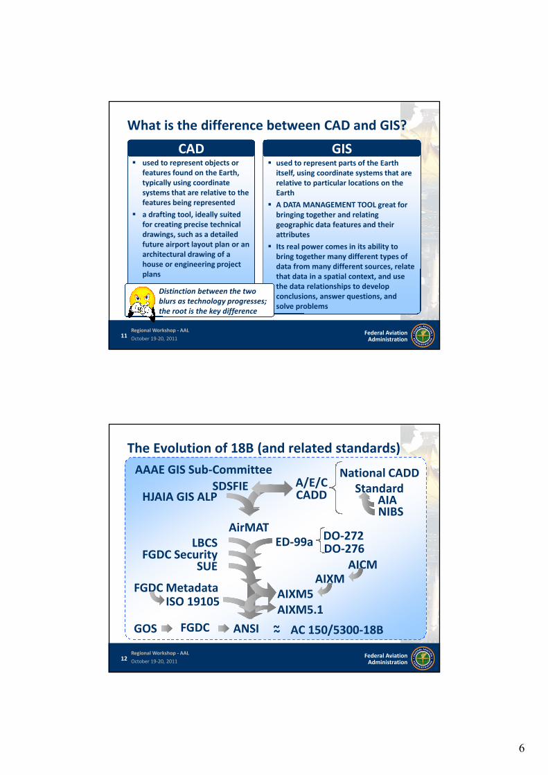
used to represent objects orfeatures found on the Earth,typically using coordinatesystems that are relative to thefeatures being represented
a drafting tool, ideally suitedfor creating precise technicaldrawings, such as a detailedfuture airport layout plan or anarchitectural drawing of ahouse or engineering projectplans
What is the difference between CAD and GIS?
CAD used to represent parts of the Earth
itself, using coordinate systems that arerelative to particular locations on theEarth
A DATA MANAGEMENT TOOL great forbringing together and relatinggeographic data features and theirattributes
Its real power comes in its ability tobring together many different types ofdata from many different sources, relatethat data in a spatial context, and usethe data relationships to developconclusions, answer questions, andsolve problems
GIS
Distinction between the twoblurs as technology progresses;the root is the key difference
12 Federal AviationAdministration
Regional Workshop - AAL
October 19-20, 2011
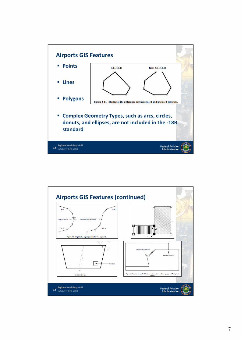
The Evolution of 18B (and related standards)
AICMAIXM
AirMAT
FGDC Metadata
DO-272
ISO 19105
DO-276ED-99a
AC 150/5300-18B
AIA
National CADDStandard
SUE
LBCSFGDC Security
NIBS
A/E/CCADD
AIXM5
GOS ANSIFGDC
SDSFIE
AAAE GIS Sub-Committee
HJAIA GIS ALP
AIXM5.1
~~
7
13 Federal AviationAdministration
Regional Workshop - AAL
October 19-20, 2011
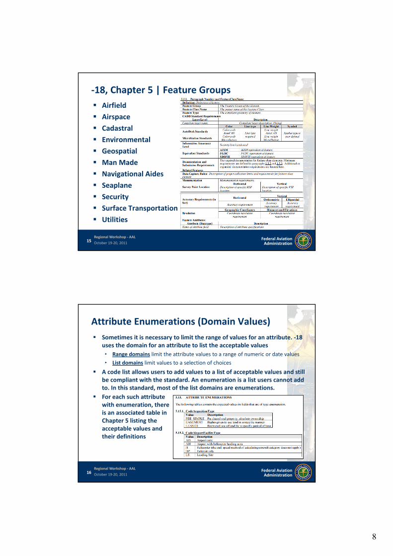
Airports GIS Features
Points
Lines
Polygons
Complex Geometry Types, such as arcs, circles,donuts, and ellipses, are not included in the -18Bstandard
14 Federal AviationAdministration
Regional Workshop - AAL
October 19-20, 2011
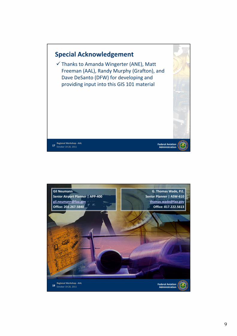
Airports GIS Features (continued)
8
15 Federal AviationAdministration
Regional Workshop - AAL
October 19-20, 2011
-18, Chapter 5 | Feature Groups
Airfield
Airspace
Cadastral
Environmental
Geospatial
Man Made
Navigational Aides
Seaplane
Security
Surface Transportation
Utilities
16 Federal AviationAdministration
Regional Workshop - AAL
October 19-20, 2011
Attribute Enumerations (Domain Values)
For each such attributewith enumeration, thereis an associated table inChapter 5 listing theacceptable values andtheir definitions
Sometimes it is necessary to limit the range of values for an attribute. -18uses the domain for an attribute to list the acceptable values
‣ Range domains limit the attribute values to a range of numeric or date values
‣ List domains limit values to a selection of choices
A code list allows users to add values to a list of acceptable values and stillbe compliant with the standard. An enumeration is a list users cannot addto. In this standard, most of the list domains are enumerations.
9
17 Federal AviationAdministration
Regional Workshop - AAL
October 19-20, 2011
Special Acknowledgement
Thanks to Amanda Wingerter (ANE), MattFreeman (AAL), Randy Murphy (Grafton), andDave DeSanto (DFW) for developing andproviding input into this GIS 101 material
18 Federal AviationAdministration
Regional Workshop - AAL
October 19-20, 2011
G. Thomas Wade, P.E.
Senior Planner | ASW-610
Office: 817.222.5613
Gil Neumann
Senior Airport Planner | APP-400
Office: 202.267.5840