Embed Size (px)
Citation preview
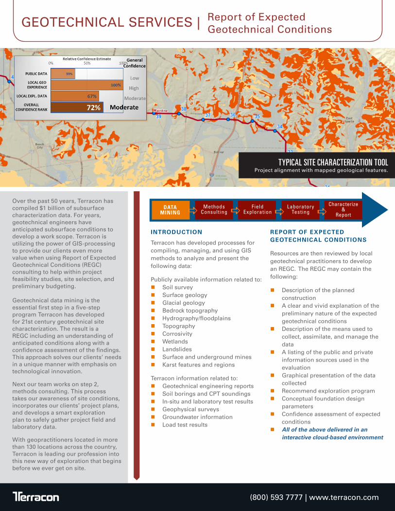
Over the past 50 years, Terracon has compiled $1 billion of subsurface characterization data. For years, geotechnical engineers have anticipated subsurface conditions to develop a work scope. Terracon is utilizing the power of GIS-processing to provide our clients even more value when using Report of Expected Geotechnical Conditions (REGC) consulting to help within project feasibility studies, site selection, and preliminary budgeting. Geotechnical data mining is the essential first step in a five-step program Terracon has developed for 21st century geotechnical site characterization. The result is a REGC including an understanding of anticipated conditions along with a confidence assessment of the findings. This approach solves our clients’ needs in a unique manner with emphasis on technological innovation.
Next our team works on step 2, methods consulting. This process takes our awareness of site conditions, incorporates our clients’ project plans, and develops a smart exploration plan to safely gather project field and laboratory data.
With geopractitioners located in more than 130 locations across the country, Terracon is leading our profession into this new way of exploration that begins before we ever get on site.
(800) 593 7777 | www.terracon.com
INTRODUCTION
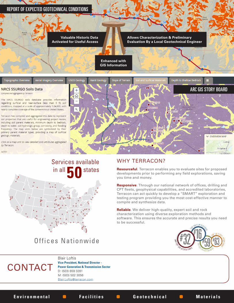
Terracon has developed processes for compiling, managing, and using GIS methods to analyze and present the following data:
Publicly available information related to: � Soil survey � Surface geology � Glacial geology � Bedrock topography � Hydrography/floodplains � Topography � Corrosivity � Wetlands � Landslides � Surface and underground mines � Karst features and regions
Terracon information related to: � Geotechnical engineering reports � Soil borings and CPT soundings � In-situ and laboratory test results � Geophysical surveys � Groundwater information � Load test results
REPORT OF EXPECTED GEOTECHNICAL CONDITIONS
Resources are then reviewed by local geotechnical practitioners to develop an REGC. The REGC may contain the following:
� Description of the planned construction
� A clear and vivid explanation of the preliminary nature of the expected geotechnical conditions
� Description of the means used to collect, assimilate, and manage the data
� A listing of the public and private information sources used in the evaluation
� Graphical presentation of the data collected
� Recommend exploration program � Conceptual foundation design
parameters � Confidence assessment of expected
conditions � All of the above delivered in an
interactive cloud-based environment
TYPICAL SITE CHARACTERIZATION TOOL Project alignment with mapped geological features.
DATAMINING
MethodsConsulting
FieldExploration
LaboratoryTesting
Characterize&
Reporta a a a
GEOTECHNICAL SERVICES | Report of Expected Geotechnical Conditions
WHY TERRACON? Resourceful. Terracon enables you to evaluate sites for proposed developments prior to performing any field explorations, saving you time and money.
Responsive. Through our national network of offices, drilling and CPT fleets, geophysical capabilities, and accredited laboratories, Terracon can act quickly to develop a “SMART” exploration and testing program providing you the most cost-effective manner to compile and synthesize data.
Reliable. We deliver high-quality, expert soil and rock characterization using diverse exploration methods and software. This ensures the accurate and precise results you need to be successful.
Valuable Historic Data Activated for Useful Access
Enhanced with GIS Information
Allows Characterization & Preliminary Evaluation By a Local Geotechnical Engineer
CONTACT
Services available in all 50 states
Off ices Nat ionwide
E n v i r o n m e n t a l F a c i l i t i e s G e o t e c h n i c a l M a t e r i a l s
ARC GIS STORY BOARD
REPORT OF EXPECTED GEOTECHNICAL CONDITIONS
Blair LoftisVice President, National Director -Power Generation & Transmission SectorD: (503) 659 3281 M: (503) 502 [email protected]