Embed Size (px)
Citation preview
Detect – Analyze - Respond
Geospatially Integrated Surveillance Systems
Kevin Campbell Vice President Sales [email protected] O: 602-424-9842 x118 www.puretechsystems.com
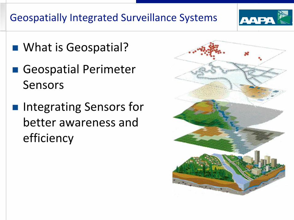
What is Geospatial?
Geospatial Perimeter Sensors
Integrating Sensors for better awareness and efficiency
Geospatially Integrated Surveillance Systems
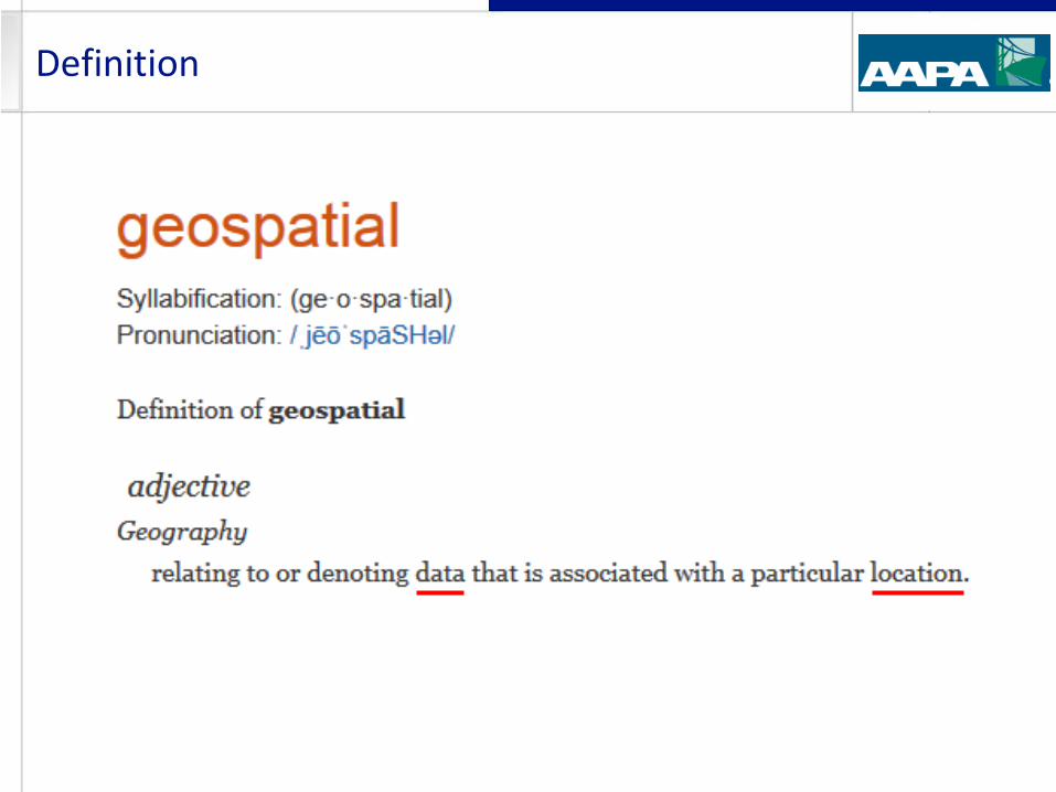
Definition
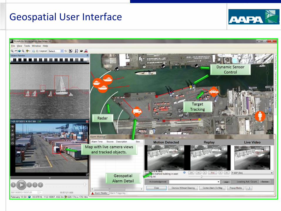
Map Based Presentation of Date (AKA GUI)
Sensor Location (Static, Often Dynamic)
Target Information (Location, Type, Distance)
Map Based control and sensor interaction
Sensor Data includes “Real World Position” data
In Real Time
And in Meta Data (Database Information)
Integrated Sensors – Sharing of positional information
Ability to use this data in real time and forensically
What Makes a Surveillance System “Geospatial?”
What Security Sensors are Considered
Geospatial?
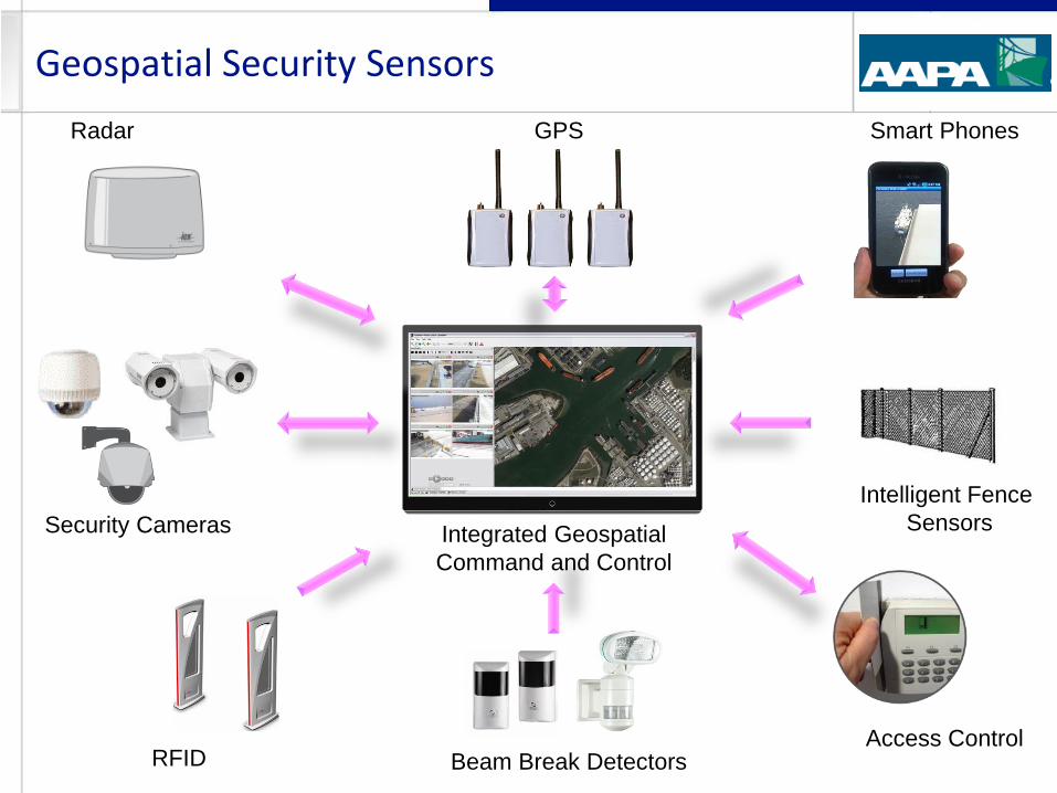
Geospatial Security Sensors
Intelligent Fence
Sensors
Radar
Security Cameras
Beam Break Detectors
GPS
Integrated Geospatial
Command and Control
Access Control RFID
Smart Phones
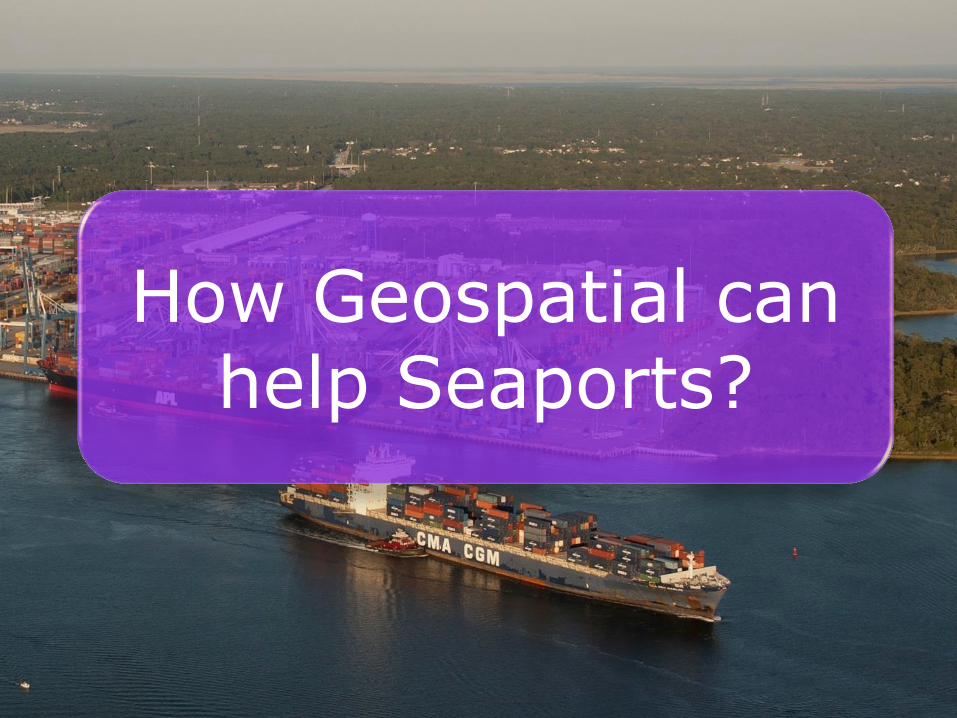
How Geospatial can help Seaports?
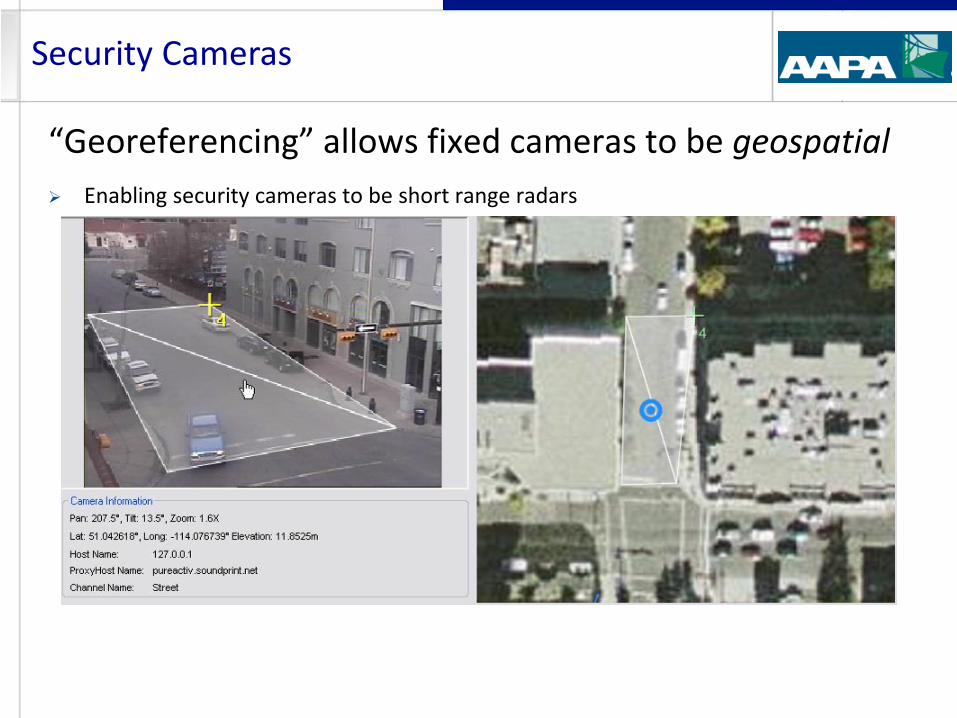
Security Cameras
“Georeferencing” allows fixed cameras to be geospatial
Enabling security cameras to be short range radars
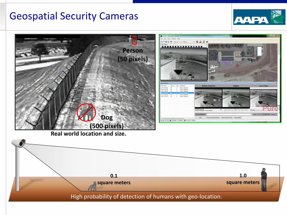
Geospatial Security Cameras
Person (50 pixels)
Dog (500 pixels)
1.0
square
meters
Real world location and size.
0.1
square
meters High probability of detection of humans with geo-location.
1.0 square meters
0.1 square meters
Security Cameras – Map Based Control
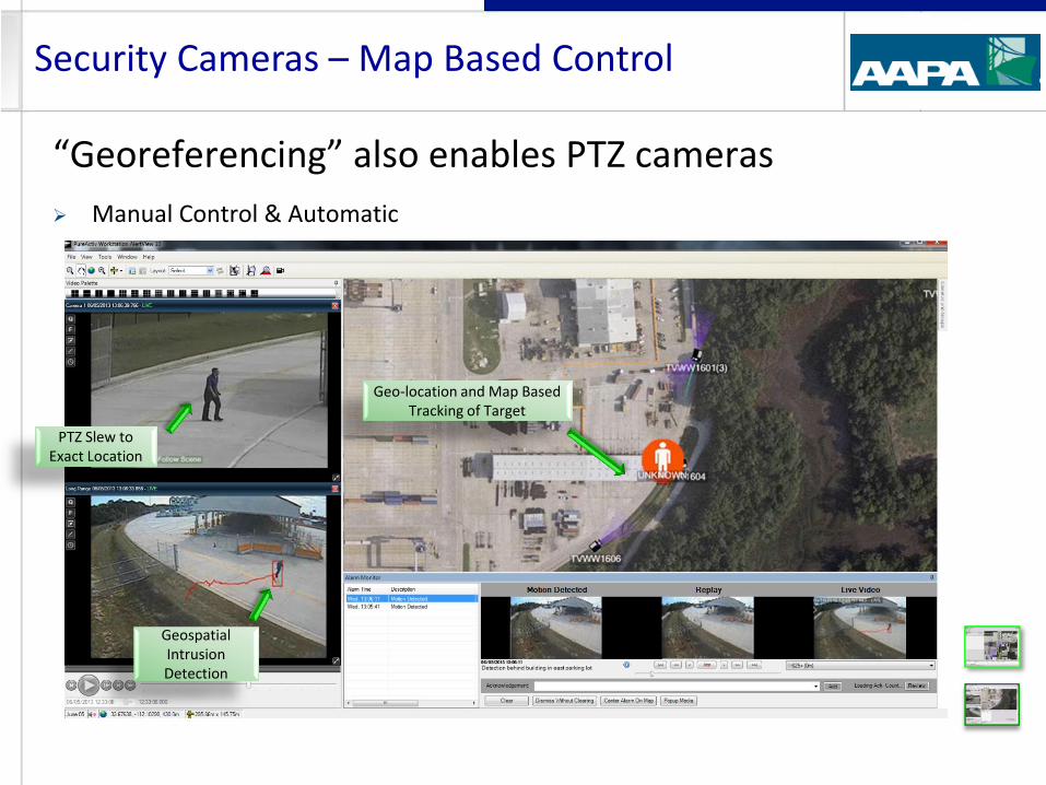
“Georeferencing” also enables PTZ cameras
Manual Control & Automatic
Geo-location and Map Based Tracking of Target
PTZ Slew to Exact Location
Geospatial Intrusion Detection
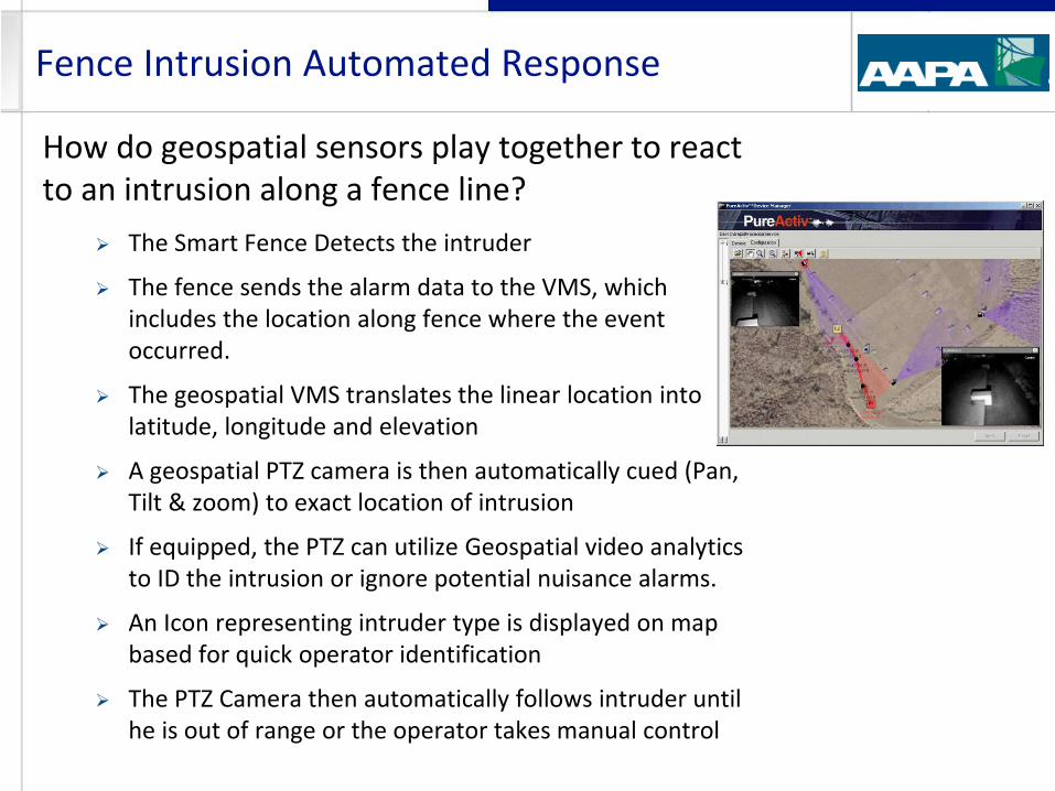
How do geospatial sensors play together to react to an intrusion along a fence line?
The Smart Fence Detects the intruder
The fence sends the alarm data to the VMS, which includes the location along fence where the event occurred.
The geospatial VMS translates the linear location into latitude, longitude and elevation
A geospatial PTZ camera is then automatically cued (Pan, Tilt & zoom) to exact location of intrusion
If equipped, the PTZ can utilize Geospatial video analytics to ID the intrusion or ignore potential nuisance alarms.
An Icon representing intruder type is displayed on map based for quick operator identification
The PTZ Camera then automatically follows intruder until he is out of range or the operator takes manual control
Fence Intrusion Automated Response
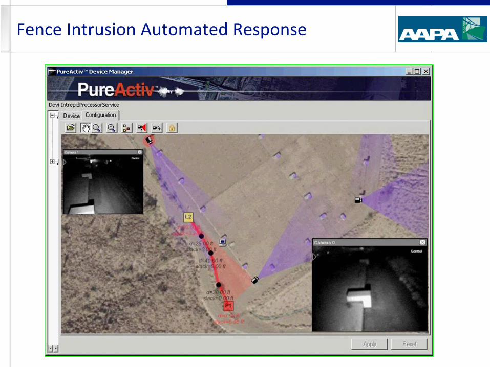
Fence Intrusion Automated Response
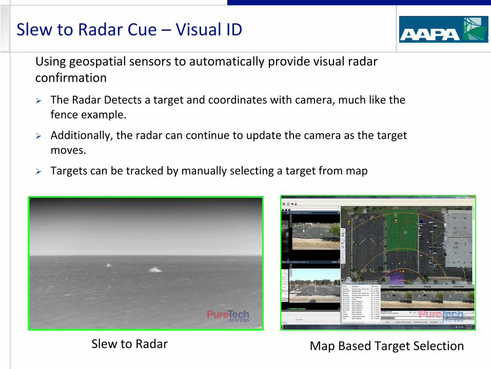
Using geospatial sensors to automatically provide visual radar confirmation
The Radar Detects a target and coordinates with camera, much like the fence example.
Additionally, the radar can continue to update the camera as the target moves.
Targets can be tracked by manually selecting a target from map
Slew to Radar Cue – Visual ID
Slew to Radar Map Based Target Selection
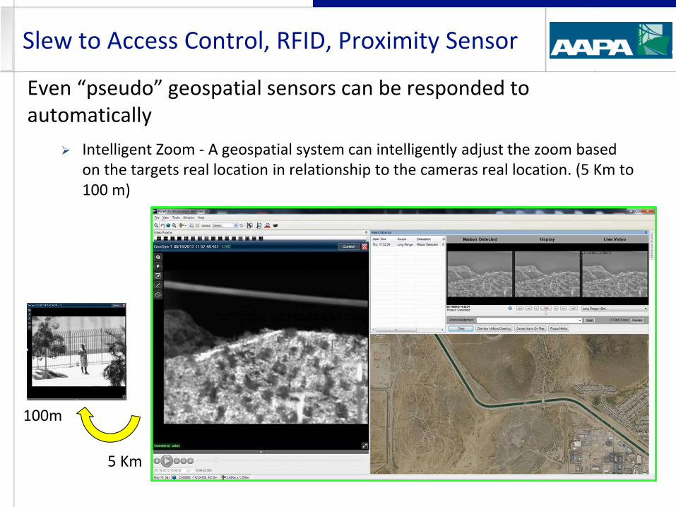
Even “pseudo” geospatial sensors can be responded to automatically
Intelligent Zoom - A geospatial system can intelligently adjust the zoom based on the targets real location in relationship to the cameras real location. (5 Km to 100 m)
Slew to Access Control, RFID, Proximity Sensor
5 Km
100m
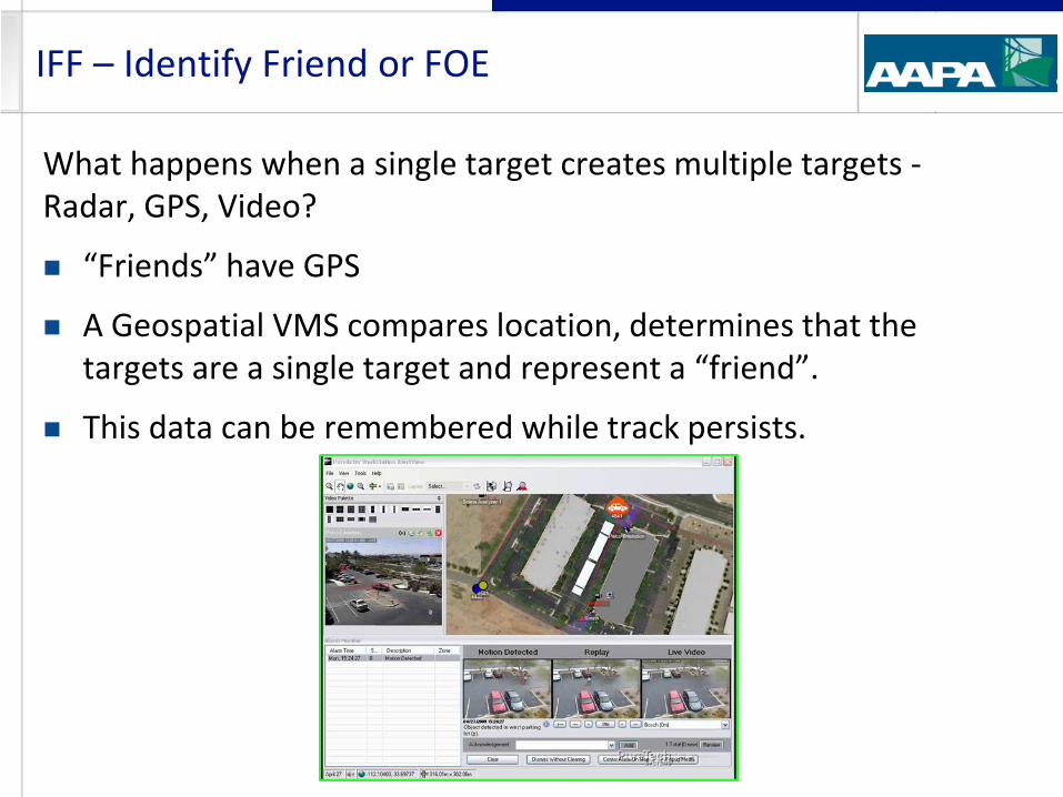
What happens when a single target creates multiple targets - Radar, GPS, Video?
“Friends” have GPS
A Geospatial VMS compares location, determines that the targets are a single target and represent a “friend”.
This data can be remembered while track persists.
IFF – Identify Friend or FOE
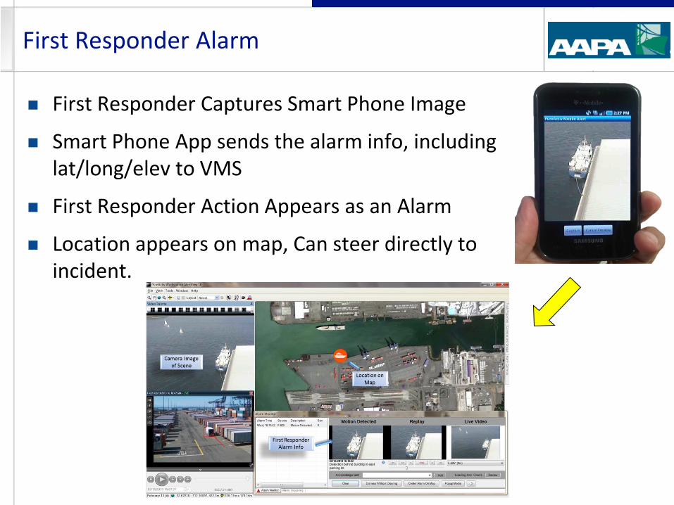
First Responder Captures Smart Phone Image
Smart Phone App sends the alarm info, including lat/long/elev to VMS
First Responder Action Appears as an Alarm
Location appears on map, Can steer directly to incident.
First Responder Alarm
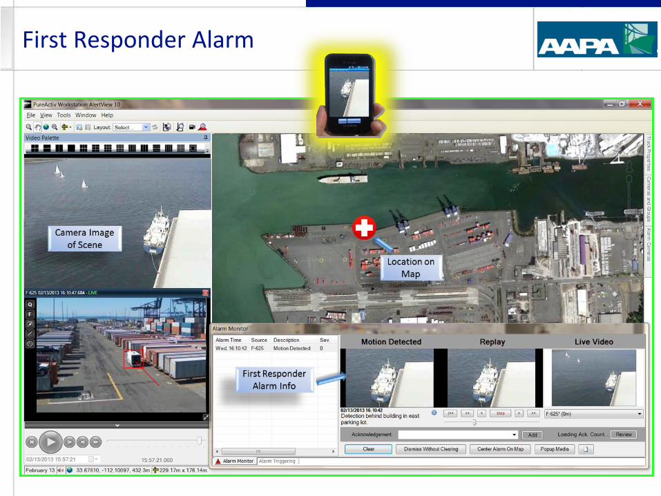
First Responder Alarm
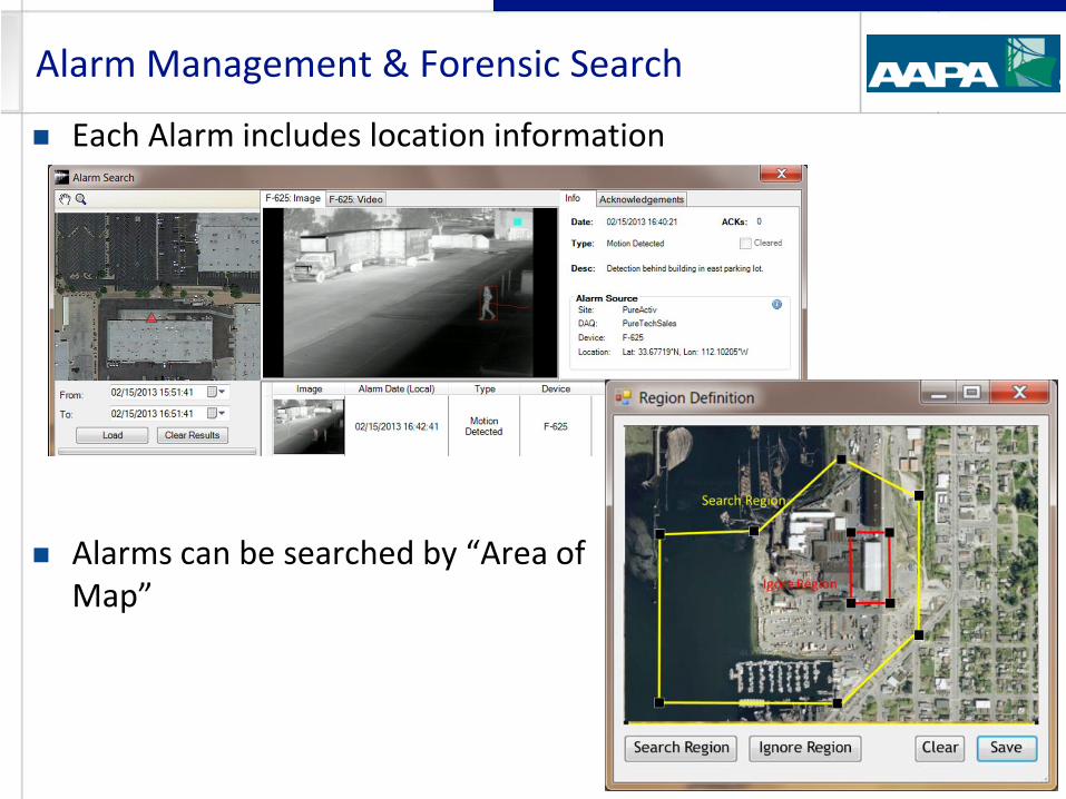
Each Alarm includes location information
Alarms can be searched by “Area of Map”
Alarm Management & Forensic Search
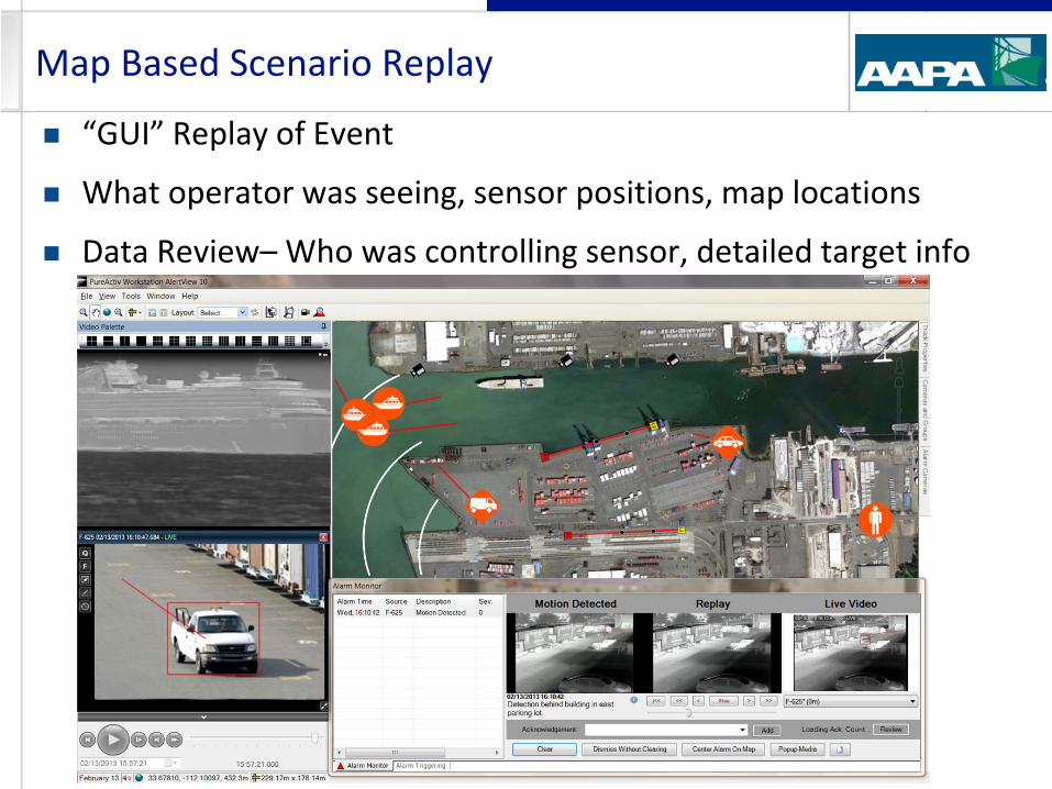
“GUI” Replay of Event
What operator was seeing, sensor positions, map locations
Data Review– Who was controlling sensor, detailed target info
Map Based Scenario Replay
Seaports have some tough security problems
Land Side, Water Side
Vast Perimeters
Many moving assets
Variety of Security Sensors
Need to quickly gain perspective of event
Need to communicate the event to others and react efficiently
Ability to review new events or research past events
Integrating Geospatial Sensors is an effective means to meet these needs
Wrap Up
Detect – Analyze - Respond
Geospatially Integrated Surveillance Systems Kevin Campbell Vice President Sales [email protected] O: 602-424-9842 x118 www.puretechsystems.com
Question?