Embed Size (px)
Citation preview
Computer Standards & Interfaces 33 (2011) 35–41
Contents lists available at ScienceDirect
Computer Standards & Interfaces
j ourna l homepage: www.e lsev ie r.com/ locate /cs i
Geospatial Resource Description Framework (GRDF) and security constructs
Ashraful Alam ⁎, Laitfur Khan, Bhavani ThuraisinghamUniversity of Texas at Dallas, Richardson, TX, USA
⁎ Corresponding author.E-mail addresses: [email protected] (A. Alam), lk
[email protected] (B. Thuraisingham
0920-5489/$ – see front matter © 2010 Elsevier B.V. Aldoi:10.1016/j.csi.2010.01.002
a b s t r a c t
a r t i c l e i n f oAvailable online 22 January 2010
Keywords:GeospatialSemantic WebData heterogeneityData aggregationGeospatial security
The Semantic Web enables an automated, ontology based information aggregation mechanism. In geographicdomain, automatic aggregation is a particularly important task in light of the over-abundance of data formatsand types. Because the formats and types are not necessarily uniform or adhere to a particular informationstructure, aggregating geospatial datawith differing formats is a challenging task. The aggregation is extremelyuseful in many areas such as business, academic, homeland security and public awareness. In this paper, wepropose a set of geospatial constructs written inWeb Ontology Language (OWL) and collectively referred to asGeographic Resource Description Framework (GRDF).Our goal is to propose a broad, semantics-aware andexpressive language for geospatial domain. The most important advantage GRDF has over other geospatiallanguages is the ability to use logical inference and dynamic content aggregation. We also publish our work onsecurity constructs for GRDF that allows domain experts and software developers to address the securityconcerns as part of the core development process instead of an ad-hoc course of action.
[email protected] (L. Khan),).
l rights reserved.
© 2010 Elsevier B.V. All rights reserved.
1. Introduction
Semantic Web enables an automated, ontology based informationaggregation mechanism. In geographic domain, automatic aggregationis a particularly important task in light of the over-abundance of dataformats and types. Because the formats and types are not necessarilyuniform or adhere to a particular information structure, aggregatinggeospatial data with differing formats is a challenging task. The aggre-gation is extremely useful in many areas such as business, academic,homeland security and public awareness. Companies rely on location-specific demographic data to create business strategies, academicresearch such as development of real-time systems benefits greatlyfrom spatiotemporal visualization, homeland security organizationsutilize geographic data to track terrorists' trail and so on. Due to thechallenge associated with aggregating heterogeneous geographic data,many of these use cases perform at a sub-optimal level. For instance, thedefense application that keeps track of information relating to enemymovement uses a different format for the stored data than theapplication that stores criminal records. A lot of intelligence data canbe extracted or inferred by combining the data from the two applica-tions, but the difference in formats gets in the way of such aggregation.
To solve geographic data heterogeneity and improve interopera-bility across multiple platforms for the data, standardized encodinglanguages have been proposed. Geographic Markup Language (GML)[19] is one of the most prominent encodingmechanisms. It is an XML-based metadata format that contains a set of schemas to encode
geospatial knowledge. The schemas define constructs for high-levelgeospatial concepts such as shape of a house or highway topology.Application developers who need more specific domain conceptsderive them from the GML constructs through XML content-derivation model. Because of the standardization process, developersand users can refer to a common definition of geospatial terms,regardless of the particular application or environment they aredealing with. Going back to the defense application, now bothmovement tracking application and criminal records application canstore geospatial component of their data in GML, allowing a muchmore seamless aggregation process than before.
However, the geospatial schemas in GML solve data heterogeneityand interoperability in geospatial domain only. The problem withinformation ‘silos’ remains despite the introduction of commonschemas. Information ‘silos’ refer to individual domains that havebecome isolated because of cross-domain data heterogeneity. Theisolated sourcesworkwell as longas there are common schemas suchasGML that the domain developers can tie their application to. However,when information starts to flow outside the boundary of the domain,the same heterogeneity and interoperability problem resurfaces. Datafrom one domain is hard to decipher by users of another domain. Thisproblem is particularly prominent on the web where large databaseswith volumes of essential information is workable only from withinthe pertinent domain; they become intractable for outside domainsto analyze in an aggregated environment. The ability of geographicapplications to inter-operate with other software and databases such aswireless applications and e-commerce is critical for national researchneeds and benefits [6].
One way to solve the problem is to have a data model for theencoding languages. This way, various domains can define their

Fig. 1. GRDF ontology diagram.
36 A. Alam et al. / Computer Standards & Interfaces 33 (2011) 35–41
schemas in a language-independent manner. The node–arc–nodemodel in the Semantic Web languages such as RDF (ResourceDescription Framework) and OWL (Web Ontology Language) providethe required language neutrality. In this paper, we propose a set ofgeospatial constructs, similar to those in GML, written in OWL andcollectively referred to as Geographic Resource Description Framework.
In this paper, ourmain contribution is a set of extensible geographicontologies that aim to cover the entire geospatial domain. Theontologies are extensible so that domain users can develop domainontologies based on GRDF. The rest of the paper is organized asfollows. In Section 2, we discuss related topics in geospatial ontologydevelopment. Section 3 introduces GRDF and its components.Sections 4 and 5 describe the two main elements of GRDF, featuremodel and geometry model, respectively. Section 6 discusses securityaspects of GRDF and the advantages of using the GRDF ontologies toenhance data safety.
2. Related work
Development of geospatial ontology is an ongoing research issueboth in computer sciences and geosciences. However, the currentresearch is aimed at developing application level ontologies thatcontain very specific and occasionally, contextual concepts. This differsfrom our approach because GRDF is viewed as a mid-level ontologyapplicable regardless of a particular application area. Arpinar et al. [1]have extended a benchmark ontology called SWETO [2] to incorporategeospatial parameters for the concepts in SWETO. However, in theirapproach, called SWETO-GS, the geospatial concepts are concrete,real-world entities extracted from individual data sources. UnlikeGRDF, the concept hierarchy evolves in a bottom-up fashion; theyfirst enumerate specific entities and then generalize them based onsimilarity criteria.
Information modelling has been used to organize concepts of aparticular domain to represent the domain information in a coherentform. Development of geographic ontologies can be viewed as a formof information modelling with a formal underlying framework. Theauthors of [4] discuss this notion abstractly and define a set of basictheories desirable in a geographic ontology. The theories help toestablish a tighter coupling between ‘intensional’ level (i.e., ontology)and ground facts (i.e., instances) so that when instance data is createdand shared, it is more efficient to capture the geospatial objects andtheir semantics. However, there is no equivalent theoretical proposalin GRDF. Of course, they can be stipulated formally through OWLproperties or as rules [5] if needed.
Due to the availability of a number of geospatial ontologies, thereis a possibility that a concept is defined using potentially differentsemantics in different ontologies. Then a geospatial client is presentedwith a dilemma of which one he or she should choose to use theconcept. The semantic heterogeneity can lead back to the same set ofproblems that ontology mechanism was supposed to solve. Unlessthe semantics are completely at a discord, this type of heterogeneityproblem can be solved with various ontology alignment techniques.Kokla and Kavouras [3] discuss concept matching techniques togroup geospatial items that refer to the same concept. The matchingprocedure is largely based on the conventional natural languageprocessing (NLP) methods such as lexical similarity or patternmatching. GRDF will lend itself very well to this work. People usingGRDF will create lower-level ontologies that belong to separateapplication domains where similar or overlapping concepts could bespecified differently. To reconcile the deviation one can use theontology alignment techniques ([6–10]) based on semantics similar-ity or the NLP methods described in [3].
There are a number of geospatial ontologies ([11–14]) that defineconcepts for specific domains or applications. The main differencebetween GRDF and these works are twofold. First and foremost, GRDFis based on a subset of first-order logic and written in OWL (Web
Ontology Language), while the others follow their own unique syntax.For instance, [15] uses XML format to aid querying geographicdata stored in a database. Second, GRDF is a mid-level ontology thatdefines the most general geospatial terms, while the latter ontologiesbelong to lower-level of the ontology hierarchy. The intent of GRDF isto allow the lower-level ontologies to bootstrap them from a commonsemantic platform. Then they can extend GRDF to definemore domainspecific concepts.
There are several initiatives ([16,17]) in the Semantic Web andgeospatial community to define geospatial concepts in a SemanticWeb language (e.g., RDF or OWL). However, some of the initiativesare incomplete or in a theoretical stage. [16] provides a very simplegeospatial vocabulary to enable users to tag or embed spatial contentsin their documents. GRDF on the other hand is a much more completelanguage that provides a broad range of geospatial constructs. Anotherrelated topic in geospatial semantics is geospatial folksonomy(e.g., [18]). Geospatial folksonomy relies on users to tag and annotatedata and services so that information can be structured. It is a collabo-rative way of organizing geospatial contents that allows people tomark information as they see fit without adhering to any particulardefinition. In contrast, ontologies such as GRDF lay out the top-levelconcepts and then users utilize these concepts to tag their data.
3. GRDF ontology
There is a direct correspondence between high-level GML schemasand GRDF ontologies. The specific content organization differsbecause OWL allows a tighter association between concepts thatbelong to the same group. Fig. 1 shows the GRDF hierarchy. The mainelements of the hierarchy are the feature and geometry model. Thefeature model describes the abstract geographic concepts whilegeometry model describes the concrete geometric shapes. Theindividual ontologies are described in the next section.
Before we delve into the details of the ontologies, a discussionabout some of the challenges faced in the design process of theontologies are presented next.
3.1. Separation of knowledge and instances
For decoupling and efficiency reasons ontology developers recom-mend separating the schema or metadata information from the actualdata. A strict ontology consists of only metadata, also referred to asknowledge, and no instances. Knowledge refers to a set of abstractconcepts while instances refer to their concrete characterization. So‘Shape’ would be the knowledge of the ‘Square’ instance. GML allowsnon-concept elements such as Null that designate absence or non-applicability of instance data. Such elements are omitted since theircorresponding meaning in OWL also is instances. We want to profileonly theGML types (simple or complex),which canbemapped toOWLknowledge base (i.e., classes, properties). The elements in the GMLschemas are there for user convenience and do not augment anymeaning to their containing concepts.
37A. Alam et al. / Computer Standards & Interfaces 33 (2011) 35–41
3.2. Modelling XML extension types
GML types that derive their content model with the XML‘extension’ mechanism (e.g., the extension base can be ‘double’)present a challenge in their conversion to OWL classes. ‘Extension’essentially, creates a subclass of the base (see MeasureType in http://schemas.opengis.net/gml/3.1.1/base/ basicTypes.xsd for a concreteexample) which can augment additional attributes and elements.However, subclassing through ‘extension’ does not necessarilytranslate to subclassing in OWL. This is particularly true if theextension base is one of the built-in XML data types. For instance,consider the GML type MeasureType in basicTypes.xsd wherethe extension base is ‘double.’ An instance of MeasureType is givenin List 1.
If we were to model it as OWL subclass of xsd:double (where xsddenotes the namespace for XML schema), then we run into theproblem of where to place the element value. Unlike XML, OWL class/type instances cannot assert the temperature value 21.23 in betweenthe open and end-tags of the type. Because of the striping nature ofthe OWL model, only way to place this in an instance is through aproperty value. Therefore, it is obvious that the most intuitive way tomodel XML extension constructs with bases referring to one of thebuilt-in data types is by creating property with range restriction set tothe base type.
3.3. Type descriptions
We provide a brief description of the types defined in the ontology.The following sections will provide more detailed analysis of the maintypes.
3.3.1. FeatureFeature represents an application object such as ‘landfill’ and
‘building’. A feature is an abstract entity in the sense that concreteinstances are instantiated from the entity.
3.3.2. GeometryGeometry type represents the spatial aspects of a feature. The
distinction between a feature and its corresponding geometricproperties, manifested via the geometry types, is important to keepin mind because majority of the GISs treat both types as one and thesame.
3.3.3. TopologyTopology is an abstract notion of defining one or more features via
unchanging geometric shapes. Unlike a geometry type instance,however, one cannot perform math on a topology instance. Thetopological components need to be “realized” by geometric counter-parts with actual coordinates to be used in calculations.
3.3.4. ValueValue is an aggregate concept for real-world values assignable to
feature properties. It is useful in encapsulating a set of concrete values(e.g., string, integer) as one object, thus enabling passing it around in acoherent fashion.
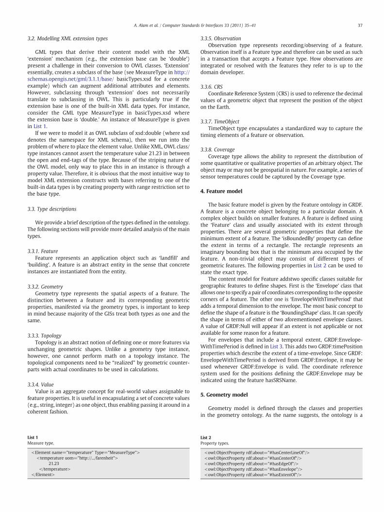
List 1Measure type.
<Element name="temperature" Type="MeasureType"><temperature uom="http://.../farenheit">
21.23</temperature>
</Element>
3.3.5. ObservationObservation type represents recording/observing of a feature.
Observation itself is a Feature type and therefore can be used as suchin a transaction that accepts a Feature type. How observations areintegrated or resolved with the features they refer to is up to thedomain developer.
3.3.6. CRSCoordinate Reference System (CRS) is used to reference the decimal
values of a geometric object that represent the position of the objecton the Earth.
3.3.7. TimeObjectTimeObject type encapsulates a standardized way to capture the
timing elements of a feature or observation.
3.3.8. CoverageCoverage type allows the ability to represent the distribution of
some quantitative or qualitative properties of an arbitrary object. Theobject may or may not be geospatial in nature. For example, a series ofsensor temperatures could be captured by the Coverage type.
4. Feature model
The basic feature model is given by the Feature ontology in GRDF.A feature is a concrete object belonging to a particular domain. Acomplex object builds on smaller features. A feature is defined usingthe ‘Feature’ class and usually associated with its extent throughproperties. There are several geometric properties that define theminimum extent of a feature. The ‘isBoundedBy’ property can definethe extent in terms of a rectangle. The rectangle represents animaginary bounding box that is the minimum area occupied by thefeature. A non-trivial object may consist of different types ofgeometric features. The following properties in List 2 can be used tostate the exact type.
The content model for Feature addstwo specific classes suitable forgeographic features to define shapes. First is the ‘Envelope’ class thatallows one to specify a pair of coordinates corresponding to the oppositecorners of a feature. The other one is ‘EnvelopeWithTimePeriod’ thatadds a temporal dimension to the envelope. The most basic concept todefine the shape of a feature is the ‘BoundingShape’ class. It can specifythe shape in terms of either of two aforementioned envelope classes.A value of GRDF:Null will appear if an extent is not applicable or notavailable for some reason for a feature.
For envelopes that include a temporal extent, GRDF:Envelope-WithTimePeriod is defined in List 3. This adds two GRDF:timePositionproperties which describe the extent of a time-envelope. Since GRDF:EnvelopeWithTimePeriod is derived from GRDF:Envelope, it may beused whenever GRDF:Envelope is valid. The coordinate referencesystem used for the positions defining the GRDF:Envelope may beindicated using the feature hasSRSName.
5. Geometry model
Geometry model is defined through the classes and propertiesin the geometry ontology. As the name suggests, the ontology is a
List 2Property types.
<owl:ObjectProperty rdf:about="#hasCenterLineOf"/><owl:ObjectProperty rdf:about="#hasCenterOf"/><owl:ObjectProperty rdf:about="#hasEdgeOf"/><owl:ObjectProperty rdf:about="#hasEnvelope"/><owl:ObjectProperty rdf:about="#hasExtentOf"/>

List 3Envelope with temporal extent.
<owl:Class rdf:about="#EnvelopeWithTimePeriod"><rdfs:subClassOf><owl:Restriction><owl:cardinality
rdf:datatype="&xsd;nonNegativeInteger">2</owl:cardinality><owl:onProperty><owl:ObjectProperty
about= http://localhost/ temporal#hasTimePosition"/></owl:onProperty>
</owl:Restriction></rdfs:subClassOf></owl:Class>
List 5Topology type.
<owl:Class rdf:about="#Face"><rdfs:subClassOf><owl:Class rdf:about="#TopoPrimitive"/>
…
<owl:maxCardinalityrdf:datatype="&xsd;nonNegativeInteger">2</owl:maxCardinality>
<owl:onProperty><owl:ObjectProperty rdf:about="#hasTopoSolid"/></owl:onProperty>
…
<owl:maxCardinalityrdf:datatype="&xsd;nonNegativeInteger">1</owl:maxCardinality>
<owl:onProperty><owl:ObjectProperty rdf:about="#hasSurface"/>
</owl:onProperty>
38 A. Alam et al. / Computer Standards & Interfaces 33 (2011) 35–41
placeholder for any concept used to define a feature's geometry.Whether it is a simple feature or a complex object consisting ofmultiple feature members, geometry ontology provides all theconstructs to specify the geometric profile of the object. The ontologyis organized in terms of complexity of the geometric forms. Ageometric form can be a trivial one-dimensional line or an intricatemesh of connecting curves.
A point is the most basic and indecomposable form of geometry.A curve is a one-dimensional form that is defined in terms of anchorpoints. A curve can be as simple as a straight-line or a multiplearcs connected at their terminal anchor points. A surface is a two-dimensional form that defines an area with three or more anchorpoints. The surface class that provides the basis for more complicatedforms included the three-dimensional geometric forms. The solidclass is used to denote a three-dimensional object's geometric shape.However, unlike the classes for the other lower dimensional forms,solid does not have its own composite types. Instead, it relies on two-dimensional classes to construct the shape.
All of the forms mentioned above can be defined as a singularentity or a multipart entity. A multipart form is basically a combi-nation of the base type enumerated in a certain geometric way. Howthey are arranged indicates the exact nature of the multipart. Thereare three types of multipart's: 1) Multi 2) Composite and 3) Complex.When a multipart entity is composed of the same base type andthere is no stipulation as to their mutual relationship, it is called Multitype. A Multi type does not allow nesting since it is a straightenumeration of the individual parts. Composite type is similar toMultitype except the individual parts have to be contiguous and nesting isallowed. So a composite type can have another composite type of thesame base form in its content model. A Complex type is the mostinvolved of the three types because it allows arbitrary combination ofthe types. The atomic parts of a Complex type can be Multi type,Composite type and even Complex type. Complex types are more of aconvenience construct for users to define their own types that maynot be composed of a unique geometric form.
The individual parts are defined through the range values ofproperties. In List 4, we illustrate how a curve can take on one of theabove multipart.
There is no such thing called ComplexCurve since a curve cannottake on a non-curve form. However, an application domain can definea shape that is composed of CompositeCurve and MultiSurface.Geometry ontology also defines a concept called ‘Ring’ that is similarto Multi type except it is restricted to have straight-lines or curves inits content model.
List 4Complex type.
<owl:Class rdf:about="#Curve"/><owl:Class rdf:about="#MultiCurve"/><owl:Class rdf:about="#CompositeCurve"/><owl:ObjectProperty rdf:about="#curveMember"/>
6. Topology model
Topology in simple terms refers to the study of topological con-structions such as surface, sphere etc. There are many GIS modellingoperations that do not assume a pre-requisite of the existenceof coordinates; instead the connectivity information is enough toperform these operations. The topology model in GRDF is definedthrough the classes and properties in topology ontology. Sincetopology is such a distinct branch of geometrical spaces, we havedecided to model the ontological elements of topology in a separateontology. Topological constructions such as nodes or faces are said tobe realized when they are modelled in terms of concrete geometricforms. For instance, a node is modelled as a point, an edge is modelledas a curve, a face is modelled as a surface, a TopoSolid is modelled assolid etc. It is important to note that the underlying geometric formsare defined in the geometry model and as such topology model ismore of an abstraction of geometric objects with a direct relianceon the concrete ontologies. This is a direct result of the fact thattopological objects are obstinate against “deformations, stretchingsand twistings” ([22]).
In commensurate with other ontologies, the base class of topologyis the RootGRDFObject. The next class in the hierarchy Topologyclass has five subclasses directly underneath in its hierarchy:1) TopoPrimitive 2) TopoCurve 3) TopoSurface 4) TopoVolume5) TopoComplex. Topology primitives are the smallest units onwhich higher dimensional topological constructions are based on.Primitives can be isolated by other primitives with co-dimension of2 or more. The primitives are consisted of the following classes:Edge, Face, and Node (List 5).
A face (as defined above in XML/RDF form) represents a surfaceoverlap and given a positive (clockwise) negative (counter-clock-wise) orientation. It is a 2-dimensional primitive bounded by a set ofdirected edges. Then there is a set of topological constructs that areisomorphic to their corresponding geometric concrete types. ATopoCurve is isomorphic to a geometric curve, whereas a TopoSurfaceis isomorphic to a geometric surface. The rationale behind the use ofthese constructs is to non-trivially represent the concrete types whenthere is a structural relationship with the more abstract topologicalconstructs. For instance, a 3-D sphere might need to be represented interms of, among other things, a TopoVolume to convey the structuralrelationship to a GIS modelling operation (Fig. 2).
TopoComplex is perhaps the most involved of all the constructssimply because it contains other types of primitives connected in a
…
<owl:minCardinalityrdf:datatype="&xsd;nonNegativeInteger">1</owl:minCardinality>
<owl:onProperty><owl:ObjectProperty rdf:about="#hasEdge"/>
</owl:onProperty>…
</owl:Class>

Fig. 2. Topology model.
List 6Sample hydrology data in GRDF.
<rdf: Description about="#VECTOR.VECTOR.HYDRO_STREAMS_CENSUS_line">
<app:hasObjectID>11070</ app:hasObjectID ><grdf:Feature><grdf:LineString srsName="http://.../TX83-NCF">
<grdf:coordinates>2533822.17263276,7108248.82783879 …
</gml:coordinates></grdf:LineString>
</grdf:Feature></rdf:Description>
List 7Sample chemical site data in GRDF.
<app:ChemSite rdf:about="#NTEnergy><app:hasSiteName> North Texas Energy</app:hasSiteName>
<app:hasSiteId> 004221</ app:hasSiteId ><grdf:BoundedBy srsName="http://.../TX83-
NCF"><grdf:coordinates> …
</grdf:coordinates></grdf:BoundedBy>
<app:hasChemicalInfordf:resource="#NTChemInfo"/>
</app:ChemSite><app:ChemInfo rdf:ID="NTChemInfo">
<app:chemical><app:hasChemName> Sulfuric Acid
</app:hasChemName><app:hasChemCode> 121NR</app:hasChemCode>
…
39A. Alam et al. / Computer Standards & Interfaces 33 (2011) 35–41
discontinuous fashion. A TopoComplex is contained within a singlemaximal complex (top-level super complex) and might contain othersub-complexes and primitives. The sub-complexes and primitiveshave lesser dimension than the TopoComplex itself.
7. Security context for GRDF
A significant aspect that can strongly affect the future direction ofGIS systems is the security concern for geospatial data. Currently,space satellites can capture images to a level of resolution that can beconsidered privacy breaches for public. A future is foreseeable whenthird party integration site will act as the mediator that lets clientsaccess scattered resources in a coherent, intelligent manner. There aresensitive geological data that owning organizations might bereluctant to expose to public use because of potential abuse. A thirdparty can provide a uniform, controlled access to such sites. But thisframework requires the third party to be trustworthy, and noteverybody would be ready to put such trust on the third party. Theemerging data clearinghouse infrastructure also poses a similarsecurity problem. Located across the globe, the clearinghouses containvolumes of data that are highly significant for research and practicalapplications, yet lack of a coherent security framework reduces theavailability of the data to potential users.
The security concerns need to be mitigated through an efficientmechanism without giving up on the powerful capabilities ofintegrated GIS's. With the evolution of thousands of geospatialclearinghouses, the methods for geospatial data exchange is shiftingfrom localized query retrievals to online process request and responsethrough web services. Geospatial Web Services service client queriesto access and modify various kinds of possibly distributed andheterogeneous geographic data sets. The phases of the web serviceprocessing such a composition have to be secure. However, securingweb services as well as handling data semantic heterogeneity whileintegrating heterogeneous geospatial data sources is beyond thescope of this proposal. In general, the user request is processed bythe web service and data access is mediated by the policy layer. Thesecurity policies have to be enforced and only the authorized data isretrieved and returned to the user. In the case of multiple geospatialdata servers, each nodemay enforce its own set of policies as specifiedand enforced by the policy framework. Data access by a web service ismediated by some sort of broker and the request is then sent todifferent locations. If the combination of policies from participatingsystems is inconsistent, additional rules may be needed to resolveconflicts.
GeoXACML [21] is an emerging security policy framework that canhandle client requests to web services over heterogeneous anddistributed data. However, it views geographic resources as objectsthat can be associated with either a class or instance of the class. As
such, it is unable to provide a fine-grain access control. For instance,consider granting access to a Building object to a user. The conferredprivilege is going to allow a user to access all the Building propertiesincluding height, extent, exit doors, and location of telecom towers,some of which should be intended only for building security personnel.Our goal is to propose a security framework that can handle securityfor geospatial applications in a wide-range of contexts.
7.1. A detailed scenario
The following scenario describes a water contamination incidentin a chemical plants zone. This scenario illustrates the need for acomprehensive geospatial security mechanism with fine-grain accesscontrol over resources. We use two databases which are populatedfrom two different geospatial data sources. One of them storeshydrology topology information of north central Texas includingaggregated streams, creeks and lakes data. The hydrology topologyand the associated metadata are available from North Central TexasCouncil of Governments ([20]). The other database houses chemicalinformation stored in various chemical facilities located in overtwenty states. Chemical sites location, types of chemicals reservedin their repository, chemical codes and contacts of site personnel arethe primary sources of data for this data store. Since most of thechemicals are in commercial use, emergency responders requirevarious levels of access to this repository. Unlike the open geography-centric hydrology topology, the nature of chemical data introducesa considerable need for secure access mechanism for the data. Lists 6and 7 show sample data from the hydrology and the chemicalrepository, respectively.
Since the facilities discharge waste products into the sewage, anon-site investigation is conducted to ascertain which area is affected
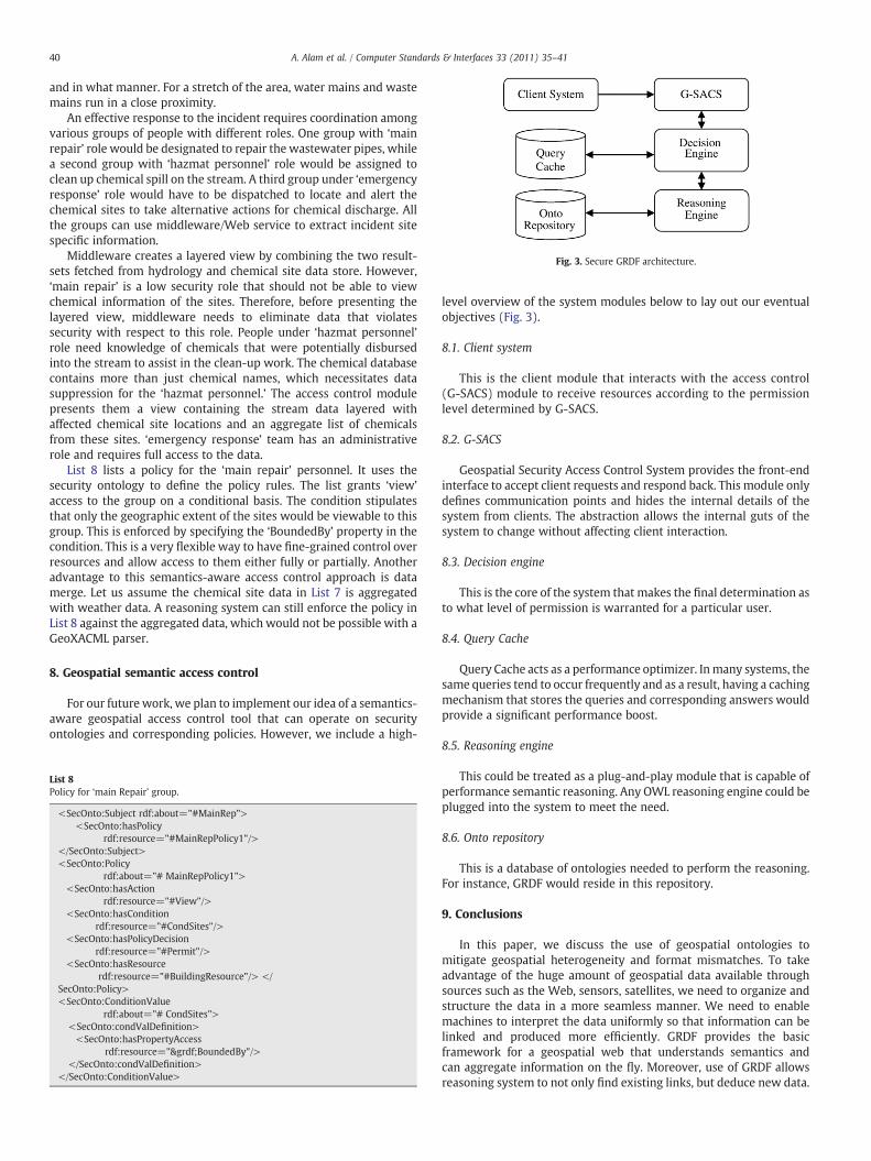
Fig. 3. Secure GRDF architecture.
40 A. Alam et al. / Computer Standards & Interfaces 33 (2011) 35–41
and in what manner. For a stretch of the area, water mains and wastemains run in a close proximity.
An effective response to the incident requires coordination amongvarious groups of people with different roles. One group with ‘mainrepair’ role would be designated to repair the wastewater pipes, whilea second group with ‘hazmat personnel’ role would be assigned toclean up chemical spill on the stream. A third group under ‘emergencyresponse’ role would have to be dispatched to locate and alert thechemical sites to take alternative actions for chemical discharge. Allthe groups can use middleware/Web service to extract incident sitespecific information.
Middleware creates a layered view by combining the two result-sets fetched from hydrology and chemical site data store. However,‘main repair’ is a low security role that should not be able to viewchemical information of the sites. Therefore, before presenting thelayered view, middleware needs to eliminate data that violatessecurity with respect to this role. People under ‘hazmat personnel’role need knowledge of chemicals that were potentially disbursedinto the stream to assist in the clean-up work. The chemical databasecontains more than just chemical names, which necessitates datasuppression for the ‘hazmat personnel.’ The access control modulepresents them a view containing the stream data layered withaffected chemical site locations and an aggregate list of chemicalsfrom these sites. ‘emergency response’ team has an administrativerole and requires full access to the data.
List 8 lists a policy for the ‘main repair’ personnel. It uses thesecurity ontology to define the policy rules. The list grants ‘view’
access to the group on a conditional basis. The condition stipulatesthat only the geographic extent of the sites would be viewable to thisgroup. This is enforced by specifying the ‘BoundedBy’ property in thecondition. This is a very flexible way to have fine-grained control overresources and allow access to them either fully or partially. Anotheradvantage to this semantics-aware access control approach is datamerge. Let us assume the chemical site data in List 7 is aggregatedwith weather data. A reasoning system can still enforce the policy inList 8 against the aggregated data, which would not be possible with aGeoXACML parser.
8. Geospatial semantic access control
For our future work, we plan to implement our idea of a semantics-aware geospatial access control tool that can operate on securityontologies and corresponding policies. However, we include a high-
List 8Policy for ‘main Repair’ group.
<SecOnto:Subject rdf:about="#MainRep"><SecOnto:hasPolicy
rdf:resource="#MainRepPolicy1"/></SecOnto:Subject><SecOnto:Policy
rdf:about="# MainRepPolicy1"><SecOnto:hasAction
rdf:resource="#View"/><SecOnto:hasCondition
rdf:resource="#CondSites"/><SecOnto:hasPolicyDecision
rdf:resource="#Permit"/><SecOnto:hasResource
rdf:resource="#BuildingResource"/> </SecOnto:Policy><SecOnto:ConditionValue
rdf:about="# CondSites"><SecOnto:condValDefinition><SecOnto:hasPropertyAccess
rdf:resource="&grdf;BoundedBy"/></SecOnto:condValDefinition>
</SecOnto:ConditionValue>
level overview of the system modules below to lay out our eventualobjectives (Fig. 3).
8.1. Client system
This is the client module that interacts with the access control(G-SACS) module to receive resources according to the permissionlevel determined by G-SACS.
8.2. G-SACS
Geospatial Security Access Control System provides the front-endinterface to accept client requests and respond back. This module onlydefines communication points and hides the internal details of thesystem from clients. The abstraction allows the internal guts of thesystem to change without affecting client interaction.
8.3. Decision engine
This is the core of the system that makes the final determination asto what level of permission is warranted for a particular user.
8.4. Query Cache
Query Cache acts as a performance optimizer. Inmany systems, thesame queries tend to occur frequently and as a result, having a cachingmechanism that stores the queries and corresponding answers wouldprovide a significant performance boost.
8.5. Reasoning engine
This could be treated as a plug-and-play module that is capable ofperformance semantic reasoning. Any OWL reasoning engine could beplugged into the system to meet the need.
8.6. Onto repository
This is a database of ontologies needed to perform the reasoning.For instance, GRDF would reside in this repository.
9. Conclusions
In this paper, we discuss the use of geospatial ontologies tomitigate geospatial heterogeneity and format mismatches. To takeadvantage of the huge amount of geospatial data available throughsources such as the Web, sensors, satellites, we need to organize andstructure the data in a more seamless manner. We need to enablemachines to interpret the data uniformly so that information can belinked and produced more efficiently. GRDF provides the basicframework for a geospatial web that understands semantics andcan aggregate information on the fly. Moreover, use of GRDF allowsreasoning system to not only find existing links, but deduce new data.
41A. Alam et al. / Computer Standards & Interfaces 33 (2011) 35–41
Because of the world-wide adoption and standardization of GML,GRDF is designed to match GML in its content descriptions andfeature relationships. For instance, a polygon in GRDF can be directlymapped to a polygon in GML. However, GRDF is written in OWL-DL, adescription logic based language that provides a very powerful andexpressive means to attach semantics to the data. One of the mostpowerful and appealing features of GRDF is the instant integration ofthe domain language with a security language. A security ontologysimilar to what we have defined for Section 7 can be easily enforcedagainst a GRDF data model without building expensive securityapplications. Because of the nature of OWL, if base datamodel changesor aggregated with other data sources, the same security frameworkwill continue to work.
References
[1] I.B. Arpinar, A. Sheth, C. Ramakrishnan, E. Usery, M. Azami, M. Kwan, Geospatialontology development and semantic analytics, in: J.P. Wilson, A.S. Fotherinham(Eds.), Handbook of Geographic Information Science, Blackwell publishing, 2004.
[2] Semantic Web Technology Evaluation Center. lsdis.cs.uga.edu/projects/semdis/sweto/.
[3] Μ. Kokla, M. Kavouras, Extracting latent semantic relations from definitionsto disambiguate geographic ontologies, GIScience 2002, 2nd InternationalConference on Geographic Information Science, Boulder, Colorado, USA,September 25–28 2002.
[4] Y. Bishr, W. Kuhn, Ontology-based modeling of geospatial information, 3rd AGILEConference on Geographic Information Science, May 25 – 27, Finland, 2000.
[5] I. Harrocks, P.F. Patel-Schenider, H. Boley, S. Tabet, B. Grosof, M. Dean, SWRL:a semantic web rule language combining OWL and RuleML, W3C MemberSubmission, May 21 2004.
[6] D. Mark, M. Egenhofer, S. Hirtle, B. Smith, Ontological foundations for geographicinformation science, Emerging Themes in GIScience Research Papers, UniversityConsortium for Geographic Information Science, 2000.
[7] Deborah L. McGuinness, Richard Fikes, James Rice, Steve Wilder, An environmentfor merging and testing large ontologies, Proceedings of the Seventh InternationalConference on Principles of Knowledge Representation and Reasoning (KR2000).Breckenridge, Colorado, USA, April 12–15 2000.
[8] Dieter Fensel et al. “State of the Art on Ontology Alignmnet”, Research document,Knowledge Web Consortium, Aug 2nd, 2004. Available at: http://www.starlab.vub.ac.be/research/projects/knowledgeweb/kweb-223.pdf.
[9] M. Ehrig, Y. Sure, FOAM — Framework for Ontology Alignment and Mapping;Results of the Ontology Alignment Initiative, Proceedings of the Workshop onIntegrating Ontologies, volume 156, pp. 72–76. CEUR-WS.org, October 2005.
[10] M. Ehrig, S. Staab, “Efficiency of ontology mapping approaches”, In InternationalWorkshop on Semantic Intelligent Middleware for the Web and the Grid at ECAI04, Valencia, Spain, August 2004.
[11] Hong-Hai Do, S. Melnik, E. Rahm, Comparison of schema matching evaluations,Proc. GI-Workshop “Web and Databases”, Erfurt (DE), 2002.
[12] N. Kaza, L.D. Hopkins, Ontology for land development decisions and plans, Studiesin Computational Intelligence, Springer Berlin, vol. 61, 2007.
[13] U. Visser, H. Stuckenschmidt, G. Schuster, T. Vögele, Ontologies for geographicinformation processing, Computers & Geosciences 28 (1) (February 2002)103–117.
[14] P. Grenona, B. Smitha, SNAP and SPAN: towards dynamic spatial ontology, SpatialCognition and Computation 4 (2004) 69–104.
[15] N. Wiegand, N. Zhou, I.F. Cruz, W. Sunna, Ontology-based geospatial XML querysystem, The National Conference on Digital Government Research., May 24–26,WA, 2004.
[16] OpenGeospatial Consortium, “Geospatial SemanticWeb Interoperability Experiment”.Available at: www.opengeospatial.org/projects/initiatives/gswie.
[17] P. Mika, Ontologies are us: a unified model of social networks and semantics,International Semantic Web Conference 3729 (2005) 522–536.
[18] Open Geospatial Consortium, “Geospatial Markup Language”. Available at: http://www.opengis.net/gml/.
[19] North Central Texas Council of Governments, “GIS Data Clearing House”. Website:http://www.dfwmaps.com/ clearinghouse/.
[20] University of Texas at Dallas, “Emergency Response System”. Website: https://erplan.net/eplan/login.htm.
[21] R. Lake, D. Burgraff, M. Trninic, L. Rae, Geospatial Markup Language: Foundationfor the Geo-Web, John Wiley and Sons, 2004.
[22] ISO 19109:2005. Geographic Information — Rules for Application Schema.Available at: http://www.iso.org/iso/catalogue_detail.htm?csnumber=39891.
Ashraful Alam is a doctoral candidate at the University ofTexas at Dallas. His research focuses on using semantic webtechnologies to resolve geospatal data heterogeneity issues.His research also aims to find a distributed solution to large-scale geospatial data processing. He received his Bachelor ofScience from the University of Texas at Austin and Master ofScience from the University of Texas at Dallas.