Embed Size (px)
Citation preview
DEFCON 16: How to evade geospatial intrusion detection techniques
Ryan W. Trost
Agenda• GIS• Geospatial Intrusion Detection
implementations• Geospatial Intrusion Detection methodology• Accuracy of IP -> lat/long translation• Okay…so how do I beat it?• Q&A
2
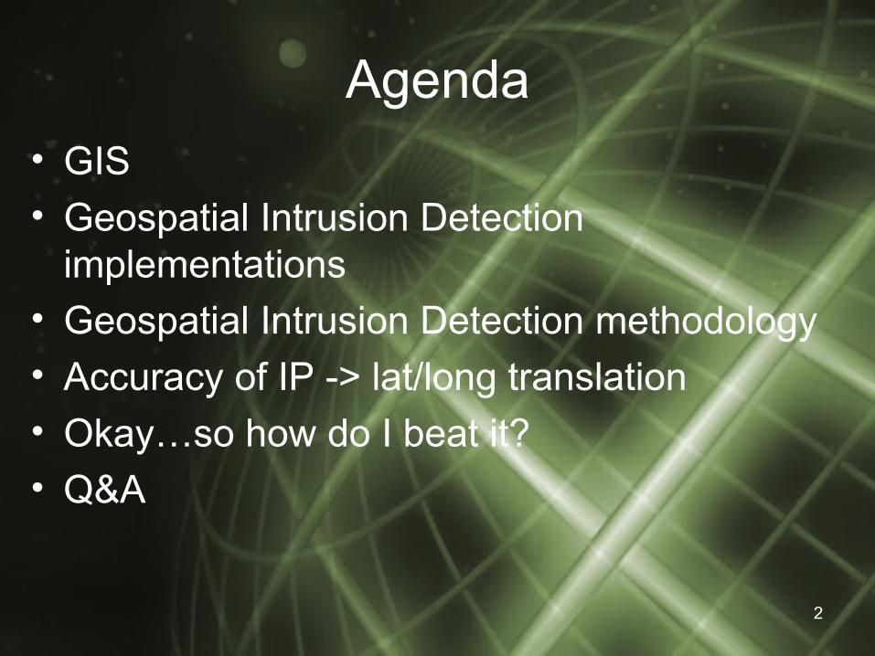
GIS
• GIS (Geographic Information Systems): computer based methodology to collect, store, manipulate, retrieve, display and analyze georeferenced data.– GoogleEarth– ESRI– Intergraph– GRASS
3
GIS
• Traditional GIS tools focused more on environmental issues
• These days thanks to GoogleEarth and/or GoogleMaps the average Internet user is starting to be exposed to the power that mapping software unleashes.– Track a cell phone (cell tower triangulation)– Track flights in mid-air!!!
4
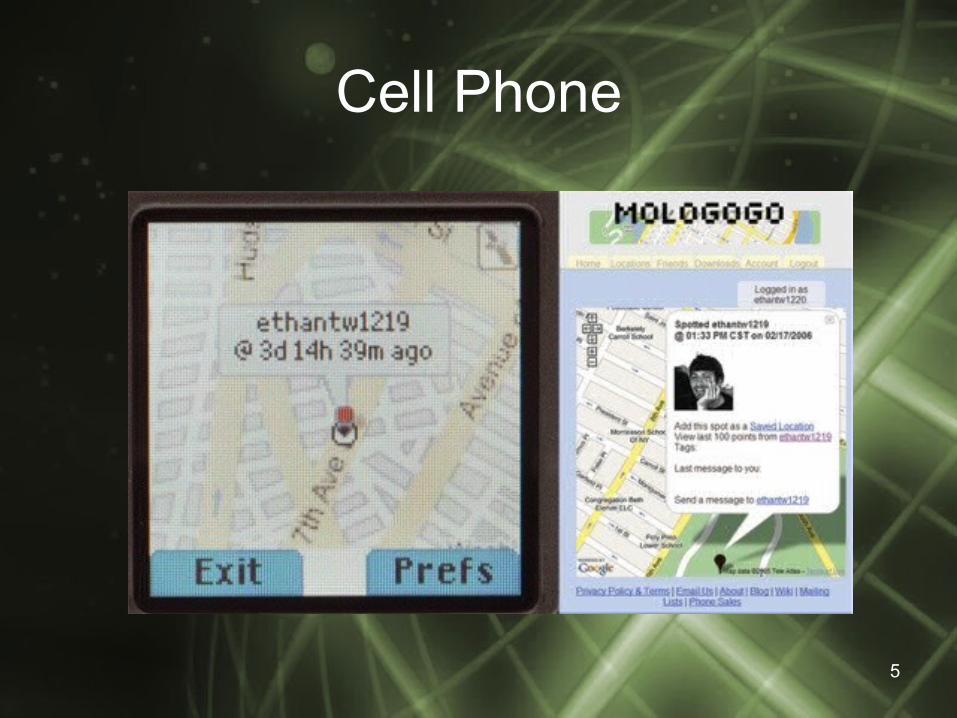
Cell Phone
5
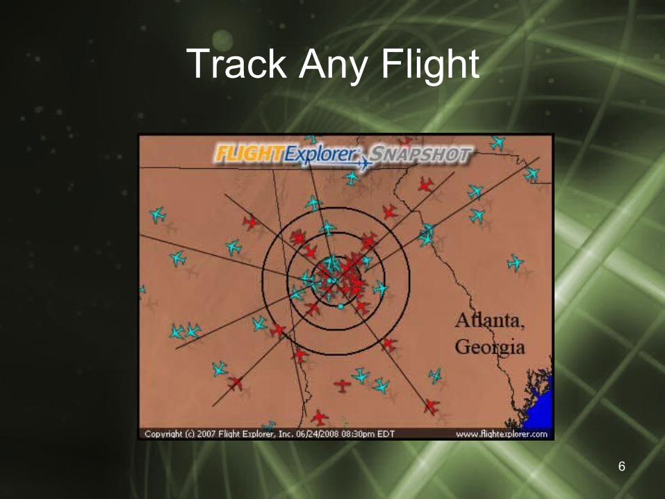
Track Any Flight
6

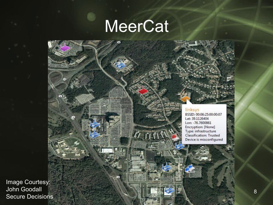
• Multiple security firms have implemented GIS tools in their products (in varying degrees)
– MeerCat (Secure Decisions)– VisCat (ETRI)– GeoSWAT
7
Where has IT security and mapping collided?
8
MeerCat
Image Courtesy:John GoodallSecure Decisions
07/06/08 9
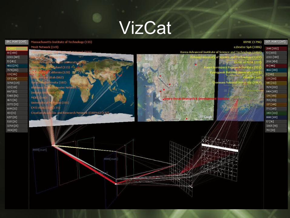
VizCat
10
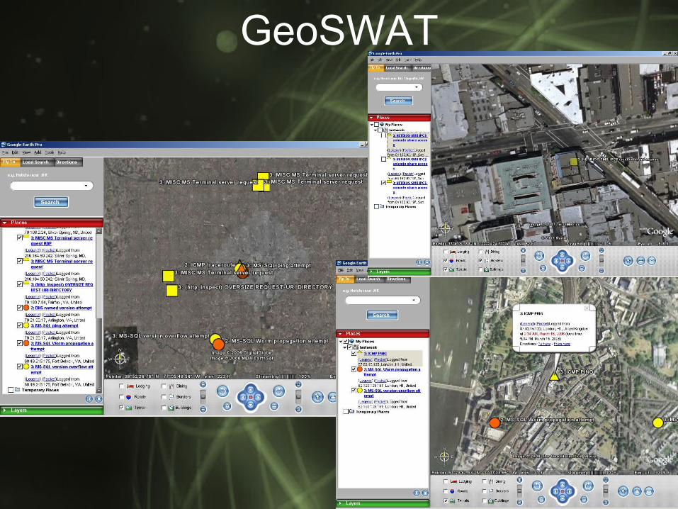
GeoSWAT
Geospatial Intrusion Detection
• Goal: find a direct correlation between externally based network alerts by plotting their source locations on a geographic map
11

How does it work?
• High-level ‘roadmap’:1. Plot rolling time period (1 week/2 weeks/4
weeks)2. Eliminate ‘friendlies’ to reduce IDS false
positives2.1 Geographically plot remote branches, SOHO,
business partners locations by street address (very accurate in GoogleEarth)
2.2 Create an IDS alert that is triggered when a customer authenticates to a website
12
Geospatial Intrusion Detection3. Run a clustering algorithm on plotted data
• There are several different clustering algorithms to choose from:
– Poisson, nearest-neighbor, Moran’s I Index, Ripley’s K Function, Getis-Ord
4. Extract network alerts within identified ‘hot-spot’
5. Run a weight calculating algorithm to evaluate if there is a relationship between alerts• Correlating elements in an alert
– Alert severity– Destination ports– Timestamp
13
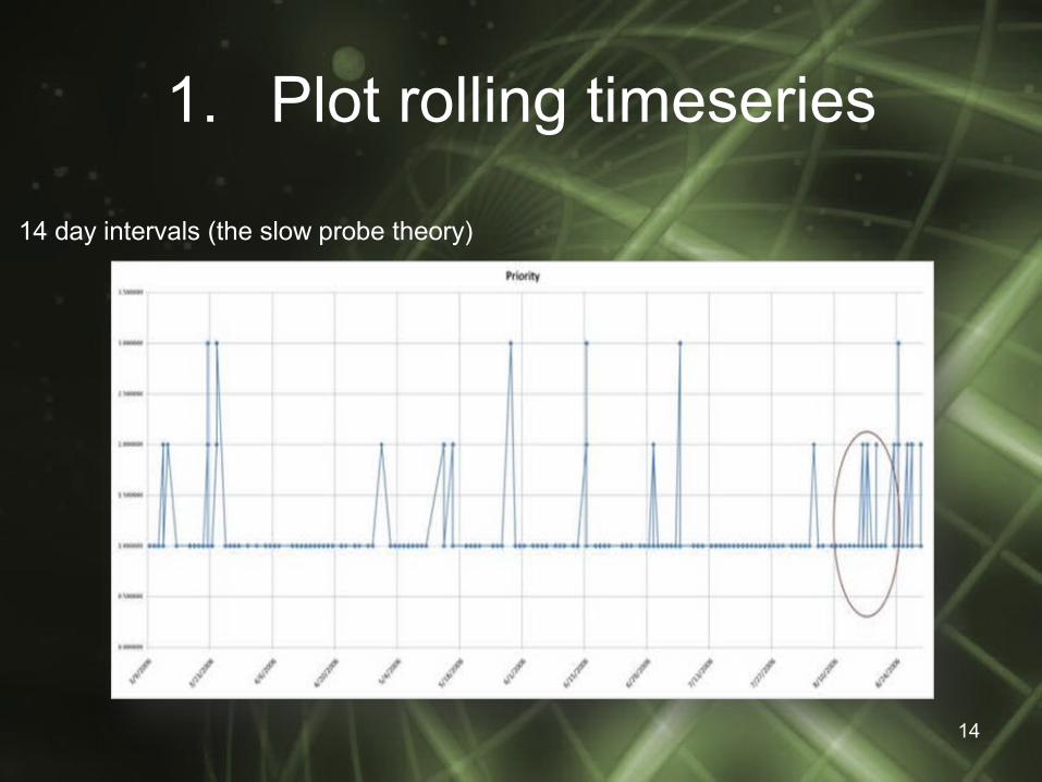
1. Plot rolling timeseries
14
14 day intervals (the slow probe theory)

2. Eliminate ‘friendlies’Map Legend = Source IDS Alert
= Remote Offices or TelecommutingResidences
15
Depending on yourrisk comfort abilities this would eliminate ~30% of potential false positives.
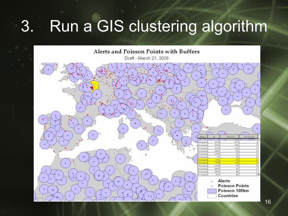
3. Run a GIS clustering algorithm
16
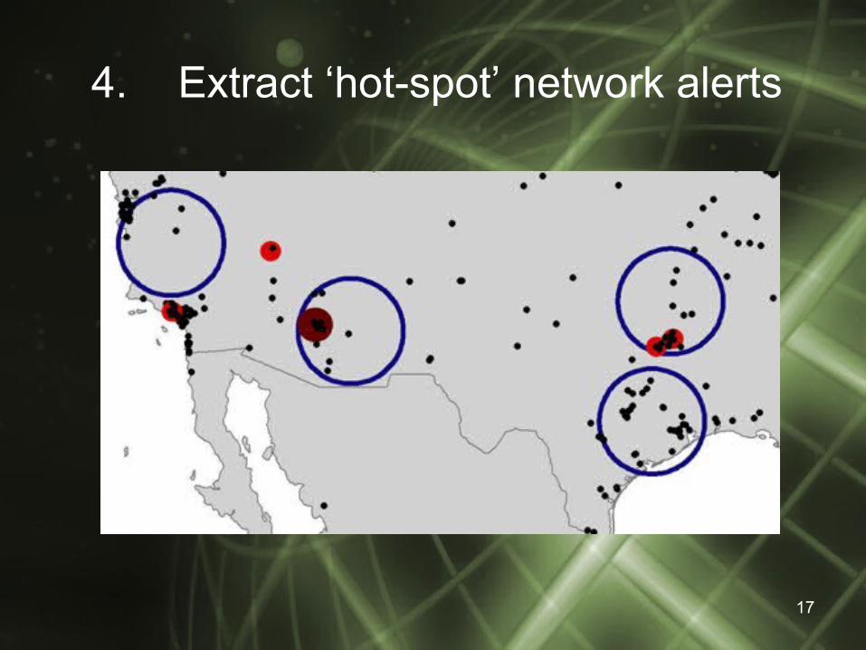
4. Extract ‘hot-spot’ network alerts
17
5.Run a weight calculating algorithm to evaluate if there is a relationship between alerts
• Insert image(s) later…
18
Accuracy translation• Vendors
– IP2Location– MaxMind– Quova (wireless capabilities)
• How is the translation calcuated?– Domain scrapping– Compare Traceroutes– Strategic partnerships with ISPs– Strategic partnerships with downloading FTP
sites19
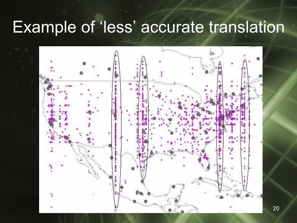
Example of ‘less’ accurate translation
20
Okay…how do I beat it?
• As with many (if not all) defenses there are always loopholes:– Most scanning/enumeration tools primarily do
sequential scans of IP address – DO NOT USE SEQUENTIAL IPs TO ATTACK A VICTIM
– Map remote locations and use a tool to extract neighboring IP addresses – which will hopefully get extracted when eliminating ‘friendlies’
– Attack from random geographic locations and with varying times
21

Deconstruct the translation file
• Insert image of deconstructed application
22

Q&A
Back to the Guinness tap…23