Embed Size (px)
Citation preview

International Journal of Environmental Protection and Policy 2019; 7(2): 46-60
http://www.sciencepublishinggroup.com/j/ijepp
doi: 10.11648/j.ijepp.20190702.12
ISSN: 2330-7528 (Print); ISSN: 2330-7536 (Online)
Geospatial Assessment of Crime and Security in Ido Local Government Area, Oyo State, SouthWest Nigeria
Babatunde Akeem Adesola*, Oyekola Martins Adewale
Department of Surveying and Geoinformatics, Faculty of Environmental Studies, The Polytechnic Ibadan, Ibadan, Nigeria
Email address:
*Corresponding author
To cite this article: Babatunde Akeem Adesola, Oyekola Martins Adewale. Geospatial Assessment of Crime and Security in Ido Local Government Area, Oyo
State, SouthWest Nigeria. International Journal of Environmental Protection and Policy. Vol. 7, No. 2, 2019, pp. 46-60.
doi: 10.11648/j.ijepp.20190702.12
Received: March 5, 2019; Accepted: April 10, 2019; Published: May 6, 2019
Abstract: Utilization of Information Technology is required in public safety management in the cities and their suburb
such as the present Ido area, Ido local government Ibadan. Geographic Information System (GIS) is an important tool
that can be used to locate crime area, and thus allow police to proactively respond to the situations before constituting a
problem. This research investigates crime and security in Ido Local Government Area of Oyo State, Southwest Nigeria
with the aim of mapping and assessing the area prone to crime, leading causes. The methodology adopted in this research
was field surveying methods with the use of Hi-target differential GPS to acquire the spatial coordinate (x, y, z) of crime
hotspots/locations and police stations in the study area. The local government consists of five areas namely; Omi-Adio
with seven (7) communities, Ologuneru with eight (8) communities, Ido with thirteen (13) communities, Apete with
fifteen (15) communities and Apata division with eleven (11) communities. The data acquired through field surveying
measurement with the Hi-target differential GPS was processed with Hi-target Geomatics Office (HGO) and Global
Navigation Satellite System (GNSS) application software in order to acquire the spatial location x, y, z data of the crime
hotspots and police stations. Proximity of police stations to crime hotspots was calculated to know how each of the crime
hotspot was distant to the police station. Further processing was done with the use of Quick Bird satellite imagery,
ArcGIS 10.2.1 (Arcmap 10.2.1) GIS application software in analyzing the location of crime and also identification of
crime patterns. The result from the crime data obtained from the field measurement and police was presented in form of
charts and map/plan. Generally from the research, it can be concluded that the major crime types common in the study
area. Therefore, the security issues in Ido local government has been dealt with but still requires more attentions by the
government and the law enforcement agencies.
Keywords: Geographic Information System (GIS), Crime Hotspots, Police Proximity
1. Introduction
Crime can be defined as a culpable disposition of an
individual or group as entrenched in the constitution of a
state. It is an act of commission or omission with legal
criminal implication for which punishment must be served
by an individual or group found culpable by a competent
court of jurisdiction. Crime is an unlawful act that is
punishable by the state law or other statutes. It is an act
done by person/group of people which is against the law of
a state, country or region. Crime mapping is the use of
Geographic Information System (GIS) to visualize and
organize spatial data for more formal statistical analysis.
Spatial analysis can be employed in both an exploratory and
well as a more confirmatory manner with the primary
purpose of identifying how certain community or ecological
factors (such as population characteristics or the built
environment) influence the spatial patterns of crime. Crime
mapping can also be used to visualize and analyze the
movement or target selection patterns of criminals. GIS
International Journal of Environmental Protection and Policy 2019; 7(2): 46-60 47
helps crime officers determine potential crime sites by
examining complex seemingly unrelated criteria and
displaying them all in a graphical, layered, spatial interface
or map. The location of a crime is an important attribute
feature, and is included along with law, offender, and target
as a dimension of a criminal event [1]. Crime is a ‘deviant
behaviour that violates prevailing norms, which may be
cultural, social, political, psychological and economic
conditions’ [2]. [3] cited by [4], described crime as a
deviant act that is threatening moral behaviours and
injurious to society. Moral decadence afflicts the
personality of individual, his property and lessens trust
among members of the society which may result to threat
and fear. Crime as violation of ‘property rights’ where the
focus was prioritized on crime against property [5]. This
will not give a comprehensive understanding on crime;
hence there are many other areas where crimes are
committed. Crime as an act that violates the law of the
society or serious offence against the law of the society for
which there is a severe punishment by law as expressed by
[2]. Many researchers classified crime into violent and
property crimes [5-7, 4, 8-13]. This classification is on the
basis of entity on which crime is committed. Violent crime
as a criminal activity that is clearly an act of brute force
engaged in taking of property or a person's life [4].
Similarly Dambazau [10] in his explanation on violent
crime said that it is an act of forcible taking of property
from a victim and may cause injury or loss of life. Violent
crime is the most ‘inhumane’ crime that continues to plague
the societies that have taken the centre stage leading to
bloodshed and economic setbacks as noted by [8].
Unemployment and economic hardship have pushed
many ‘jobless youths, some of whom are graduates, into
various deadly crimes’ as opined by [8]. Unemployment is
the main causes for ‘eruption and escalation of crimes in
urban areas across the breadth of Nigeria’ as found by [14].
Unemployment is closely linked to crime no matter the
region of the World. He also argued that urban crimes are
influenced by poverty, unstable jobs, the high cost of living
and financial difficulties, limited educational opportunities,
inadequate health and sanitation, and inadequate housing as
posits by [13]. Unemployment, poverty, poor governance
and lack of policy initiatives and implementation to some
extent encouraged criminal groups to thrive and appear to
be the root cause of urban crimes as believed by [8].
Therefore, urbanization does not have an exclusive hold on
urban crime causes but, [13] concludes that it does increase
the opportunities to be exposed to criminal activities.
Therefore, this study aimed at mapping the crime hotspots
and determining police station proximity to crime each
crime area in Ido local government area, Oyo State,
Southwest, Nigeria.
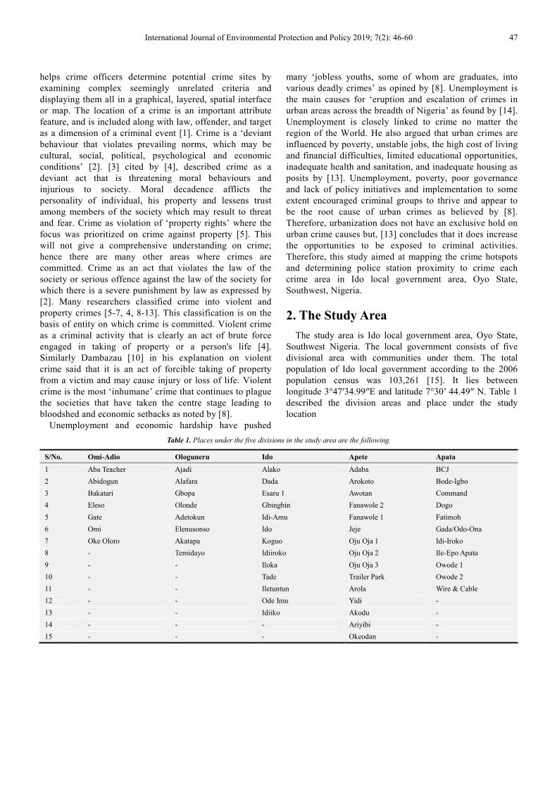
2. The Study Area
The study area is Ido local government area, Oyo State,
Southwest Nigeria. The local government consists of five
divisional area with communities under them. The total
population of Ido local government according to the 2006
population census was 103,261 [15]. It lies between
longitude 3°47′34.99″E and latitude 7°30’ 44.49″ N. Table 1
described the division areas and place under the study
location
Table 1. Places under the five divisions in the study area are the following.
S/No. Omi-Adio Ologuneru Ido Apete Apata
1 Aba Teacher Ajadi Alako Adaba BCJ
2 Abidogun Alafara Dada Arokoto Bode-Igbo
3 Bakatari Gbopa Esaru 1 Awotan Command
4 Eleso Olonde Gbingbin Fanawole 2 Dogo
5 Gate Adetokun Idi-Amu Fanawole 1 Fatimoh
6 Omi Elenusonso Ido Jeje Gada/Odo-Ona
7 Oke Oloro Akatapa Koguo Oju Oja 1 Idi-Iroko
8 - Temidayo Idiiroko Oju Oja 2 Ile-Epo Apata
9 - - Iloka Oju Oja 3 Owode 1
10 - - Tade Trailer Park Owode 2
11 - - Iletuntun Arola Wire & Cable
12 - - Ode Imu Yidi -
13 - - Idiiko Akodu -
14 - - - Ariyibi -
15 - - - Okeodan -

48 Babatunde Akeem Adesola and Oyekola Martins Adewale: Geospatial Assessment of Crime and Security in Ido
Local Government Area, Oyo State, SouthWest Nigeria
Figure 1. Digitized Map of the Study Area.

International Journal of Environmental Protection and Policy 2019; 7(2): 46-60 49
3. Material and Methods
For the purpose of this research, the main source of data was
adopted from field observations through surveying method as
primary data. The primary data source was based on the use of
Hi-target differential Global Positioning System to acquire the
(x, y, z) coordinates of crime hotspots for mapping purposes.
Secondly, the secondary data source was adopted from the x, y,
z, coordinate collected from the Oyo State Secretariat Agodi
Ibadan, Journals, Books, Conference paper presentation and
the information of number of police officers/staff from the
police divisional headquarter in the study area.
3.1. Equipment Used
3.1.1. Hardware
i. Hi-target Differential Global Positioning System with
its accessories (Model V30 GT)
ii. Handheld Global Positioning System (78s) for ground
tuiting
iii. Laptop computer (Dell Version)
iv. Hp laserjet printer (2015 version)
v. Safety boot (5 pairs)
vi. Raincoat/water proof jacket (5)
3.1.2. Software
i. Quickbird satellite image
ii. ArcGIS 10.2.1 (Arcmap 10.2.1)
iii. Microsoft word office 2007
iv. Microsoft Excel 2007
3.2. Method/Procedures of Data Acquisition
3.2.1. Procedures of Acquiring Data for Crime Hotspots
Hi-target differential GPS which comprises of two GPS
(one at control station called base station and the other one
on all point to determine called the rover station) was used to
acquire the coordinate x, y, z of crime hotspots in the study
area. The mode of operation used in acquiring the data was
static mode whereby the differential GPS on the base station
acquire a single data and continue to refine it to the
maximum accuracy while the other GPS which serve as rover
in all crime hotspots to be determined was given a time
interval of five (5) minutes to acquire (x, y, z) data for all the
hotspots in the study area. The field observation commenced
from a known control point at Eleyele hill with control
number (ICS 147 P) (table 2). One of the GPS was set on the
control point which serves as base station and the other one
was used as a rover on all crime hotspots. The spatial
locations of the five police division areas were also acquired
using the same method (table 3). Table 4 showed number of
staff per police station.
Figure 2. Data Acquisition on Control Point (base point) at Eleyele Hill.
Figure 3. Data Acquisition on crime area.
Figure 4. Methodology workflow/framework for the research.

50 Babatunde Akeem Adesola and Oyekola Martins Adewale: Geospatial Assessment of Crime and Security in Ido
Local Government Area, Oyo State, SouthWest Nigeria
Table 2. Coordinate of control point collected from Oyo State Secretariat.
Control Point Easting (m) Northing (m) Height (m)
ICP 147 P 594068.598 820087.878 257.921
Data processing
The data acquired with the Hi-target differential GPS was
downloaded into the computer. Hi-target Geomatics Office
(HGO) and Global Navigation Satellite System (GNSS)
application software was used to process the data x, y, z
acquired from the field (see figures 5-7 for processing detail
for the result of the processed data). The processed data x, y,
z were presented from (table 5). Distance from each police
division area to the crime hotspots was calculated to know
how far each of the crime hotspots is distant to the police
station (table 6).
Figure 5. GNSS data under process for the x, y, z.

International Journal of Environmental Protection and Policy 2019; 7(2): 46-60 51
Figure 6. Showing HGO data processing for the x, y, z.
Figure 7. Showing HGO data processing showing crime locations.

52 Babatunde Akeem Adesola and Oyekola Martins Adewale: Geospatial Assessment of Crime and Security in Ido
Local Government Area, Oyo State, SouthWest Nigeria
Table 3. Number of police officer present in each of the five division area.
Location Male Female Total
Omi-Adio 40 28 68
Ologuneru 6 4 10
Ido 47 23 70
Apete 30 23 53
Apata 40 15 65
Total 163 93 266
The Source of the table 3 above is from Oyo State Police
Command and the information was collected in November, 2018.
Table 4. Processed coordinates x, y, z of the police station.
Police Station Location Easting (m) Northing
(m) Height (m)
Omi-Adio Police Station 582234.713 816564.773 280.904
Ologuneru Police Station 591685.710 821872.890 217.233
Ido Police Station 584111.510 825947.850 212.089
Apete Police Station 596236.120 823526.710 185.466
Apata Police Division 593012.171 815752.642 269.053
Table 5. Processed data (x, y, z) coordinates of crime hotspots in five
Division areas.
Location Easting (m) Northing (m) Height (m)
Omi-Adio Division
Aba Teacher 582267.188 816565.680 240.101
Abidogun 1 582895.511 817017.921 183.965
Bakatari 1 577118.612 817240.636 397.64
Eleso 578497.342 817376.080 338.871
Gate 582642.469 817092.339 223.597
Omi 582681.321 817003.459 194.829
Oke Oloro 583113.182 816817.829 215.652
Ologuneru Division
Ajadi 592343.515 821368.325 162.219
Alafara 591341.963 820721.985 111.434
Gbopa 590457.805 822606.910 111.479
Olonde 590971.621 823301.405 137.727
Adetokun 592978.551 820507.383 172.053
Temidayo 579883.140 829049.200 156.345
Akatapa 589758.237 826827.444 180.225
Elenusonso 591256.575 822144.706 122.564
Ido Division
Alako 575800.594 832637.066 483.389
Dada 583057.103 823279.392 134.076
Esaru 580226.558 828813.276 328.09
Gbingbin 586705.644 825546.580 15.211
Idi-Amu 577254.284 830998.218 485.333
Idiiroko 582779.606 820630.038 280.022
Ido 583373.904 825699.938 106.372
Koguo 579619.457 829773.699 335.205
Ile Titun 583116.066 828718.336 298.560
Idiiko 577770.811 821769.041 215.269
Tade 580988.151 822271.750 308.117
Ode Imu 575609.185 824493.946 255.416
Iloka 577783.488 827963.578 200.055
Apete Division
Adaba 593915.448 824161.877 199.225
Arokoto 595271. 379 823969.821 264.853
Awotan 595170.340 823366.951 242.113
Fanawole 2 596459.322 823703.878 269.459
Fanawole 1 596222.883 823886.849 262.927
Jeje 595376.538 823914.256 263.92
Oju Oja 1 596634.688 823236.537 267.64
Oju Oja 2 596573.916 823266.439 265.368
Oju Oja 3 596753.991 823278.970 268.017
Location Easting (m) Northing (m) Height (m)
Trailer Park 593175.697 825137.709 172.077
Arola 596487.271 824023.054 268.124
Yidi 596164.684 824799.794 267.178
Akodu 595423.965 825524.314 264.595
Ariyibi 595195.186 825481.432 249.491
Oke Odan 595212.620 826625.440 242.003
Apata Division
BCJ 592384.629 816060.785 288.536
Bode-Igbo 587182.258 817473.872 294.281
Command 586763.548 817456.613 299.148
Dogo 591474.114 816095.427 297.870
Fatimoh 594346.151 815531.562 270.721
Gada/Odo-Ona 593627.664 816012.915 261.344
Ile-Epo Apata 591305.647 816112.294 293.855
Owode 1 589242.748 817581.588 308.413
Owode 2 588696.688 817826.584 314.295
Wire&Cable 588420.990 817770.302 313.781
Table 6. Distance/proximity of Police Station to Crime Area.
Police
Station
Crime location
hotspots
Distance from Police Station
to crime area in km
Omi
Aba Teacher 0.18
Abidogun 0.82
Bakatari 5.06
Eleso 3.71
Gate 0.63
Omi 0.62
Oke Oloro 0.91
Ologuneru
Ajadi 0.88
Alafara 1.31
Gbopa 1.41
Olonde 1.53
Adetokun 1.93
Akatapa 0.54
Elenusonso 0.51
Temidayo 3.89
Apete
Adaba 2.41
Arokoto 1.06
Awotan 1.07
Fanawole 2 0.37
Fanawole 1 0.29
Jeje 0.94
Oju Oja 1 0.49
Oju Oja 2 0.42
Oju Oja 3 0.57
Trailer Park 3.46
Arola 1.75
Yidi 1.39
Akodu 2.14
Ariyibi 2.31
Okeodan 3.29
Ido
Alako 10.68
Dada 2.87
Esaru 4.84
Gbingbin 2.61
Idi-Amu 8.53
Ido 0.79
Koguo 5.91
Idi-Iroko 5.48
Ile-titun 2.93
Idiiko 7.60
Tade 4.83
Ode Inu 8.64
Iloka 6.65

International Journal of Environmental Protection and Policy 2019; 7(2): 46-60 53
4. Results, Analysis and Discussion
The result presented in figures 8-19 was as a result of field
observations on crime hotspots and police station locations
through the field observations by surveying method. The
result showed generalized map of crime hotspots and police
station, the individual area showing communities where
crime occurred in the study area.
Figure 8. Generalized map showing Crime Hotspots in Ido Local Government Area, Oyo State.
Figure 9. Generalized Map showing 1km, 2km, 3km Buffering in Ido Local Government Area.

54 Babatunde Akeem Adesola and Oyekola Martins Adewale: Geospatial Assessment of Crime and Security in Ido
Local Government Area, Oyo State, SouthWest Nigeria
Figure 10. Map showing Crime Hotspots in Apete Area in Ido Local Government Area.
Figure 11. Map showing 1km, 2km, 3km Buffering in Apete in Ido Local Government Area.

International Journal of Environmental Protection and Policy 2019; 7(2): 46-60 55
Figure 12. Map showing Crime Hotspots in Ido Area in Ido Local Government Area.
Figure 13. Map showing 1km, 2km, 3km Buffering in Ido area in Ido Local Government Area.

56 Babatunde Akeem Adesola and Oyekola Martins Adewale: Geospatial Assessment of Crime and Security in Ido
Local Government Area, Oyo State, SouthWest Nigeria
Figure 14. Map showing Crime Hotspots in Ologuneru Area in Ido Local Government Area.
Figure 15. Map showing 1km, 2km, 3km Buffering in Ologuneru area in Ido Local Government.

International Journal of Environmental Protection and Policy 2019; 7(2): 46-60 57
Figure 16. Map showing Crime Hotspots in Omi-Adio Area in Ido Local Government Area.
Figure 17. Map showing 1km, 2km 3km Buffering in Omi-Adio area in Ido Local Government.

58 Babatunde Akeem Adesola and Oyekola Martins Adewale: Geospatial Assessment of Crime and Security in Ido
Local Government Area, Oyo State, SouthWest Nigeria
Figure 18. Map showing Crime Hotspots in Apata Area in Ido Local Government Area.
Figure 19. Map showing 1km, 2km, 3km Buffering in Apata area in Ido Local Government Area.
International Journal of Environmental Protection and Policy 2019; 7(2): 46-60 59
Figure 8 showed all the major crime hotspots in the study
area and how closely they are to the police stations. Figures
10, 12, 14, 16 and 18 showed the individual area where crime
hotspots exists from the five major area of the study area.
From figures 9, 11, 13, 15, 17, 19 above, 1km, 2km and 3km
buffering analysis was carried out which showed how close
and far of the police station to the crime hotspots. In Apete
area, it showed that area like trailer park (3.46km), Oke-Odan
(3.29km) are the areas that are too far to the police station
while others are close. In Ido area, area like Alako (10.68km)
Esaru (4.84km), Idi-Amu (8.53km), Idi-Iroko (5.48km),
Koguo (5.91km), Idiiko (7.60km), Tade (4.83km), Ode-Inu
(8.64km), and Iloka (6.65km) are those areas that too far
from the police while others in Ido area are close but not too
close. In Ologuneru area, it showed that only in Temidayo
community is very far to the police station while others are
close and not too close. In Omi-Adio, area like Bakatari
(5.06km), and Eleso (3.71km) are the area that are far from
police station while others are close and not too close. Bode-
Igbo (6.08km), Command (6.47km), Owode 1 (4.20km),
Owode 2 (4.79km).
5. Conclusions
The use geospatial analysis has significance importance in
reducing and preventing crime. Most of the police agencies
nowadays adopted the use of geographical information
system in crime investigations and analysis. The data used in
this research is from five divisional police department, field
data acquired through surveying methods in Ido local
government area of Oyo State, Nigeria. From the finding of
this study, the crime data obtained will be depicted on a
spatial domain which may be use to show the correlation
between each type of crime committed within the five
locations studied. Maps produced displayed the
locations/hotspots where crimes occurred, and they can be
used to help direct police patrols to the places where they are
mostly needed. In crime assessment, it showed that there is
no direct relationship between crime hotspots and distance to
the police stations. Therefore, by increasing the number of
police stations and number of police officers/patrol with
available facilities required, it is possible to reduce crime rate
in the affected areas as well as the study area as a whole. The
methodological frame work and the results that was applied
in this study presents investigation for crime mapping which
have a very promising use in the existing scenario and
provides an effective method to law enforcement agencies for
crime detection and its prevention within the study area.
Hence, the investigations and the results of this study may be
used by the law enforcement agencies within the study area
for future purposes so as to ensure public safety. Therefore,
the security issues in the two areas and in Ido local
government area of Oyo State in general requires more
attentions by the government, community itself as well as the
law enforcement agencies
6. Recommendations
i. A system for recording crime data based on locations
is recommended.
ii. The use of CCTV and drone should be employed i.e.
in monitoring area prone to crime. This will be more
effect of cost less.
iii. Community residents should be encouraged to
participate in the overall security of their
environment.
iv. Police should make fund available as an incentives to
those who are ready to vital information crime.
v. Where distances are much, proximity should be
enhanced. More police station should be
established/created
vi. Government should provide job/employment so that
crime could be reduced.
vii. Government should establish a vigilante group that
will be helping the police in fighting crime. Also, more
patrol vehicles should be given to the police within the
study area.
Acknowledgements
Authors’ acknowledged the contribution of Mr. Adewuyi
Gbola Kehinde of the department of Surveying and
Geoinformatics and the following students; Ajibade Oludare,
Morawo Joshua, Ojoawo Johnson, Adeniran Mayowa,
Adeeko Isaac, and Ogundepo Toheeb for their assistance
during the execution of the research project.
This research was sponsored by Tertiary Education
Trust Fund (TETFUND). Address: TETFUND Building:
No 6 Zambezi Crescent, Off Aguiyi Ironsi Street,
Maitama, Abuja, FCT Nigeria.
References
[1] Brantingham, P. J. and P. L. Brantingham (eds.) (1991). Environmental Criminology. Prospect Heights, IL: Waveland Press.
[2] Tenibiaje, D. J. (2010). Personality and development of crime in Nigeria. Current Research Journal of Social Sciences, 2 (4), 214–219.
[3] Louis, S., Cookie, W. S., Louis, A. Z. and Sheldon, R. E. (1981). Human Response to Social Problems. The Dorsey Press, Illinois.
[4] Usman, U., Yakubu, M., and Bello, A. Z. (2012). An investigation on the rate of crime in Sokoto state using principal component analysis. Nigerian Journal of Basic and Applied Science, 20 (2), 152–160.
[5] Habibullah, M. S., Baharom, A. H., and Tan, K. S. (2013). Crime and police personnel in Malaysia: An empirical investigation. Prosiding Persidangan Kebangsaan Ekonomi Malaysia Ke VIII (2013).

60 Babatunde Akeem Adesola and Oyekola Martins Adewale: Geospatial Assessment of Crime and Security in Ido
Local Government Area, Oyo State, SouthWest Nigeria
[6] Kien, L. H. (2015). The impacts of street crime to commercial real estate in Johor Bahru city centre (JBCC) case study: Jalan Wong Ah Fook and Jalan Trus. Unpublish undergraduate project dissertation submitted to the Department of Real Estate Management, Faculty of Technology Management and Business, Universiti Tun Hussein Onn Malaysia (UTHM).
[7] Sewuese, C. (2014). Spatial pattern of urban crime in Makurdi, Benue State, Nigeria. Un-publish undergraduate a project dissertation submitted to the Department of Urban and Regional Planning. Bauchi: Faculty of Environmental Technology, Abubakar Tafawa Balewa University.
[8] Ajaegbu, O. O. (2012). Rising youth unemployment and violent crime in Nigeria. American Journal of Social Issues Humanities, 2 (5), 315–321.
[9] Amin, M. B., Rahim, M. K., and Ayu, G. M. S. (2014). A trend analysis of violent crimes in Malaysia. Health and the Environment Journal, 5 (2), 41–56.
[10] Dambazau, A. B. (2007a). Criminology justice (Second Ed.) Ibadan: Spectrum Books Limited.
[11] Dambazau, A. B. (2007b). The Nigerian police and crime prevention: Criminology and criminal justice Nigerian, 5 Kaduna. Ch: Defence Academy Press, 221.
[12] Okafor, E. E. (2011). Youth unemployment and implications for stability of democracy in Nigeria. Journal of Sustainable Development in Africa, 13 (1), 1520–5509.
[13] Soh, M. B. C. (2012). Crime and urbanization: Revisited Malaysian case. Procedia – Social and Behavioral Sciences, 42, 291–299.
[14] Katsina, A. M. (2013). Trend analysis of poverty and urban crime in Nigeria since 1999. International Journal of Arts and Commerce, 1 (2).
[15] National population census (2006).