Embed Size (px)
Citation preview
GeoServer, the open source server for
interoperable spatial data handling
Ing. Simone Giannecchini, GeoSolutions Ing. Andrea Aime, GeoSolutions
Outline
Who is GeoSolutions?
Quick intro to GeoServer
What’s new in the 2.2.x series
What’s new in the 2.3.x series
What’s cooking for the 2.4.x series
FOSSGIS 2013, FOSSGIS 2013, RapperswilRapperswil June 14June 14thth 20132013
GeoSolutions
Founded in Italy in late 2006
Expertise
• Image Processing, GeoSpatial Data Fusion
• Java, Java Enterprise, C++, Python
• JPEG2000, JPIP, Advanced 2D visualization
Supporting/Developing FOSS4G projects
GeoTools, GeoServer
GeoNetwork, GeoBatch, MapStore
ImageIO-Ext and more: https://github.com/geosolutions-it
Focus on Consultancy
PAs, NGOs, private companies, etc…
FOSSGIS 2013, FOSSGIS 2013, RapperswilRapperswil June 14June 14thth 20132013
GeoServer quick intro
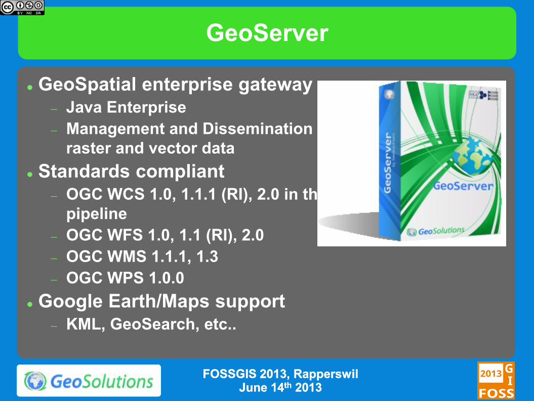
GeoServer
GeoSpatial enterprise gateway Java Enterprise
Management and Dissemination of
raster and vector data
Standards compliant OGC WCS 1.0, 1.1.1 (RI), 2.0 in the
pipeline
OGC WFS 1.0, 1.1 (RI), 2.0
OGC WMS 1.1.1, 1.3
OGC WPS 1.0.0
Google Earth/Maps support KML, GeoSearch, etc..
FOSSGIS 2013, FOSSGIS 2013, RapperswilRapperswil June 14June 14thth 20132013
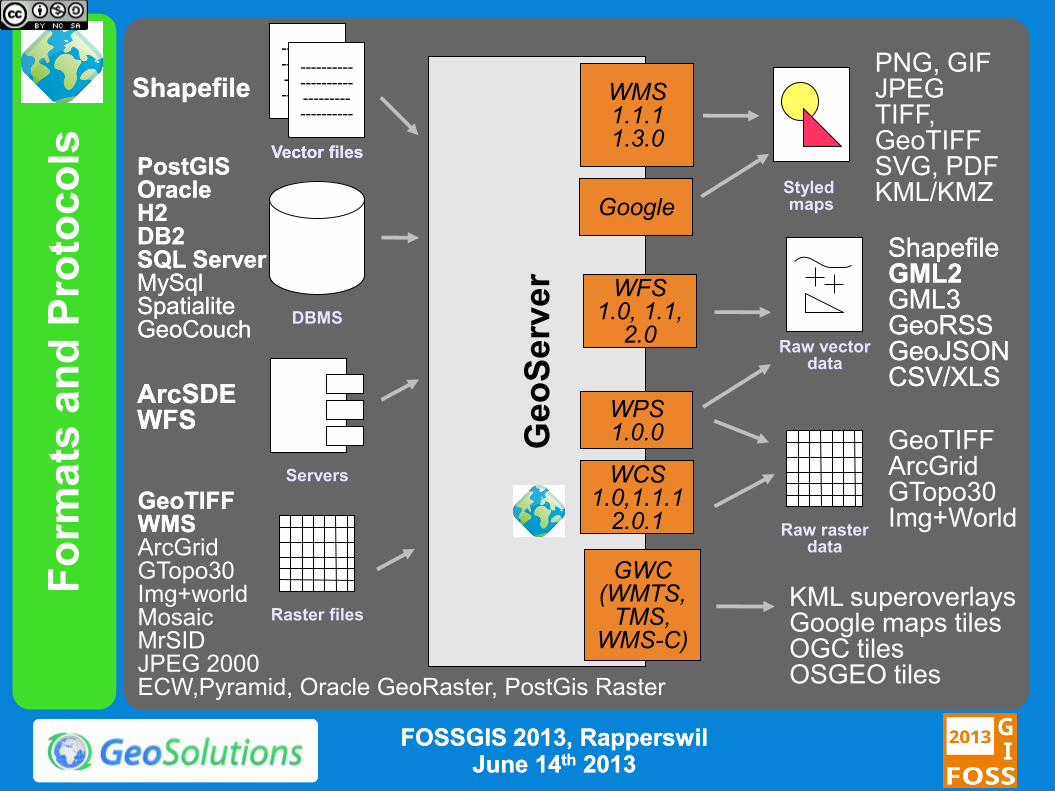
Fo
rmats
an
d P
roto
co
ls
Ge
oS
erv
er
WFS 1.0, 1.1,
2.0
WMS 1.1.1 1.3.0
PostGISPostGIS OracleOracle H2H2 DB2DB2 SQL ServerSQL Server MySqlMySql SpatialiteSpatialite GeoCouchGeoCouch
ShapefileShapefile
---------- ---------- --------- ----------
---------- ---------- --------- ----------
---------- ---------- --------- ----------
ArcSDEArcSDE WFSWFS
PNG, GIF JPEG TIFF, GeoTIFF SVG, PDF KML/KMZ
ShapefileShapefile GML2GML2 GML3GML3 GeoRSSGeoRSS GeoJSONGeoJSON CSV/XLSCSV/XLS
Raw vector data
Servers
Styled maps
DBMS
Vector filesVector files
WCS 1.0,1.1.1
2.0.1 GeoTIFFGeoTIFF WMSWMS ArcGrid GTopo30 Img+world Mosaic MrSID JPEG 2000 ECW,Pyramid, Oracle GeoRaster, PostGis Raster
Raster files
Raw raster data
GeoTIFF ArcGrid GTopo30 Img+World
GWC (WMTS,
TMS, WMS-C)
KML superoverlays Google maps tiles OGC tiles OSGEO tiles
WPS 1.0.0
FOSSGIS 2013, FOSSGIS 2013, RapperswilRapperswil June 14June 14thth 20132013
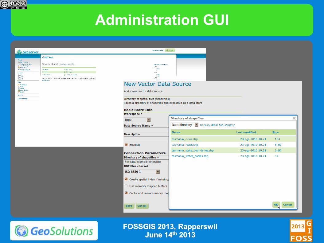
Administration GUI
FOSSGIS 2013, FOSSGIS 2013, RapperswilRapperswil June 14June 14thth 20132013
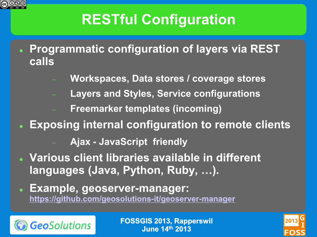
RESTful Configuration
Programmatic configuration of layers via REST calls
Workspaces, Data stores / coverage stores
Layers and Styles, Service configurations
Freemarker templates (incoming)
Exposing internal configuration to remote clients
Ajax - JavaScript friendly
Various client libraries available in different languages (Java, Python, Ruby, …).
Example, geoserver-manager: https://github.com/geosolutions-it/geoserver-manager
FOSSGIS 2013, FOSSGIS 2013, RapperswilRapperswil June 14June 14thth 20132013
WMS
Dissemination of Maps
Fusing raster and vector data seamlessly
Rule/scale driven rendering
WMS 1.1.1 and 1.3 support
SLD
Basic support for SLD 1.1 and SE 1.1
Full support for SLD 1.0
CSS extension for compact styling
Many rendering extensions available
FOSSGIS 2013, FOSSGIS 2013, RapperswilRapperswil June 14June 14thth 20132013
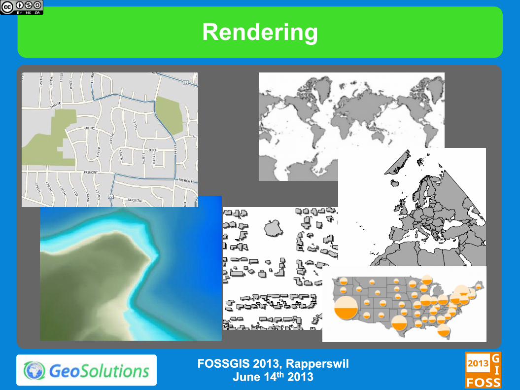
Rendering
FOSSGIS 2013, FOSSGIS 2013, RapperswilRapperswil June 14June 14thth 20132013
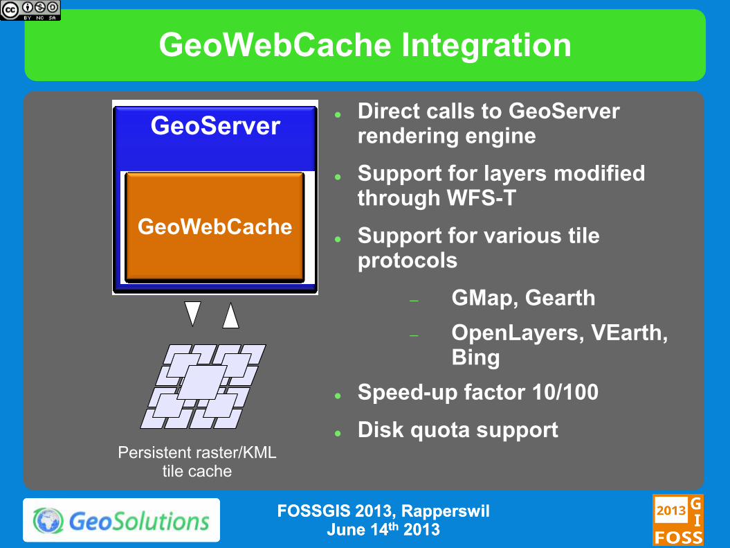
GeoWebCache Integration
GeoServer
GeoWebCache
Persistent raster/KML tile cache
Direct calls to GeoServer rendering engine
Support for layers modified through WFS-T
Support for various tile protocols
GMap, Gearth
OpenLayers, VEarth, Bing
Speed-up factor 10/100
Disk quota support
FOSSGIS 2013, FOSSGIS 2013, RapperswilRapperswil June 14June 14thth 20132013
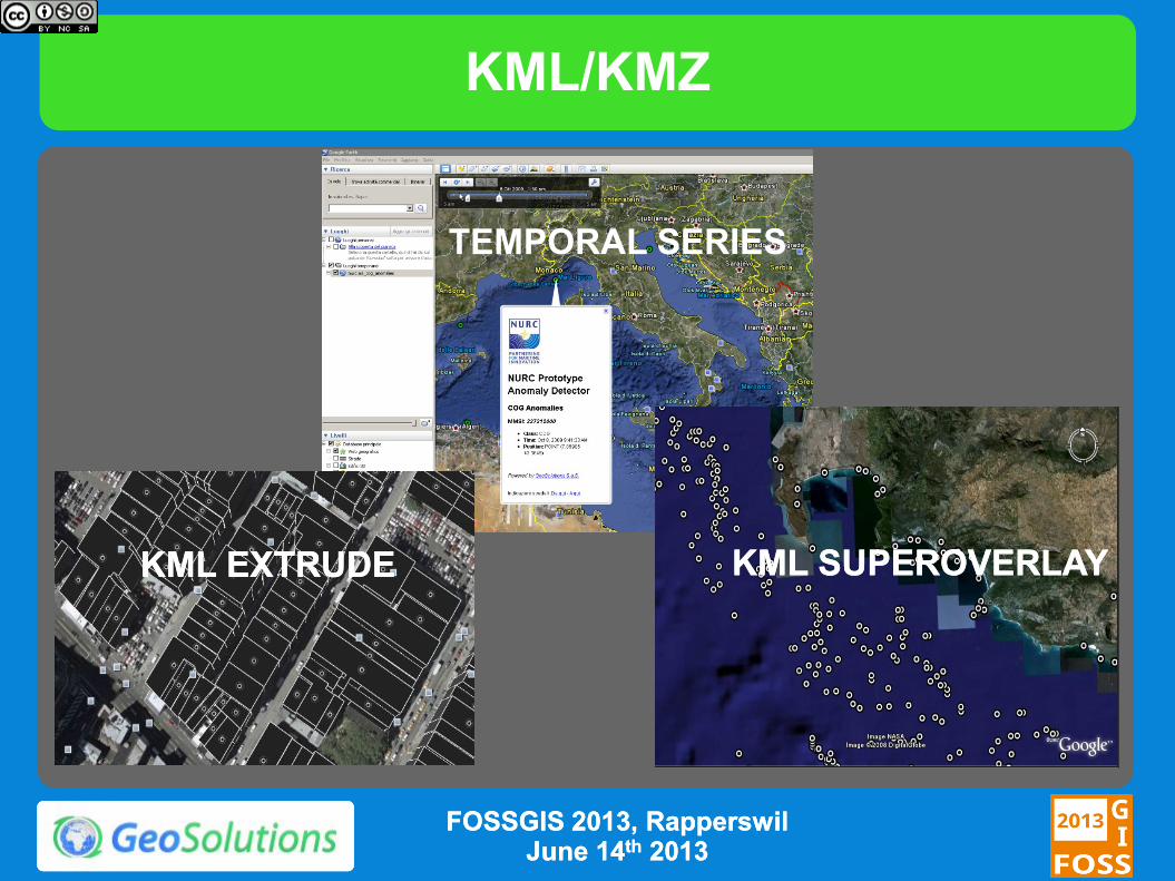
KML/KMZ
TEMPORAL SERIES
KML EXTRUDEKML EXTRUDE KML SUPEROVERLAYKML SUPEROVERLAY
FOSSGIS 2013, FOSSGIS 2013, RapperswilRapperswil June 14June 14thth 20132013
WFS
Dissemination and filtering of vector data
WFS 1.0, 1.1 and 2.0 (since 2.2.0)
Transaction and paging available in all versions
Simplified filtering via CQL
Formats:
GML 2, 3.1 and 3.2
CSV, Excel spreadsheet, GeoRSS, GeoJSON
Shapefile (zipped)
Any other format supported by ogr2ogr (configurable)
FOSSGIS 2013, FOSSGIS 2013, RapperswilRapperswil June 14June 14thth 20132013
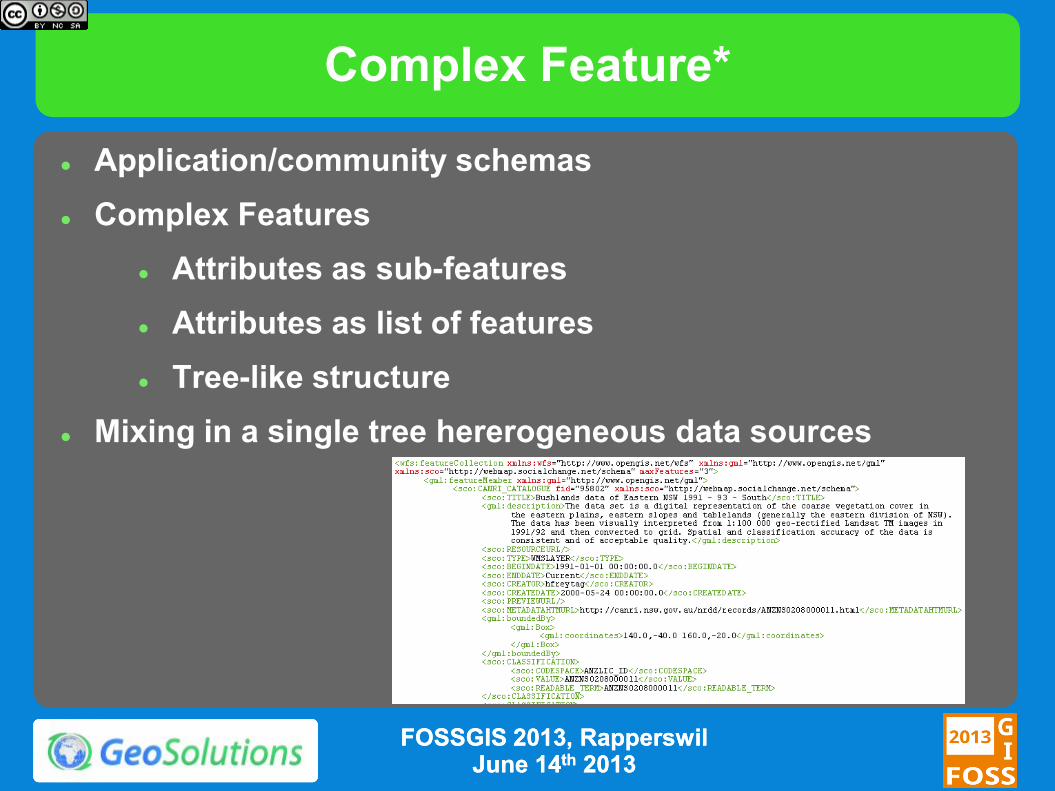
Complex Feature*
Application/community schemas
Complex Features
Attributes as sub-features
Attributes as list of features
Tree-like structure
Mixing in a single tree hererogeneous data sources
FOSSGIS 2013, FOSSGIS 2013, RapperswilRapperswil June 14June 14thth 20132013
WCS
Raster data dissemination
Raw raster data useful for analysis, no maps!
Support for TIME and ELEVATION (via ImageMosaic plugin)
WCS 1.0 and 1.1.1
Output formats
GeoTiff, ArcGrid
GDAL based formats under discussion
Extensions
ELEVATION as band management
FOSSGIS 2013, FOSSGIS 2013, RapperswilRapperswil June 14June 14thth 20132013
WPS
WPS 1.0
Official Extension
Raster and Vector data support
High performance processes (raster/vector statistics, raster/vector format conversions and more)
Integrated WPS
Direct access to data sources
Automatic publishing of results as new layers
Embedding processes into SLD styles (rendering transformation, since 2.2.0)
FOSSGIS 2013, FOSSGIS 2013, RapperswilRapperswil June 14June 14thth 20132013
What’s new in 2.2.x
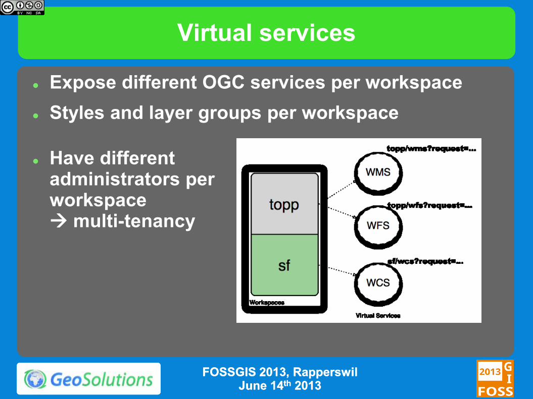
Virtual services
Expose different OGC services per workspace
Styles and layer groups per workspace
Have different administrators per workspace multi-tenancy
FOSSGIS 2013, FOSSGIS 2013, RapperswilRapperswil June 14June 14thth 20132013
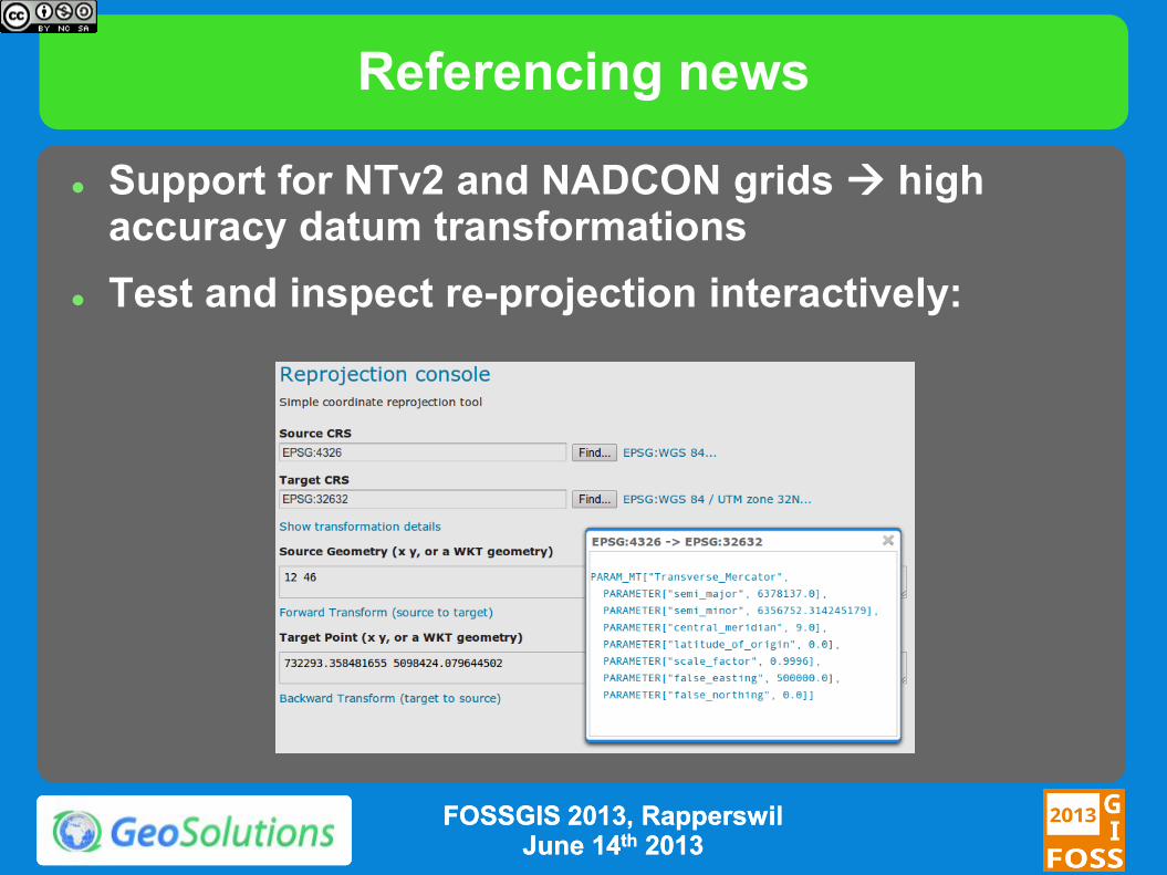
Referencing news
Support for NTv2 and NADCON grids high accuracy datum transformations
Test and inspect re-projection interactively:
FOSSGIS 2013, FOSSGIS 2013, RapperswilRapperswil June 14June 14thth 20132013
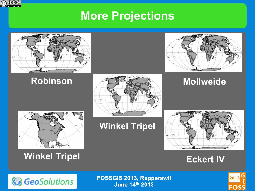
More Projections
FOSSGIS 2013, FOSSGIS 2013, RapperswilRapperswil June 14June 14thth 20132013
Robinson Mollweide
Winkel Tripel
Eckert IV Winkel Tripel
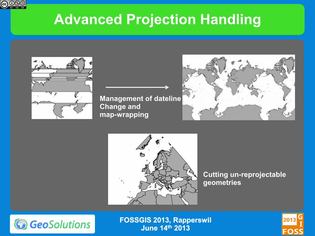
Advanced Projection Handling
Management of dateline Change and map-wrapping
Cutting un-reprojectable geometries
FOSSGIS 2013, FOSSGIS 2013, RapperswilRapperswil June 14June 14thth 20132013
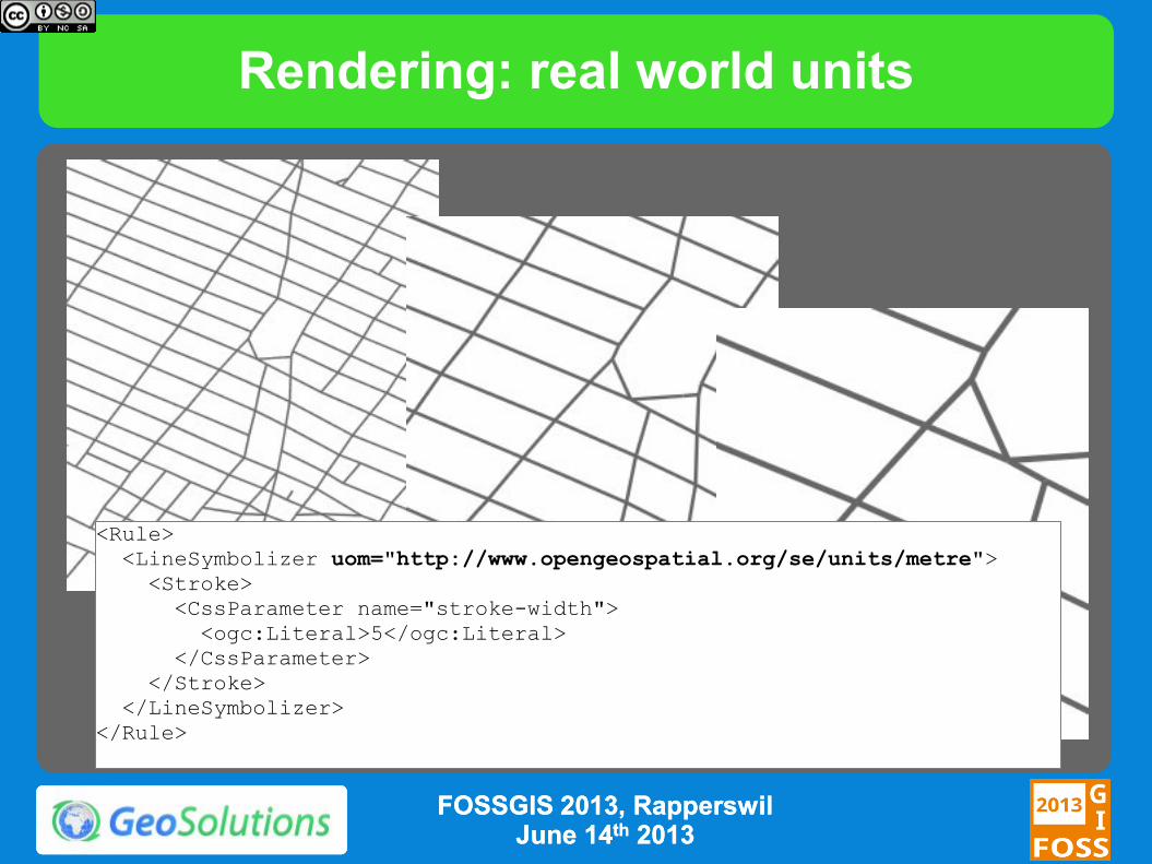
Rendering: real world units
<Rule>
<LineSymbolizer uom="http://www.opengeospatial.org/se/units/metre">
<Stroke>
<CssParameter name="stroke-width">
<ogc:Literal>5</ogc:Literal>
</CssParameter>
</Stroke>
</LineSymbolizer>
</Rule>
FOSSGIS 2013, FOSSGIS 2013, RapperswilRapperswil June 14June 14thth 20132013
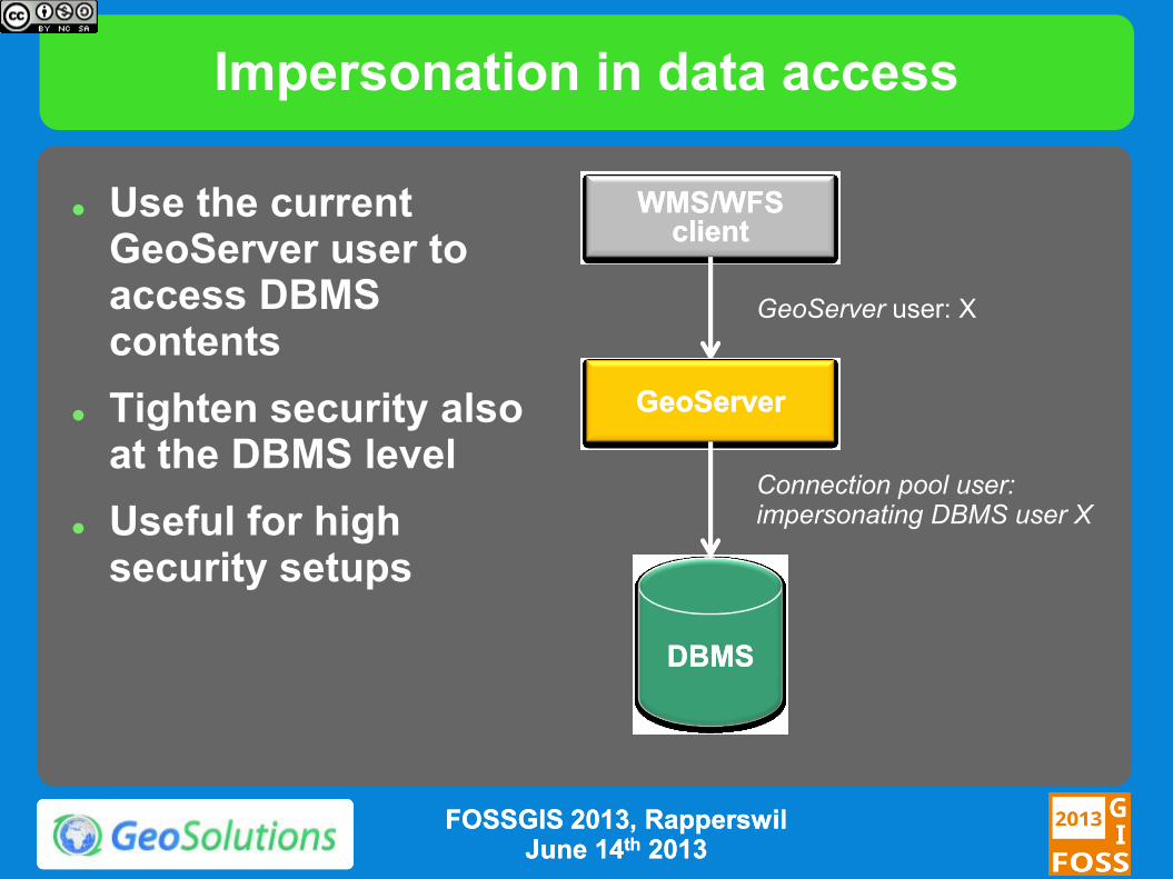
Impersonation in data access
WMS/WFS WMS/WFS
clientclient
GeoServerGeoServer
GeoServer user: X
DBMSDBMS
Connection pool user: impersonating DBMS user X
Use the current GeoServer user to access DBMS contents
Tighten security also at the DBMS level
Useful for high security setups
FOSSGIS 2013, FOSSGIS 2013, RapperswilRapperswil June 14June 14thth 20132013
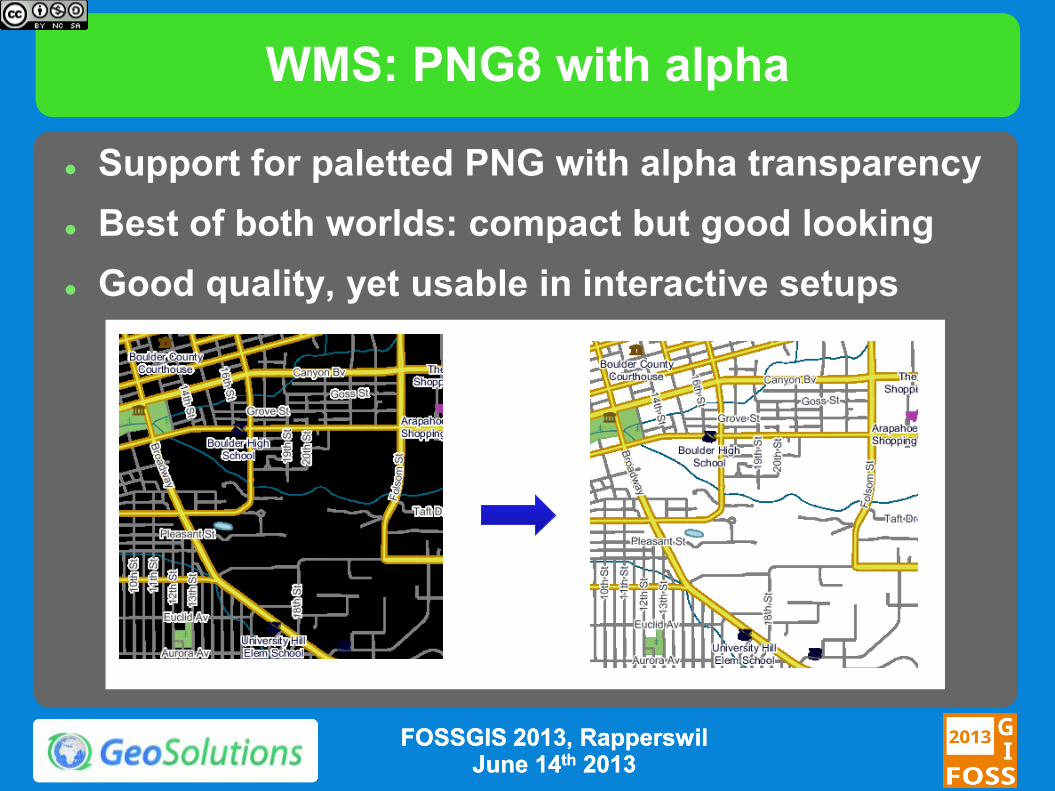
WMS: PNG8 with alpha
Support for paletted PNG with alpha transparency
Best of both worlds: compact but good looking
Good quality, yet usable in interactive setups
FOSSGIS 2013, FOSSGIS 2013, RapperswilRapperswil June 14June 14thth 20132013
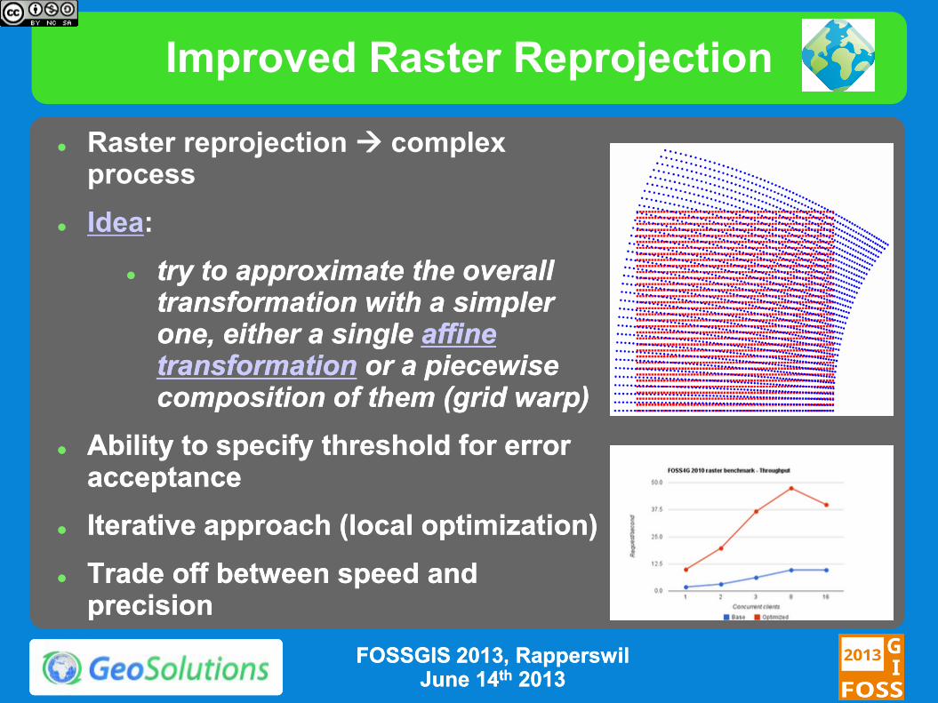
Improved Raster Reprojection
Raster reprojection complex process
Idea:
try to approximate the overall try to approximate the overall transformation with a transformation with a simpler simpler one, either a singleone, either a single affine affine transformationtransformation or a piecewise or a piecewise composition of them (grid warp)composition of them (grid warp)
Ability to specify threshold for error Ability to specify threshold for error acceptanceacceptance
Iterative approach (local optimization)Iterative approach (local optimization)
Trade off between speed and Trade off between speed and precisionprecision
FOSSGIS 2013, FOSSGIS 2013, RapperswilRapperswil June 14June 14thth 20132013
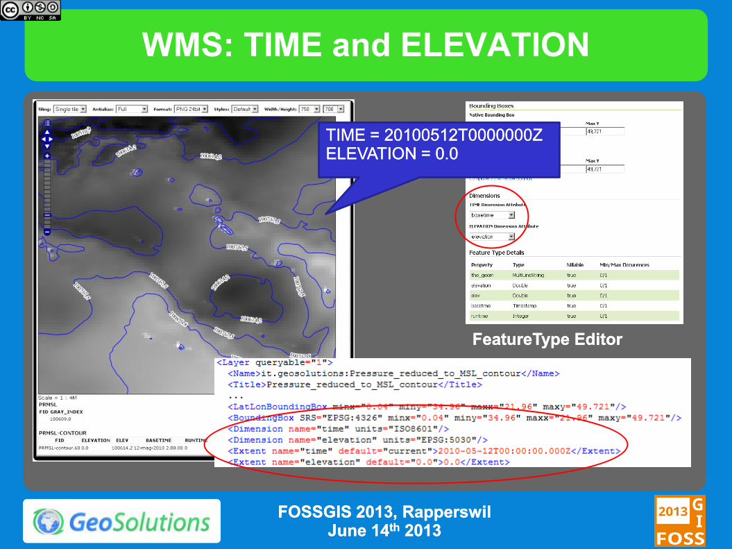
WMS: TIME and ELEVATION
TIME = 20100512T0000000ZTIME = 20100512T0000000Z ELEVATION = 0.0ELEVATION = 0.0
FeatureType EditorFeatureType Editor
FOSSGIS 2013, FOSSGIS 2013, RapperswilRapperswil June 14June 14thth 20132013
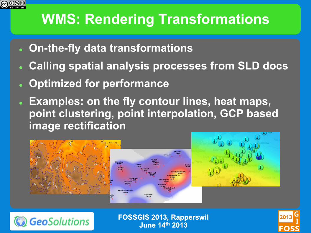
WMS: Rendering Transformations
On-the-fly data transformations
Calling spatial analysis processes from SLD docs
Optimized for performance
Examples: on the fly contour lines, heat maps, point clustering, point interpolation, GCP based image rectification
FOSSGIS 2013, FOSSGIS 2013, RapperswilRapperswil June 14June 14thth 20132013
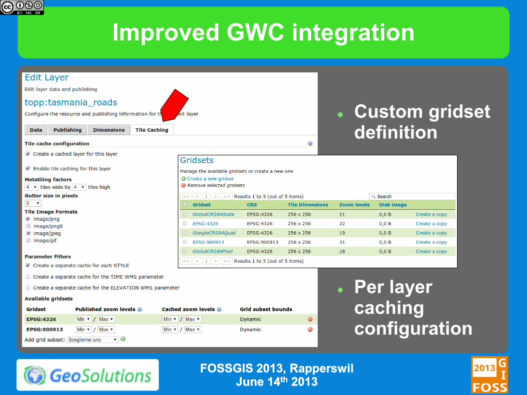
Improved GWC integration
Custom gridset definition
Per layer caching configuration
FOSSGIS 2013, FOSSGIS 2013, RapperswilRapperswil June 14June 14thth 20132013
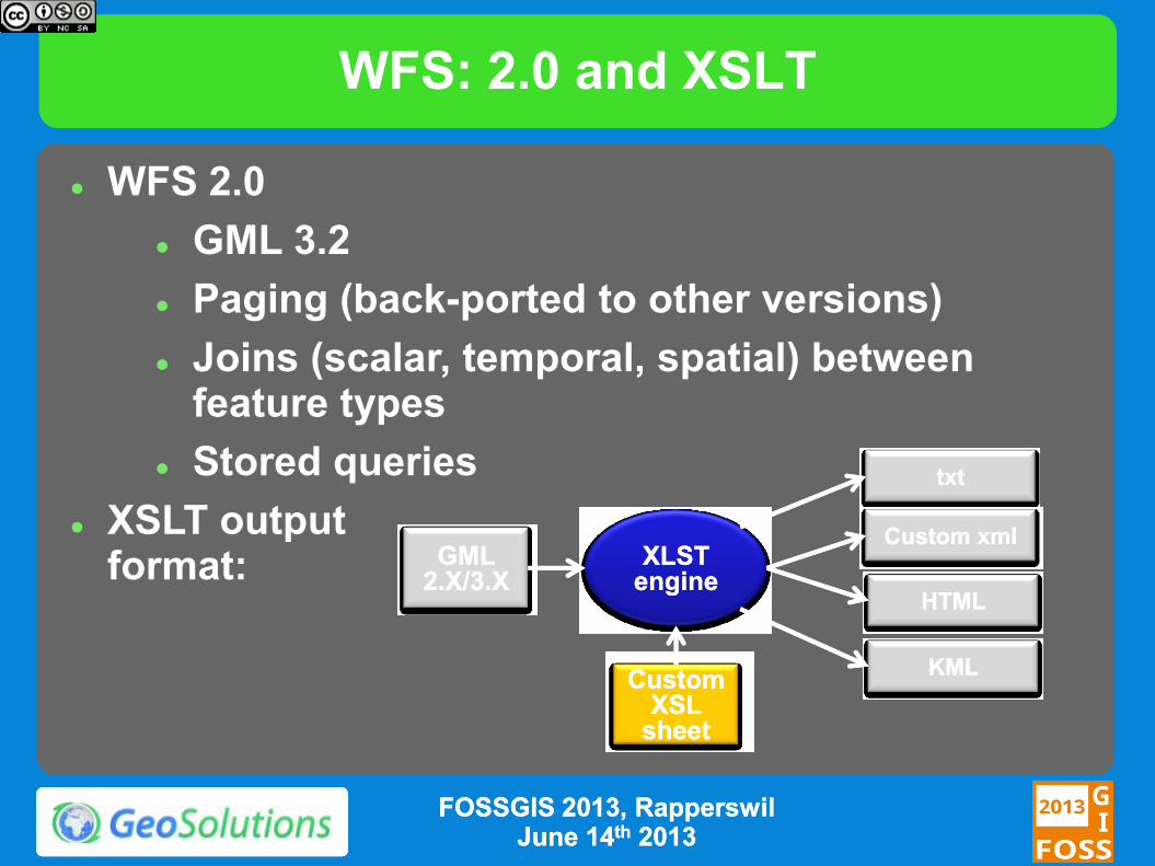
WFS: 2.0 and XSLT
WFS 2.0
GML 3.2
Paging (back-ported to other versions)
Joins (scalar, temporal, spatial) between feature types
Stored queries
XSLT output format:
GML GML 2.X/3.X2.X/3.X
CustomCustom XSL XSL
sheetsheet
XLST XLST engineengine
txttxt
Custom xmlCustom xml
HTMLHTML
KMLKML
FOSSGIS 2013, FOSSGIS 2013, RapperswilRapperswil June 14June 14thth 20132013
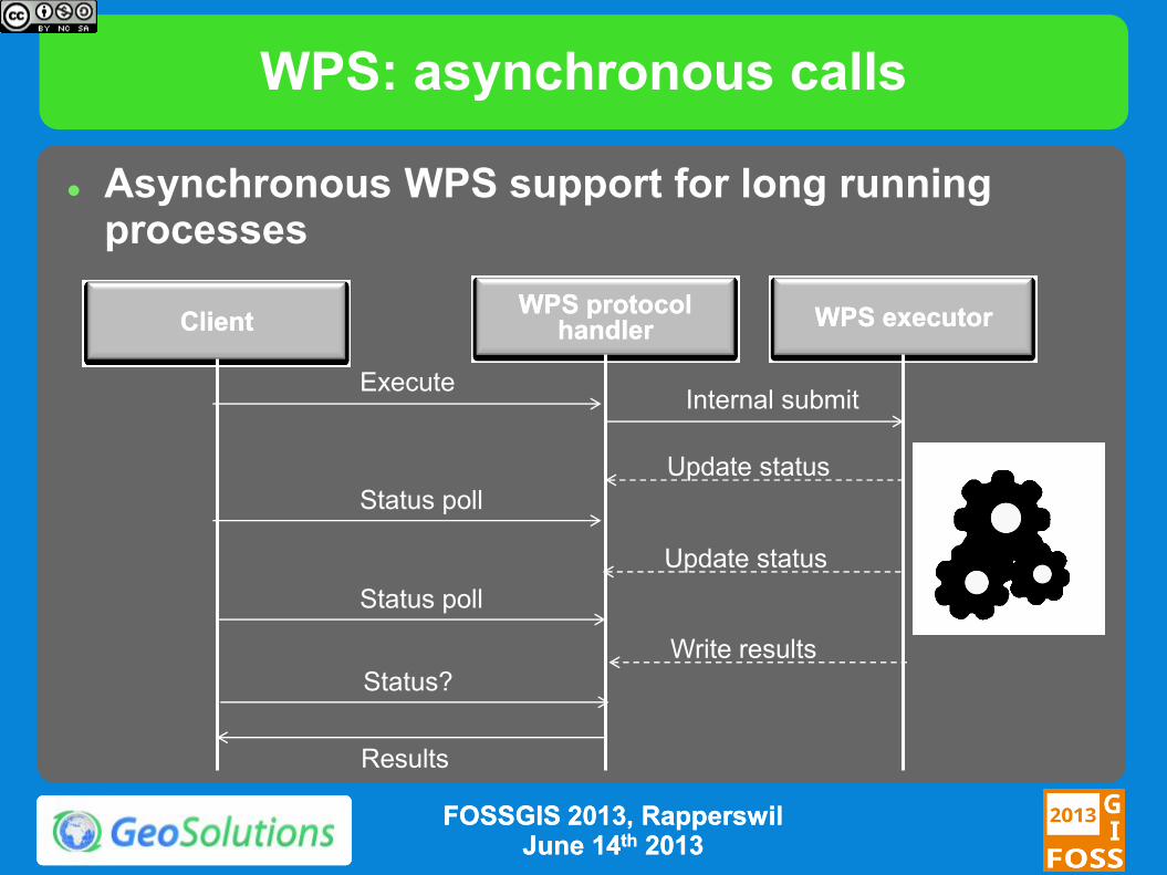
WPS: asynchronous calls
Asynchronous WPS support for long running processes
WPS protocol WPS protocol
handlerhandler WPS executorWPS executor ClientClient
Execute Internal submit
Status poll
Update status
Update status
Write results
Status poll
Status?
Results
FOSSGIS 2013, FOSSGIS 2013, RapperswilRapperswil June 14June 14thth 20132013
Security: Authentication
Pluggable user sources, available out of the box:
LDAP, DBMS
Pluggable authentication mechanisms, available out of the box:
BASIC/DIGEST HTTP, CAS
Possible to integrate with other mechanisms and in-house solutions
Available since 2.2.0, before only basic HTTP auth + simple text file for users
FOSSGIS 2013, FOSSGIS 2013, RapperswilRapperswil
June 14June 14thth 20132013
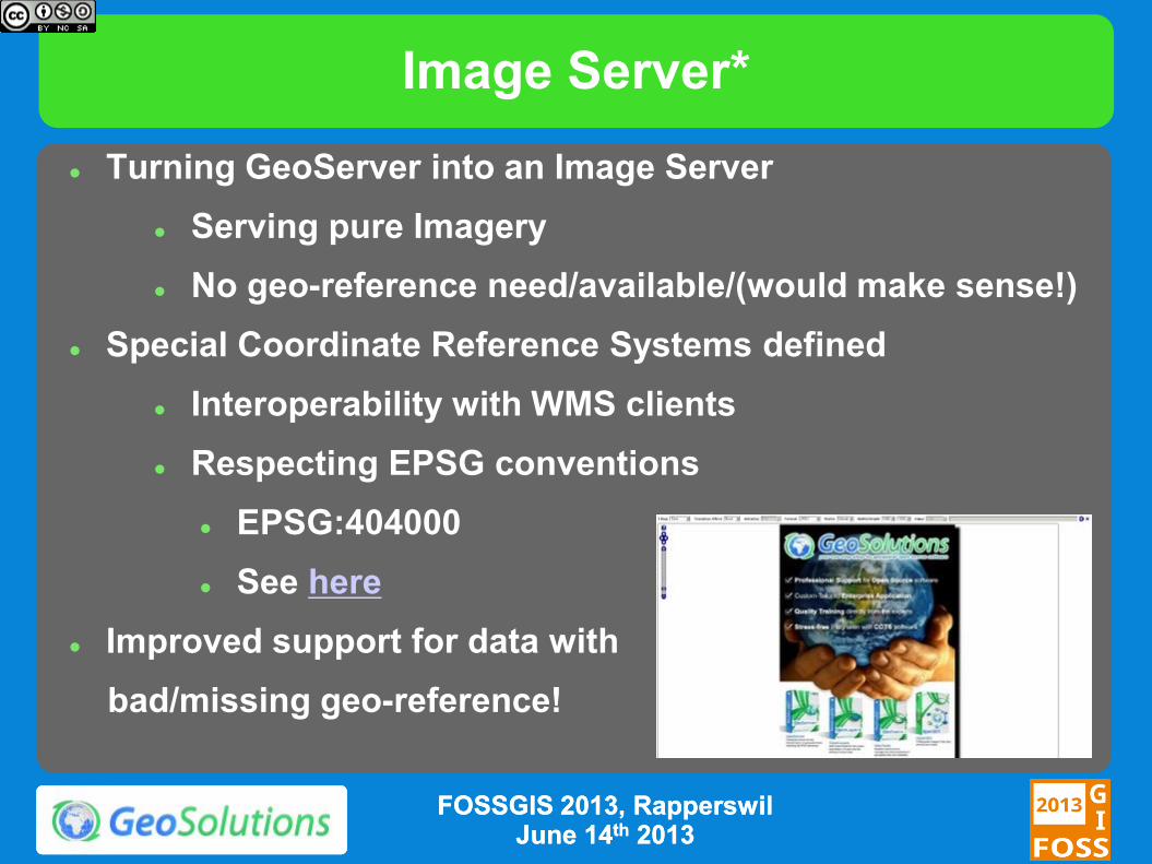
Image Server*
Turning GeoServer into an Image Server
Serving pure Imagery
No geo-reference need/available/(would make sense!)
Special Coordinate Reference Systems defined
Interoperability with WMS clients
Respecting EPSG conventions
EPSG:404000
See here
Improved support for data with
bad/missing geo-reference!
FOSSGIS 2013, FOSSGIS 2013, RapperswilRapperswil June 14June 14thth 20132013
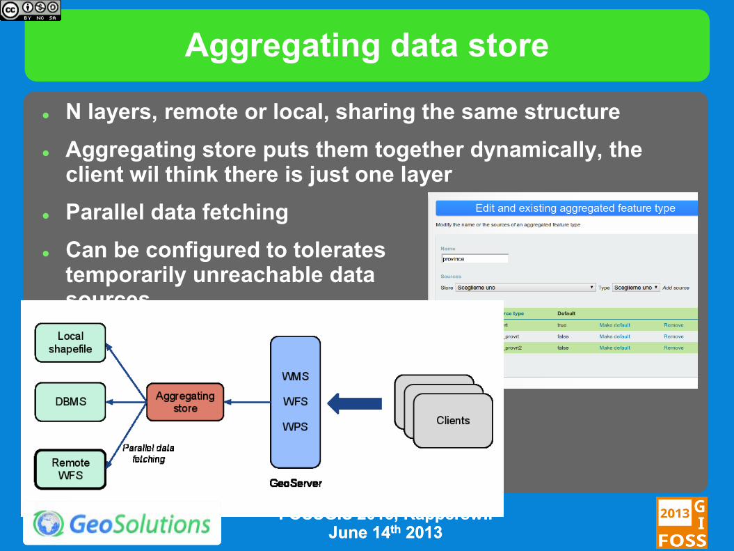
Aggregating data store
N layers, remote or local, sharing the same structure
Aggregating store puts them together dynamically, the client wil think there is just one layer
Parallel data fetching
Can be configured to tolerates temporarily unreachable data sources
FOSSGIS 2013, FOSSGIS 2013, RapperswilRapperswil June 14June 14thth 20132013
What’s new in 2.3.x
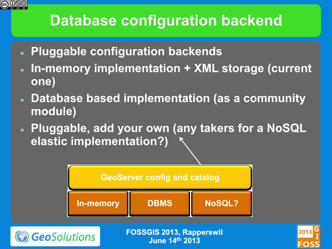
Database configuration backend
Pluggable configuration backends
In-memory implementation + XML storage (current one)
Database based implementation (as a community module)
Pluggable, add your own (any takers for a NoSQL elastic implementation?)
InIn--memorymemory
GeoServerGeoServer configconfig and and catalogcatalog
DBMSDBMS NoSQLNoSQL??
FOSSGIS 2013, FOSSGIS 2013, RapperswilRapperswil June 14June 14thth 20132013
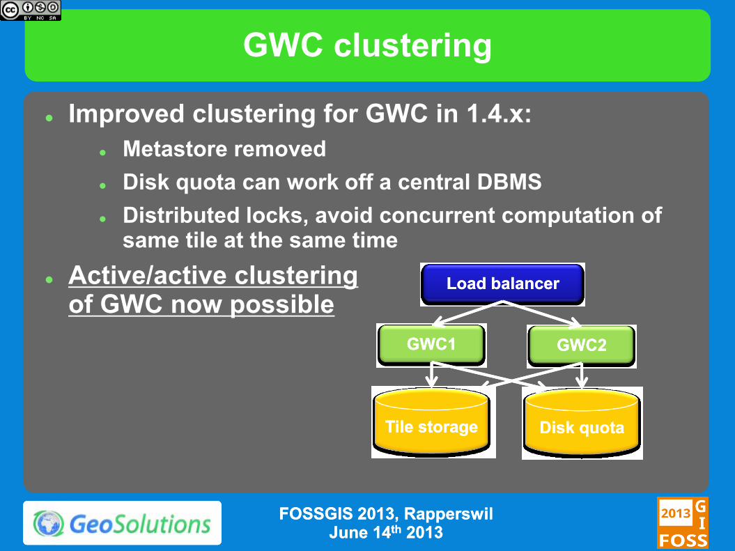
GWC clustering
Improved clustering for GWC in 1.4.x:
Metastore removed
Disk quota can work off a central DBMS
Distributed locks, avoid concurrent computation of same tile at the same time
Active/active clustering of GWC now possible
GWC1GWC1
TileTile storagestorage Disk quotaDisk quota
GWC2GWC2
LoadLoad balancerbalancer
FOSSGIS 2013, FOSSGIS 2013, RapperswilRapperswil June 14June 14thth 20132013
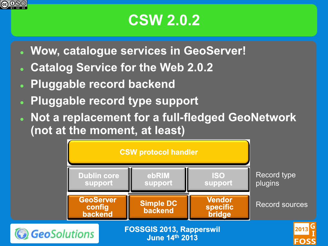
CSW 2.0.2
Wow, catalogue services in GeoServer!
Catalog Service for the Web 2.0.2
Pluggable record backend
Pluggable record type support
Not a replacement for a full-fledged GeoNetwork (not at the moment, at least)
Dublin core Dublin core supportsupport
GeoServerGeoServer configconfig
backendbackend
CSW CSW protocolprotocol handlerhandler
ebRIMebRIM supportsupport
ISO ISO supportsupport
Simple DC Simple DC backendbackend
Vendor Vendor specific specific bridgebridge
Record type plugins
Record sources
FOSSGIS 2013, FOSSGIS 2013, RapperswilRapperswil June 14June 14thth 20132013
CSW 2.0.2
Current implementation
Demo backend with Dublin Core record support, passes CITE certifications tests
ISO + Dublin core backend reporting layers in the GeoServer configuration, in development
ebRIM (Earth Observation profile) implementation plus proxy to a in-house, vendor specific catalog (proxy front-end model)
Currently a community module
will be graduated to extension once the ISO backend over the GeoServer own config is completed
FOSSGIS 2013, FOSSGIS 2013, RapperswilRapperswil June 14June 14thth 20132013
WCS 2.0
WCS 2.0 implementation with extensions:
Range subsetting
Scaling and interpolation
CRS (reprojection)
GeoTiff & NetCDF encoding
Earth Observation profile support Temporal series
Exposing mosaic structure
EO metadata describing sensors
NetCDF support as both input and output
Sponsors DLR (German spatial agency)
EUMETSAT (European operational satellite agency for monitoring weather, climate and the environment)
FOSSGIS 2013, FOSSGIS 2013, RapperswilRapperswil
June 14June 14thth 20132013
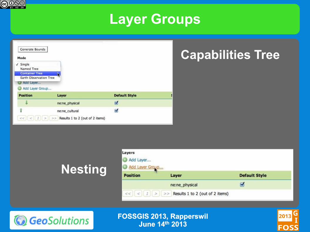
Layer Groups
FOSSGIS 2013, FOSSGIS 2013, RapperswilRapperswil June 14June 14thth 20132013
Capabilities Tree
Nesting
Other Enhancements
WPS Process Selection
WMS Additional Dimensions
More INSPIRE
Monitoring Extension
Extensive JSONP Support
Security Subsystem Improvements
FOSSGIS 2013, FOSSGIS 2013, RapperswilRapperswil June 14June 14thth 20132013

What’s cooking for 2.4.x (plus wish list )
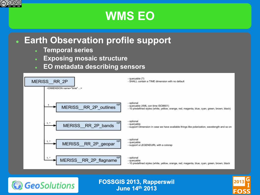
WMS EO
Earth Observation profile support Temporal series
Exposing mosaic structure
EO metadata describing sensors
FOSSGIS 2013, FOSSGIS 2013, RapperswilRapperswil June 14June 14thth 20132013
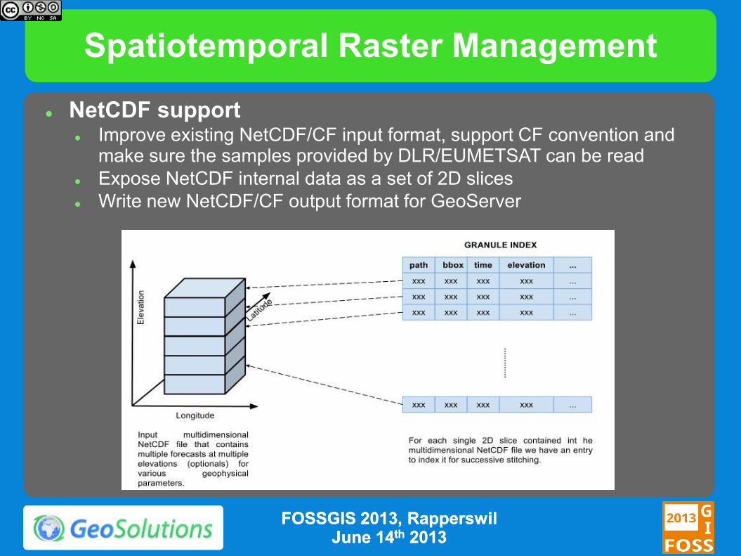
Spatiotemporal Raster Management
NetCDF support Improve existing NetCDF/CF input format, support CF convention and
make sure the samples provided by DLR/EUMETSAT can be read
Expose NetCDF internal data as a set of 2D slices
Write new NetCDF/CF output format for GeoServer
FOSSGIS 2013, FOSSGIS 2013, RapperswilRapperswil June 14June 14thth 20132013
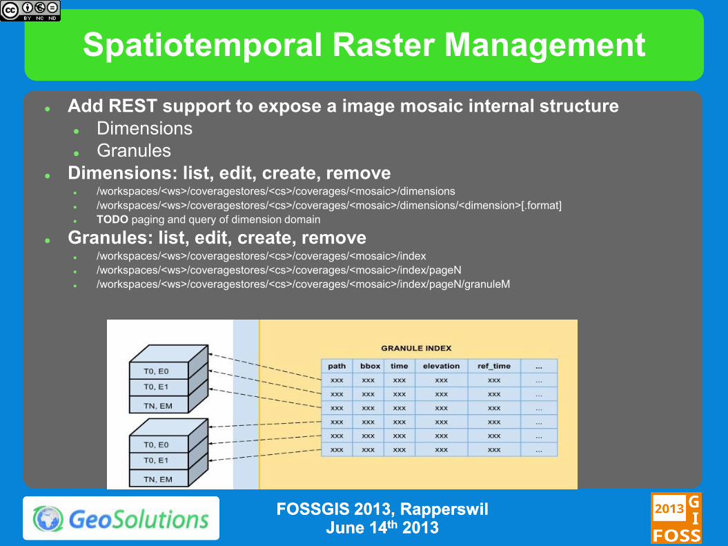
Spatiotemporal Raster Management
Add REST support to expose a image mosaic internal structure
Dimensions
Granules
Dimensions: list, edit, create, remove /workspaces/<ws>/coveragestores/<cs>/coverages/<mosaic>/dimensions
/workspaces/<ws>/coveragestores/<cs>/coverages/<mosaic>/dimensions/<dimension>[.format]
TODO paging and query of dimension domain
Granules: list, edit, create, remove /workspaces/<ws>/coveragestores/<cs>/coverages/<mosaic>/index
/workspaces/<ws>/coveragestores/<cs>/coverages/<mosaic>/index/pageN
/workspaces/<ws>/coveragestores/<cs>/coverages/<mosaic>/index/pageN/granuleM
FOSSGIS 2013, FOSSGIS 2013, RapperswilRapperswil June 14June 14thth 20132013
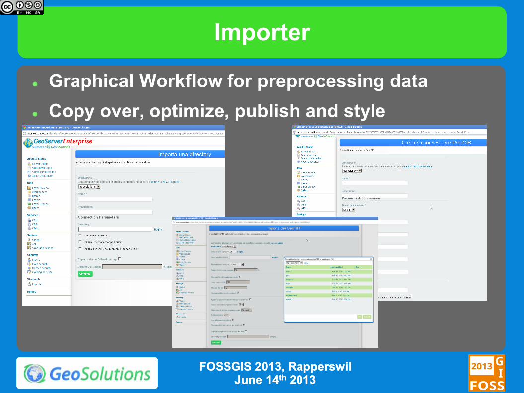
Importer
Graphical Workflow for preprocessing data
Copy over, optimize, publish and style
FOSSGIS 2013, FOSSGIS 2013, RapperswilRapperswil June 14June 14thth 20132013
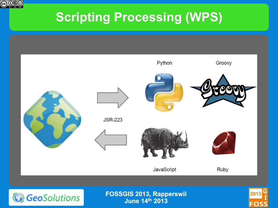
Scripting Processing (WPS)
FOSSGIS 2013, FOSSGIS 2013, RapperswilRapperswil June 14June 14thth 20132013
More…
QGIS Integration
Vector Data Attribute Remapping
Advanced Authorization Subsystem
Circular Arc Support
FOSSGIS 2013, FOSSGIS 2013, RapperswilRapperswil June 14June 14thth 20132013

The End
Questions?Questions? [email protected]@geo--solutions.itsolutions.it
[email protected]@geo--solutions.itsolutions.it
FOSSGIS 2013, FOSSGIS 2013, RapperswilRapperswil June 14June 14thth 20132013