Embed Size (px)
Citation preview
GEOMORPHOLOGY, SEDIMENTOLOGY AND
STRATIGRAPHY OF PERAK RIVER AND COASTAL PLAINS.Maizatul Asnida binti Abdul Manaf (G01417)
Supervisor: AP Dr. Abdul Hadi bin Abdul RahmanCo-supervisor: En. Jasmi Ab Talib
1
OUTLINE:INTRODUCTION
RESEARCH BACKGROUND
PROBLEM STATEMENT
METHODOLOGY
2
RESEARCH OBJECTIVE
RESEARCH FINDING & CONCLUSION
FUTURE DIRECTION
• This study focuses on the geomorphology,sedimentology and stratigraphy of the PerakRiver and its coastal plain areas.
• It is an attempt to unravel the controls on theevolution of the river and the sedimentationon the coastal-deltaic plain of the larger partof Perak.
• This study will try to document the presentgeographical and geomorphologic aspects ofthe river, as well as the Quaternarysuccessions of the coastal plain.
.
INTRODUCTION
3
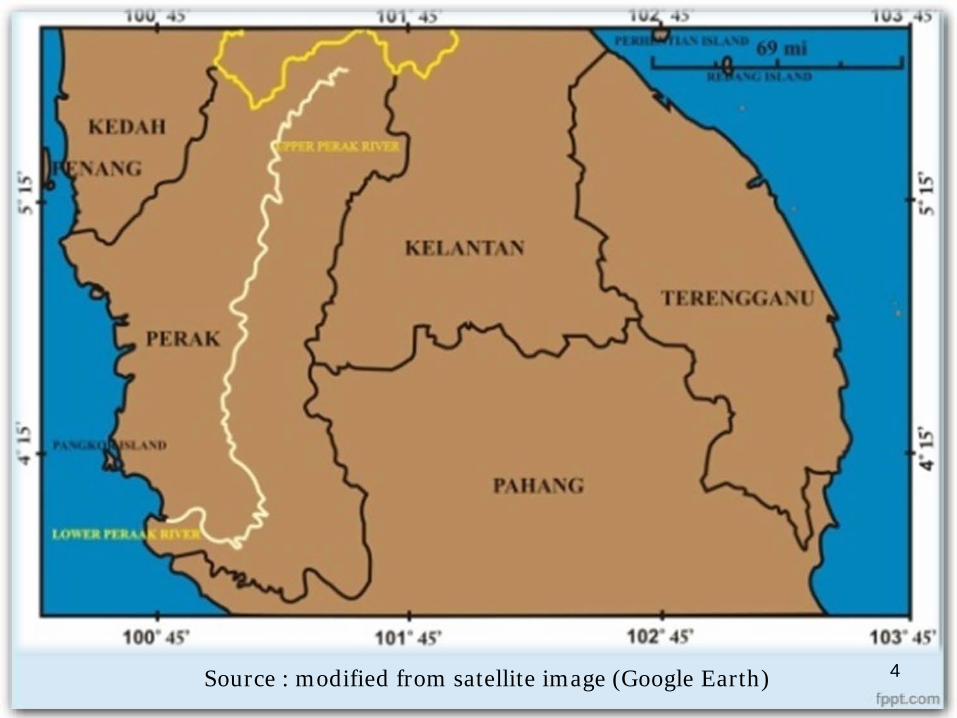
Source : modified from satellite image (Google Earth) 4
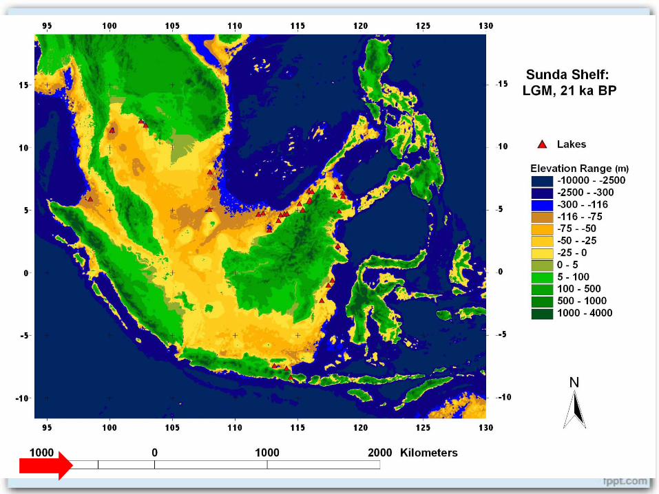
1. Holocene sea-level change Exposed during Last Glacial Maximum (LGM);
about -116m below MSL. Situated middle of Sundaland. ‘A savanna corridor’
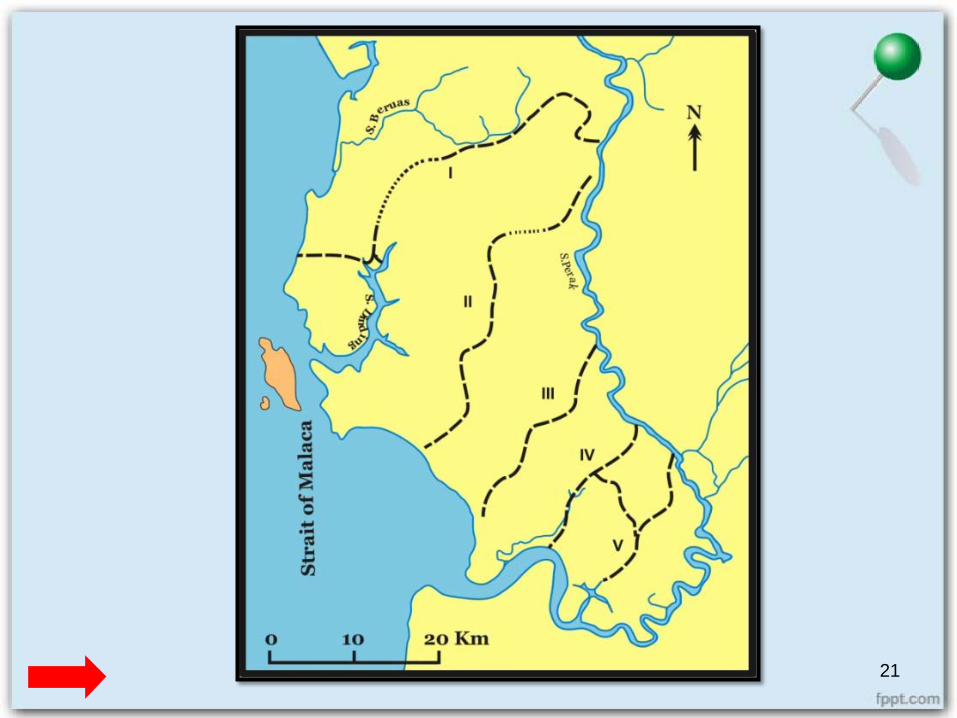
2. Perak River evolution Studied by Koopmans (1964). 5 evolution based on aerial photograph.
5
RESEARCH BACKGROUND
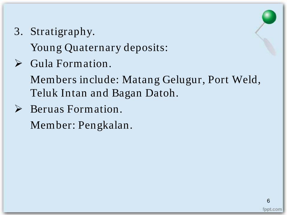
3. Stratigraphy.Young Quaternary deposits:
Gula Formation. Members include: Matang Gelugur, Port Weld, Teluk Intan and Bagan Datoh.
Beruas Formation.Member: Pengkalan.
6
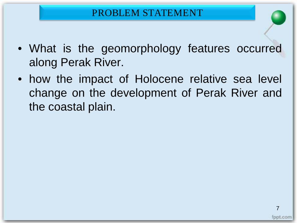
• What is the geomorphology features occurredalong Perak River.
• how the impact of Holocene relative sea levelchange on the development of Perak River andthe coastal plain.
PROBLEM STATEMENT
7
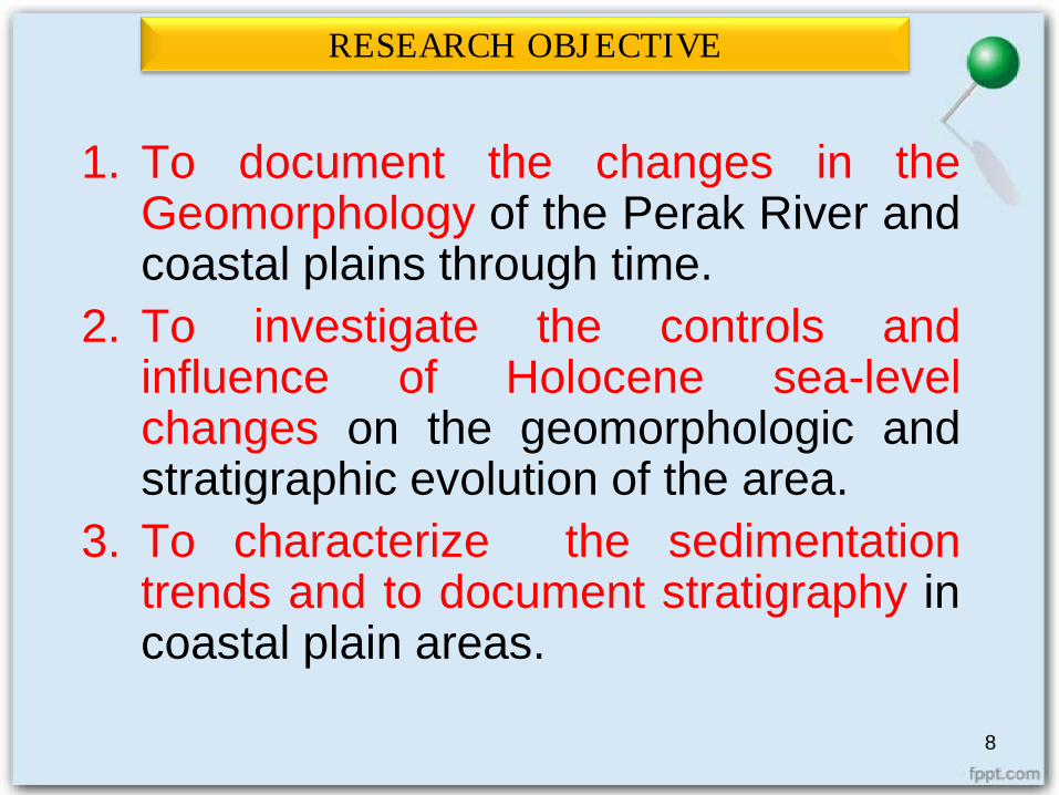
1. To document the changes in theGeomorphology of the Perak River andcoastal plains through time.
2. To investigate the controls andinfluence of Holocene sea-levelchanges on the geomorphologic andstratigraphic evolution of the area.
3. To characterize the sedimentationtrends and to document stratigraphy incoastal plain areas.
RESEARCH OBJECTIVE
8
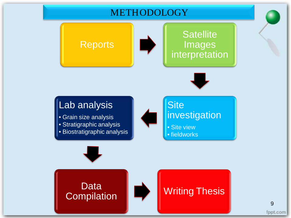
ReportsSatellite Images
interpretation
Site investigation• Site view• fieldworks
Lab analysis• Grain size analysis• Stratigraphic analysis• Biostratigraphic analysis
Data Compilation Writing Thesis
9
METHODOLOGY
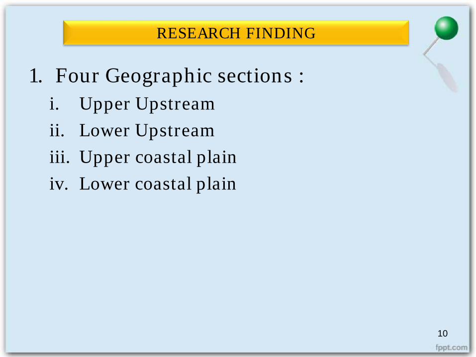
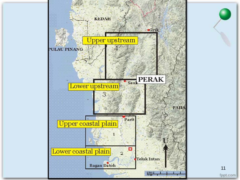
1. Four Geographic sections :i. Upper Upstreamii. Lower Upstreamiii. Upper coastal plainiv. Lower coastal plain
10
RESEARCH FINDING
11
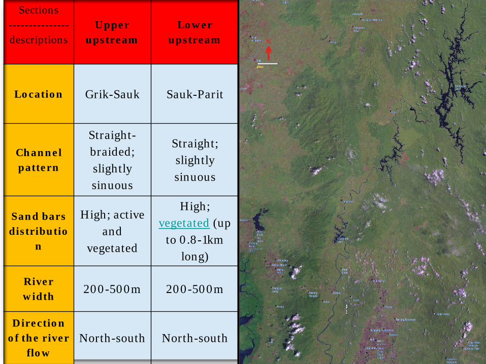
Sections---------------descriptions
Upper upstream
Lower upstream
Location Grik-Sauk Sauk-Parit
Channel pattern
Straight-braided; slightly sinuous
Straight; slightly sinuous
Sand barsdistributio
n
High; active and
vegetated
High; vegetated (up
to 0.8-1km long)
River width 200-500m 200-500m
Direction of the river
flowNorth-south North-south
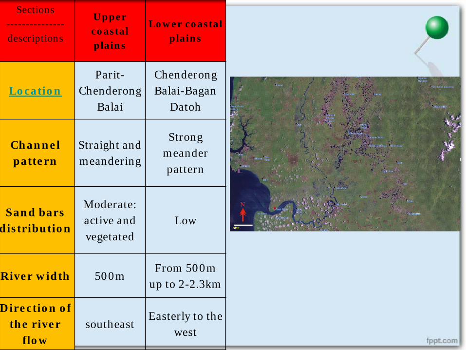
Sections---------------descriptions
Upper coastal plains
Lower coastal plains
LocationParit-
ChenderongBalai
Chenderong Balai-Bagan
Datoh
Channel pattern
Straight and meandering
Strong meander pattern
Sand barsdistribution
Moderate: active and vegetated
Low
River width 500mFrom 500m
up to 2-2.3km
Direction of the river
flowsoutheast
Easterly to the west

2. Borehole Data. Collection and compilation from previous studies.
14
STRATIGRAPHYThis Quaternary sediment is thins towards the foothills, but maythicken up to 76m towards the lower coastal plain.
The borehole data analysis from earlier reseacher shows:• Lithologies: peat, clay, silt, sand and gravel. • Borehole depth: 4 meters to 78 meters around 15 areas.
Upper coastal areas (Lambor Kanan):Beruas F (clay, silt, gravel, peat) underlies by Gula F ( clay, silt ,sand).
Foodplain (Ayer Tawar):2 layers contain of plant remains and peat. (clay, silt, sand and peat)
Lower coastal areas (Teluk Intan): Clayey sediment and peat at the top of each log.
River mouth (Bagan Datoh):Gula F: Matang Gelugur M (sand, silt), Teluk Intan M (sand, clay, silt, plant remains) 15
16
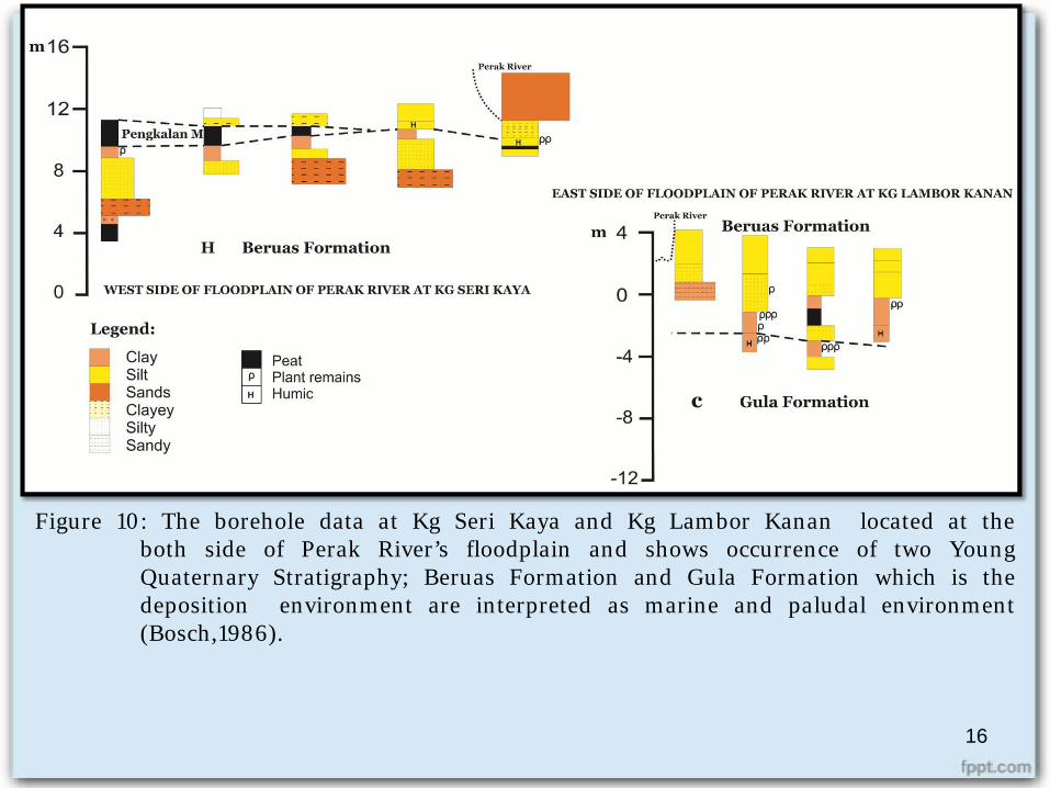
Figure 10: The borehole data at Kg Seri Kaya and Kg Lambor Kanan located at theboth side of Perak River’s floodplain and shows occurrence of two YoungQuaternary Stratigraphy; Beruas Formation and Gula Formation which is thedeposition environment are interpreted as marine and paludal environment(Bosch,1986).
17
CONCLUSION
1. The flows direction: from north to the south and change its direction towards the west from Teluk Intan to Bagan Datoh. Factors may influence the changes:
i. The topography and types of river bank. ii. human impact: vegetation and development
2. Holocene Sea-level change.Eg: Kg Seri Kaya and Kg. Lambor Kanan from loginterpretation from borehole data by Bosch (1986) as shownin Figure 11 .
3. River channel patterni. Straight-braided : high distribution of sand bars ii. Meandering : moderate to low distribution of sand bars
18
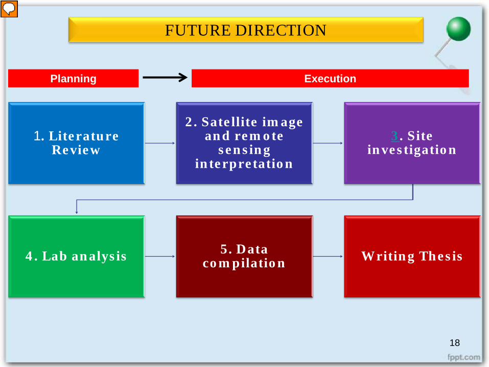
FUTURE DIRECTION
1. Literature Review
2. Satellite image and remote
sensing interpretation
3. Site investigation
4. Lab analysis 5. Data compilation Writing Thesis
Planning Execution

THANK YOU FOR YOUR ATTENTION~
19
20
21
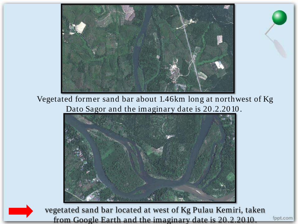
Vegetated former sand bar about 1.46km long at northwest of Kg Dato Sagor and the imaginary date is 20.2.2010.
vegetated sand bar located at west of Kg Pulau Kemiri, taken from Google Earth and the imaginary date is 20.2.2010.
23
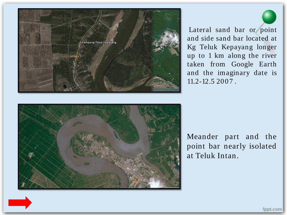
Lateral sand bar or pointand side sand bar located atKg Teluk Kepayang longerup to 1 km along the rivertaken from Google Earthand the imaginary date is11.2-12.5 2007 .
Meander part and thepoint bar nearly isolatedat Teluk Intan.
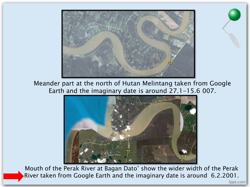
Meander part at the north of Hutan Melintang taken from Google Earth and the imaginary date is around 27.1-15.6 007.
Mouth of the Perak River at Bagan Dato’ show the wider width of the Perak River taken from Google Earth and the imaginary date is around 6.2.2001.
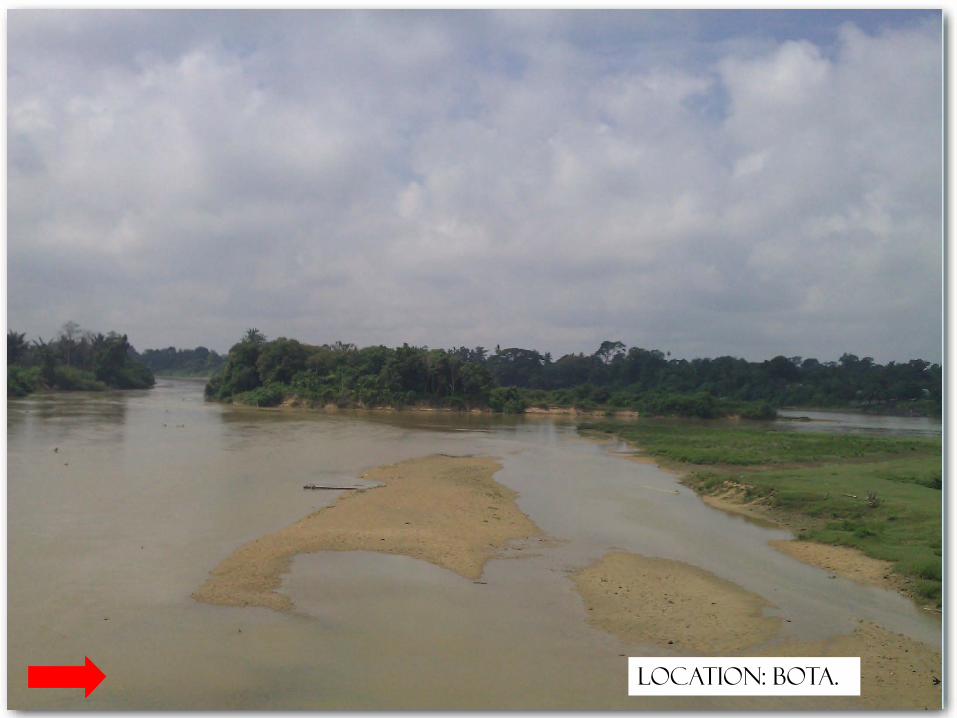
26Location: Bota.
27
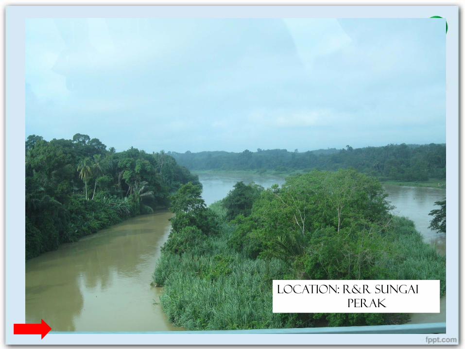
Location: R&R Sungai Perak
28
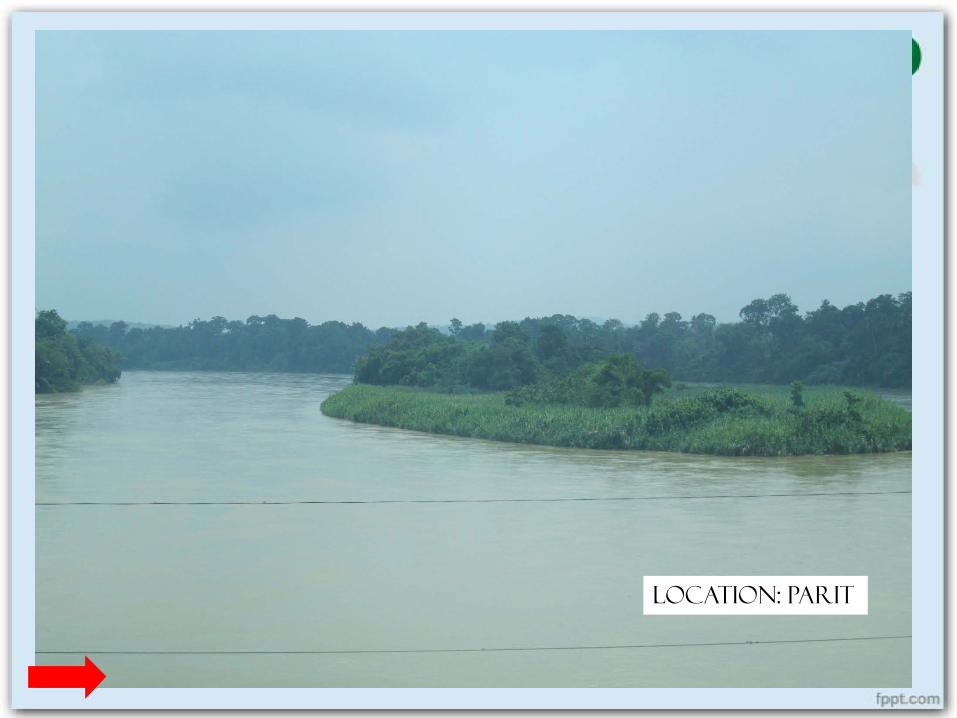
Location: Parit