Embed Size (px)
Citation preview

November 2014
GeoMOLGThe Integrated Spatial Information System of the Ministry of Local Government
Ministry of Local Government

In partnership with Local Governance and Civil Society Programme implemented by GIZ on behalf of the German Federal Ministry for Economic Cooperation and Development BMZ
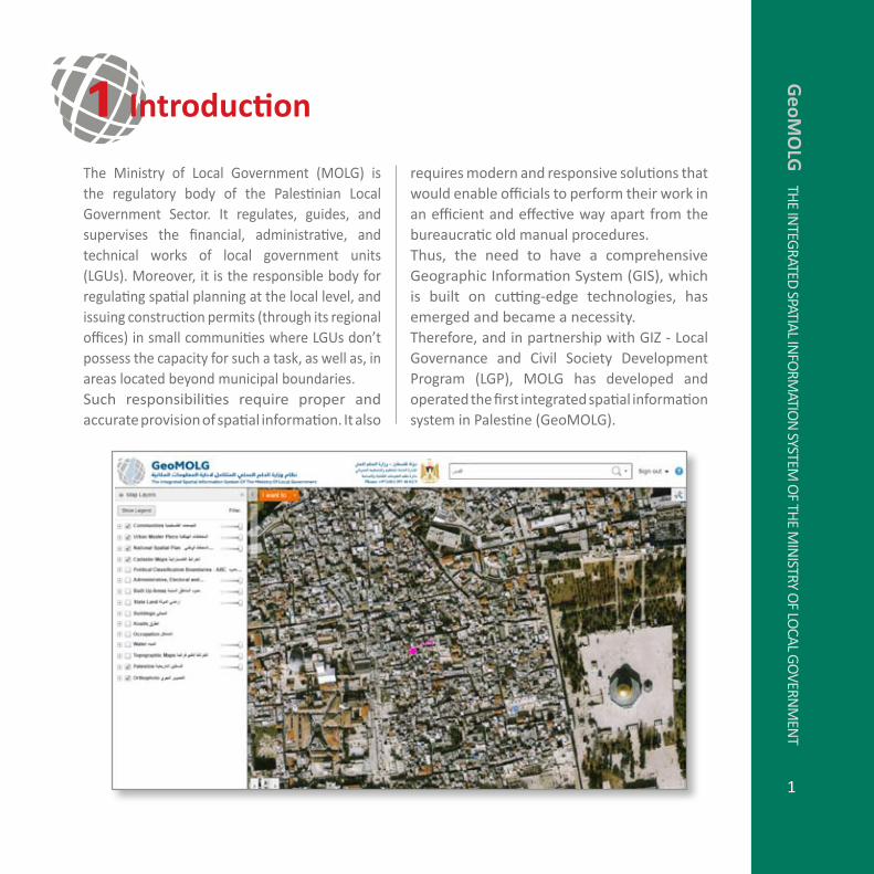
The Ministry of Local Government (MOLG) is the regulatory body of the Palestinian Local Government Sector. It regulates, guides, and supervises the financial, administrative, and technical works of local government units (LGUs). Moreover, it is the responsible body for regulating spatial planning at the local level, and issuing construction permits (through its regional offices) in small communities where LGUs don’t possess the capacity for such a task, as well as, in areas located beyond municipal boundaries. Such responsibilities require proper and accurate provision of spatial information. It also
GeoM
OLG
The In
TeGraTed
SpaTIaL InfO
rMaTIO
n SySTeM
Of Th
e MIn
ISTry Of LO
caL GO
vernM
enT
1
requires modern and responsive solutions that would enable officials to perform their work in an efficient and effective way apart from the bureaucratic old manual procedures. Thus, the need to have a comprehensive Geographic Information System (GIS), which is built on cutting-edge technologies, has emerged and became a necessity. Therefore, and in partnership with GIZ - Local Governance and civil Society development program (LGp), MOLG has developed and operated the first integrated spatial information system in Palestine (GeoMOLG).
1 Introduction

The key benefits of GeoMOLG can be summarized in terms of reduction of time, cost, and efforts in responding to stakeholders’ inquiries relevant to spatial data on one hand, and in processing applications that require initial spatial data input, on the other hand. Some primary numbers reveals that 400,000 nIS and 1,800 work days have been saved per year at the level of MOLG departments and its eleven regional offices across the West Bank. Such benefits are demonstrated by the following:
field visits are reduced as a result of the • availability of an aerial photo of 25cm resolution in the system that provides very rich visual interpretation for the reality. for example, in hebron regional Office, field visits dropped from 15 to 4 per week. Efforts are decreased in reaching spatial • data due to all spatial data is available in digital format instead of hard copies.Time is minimized in providing\obtaining • spatial data due to serving requests through friendly and very powerful applications.
Furthermore, and for the first time in the country, key institutions and line ministries are able to share among themselves up-to-date spatial information as it happens in
2
the real-time. Such a development allows stakeholders to view the spatial information as produced by its source agency. for example, all spatial information related to Urban Master plans (UMps) is being produced by MOLG and viewed by all stakeholders connected to the system. The same applies to spatial information produced by institutions such as Ministry of agriculture, Land authority, LGUs, and others. Thus, data improbability has been realized in an effective manner, which allows the realization of the E-Government vision.
Geo
MO
LG
The
InTe
Gra
Ted
Spa
TIaL
InfO
rMaT
IOn
SyS
TeM
Of
The
MIn
ISTr
y O
f LO
caL G
Ove
rnM
enT 2 Key Benefits of GeoMOLG

3
developing a GIS based system is not the first attempt of its kind either at the local or at the national level. However, GeoMOLG is considered distinct due to the following facts:
GeoMOLG is the most comprehensive GIS 1. based system at the national scale where major amounts of the national spatial data are made accessible.GeoMOLG is featured by the most powerful 2. web mapping application (Geocortex). The application starts with a browser and, thus, no sophisticated expertise is required to get familiar with its functionalities and capabilities.
The following are the key factors for the design of GeoMOLG:
The system should contain all spatial data 1. needs of MOLG departments and regional offices, as well as, data needs of LGUs.The system could be accessed through 2. intranet and/or internet using web browsing and, thus, there is no need to deploy any other specific applications at the end user machine.
The system must be user-friendly and, 3. thus, end users don’t need to be IT or GIS experts to get familiar with it.The system should contain the most 4. accurate and updated data. Updates can be performed via web mapping application for simple data while the more complex data can be edited through desktop software.The system must be able to connect to 5. other systems and multiple data formats.
4 Key Considerations of the GeoMOLG Design
3 What Makes the GeoMOLG Distinct?G
eoMO
LG Th
e InTeG
raTed SpaTIaL In
fOrM
aTIOn
SySTeM O
f The M
InISTry O
f LOcaL G
Overn
Men
T
GeoMOLG database is built on Microsoft 3. SQL Server, and enabled with the arcSde technology which allows simultaneous multi-editing either with the desktop or the web application.GeoMOLG is entirely developed in-house 4. to invest in available staff, thus, ensuring high level of sustainability of the system.GeoMOLG is the nucleus for an integrated 5. spatial information system for Palestine that takes care of all spatial data streamed from multiple official channels where this data is edited, validated, and maintained by its owner and source.
The following methodology has been applied to develop GeoMOLG as an integrated spatial information system that responds precisely to the business requirements of MOLG and LGUs:
5.1 Business Requirement IdentificationThis has included proper identification of tasks, functions, and tools that the system would serve and handle. for example, obtaining spatial information related to a particular parcel includes development regulations, offsets, licensing fees, and other information in accordance with land uses specified in Urban Master plans (UMps).
5.2 Data CollectionBased on the identified functionality of the system, relevant data has been made available either through direct connection with the source of the data or through in-house digitization of this data.
5 Methodology of Developing GeoMOLG
5.2.1 Spatial Data Availability through GeoMOLGGeoMOLG includes and provides, but not limited to, the following set of spatial data:
Urban Masters plans (UMps) :1. approved UMps in areas (a) and (B)i. UMPs in objection phase in Areas (A) ii. and (B)approved UMps in area (c)iii. UMPs in objection phase in Area (C) iv. detailed UMpsv. Partial UMPs (developed at the era of vi. Israeli occupation before 1992)expansions of UMpsvii. Modifications on UMPsviii.
Modification of an existing land use a. and/or road within the boundary of UMpsDetailing a particular area within the b. boundary of UMps such as proposing new roads and/or land use
cadastral plans (blocks and parcels): to 2. identify the ownership boundaries.Political classification of the West Bank in 3. accordance to Oslo accords: Boarders of areas (a), (B), and (c)Land classification maps according to the 4. agricultural value (high, medium, low)Biodiversity areas5. natural reserve areas6.
4
Geo
MO
LG
The
InTe
Gra
Ted
Spa
TIaL
InfO
rMaT
IOn
SyS
TeM
Of
The
MIn
ISTr
y O
f LO
caL G
Ove
rnM
enT

Landscapes areas7. archeological sites8. Streams and rivers9.
contours10. State lands (registered, announced, 11. surveyed)Communities (Attributes: population, LGU 12. classification, services, UMP status, etc.)Facilities and services locations13. Administrative boundaries of local 14. communitiesAdministrative boundaries of governorates15.
5
Updated Orthophoto (2014) with a spatial 16. resolution (pixel size) of 25 cm and a spatial accuracy (locational error) of 50 cm.
5.2.2 Why Spatial Data Matters on the Local Context of Palestine?The following table clarifies some of the decisions that are taken in light of spatial data provided. This table is intended to demonstrate how critical the consequences of decisions that are built on the basis of the available data.
Spatial Data Implications for Decision Making
Urban Master plans (UMps)
UMPs set the regulations for the development of lands. Thus, having all UMps from its source through GeoMOLG, provide a comprehensive and integrated set of land-use regulations such as development percentages, offsets, licensing fees, and others for any land parcel across the country.
Political classification of the West Bank: Areas A, B, c
The political classification of the West Bank land in accordance to Oslo has the following implications on decisions related to service delivery as follows:
1. Construction permits:
in Areas (A) and (B), are issued by the Palestinians, but in Area (C) are •issued by the other party.
2. Utilities:
In areas (a) and (B), water, electricity, and sewerage services are provided •by the Palestinians against verifying the permit of construction for the building in question
In Area (C) such services are provided by Palestinians against commitment •from the owner to follow the Palestinian regulations.
Thus, providing the exact borders of these a, B, c areas through GeoMOLG would contribute to the resilience of people residing in area c and would improve service delivery level.
GeoM
OLG
The In
TeGraTed
SpaTIaL InfO
rMaTIO
n SySTeM
Of Th
e MIn
ISTry Of LO
caL GO
vernM
enT

Agricultural Classification Providing such a comprehensive up to date information through GeoMOLG would regulate the development in the country since:
Construction is not permitted in areas of high agricultural value.•
Construction is subject to the decisions of the prospective committees •regarding areas of medium agricultural value
Construction is allowed in areas classified as low agricultural value.•
cadaster Maps (Blocks and parcels)
It provides all relevant information of land parcels such as its surface area and location in an up-to-date manner.
natural reserve Construction is not allowed in all areas classified as natural reserved
Biodiversity Construction is not allowed in all areas classified as biodiversity
archeological areas Construction is not allowed in all areas that have archeological sites
valleys Construction is not allowed within a specific buffer (stated in the law) for the edges of valleys
aerial photos Aerial Photos provide very rich visual context for spatial data on the ground. Some benefits are:
Lands located outside the UMps are allowed to have one building only • whereas several constructions are not allowed. When applying for a construction permit in these lands, it can be assured through the aerial photo the current situation of these lands and thus no permit is issued in case there was an existing building or construction on it.
Errors and mistakes can be detected in other layers particularly the land • classification according to agricultural value.
5.2.3 Data Update MechanismLand use spatial data of UMPs is dynamic and changes are happening over time. Therefore, in order to ensure the provision of the most updated version of UMPs, a Minister’s decree has been issued which requires MOLG department to provide GeoMOLG with all
relevant updates. Currently, the GIS core staff at MOLG edits the approved modifications of UMps. however, the plan is to delegate such a task to the staff of the regional offices in order to be able to maintain these updates directly.
6
Geo
MO
LG
The
InTe
Gra
Ted
Spa
TIaL
InfO
rMaT
IOn
SyS
TeM
Of
The
MIn
ISTr
y O
f LO
caL G
Ove
rnM
enT

5.2.4 GPS Technology to Double Check the DataIn principle, the major inputs to commence developments of UMPs are the spatial entities on the ground for the area of interest. Therefore, more accurate data produces better UMPs. Generally, the spatial entities of the area of interest are represented in cad formats. The process can be described as follows:
aerial photos• are captured with particular scale, resolution and accuracy.aerial photos• are processed to ensure best output possible in all terms.Spatial entities are digitized to provide • them in cad format.
However, it is very common to find that the spatial accuracy of CAD format entities is low.
7
for that purpose, MOLG is employing the GPS technology to double check that spatial location of the CAD formats entities (mainly provided by the private sector) match their correct location in reality. Therefore, the XY coordinates of a particular CAD objects obtained from the digitized version is compared with their corresponding Xy coordinates captured by the GpS. The error is calculated at this level and remarks are supplied.In this regard, it should be indicated that the specification of the aerial photo plays a major role in specifying the level of accuracy of the output. The most critical specifications of aerial photos are:
Spatial accuracy (XYZ coordinates in • respect with the correct values)
GeoM
OLG
The In
TeGraTed
SpaTIaL InfO
rMaTIO
n SySTeM
Of Th
e MIn
ISTry Of LO
caL GO
vernM
enT

Where X is the scale. For example, if an image is captured with a scale of 1:2500, then its resolution could be 50 cm.Originally, the scale of an aerial photo can be determined based on the flying height of the aircraft (H) and the focal length of the camera lens (f) as shown in the equation below:
for example, if an image is captured with a flying height of 1,800m with a camera lens of 15 cm, then the scale of the image would be 1:12000.
Spatial Resolution (pixel or cell size)• Image scale• Radiometric resolution (in bits)• Spectral resolution (number of bands)• Temporal resolution (date of capturing)• Time of capturing• coordinate system• Image format (ecw, jpg, tiff, etc.)•
In practice, the resolution of an image (R) can be derived from the image scale according to the equation below:
8
5.3 Software SelectionSoftware selection for GeoMOLG was based on ensuring the deployment of the most powerful GIS based applications and technologies. Those are depicted in the following table:
Application Product Version
engineering 1. Drafting Application
autocad 2015
Interoperability 2. Application
fMe desktop 2014
8
Geo
MO
LG
The
InTe
Gra
Ted
Spa
TIaL
InfO
rMaT
IOn
SyS
TeM
Of
The
MIn
ISTr
y O
f LO
caL G
Ove
rnM
enT

desktop 3. Mapping Application
arcGIS desktop (advanced Level)
10.2.2
enterprise 4. Spatial database
Microsoft SQL Server•Oracle•arcSde License (enterprise •Level)
201411g
Spatial Data 5. publisher
arcGIS Serve (Standard •Level)Image Server extension•
10.2.2
Web Mapping 6. Application
Geocortex Essentials•The Geocortex viewer o for SilverlightThe Geocortex viewer o for hTML5
Geocortex Optimizer •
4.1.2
Cloud Solution7. arcGIS Online(Desktop, Server and Web application solution via clouds)
Mobile Solution8. arcpad(to dynamically capture data from the field)
10.2
9
GeoM
OLG
The In
TeGraTed
SpaTIaL InfO
rMaTIO
n SySTeM
Of Th
e MIn
ISTry Of LO
caL GO
vernM
enT

5.4 Hardware SelectionHardware selection for GeoMOLG was based on ensuring a high level capacity to operate and process heavy spatial data editing and sharing. Those are highlighted in the following table.
Equipment Specifications
Server Machine1. 32 cores, 64 GB raM
network2. caT 7
Switch 3. 10/100/1000
editors Machine4. i7 32 GB or Xeon 3.5Gh
GpS device (rover)5. Tablet: Leica cS25antenna: Leica GG03System: RTK (differential)Data line: WatanyiaSoftware: Zeno field (ArcPad 10.2)accuracy: 2cm
5.5 Training and Capacity BuildingTraining themes are designed to fit the target group and users of the system. Mainly, training courses are addressed to three levels of users as following:
End-users • Data editing • System administration•
10
Geo
MO
LG
The
InTe
Gra
Ted
Spa
TIaL
InfO
rMaT
IOn
SyS
TeM
Of
The
MIn
ISTr
y O
f LO
caL G
Ove
rnM
enT
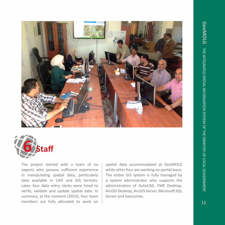
The project started with a team of six experts who possess sufficient experience in manipulating spatial data, particularly data available in cad and GIS formats. Later, four data entry clerks were hired to verify, validate and update spatial data. In summary, at the moment (2014), four team members are fully allocated to work on 11
6 Staff
spatial data accommodated at GeoMOLG while other four are working on partial basis. The entire GIS system is fully managed by a system administrator who supports the administration of AutoCAD, FME Desktop, ArcGIS Desktop, ArcGIS Server, Microsoft SQL Server and Geocortex.
GeoM
OLG
The In
TeGraTed
SpaTIaL InfO
rMaTIO
n SySTeM
Of Th
e MIn
ISTry Of LO
caL GO
vernM
enT

The project has started in december 2012. In May 2013, GeoMOLG was launched for the first time in its initial edition in basis of Application Developer Framework (ADF), a simple web mapping application. The duration that preceded the launch included identifying of functions and tools that should be available in the system, software and hardware deployment, collecting data and training. In november of the same year, the second generation of the system was launched that took the advantage of Geocortex as web mapping application. This forms a quantum leap in the way to reach the spatial data with the possibility to update it. Within this context, it should be
Currently, in order to access GeoMOLG, users need to have credentials (user name and password) based on which the level of accessibility to the spatial data is determined. The level of accessibility can be summarized on the following policies:
Users are able to see ALL the available information in the system• Users are able to see SOME of the available information in the system• Users are allowed to modify the available information in the system• Users are allowed to download the information from the system•
12
mentioned that all MOLG directorates were linked to the system to be able to obtain the spatial information easily and to dispense gradually from the paper maps to digital.
Geo
MO
LG
The
InTe
Gra
Ted
Spa
TIaL
InfO
rMaT
IOn
SyS
TeM
Of
The
MIn
ISTr
y O
f LO
caL G
Ove
rnM
enT
8 Accessibility to GeoMOLG
7 Project Duration and First Launch
The features below will be included in the system and are currently under development:
Geocoding: It assures reaching locations 1. by providing the location address (number of building, street name, and town name). dual range and Single house styles are used in building the address locator. Fabric: To preserve the history in editing 2. parcels as they are subject to splitting or union. 13
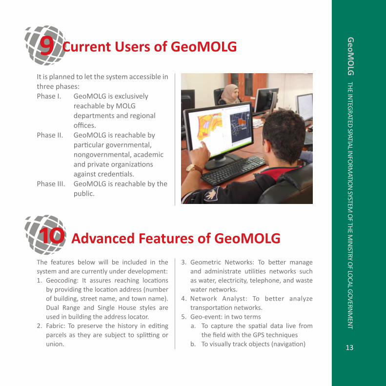
9 Current Users of GeoMOLG
10 Advanced Features of GeoMOLGGeometric Networks: To better manage 3. and administrate utilities networks such as water, electricity, telephone, and waste water networks.network analyst: To better analyze 4. transportation networks.Geo-event: in two terms5.
To capture the spatial data live from a. the field with the GPS techniquesTo visually track objects (navigation)b.
It is planned to let the system accessible in three phases:
GeoMOLG is exclusively phase I. reachable by MOLG departments and regional offices.GeoMOLG is reachable by phase II. particular governmental, nongovernmental, academic and private organizations against credentials.GeoMOLG is reachable by the phase III. public.
GeoM
OLG
The In
TeGraTed
SpaTIaL InfO
rMaTIO
n SySTeM
Of Th
e MIn
ISTry Of LO
caL GO
vernM
enT

MOLG and GIZ have prepared an ambitious but realistic plan to further develop and enhance the capacities of GeoMOLG. The purpose of such enhancement is to set solid grounds for policy formulation, planning, and decision making in the country. It also aims at improving the level and quality of services provided through to the Palestinian public. The below are selected envisaged improvements
Geo
MO
LG
The
InTe
Gra
Ted
Spa
TIaL
InfO
rMaT
IOn
SyS
TeM
Of
The
MIn
ISTr
y O
f LO
caL G
Ove
rnM
enT
14
that will materialize at the short run:Drafting construction offsets by • GeoMOLGannouncing UMps for public and • collecting objections via GeoMOLGIssuing constructions permits • electronically, accessing the GeoMOLG via smart • phones (to fit display limitation)
11 Future Plan

Dr. Tawfiq Boudari “We are proud of what we have achieved so far regarding the development of an integrated spatial information system for the benefit of MOLG and its directorates. In addition the GeoMOLG is designed to provide the most important spatial data at the national scale, and we care about its quality according to the massive impact of this data in making critical decisions.”
Dr.Azzam Al-Hjouj “The vision of MOLG is to share spatial data with other institutions particularly when it related to the urban master plans. The benefit of this vision is to reach the land use maps for all communities at the national level. GeoMOLG bridges the gap and put this spatial information on a plate of gold for the benefit of prospective users.”
Eng.Jehad Rabaya “With limited resources, we are able to invest in our staff and build in-house what precisely fits our need in the field of spatial data. We are delighted to manufacture GeoMOLG within a short time with full functionalities and capabilities.”
Eng. Jamal Numan“GeoMOLG is seen to be an actual cache in the account of the Palestinian E-Government. Our mission is to ease the accessibility to national spatial data since we believe that the issue is to take the advantage of data but not to merely own it.”
15
12 The TeamG
eoMO
LG Th
e InTeG
raTed SpaTIaL In
fOrM
aTIOn
SySTeM O
f The M
InISTry O
f LOcaL G
Overn
Men
T

Mr. Ulrich Nitschke “The availability of spatial data is a key component to start and implement particular projects or to take decisions. Therefore, we have ranked the development of an integrated GIS system as main priority and thus resources are allocated to help realizing this project. We are impressed with the level of the newly introduced GIS system and being put into operation. We are looking forward to maintain the enhancement and improvement of the system to serve other urgent functions and tools and thus to ameliorate services introduced to the public.”
Eng. Rani Daoud “GIZ is very interested in introducing adequate cutting-edge technologies to the officials for the purpose of improving services offered to the public. GeoMOLG has significantly enhanced the workflow, and reduced the cost, time and efforts to reach spatial data based on which important decisions are built.”
Steffen Gauger“Personally, I’m very glad to see our dreams of spatial data are coming true. Before my contract ends with the GIZ, I could see how the end users were happy with this crucial enhancement and how they were eager to include further functionalities to be served via GeoMOLG.”
Alexander Strunck“As a new team member of the cooperation between MOLG and GIZ, I’m impressed by the wide range of functions of GeoMOLG in such a short development time. Now the time starts to enhance the system with even more data and functions. We will take the system to the next level.”
Geo
MO
LG
The
GIS
SyS
TeM
Of
The
MIn
ISTr
y O
f LO
caL
GO
vern
Men
T
16