Embed Size (px)
Citation preview
GEOMATICS SURVEYING AND MAPPING EXPERTS FOR OVER 70 YEARS

2 SURVEYING AND MAPPING SOLUTIONS SPANNING THE ENTIRE PROJECT LIFECYCLE
700
200
28
Surveying Professionals
Active Field Crews
Geomatics Offices Across Canada The Bow – Calgary, Alberta
70+Years of Experience
3
GEOM
ATIC
S
SURVEYING AND MAPPING SOLUTIONS SPANNING THE ENTIRE PROJECT LIFECYCLE
Part art, part science, part technology, the Geomatics profession is constantly evolving. From the very first structures, early surveyors used primitive instruments and simple geometry to perform layouts and measurements. Today, advancing technology and field-to-finish data management enables WSP’s Geomatics professionals to deliver measurements unparallel in accuracy.
WSP is proud to be the largest survey provider in Canada, with over 700 Geomatics professionals, including more than 200 field crews working from 28 office locations coast-to-coast. Our strong project teams and proven track record, coupled with our commitment to safety and ISO 9001:2008 aligned quality program, means that our clients can have full confidence that their projects will be completed safely, on time, on budget, and be delivered as a high-quality product. From municipal development, to industrial construction and to Oil & Gas specific projects, we work in all sectors and at all stages of the job.
Knowledge is power, and having access to project-critical data from the office at all times means efficient communication and project management, as well as minimal errors and timeline overruns. A unique part of WSP’s approach to surveying includes the development and use of custom GIS tools and applications that allow this level of project knowledge. Using the best in survey technology and having access to award-winning GIS developers, no job is too large or complex for our team.
Safety is a big part of who we are. We have an award winning safety program ingrained in our culture, encompassing management, to junior staff and from office support to field operations. Our track record proves that we are committed, at all levels of our organization, to the health and safety of our employees.
GEOMATICS SERVICES ARE AN ESSENTIAL ELEMENT TO ANY ENGINEERING PROJECT NO MATTER HOW LARGE OR SMALL. WSP IS THE LEADER AND THE PREMIER CHOICE FOR GEOMATICS SOLUTIONS IN CANADA. FIRST ON THE GROUND, WSP GOES WHERE YOUR PROJECTS ARE BECAUSE GEOMATICS IS MORE THAN A PROFESSION – IT’S A WAY OF LIFE.
4
OUR PROJECT EXPERIENCE
WSP DELIVERS GEOMATICS SOLUTIONS TO SOME OF THE LARGEST PROJECTS IN CANADA. WE ARE PROUD TO HAVE A PREMIER REPUTATION AND LONG-TERM RELATIONSHIPS WITH OUR CLIENTS.
2
1
CLIENT: TransCanada Pipelines
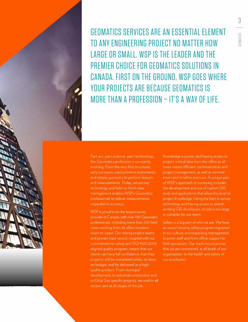
WSP has worked with TransCanada on new projects and existing infrastructure within its vast network. On the PRGT project, WSP provided scouting, preliminary design, survey, preliminary mapping products and survey plans, and crossing surveys through over 800 kilometres of rugged terrain from Hudson’s Hope to British Columbia’s northern coast.
1 | PRINCE RUPERT GAS TRANSMISSION (PRGT) – NORTHERN BC
CLIENT: Aecon, Keller, Graham, PCLWSP provided surveying services for the construction of this $4.1B Greenfield solution potash mine. Breaking ground in 2012, WSP was in the field with the early earthworks for the main site and the camp site, and carried on to all the piling (approximately 2,600 piles), foundations, underground facilities, well pads, and ponds.
3 | K+S LEGACY MINE REGINA, SK
CLIENT: Supreme Walters Joint Venture Ledcor Construction Ltd. WSP provided professional Geomatics services on The Bow, a $1.4B crescent-shaped, steel-frame tower, on many aspects of the construction including the establishment and maintenance of the precise exterior control network. The control network was comprised of external stable control monuments installed and coordinated by WSP. In addition, the external control network was augmented through the installation, coordination, and maintenance of a network of roof-top, 360-degree prisms on neighbouring buildings.
2 | THE BOW CALGARY, AB
5
GEOM
ATIC
S
3 4
5
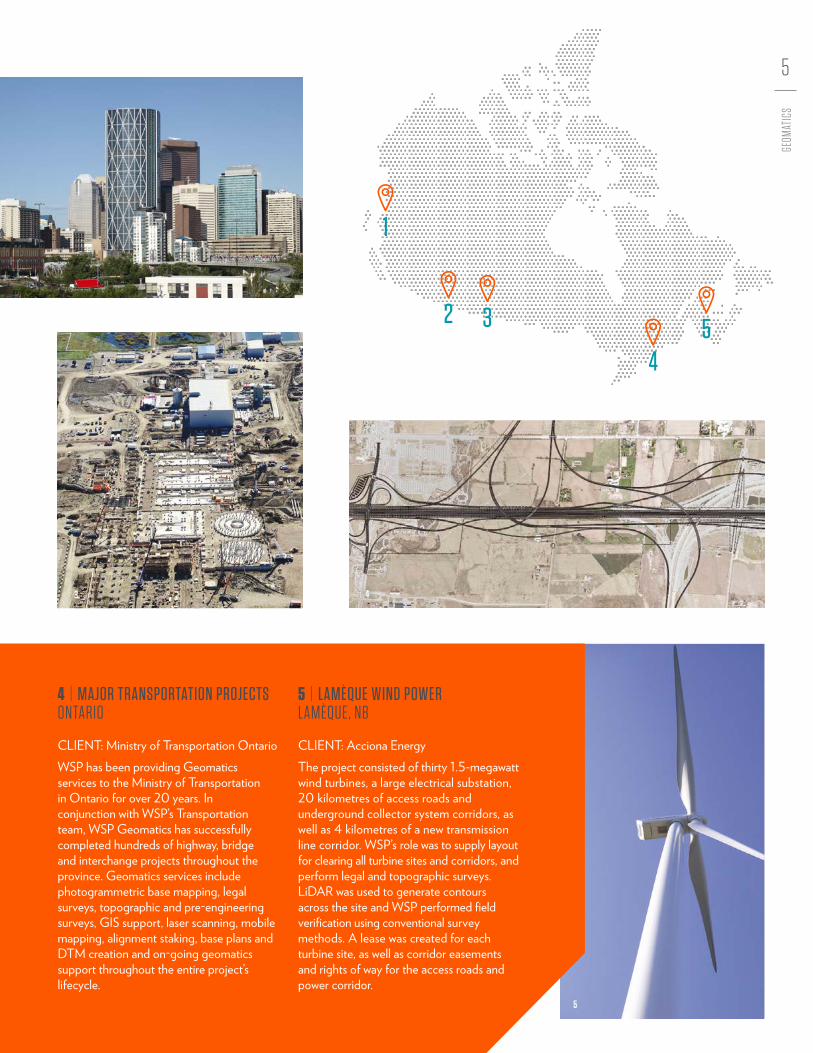
CLIENT: Ministry of Transportation OntarioWSP has been providing Geomatics services to the Ministry of Transportation in Ontario for over 20 years. In conjunction with WSP’s Transportation team, WSP Geomatics has successfully completed hundreds of highway, bridge and interchange projects throughout the province. Geomatics services include photogrammetric base mapping, legal surveys, topographic and pre-engineering surveys, GIS support, laser scanning, mobile mapping, alignment staking, base plans and DTM creation and on-going geomatics support throughout the entire project’s lifecycle.
CLIENT: Acciona EnergyThe project consisted of thirty 1.5-megawatt wind turbines, a large electrical substation, 20 kilometres of access roads and underground collector system corridors, as well as 4 kilometres of a new transmission line corridor. WSP’s role was to supply layout for clearing all turbine sites and corridors, and perform legal and topographic surveys. LiDAR was used to generate contours across the site and WSP performed field verification using conventional survey methods. A lease was created for each turbine site, as well as corridor easements and rights of way for the access roads and power corridor.
4 | MAJOR TRANSPORTATION PROJECTS ONTARIO
5 | LAMÈQUE WIND POWER LAMÈQUE, NB
1
2 3
45
6
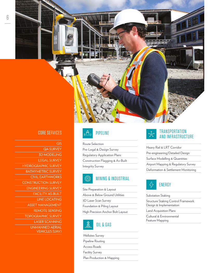
OIL & GAS
Wellsites SurveyPipeline RoutingAccess Roads Facility SurveyPlan Production & Mapping
TRANSPORTATION AND INFRASTRUCTURE
Heavy Rail & LRT Corridor Pre-engineering/Detailed Design Surface Modelling & QuantitiesAirport Mapping & Regulatory SurveyDeformation & Settlement Monitoring
PIPELINE
Route Selection Pre-Legal & Design SurveyRegulatory Application PlansConstruction Flagging & As-BuiltIntegrity Survey
MINING & INDUSTRIAL
Site Preparation & Layout Above & Below Ground Utilities 3D Laser Scan SurveyFoundation & Piling Layout High Precision Anchor Bolt Layout
ENERGY
Substation Staking Structure Staking Control Framework Design & ImplementationLand Acquisition Plans Cultural & Environmental Feature Mapping
CORE SERVICES
GISQA SURVEY
3D MODELINGLEGAL SURVEY
HYDROGRAPHIC SURVEYBATHYMETRIC SURVEY
CIVIL EARTHWORKSCONSTRUCTION SURVEY
ENGINEERING SURVEYFACILITY AS-BUILT
LINE LOCATINGASSET MANAGEMENT
REMOTE SENSINGTOPOGRAPHIC SURVEY
LASER SCANNINGUNMANNED AERIAL
VEHICLES (UAV)
7
GEOM
ATIC
S
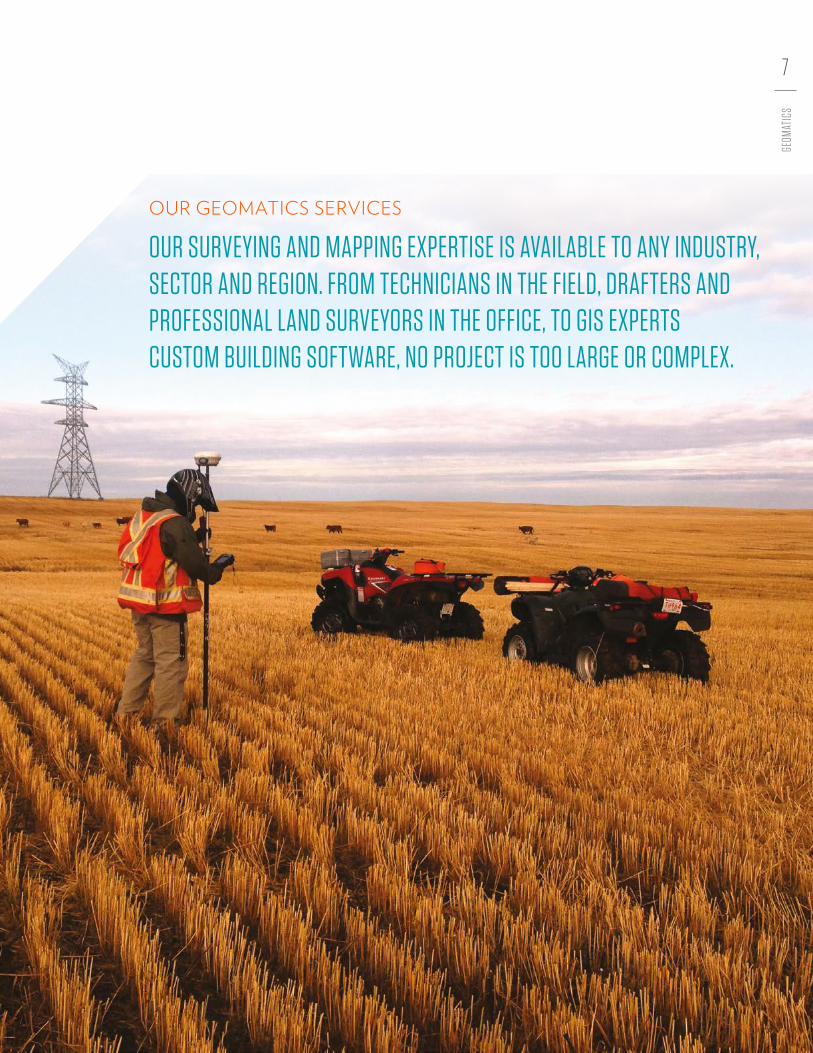
OUR GEOMATICS SERVICES
OUR SURVEYING AND MAPPING EXPERTISE IS AVAILABLE TO ANY INDUSTRY, SECTOR AND REGION. FROM TECHNICIANS IN THE FIELD, DRAFTERS AND PROFESSIONAL LAND SURVEYORS IN THE OFFICE, TO GIS EXPERTS CUSTOM BUILDING SOFTWARE, NO PROJECT IS TOO LARGE OR COMPLEX.

ABOUT WSP IN CANADAAs a Canadian multinational, WSP is one of the world’s leading engineering consulting firms. A leader in transforming the built environment and restoring the natural environment, our expertise ranges from engineering iconic buildings to designing sustainable transport networks, to environmental remediation and urban planning, to developing tomorrow’s energy sources and finding innovative ways to extract essential resources. Working with governments, businesses, architects and planners, we provide integrated solutions for all of the markets in which we operate. With more than 8,000 dedicated professionals in Canada, supported by a worldwide network spanning 40 countries, our teams are committed to helping our clients succeed no matter how they grow, what they choose to do, or where they move.
wspgroup.ca
© 2016 WSP Canada Inc. All rights reserved. CA-MK-BR-008-FR-201608