Embed Size (px)
Citation preview
Geomajas Framework
By:Nikhil MorajkarChaitanya KSR
http://www.gise.cse.iitb.ac.in/ksr2/Demo:
What is Geomajas ?
Geomajas is a free and open source GIS framework which seamlessly integrates powerful server side algorithms into the web browser.
Focus of Geomajas
• To provide a platform for server-side integration of geospatial data (be it through GeoTools or Hibernate), allowing multiple users to control and manage the data from within their own browsers.
• provides a set of powerful building blocks, from which the most advanced GIS application can easily be built.

What makes it unique?
• Its strong server side focus.• The processing, styling, filtering, caching, etc.
of geospatial data always happens within a secured context.Therefore making Geomajas applications incredibly scalable and performing, keeping the client a real thin client.
Core Features• Integrated client-server architecture.• Geometry and attribute editing.• Custom attribute definitions.• Advanced querying capabilities (CQL).• Out-of-the-box security.• Extensible plug-in mechanism.• Multiple front-end technologies.• Cross browser support, without the need for
browser plug-ins.
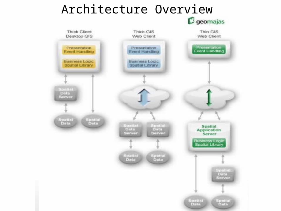
Architecture Overview
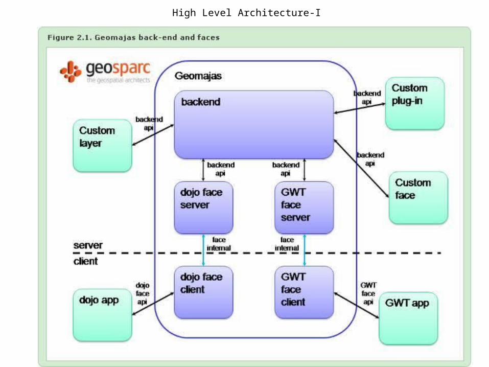
High Level Architecture-I
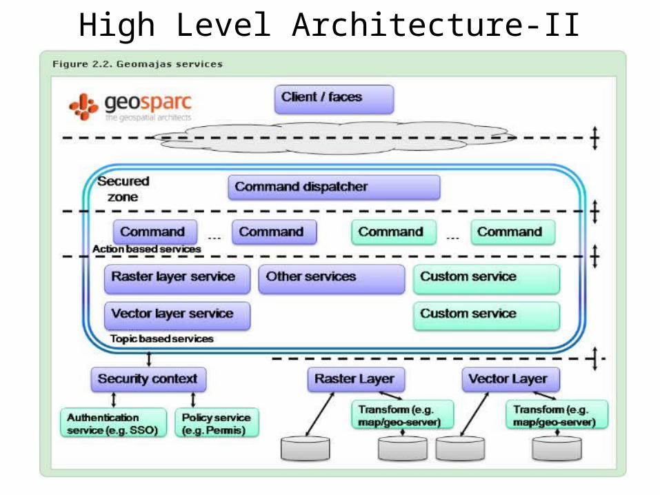
High Level Architecture-II
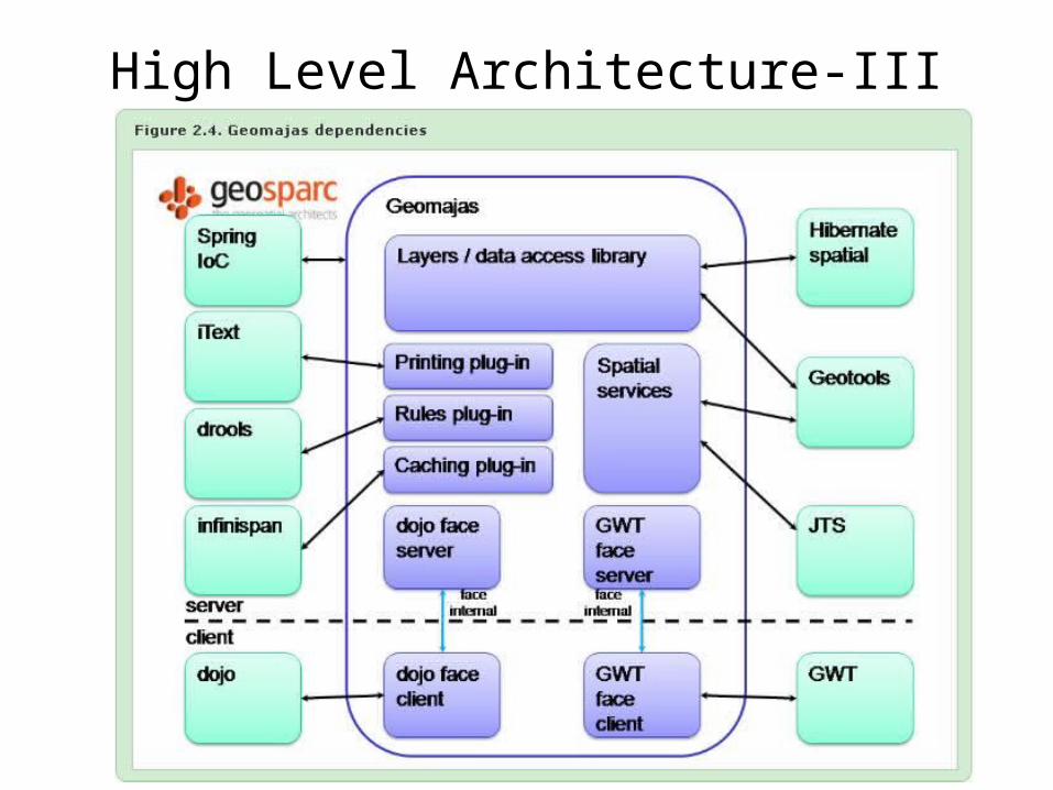
High Level Architecture-III
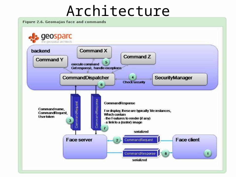
Architecture
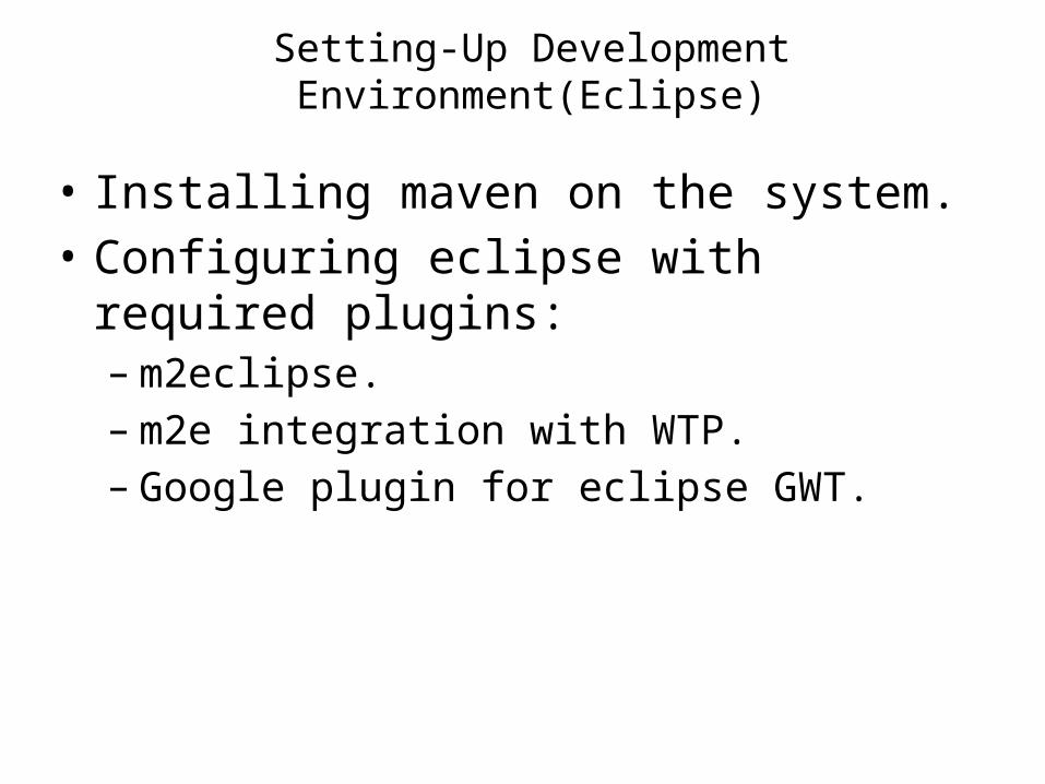
Setting-Up Development Environment(Eclipse)
• Installing maven on the system.• Configuring eclipse with required plugins:– m2eclipse.– m2e integration with WTP.– Google plugin for eclipse GWT.
Challenges faced…• Setting maven with eclipse.– Classpath for maven with eclipse.– Settings.xml file missing and required changes
after adding.
Our Approach..• Back-End level OR Application level….?
Confused….!!!!
Editing Source Code• Creating own tools.• TimeLine• Styler• Un advisable ,courtesy- active forum members of
nable- geomajas.
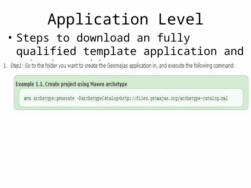
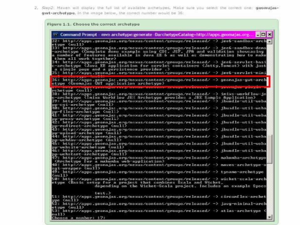
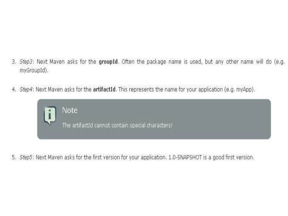
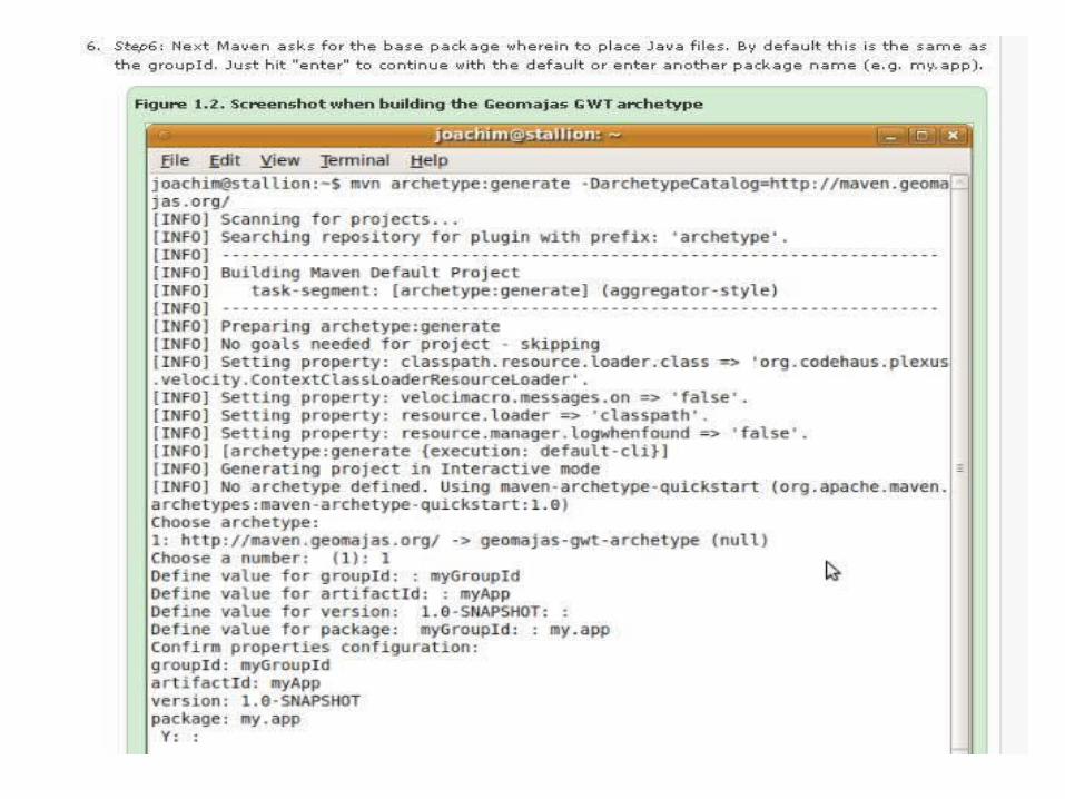
Application Level• Steps to download an fully qualified template
application and make it working:
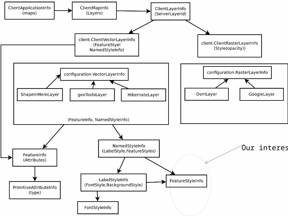
Our interest
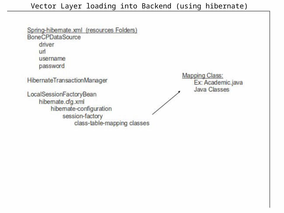
Vector Layer loading into Backend (using hibernate)
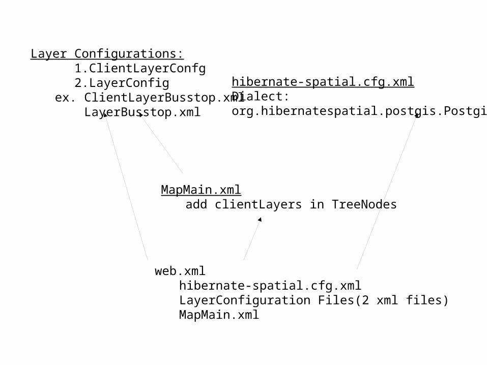
Layer Configurations: 1.ClientLayerConfg 2.LayerConfig
ex. ClientLayerBusstop.xml LayerBusstop.xml
hibernate-spatial.cfg.xmlDialect:org.hibernatespatial.postgis.PostgisDialect
MapMain.xmladd clientLayers in TreeNodes
web.xmlhibernate-spatial.cfg.xmlLayerConfiguration Files(2 xml files)MapMain.xml
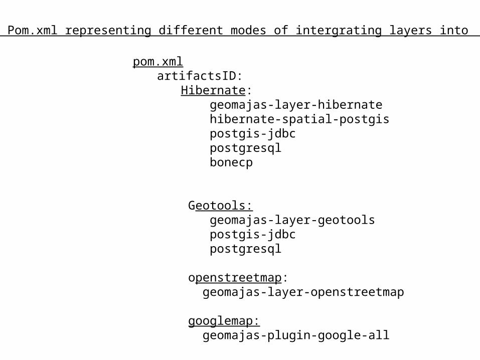
pom.xmlartifactsID:
Hibernate: geomajas-layer-hibernate hibernate-spatial-postgis postgis-jdbc postgresql bonecp
Geotools: geomajas-layer-geotools postgis-jdbc postgresql openstreetmap: geomajas-layer-openstreetmap
googlemap: geomajas-plugin-google-all
Maven Pom.xml representing different modes of intergrating layers into backend
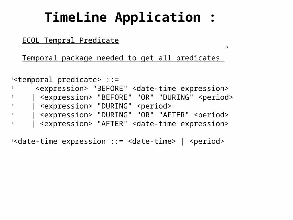
l<temporal predicate> ::=l <expression> "BEFORE" <date-time expression>l | <expression> "BEFORE" "OR" "DURING" <period>l | <expression> "DURING" <period>l | <expression> "DURING" "OR" "AFTER" <period>l | <expression> "AFTER" <date-time expression>
l<date-time expression ::= <date-time> | <period>
ECQL Tempral Predicate
Temporal package needed to get all predicates”
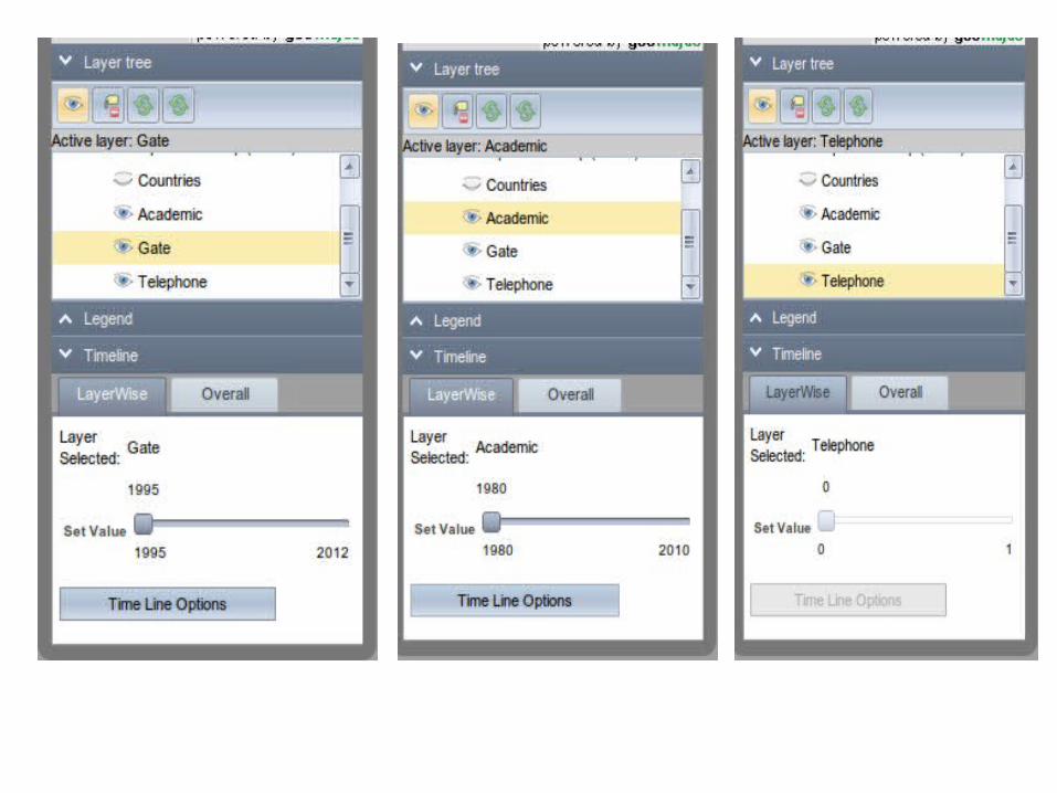
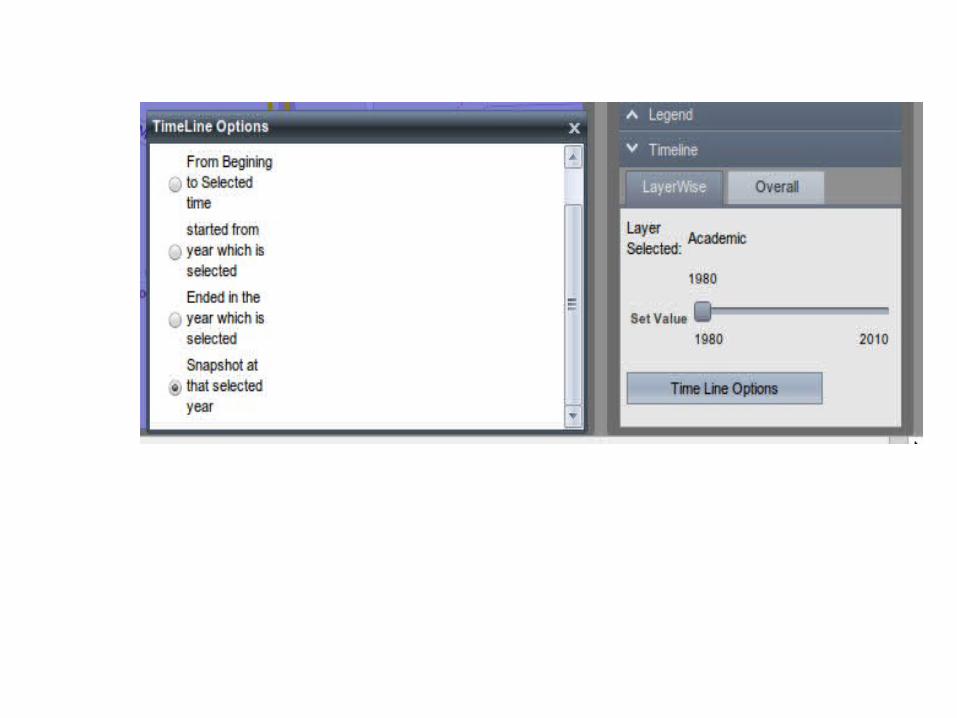
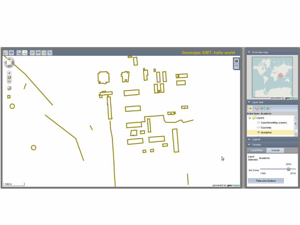
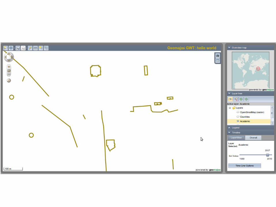
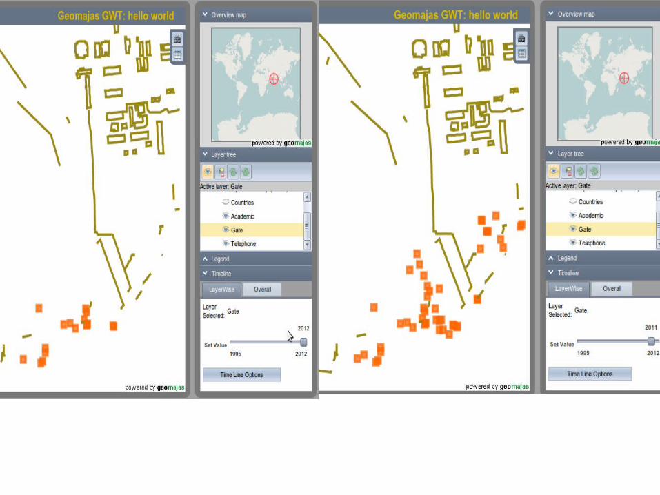
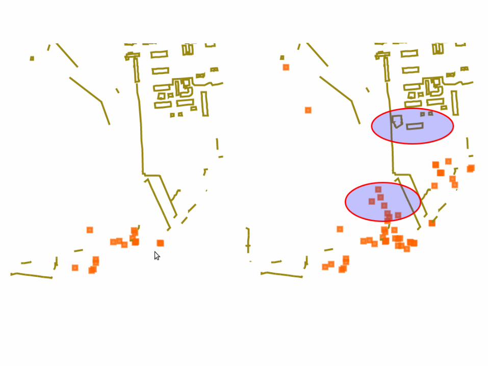
TimeLine Application :
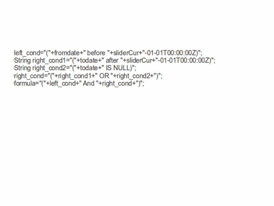
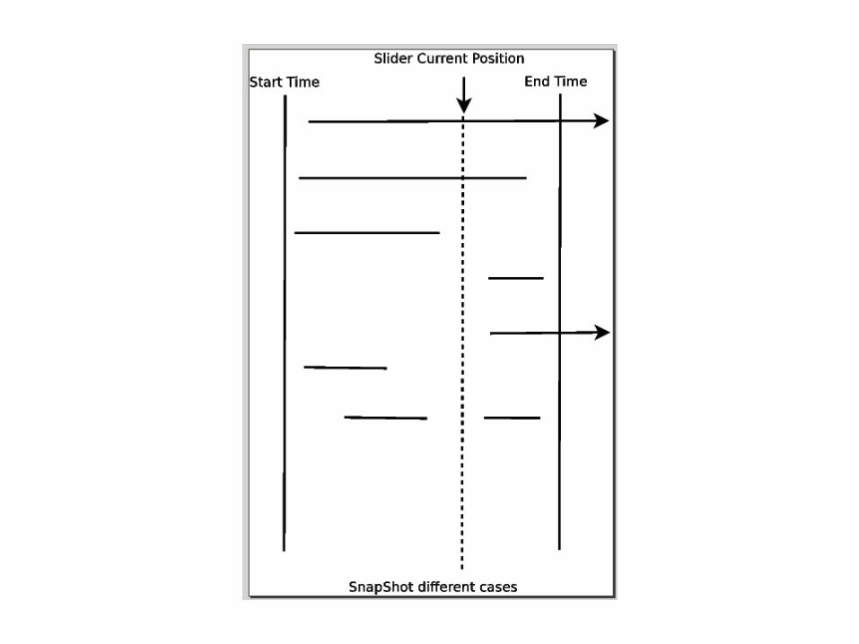
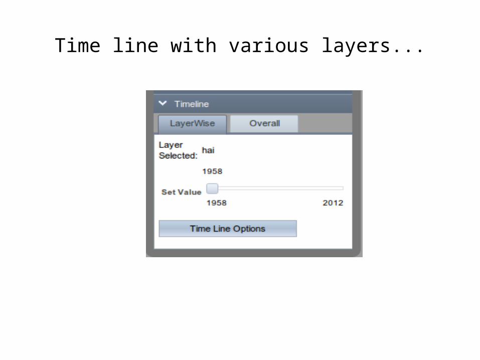
Time line with various layers...
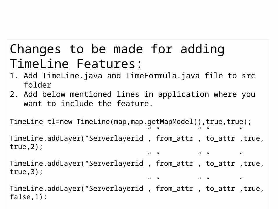
Changes to be made for adding TimeLine Features:1. Add TimeLine.java and TimeFormula.java file to src folder2. Add below mentioned lines in application where you want to include the
feature.
TimeLine tl=new TimeLine(map,map.getMapModel(),true,true);
TimeLine.addLayer(“Serverlayerid”,”from_attr”,”to_attr”,true,true,2);
TimeLine.addLayer(“Serverlayerid”,”from_attr”,”to_attr”,true,true,3);
TimeLine.addLayer(“Serverlayerid”,”from_attr”,”to_attr”,true,false,1);
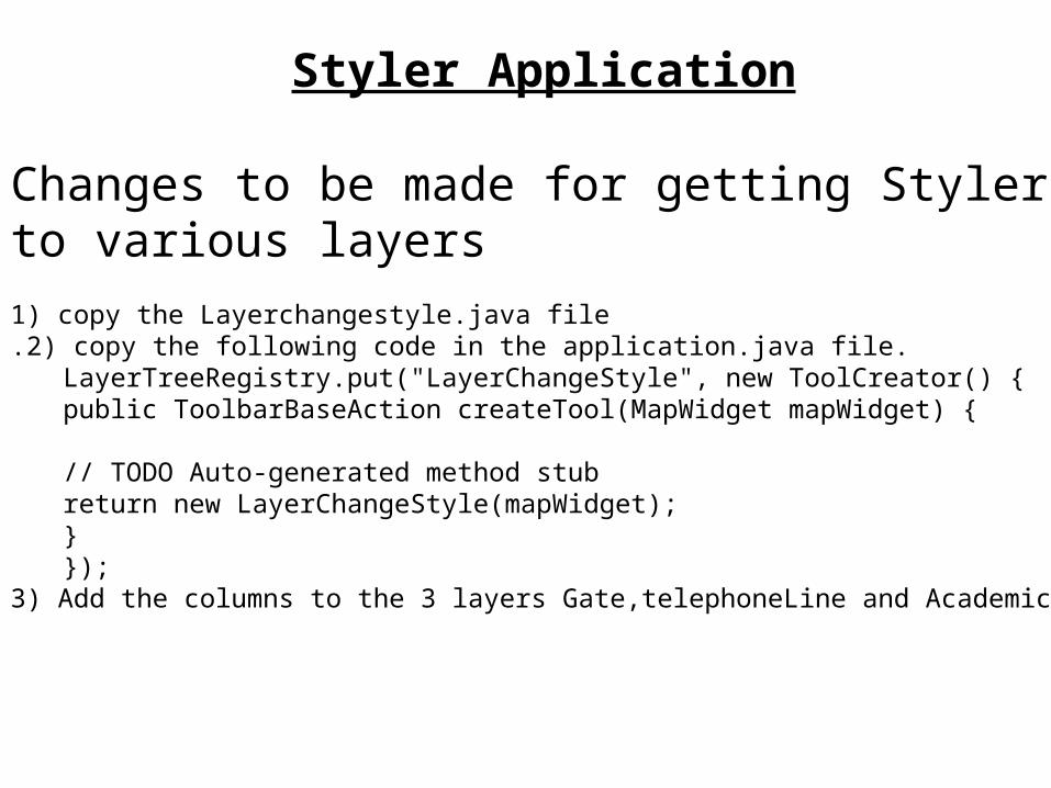
Changes to be made for getting Styler to various layers1) copy the Layerchangestyle.java file.2) copy the following code in the application.java file.
LayerTreeRegistry.put("LayerChangeStyle", new ToolCreator() {public ToolbarBaseAction createTool(MapWidget mapWidget) {
// TODO Auto-generated method stubreturn new LayerChangeStyle(mapWidget);}});
3) Add the columns to the 3 layers Gate,telephoneLine and Academic.
Styler Application
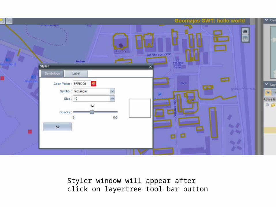
Styler window will appear after click on layertree tool bar button
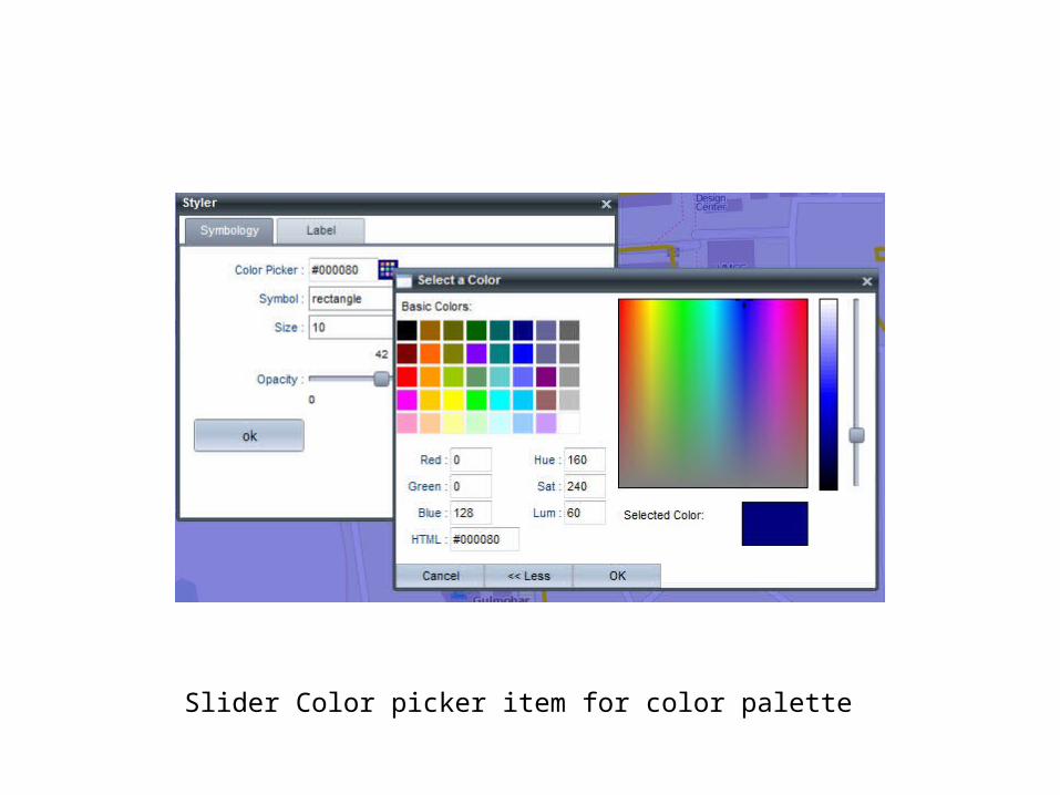
Slider Color picker item for color palette
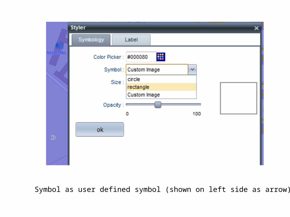
Symbol as user defined symbol (shown on left side as arrow)
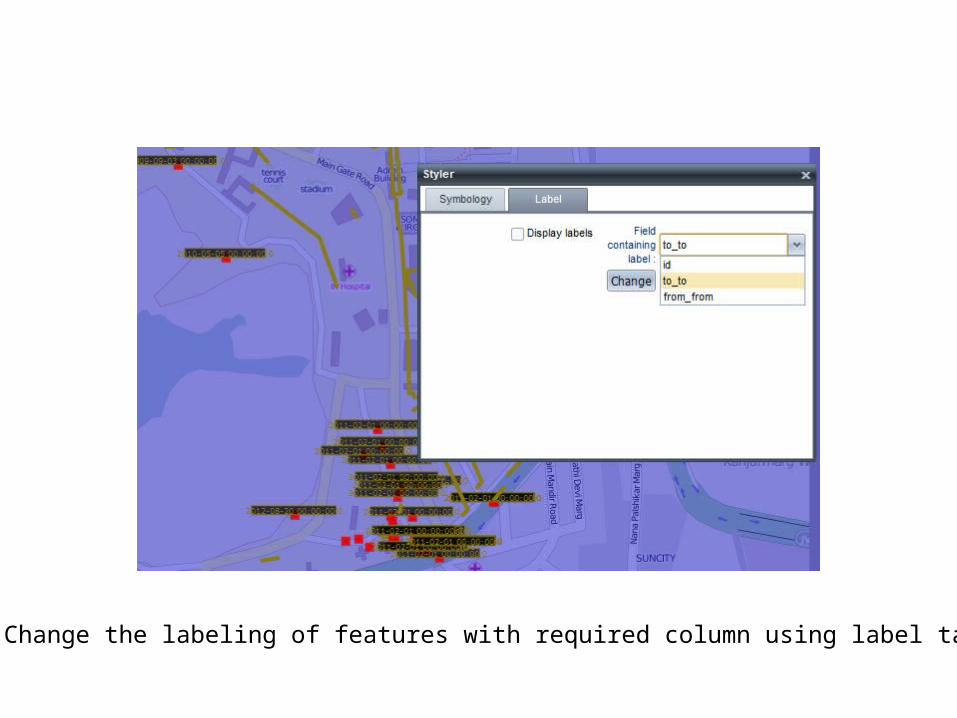
Change the labeling of features with required column using label tab

Thank you