Embed Size (px)
Citation preview

GENERAL CERTIFICATE OF EDUCATION TYSTYSGRIF ADDYSG GYFFREDINOL GENERAL CERTIFICATE OF SECONDARY EDUCATION TYSTYSGRIF GYFFREDINOL ADDYSG UWCHRADD
EXAMINERS' REPORTS
GEOLOGY SUMMER 2007
Page Geology (AS/Advanced)
GL1 2 GL2a 5 GL2b 8 GL3 11 GL4 15 GL5 19 GL6 27
Geology (GCSE) 32
Statistical Information GCE (AS/Advanced) This booklet contains summary details for each unit: number entered; maximum mark available; mean mark achieved; grade ranges. N.B. These refer to 'raw marks' used in the initial assessment, rather than to the uniform marks reported when results are issued. GCSE The Examiners' Report may refer in general terms to statistical outcomes. Statistical information on candidates' performances in all examination components (whether internally or externally assessed) is provided when results are issued. As well as the marks achieved by individual candidates, the following information can be obtained from these printouts: For each component: the maximum mark, aggregation factor, mean mark and standard deviation of marks obtained by all candidates entered for the examination. For the subject or option: the total entry and the lowest mark needed for the award of each grade. Annual Statistical Report Other information on a centre basis is provided when results are issued. The annual Statistical Report (issued in the second half of the Autumn Term) gives overall outcomes of all examinations administered by WJEC.
1
GEOLOGY
General Certificate of Education 2007
Advanced Subsidiary/Advanced
Chief Examiner: Mr. Peter Loader, St. Bede's College, Manchester Principal Examiners: GL1 Mr. Dave Evans, King-George V College, Southport GL2a Mr. I.C. Wall, Bolton Sixth Form College GL3 Mr. Peter Loader, St Bede's College, Manchester GL4 Miss Jo Conway, Yale College, Wrexham GL5 Mr Elliott Hughes Chief Coursework Moderators: GL2b Dr. Alan Seago, Open University GL6 Mr. Ian Kenyon, Truro School
2
GEOLOGY
General Certificate of Education 2007
Advanced Subsidiary/Advanced
GL1 Foundation Geology
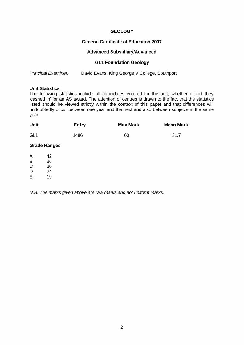
Principal Examiner: David Evans, King George V College, Southport Unit Statistics The following statistics include all candidates entered for the unit, whether or not they 'cashed in' for an AS award. The attention of centres is drawn to the fact that the statistics listed should be viewed strictly within the context of this paper and that differences will undoubtedly occur between one year and the next and also between subjects in the same year. Unit Entry Max Mark Mean Mark GL1 1486 60 31.7 Grade Ranges A 42 B 36 C 30 D 24 E 19 N.B. The marks given above are raw marks and not uniform marks.

3
UNIT GL1 FOUNDATION GEOLOGY This proved to be a paper which discriminated well, and clearly revealed those students who had a sound knowledge of the basics of Geology, and those who did not! As usual, the paper contained straightforward knowledge and recall questions and the higher level “problem-solving” aspects. The paper allowed the full range of abilities to be demonstrated. Q.1 (a) Surprisingly few students could correctly name the rocks at R and S, with a
range of answers including metamorphic and sedimentary rocks, and even minerals. Most students identified pillow lavas as the structure in layer Q, but fewer noted the presence of dykes in layer R. A wide range of minerals were used as answers to part (ii) but the number of correct answers was poor, indicating that many students are not learning the basic details needed to achieve highly on the “knowledge” part of this paper. Most students noted the specific relationship between cooling rate and crystal size, but fewer related this to the depth of crystallisation.
(b) Most students could explain how pillow lavas formed in underwater eruptions
but fewer responded correctly to the question concerning how basaltic magma formed. It was more common for students to write about how and why magma rises (for which no credit was given), rather than the role of partial melting in the mantle.
(c) Most students correctly plotted the graph to show a positive correlation, and
linked this to the increasing age of crust further from its point of origin at the ridge. Credit was also given for the suggestion of a continental source for ocean floor sediment at B.
Q.2 (a) Many students noted that relative age relies upon a comparison of age of two
geological features, so that the terms “older than” or “younger than “ can be correctly applied. The most common error was to note relative age as “approximate” or “estimates” of age. The majority of students correctly identified and explained the role of cross cutting relationships in interpreting the dyke as younger than the Carboniferous rocks but older than the Quaternary sediments.
(b) In b(i), most candidates recognised a process of interaction between the
atmosphere and a living tree, and correctly noted in b(ii) the decline in 14C as it radioactively decays without subsequent replacement in a tree fossil. In b(iii), the majority of candidates correctly recognised the essentials of carbon dating, namely a once organic material which is young enough to still have detectable 14C present. The responses to this question were, on the whole, much more successful than on the previous occasion on which this topic was examined.
Q.3 (a) Most students noted the strongly sedimentary nature of Fig 3a and correctly
located it in the shale, outside the metamorphic aureole. (b) The vast majority of candidates identified the role of pressure during regional
metamorphism in the formation of slate. More detailed answers noted the low grade of the metamorphism and the alignment of crystals. However, for full marks, students had to make use of Fig 3b, linking the regional metamorphism to the fold formation in the slate.

4
(c) This proved to be a very straightforward data response question, with the shorter wavelength of folds in the slate, and the specific directions of trend of fold axes in the two rocks quoted. A significant minority of students had difficulty establishing compass directions correctly.
(d) It was anticipated that students would recognise the likely younger age of the
shale, which must have post-dated the regional metamorphism that formed the slate. Consequently, by use of the rule “the younger bed is on the downthrow side of a fault”, the downthrow to the SE was more likely. Credit was given for alternative answers, and for correctly quoting the age relationship rule.
(e) This question was done relatively poorly this year, with very few fieldwork
sketches developed. Full marks could be awarded without reference to fieldwork. Many diagrams proved to be very basic, lacking any sense of scale or actual examples. For full marks, students had to identify whether tension, compression or shear had formed the fold or fault. Too many candidates provided detailed diagrams of plate boundaries for which little or no credit could be given. Plate tectonics is not the answer to everything.
Q.4 This proved to be a high scoring question with the majority of students correctly
identifying the trilobite in part a(i), although a range of fossil groups were seen as answers. The glabella was also well known, although notable incorrect answers included “cobalt” and “cervix”.
Part (b) was often well answered and (c), too, was invariably answered correctly,
explaining the difficulties of preserving soft tissues. The loss of the mineral calcite by acidic pore-waters was often ignored in section (d),
although its replacement by quartz was a common aspect of the answer. Part (e) was competently undertaken, although only the best students could explain
why conditions such as energy levels may have changed. The most common explanation gave the decline in energy level related to a rise in sea level. However, other creditable explanations, related to turbidity currents or storm events were received.

5
GEOLOGY
General Certificate of Education 2007
Advanced Subsidiary/Advanced
GL2a Investigative Geology
Principal Examiner: I.C. Wall, Bolton Sixth Form College Unit Statistics The following statistics include all candidates entered for the unit, whether or not they 'cashed in' for an AS award. The attention of centres is drawn to the fact that the statistics listed should be viewed strictly within the context of this paper and that differences will undoubtedly occur between one year and the next and also between subjects in the same year. Unit Entry Max Mark Mean Mark GL2a 1507 60 31.8 Grade Ranges A 41 B 36 C 31 D 26 E 21 N.B. The marks given above are raw marks and not uniform marks.
6
UNIT GL2a INVESTIGATIVE GEOLOGY The paper was similar to previous examinations in that it contained questions testing the range of skills and techniques flagged up in Unit GL1 of the specification. The demands made by the paper on candidates were broadly comparable with previous years, although the mean mark was down compared with 2006. An increase in the standard deviation indicated that the questions produced a range of responses that allowed for differentiation. Although it is felt that the better candidates performed as well as in previous years, there may be a suggestion that there was a slightly poorer cohort of weaker students. Q.1 Many candidates accurately read the question stem and wrote about the porphyritic
texture with random crystals of Specimen A in part (a)(i); some answers were solely about the mineral composition. In part (ii), most candidates linked the coarse texture with slow cooling, with a large number also suggested a two-stage cooling history. Part (iii) was about planning and implementation. The most obvious physical property which could distinguish between the two minerals given the equipment “specified by the Supervisor” was cleavage. Many candidates penalised themselves with a choice of streak or hardness. Candidates were expected to describe and explain the features shown on Photographs 1 and 2 and Map 1 and relate these to the statement in the stem of (b). Better scripts described Photograph 1 as a discordant intrusion at the margin of Rock Unit A and linked this to a melt penetrating fractures in the cold (brittle) country rock; others described a finer texture in the intrusion and explained this as a chilled margin against the cold country rock. Photograph 2 showed chiastolite/andalusite porphyroblasts indicating that the melt caused contact metamorphism in the baked margin/aureole of the cold country rock. Map 1 showed radial dip of the country rock indicating that the forceful nature of the pluton caused the country rock to dome. Weaker students found it difficult to organise their answers into description and explanation as well as failing to link back to the statement.
Q.2 Part (a) allowed candidates to gain credit provided they followed the rubric – a
scaled, labelled diagram representative of texture of Rock Unit B as shown on Photograph 3. Drawing marks were allocated scale, shape of clasts, internal structure of clasts and partial cement/pore spaces. There was a wide variety in quality. Some candidates drew views of the rhombs of Specimen B. Many correctly stated the result of the acid test in (b)(i), with calcite being the commonest answer in part (b)(ii). Weaker candidates seem to decide upon an alternative name, e.g., barite or fluorite and then attempt to describe a test which fitted their answer. Part c (i) saw many lose the quality mark by being very careless or “stylistic”, but most gained credit for showing lobes and saddles. No credit was given for planes of symmetry! The era in part (ii) was not always correctly identified, although the majority of scripts gained credit for recognising a goniatitic suture or alternatives, e.g., early stage of ammonoid development or not “too complex”. Part (d) required a true or false judgement for Photographs 3 and 4 with credit only being awarded if the reason was correct. Photograph 3 was a shallow-water oolitic limestone, but because this is not named in the specification, credit was also awarded if candidates reasoned that the rock was a shallow-water limestone because it contained corals or crinoids. Photograph 4 showed a cephalopod/ammonoid/goniatite but few gained the second mark here because, being extinct, the principle of uniformitarianism is the clue to their former marine habitat.

7
Q.3 The stem was deliberately wordy to focus candidates on a question which was novel to paper 2a. Specimens of the two underlying rock units (Specimen A and C) were given to candidates but the answers to parts (c)(iii) and (v) suggested that most candidates didn’t even consider them when attempting these sections. Part (a) was unusual to this paper in that it is usually tested in GL1. It was, however, inserted to attempt to get candidates to concentrate on “planes of weakness”; although many gained full credit, they didn’t refer back to this in later sections. Answers dealing with chemical weathering or erosion failed to impress the examiners. Some candidates wasted possible credit by not organising their answers in part (b), or by suggesting chalcopyrite or galena as a metamorphic mineral! The numerical, graphical and data response skills required by parts (c)(i), (ii) and (iv) ensured that many candidates gained credit but the responses to parts (iii) and (v) were poor. Clasts have their own typical shapes determined by characteristic planes of weakness – schists have a foliation so discs are common as physical weathering releases “thin” fragments which get rounded by attrition during their transport. The better candidates gained some credit in part (v) by suggesting that clasts of Rock Unit A (granite) were not discs because they were igneous and so lacked a “foliation”, but scripts were rarely encountered which suggested that being an igneous rock, cooling joints may have caused blocks/cubes to be released by physical weathering, thus rounding into spheres during transport.
Q.4 Parts (a)(i) and (ii) were answered correctly by many candidates. Previous reports
have stated that candidates must be accurate when drawing axial plane traces across the surface outcrop – as usual, the unconformity truncates it on this map (part (b)).
The innovation in (c)(i) was that it allowed a simple calculation of throw of Fault F1; some candidates responded with a figure for F2! Part (ii) generated the usual wide range of responses/guesses(?) about fault classification. Many scripts failed to score in part (iii) because they simply repeated that Fault F2 has only a vertical movement, or even worse, stated that it was not possible to see any evidence of vertical movement. The fault was a straight line, therefore has a vertical (900) dip, thus making it impossible to identify the hanging or footwall – the better candidates scored both marks here.
Q.5 The very flexible mark scheme traditionally used in questions of the type in part (a)
continues to allow credit to be given for any good interpretation of the information given on Map 1. There are some centres who obviously spend considerable time and effort on mapwork and here candidates’ scores on this question are of a much higher standard than that of the rest of their responses within the paper, as well as of other centres. The geological history in part (b) was partially completed this year and was subsequently reduced in weighting, but it still achieved a wide range of responses. Weaker candidates had particular difficulty in placing the superficial deposits into the relative time scale.

8
GEOLOGY
General Certificate of Education 2007
Advanced Subsidiary/Advanced
GL2b Internal Assessment
Principal Examiner: Dr. Alan Seago, Open University Unit Statistics The following statistics include all candidates entered for the unit, whether or not they 'cashed in' for an AS award. The attention of centres is drawn to the fact that the statistics listed should be viewed strictly within the context of this paper and that differences will undoubtedly occur between one year and the next and also between subjects in the same year. Unit Entry Max Mark Mean Mark GL2b 141 60 38.4 Grade Ranges A 44 B 39 C 34 D 29 E 24 N.B. The marks given above are raw marks and not uniform marks.

9
UNIT GL2b INTERNAL ASSESSMENT Fifteen centres submitted field investigations for moderation. It is pleasing to report that centres are taking note of comments made in individual centre reports in previous years so that there is a continuing improvement in the suitability of tasks being undertaken and the quality of candidates' work. There has been a reduction in the number of centres where scaling is required and the amount of scaling that has to be applied. For some centres scaling had to be applied to raise the marks of their candidates. There are four main reasons why scaling has to be applied; • reliable rank order but marks generous or severe • failure to show how criteria have been achieved by annotation of candidates' work Centres are not now creating difficulties for themselves and for the moderators by submitting field investigations from outside the context of GL1 skills. Centres should be aware of the required context of the investigation at all times as described in the specifications. The centres are to be congratulated on: • the standard of work produced by the candidates • the opportunities given to the candidates to study geology in such suitable areas • and in most cases the accuracy of the assessment. The enthusiasm for geology and expertise of the teaching staff in centres is obvious from the quality and effort put into coursework submissions. The better investigations include the demonstration of basic field skills such as rock identification and textures, identification of field structures using dip and strike/field sketches, sedimentary logging and fossil identification. The data collected can be manipulated and presented in cartographical or graphical form. Some excellent field investigations are now being seen which are well suited to the assessment framework. It is good to see geological field skills being demonstrated with a high degree of competence. There were however a minority of investigations which would have been more suited to GCSE lacking, as they did, any scope for advanced analytical skills and any degree of complexity. In some cases there was no risk assessment although the number of instances is decreasing. It was pleasing to see the extensive use of the Planning Tracking sheet. Some thought has to be given at the planning stage as to whether the data being collected is suitable for processing and analysis e.g. histograms, cross-sections, logs, rose diagrams maps and geological histories. A number of centres are now making preliminary visits to sites in order to allow some forward planning by candidates, which often results in better Planning marks. Some candidates devoted insufficient time on the retrieval and evaluation of relevant material from different sources. Some field notes consisted entirely of tables of data and it would be an improvement to see a variety of data collection including field sketches and rock descriptions etc. In a number of cases, opportunities for the collection of basic field data have been missed. Observations such as rock identification, grain size, sorting, direction of cross- bedding, clast roundness/orientation, field sketches, dip and strike measurements should normally be part of every investigation where appropriate. There is no need for candidates to repeat observations made in the field notebook within a report unless it contributes significantly to the analysis. It is more advantageous for candidates to concentrate their efforts on the analysis and evaluation.

10
A mixture of tasks were undertaken, with a rough break down being investigations into: interpretation of sedimentary environments (sedimentary logs, fossils and rock description) mapping exercises (leading to drawing up of geological sections and history) analysis of fossil assemblages joint orientation related to faulting (rose diagrams and stereonets) structural analysis (faulting and folding styles related to compression or tension) textures of Quaternary coarse grained sediment Centres are to be congratulated on the variety of opportunities given to candidates in areas of outstanding geology such as, North Wales, Isle of Arran, Pembrokeshire, Ogmore, Yorkshire coast, Alderley Edge, Gower Penninsula, Dorset, Devon and Cornwall. Other centres made good use of suitable local geological locations. Centres should be aware that there is help available from the WJEC. Published exemplars of coursework investigations can be obtained from the WJEC offices and INSET activities are provided. Moderators' reports on the current moderation process are sent out to centres. Centres are urged to act on any recommendations in the Moderators Reports, The Moderators do not enjoy moderating work which achieves low marks as this is going to be disappointing for the centre and the candidates, especially when there is often so much suitable geology on the centre's doorstep which with a little help and guidance can result in a successful submission. There are guidelines in the specification such as Planning Aid p62 and suggested investigations p22. Alternatively the centre could discuss suitable investigations with myself through email/ telephone as several centres do. This can include advice on the suitability of coursework investigations prior to carrying them out and examination of candidate's draft field investigations. My contact details can be obtained from the WJEC Geology officer in Cardiff. Any centre having a problem with applying the assessment framework should contact the WJEC well in advance of the submission date.

11
GEOLOGY
General Certificate of Education 2007
Advanced Subsidiary/Advanced
GL3 Geology and the Human Environment
Principal Examiner: Peter Loader, St. Bede's College, Manchester Unit Statistics The following statistics include all candidates entered for the unit, whether or not they 'cashed in' for an AS award. The attention of centres is drawn to the fact that the statistics listed should be viewed strictly within the context of this paper and that differences will undoubtedly occur between one year and the next and also between subjects in the same year. Unit Entry Max Mark Mean Mark GL3 1292 50 31.0 Grade Ranges A 36 B 31 C 27 D 23 E 19 N.B. The marks given above are raw marks and not uniform marks.

12
GL3 – GEOLOGY AND THE HUMAN ENVIRONMENT
General The overall quality of the responses for the data response questions was very good this year. Both were readily accessible to candidates, especially question 2, but discriminated well. The quality of the essays was generally good, with a number of full marks being given for each of the essay questions. The most popular question (question 4) was best answered by candidates who knew their case studies and were able to directly answer the question set, particularly in part (b). Q.1 A very accessible question which discriminated well. (a) Generally this was well answered, although it was not always clear that
students were aware of the relevance of the water table. Two locations for the spring were automatically accepted; at the intersection of the water table and the surface beneath the tip and the intersection of the tip and the glacial till. Sometimes it was unclear where candidates understood the spring to be and where candidates did not communicate precise locations by placing the arrow head accurately, marks could not be awarded.
(b) A disappointingly large number of candidates did not attempt this question at
all and those that did had little idea where failure might occur. Only a small number of very good candidates curved the boundary between the till and debris into the debris to show rotational slip but any appropriate slip plane associated with the spring and base of the tip was accepted.
(c) (i) The examiners were pleased that his section was generally well
answered with pore pressure and angle of slope being the most popular correct answers. Only feasible triggers that might relate to this situation were accepted.
(ii) Some excellent explanations linked to possible triggers were seen,
particularly in relation to the two mentioned above. (d) This was also well answered with a full range of remedial solutions proposed.
Reduction in the critical slope angle, terracing and drainage solutions were the most popular. Credit was given to some dubious stability schemes where these were directly explained, e.g., rock bolts and nets but candidates who suggested the answer was not to build the tip there in the first place gained little credit as they had not directly answer the question. A small number of candidates thought that the ’tip’ referred to a domestic rubbish tip.
(e) Although generally well answered, a significant number lost a mark with
superficial responses, e.g., “toxic materials might be dissolved out which would be dangerous”. Here, there is no specific reference to a case study, the type of toxins involved, how it might be dissolved out or why it is dangerous. There were, however, some excellent accounts of acid mine drainage and references to case studies.

13
Q.2 This question was very accessible but discriminated well at the top end of the range. (a) The majority of candidates correctly identified a positive and negative
correlation within the data. (b) (i) This was well answered. although factors of 32 (such as 320 or
32,000) were sometimes quoted. A minority of candidates gave numbers which were inexplicably unrelated to the data.
(ii) Very well answered. reflecting sound understanding of this area of the
specification. Most candidates correctly referred to the time needed for large stress to build up. Others argued that stresses would probably be released by the minor quakes before they could build up to sufficient stress to induce a large earthquake.
(c) (i) This was generally well answered and this method was either clearly
taught or candidates responded well to the direction given. A small number of candidates confused the two scales on the left hand column thus plotting a 25 sec lag time as 25 km. Allowance was made for this and it did not prevent them from obtaining the other 2 marks for this question.
(ii) Well answered. The greatest number of errors occurred in (1), with 10
being a popular answer for the energy released, although 1.25 was also a common incorrect answer. Generally, an incorrect answer for the magnitude in (i) conflicted with correct answers in part (ii).
(d) Generally well answered, although a disappointing number misread the
question (“seismic activity”) and discussed any prediction technique (e.g. radon emissions or water table levels), for which little credit could be given.
Section B Question 4 was by far the most popular, although candidates obtained full marks in each of the three essays.
Q.3 Though this was not a popular choice some excellent (full marks) responses were
seen. (a) Definitions of porosity and permeability were nearly always correct. Most
candidates considered grain size and shape, whilst sorting and packing was only referred to by the more able candidates. Although specific retention was rarely mentioned, a few candidates found it difficult to explain how a porous rock might also result in low permeability. Thus, some claimed that a porous rock (able to retain a large volume of fluid) had to be impermeable (so the fluid did not percolate away) so the best aquifer was a shale because it could retain a high volume of water and would not be lost.
(b) Exhaustion, salt water incursion and subsidence were by far the most popular
choices and were generally well answered. Candidates who did not mention case studies in this section were at a disadvantage, since many did.

14
Q.4 This was by far the most popular choice. Generally, this was well answered, although many candidates did not pay sufficient attention to the rubric. For example, some candidates often gave excellent descriptions of the phenomena but did not adequately explain how they could be hazardous. Excellent use was made of case studies, with most candidates mentioning at least two and some, five or six. Candidates who did not refer to case studies made themselves ineligible for full marks. Most candidates who referred to case studies cited Mount St Helens; Mount Pinatubo, Nevado del Ruiz, Heimaey, Hawaii, Montserrat and Lake Nyos were the other studies frequently mentioned.
(a) A significant number of candidates considered all three options in (a). The
best response was credited but resulted in the candidate wasting valuable time.
(i) This was well understood and described, with the most common
omission being a source of the water. Weaker candidates found it difficult to stick with the question, writing all they knew about lahars and not concentrating on what makes them hazardous.
(ii) Some excellent answers were seen, most of which considered Lake
Nyos in detail. Weaker candidates could only name one gas and sometimes no gas was named. CO2 and SO2 were by far the most common acceptable examples but a disappointing number mentioned SiO2, SiO4 and SO4. Also, a significant number of candidates claim that radon is a gas that is commonly detected at fumeroles.
(iii) Generally the answers were good, covering a wide range of eruptions
and products. However, often candidates did not focus on the significance of the blast/explosion and tended to go off topic and discuss volcanic eruptions generally. Details of ash or pyroclastic flows were not relevant to the question and given little credit.
(b) Excellent responses tended to consider a “successful” prediction such as
Pinatubo or Mount St Helens with one which was not predicted (Vesuvius 79AD, Mont Pelee or Krakatoa) or critically assessed the Montserrat and Mount St Helens eruptions, questioning how accurate the predictions had been (lateral blast at Mt St Helens). Almost invariably, these candidates scored highly. Weaker candidates answered generally, used case material inaccurately and often failed to comment on the “extent” to which an eruption can be predicted or minimized.
Q.4 (a) Not popular, but this was generally well answered by those who attempted it.
The significance of the dilation of micro-cracks and diffusion of radon and water into them was generally well understood. There was occasionally some confusion as to the general sequence of changes.
(b) This was poorly answered, though most candidates were aware that radon is
commonly associated with granite. Rarely were any other associations acknowledged, although a pleasing number of candidates were aware of the solubility of radon in groundwater. Pathways to the surface were usually identified although many accounts were superficial, referring to “cracks”; the best candidates discussed joints, faults, bedding planes as well as considering the (inter-granular) permeability of rocks. Surface geology was often ignored, though the risks from radon were generally well understood.
15
GEOLOGY
General Certificate of Education 2007
Advanced
GL4 Interpreting the Geological Record
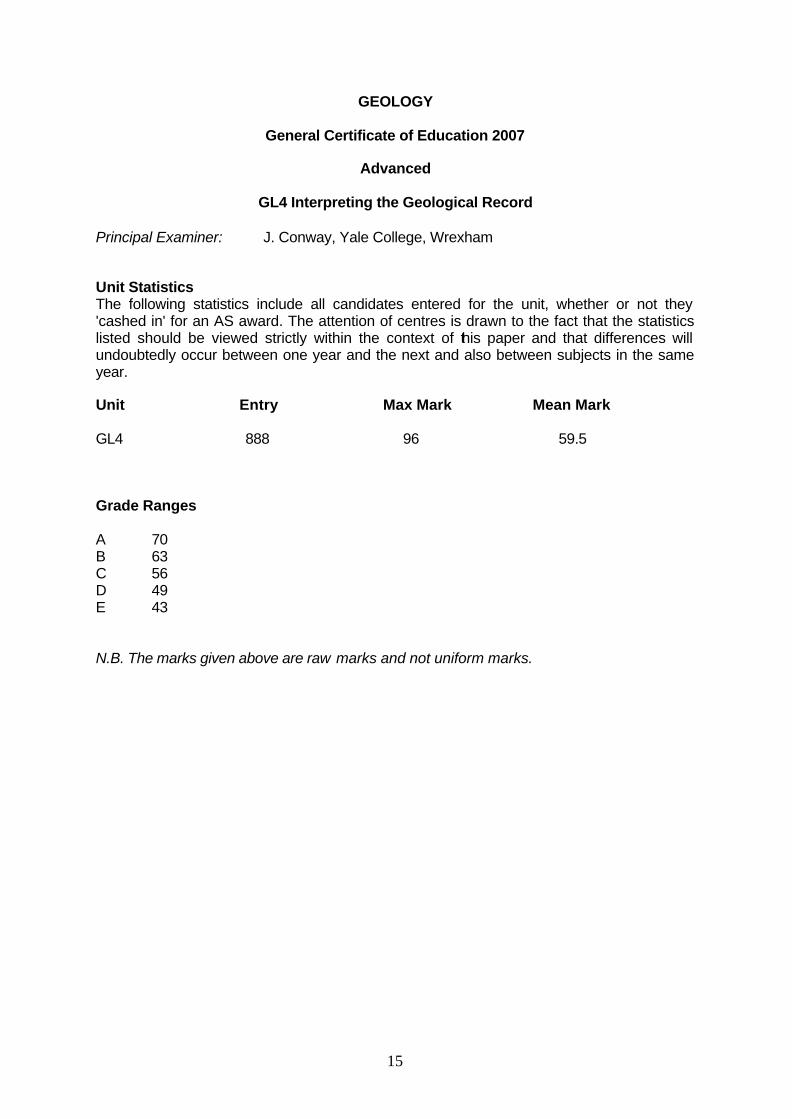
Principal Examiner: J. Conway, Yale College, Wrexham Unit Statistics The following statistics include all candidates entered for the unit, whether or not they 'cashed in' for an AS award. The attention of centres is drawn to the fact that the statistics listed should be viewed strictly within the context of this paper and that differences will undoubtedly occur between one year and the next and also between subjects in the same year. Unit Entry Max Mark Mean Mark GL4 888 96 59.5 Grade Ranges A 70 B 63 C 56 D 49 E 43 N.B. The marks given above are raw marks and not uniform marks.

16
GL4 INTERPRETING THE GEOLOGICAL RECORD The paper worked well this year, and the mean mark 59.5 was in line with last year. Questions discriminated between candidates and a wide range of marks was seen. Section B showed a continuing improvement on previous years. SECTION A: Q.1 The question focussed on a sedimentary rock being subjected to different types of
metamorphism. Candidates scored well on this question, with few candidates gaining less than half
the available marks.
(a) The majority of candidates were able to identify the fossil group and give reasons for the rock being named shale. In part (iii), some candidates did not get access to full marks as they did not explain their evidence, e.g., simply stating fine grained was not enough to support their environment.
(b) The majority of candidates were able to describe the conditions of
metamorphism which created Rock B and gave good supporting evidence. (c) Many candidates interpreted the question as taking Rock A through the
processes of B and then to form Rock C, when the question clearly stated the formation of Rock C from Rock A. Only the stronger candidates gained full marks on this part of the question. The answer was marked holistically and many candidates gained most of the marks only missing out on the order of processes in metamorphism.
Q.2 The question examined rock deformation. The question was well answered and many candidates gained very good marks on
the question.
(a) Many candidates scored highly, although a significant number of candidates stated the fault had “no dip” and also found difficulty in identifying the type of fault.
(b) Candidates were very able to recognise the rock contained clasts of all the
rocks and the angular fragments could only be brought together along the fault as a breccia.
(c) Candidates often scored well on part (i), giving crystal size, shape and
referring back to figure 2a to discuss discordance. Part (ii) was often poorly answered with candidates repeating the term chemical weathering without any explanation. The best candidates were able to go into detail about hydrolysis and water affecting the rocks along the joints, particularly at the joint boundaries.

17
Q.3 This question examined magma emplacement and extrusion. Candidates frequently scored well.
(a) Well answered by most. (b) Candidates found part (i) a little more challenging. The majority of candidates
were easily able to describe a similarity (both melts being less viscous at higher temperatures), although they found it more difficult to describe a difference and either described temperature or viscosity rather than the relationship (granitic magmas are always more viscous or decrease in viscosity faster than the basaltic magmas). Parts (ii) and (iii) were well answered.
(c) Well answered. (d) In part (i), some candidates gave the impression that sea water was rushing
down the subduction zone rather than being taken down incorporated within sediments. Part (ii) was well answered.
Q.4 The question examined the fossil part of the specification, covering trilobites as a
group and evolution.
(a) The majority of candidates were able to identify that the pygidium was smaller than the cephalon but that the other parts of the description were correct.
(b) In part (i), some candidates did not explain how the morphological feature
they stated would suggest that trilobite B was an active swimmer. Good answers clearly looked at the figures given and explained that the large eyes were situated on the side of the cephalon to give vision above and below or talked about the streamlined body for fast movement. Part (ii) asked candidates to focus specifically on trilobite C and the reconstruction proposed in the figure. Many candidates chose to say the genal spines were for protection, which was not the case in the reconstruction shown. Similarly they talked about the limbs being used for walking.
(c) Well answered. (d) Well answered. (e) Some candidates got confused and focussed on the difference between
punctuated and gradual evolution in the fossil record rather than how reliable the fossil record was.
Section B: The map extract of Worcester was clearly reproduced, this year accompanied by a section of the map at 1:25,000 and a cross section. Q.5 This question was generally well done, with many candidates scoring full marks.
(a) Well answered, although in part (i), a common incorrect response was Mercia mudstone or Sherwood sandstone, showing some candidates did not understand the difference between solid and drift.

18
(b) Surprisingly, many candidates gave incorrect dip angles over 90° in part (i) and in part (iii) were unable to use the term unconformity.
Q.6 This question was not as well answered as the examiners had hoped.
(a) (i) was generally well done. Candidates were awarded marks for the rise in mGal from B towards A, the levelling off/dip towards A and their overall accuracy. Surprisingly, some candidates did not appear to have used figure 6a when drawing the profile on figure 6b.
(ii) was less well answered. Examiners had expected candidates to link the
Permo-Trias rocks with lower density and hence the lower gravity and to go into detail about the East Malvern Fault, with the thicker sequence having a lower gravity. Many candidates were let down by poor English skills here and gave confused explanations about increasing anomalies when they were referring to a positive reading in the mGal.
Q.7 Candidates performed well on this question and examiners saw the whole mark
range being used, with the majority of candidates scoring over half the available marks.
(a) Generally well done, though a number of candidates said the fold type was an
anticline rather than a syncline. (b) (i) well answered. Part (ii) asked candidates to evaluate the statements about
the Colwall and East Malvern faults. Some candidates struggled to determine that the Colwall Fault was reverse and the East Malvern Fault was normal and were unlikely to have occurred during the same period of deformation.
Q.8 Although the question discriminated well, only the highest level candidates accessed
the top marks of the question.
(a) Generally well done, though a small number of candidates incorrectly described vesicles in the MvC making it permeable. Good answers described the faulting and junction of permeable/impermeable rocks to create the springs
(b) In part (i) candidates answered well, talking about the different rock types,
dips and faulting along the line of section. Part (ii) was well answered, although a small number of candidates repeated the descriptions they gave in part (i) without an assessment of why they might prove beneficial or negative to the tunnel building.
19
GEOLOGY
General Certificate of Education 2007
Advanced
GL5 Geological Themes
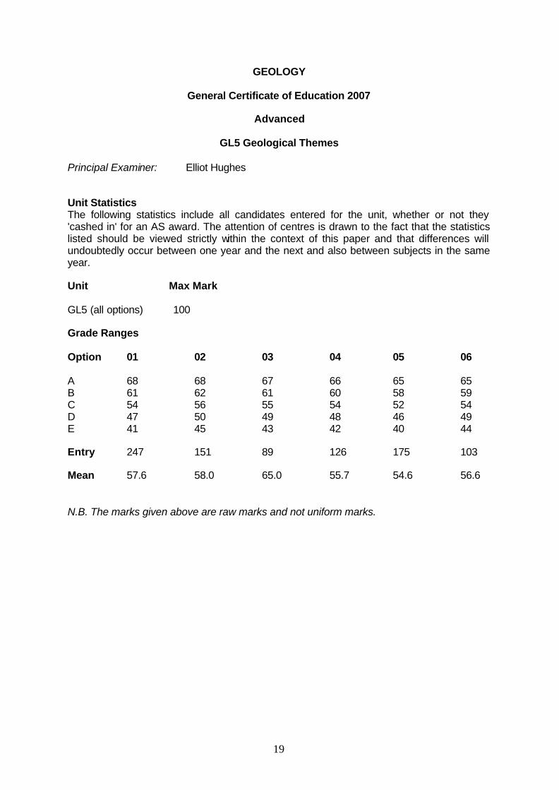
Principal Examiner: Elliot Hughes Unit Statistics The following statistics include all candidates entered for the unit, whether or not they 'cashed in' for an AS award. The attention of centres is drawn to the fact that the statistics listed should be viewed strictly within the context of this paper and that differences will undoubtedly occur between one year and the next and also between subjects in the same year. Unit Max Mark GL5 (all options) 100 Grade Ranges Option 01 02 03 04 05 06 A 68 68 67 66 65 65 B 61 62 61 60 58 59 C 54 56 55 54 52 54 D 47 50 49 48 46 49 E 41 45 43 42 40 44 Entry 247 151 89 126 175 103 Mean 57.6 58.0 65.0 55.7 54.6 56.6 N.B. The marks given above are raw marks and not uniform marks.

20
GL5 GEOLOGICAL THEMES General : Examiners are at pains to reward good geological reasoning even if it might be at variance with the mark scheme and / or opinions of the examiner. In Section A, quoting relevant figures from graphs was readily credited. Numerical questions / calculations were attempted much better this year. Evaluation continues to be a very strong indicator of the better candidates. Weaker candidates rarely make any attempt to evaluate, or if they do, discussion is very superficial. However, some candidates excel in this area and are invariably those who obtain (in particular) full marks for Section B. There is a clear pattern of weaker candidates tending to score reasonably in Section A but poorly in Section B. Another pattern that is evident is the usage of correct terminology. This sometimes results in a candidate obtaining very high marks for an essay comprising of no more than two sides of diagrams and / or text. On the other hand, some candidates write many pages (much of which may be repetitive and often irrelevant) to obtain a lesser mark. There is considerable trade-off in many essays between breadth and depth. For example, Unit 2 Q.3. Here, candidates were asked to consider mineral formation. Most of the highest scoring candidates discussed one example of each (epigenetic and syngenetic) in detail. But others preferred to consider several of each in lesser detail. Both approaches are eligible for full marks so long as the candidate can demonstrate real insight. In this particular essay a small number of good candidates got the terms epigenetic and syngenetic confused, but proceeded to give excellent accounts of the processes. There were similar cases of confusion in other essays in other units. Such candidates were penalised only very slightly as the principles are considered to be of far greater importance than specific words. Candidates should be encouraged to discuss principles even if they cannot recall, or are unsure of, specific terms. Students should be encouraged to include more diagrams in general. It is clearly evident that those who employ well-labelled diagrams consistently score higher marks than those who do not include diagrams. Unit 1 - Quaternary Q.1 (a) (i) A significantly small minority of candidates incorrectly stated that the
carbonate muds were to the east of the island; otherwise generally well answered.
(ii) Generally a well-answered question. (b) Not particularly well answered by some. A significant number of candidates
talked a lot about wind direction without qualifying why this was important. (c) (i) Generally well answered, although some candidates did not illustrate
concentric layers within the oolite. (ii) Quite a poorly answered question, discussion of oolite formation was
generally better than the formation of cross-bedding, which was either not mentioned or glossed-over.

21
Q.2 (a) Generally well answered, although some candidates mentioned periglacial features which received no marks.
(b) (i) Not particularly well-answered. Most answers centred around the
erosion of the corrie by the glacier and did not mention the importance of the impermeable till or the moraine ridges. A not insignificant number suggested that the structure might be a kettle hole.
(ii) Most candidates did not read the question properly and just gave one
reason, when the question implied there was more than one. (c) (i) A very well-answered question. (ii) Quite poorly answered. A significant number of candidates repeated
some of what they had written in (c)(i). (d) Quite poorly answered. Many candidates wrote ‘this statement is true’ and
then went on to list glacial and periglacial features. This is not evaluation and received no credit.
Q.3 The idea behind this question was that the average candidate would be able to
describe the cycles and suggest that when they acted in unison they might produce significant fluctuations in the climate. They were then expected to outline the effect of continents and mountains on marine and atmospheric conditions. The better candidates were expected to emphasise the probable effect of the position of continents (with particular reference to the Quaternary) and the fact that this is probably the reason for the glaciation in the Quaternary. The cycles would be superimposed on this to produce a fluctuating climate (glacials and interglacials).
Most candidates scored reasonably well but higher marks were lacking. Many
candidates did not obtain as many marks as they might have by not including diagrams. (a) was generally answered much better than (b) which often received quite scant attention. Having said that, in (a) many candidates described the cycles with little or no reference to how they might affect climate (preferring to talk in terms of glacials and interglacials). There were some very exaggerated claims such as (re eccentricity) “when the Earth is farther from the Sun there will be glacials, and there will be interglacials when the Earth is close to the Sun.” There were also many candidates who were obviously confused and made contradictory statements or incorrect ones such as “when the Earth’s axis has a large tilt, more radiation falls on the Earth.” A large number of candidates stated that as tilt increases, the poles are further from the Sun and thus receive less radiation. A small percentage made the point that it is a combination of the cycles that is likely to have a great effect. Only a handful of candidates suggested that although the cycles may combine to have a great effect, they could act against each other.
The better candidates ‘discussed the importance’ in (b) as asked and scored very
highly for this evaluation. Some candidates to their credit referred to the environmental impact of other factors such as volcanic activity in (b).
22
Q.4 Reasonably well-answered. Many candidates focused entirely on one theme – particularly pollen, or 18O/16O. Some candidates claim that 14C/12C varies with temperature. Overall, many candidates do not know that when writing chemical formulae, e.g., CO2, the numbers are subscripts not superscripts, i.e., it is not CO2. Very few candidates attempted any evaluation, blithely agreeing with the statement in the last few sentences does not constitute evaluation. Those candidates that scored highly on this question attempted detailed evaluation.
Q.5 A generally well answered question, although the lack of diagrams let many
candidates down and resulted in them needlessly losing marks. It should be pointed out to students that they wouldn’t expect to see a geology textbook devoid of diagrams and pictures – so why should they submit an exam answer like this.
Again there was a lack of evaluation in this question and some candidates wrote an
entire essay without mentioning specific examples, which resulted in a loss of marks. Some candidates neglected to discuss underground drainage and had obviously not
read the question completely. Unit 2 - Natural Resources Q.1 (a) (i) Generally well answered. (ii) Some candidates got confused by the ‘% of seawater evaporated’ and
put salts of Na and K. (iii) Generally well answered, although quite a number of candidates put
‘erosion’ or ‘brought down by rivers’, without explaining where the material in the rivers came from - these answers were not credited.
(b) (i) Quite poorly answered. A lot of candidates answered ‘eustatic sea
level change’ or simply ‘rise in sea level’ - ‘rain water’ was also a fairly regular answer that was not credited.
(ii) Generally well answered. (iii) Most candidates obtained one mark for the need for replenishment but
then missed the point about the importance of subsidence and so did not secure the second mark.
(c) Reasonably well answered; most candidates got ‘temperature’ and
associated lack of evaporation, fewer candidates answered that it was too turbulent, or too high energy or that there is a lack of suitable lagoons.
Q.2 (a) (i) Most got this correct, although some placed arrows within the strata
and not at the surface. (ii) Most candidates mentioned the permeable chalk with impermeable
rocks above and below. However, a much smaller number mentioned the syncline or its importance.

23
(b) Generally a well answered question, although only a small minority of candidates mentioned the joints or bedding planes in Figure 2b . Some candidates are confusing porosity and permeability or blending the two into one discussion. For the 3 marks, candidates were expected to make the distinction clear. Some candidates thought that the chalk was exhibiting cleavage and most referred to “large” holes in the coccoliths or “large” gaps between the grains. The latter was accepted.
(c) (i) A well answered question for which most candidates received full
marks. (ii) Not many candidates obtained full marks. "Pollution" (for surface
reservoirs) was not an acceptable answer. Something more specific was required "chemicals" was accepted but not "acid rain". Few mentioned that underground water required less chemical treatment than reservoir water and so was better tasting.
Section B Q.3 This was a reasonably well-answered question with a very wide range of case
studies. Some candidates seem to have learned a pre-prepared answer which did not address certain parts of this question (namely, epigenetic deposits.) Many answers focussed too much on syngenetic deposits.
Only a small minority of candidates attempted any form of evaluation but those that
did received higher marks. Some candidates talked about the deposits in general without mentioning specific examples.
Q.4 (a) The most popular question in this section. However, an alarming number of
candidates did not address the first part of the question relating to how oil forms, and a worrying number seem to be confusing the formation of coal with that of oil, with much talk of swamps and dead trees, etc.. Unfortunately many answers focussed predominantly on oil traps.
(b) Generally not as well answered as part (a), most just described anticlinal
traps but made little attempt to explain, let alone evaluate their importance. In general, evaluation was poor in this question. Q.5 Not answered by many candidates, but generally a reasonably well answered
question – although again the evaluation asked for in the question was often non existent or very poor. Geophysical techniques were generally covered much more thoroughly than geochemical techniques, which all too often, were included almost as an after thought. There were more diagrams included for this question than the other two questions in this section. A significant number of candidates claimed that oil could be detected using seismic techniques because S-waves cannot travel through a liquid.
Unit 3 – Evolution of Britain Q.1 (a) (i) Very well answered. (ii) Very well answered.

24
(b) (i) Not well answered. A wide range of answers was accepted for the hinge shape. Examiners expected “sharp” or “pointed” but were pleasantly surprised at the number of candidates who stated “angular” and a few even “chevron”. Candidates found it much more difficult to give the dip of the axial plane or the interlimb angle, even within the allowed tolerances.
(ii) Generally well answered. The only real problem was with candidates
who wrote (for example) 1 : the folds are smaller scale at location 1; and 2 : the fold is larger scale at location 3. This was considered to be only one difference and was marked accordingly.
(c) A well answered question. (d) Generally a well answered question, although few candidates attempted any
evaluation of the statement and consequently only a very small minority of candidates scored full marks for this part.
Q.2 (a) (i) Very well answered. (ii) Reasonably well answered, although many candidates did not
mention the energy / velocity of the turbidity current. (b) (i) Generally well answered, although few discussed the evidence from
the chert interbedded with the black shale. However, a very large number of candidates were able to make three valid points just by considering the significance of “black”, “graptolitic” and “shales” (usually, anaerobic, marine and low-energy).
(ii) Quite a poorly answered question; better candidates recognised that
these rocks were likely to have been formed at a constructive plate margin/spreading centre. Some candidates did not state that pillow lavas form below water. It was a common assertion that pillows indicate a marine environment. Although this was accepted, it should be noted that this is not necessarily true.
(c) Relatively few candidates recognised that the thickest turbidites would occur
in the trench, i.e., borehole 2. Q.3 This question was not all that popular, and many answers to (a) failed to address the
question adequately and gave obviously prepared answers which did not fit the question. Specifically, there was generally much description of the igneous features of NW Scotland / Ireland but relatively little effort was made to relate this to plate tectonics, as the question asked. Indeed, candidates from several centres rigorously described the igneous geology of Arran, which unfortunately did not address the question and so in some cases achieved low marks. Part (b) was very poorly answered, with virtually no candidates attempting any evaluation.
Q.4 This was the most popular question of the three essay questions. For part (a), some candidates discussed the issue in very general terms and not in
any systematic way. The better answers logically discussed the evidence from the Devonian, Carboniferous and Permian separately, before pulling it all together in a summary paragraph. The rocks were much better discussed than fossils. Some candidates chose to ignore the latter altogether.

25
Part (b) was generally much weaker than (a). A sizeable minority of candidates appear not to have read the question properly and assumed that (b) was not related to either the initial statement or part (a). Many candidates needlessly expounded at great length the principles behind paleomagnetic work and did not relate this specifically to the question. Again few candidates attempted any evaluation.
Q.5 This question was only answered by a few – and generally not very well. Techniques
were generally well described, albeit rather limited, but the discussion of how the data might be presented was very weak. Little evaluation was attempted in (b) which generally produced statements like “ I used XYZ technique in my fieldwork and found it to be very useful.”
Unit 4 – Lithosphere Q.1 (a) (i) Well answered. The vast majority of candidates scored 2 marks. (ii) Reasonably well answered, although a minority of candidates placed
the line just to the right of the SE 200 m contour in reverse polarity crust, apparently because this looked as if it gave a symmetrical pattern.
(iii) Most candidates, even those who had placed the line in the wrong
place, gave at least one correct answer for this section (b) (i) Well answered with a very small number opting for Gauss. (ii) Universally well-answered. The only other answer encountered was 4. (iii) Generally well answered. (c) (i) This question discriminated very well. The most common errors were incorrect distances and some
candidates divided (what would have been) a correct answer by 2. (ii) Some exceptional answers, with some referring to ridge push and slab
pull, neither of which were expected. Q.2 (a) (i) Generally well answered, although some candidates only labelled two
of the 4 arrows. (ii) Generally poorly answered, relatively few recognised that the third
principal stress direction is at right angles to the other two, not 45°. (iii) Surprisingly poorly answered; relatively few candidates recognised
this as reverse faulting and even fewer were able to give a valid reason. All three types of faults (normal, reverse and tear) were given, in more or less equal numbers.

26
(b) A reasonably well answered question which discriminated very well. Most candidates recognised the two structures in X and Y. Some candidates got too caught up in trying to work out the bigger picture and did not state whether X and Y were upside down or not. Relatively few recognised that one was upside down and the other was the right way up and that this was somewhat odd. Accordingly few got full marks.
(c) A variable response with some excellent discussions. The expected response
was that they are both formed by compression and thus could have formed at the same time. Some good candidates discussed the conditions under which folding and faulting might occur at the same time.
Q.3. This question was not popular. Most of the answers were very disappointing. The
main problem was that candidates did not address the question and discussed the evidence from seismics for the structure of the Earth, rather than in terms of plate tectonics. Consequently these candidates scored very low marks. Evidently good students (judging by their marks for Section A) failed to address the question. What made this even more disappointing was that if the question had asked for the internal structure of the Earth (not in the specification for Unit 4) several candidates would have scored very high and even full marks. Marks secured by these candidates tended to be for the (nature of the) asthenosphere.
Q.4. This was the most popular choice with over three quarters of candidates opting for
this question. Many answers were of a very high standard but it was clearly evident that the vast majority of the high scoring scripts made full use of well-labelled diagrams. The second part of the question was often ignored, written about in a few cursory sentences or generally poorly completed.
Some points of note in this essay were: 1. Some candidates are still stating that the slab melts in a subduction zone. Generally
it does not melt (unless it is <5m.y.) as it is too cold. By far and away the main source of magmatism in subduction zones comes from fluid-induced melting of the mantle wedge. The fluid is driven off the descending slab, by metamorphic dehydration reactions as the slab gets deeper.
2. Some candidates are calling mantle plumes ‘magma plumes’ and stating that they are entirely molten. The mantle is SOLID, and melts to produce magma, by either decompression (at a MOR), fluid addition lowering the solidus (at a subduction zone,) or by heating up the mantle above ambient temperature (e.g., mantle plumes and hotspots).
3. A few candidates are still using the term ‘geosyncline’ . Examiners do not recognise this in a modern plate tectonics context.
Q.5 Only attempted by a handful of candidates and generally quite a poorly answered
question. Some candidates got into difficulties by attempting to answer without the use of labelled diagrams. Most candidates did not attempt any evaluation. In general, the description of isostacy and its relationship to basin formation was poorly explained.
As indicated in the specification, candidates are only expected to have studied one
type of basin, but some candidates discussed basins formed by compressional and tensional regimes. As per usual in this sort of situation, essays are judged on a depth versus breadth basis such that neither group of candidates is disadvantaged.
The North Sea is by far and away the most popular case study.

27
GEOLOGY
General Certificate of Education 2007
Advanced
GL6 Geological Investigation
Principle Examiner: Ian Kenyon, Truro School, Cornwall Unit Statistics The following statistics include all candidates entered for the unit, whether or not they 'cashed in' for an AS award. The attention of centres is drawn to the fact that the statistics listed should be viewed strictly within the context of this paper and that differences will undoubtedly occur between one year and the next and also between subjects in the same year. Unit Entry Max Mark Mean Mark GL6 891 60 42.4 Grade Ranges A 48 B 42 C 36 D 30 E 24 N.B. The marks given above are raw marks and not uniform marks.

28
GL6 – GEOLOGICAL INVESTIGATION Administration The administration and moderation of the coursework samples ran smoothly once again this year. The Principal Moderator is very grateful for the efficient organisation and punctuality of the majority of centres. Only a small number of centres submitted materials after the May 4th deadline. Packaging Coursework When packing the coursework samples please try to reduce bulk and weight as far as possible. A4 hardback ringbinders should not be used. It is helpful (and cheaper for centres) to use slim plastic folders that can be packed efficiently. The use of large and heavy field notebooks containing only a few pages of assessed material is to be discouraged. Please consider detaching the relevant pages of field notes and inserting them in the front of the report with a paper clip. Alternatively photocopy the relevant pages and include in the front of the report. All materials for moderation should be included in just one modest sized package. GLF 1 Forms A completed GLF 1 form should be included with the coursework sample. This is used by the moderator to make any recommendations for mark adjustments. Please note it is not necessary to write out the details of the investigations undertaken in the space allocated on the right hand side of the form. The GLF1 form should list all candidates and their marks from the centre, not just those selected as a sample for moderation. It is helpful to mark with an asterisk on the left hand side those which are included in the sample. GLF 2 Forms A completed GLF 2 form should be included for each investigation undertaken, i.e. two for each candidate in the sample. This is used primarily to assess the planning of the investigation. The quality of the planning sheets varied from exceptional, exhaustive and comprehensive to inadequate, inappropriate and shoddy. The best marks for planning were achieved where students carried out a pilot study to test their planning, then modified the original plan in the light of this. A significant number of centres were over-generous on awarding marks for planning. It is not possible to score full marks on this section when candidates have failed to make any predictions about possible outcomes and anticipated sources of error. GLF 3 Forms A completed GLF 3 form should be submitted for each candidate in the sample. Please make full use of the opportunity to comment on the work of individual candidates on the GLF 3 form. Ideally the use of 4 ‘post-it’ notes should be used to locate within the work, where and why the marks have been awarded. A few centres still fail to comply with this request each year and possibly disadvantage their candidates as a result. Please note that this year a new version of the GLF3 form was introduced. This requires authentication signatures by the candidate and supervising teacher in each case. A number of centres submitted the GLF3 forms without signatures or used the old style GLF3 form. In these instances the centres were contacted and had to re-submit additional forms with the authentication signatures.

29
C Forms Please note that the C forms (red/pink) for recording candidates’ marks should be sent directly to WJEC and not the moderator of coursework. Implementation In order to provide evidence for implementation, it is vital that the appropriate field and laboratory notes are included with the report. It should also be noted that laboratory work must yield some raw data that could not be collected in the field. Bringing back rock samples then describing them as in a ‘traditional’ practical is not really in the spirit of the new assessment. Good examples of lab work included: Making thin sections of rock samples followed by microscope analysis Sieving sediments and calculating sorting, skewness and kurtosis Establishing composition of sediment samples using point counts Testing rock samples for resistance to abrasion, impact and polishing Modelling rock deformation using plasticine and mars bars Simulating mass movements and tsunami generation in a wave tank Porosity and permeability of rocks related to their utilization potential Modelling tsunami characteristics in a wave tank Testing the resistance of various mollusc shells to abrasion/attrition and linking to preservation potential The overall quality and quantity of the lab and field notes were a little disappointing again this year and could easily be improved upon. Field sketches were particularly poor. Ideally each field location should have a six-figure grid reference. If sites are close together, then the same reference should be given with ’5 metres west of site 3’. It was pleasing to note some very accurate fieldwork locations were given by a few centres using GPS. All field sketches should have grid reference, scale, compass orientation and detailed annotations. Simplistic labelling of sketches should be discouraged. Information from secondary sources such as bed ages or detailed palaeogeographies should not appear in the field notes. Photographs are also inappropriate in the field notes. The field notes should be used to interpret the photographs in the report. Field notes should consist of detailed observations, measurements and records made individually by each candidate. Identical notes obviously dictated in the field are to be strongly discouraged. It is strongly recommended to practise field sketching from photographs or slides prior to fieldwork being carried out. The field and lab notes provide the basis for the report and should be considered the most important part of the investigation. Analysis This involves some synthesis and interpretation of the primary data collected in the lab or field. There must be some development from the field or lab notes, rather than simply copying out the same information in a neater form.

30
The use of photographs is to be strongly encouraged but these should be used selectively and integrated within the text. Transparent overlays or outline diagrams adjacent to photographs may be used to highlight important features or annotated digitally. Grid reference, compass orientation and scale should be included as a matter of course. Please discourage the indiscriminate use of photographs, which lack location and annotations. Only include photographs, which are directly relevant to the investigation. As a general guide no more than 8 to 10 photographs should be included. Only about 40% of the candidates included photographs this year and the majority were poorly annotated. Statistical analysis is recommended if it is appropriate to the data collected. Excellent investigations on sedimentary environments included work on sorting, skewness and kurtosis. Particle size and shape was assessed using Zinng’s, Krumbein’s and Cailleux’s indices. Spearman’s Rank, Chi Square and Vector analysis were also used by some centres. Point counts were used to assess the mineralogical composition of rock and sediment samples. Spreadsheets were used by a number of centres, but not always to the best effect. Printouts of cumulative frequency graphs, Zinng diagrams and histograms were rarely annotated to show evidence of thorough analysis and interpretation. Evaluation Evaluation must be included as a separate section within the report. It is an opportunity for students to reflect objectively on the work they have carried out. The quality of evaluations varied from sophisticated and thorough to simplistic and inappropriate. It may be worthwhile suggesting to students to break up the evaluation into a number of distinct components: Evaluating the planning sheet they completed. How appropriate were the techniques and methods they selected? This may refer to methods of sampling, sample size and sample number. What problems or limitations were encountered during implementation? This could involve reference to confusion between true and apparent dip or problems between the base map geology and actual rock outcrops. An outline of the way in which the investigation could be improved, given more time and/or resources and with the benefit of hindsight. An overview of the investigation based on the likely reliability/validity of the data collected in the available time frame. Which part(s) of the investigation(s) yielded the most/least reliable data and why? Are the conclusions made concrete, tentative or partial? How do these findings compare with published work on the same area/topic. How do they compare with the results/conclusions of students from last year? Evaluation is not a list of excuses. Naïve and simplistic statements regarding lack of time, bad weather and lack of familiarity with equipment do not form the basis of a mature evaluation. As a rough guide one side of A4 word-processed text is a probable optimum length for evaluation. The Report It is now expected that students make use of IT and finish reports to a professional standard. It was encouraging to see so many centres making appropriate use of IT this year and just a few hand-written reports were submitted this year.

31
As a rough guide, the optimum length for each report should be between 1250 and 1750 words. This excludes maps, diagrams, photographs, graphic logs and statistics. Quality rather than quantity is to be encouraged. The reports should be concise, relevant and clearly focused. Please dissuade students from including large amounts of photocopied material from secondary sources. The report should be based on the primary data collected in the lab or field and there should be some cross-referencing between the two. Safety considerations should be briefly acknowledged and students should be encouraged to be aware of the importance of the need for conservation of geological sites. The report might include the following sections, though they may be subsumed under a smaller number of headings:
Contents Page Location Map Introduction
Aims/Hypotheses Safety Aspects
Methods Of Data Collection Data Presentation
Data Analysis Statistical Analysis
Graphs/Printouts With Annotations Photographs With Annotations
Conclusions Evaluation
Bibliography Acknowledgements
Standards The standard of coursework submitted this year represents yet another improvement on last year as many centres have again clearly acted upon the advice given on moderator feedback forms. Teacher marking is now very close to that of the principal moderator on all four components of the assessment criteria. In 2007 only a two centres were adjusted downwards and five were adjusted upwards. Help and advice is available from the Principal Moderator at any time. Contact email address is [email protected] Telephone (01872) 554469 (Home) or (01872) 272763 (School) (07971) 961365 (Mobile) Coursework for 2008 can be submitted any time after 1st April 2008.

32
GEOLOGY
General Certificate of Secondary Education 2007
Chief Examiner: Dr Alan Seago, Open University Principal Examiners: Paper 1 Higher Tier Dr Alan Seago Paper 1 Foundation Tier Dr Alan Seago Paper 2 Foundation Tier David Lomax Paper 2 Higher Tier David Lomax Principle Moderator: Dr Alan Seago Entry Max Mark Mean Mark Paper 1 Foundation 216 100 54.9 Paper 1 Higher 424 100 72.5 Paper 2 Foundation 217 90 49.2 Paper 2 Higher 423 90 54.5 Coursework Paper 1 Foundation Tier There was a large increase in the mean mark, which suggests that the candidates found the questions slightly more accessible than in 2006 and also that the candidates were of a higher ability than previous recent years. The use of similar data for both papers with a greater overlap of questions increases comparability with the Higher paper. This provides a greater assurance that a Grade C achieved on the Foundation Paper is equivalent to a Grade C on the Higher Paper. It is pleasing to report another successful year for centres with some high quality candidates and all candidates able to gain significant marks on each question. The number of candidates unable to attempt large sections of the paper has reduced considerably. Q.1 This question tested the general principles of earthquakes using earthquakes along
the San Andreas Fault as a stimulus. A question which discriminated well and proved to be quite challenging for candidates.
(a) Most candidates correctly labelled the first arrival of the S waves and were
aware that L waves caused the most damage. However, some did not understand the reasons why and the answers were somewhat vague.
(b) Most candidates saw the epicentres as being related the fault. A minority of
candidates confused focus and epicentre. Most correctly identified the plate margin as conservative.
(c) Many answers described making buildings and bridges safer but not always
giving any information on how. Some candidates wrote about nothing else so could not achieve the full marks for the question. Improved prediction, warning systems and evacuation plans were other common correct answers.

33
Q.2 This question allowed candidates to demonstrate their knowledge of the influence of magma on volcanic shapes. Candidates interpreted information concerning the island arc and described possible methods of volcanic prediction. Candidates performed well on the question. (a) Most could describe the composition of the magma on the graph correctly.
The comparison of andesitic and basaltic volcanoes was well done. Most candidates knew that andesitic magma was viscous with a high gas content and explosive and basaltic magma was the reverse – but didn’t always explain why this resulted in the characteristic structure. Good answers referred to the andesitic vent becoming blocked and the pressure from the gas within the magma causing eruption and layers of ash. This alternated with periods of effusive eruption producing the characteristic structure of an andesitic volcano
(b) The shape of the volcanic islands was usually referred to as an arc or
crescent but there were some curious descriptive terms. Most could read the thickness of the ash. Risks to people were mainly correctly given as inhalation, choking, suffocation and burning plus the weight of the ash leading to building collapse. However some candidates described pyroclastic flows. Many candidates described methods of predicting earthquakes rather than volcanic eruption although in some cases this could be interpreted as correct if the volcanic activity was related to volcanoes.
Q.3 The candidates’ knowledge of fossil morphology was generally good.
(a) Very few candidates failed to identify the parts of the fossils although ‘septa’
did cause some problems. The methods of preservation were accurately matched to the descriptions.
(b) Many candidates stated that the number of stipes decreased but were less
clear about the changes in position of the thecae. The two characteristics of fossils used for dating were not well known well - good answers referred to short time range, widespread, abundant and ease of identification.
Q.4 The most challenging question on the paper
(a) The identification of the sedimentary structures and their origin proved to be
very challenging for candidates. From the number of incorrect answers it was obvious that some candidates did not have a comprehensive knowledge of sedimentary structures.
(c) Candidates seem unable year upon year to obtain the current direction from
cross lamination (d) Far too many candidates did not read that G was a sedimentary structure and
described cooling of lava whilst others described freeze-thaw weathering. (e) Candidates had a good comprehension of the use of graded bedding as a
way up structure.

34
Q.5 This question tested knowledge of sedimentary rock types and went on to examine the environmental aspects of limestone quarrying and the principles of planning for a landfill site, using a case study which the candidates could relate to. (a) Most candidates could name the sedimentary rocks from the properties
provided. The most common mistake was to confuse halite and limestone. (b) Most candidates could interpret the graph and complete the sentences
relating porosity and permeability to properties of rocks forming oil traps. A significant number of candidates confused cap and reservoir rocks.
(c) The term aggregate seemed unfamiliar to many – bricks and cement were
common mistakes. The majority of candidates could identify two suitable environmental problems produced by the quarry, and ways of reducing them. Most candidates could give advantages and disadvantages for each landfill site’s location. Candidates did not always see the advantage of the impermeable shale although there were alternative responses credited.
Q.6 The variety of rock types and structures characteristic of the Caledonian orogeny
was generally well answered by the candidates perhaps without them appreciating the context of most parts of the question (a) Virtually all candidates could place the rock types in their correct position
within the rock cycle. (b) Most candidates answered this section well, although some had difficulty
recognising the schist. Candidates could identify the igneous body as a batholith but could not easily explain why - other than repeating ‘slow cooling’ from the previous answer.
(c) The fault was correctly identified by many as was the angle of dip and arrows
showing the upthrown and downthrown sides. (d) Most could name the Caledonian orogeny.
Q.7 This question tested various parts of the specification including dating, plate movements and weathering and also involved the plotting of a graph. The material was well handled by the candidates. (a) Most candidates achieved full marks for plotting the graph and determining
the latitude of Britain. (b) Most could use the Data sheet to state when the basalt was formed and
understood how relative dating could be used to work out which was the younger rock. Absolute dating is an area for improvement - radio-carbon dating was often given instead of radio-metric. Many knew the principles and explained how it worked but didn’t know the correct term. Most correctly stated opening of the North Atlantic as their reason for the basaltic eruptions.
(c) Freeze thaw weathering was generally very well explained. However there
were a few candidates who did not understand the difference between erosion and weathering or who described exfoliation weathering.

35
Paper 1 Higher Tier The paper followed the style of recent years. There was a large increase in the mean mark and the candidates continue to find that the different style of presentation has advantages over a separate book of data. Whilst the ability of the candidates was higher than in previous recent years, the paper also appeared more accessible. It is pleasing to report another successful year for centres with some high quality candidates and all candidates able to gain significant marks on each question. The biggest criticism of candidates was not reading the question properly- not understanding command words such as describe or explain. There was on occasions a lack of detail in answers and candidates insisted on giving lists instead of an explanation. .
Q.1 This question tested the general principles of earthquakes using earthquakes along
the San Andreas Fault as a stimulus. A question which discriminated well and proved to be quite challenging for candidates. (a) Most candidates correctly labelled the first arrival of the S waves and were
aware that L waves travelled through the crust causing the most damage. However, some did not understand the reasons why and the answers were somewhat vague.
(b) Most candidates saw the epicentres as being related the fault. Most correctly
identified the earthquakes as shallow focus but the angle and direction of dip was not well answered and candidates could not apply a basic geological technique to this question. A minority of candidates confused focus and epicentre. Most correctly identified the plate margin as conservative.
(c) Reduction of risks from earthquakes – many answers described making
buildings and bridges safer but not always giving any information on how. Some candidates wrote about nothing else so could not achieve the full marks for the question. Improved prediction, warning systems and evacuation plans were other common correct answers.
Earthquake activity at a convergent plate margin. For some this question demonstrates how candidates often answer the question they want to see not the question set. There were diagrams and descriptions of subduction zones and volcanic features with a brief reference to earthquake activity in some cases.
Q.2 This question allowed candidates to demonstrate their knowledge of the influence of
magma on volcanic shapes and types of eruption. Candidates interpreted information concerning the island arc and described possible hazards. Candidates performed well on the question. (a) Most could plot the composition of the magma on the graph correctly and
identify a constructive plate margin. The comparison of andesitic and basaltic volcanoes was well done. Most candidates knew that andesitic magma was viscous with a high gas content and explosive and basaltic magma was the reverse – but didn’t always explain why this resulted in different types of eruption. Good answers referred to the andesitic vent becoming blocked and the pressure from the gas within the magma causing explosive eruptions.

36
(b) The shape of the volcanic islands was usually referred to as an arc or crescent but there were some curious descriptive terms. A lot drew the oceanic trench in the middle of the island. Most understood the impact of the wind on ash accumulation and how to read the thickness of the ash. Risks to people were mainly correctly given as inhalation, choking, suffocation and burning plus the weight of the ash leading to building collapse. However some candidates described pyroclastic flows and some of those who did realise the effect of heavy rain thought it would trigger landslides rather than mudflows.
Q.3. The candidates’ knowledge of graptolites was good but the identification of the
sedimentary structures and their origin proved to be much more challenging. (a) Very few candidates failed to identify pyrites but graptolites were less well
recognised. Cast and mould were often confused. Many candidates stated that the number of stipes decreased but were less clear about the changes in position of the thecae. Why changes such as these make a fossil useful for identifying rocks wasn’t well answered - good answers referred to rapid evolution and ease of identification.
(b) From the number of incorrect answers it was obvious that some candidates
did not have a comprehensive knowledge of sedimentary structures or way up structures. Far too many candidates did not read that K was a sedimentary structure and described cooling of lava whilst others described freeze-thaw weathering.
Q.4 This question tested lithification in a different way from previous occasions and went
on to examine the environmental aspects of limestone quarrying and the principles of planning for a landfill site using a case study which the candidates could relate to.
(a) Most candidates could name the sedimentary rocks from the properties
provided. The most common mistake was to confuse breccia and conglomerate.
(b) Some candidates found it hard to explain the word compaction without using
the word again. Water was usually given as the origin of the cement with better candidates picking up dissolved elements from the diagram and some suggesting calcite precipitating out. Most realised that a cement would make the rock less permeable and less porous.
(c) The term aggregate seemed unfamiliar to many – bricks and cement were
common mistakes. Some candidates confused sieving and filtering. Most candidates could identify suitable environmental problems produced by the quarry, although a minority of answers were often brief and not expanded upon properly. Most candidates could give advantages and disadvantages for each landfill site’s location. Candidates did not always see the advantage of the impermeable shale although there were alternative responses credited.
Q 5 The variety of rock types and structures characteristic of the Caledonian orogeny
was generally well answered by the candidates perhaps without them appreciating the context of most parts of the question (a) Most candidates answered this section well, although some had difficulty
recognising the granite.

37
(b) The fault was correctly identified by many as was the angle of dip and arrows showing the upthrown and downthrown sides.
(c) Reading a compass bearing is a problematic skill for many candidates at this
level. (d) Most could name the Caledonian orogeny. The evidence was clearly
identified by candidates but not always with a good explanation. On occasions some candidates identified the correct evidence for plate collision but then repeated ‘plate collision’ as the explanation. This question wasn’t read carefully enough and sometimes answers referred to subduction of oceanic plates.
Q.6 This question tested various parts of the specification including dating, plate
movements and weathering and also involved the plotting of a graph. The material was well handled by the candidates. (a) Most candidates achieved full marks for plotting the graph and determining
the latitude of Britain. However, the timescale for rapid change was not so well answered.
(b) Most could use the Data sheet to state when the basalt was formed and
understood how relative dating could be used to work out which was the younger rock. Absolute dating is an area for improvement - radio-carbon dating was given instead of radio-metric. Many knew the principles and explained how it worked but didn’t know the correct term. Most correctly stated constructive plate margin and sea-floor spreading as their reason for the basaltic eruptions.
(c) Freeze thaw weathering was generally very well explained. However there
were a few candidates who did not understand the difference between erosion and weathering or who described exfoliation weathering . Very few candidates attempted to explain the weathering of granite in hot climates and those who did generally got less marks – they usually failed to mention the effect on the feldspar.

38
Paper 2 Principal Examiner: Mr David Lomax The questions for the Higher and Foundation Tiers were similar with differentiation provided by the levels of difficulty. Both tiers had the same photographs and specimens. Foundation Tier The paper included a geological map, two photographs and five specimens. The paper achieved the full range of marks with a number of candidates performing very well. The performance on this paper was better than in previous years. There were very few poor scripts this year. Last year it was reported that the trend of improved sketches has been reversed. However, this year sketching was generally impressive. The quality of mapwork was better than in previous years with the sections particularly good. Generally, candidates performed well on all questions, with some part questions producing better responses than others. There is no evidence that any candidate did not finish in the time permitted. Q.1 Map As in previous years, a high proportion of the marks available for this paper were allotted to this question (35/90). Generally, all candidates achieved a degree of success on some parts of the question and the quality of mapwork had improved once again, continuing the trend of previous years. (a) The three part questions are straightforward and are intended to provide candidates
with a good start. The majority of candidates answered well and showed a good understanding of the questions.
(b) The standard of cross-sections was very impressive with many candidates achieving
very high marks. There were fewer poor attempts than in previous years. The fault was already drawn on the section and this proved beneficial. Candidates of all ability were able to draw in the horizontal beds, the dyke and the major intrusion. The syncline was also well done by most. A common error was extending beds through the fault. Labelling the rocks was generally well done but many candidates were unable to label the unconformity.
(c) Candidates of all ability were able to extend the fault and beds of sandstone.
However, few were able to measure the throw of the fault despite the stem of the question explaining how it was to be done. There were many wild guesses and unanswered questions. Only the more able gained full credit for this question.
(d) This question tested candidates' understanding of coalmining by focusing on one
location on the map. Part (i), looking at the advantages of the location, was very well done with candidates recognising that the coal measures being on the surface allowed open cast mining. However, part (ii), disadvantages of the location, was not well done with few recognising the problems presented by the 60 degree dip of the coal.
(e) Generally answered very well by candidates of all abilities.

39
(f) This year the marks allocated for dating pairs of events were reduced and this style of question was used for the first time. The simpler style helped candidates and the question was well done with many candidates achieving high marks.
(g) The number of marks available for this question was reduced from the eight of
previous years to four. Candidates also had to order events rather than rocks. These changes led to a better performance than in previous years. Generally candidates showed a good understanding of cross cutting relationships.
Q.2 OOLITIC LIMESTONE Generally the question was well done by candidates of all ability. The stem of the question informed candidates that the specimen reacted with dilute hydrochloric acid. (a) Most candidates correctly answered calcite. A common error was to refer to the
mineral as calcium carbonate, chemically correct but not accepted as the mineral name.
(b) The quality of sketching was variable. Candidates who drew just a few oolites at a
larger scale achieved full marks. Those who attempted to draw the whole specimen generally did not show the shape of the grains and lost a mark as a result. Scales were generally appropriate and labelling was also good. Part (iv) was also well done and it is clear that Foundation Level candidates respond well to this type of question. Three marks were available and most candidates achieved at least two of the three marks available.
(c) Generally well answered by candidates of all abilities. Few candidates ticked only
one box, thereby losing a mark. Q.3 BASALT The question included a photograph of columnar jointing. The responses were rather mixed, with candidates generally performing well on the first part and not as well on the later parts. (a) The use of true/false enabled students to achieve high marks. Candidates of all
abilities were able to correctly name the rock. (b) This question was surprisingly poorly done by candidates of all ability. The
photograph showed well formed hexagonal columns from Staffa Island. Candidates who correctly answered columnar jointing for part (i) achieved two marks but these were few and far between. Candidates could achieve one mark by describing the feature. Responses to part (ii) were also disappointing. Some candidates did not read the stem of the question and did not cross out the words, thereby confusing the examiner who was unable to work out how they had answered. Candidates must be encouraged to read the stem of every question.

40
Q.4 BRACHIOPOD The question used a plaster cast of a Terebratula. Candidates of all ability performed very well and the quality of sketching was impressive. (a) Answered well by candidates of all ability. Four marks were available and many
candidates achieved full marks. The stem asked for two specimens and all candidates followed this instruction and gained two marks. In addition many candidates showed the external features of the shell and gained additional credit. It was also pleasing that candidates used the space available drew sketches of appropriate size. Scales were generally well done especially by those who included actual measurements. Those who use X2 or something similar sometimes lose the mark because their scale is inaccurate. The drawing of a line of symmetry was very well done, candidates showing an impressive understanding of the concept.
(b) Most candidates achieved two marks, correctly answering two and sea, but
approximately half the candidates answered bivalve instead of brachiopod.
Q.5 SLATE Metamorphic questions are generally done poorly and this question was designed in order to rectify this situation. It proved to be more accessible than metamorphic questions in previous years and was well done by candidates of all ability. The specimen was a typical slate showing slatey cleavage. (a) This question required candidates to compare and contrast the specimen with
diagrams. It did not require a detailed understanding of metamorphic changes. Candidates were able to identify two differences for parts (i) and (ii). For example, the grain size and foliation were well recognised as clear differences. Part (iii) was less well done with only the most able noting the foliation present in both rocks.
(b) This question required candidates to describe the origin of the slate by ticking boxes.
The response was excellent with many candidates achieving full marks. (c) Well done by candidates of all ability. Q.6 PHOTOGRAPH OF A FAULT. The photograph shows a vertical fault through a horizontally bedded sedimentary sequence. (a) The quality of sketching was generally excellent, far better than last year. Candidates
should be aware that marks for the photograph sketch are awarded for the clarity and detail of the sketches. Examiners do not expect works of art but they will expect all the main features before awarding maximum marks. In this case, candidates needed to show the fault, the displacement of the beds and the detail within the beds. Labelling was generally well done although candidates need to make sure their labels do go to the feature being labelled. Candidates showed a good understanding of the fault and were able to label the downthrown side.
(b) Not very well done with many candidates clearly not understanding the requirements
of the question.

41
Q.7 FLUORITE This question used a specimen which is not on the specification. However, candidates were not expected to name the specimen. They were asked to test the mineral without the data sheet to help them. The candidates needed an understanding of mineral tests and observations rather than knowledge about the mineral. Candidates performed very well on parts (a) to (c), but not on (d). Only one candidate from the complete cohort attempted to name the mineral gaining no credit for doing this. (a) and (b) Well done by candidates of all ability.
(a) Identical question to one used for the last two years. As reported last year,
candidates need to be more accurate in reporting the results of tests. (b) Not very well done, with candidates finding it hard to come up with other
characteristics. Credit was given for any appropriate answer. Higher Tier The performance on this paper was better than in previous years and there were fewer low scoring scripts than last year. Candidates of all ability scored quite well on most questions with a number of part questions proving somewhat problematical. The quality of sketching was generally good, although the quality of mapwork was not up to the very high standards of last year. There was no evidence of any candidate failing to finish in the time allotted for the paper. Q.1 Map It was mentioned in last year's report that there had been an improvement in the quality of mapwork. Although this trend has not continued the mapwork from candidates of all ability was good. However, there are still some mapwork areas which even the more able are finding problematical. For example, very few understood the word strike. There was an error on shading of the map and the examiners, while apologising for this, looked in detail at all scripts and no candidate was disadvantaged by this unfortunate mistake. (a) Few candidates understood the word strike. Most candidates used the direction of
dip as their answer. (b) Answered well by candidates of all ability. (c) The cross-sections were generally well done but even the most able made errors
which prevented maximum marks being obtained. Whether candidates achieve high marks or not does seem to be centre based. Some candidates clearly did their section without reading the stem of the question, thereby drawing the fault incorrectly. The horizontal and dipping beds were usually correctly drawn, although the hidden beds proved difficult for weaker candidates. Examiners will accept a major intrusion as vertical or steeply dipping but not going inwards as it goes down. Labelling was well done by candidates of all ability. Where it was done, the metamorphic aureole was well drawn. However, a number of candidates simply did not do this part question. As it was a straightforward question, it may be assumed that candidates missed the question. Candidates should be encouraged to read all part questions.

42
(d) There were five marks available for this question and a lot of scope for candidates to discuss the advantages and disadvantages of three locations for a coal mine. Most candidates achieved at least two marks but few were able to go on and get high marks. There were a few errors but generally candidates did not write enough for the marks available. The best way to answer this question would have been to take each location in turn and attempt to give one advantage and disadvantage for each.
(e) Generally well answered, with candidates of all ability able to recognise the
unconformity and explain their answer. (f) The geological history followed the same format as in previous years and candidates
either performed well or poorly. Centres must practise the skills needed for this question. There was a tendency, as in previous years, to focus on the cross-section and not the whole map. As a result, the thrust and metamorphic rocks were often missing. It is not possible to determine an accurate sequence of events because some features do not cross. Candidates will gain credit for noting this fact. Centres should explain to candidates that detail regarding the environments of deposition of each sediment is not required.
Q.2 OOLITIC LIMESTONE. Candidates of all ability scored well on this question. The candidates were told that the specimen reacted with dilute hydrochloric acid. (a) Generally well done although some candidates incorrectly answered calcium
carbonate. (b) Very well done by candidates of all ability. Candidates were expected to comment on
texture and, because this term had caused problems in previous years, this was explained in the question stem. Candidates were able to comment on all aspects and most did include some measurements.
(c) Either very well done or answered poorly. Candidates either knew about the
formation of the specimen and were able to achieve two marks or they had little idea. Vague answers such as “in the sea” are not given credit at this level.
(d) Many candidates only achieved one mark by answering limestone as opposed to
oolitic limestone. The marks available suggested that two marks were on offer. Q.3 BASALT The specimen was a typical fine grained basalt and candidates generally performed well on the question. (a) Candidates had to make three observations which would help to name the rock. Most
answered very well, achieving two or three marks. A few used minerals identification methods but generally candidates used the specimen very well, observing the grain size, colour and density. Most were able to identify the rock, although a few answered dolerite or gabbro.

43
(b) This question used a photograph of columnar jointing taken on Staffa Island. Candidates of all abilities were able to recognise the feature and achieve two marks. Those who did not name the feature usually gained one mark for an appropriate description. Part (ii) required candidates to use the map, specimen and photograph. Those who followed this instruction answered well, although often not in sufficient detail to gain full marks. Centres should encourage candidates to write at length where four or more marks are available.
Q.4 BRACHIOPOD The specimen was a plaster cast of a Terebratula brachiopod. The external features were clearly visible. The question was generally well done by candidates of all ability. (a) Candidates were asked to draw two views of the specimen, one from the front and
one from the side. This is the way candidates should have been taught how to draw brachiopods and most candidates achieved two marks. Two additional marks were available for external details and some candidates did not include these details. However, generally the quality of sketching was very good. Most candidates achieved the mark for scale but a few scales were so inaccurate that a mark could not be given. Measurements in millimetres on the actual drawing are by far the best way to ensure this mark is achieved.
(b) Candidates had to describe how this specimen was different from a bivalve.
Generally this was well done, although some candidates described symmetry without reference to diagrams and their responses were often confused. The stem of the question suggested adding to existing sketches or drawing additional diagrams. The best answers came from those who followed this suggestion. A few candidates referred to the internal features of a bivalve and as the specimen did not show internal features this was not accepted as an answer.
Q. 5 SLATE The first part was identical to question 5 on the Foundation Tier and, as expected, the responses on this tier were better. In previous years, candidates have generally performed poorly on metamorphic questions and, as a result, this question was intended to be accessible to candidates of all abilities. Generally candidates performed well on this question. (a) Candidates were expected to compare and contrast the specimen with two sketches
of other metamorphic rocks. Candidates were able to achieve high marks by looking closely at the fine grained, cleaved specimen and relating it to the sketches. Candidates of all ability performed well. It was pleasing to see proper geological terms such as foliation frequently used. A few candidates compared the two sketches without reference to the specimen and again it is worth emphasising the importance of reading the information in the question stem.
(b) Candidates were provided with descriptions of the two rocks in the sketches and
asked to do the same for the specimen. Answers were generally impressive, with many candidates following the format given and achieving three or four marks out of four.
(c) Well done by candidates of all abilities.

44
Q.6 PHOTOGRAPH OF A FAULT. The quality of sketching was generally very good and many candidates scored highly on this question. The photograph showed a vertical fault in a sedimentary sequence. (a) This was a straightforward photograph in which the features are clear. Those
candidates achieving maximum marks were able to sketch the fault and show displacement as well as the detail within the beds. Those candidates who achieved only one or two marks generally omitted the finer details. On the whole, sketching was impressive and better than last year.
(b) Labelling was generally well done, although the point made in previous years still
applies. Candidates must make sure their labels actually go directly to the feature being labelled. The displacement along the fault plane varies on the photograph resulting in the mark scheme allowing for a wide range of measurements and candidates generally showed a good understanding.
(c) This question required candidates to compare and contrast two points on the
photograph. This was very well done. Q.7 FLUORITE This question used a mineral which is not on the specification. Candidates were not expected to identify the mineral and received no credit if they did. They were simply asked to use tests and observations to describe the physical characteristics of the mineral. Generally this was very well done by candidates of all abilities. They were able to use skills that had been taught in the classroom/laboratory without worrying about the name of the mineral. There were some errors regarding hardness testing but generally candidates correctly described streak, cleavage, lustre, density and reaction to water. Credit was also given for comments on transparency but at this level credit was not given for colour.

45
COURSEWORK Principal moderator: Dr Alan Seago Administration The administration and moderation of the coursework samples ran smoothly once again this year. The Principal Moderator is very grateful for the efficient organisation and punctuality of the majority of centres. Packaging Coursework When packing the coursework samples, please try to reduce bulk and weight as far as possible. A4 hardback ring binders should not be used. It is helpful (and cheaper for centres) to use slim plastic folders that can be packed efficiently. The use of large and heavy field notebooks containing only a few pages of assessed material is to be discouraged. Please consider detaching the relevant pages of field notes and inserting them in the front of the report with a paper clip. Alternatively photocopy the relevant pages and include in the front of the report. Forty-nine centres submitted coursework for moderation. Fieldwork and Laboratory based Investigations Please note that the requirements for coursework must include fieldwork and each candidate must include work based in the field. Planning and evaluation of fieldwork only does not therefore meet the requirements of the specification. Please state clearly on the GL2 form whether Lab (L) or Field (F) is being assessed for each skill. This is important where a skill is assessed by two different pieces of work and the investigation being used as a basis for the final mark must be identified. Centres must ensure that each candidate’s submission includes work based in the field. In some cases, where a candidate achieved equal marks for a skill in the field and laboratory investigation there was no indication on the Gl2 form from which investigation the final mark was derived. Although there was no choice in some cases, in others it was left to the moderator who could have been moderating work which was not used in the final assessment by the centre. Circling of the marks on the Gl2 form used in the assessment would easily solve the problem. A Gl1 form should be included with the coursework sample. The Gl1 form should note the total number of candidates being submitted as well as the list of those used for sampling so that appropriate scaling can take place where necessary. There were some excellent field investigations seen which are being perfected by the centres and well suited to the specification. The best investigations allowed the candidates to demonstrate essential field skills (such as rock descriptions, field sketching, fossil identification, dip and strike and sedimentary logging) and perform suitable analytical techniques on the data collected. It is good to see geological field skills being demonstrated with a high degree of competence. The work produced by the best candidates would be a credit to students at a higher level and centres are congratulated on the improving quality of work submitted by their candidates. Many centres are also to be congratulated on the accuracy of their assessment so that the need for scaling is progressively being reduced. For some centres scaling had to be applied to raise the marks of their candidates. There are four main reasons why scaling has to be applied; • awarding of marks on inappropriate tasks e.g. very basic laboratory investigations • reliable rank order but marks generous or severe • failure to recognise that candidates have not met some aspect of the specification,
e.g., include work based in the field. • failure to show how criteria have been achieved by annotation of candidates' work

46
A mixture of field tasks was undertaken with a rough break down being investigations into; interpretation of sedimentary environments mapping exercises leading to geological sections and history structural analysis such as assessment of the degree of crustal shortening and joint analysis weathering of building stones fossil studies clast analysis of pebble beds and interpretation of environment Centres are to be congratulated on the variety of opportunities given to candidates in areas of outstanding geology such as the Dorset Coast, North Devon, Cornwall, Faringdon, Wren's Nest, Sedburgh, Gloucestershire, Berwick, Anglesey, Alderley Edge, Arran, Lake District, Yorkshire Coast, Peak District, Shropshire, the coast of Northern Ireland and Hampshire. Other centres used a variety of local geological locations. Laboratory investigations included the effect of temperature on the speed of 'lava flows', affect of attrition on size and shape of pebbles, distance travelled by volcanic fragments, density of various rock types and sieving exercises to determine grain size and sorting. Some of the laboratory investigations have a number of well-documented shortcomings particularly the linking of the rather mechanical exercise to anything geological. The lab investigations when well-executed and analysed are good examples of science investigations but when there is little attempt to link it to geology it has little relevance to the specification. It also denies candidates the opportunity of demonstrating their skills at analysing geological data and presenting work in the usual geological format of maps, sections, sedimentary logs, rose diagrams etc. The spirit of the specification is now firmly towards fieldwork but making some provision for laboratory work particularly in difficult circumstances. There are however a variety of options which can be used to fit the specifications. A minority of centres still submit a substantial amount of laboratory work although centres are beginning to see the benefits of submitting a single piece of fieldwork which covers all of the skill areas. There are sometimes problems with centres which submit mostly laboratory work in terms of fulfilling the requirements of the specification which specifies the inclusion of 'work based in the field'. Some centres interpret this very loosely. The number of centres submitting work restricted to building stone or gravestone studies is also substantially reduced. In some cases, the laboratory work is not of a complex enough nature to allow candidates to demonstrate higher levels of the skills no matter how well done. In the view of the moderation team, field observations are far superior to some of the basic recording in the laboratory under perfect conditions, and much more illustrative of the geological skills of the candidates. There is no requirement to submit any lab work. Planning A problem in some cases was a lack of focus for the investigation. If clearly focused, for example, on 'the environment of deposition of the Purbeck beds of Lulworth Cove' candidates can concentrate collecting data such as grain size, sorting, sedimentary logging and fossil content. With a lack of focus and definition of aims, candidates may collect irrelevant data such as fold shape and attitude and be distracted from the main investigation. An investigation entitled 'examine the geology of a section of the Pembrokeshire coast' is unlikely to be a success. This sort of investigation, where the candidates are taken from locality to locality collecting observations at the direction of the leader, results in very poor planning and evaluation although the observations and the analysis may very well be of a high standard. This approach commonly results in every candidate having the same plan, method of recording data and analytical techniques. This makes differentiation between candidates very difficult. It also often results in 'planning' in the past tense. Even if all of the

47
candidates undertake the same field investigation it is important that they have the opportunity to come up with their own ideas for data collection and presentation. This type of work may be valid in terms of a teaching exercise but not suited to the internal assessment component. With slight modification, most of the field investigations submitted were suited to the criteria. In some cases instructions were included for each locality rather than allowing individuals to plan and develop their own method. The planning by some candidates was very brief e.g. no indication of sampling, no field procedure (roundness chart, how to measure orientation of clasts, dip and strike, or a pre-designed data collection table). Some candidates had little or no data in the field notes yet were able to produce the same in a report. The use of secondary sources at the planning stage needs further development by some centres and candidates need to demonstrate their detailed knowledge of geology to achieve the high mark range for Analysis and Planning. A number of centres are now making preliminary visits to sites in order to allow some forward planning by candidates, which often results in better Planning marks. Where candidates submitted laboratory work for Planning, there was sometimes no risk assessment which, taking the criteria literally, could mean that not even 2 marks are awarded for Planning. Obtaining Evidence In a number of cases, opportunities for the collection of basic field data have been missed. Observations such as rock identification, grain size, sorting, direction of cross-bedding, clast roundness/orientation, field sketches, dip and strike measurements and sedimentary logs should normally be part of every investigation where appropriate. Some thought has to be given at the data collection stage as to whether the form of the data being collected is suitable for processing and analysis, e.g., histograms, cross-sections, logs, rose diagrams maps and geological histories. There is no need for candidates to repeat observations made in the field notebook within a report unless it contributes significantly to the analysis. It is more advantageous for candidates to concentrate their efforts on the analysis and evaluation. Field notes should consist of detailed observations, measurements and records made individually by each candidate. Identical notes, obviously dictated in the field, are to be strongly discouraged. It is strongly recommended to practise field sketching from photographs or slides prior to fieldwork being carried out. The field and lab notes provide the basis for the report and should be considered the most important part of the investigation. In order to provide evidence of this skill, it is essential that the original field notes are included with the report. Analysis This involves some synthesis and interpretation of the primary data collected in the lab or field. There must be some development from the field or lab notes, rather than simply copying out the same information in a neater form. The use of photographs is to be strongly encouraged but these should be used selectively and integrated within the text. Transparent overlays or outline diagrams adjacent to photographs may be used to highlight important features or annotated digitally. Grid reference, compass orientation and scale should be included as a matter of course.

48
Please discourage the indiscriminate use of photographs, which lack location and annotations. Only include photographs, which are directly relevant to the investigation. In some cases moderators were unsure as to whether maps showing the geology were actually completed in the field, and therefore an observational skill or whether they had been completed afterwards using the field data, and therefore part of analysis. Some annotation by centres would have helped with this. The same was true of sedimentary logs. Evaluation This continues to be the problem skill for candidates. Very few candidates are able to discuss sources of errors in their measurements or describe detailed further work to provide additional evidence. Candidates could evaluate aspects of the investigation e.g. evaluating the planning they completed. How appropriate were the techniques and methods they selected? This may refer to methods of sampling, sample size and sample number. What problems or limitations were encountered during implementation? This could involve reference to confusion between true and apparent dip. An outline of the way in which the investigation could be improved, given more time and/or resources and with the benefit of hindsight. An overview of the investigation based on the likely reliability/validity of the data collected in the available time frame. Which part(s) of the investigation(s) yielded the most/least reliable data and why? Are the conclusions made concrete, tentative or partial? Evaluation is not a list of excuses. Simplistic statements regarding lack of time and bad weather do not form the basis of a mature evaluation. The Report It is now expected that students make use of IT and finish reports to a professional standard. It was encouraging to see so many centres making appropriate use of IT this year and just a few hand-written reports were submitted. Quality rather than quantity is to be encouraged. The reports should be concise, relevant and clearly focused. Please dissuade students from including large amounts of photocopied material from secondary sources. Assessment Virtually all centres provide sufficient information to facilitate the moderation process and the annotation by teachers is much appreciated. Assessment was generally accurate but there were equal numbers of examples of generous and severe assessment indicating that the assessment criteria are being applied realistically. Clearer annotation by some centres may have resulted in higher marks for candidates by indicating where criteria have been achieved or clearer presentation of marks used in assessment on GL2 forms. There were rare errors in addition and discrepancies between marks on the candidates' work and on the Gl1 or Gl2 forms. Many centres have again clearly acted upon the advice given on moderator feedback forms. The WJEC recognises the effort and enthusiasm that geology teachers invest in their candidates, which certainly shines through in the quality of work that they produce. The Moderators are always willing to provide as much support as is requested by the centre.

49
Centres should be aware that there is help available from the WJEC. Published exemplars of coursework investigations can be obtained from the WJEC offices. Moderators' reports on the current moderation process are sent out to centres. Centres are urged to act on any recommendations in the Moderators Reports. The Moderators do not enjoy moderating work which achieves low marks as this is going to be disappointing for the centre and the candidates, especially when there is often so much suitable geology on the centre's doorstep, which, with a little help and guidance can result in a successful submission. There are guide-lines in the specification such as Annex 1. The scattered nature of centres makes INSET very difficult to target, particularly as there is quite a turn-over of new and old centres but centres can discuss suitable investigations with me thorough email/ telephone as several centres do. This can include advice on the suitability of coursework investigations prior to carrying them out and examination of candidate's draft field investigations. My email address is [email protected] Telephone 01824780655 Geology Examiners Report (June 2007)/JD

WJEC 245 Western Avenue Cardiff CF5 2YX Tel No 029 2026 5000 Fax 029 2057 5994 E-mail: [email protected] website: www.wjec.co.uk/exams.html