Embed Size (px)
Citation preview

52JetSW8*eS Saj02SEee49 SESEGANAGA LAKE 010
GEOLOGICAL REPORT
ON THE
VANESSA NORTH GROUP, ONTARIO
by
Owen L. Younge
August 7, 1971
DUPLICATE COPYPOOR QUALITY ORIGINAL
TO FOLLOW
•-•J .vv\S/''-..;a w'
U6l *
OXVY1MO *dnOV9 HOfOII VSSZXYA
UKMOT
1.
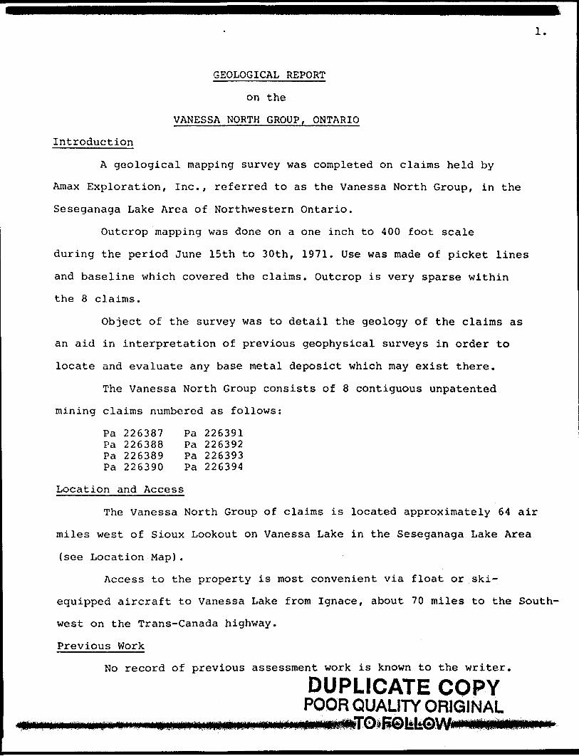
GEOLOGICAL REPORT
on the
VANESSA NORTH GROUP, ONTARIO
Introduction
A geological mapping survey was completed on claims held by
Amax Exploration, Inc., referred to as the Vanessa North Group, in the
Seseganaga Lake Area of Northwestern Ontario.
Outcrop mapping was done on a one inch to 400 foot scale
during the period June 15th to 30th, 1971. Use was made of picket lines
and baseline which covered the claims. Outcrop is very sparse within
the 8 claims.
Object of the survey was to detail the geology of the claims as
an aid in interpretation of previous geophysical surveys in order to
locate and evaluate any base metal deposict which may exist there.
The Vanessa North Group consists of 8 contiguous unpatented
mining claims numbered as follows:
Pa 226387 Pa 226391Pa 226388 Pa 226392Pa 226389 Pa 226393Pa 226390 Pa 226394
Location and Access
The Vanessa North Group of claims is located approximately 64 air
miles west of Sioux Lookout on Vanessa Lake in the Seseganaga Lake Area
(see Location Map).
Access to the property is most convenient via float or ski-
equipped aircraft to Vanessa Lake from Ignace, about 70 miles to the South-
west on the Trans-Canada highway.
Previous Work
No record of previous assessment work is known to the writer.
DUPLICATE COPYPOOR QUALITY ORIGINAL
GEOLOGICAL REPORT
on t h*
VAKESSA ttORTH CROUP. OKTARIO
Introduction
A geological Mapping survey was completed on claims held by
Aaax Exploration, Inc. , referred to at tba Vaaaaaa Horth Croup, In the
Seseganaga Lake Area of Northwestern Ontario.
Outcrop mapping vaa done on a one Inch to 400 foot scale
during the period June 15th to 30th, 1971. Die vat made of picket linea
and a baseline wblch covered the claims. Outcrop i t very nparse within
the 8 clalsis.
Object of the survey vat to detail the geology of the clalsis aa
an aid lo interpretation of previous geopbyalcal surveys in order to
locate and evaluate any base Metal deposit* which auy exist there.
The Vaaessa Borth Group consists of 8 contiguous uapaeeated
Inlng claims numbered as follows:
Pa 226387^ Pa 226391 "'Pa 22638f ̂ Pa 226392 *'Pa 2263*9 M P* 226393*tPa 226390 - ^ Pa 226394"*
Location and Access
The Vanesaa Borth Croup of claim Is located approxinately 64 air
iles west of Sioux Lookout on Vanessa Lake In the Seseganaga Lake Area
(see Location Map).
Access to the property Is vost convenient via float or ski-
equipped aircraft to Vanessa Lake fro* Ignace, about 70 miles to the South-
west on the Trana-Canada highway.
Previous Work
No record of previous assessment work is known to the writer.
2.
Topography and Drainage
Most of the claims area is covered by a large outwash sand
plain which forms a shallow bay with sand bottom to the south and lines
the shore with a narrow sand beach. Together with an alder swamp lining
a creek which drains into a small lake to the north, this sand plain
almost completely covers the rocks.
Relief is low and gentle in the claim group.
Geology
The rare outcrops are confined to the southwest corner of claim
226389 and close to the baseline in the southeast corner of claim 226388.
The rocks which outcrop are all basic metavolcanics.
The basic metavolcanic rocks are schistose, aphanitic or fine
grained, dark green to grey on the weathered surface. They have a chlorite-
hornblende-biotite-feldspar matrix. The strike of the schistosity is ap
proximately N20 0 and dips 76 0 to 83 0 West.
There is some jointing in the metavolcanics. Joints are 070 0
strike and 80 0 North dip.
In the bay just northeast of our claims, there is a large outcrop
of basic metavolcanic rocks. Most of the claims are overlain by sand and
sandy boulder overburden of an old outwash plain.
Mineralization
There are no visible exposures of sulphide mineralization in the
rare exposures seen on the claims.
Conclusions
Lack of rock exposure made correlation with the EM and magnetometer
surveys previously done on the claims, impossible.
DUPLICATE COPYPOOR QUALITY ORIGINAL
TO FOLLOW
Topography and Drainage
Mott of the dal** area l* covered by a large oucwaah aand
plain vhlch forme a hallow bay with aand bottom to tha aouth and line*
tha shore with a narrow aaad beach. Together with an alder swamp lining
a creek which drains Into a avail lake to the north, thia sand plain
almost completely cover* the rocks.
Relief la low and gentle In tbe claim group.
Geology
The rare outcrop* are confined to the aouthwent corner of claim
226389 and cleat to the baseline In the southeast corner of claim 22*388.
The rocks which outcrop are all basic metavolcanlcs.
The basic metavolcanlc rocks are acblstoae, aphanitic or flne-
gralaed, dark green to grey on the weathered surface. They have a chlorite*
hornblende-blotIte-feldspar matrix. The strike of the schistosity la ap
proximately K200W and dips 760 to 830 West.
There is some jointing In the matavolcanlcs. Joints are 0700
atrlke and 80O Worth dip.
In the bay Just northeast of our claims, there la t l arge outcrop
of basic metavolcanlc rocks. Host of the claims ara overlain by sand end
aandy boulder overburden of an old outwash plain.
Mineralisation
There are no visible exposures of sulphide mineralisation in the
rare exposures see* on the claims.
Conclusions
Lack of rock exposure made correlation with the EM and magnetometer
aurveya previously done on the claims, impossible.

Reconunendations
Because of the lack of outcrop, it is recommended that a geo
chemical soil survey be carried out on the Vanessa Group claims
Pa 226389 and 26388 West of the baseline, in order to try and
interpret conductor zone 'A 1 and its possible extension to the south.
August 7, 1971 Owen L. Younge Geologist.
Ree ndttlons
of the lack of outcrop, it la recoMeoded that a veo-
chewical soil survey be carried out on the Vanenaa Croup cUias
Pa 226392, 226389 and 226383 West of the baseline, in order to try and
Interpret conductor lone 'A' and its possible extension to the south.
August 7, 1971..
. TfoOven L. Tounge , Geologist.
52J*1SWe005 52jei2SEe049 SESEGANAGA LAKE 020
REPORT ON
CRONE RADEM GEOPHYSICAL SURVEY
VANESSA NORTH GROUP
SESEGANAGA LAKE AREA
DISTRICT OF THUNDER BAY
PATRICIA MINING DIVISION, ONTARIO
Amax Exploration, Inc., Room 204, 231 Arthur St., Thunder Bay (P), Ontario, August 16, 1971
J.E. Steers,
DUPLICATE COPYPOOR QUALITY ORIGINAL
TO FOLLOW
XZPOHT OH
CROC tADCM CEOPBTSICAL SUtVKT
RECEIVED
AUS l 9 1971PROJCCTS SECTION
VAVISSA VOfTB GtOOP
SSSCCABAGA LAB AHA
DisnicT or nuvKi BAT
PATRICIA KIVZVG D IT IS I OB, ONTARIO.
Aaax Exploration, Inc., too* 204, 231 Arthur St., Thunder Ety (P), Ontario, August 16, 1971.
J.E. Statra.
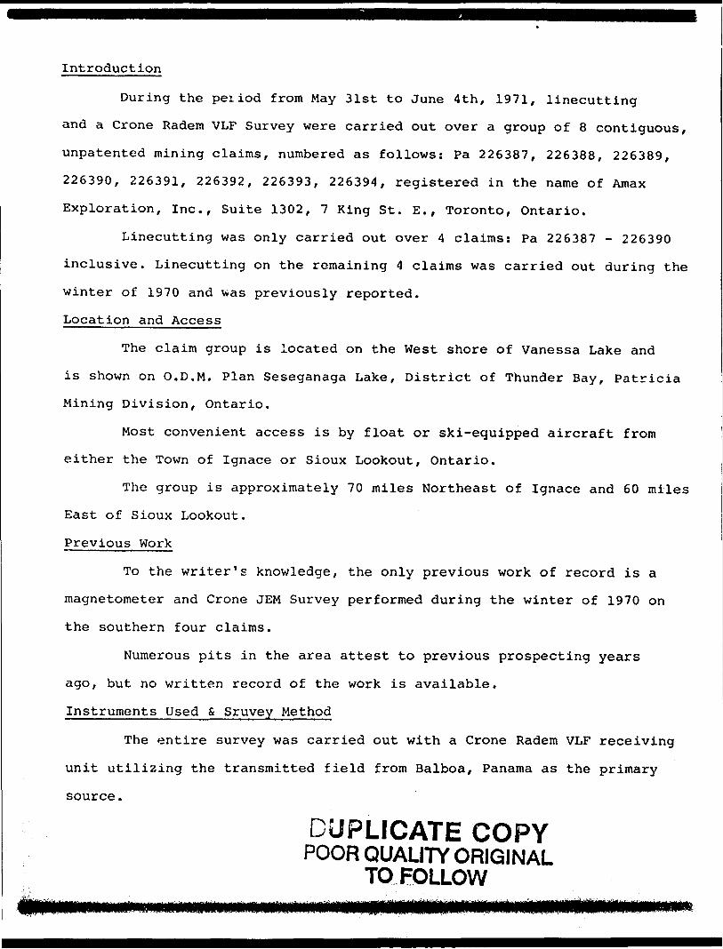
Introduction
During the period from May 31st to June 4th, 1971, linecutting
and a Crone Radem VLF Survey were carried out over a group of 8 contiguous,
unpatented mining claims, numbered as follows: Pa 226387, 226388, 226389,
226390, 226391, 226392, 226393, 226394, registered in the name of Amax
Exploration, Inc., Suite 1302, 7 King St. E., Toronto, Ontario.
Linecutting was only carried out over 4 claims: Pa 226387 - 226390
inclusive. Linecutting on the remaining 4 claims was carried out during the
winter of 1970 and was previously reported.
Location and Access
The claim group is located on the West shore of Vanessa Lake and
is shown on O.D.M. Plan Seseganaga Lake, District of Thunder Bay, Patricia
Mining Division, Ontario.
Most convenient access is by float or ski-equipped aircraft from
either the Town of Ignace or Sioux Lookout, Ontario.
The group is approximately 70 miles Northeast of Ignace and 60 miles
East of Sioux Lookout.
Previous Work
To the writer's knowledge, the only previous work of record is a
magnetometer and Crone JEM Survey performed during the winter of 1970 on
the southern four claims.
Numerous pits in the area attest to previous prospecting years
ago, but no written record of the work is available.
Instruments Used S Sruvey Method
The entire survey was carried out with a Crone Radem VLF receiving
unit utilizing the transmitted field from Balboa, Panama as the primary
source.
DUPLICATE COPYPOOR QUALITY ORIGINAL
TO FOLLOW
lctroductlop
Durfcjc th* period fro* M*y 31it to June 4th. 1971, Unecuttin*
and t Crone E* d e* VLF Survey ve r* carried out over a *roup of P contiguous,
unpatented mining claims, numbered as follows: PA 22*3*7? 2263P? 1 '' 2263*9, '(
22f390, 226391, 226392,' 226393',' 226394, registered In the ne*e of Amax
Exploration, Inc., Suite 1302, 7 King St. E.. Toronto, Ontario.
Linecutting was only carried out over 4 claisis: PA 226387 - 226390
Inclusive. Linecutting on the revaluing 4 claims was carried out during the
winter of 1970 and wss previously reported.
Location and Access
The claim group la located on the Vest shore of Vanessa Lake and
Is shown on O.D.M. Plan Seseganaga Lake, District of Thunder Bay, Patricia
Mining Division, Ontario.
Most convenient access la by float or aki-equipped aircraft frosi
either the Town of Ignace or Sioux Leokout, Ontario.
The group la approximately 70 miles northeast of Ignace and 60 miles
East of Sioux Lookout.
Previous Verk
To the writer's knowledge, the only previous work of record is a
magnetometer and Crone JTM Survey performed during the winter of 1970 on
the southern four claims.
Numerous pits in the *rea attest to previous prospecting years
ago, but no written record of the work la available.
^Instrument Used t, Survey Method
The entire survey was carried out with a Crone lad** VL7 receiving
unit uttltilng the transmitted field from Balboa, Panama as the primary
source.

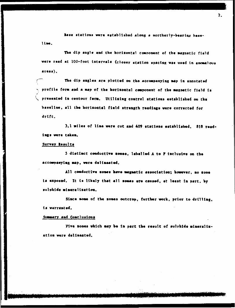
Base stations were established along a northerly-bearing base
line.
The dip angle and the horizontal component of the magnetic field
were read at 100-foot intervals (closer station spacing was used in anomalous
areas).
The dip angles are plotted on the accompanying map in annotated
profile form and a map of the horizontal component of the magnetic field is
presented in contour form. Utilizing control stations established on the
baseline, all the horizontal field strength readings were corrected for
drift.
3. l miles of line were cut and 409 stations established. 818 read
ings were taken.
Survey Results
5 distinct conductive zones, labelled A to F inclusive on the
accompanying map, were delineated.
All conductive zones have magnetic association; however, no zone
is exposed. It is likely that all zones are caused, at least in part, by
sulphide mineralization.
Since none of the zones outcrop, further work, prior to drilling
is warranted.
Summary and Conclusions
Five zones which may be in part the result of sulphide mineraliz
ation were delineated.
DUPLICATE COPYPOOR QUALITY ORIGINAL
TO FOLLOW
last stations ware established along a northerly-bearing base-
The dip angle and tbe borisontal component of the magnetic field
were read at 100-foot intervals (closer station spacing was used in anomalous
reas).
\~~ Tbe dip angles are plotted on tbe accompanying map in annotated
v profile fora and a map of tbe horlsontal component of tbe magnetic field Is
\ presented In contour fens. Utilising control stations established on the
baseline, all tbe borisontal field strength readings were corrected for
drift.
3.1 miles of line were cut and 409 stations established. 818 read
ings were taken.
Survey Jesuits
3 distinct conductive sones, labelled A to r inclusive on tbe
accompanying map, were delineated.
All conductive sones have magnetic association; however, no s one
is exposed. It Is likely that all comes are caused, at least in part, by
sulphide mineralisation.
Since none of the sones outcrop, further work, prior to drilling,
is warranted.
Summary and Cone 1usions
yive sones which may he In part the result of sulphide mineralis
ation were delineated.
It is recommended that the area receive careful geological
mapping and soil geochemis-ry before consideration is given to testing
the zones by diamond drilling.
Respectfully submitted,
Thunder Bay, Ontario August 16, 1971
J.E. Steers, FGAC, P. Eng, Geologist.
DUPLICATE COPYPOOR QUALITY ORIGINAL
TO FOLLOW
It Is recos**e*ded that the erea receive careful
msp^ian cod toil geochemistry before consideration is niven to testing
the soaes by d i Mond drill las.
.C '.t f r ,. ^V, * f-.-- - —".'-.l,. * le spect f itHT^fObtil 11 ed,
Thunder Rey, Ontario, August 16, 1971.
J.E. Geologist.
C, P.Eng.
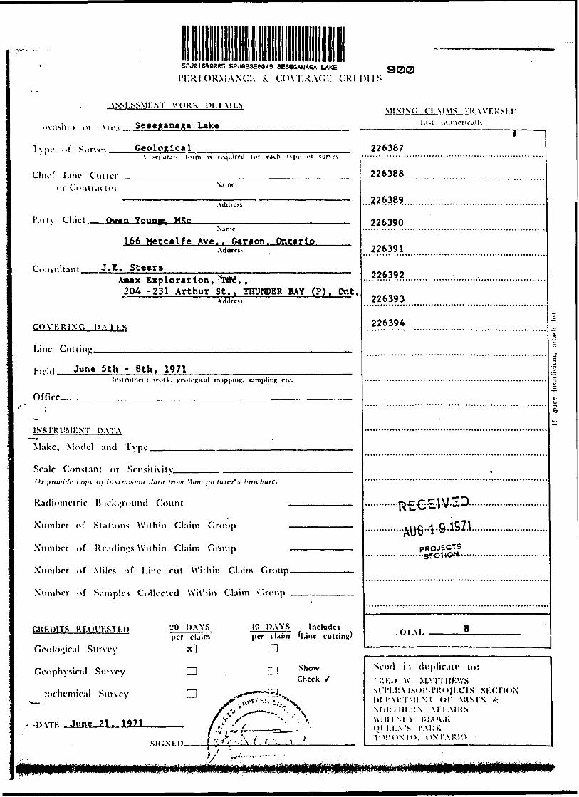
sajeisweees ssjesssewa SESEGANAGA LAKE 300 I'KRlORMANCr. fc COVI.KAf.K CRI.DIIS
ASSI.SSMKNl WORK ni.TAIl.S
.ivnship o, \,,M Seseganaga Lake '-"' """-",alh
Tvpe ot Sm-vi-K GeologicalA M-|urjif lorm is rrtjiiirrd lor rjct) H |'i i'l 'urvrs
Chief Line Cutteror Contianor N"'nr
. \ddrctt
Partv Chief Owen Young*, HSeN.irm-
166 Metcalfe Ave. . Carton. OntarioAddress
Consultant J. E. SteersAmax Exploration, *W6. ,
204 -231 Arthur St., THUNDER BAY (P)j Ont.Address
CO VK R INC, DA I K S
Line Cuiiiiu'
Kidd J""* 5th - Bth, 1971Insinttnrn! \vnrk, ^c'olopital m.ipping, jumpling r t c.
Offirr
1
INSTRl'MKNT DATA
Make, Model and Tvpe.
Scale Constant or Sensitivitvf'r firni'irlr cn/'y of instrument ilnla f mm \\aniiliiclnrcr' x I'tncl'iirc.
K-ifliiimi-lrir li irl m i uinil fniint
Number of Stations Within Claim Group —————————
Number of Readings Within Claim Group —————————
Number of Miles of Line cut Within Claim Group
Number of Samples Collected Within Claim '",roup , ,, , , ,
CRF.DITS RKOl'KSTKD 20 DAYS -10 DAYS Includesper claim per claim H.ine cuttingJ
Geological Survey SO CD
Geophvsical Suivcy CD CD show 1 ' Check y
:ochemical Survey 1 i ^I*-r—~'~Q-^/Tv*tfr "AV\ /v1 S —— "- , \
.MVTK June 21. 1971 f p S, ' - J'
Kir-.vi.-i> f '-:^-:;\ ( . f 'i ,V J
' 1 226387
226388
*\*t f. IQn..2.2.6382............. .......,.............................
226390
226391
226392
226393
226394
*
•-•-•-R^C-SW-ii^---------"..............AUe..V8.192A..........................
PROJECTS.....................ste.TlON...............................
THTM 8
Send in duplicate lo: fXI.D W. M.VnilKWSsfi'i.itMsoi'. I'Ko.ji.crs si.cnoNDI.I'Al: IMI.XI 01 MI.M.S K: NOKllll.RX A FI- AIRS uiniMY I;I.*K:K ijl'l I.X'S I'\KK lOIUiMO. ONTARIO
j:^?5
5V
1

IM.RIORMANCK fc COVKRAGI. CRF.DHS
ASSESSMENT WORK DETA11.S.
li.\\nship or Ate:! Seseganaga Lake
Type of Survey Rade* "VLP" ElectrojCjiagLetic——————A sriuratr l orin is rnitiirrd tot r.irh type nl survrv
Chief Lino Cmi.-r R.J. Penney or Contractor N.inic
Inglevood Creac. , Thunder Bay "P".Addre.s
Partv Chiof R. J. PenneyNjmr
•t aboveAddress
Consultant J.E. Steera.Amax Exploration, Inc.204 - 231 Arthur St., THUNDER BAY (P). Ontario.
Address
COVKRIXC DATES
Line Cm t inc. 31 " -*upe 3' incl * 1 971
Field June 4. 1971Instnimcnt work, geological mapping, sampling etc.
orfirp June 14. 15, 16. 1971.———————————
INSTRUMENT DATA
"* Make, Model and Typr Crone Radea "VLF"
Scale Constant or Scnsitiviiv, JL l
409
Or p rovide (~op\ nj instrument itatfi /ror: Manufacturer's brochure.
Radiometric Background Count
Number of Stations Within Claim Group
Number of Readings Within Claim Group
Number of Miles of Line cut Within Chshn Group————i..
Number of Samples Collected Within Claim Group ——————
818
CRF.nrrs RKOUF.STED
Geological Survey
Geophysical Survey
Geochemical Survey
20 DAYS per claim
a40 DAYS Includes per claim (Line cutting)
nShow Check J
DATE 1971
SIGNEDRote:- lines cut on 226387 to
MIXING CLAIMS l RAVF.RSF.D List riiimcrit .illv
226387
226388
40 day*
40
226389
226390
40
40
226391 - 20
226392 20
226393 - 20
226394 - 20
) i ' ' :'i '\uii 20 rf c^'.- ' ' ^tfcv, f/i** -i^r
TOTAL 8 claias - 240
Send in duplicate lo:JUKI) W. MA'IT!IK\\'S SL'I'ILRX'ISOK-l'ROH.CrS SUCTION DKI'ARTMtNT OK MINKS 8: NOKTIir.KN AFFAIRS WIHTNKY IJI.OCK QL'KF.N'S PARK TORONTO. ONTARIO
C, -line cutting on 226391 to 226394 previously
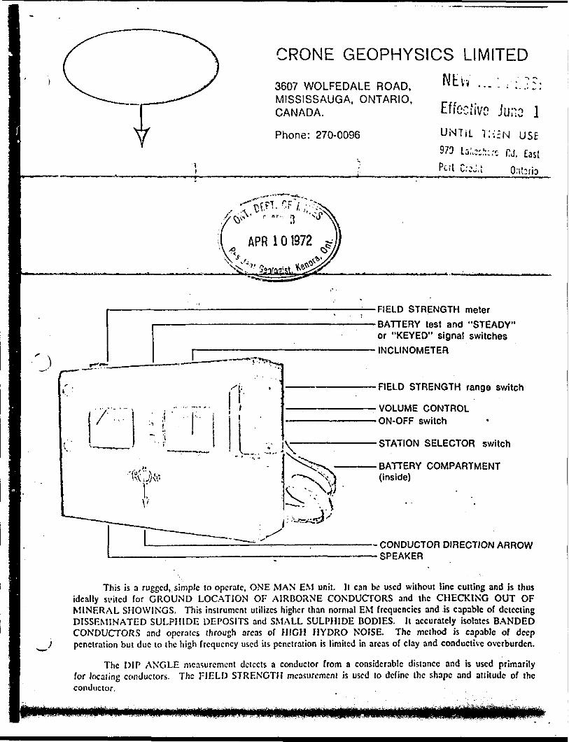
CRONE GEOPHYSICS LIMITED
Nth ...:,-;.?:; Effective Ju;io l
Phone: 270-0096 UNTIL l;-;EN USE
973 La:.cch:.-c w. EastP " - 1 f* i *. * vi i orcj.t (hiTia
3607 WOLFEDALE ROAD, MISSISSAUGA, ONTARIO, CANADA.
FIELD STRENGTH meter
BATTERY test and "STEADY" or "KEYED" signal switches
INCLINOMETER
FIELD STRENGTH range switch
VOLUME CONTROL ON-OFF switch
STATION SELECTOR switch
BATTERY COMPARTMENT (inside)
- CONDUCTOR DIRECTION ARROW- SPEAKER
This is a rugged, simple to operate, ONE MAN EM unit. It can be used without line cutting and is thus ideally suited for GROUND LOCATION OF AIRBORNE CONDUCTORS and the CHECKING OUT OF MINF.RAL SHOWINGS. This instrument utilizes higher than normal EM frequencies and is capable of detecting DISSEMINATED SULPHIDE DEPOSITS and SMALL SULPHIDE BODIES. It accurately isolates BANDED CONDUCTORS and operates through areas of HIGH HYDRO NOISE. The method is capable of deep penetration but due to the high frequency used its penetration is limited in areas of clay and conductive overburden.
The DIP ANGLE measurement detects a conductor from a considerable distance and is used primarily for locating conductors. The FIELD STRENGTH measurement is used to define the shape and attitude of the conductor.

SPECIFICATIONS
Source of Primary Field:
Number of Stations:
VLF Communication Stations 12 to 24 KHz
7 switch selectable
Stations Available: The seven standard stations arc Cutler, Maine, 17.8; Seattle, Washington, 18.6; Collins, Colorado, 20.0; Annapolis, Md., 21.4; Panama, 24.0; Hawaii, 23.4; England, 16.0. Alternative stations which may bc substituted arc: Gorki, Russia, 17.1; Japan, 17.4; England, 19.6; Australia, NWC, 22.3 KHz.
Check that Station is Transmitting: Audible signal from speaker.
Parameters Measured and Means:(1) DIP ANGLE in degrees, from the horizontal of the magnetic component of the VLF field. Detected by minimum on the field strength meter and read from an inclinometer with a range of ±80" and an accuracy of :tVi e .
(2) Field Strength (total or horizontal component) of the magnetic component of the VLF field. Measured as a per cent of normal field strength established at a base station. Accuracy ±2% dependent on signal. Meter has two ranges: O — 3009& and O — 60095*. Switch for "keyed" or "F.S." (steady) signal.
(3) Out of Phase component of the magnetic field, perpendicular in direction to the resultant field, measured without sign, as a per cent of normal field strength. This is the minimum reading of the Field Strength meter obtained when measuring the dip angle. Accuracy ±^
Operating Temperature Range:
Dimensions and Weight:
Shipping:
Batteries:
-200 to 4-HO0 F.
3.5" X 7.5" X 10.5" — 6 Ib.
Foam lined 'vooden case — shipping wt. — 15 Ib. .
2 of 9 volt: Eveready 216, Burgess 2U6, Mallory M-1604Average life expectancy — 3 weeks to 3 months dependent on amount of usage.
Units Available on a Rental or Purchase Basis. Contract Services Available for Field Surveys.
r
416 965-69J8
\~ \t. *.'-
April 3, J
Mr. W. A. Buchan Mining Recorder Court House Sioux Lookout, Ontario
Dear Sir:Re: Mining Claim PA. 226391 et al Seseganaga Lake and Squaw Lake File 2.569__________________
The Geophysical (Electromagnetic) and Geological assessmentwork credits as listed with my Notice of Intent dated March16, 1972 have been approved as of the. date above. Pleaseinform the recorded holder and so Indicate on your records.
* j
Yours very truly,
Fred W. MatthewsSupervisor
Projects Section
OJ/mh
cc: Amax Exploration, -Inc. Toronto, Ontario
cc: Amax Exploration, Inc. Thunder bay "P", Ontar:
Utn: Mr. J.E. Stters
APR 101272 *
cc: Mr. H. L. KingResident Geologist . 808 Robertson Street Kenora, Ontario
-*o*.s
LtL
503O*3 3O3I51 |S05i: 13123 j 3O30S* — —J — —f-
l**l l
' 3'O*O* J 1O3O*7,| 3O3O94
.. - .Ti-V"!— —- ~~ T "**Y *.. * S
\yj
JOWM 'SOS"3" l 30312* . 3 O3O37 J3OSO3* 30**-* (304*^
- '
3O30*3 3O9OVO |3O3'30 j 3oV*i{(l 3O9O3* l 3O3033 3O3O3O
IV IN
l 303O**l3O30*2 '3OJO*l I l l
1 3O9O4* . 3O3O4V
l
'3O9O32 5O305I
Ci 'P." |"lP^. W fm I P* 7.7" (^ ~-
3O4M* 3O4**7 . 3O4**O l
~V "Hll" Us CVr j" "-
*ZS50 l 2*294* |2*Zi40 (^ tE Z :T-J- -1 ̂ - -l " - -Uss.'J5'' 4 .-- - Tli* l
J P* "A ' ft,
I27MM i
310727
CGT"
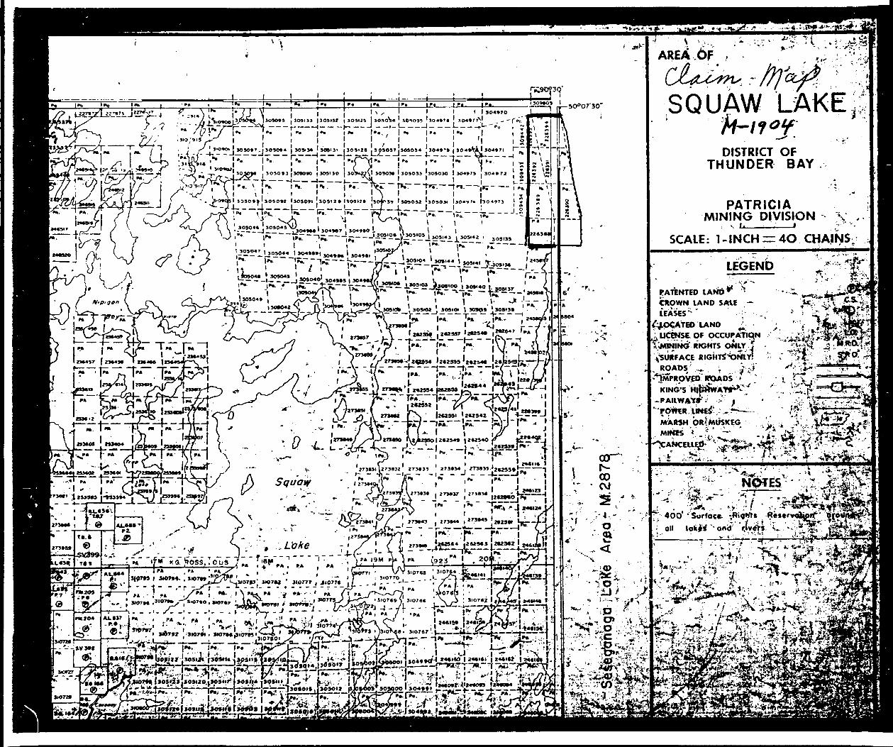
AREA OF
SQUAW LAKEDISTRICT OF
THUNDER BAY
PATRICIA MINING DIVISION
SCALE: l -INCH — 4O CHAINS;
LEGEND1 - v X ~-*
PATENTED LAND** * CROWN LAND SAtE ,—CEASES'*- " ;
'LOCATED IAND ^ ; ^ UCENSe OF OCCUPATION[jvliNING RIGHTS ONLY j ^SURFACE
ROADS' ^, ^JMPRpVEO"
KING'S H|t
'•••: M
, v-'•' ^^-; -,.-.- *t*-
- l . ; '-- *f' '"^ .''^-*a*f.:' ' ;
400* ' Sorfoce. ^Rion tov*f -- oiuP

1?^
™ ~
4
- "
fr4
-:*
; 'W
'
' .
8
l ';
' '
,. ..
~ "
:**M
..'j~
^ffi'
v-tif
- E^^
^^^^
^^^^
^TT
n y
i! *t
t **
t i
g*""
T^r
'*"r*
""T
^^!*
^'"'!
r'^"^
ii)
i ^.
t ~
T x,
ito
i'Tii?
}i!f
""**
^^^^
^^n^
i fci
f^
^5f
H
?M -
fi ?'
I ^
S^p^O
l^Ls 2
. :
JT:
i sT
s^T
l :| P
! i S
rfT
t!tl
'/W
.''!'
l :
Ir
l "
i L*
i a
' 5
"^
Ti B
! ^
f-i-Jj
i i
11
i '
is 8
, i
s i J
L-J
--^A
-r^f
i^i^
*' S
*-
^
T
^ ^^
-^ m
iri'j.
;!i
Ms
i s
, "
ig
*,
s |g
(5
S 3
ii
i* {
i s
g , S
^-\
i a
i -.
^--
-'V
"f
1,1
i .1
B
L^.
..L
—..
.L --L
-- —
-*1-
--i—
——
j.——
——
——
——
i——
—i—
—"*
——
f- ^-j--
-L 4
-V--
- -i--
^,-^
' S
. f*
--*
*'
h^
l^'v1-
:! I :i
l 1!
•'•H l
i! 'I
1- !i l
:: f V
^K^U
brH
rr;-
;-Lr^
, '"j
rtiiii
ffi^
1^-'
^^^
-r
V^ ^
•^r:0 s
,^
^ ^
r * C
5Tx
.li
(X")
226392 22639
I________.———l———-
GHL curs Tfz(C#L.c.i
52J82SEW49 SESEGANAGA LAKE
o
45
BS
125
165
2O S'
245
28 S'
325
365
4OS-
445-
485
52 S
LEGEND
VANESSA NORTH GROUP
eMT l -R ft C? E t~\ ( CfO^t \J L F" )
STATION ; B AU (iofl P w w P. m P,
^fes l D IP A N G, te s I N De c-iRe
PROFILE: SC^UET o l ~ 2O
ELECTROMAGNETIC
for
AMAX EXPLORATION
by
SURVEY
NC
OFR J Penney, Contractor
OF
DIP
-.U* W.,t
Scale; l " * 4 0052J02SEOC49 SESEGANAGA LAKE S10
o
4 S
8S
12 S
165
205-
245-
28 S-
325-
365
405-
445-
485
525
\
L C C E M o
VANESSA NORTH GROUP
c f
S O i^ '^ CC S 'T ^-r ion
Re/^o'f-'r^s ^ ^/
TiElL-D S -r K E: i-J ^ "T" H
Nur-if^eR OF
D M T ei Of Sur-^x/
'S A u Q O A P -A rv .O
S ~r R E t^J c, -r H - Al
ou^r-lt S e T T i rsi Ci
A D lw C 5 " 4-OS
\ O O
E LELC"T
ST
5 UR\yE
AMAX EXPLORATION, INC
R . J . Pe
52J01SW0005 S2J02SE0049 SESEGANAGA LAKE
Scale : 1" r 400