Embed Size (px)
Citation preview
armasuisseFederal Office of Topography swisstopoSwiss Geological Survey
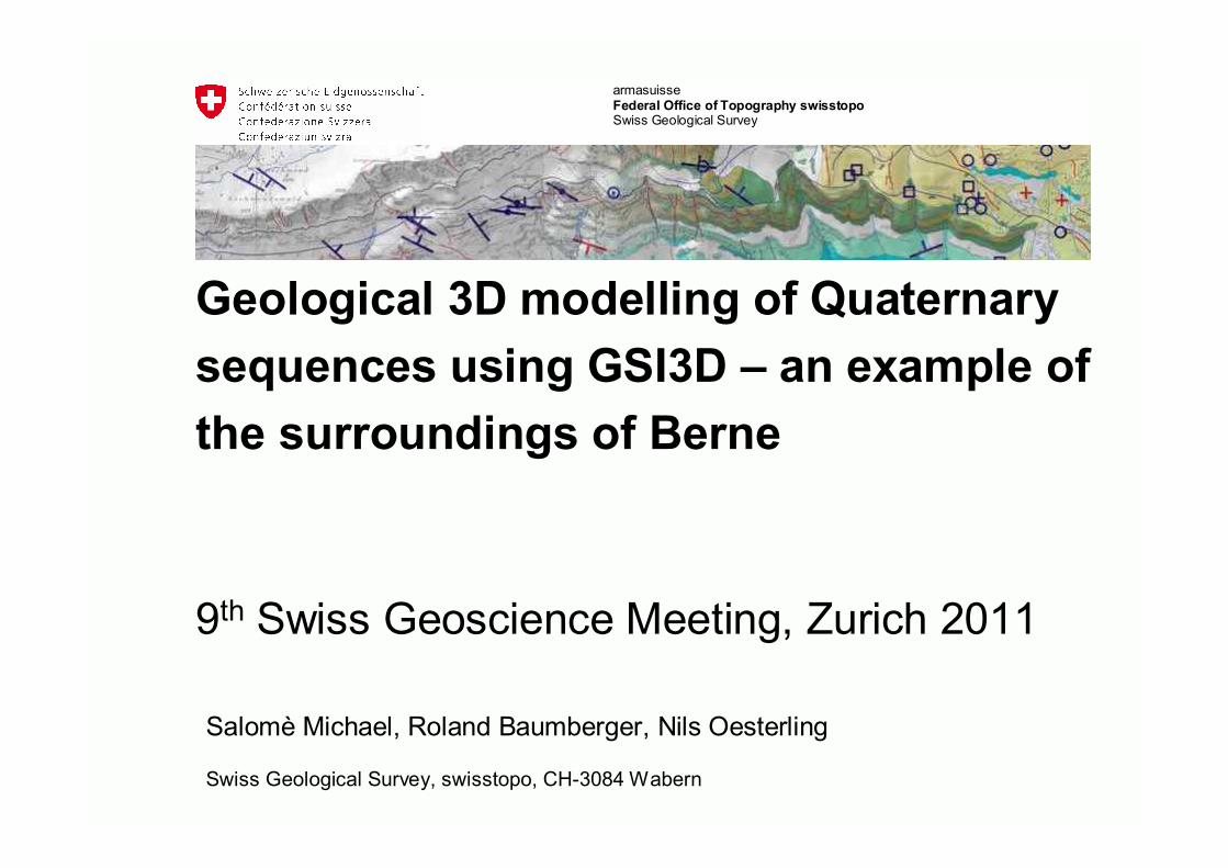
Salomè Michael, Roland Baumberger, Nils Oesterling
Swiss Geological Survey, swisstopo, CH-3084 Wabern
Geological 3D modelling of Quaternary sequences using GSI3D – an example of the surroundings of Berne
9th Swiss Geoscience Meeting, Zurich 2011

2Federal Office of Topography swisstopoSwiss Geological Survey
SGM2011 Zürich | 15. Geoscience and Geoinformation
Content
• Introduction• Input Data• Construction in GSI3D• Model Results• Reliability• Outlook
GSI3D – geological surveying and investigation in three dimensions

3Federal Office of Topography swisstopoSwiss Geological Survey
SGM2011 Zürich | 15. Geoscience and Geoinformation
Introduction
• Aims of SGS in the domain of 3D modelling (extract)• Offer geological 3D models at different scales and
resolutions covering different topics• Ease the communication on geology, visualise complex
facts and encourage the understanding of geology in the broad public
• […]
• Software in use• Move (Midland Valley): bedrock formations• GSI3D (BGS): Quaternary sequences

4Federal Office of Topography swisstopoSwiss Geological Survey
SGM2011 Zürich | 15. Geoscience and Geoinformation
Introduction
• The testing area of the first Quaternary 3D model is in the Berne vicinity
• Area: 45.5 km2
Extract of GA25, map sheet no.100, Bern; (596‘000 /194‘000 – 602‘500/201‘000)

5Federal Office of Topography swisstopoSwiss Geological Survey
SGM2011 Zürich | 15. Geoscience and Geoinformation
Extract of GA25, map sheet no.100, Bern
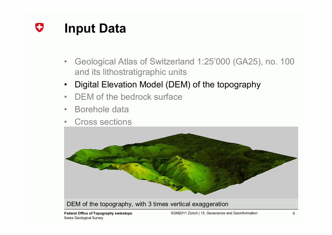
Input Data
• Geological Atlas of Switzerland 1:25’000 (GA25), no. 100 and its lithostratigraphic units
• Digital Elevation Model (DEM) of the topography• DEM of the bedrock surface• Borehole data• Cross sections
6Federal Office of Topography swisstopoSwiss Geological Survey
SGM2011 Zürich | 15. Geoscience and Geoinformation
Input Data
• Geological Atlas of Switzerland 1:25’000 (GA25), no. 100 and its lithostratigraphic units
• Digital Elevation Model (DEM) of the topography• DEM of the bedrock surface• Borehole data• Cross sections
DEM of the topography, with 3 times vertical exaggeration

7Federal Office of Topography swisstopoSwiss Geological Survey
SGM2011 Zürich | 15. Geoscience and Geoinformation
Input Data
• Geological Atlas of Switzerland 1:25’000 (GA25), no. 100 and its lithostratigraphic units
• Digital Elevation Model (DEM) of the topography• DEM of the bedrock surface• Borehole data• Cross sections
DEM of the bedrock surface, with 3 times vertical exaggeration(Courtesy: University of Berne, Institute of Geological Sciences)
8Federal Office of Topography swisstopoSwiss Geological Survey
SGM2011 Zürich | 15. Geoscience and Geoinformation
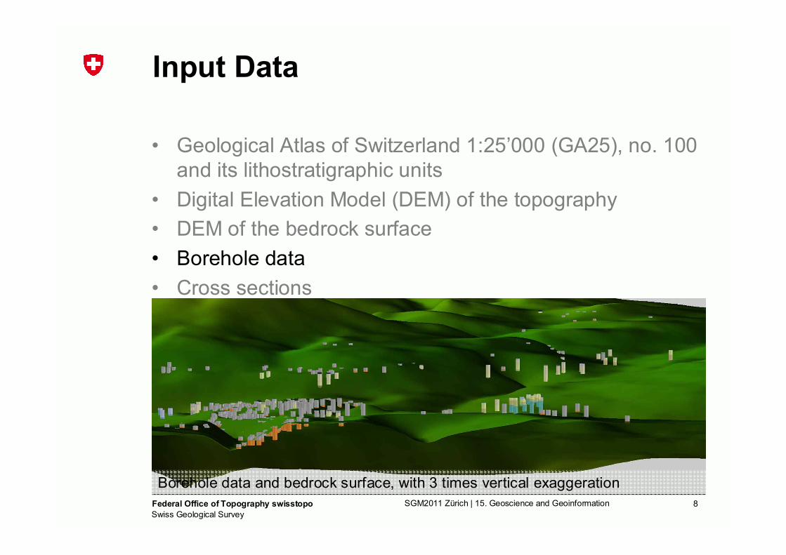
Input Data
• Geological Atlas of Switzerland 1:25’000 (GA25), no. 100 and its lithostratigraphic units
• Digital Elevation Model (DEM) of the topography• DEM of the bedrock surface• Borehole data• Cross sections
Borehole data and bedrock surface, with 3 times vertical exaggeration

9Federal Office of Topography swisstopoSwiss Geological Survey
SGM2011 Zürich | 15. Geoscience and Geoinformation
Input Data
• Geological Atlas of Switzerland 1:25’000 (GA25), no. 100 and its lithostratigraphic units
• Digital Elevation Model (DEM) of the topography• DEM of the bedrock surface• Borehole data• Cross sections
Section no. 6 (600’650/201’000-602’500/199’150)

10Federal Office of Topography swisstopoSwiss Geological Survey
SGM2011 Zürich | 15. Geoscience and Geoinformation
Construction in GSI3D – sections
• Geological fence diagram, based on the geological map
Fence diagram: View from S to N

11Federal Office of Topography swisstopoSwiss Geological Survey
SGM2011 Zürich | 15. Geoscience and Geoinformation
Construction in GSI3D – sections
• Geological fence diagram, based on the geological map• Refinement by implementing boreholes
Fence diagram: View from S to N

12Federal Office of Topography swisstopoSwiss Geological Survey
SGM2011 Zürich | 15. Geoscience and Geoinformation
Construction in GSI3D – sections
• Geological fence diagram, based on the geological map• Refinement by implementing boreholes• Helper sections for specific areas
Fence diagram: View from S to N
13Federal Office of Topography swisstopoSwiss Geological Survey
SGM2011 Zürich | 15. Geoscience and Geoinformation
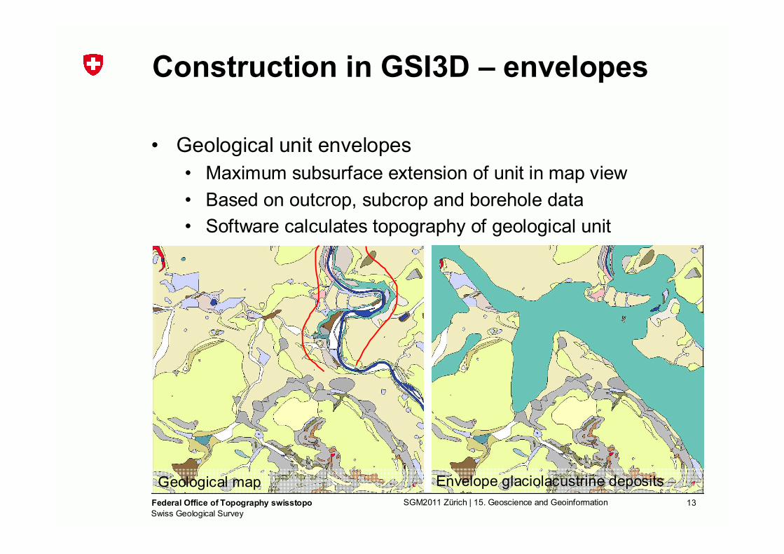
Construction in GSI3D – envelopes
• Geological unit envelopes• Maximum subsurface extension of unit in map view• Based on outcrop, subcrop and borehole data• Software calculates topography of geological unit
Geological map Envelope glaciolacustrine deposits

14Federal Office of Topography swisstopoSwiss Geological Survey
SGM2011 Zürich | 15. Geoscience and Geoinformation
Topology Check
Sections• Crossing section
arrows• Cropline arrows
• Envelopes• Correlation snap-
points
Envelope with correlation snap-points
Section with correlation arrows,3 times vertical exaggeration

15Federal Office of Topography swisstopoSwiss Geological Survey
SGM2011 Zürich | 15. Geoscience and Geoinformation
Model Results
Block model: view from S to N, with 3 times vertical exaggeration

16Federal Office of Topography swisstopoSwiss Geological Survey
SGM2011 Zürich | 15. Geoscience and Geoinformation
Model Results
Exploded layer model: view from E to W, with 3 times vertical exaggeration

17Federal Office of Topography swisstopoSwiss Geological Survey
SGM2011 Zürich | 15. Geoscience and Geoinformation
Reliability of Model Data
IDW interpolation map (d:900, e:0.5) for the Berne model
q4m
qF
q3SL
KA
Qua
tern
ary
bedr
ock

18Federal Office of Topography swisstopoSwiss Geological Survey
SGM2011 Zürich | 15. Geoscience and Geoinformation
Use / Outlook
• Use• Tool for foundation investigations (first estimations)• Tool for resource management• Aim SGS: Ease the communication on geology …
• Outlook• Further investigations on the reliability of 3D models• Integration of new data
→ Refinement of the model• Compilation of 3D models in Move
→ Vision (Aim SGS): nationwide geological 3D model

19Federal Office of Topography swisstopoSwiss Geological Survey
SGM2011 Zürich | 15. Geoscience and Geoinformation
Thank you for your attention
Contact: [email protected]
Visualisation of the 3D-data in Move
20Federal Office of Topography swisstopoSwiss Geological Survey
SGM2011 Zürich | 15. Geoscience and Geoinformation

21Federal Office of Topography swisstopoSwiss Geological Survey
SGM2011 Zürich | 15. Geoscience and Geoinformation
1. Develop principles, rules and know-how in the domain of 3D geology2. Offer area-wide 3D models (" 3D base models) in different scales
(1:500’000, 1:25’000) and resolutions covering different topics that are valid, geologically consistent as well as of high quality and accuracy
3. Set up a geological 3D community to exchange knowledge, know-how, data, resources etc.
4. Integrate geological 3D models into other applications and products of swisstopo and partners
5. Develop and distribute new products (e.g. depth maps, isolines) and services(WMS, WFS, WFS-T) based on geological 3D models
6. Ease the communication on geology, visualise complex geological facts and encourage the understanding of geology in the broad public - geology is an every-day topic!
Audience: Private sector, science and administration (+public)
Geological 3D modellingAims

22Federal Office of Topography swisstopoSwiss Geological Survey
SGM2011 Zürich | 15. Geoscience and Geoinformation
New Info